Dunstable

Heritage Site in Bedfordshire

England

Dunstable

Dunstable Downs car park
Dunstable Downs car park Credit: Colin Pyle

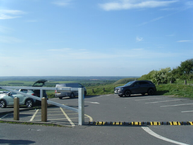
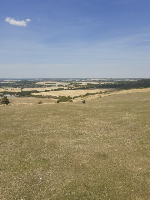
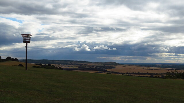
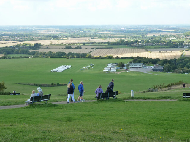
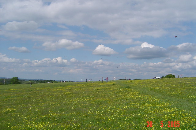
Dunstable, located in the county of Bedfordshire, England, is a historic town known for its rich heritage and notable landmarks. Situated on the eastward tail of the Chiltern Hills, Dunstable is surrounded by picturesque countryside and offers breathtaking views of the Dunstable Downs.

One of the most significant landmarks in Dunstable is the Dunstable Priory, which dates back to the 12th century. This magnificent church, with its impressive Gothic architecture, is a remnant of the Augustinian priory that once stood on the site. Visitors can explore the priory's beautiful gardens and experience the tranquility of the surrounding area.

Another notable feature of Dunstable is its ancient cross, known as the "Cross of St. Albans." Erected in the 15th century, this stone cross served as a resting place for pilgrims traveling to St. Albans Abbey. Today, the cross stands proudly in the town center, reminding visitors of Dunstable's historical significance.

Dunstable is also home to the Priory House Heritage Centre, a museum that showcases the town's past through a collection of artifacts and exhibits. Here, visitors can learn about Dunstable's medieval origins, its role in the hat-making industry, and its connections to notable figures such as Henry VIII and Thomas Becket.

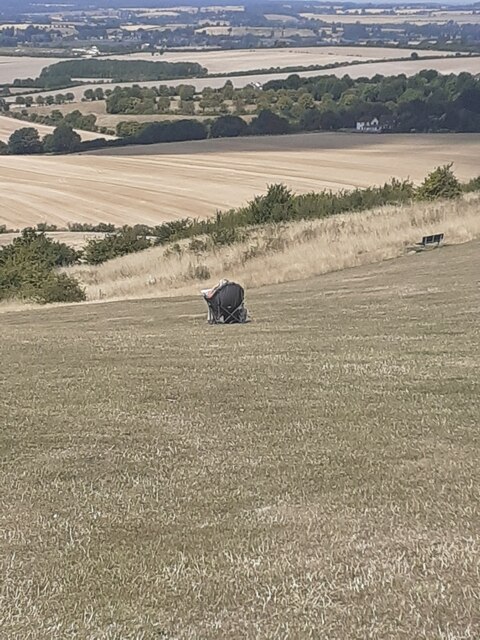
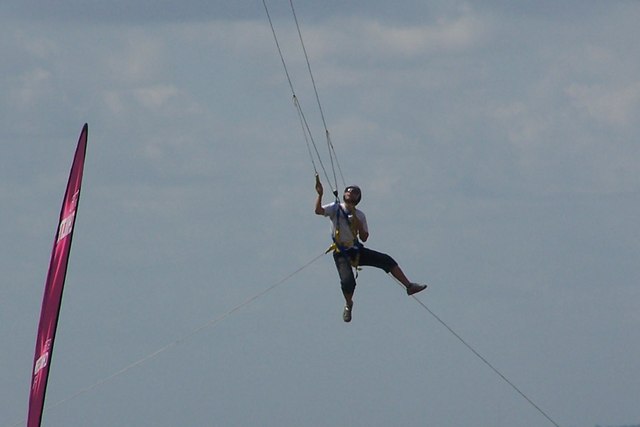
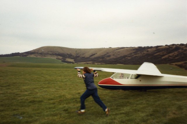
In addition to its heritage sites, Dunstable offers a range of recreational activities for outdoor enthusiasts. The Dunstable Downs, a designated Area of Outstanding Natural Beauty, provide ample opportunities for hiking, picnicking, and gliding, thanks to the presence of the London Gliding Club.

Overall, Dunstable, Bedfordshire, is a town steeped in history and natural beauty, attracting visitors from near and far with its rich heritage, iconic landmarks, and stunning landscapes.

If you have any feedback on the listing, please let us know in the comments section below.

Dunstable Images

Images are sourced within 2km of 51.882/-0.525 or Grid Reference TL0121. Thanks to Geograph Open Source API. All images are credited.
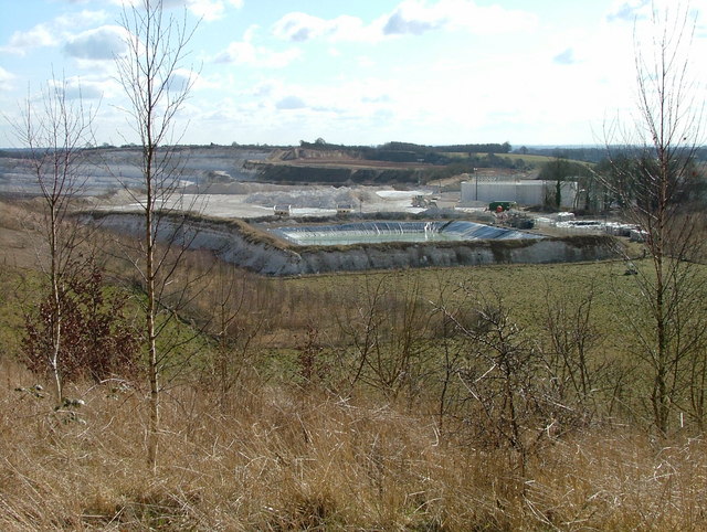
Dunstable Downs car park
Car park on the Dunstable Downs in summer Yes, we did have an ice cream.
Car park on the Dunstable Downs in summer
Yes, we did have an ice cream.
Part of the Dunstable Downs in the summer of 2022 Glorious.
Part of the Dunstable Downs in the summer of 2022
Glorious.
Scene on the Dunstable Downs in summer 2022 This elegant and independent woman has settled herself into a most comfortable and commodious looking chair and is drinking in the exceptional views laid out in front of her. My type of person! No boring sea view. No sitting in her back garden and looking at the Downs. She has picked up her mat and walked. She knows that she needs the scale of a JMW Turner or Constable painting and subject matter to match. She is aloof but also very much central to the scene. I envied her her vision, insight and depth of thought. More of this please!
Scene on the Dunstable Downs in summer 2022
This elegant and independent woman has settled herself into a most comfortable and commodious looking chair and is drinking in the exceptional views laid out in front of her. My type of person! No boring sea view. No sitting in her back garden and looking at the Downs. She has picked up her mat and walked. She knows that she needs the scale of a JMW Turner or Constable painting and subject matter to match. She is aloof but also very much central to the scene. I envied her her vision, insight and depth of thought. More of this please!
On the Icknield Way Trail, Dunstable Downs - view to Beacon Hill
View from Dunstable Downs Dunstable Downs Airfield is below, much used by gliders.
View from Dunstable Downs
Dunstable Downs Airfield is below, much used by gliders.
Kite flying on Dunstable Downs Looking north. Although they are not easy to see on the photograph, the sky was full of kites.
Kite flying on Dunstable Downs
Looking north. Although they are not easy to see on the photograph, the sky was full of kites.
Kensworth chalk quarry Actually, this spreads across four squares.  This is the area used for processing  I think.
Kensworth chalk quarry
Actually, this spreads across four squares. This is the area used for processing I think.
Bloke flying a kite or Kite Flying a bloke This was a loon who, with a number of kites tied together, used the kites to lift him off the ground.  At this stage he is about 10m off the ground.  He is tied to the ground.

Taken at the Dunstable kite festival on the downs
Bloke flying a kite or Kite Flying a bloke
This was a loon who, with a number of kites tied together, used the kites to lift him off the ground. At this stage he is about 10m off the ground. He is tied to the ground. Taken at the Dunstable kite festival on the downs
Dunstable Downs A young girl acting as a wing-runner assisting with the launch of a glider at the London Gliding Club, with the 'Bowl' and Dunstable Downs in the background.
Dunstable Downs
A young girl acting as a wing-runner assisting with the launch of a glider at the London Gliding Club, with the 'Bowl' and Dunstable Downs in the background.
Chilterns Gateway Centre Front aspect view - capturing the setting sun on the new visitors centre.
Chilterns Gateway Centre
Front aspect view - capturing the setting sun on the new visitors centre.
Two walkers on the Icknield Way In the background is the Chilterns Gateway visitor centre - for those who like their country views with a roof and a cappuccino.
Two walkers on the Icknield Way
In the background is the Chilterns Gateway visitor centre - for those who like their country views with a roof and a cappuccino.
Litter and rubbish bins At the car park on Dunstable Downs.
Litter and rubbish bins
At the car park on Dunstable Downs.
Dunstable Downs View south across the flat top of the Chiltern scarp.
Dunstable Downs
View south across the flat top of the Chiltern scarp.
Kensworth Chalk Quarry Panorama This enormous hole in the ground in the parish of Kensworth just south of Dunstable is not what you would call pretty - however in its sheer scale and almost dazzling whiteness, it is rather majestic ! I can only guess at its dimensions, but it must cover over 100 acres and be several hundred feet deep. And perhaps the most amazing thing is that unless you happen to get to this point there is virtually no evidence that it exists.
To give an idea of its scale, have a look at the closer photo here <a href="https://www.geograph.org.uk/photo/1175264">TL0219 : Kensworth Chalk Quarry</a> and you may make out a tiny yellow "grub" which is in fact an enormous earth mover.
Kensworth Chalk Quarry Panorama
This enormous hole in the ground in the parish of Kensworth just south of Dunstable is not what you would call pretty - however in its sheer scale and almost dazzling whiteness, it is rather majestic ! I can only guess at its dimensions, but it must cover over 100 acres and be several hundred feet deep. And perhaps the most amazing thing is that unless you happen to get to this point there is virtually no evidence that it exists. To give an idea of its scale, have a look at the closer photo here TL0219 : Kensworth Chalk Quarry and you may make out a tiny yellow "grub" which is in fact an enormous earth mover.
Kensworth Chalk Quarry This is a close-up of part of the quarry seen in <a href="https://www.geograph.org.uk/photo/1175259">TL0219 : Kensworth Chalk Quarry Panorama</a>. If you look closely near the top of the quarry about 1/5 of the way from the left side of the photo, you may be able to make out a little yellowish object. This is in fact an enormous earth moving vehicle - about half as big again as a double decker bus - this will give an idea of the scale of this mammoth pit.
Kensworth Chalk Quarry
This is a close-up of part of the quarry seen in TL0219 : Kensworth Chalk Quarry Panorama. If you look closely near the top of the quarry about 1/5 of the way from the left side of the photo, you may be able to make out a little yellowish object. This is in fact an enormous earth moving vehicle - about half as big again as a double decker bus - this will give an idea of the scale of this mammoth pit.
Footpath skirting quarry - View northwestwards This muddy footpath follows the northeastern and northern edges of <a href="https://www.geograph.org.uk/photo/1175264">TL0219 : Kensworth Chalk Quarry</a> and a little further on skirts the ancient strip lynchetts to the south of the Stipers Hill area of Dunstable. The view along the footpath in the opposite direction can be seen in <a href="https://www.geograph.org.uk/photo/1175568">TL0219 : Footpath skirting quarry - View southeastwards</a>
Footpath skirting quarry - View northwestwards
This muddy footpath follows the northeastern and northern edges of TL0219 : Kensworth Chalk Quarry and a little further on skirts the ancient strip lynchetts to the south of the Stipers Hill area of Dunstable. The view along the footpath in the opposite direction can be seen in TL0219 : Footpath skirting quarry - View southeastwards
Kensworth Quarry - deepest level This view of <a href="https://www.geograph.org.uk/photo/1175264">TL0219 : Kensworth Chalk Quarry</a> focuses on the deepest level of the quarry where water has collected in eau-de-Nil pools. Some of the industry associated with the workings can be seen at a much higher level beyond the pit.
Spot the parascender top right. Note - the prominent mast top centre is similar to the one seen in close-up here <a href="https://www.geograph.org.uk/photo/1175272">TL0119 : Radio Mast, Isle of Wight Lane</a> but is I think the one at TL01441960
[Edit Dec 2010] I am obliged to Dylan Moore who tells me that there is a pipeline directly from this quarry taking chalk slurry all the way to a cement processing plant in Rugby, a Geograph photo of which can be seen here <a href="https://www.geograph.org.uk/photo/95222">SP4875 : Second View from Rugby (now Cemex) Cement Tower</a>
Kensworth Quarry - deepest level
This view of TL0219 : Kensworth Chalk Quarry focuses on the deepest level of the quarry where water has collected in eau-de-Nil pools. Some of the industry associated with the workings can be seen at a much higher level beyond the pit. Spot the parascender top right. Note - the prominent mast top centre is similar to the one seen in close-up here TL0119 : Radio Mast, Isle of Wight Lane but is I think the one at TL01441960 [Edit Dec 2010] I am obliged to Dylan Moore who tells me that there is a pipeline directly from this quarry taking chalk slurry all the way to a cement processing plant in Rugby, a Geograph photo of which can be seen here SP4875 : Second View from Rugby (now Cemex) Cement Tower
Show me another place!

Dunstable is located at Grid Ref: TL0121 (Lat: 51.882, Lng: -0.525)

What 3 Words

///ruins.edit.final. Near Dunstable, Bedfordshire

Nearby Locations

California Dunstable

Related Wikis

Dunstable Friary

Dunstable Friary was a Dominican friary in Dunstable, Bedfordshire, England. It was located to the west of Watling Street, between the present-day High...

Queensbury Academy, Dunstable

Queensbury Academy (formerly Queensbury Upper School) is an 11–18 mixed, secondary school and sixth form with academy status in Dunstable, Bedfordshire...

Municipal Borough of Dunstable

The town of Dunstable in Bedfordshire, England was governed as an ancient borough between the twelfth century and the sixteenth century. The town’s borough...

Dunstable

Dunstable ( DUN-stə-bəl) is a market town and civil parish in Bedfordshire, England, east of the Chiltern Hills, 30 miles (50 kilometres) north of London...

Nearby Amenities

Located within 500m of 51.882,-0.525
Mini Roundabout
Source: survey
Lat/Long: 51.8805728/-0.5276982
Parking
Lat/Long: 51.8818471/-0.5257702
Traffic Calming: table
Lat/Long: 51.8783104/-0.5234174
Turning Circle
Turning Circle: hammer
Lat/Long: 51.8799566/-0.5215672
Turning Circle
Turning Circle: hammer
Lat/Long: 51.8803386/-0.5207097
Traffic Calming: island
Lat/Long: 51.8793491/-0.5307713
Place Of Worship
Dunstable Baptist Church
Denomination: baptist
Religion: christian
Lat/Long: 51.8844555/-0.5223749
Traffic Calming: island
Lat/Long: 51.8847031/-0.5229602
Recycling
Lat/Long: 51.8848064/-0.5224332
Mini Roundabout
Direction: clockwise
Lat/Long: 51.883416/-0.5317246
Addr Housenumber: 10
Addr Street: Hilton Avenue
Lat/Long: 51.8775708/-0.5244723
Addr Housenumber: 1
Addr Street: Hilton Avenue
Lat/Long: 51.8780318/-0.5233394
Turning Circle
Turning Circle: hammer
Lat/Long: 51.8800096/-0.5297906
Addr Housenumber: 1
Addr Street: Windermere Close
Lat/Long: 51.8801943/-0.5269025
Addr Housenumber: 4
Addr Street: Windermere Close
Lat/Long: 51.8805056/-0.5265592
Addr Housenumber: 5
Addr Street: Windermere Close
Lat/Long: 51.8807358/-0.5265269
Addr Housenumber: 12
Addr Street: Windermere Close
Lat/Long: 51.8803517/-0.5258296
Addr Housenumber: 13
Addr Street: Windermere Close
Lat/Long: 51.8803782/-0.5262158
Addr Housenumber: 16
Addr Street: Windermere Close
Lat/Long: 51.8800404/-0.5265699
Addr Housenumber: 2
Lat/Long: 51.8817169/-0.5191968
Addr Housenumber: 12
Lat/Long: 51.8813394/-0.5186818
Addr Housenumber: 98
Lat/Long: 51.8818162/-0.5194114
Addr Housenumber: 82
Lat/Long: 51.8821275/-0.5188964
Addr Housenumber: 80
Ele: 134.469116210938
Lat/Long: 51.8826779/-0.5181286
Addr Housenumber: 61
Lat/Long: 51.8822467/-0.5184458
Addr Housenumber: 57
Ele: 129.66259765625
Lat/Long: 51.882381/-0.518145
Addr Housenumber: 1
Lat/Long: 51.8821408/-0.5182634
Addr Housenumber: 11
Ele: 149.369384765625
Lat/Long: 51.881745/-0.517867
Addr Housenumber: 2
Lat/Long: 51.8821076/-0.5185853
Addr Housenumber: 12
Lat/Long: 51.8815646/-0.5182419
Addr Housenumber: 63
Lat/Long: 51.8819752/-0.5187891
Addr Housenumber: 67
Ele: 148.888793945313
Lat/Long: 51.881841/-0.5190179
Addr Housenumber: 1
Lat/Long: 51.8816772/-0.5188106
Addr Housenumber: 7
Lat/Long: 51.8814387/-0.5184994
Ele: 142.400024414063
Lat/Long: 51.8820499/-0.5187864
Crossing
Crossing: unmarked
Crossing Island: no
Crossing Markings: no
Tactile Paving: yes
Traffic Calming: table
Lat/Long: 51.8848887/-0.5195559
Bicycle Parking
West Street (Square Deal)
Capacity: 6
Covered: no
Lat/Long: 51.8856626/-0.5218948
Bicycle Parking
High St South
Capacity: 6
Covered: no
Lat/Long: 51.8845322/-0.5190608
Toilets
Access: yes
Wheelchair: no
Lat/Long: 51.8843979/-0.5213375
Pedalworks Bike Shop
Addr Housenumber: 5-7
Addr Postcode: LU6 1SL
Addr Street: West Street
Shop: bicycle
Website: https://www.pedalworks.co.uk/
Lat/Long: 51.8857542/-0.5214144
Building: house
Lat/Long: 51.8783934/-0.5222231
Building: house
Lat/Long: 51.8785922/-0.522411
Crossing
Lat/Long: 51.8848631/-0.5262816
Post Box
Collection Times: Mo-Fr 16:45; Sa 12:00
Note: Detail missing from postbox due to damaged exterior: surveyed on 28/10/2013. Collection times and reference assumed from Royal Mail data.
Operator: Royal Mail
Operator Wikidata: Q638098
Ref: LU6 3
Source: survey
Lat/Long: 51.8843716/-0.5189491
Post Box
Collection Times: Mo-Fr 16:30; Sa 12:00
Operator: Royal Mail
Operator Wikidata: Q638098
Ref: LU6 19
Source: survey
Lat/Long: 51.8847862/-0.526661
Post Box
Collection Times: Mo-Fr 17:30; Sa 11:45
Operator: Royal Mail
Operator Wikidata: Q638098
Ref: LU6 99
Source: survey
Lat/Long: 51.8853125/-0.5206248
Post Box
Collection Times: Mo-Fr 16:30; Sa 11:45
Operator: Royal Mail
Operator Wikidata: Q638098
Ref: LU6 98
Source: survey
Lat/Long: 51.8855235/-0.5221042
Post Box
Collection Times: Mo-Fr 16:30; Sa 11:45
Operator: Royal Mail
Operator Wikidata: Q638098
Ref: LU6 81
Source: survey
Lat/Long: 51.8856112/-0.5224974
Post Box
Collection Times: Mo-Fr 16:15; Sa 11:45
Operator: Royal Mail
Operator Wikidata: Q638098
Ref: LU6 35
Source: survey
Lat/Long: 51.8808592/-0.5275255
Post Box
Collection Times: Mo-Fr 16:15; Sa 11:45
Operator: Royal Mail
Operator Wikidata: Q638098
Ref: LU6 77
Source: survey
Lat/Long: 51.8811884/-0.5221436
Pub
The Pheasant Inn
Addr City: Dunstable
Addr Country: GB
Addr Housenumber: 208
Addr Postcode: LU6 1NX
Addr Street: West Street
Fhrs Authority: Central Bedfordshire
Fhrs Id: 1067489
Fhrs Local Authority Id: 167462
Phone: +44 1582 662 706
Tourism: guest_house
Website: https://www.the-pheasant-inn-dunstable.co.uk/
Lat/Long: 51.8837417/-0.5308989
Travel Choices Hub
Addr City: Dunstable
Addr Housename: Travel Choices Hub
Addr Housenumber: 1
Addr Postcode: LU6 3SN
Addr Street: Ashton Square
Description: Offering help and advice for sustainable transport choices including: Walking, Cycling, Bus & Train. We have an extensive knowledge and resources, including maps, covering the local area and beyond. Open Tuesday to Saturday 10:00 am to 4:00 pm
Information: Information_Centre
Operator: Sustrans
Phone: +44 1582 813 018
Tourism: information
Lat/Long: 51.885643/-0.5210744
Taxi
Lat/Long: 51.8854004/-0.5226848
Crossing
Button Operated: yes
Crossing: traffic_signals
Crossing Ref: pelican
Lat/Long: 51.8842791/-0.5284333
British Heart Foundation
Brand: British Heart Foundation
Brand Wikidata: Q4970039
Brand Wikipedia: en:British Heart Foundation
Shop: charity
Website: https://www.bhf.org.uk/what-we-do/find-bhf-near-you/dunstable-furniture-electrical-store
Lat/Long: 51.8856653/-0.5215971
Lombardo's Continental
Addr City: Dunstable
Addr Country: GB
Addr Housenumber: 17
Addr Postcode: LU6 1SL
Addr Street: West Street
Fhrs Authority: Central Bedfordshire
Fhrs Id: 450137
Fhrs Local Authority Id: 11824
Shop: deli
Lat/Long: 51.8854815/-0.522088
Kopernik Polish Supermarket
Addr City: Dunstable
Addr Country: GB
Addr Housenumber: 17-19
Addr Postcode: LU6 1SL
Addr Street: West Street
Fhrs Authority: Central Bedfordshire
Fhrs Id: 1038469
Fhrs Local Authority Id: 166739
Shop: supermarket
Lat/Long: 51.8854277/-0.5222449
Restaurant
The Spice Lounge
Addr City: Dunstable
Addr Country: GB
Addr Housenumber: 21
Addr Postcode: LU6 1SL
Addr Street: West Street
Fhrs Authority: Central Bedfordshire
Fhrs Id: 450687
Fhrs Local Authority Id: 67203
Lat/Long: 51.8853847/-0.5224152
Dunstable Model Centre
Shop: toys
Lat/Long: 51.885364/-0.5224903
Cafe
Yum-Yum-Cafe
Addr City: Dunstable
Addr Country: GB
Addr Housenumber: 27-29
Addr Postcode: LU6 1SL
Addr Street: West Street
Fhrs Authority: Central Bedfordshire
Fhrs Id: 1046694
Fhrs Local Authority Id: 164386
Lat/Long: 51.8853292/-0.522615
Pub
The Victoria
Addr City: Dunstable
Addr Country: GB
Addr Housenumber: 69
Addr Postcode: LU6 1ST
Addr Street: West Street
Fhrs Authority: Central Bedfordshire
Fhrs Id: 450663
Fhrs Local Authority Id: 66884
Lat/Long: 51.8850312/-0.5242056
Kindergarten
Linden House Nursery
Addr City: Dunstable
Addr Country: GB
Addr Housenumber: 83
Addr Postcode: LU6 1SE
Addr Street: West Street
Fhrs Authority: Central Bedfordshire
Fhrs Id: 450662
Fhrs Local Authority Id: 66877
Lat/Long: 51.8849914/-0.524189
Dentist
Darrell House Dental Practice
Healthcare: dentist
Lat/Long: 51.8847895/-0.5255547
Doctors
West Street Surgery
Healthcare: doctor
Lat/Long: 51.8847431/-0.5258578
Social Facility
Kirby House
Social Facility: assisted_living
Social Facility For: senior
Lat/Long: 51.8843011/-0.5277917
S A Bates & Son
Shop: funeral_directors
Lat/Long: 51.8844832/-0.5270433
Cordover
Building: yes
Lat/Long: 51.8841653/-0.528245
Geere & Pepper Memorials
Craft: stonemason
Lat/Long: 51.8837158/-0.5310358
Social Facility
Tudor House
Addr City: Dunstable
Addr Country: GB
Addr Housenumber: 76
Addr Postcode: LU6 1NX
Addr Street: West Street
Fhrs Authority: Central Bedfordshire
Fhrs Id: 450521
Fhrs Local Authority Id: 45000
Operator: Janes Care Homes
Social Facility: assisted_living
Social Facility For: senior
Lat/Long: 51.8851868/-0.5252758
Addr City: Dunstable
Addr Country: GB
Addr Housenumber: 70
Addr Postcode: LU6 1TA
Addr Street: West Street
Fixme: Boots has closed. Needs a survey.
Shop: yes
Lat/Long: 51.8851628/-0.5247729
KT Mini Mart
Addr City: Dunstable
Addr Country: GB
Addr Housenumber: 60
Addr Postcode: LU6 1TA
Addr Street: West Street
Fhrs Authority: Central Bedfordshire
Fhrs Id: 844881
Fhrs Local Authority Id: 94413
Shop: convenience
Lat/Long: 51.8852158/-0.5244483
P & L Cash Registers
Shop: computer
Lat/Long: 51.8852282/-0.5243799
Jonquil Florist
Shop: florist
Lat/Long: 51.8852365/-0.5243289
Restaurant
Olive Garden
Addr City: Dunstable
Addr Country: GB
Addr Housenumber: 54-54
Addr Postcode: LU6 1TA
Addr Street: West Street
Brand: Olive Garden
Brand Wikidata: Q3045312
Cuisine: italian
Fhrs Authority: Central Bedfordshire
Fhrs Id: 632947
Fhrs Local Authority Id: 152855
Lat/Long: 51.8852531/-0.5242324
Fast Food
Sunshine
Addr City: Dunstable
Addr Country: GB
Addr Housenumber: 50
Addr Postcode: LU6 1TA
Addr Street: West Street
Fhrs Authority: Central Bedfordshire
Fhrs Id: 906572
Fhrs Local Authority Id: 159865
Lat/Long: 51.8852655/-0.5241492
Le Bonne Salon
Shop: hairdresser
Lat/Long: 51.8852928/-0.52405
Barber Shop
Shop: hairdresser
Lat/Long: 51.8854219/-0.5232587
Vaping Not Smoking
Shop: tobacco
Lat/Long: 51.8854567/-0.5230388
Knowles Benning
Office: lawyer
Lat/Long: 51.8856231/-0.5225413
Bank
HSBC UK
Addr Country: GB
Atm: yes
Brand: HSBC UK
Brand Wikidata: Q64767453
Contact Website: https://www.hsbc.co.uk/branch-list/dunstable/
Lat/Long: 51.8856355/-0.5223951
Robinsons
Office: estate_agent
Lat/Long: 51.8856612/-0.5222569
TWP Flooring
Shop: carpet
Lat/Long: 51.8856984/-0.522147
Sweeny's
Shop: hairdresser
Lat/Long: 51.8857464/-0.5220223
Hand of Mysteries
Shop: tattoo
Lat/Long: 51.8858143/-0.5218184
Cafe
The Way
Addr City: Dunstable
Addr Country: GB
Addr Housenumber: 6
Addr Postcode: LU6 1SX
Addr Street: West Street
Fhrs Authority: Central Bedfordshire
Fhrs Id: 1016600
Fhrs Local Authority Id: 163649
Lat/Long: 51.885902/-0.5215931
Cafe
Cafe Nostalgia
Addr City: Dunstable
Addr Country: GB
Addr Housenumber: 4
Addr Postcode: LU6 1SX
Addr Street: West Street
Fhrs Authority: Central Bedfordshire
Fhrs Id: 964751
Fhrs Local Authority Id: 162665
Lat/Long: 51.8859451/-0.5215099
Bar
Scarlets
Addr City: Dunstable
Addr Country: GB
Addr Housenumber: 46-48
Addr Postcode: LU6 1TA
Addr Street: West Street
Fhrs Authority: Central Bedfordshire
Fhrs Id: 958293
Fhrs Local Authority Id: 161402
Lat/Long: 51.8853358/-0.5240473
Bar
Masonic Hall
Addr City: Dunstable
Addr Country: GB
Addr Postcode: LU6 3JJ
Addr Street: Cemetery Lane
Fhrs Authority: Central Bedfordshire
Fhrs Id: 450388
Fhrs Local Authority Id: 19586
Lat/Long: 51.8813276/-0.5279338
Cafe
Jacs Coffee Shop
Addr City: Dunstable
Addr Country: GB
Addr Postcode: LU6 3AH
Addr Street: Bullpond Lane
Addr Unit: Units 2 to 3
Fhrs Authority: Central Bedfordshire
Fhrs Id: 1091556
Fhrs Local Authority Id: 168760
Lat/Long: 51.8836786/-0.5231246
Wilson Dry Cleaners
Shop: dry_cleaning
Lat/Long: 51.8837597/-0.5231944
Cafe
The Coffee Pod
Addr City: Dunstable
Addr Housenumber: 20
Addr Postcode: LU6 3HR
Addr Street: High Street South
Cuisine: coffee_shop
Outdoor Seating: yes
Lat/Long: 51.8856115/-0.5206597
Celebrations
Payment App: yes
Payment Cash: yes
Payment Coins: yes
Payment Contactless: yes
Payment Credit Cards: yes
Payment Debit Cards: yes
Payment Google Pay: yes
Payment Maestro: yes
Payment Mastercard: yes
Payment Mastercard Contactless: yes
Payment Notes: yes
Payment Visa: yes
Payment Visa Debit: yes
Payment Visa Electron: yes
Shop: gift
Lat/Long: 51.8855743/-0.5206195
Studio J
Shop: clothes
Lat/Long: 51.8855221/-0.5205658
Beards & Barbers
Shop: hairdresser
Lat/Long: 51.8854907/-0.5205188
Four Seasons
Shop: clothes
Lat/Long: 51.8853789/-0.5203861
Niftys
Shop: tattoo
Lat/Long: 51.8853433/-0.5203365
Hair Boutique
Shop: hairdresser
Lat/Long: 51.885316/-0.520299
Alexander & Co
Office: estate_agent
Lat/Long: 51.8848855/-0.5199838
Veterinary
Noah's Ark
Lat/Long: 51.8846935/-0.5196351
Choice Foods
Addr City: Dunstable
Addr Country: GB
Addr Housenumber: 62-72
Addr Postcode: LU6 3HD
Addr Street: High Street South
Fhrs Authority: Central Bedfordshire
Fhrs Id: 546555
Fhrs Local Authority Id: 75949
Shop: convenience
Lat/Long: 51.8845097/-0.5192998
Wrigglies
Shop: pet
Lat/Long: 51.8844501/-0.5191764
Byron Ferne
Office: lawyer
Lat/Long: 51.8843392/-0.5189592
Pharmacy
West Street Pharmacy
Addr City: Dunstable
Addr Country: GB
Addr Housenumber: 8-10
Addr Postcode: LU6 1SX
Addr Street: West Street
Fhrs Authority: Central Bedfordshire
Fhrs Id: 1173439
Fhrs Local Authority Id: 67300
Healthcare: pharmacy
Lat/Long: 51.8858457/-0.5217057
Turning Circle
Turning Circle: hammer
Lat/Long: 51.881729/-0.5178831
Direction: 225
Generator Method: photovoltaic
Generator Output Electricity: yes
Generator Solar Modules: 6
Generator Source: solar
Generator Type: solar_photovoltaic_panel
Location: roof
Power: generator
Lat/Long: 51.878918/-0.5212287
Direction: 45
Generator Method: photovoltaic
Generator Output Electricity: yes
Generator Solar Modules: 5
Generator Source: solar
Generator Type: solar_photovoltaic_panel
Location: roof
Power: generator
Lat/Long: 51.8789367/-0.521203
Direction: 135
Generator Method: photovoltaic
Generator Output Electricity: yes
Generator Solar Modules: 2
Generator Source: solar
Generator Type: solar_photovoltaic_panel
Location: roof
Power: generator
Lat/Long: 51.8788978/-0.5212616
Turning Circle
Turning Circle: knuckle
Lat/Long: 51.879343/-0.5215557
Direction: 135
Generator Method: photovoltaic
Generator Output Electricity: yes
Generator Solar Modules: 72
Generator Source: solar
Generator Type: solar_photovoltaic_panel
Location: roof
Power: generator
Lat/Long: 51.8782348/-0.5249912
Direction: 135
Generator Method: photovoltaic
Generator Output Electricity: yes
Generator Solar Modules: 70
Generator Source: solar
Generator Type: solar_photovoltaic_panel
Location: roof
Power: generator
Lat/Long: 51.8782751/-0.5263144
Direction: 130
Generator Method: photovoltaic
Generator Output Electricity: yes
Generator Solar Modules: 80
Generator Source: solar
Generator Type: solar_photovoltaic_panel
Location: roof
Power: generator
Lat/Long: 51.8781495/-0.5275293
Direction: 220
Generator Method: photovoltaic
Generator Output Electricity: yes
Generator Solar Modules: 120
Generator Source: solar
Generator Type: solar_photovoltaic_panel
Location: roof
Power: generator
Lat/Long: 51.8783181/-0.5279509
Turning Circle
Turning Circle: knuckle
Lat/Long: 51.8815991/-0.5188279
Direction: 230
Generator Method: photovoltaic
Generator Output Electricity: yes
Generator Solar Modules: 20
Generator Source: solar
Generator Type: solar_photovoltaic_panel
Location: roof
Power: generator
Lat/Long: 51.8814491/-0.5179636
Direction: 220
Generator Method: photovoltaic
Generator Output Electricity: yes
Generator Solar Modules: 8
Generator Source: solar
Generator Type: solar_photovoltaic_panel
Location: roof
Power: generator
Lat/Long: 51.8818204/-0.5183224
Crossing
Crossing: unmarked
Crossing Markings: no
Lat/Long: 51.8788432/-0.5296575
Bus Stop
Bus: yes
Public Transport: platform
Lat/Long: 51.8791271/-0.5293212
Direction: 125
Generator Method: photovoltaic
Generator Output Electricity: yes
Generator Solar Modules: 3
Generator Source: solar
Generator Type: solar_photovoltaic_panel
Location: roof
Power: generator
Lat/Long: 51.8792572/-0.5288008
Direction: 305
Generator Method: photovoltaic
Generator Output Electricity: yes
Generator Solar Modules: 3
Generator Source: solar
Generator Type: solar_photovoltaic_panel
Location: roof
Power: generator
Lat/Long: 51.8792836/-0.5288592
Direction: 35
Generator Method: photovoltaic
Generator Output Electricity: yes
Generator Solar Modules: 3
Generator Source: solar
Generator Type: solar_photovoltaic_panel
Location: roof
Power: generator
Lat/Long: 51.8792909/-0.5288029
Direction: 220
Generator Method: photovoltaic
Generator Output Electricity: yes
Generator Solar Modules: 16
Generator Source: solar
Generator Type: solar_photovoltaic_panel
Location: roof
Power: generator
Lat/Long: 51.8796483/-0.5252055
Fixme: solar panel?
Lat/Long: 51.8793644/-0.5251123
Bus Stop
Bus: yes
Public Transport: platform
Lat/Long: 51.8785716/-0.5239807
Direction: 130
Generator Method: photovoltaic
Generator Output Electricity: yes
Generator Solar Modules: 6
Generator Source: solar
Generator Type: solar_photovoltaic_panel
Location: roof
Power: generator
Lat/Long: 51.879417/-0.5242487
Direction: 220
Generator Method: photovoltaic
Generator Output Electricity: yes
Generator Solar Modules: 5
Generator Source: solar
Generator Type: solar_photovoltaic_panel
Location: roof
Power: generator
Lat/Long: 51.8794086/-0.5243156
Direction: 220
Fixme: survey for panel count
Generator Method: photovoltaic
Generator Output Electricity: yes
Generator Solar Modules: 15
Generator Source: solar
Generator Type: solar_photovoltaic_panel
Location: roof
Power: generator
Lat/Long: 51.8798898/-0.5244614
Turning Circle
Turning Circle: knuckle
Lat/Long: 51.8795006/-0.5223428
Direction: 315
Generator Method: photovoltaic
Generator Output Electricity: yes
Generator Solar Modules: 4
Generator Source: solar
Generator Type: solar_photovoltaic_panel
Location: roof
Power: generator
Lat/Long: 51.8801876/-0.5215778
Direction: 225
Generator Method: photovoltaic
Generator Output Electricity: yes
Generator Solar Modules: 3
Generator Source: solar
Generator Type: solar_photovoltaic_panel
Location: roof
Power: generator
Lat/Long: 51.8801552/-0.521583
Direction: 135
Generator Method: photovoltaic
Generator Output Electricity: yes
Generator Solar Modules: 11
Generator Source: solar
Generator Type: solar_photovoltaic_panel
Location: roof
Power: generator
Lat/Long: 51.8810679/-0.5214759
Direction: 135
Generator Method: photovoltaic
Generator Output Electricity: yes
Generator Solar Modules: 9
Generator Source: solar
Generator Type: solar_photovoltaic_panel
Location: roof
Power: generator
Lat/Long: 51.8812883/-0.5218177
Direction: 140
Generator Method: photovoltaic
Generator Output Electricity: yes
Generator Solar Modules: 7
Generator Source: solar
Generator Type: solar_photovoltaic_panel
Location: roof
Power: generator
Lat/Long: 51.8818606/-0.5227625
Direction: 50
Generator Method: photovoltaic
Generator Output Electricity: yes
Generator Solar Modules: 4
Generator Source: solar
Generator Type: solar_photovoltaic_panel
Location: roof
Power: generator
Lat/Long: 51.8819091/-0.5227766
Direction: 135
Generator Method: photovoltaic
Generator Output Electricity: yes
Generator Solar Modules: 10
Generator Source: solar
Generator Type: solar_photovoltaic_panel
Location: roof
Power: generator
Lat/Long: 51.8825905/-0.5203871
Crossing
Crossing: zebra
Crossing Island: no
Crossing Markings: zebra
Tactile Paving: yes
Traffic Calming: table
Lat/Long: 51.8854273/-0.5229394
Direction: 150
Generator Method: photovoltaic
Generator Output Electricity: yes
Generator Solar Modules: 10
Generator Source: solar
Generator Type: solar_photovoltaic_panel
Location: roof
Power: generator
Lat/Long: 51.8835859/-0.524326
Turning Circle
Turning Circle: knuckle
Lat/Long: 51.882747/-0.5274506
Direction: 155
Generator Method: photovoltaic
Generator Output Electricity: yes
Generator Solar Modules: 9
Generator Source: solar
Generator Type: solar_photovoltaic_panel
Location: roof
Power: generator
Lat/Long: 51.8836594/-0.5286974
Traffic Calming: island
Lat/Long: 51.8834491/-0.5315606
Farmfoods
Addr Housenumber: 19,21,23
Addr Postcode: LU6 3SN
Addr Street: Ashton Square
Brand: Farmfoods
Brand Wikidata: Q5435841
Brand Wikipedia: en:Farmfoods
Fhrs Id: 782764
Shop: frozen_food
Lat/Long: 51.8854269/-0.5209923
Taxi
Dunstable Square Taxi Rank
Lat/Long: 51.8843988/-0.5189384
Place Of Worship
My Father's House Dunstable
Denomination: pentecostal
Religion: christian
Lat/Long: 51.8855792/-0.5239642
Place Of Worship
Dunstable Christadelphan Church
Religion: christian
Lat/Long: 51.8837332/-0.5270447
Bus Stop
Dunstable West Street, Stop T1
Bench: yes
Bus: yes
Departures Board: realtime
Public Transport: platform
Shelter: yes
Lat/Long: 51.885577/-0.5221319
Crossing
Crossing: unmarked
Crossing Markings: no
Lat/Long: 51.8782659/-0.5234872
Crossing
Crossing: traffic_signals
Crossing Island: no
Crossing Markings: dots
Crossing Ref: pelican
Tactile Paving: yes
Lat/Long: 51.8849363/-0.5256389
Crossing
Crossing: uncontrolled
Lat/Long: 51.8851334/-0.5248736
Crossing
Crossing: uncontrolled
Lat/Long: 51.884021/-0.5240262
Crossing
Crossing: uncontrolled
Lat/Long: 51.883907/-0.5239864
Crossing
Crossing: uncontrolled
Lat/Long: 51.8836156/-0.5232781
Barrier: swing_gate
Lat/Long: 51.8827253/-0.5244361
Barrier: swing_gate
Lat/Long: 51.8827135/-0.5247109
Crossing
Crossing: unmarked
Crossing Island: no
Crossing Markings: no
Tactile Paving: yes
Traffic Calming: table
Lat/Long: 51.8855036/-0.5228647
Crossing
Crossing: uncontrolled
Lat/Long: 51.8853012/-0.5239197
Crossing
Crossing: uncontrolled
Lat/Long: 51.8850244/-0.5255487
Crossing
Crossing: uncontrolled
Lat/Long: 51.8849411/-0.5259326
Bus Stop
Bus: yes
Public Transport: platform
Lat/Long: 51.8847713/-0.5262738
Bus Stop
Bus: yes
Public Transport: platform
Lat/Long: 51.8840824/-0.5293303
Bus Stop
Bus: yes
Public Transport: platform
Lat/Long: 51.883565/-0.5309193
Crossing
Crossing: uncontrolled
Lat/Long: 51.8841997/-0.523406
Crossing
Crossing: unmarked
Crossing Island: no
Crossing Markings: no
Tactile Paving: yes
Lat/Long: 51.8852314/-0.5233605
Crossing
Crossing: uncontrolled
Lat/Long: 51.8850047/-0.5231309
Bus Stop
Bus: yes
Public Transport: platform
Lat/Long: 51.8850691/-0.5251739
Surface: asphalt
Traffic Calming: table
Lat/Long: 51.8850134/-0.5248009
Parking
Lat/Long: 51.8811828/-0.5282822
Barrier: swing_gate
Lat/Long: 51.8826953/-0.5223722
Crossing
Lat/Long: 51.8821094/-0.5319428
Crossing
Lat/Long: 51.8816129/-0.5311999
Crossing
Lat/Long: 51.8814645/-0.5309821
Crossing
Lat/Long: 51.8813604/-0.5308292
Barrier: bollard
Bicycle: designated
Bollard: fixed
Colour: Black
Foot: designated
Motor Vehicle: no
Lat/Long: 51.8813733/-0.5281375
Crossing
Crossing: unmarked
Crossing Island: no
Crossing Markings: no
Tactile Paving: yes
Lat/Long: 51.8796093/-0.5256706
Crossing
Crossing: unmarked
Crossing Island: no
Crossing Markings: no
Tactile Paving: yes
Lat/Long: 51.8801194/-0.5267191
Crossing
Crossing: unmarked
Crossing Island: no
Crossing Markings: no
Tactile Paving: yes
Lat/Long: 51.8805141/-0.5275776
Crossing
Crossing: unmarked
Crossing Island: no
Crossing Markings: no
Tactile Paving: yes
Lat/Long: 51.8789475/-0.5294253
Crossing
Crossing: unmarked
Crossing Island: no
Crossing Markings: no
Tactile Paving: yes
Lat/Long: 51.8786481/-0.5296567
Crossing
Crossing: unmarked
Crossing Island: no
Crossing Markings: no
Tactile Paving: yes
Lat/Long: 51.8838645/-0.5299827
Crossing
Crossing: unmarked
Crossing Island: no
Crossing Markings: no
Tactile Paving: yes
Lat/Long: 51.8846905/-0.5265554
Crossing
Crossing: unmarked
Crossing Island: no
Crossing Markings: no
Tactile Paving: yes
Lat/Long: 51.8843354/-0.5280769
Crossing
Lat/Long: 51.8841192/-0.5289194
Crossing
Lat/Long: 51.8837767/-0.5301939
Crossing
Lat/Long: 51.8845511/-0.5272112
Crossing
Lat/Long: 51.8849947/-0.5247872
Crossing
Lat/Long: 51.884805/-0.5260208
Crossing
Lat/Long: 51.884708/-0.5223423
Crossing
Lat/Long: 51.8845088/-0.5226727
Bus Stop
Bus: yes
Public Transport: platform
Lat/Long: 51.8847393/-0.5192861
Crossing
Crossing: unmarked
Crossing Island: no
Crossing Markings: no
Tactile Paving: yes
Traffic Calming: table
Lat/Long: 51.8845111/-0.5189559
Crossing
Crossing: unmarked
Crossing Island: no
Crossing Markings: no
Tactile Paving: yes
Traffic Calming: table
Lat/Long: 51.8846003/-0.5191074
Crossing
Lat/Long: 51.8844419/-0.519049
Crossing
Crossing: uncontrolled
Lat/Long: 51.8794593/-0.5256205
Crossing
Lat/Long: 51.8836441/-0.5234139
Historic: monument
Lat/Long: 51.8849353/-0.5197343
Barrier: bollard
Lat/Long: 51.8858269/-0.5212354
Post Office
Source: OS OpenMap Local
Lat/Long: 51.8852945/-0.520834
Camera Mount: wall
Camera Type: panning
Man Made: surveillance
Surveillance: public
Surveillance Type: camera
Lat/Long: 51.8857844/-0.5212457
Crossing
Lat/Long: 51.8859356/-0.5255141
Crossing
Lat/Long: 51.8863338/-0.5264777
Crossing
Lat/Long: 51.8859876/-0.5233321
Crossing
Lat/Long: 51.8863275/-0.5237146
Crossing
Lat/Long: 51.8808342/-0.5195163
Crossing
Lat/Long: 51.8782786/-0.521748
Crossing
Lat/Long: 51.8824194/-0.525962
Crossing
Lat/Long: 51.8814918/-0.5264901
Crossing
Lat/Long: 51.8803282/-0.5280824
Crossing
Lat/Long: 51.8834548/-0.5272003
Crossing
Lat/Long: 51.8815954/-0.5226393
Crossing
Lat/Long: 51.8800482/-0.5250896
Crossing
Lat/Long: 51.8821424/-0.5215066
Crossing
Lat/Long: 51.8822601/-0.5214594
Crossing
Lat/Long: 51.8821355/-0.5216999
Crossing
Lat/Long: 51.8822708/-0.5216536
Crossing
Lat/Long: 51.8833875/-0.5228566
Crossing
Lat/Long: 51.880586/-0.5248465
Camera Mount: pole
Camera Type: panning
Man Made: surveillance
Surveillance: public
Surveillance Type: camera
Lat/Long: 51.8852439/-0.5201689
Clock
Date: no
Display: analog
Faces: 4
Support: wall_mounted
Visibility: area
Lat/Long: 51.884938/-0.5197237
The data included in this document is from www.openstreetmap.org. The data is made available under ODbL.

Have you been to Dunstable?

Leave your review of Dunstable below (or comments, questions and feedback).