Dùn Chuidhir

Heritage Site in Inverness-shire

Scotland

Dùn Chuidhir

Tràigh Tuath The mouth of the short Allt Ruadh is just seen on the left as it flows into the sea.
Tràigh Tuath Credit: John Lucas

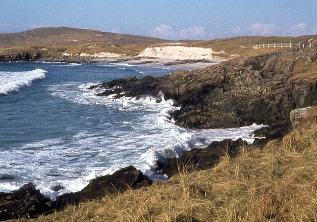
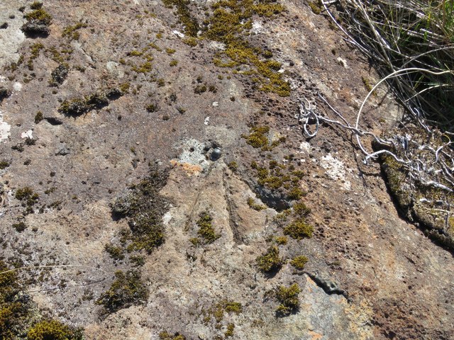
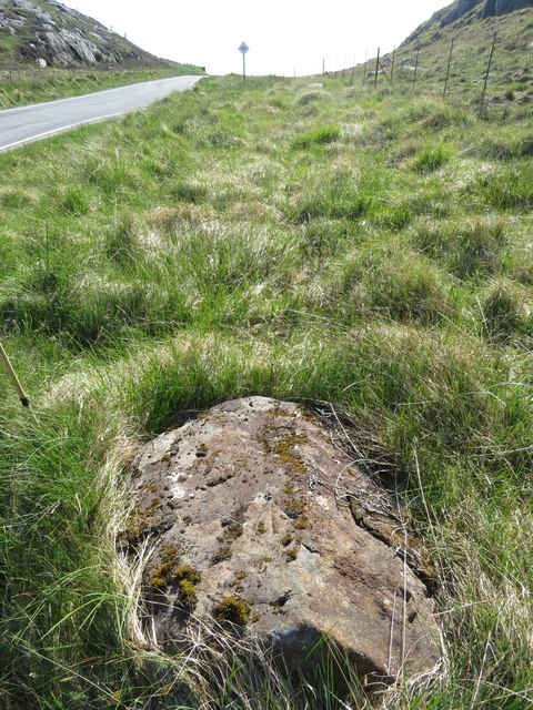
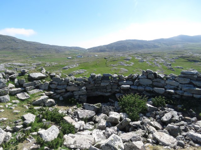
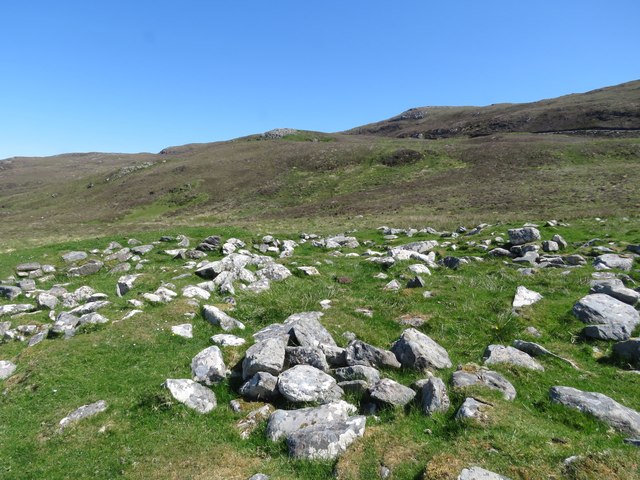
Dùn Chuidhir, located in Inverness-shire, Scotland, is a historic heritage site that dates back to the Iron Age. The site consists of the remains of an ancient hill fort, situated on a prominent hill overlooking the surrounding landscape.

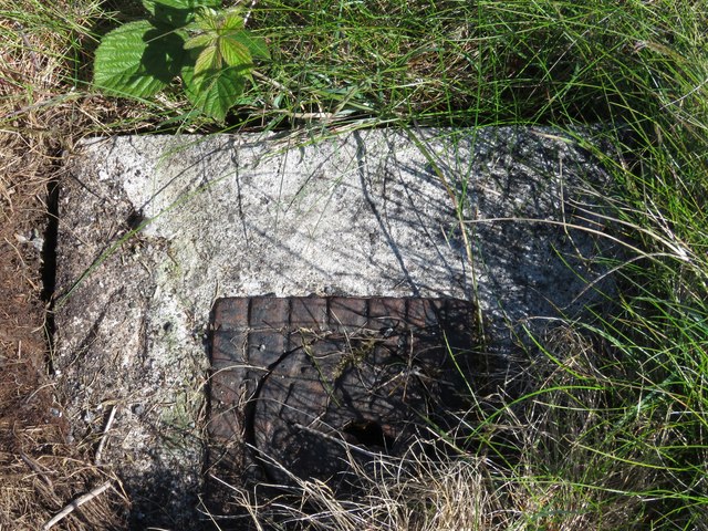
The fort is believed to have been constructed around 2,000 years ago and was likely used for defensive purposes by the ancient inhabitants of the area. The site features a series of earthworks and ditches that would have provided protection for the inhabitants of the fort.

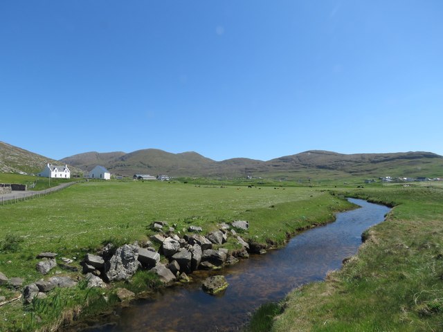
Today, visitors to Dùn Chuidhir can explore the remains of the fort and enjoy panoramic views of the surrounding countryside. The site is a popular destination for history enthusiasts and those interested in ancient civilizations.

Dùn Chuidhir is a significant archaeological site that provides valuable insights into the lives and culture of the people who lived in this region during the Iron Age. The site is managed and maintained by local authorities to ensure its preservation for future generations to enjoy and learn from.

If you have any feedback on the listing, please let us know in the comments section below.
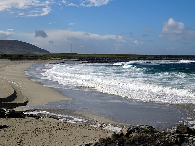
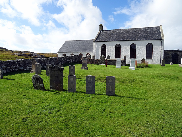
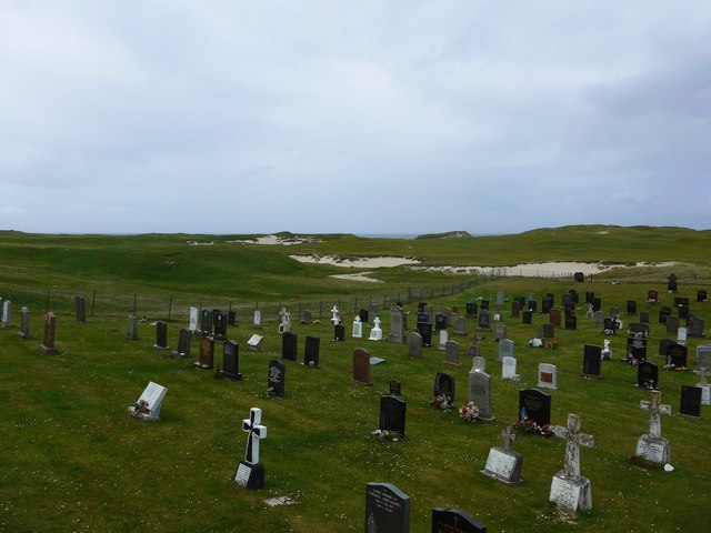
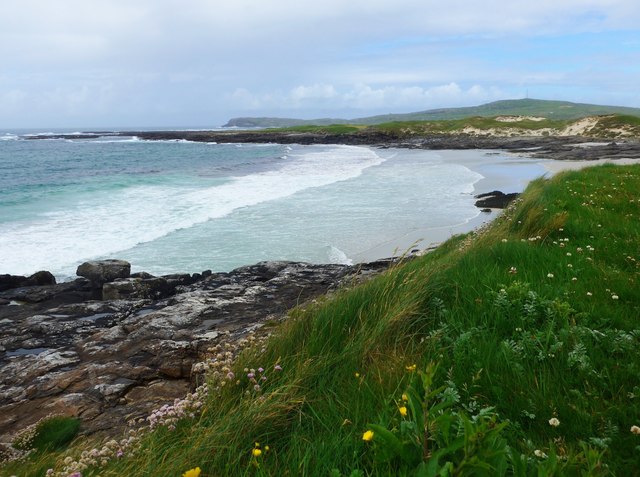
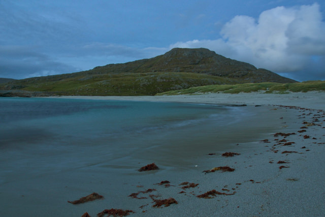
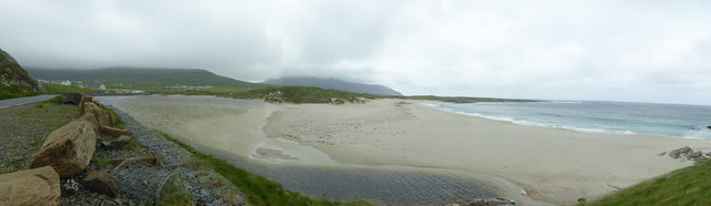
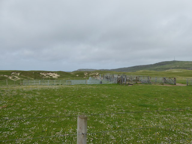
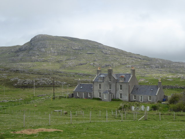
Dùn Chuidhir Images

Images are sourced within 2km of 57.002/-7.493 or Grid Reference NF6603. Thanks to Geograph Open Source API. All images are credited.

Tràigh Tuath The mouth of the short Allt Ruadh is just seen on the left as it flows into the sea.
Tràigh Tuath
The mouth of the short Allt Ruadh is just seen on the left as it flows into the sea.
Cemetery at Cuidhir The cemetery contains several Commonwealth War Graves of naval origins. The stories of some of the casualties can be found in the descriptions of the following images:
<a href="https://www.geograph.org.uk/photo/4513717">NF6703 : Four war graves in Cuidhir Cemetery</a>
<a href="https://www.geograph.org.uk/photo/4514731">NF6703 : Three war graves in Cuidhir Cemetery</a>
<a href="https://www.geograph.org.uk/photo/4676860">NF6703 : Memorial to 3 crew members of SS Idomeneus</a>
<a href="https://www.geograph.org.uk/photo/4676877">NF6703 : Commonwealth war grave of John Mackinnon</a>
Cemetery at Cuidhir
The cemetery contains several Commonwealth War Graves of naval origins. The stories of some of the casualties can be found in the descriptions of the following images: NF6703 : Four war graves in Cuidhir Cemetery NF6703 : Three war graves in Cuidhir Cemetery NF6703 : Memorial to 3 crew members of SS Idomeneus NF6703 : Commonwealth war grave of John Mackinnon
Memorial to 3 crew members of SS Idomeneus Chan Sung, Chung Cheong and Leong Kow were members of the crew of SS Idomeneus which was torpedoed on 15th September 1917 en-route from New York to Liverpool. Although the ship was not sunk, the explosion caused the death of 4 crew members, 3 of whom are commemorated here. The ship was beached on Vatersay, eventually repaired and renamed, it continued sailing until 1933.
Memorial to 3 crew members of SS Idomeneus
Chan Sung, Chung Cheong and Leong Kow were members of the crew of SS Idomeneus which was torpedoed on 15th September 1917 en-route from New York to Liverpool. Although the ship was not sunk, the explosion caused the death of 4 crew members, 3 of whom are commemorated here. The ship was beached on Vatersay, eventually repaired and renamed, it continued sailing until 1933.
Commonwealth war grave of John Mackinnon John Mackinnon was a member of the Royal Naval Reserve and a 2nd hand on HMS Balmoral Castle which was a hired trawler during WWI. He was a native of Barra and hailed from nearby Allasdale.

John died of illness on Christmas Day 1918 at the age of 22.
Commonwealth war grave of John Mackinnon
John Mackinnon was a member of the Royal Naval Reserve and a 2nd hand on HMS Balmoral Castle which was a hired trawler during WWI. He was a native of Barra and hailed from nearby Allasdale. John died of illness on Christmas Day 1918 at the age of 22.
Tràigh Hamara, Barra
Abhainn Mòr at Borgh, Barra
Cuidhir Church, Barra
Rivet on fire hydrant surround, near Cuidhir, Barra Ordnance Survey rivet benchmark, described on database at <span class="nowrap"><a title="http://www.bench-marks.org.uk/bm76369" rel="nofollow ugc noopener" href="http://www.bench-marks.org.uk/bm76369">Link</a><img style="margin-left:2px;" alt="External link" title="External link - shift click to open in new window" src="https://s1.geograph.org.uk/img/external.png" width="10" height="10"/></span>.
Rivet on fire hydrant surround, near Cuidhir, Barra
Ordnance Survey rivet benchmark, described on database at LinkExternal link.
Rivet benchmark on roadside rock near Cuidhir, Barra Ordnance Survey rivet benchmark on rock just off the road east of Cuidhir.For full description, see <span class="nowrap"><a title="http://www.bench-marks.org.uk/bm76368" rel="nofollow ugc noopener" href="http://www.bench-marks.org.uk/bm76368">Link</a><img style="margin-left:2px;" alt="External link" title="External link - shift click to open in new window" src="https://s1.geograph.org.uk/img/external.png" width="10" height="10"/></span>. See also <a href="https://www.geograph.org.uk/photo/4997751">NF6803 : Rivet benchmark on roadside rock near Cuidhir, Barra</a>.
Rivet benchmark on roadside rock near Cuidhir, Barra
Ordnance Survey rivet benchmark on rock just off the road east of Cuidhir.For full description, see LinkExternal link. See also NF6803 : Rivet benchmark on roadside rock near Cuidhir, Barra.
Rivet benchmark on roadside rock near Cuidhir, Barra See also <a href="https://www.geograph.org.uk/photo/4997749">NF6803 : Rivet benchmark on roadside rock near Cuidhir, Barra</a>.
Rivet benchmark on roadside rock near Cuidhir, Barra
Dun Chuidhir, Barra Situated on the west side of the island, this dun is quite well preserved.
Dun Chuidhir, Barra
Situated on the west side of the island, this dun is quite well preserved.
Taigh Talamhanta, Barra's aisled house Information from Canmore:
<span class="nowrap"><a title="https://canmore.org.uk/site/9721/barra-allasdale-tigh-talamhanta" rel="nofollow ugc noopener" href="https://canmore.org.uk/site/9721/barra-allasdale-tigh-talamhanta">Link</a><img style="margin-left:2px;" alt="External link" title="External link - shift click to open in new window" src="https://s1.geograph.org.uk/img/external.png" width="10" height="10"/></span>

Tigh Talamhanta (The House under the Ground), was excavated by Scott in 1950-1 and by Young in 1953.

The site comprises an aisled farmhouse, souterrain, kilnhouse and steading, in a partially walled enclosure of 1 1/2 acres. The wall ends in a marshy area near the barn, but intermittent mounds in the marsh are probably the remains of a continuous earthen bank completing the enclosure.

A long period of occupation is attested by the pottery commencing in the late 1st century, but it is not possible to give a terminal date. The steading was overlaid by an 18th century structure.
Taigh Talamhanta, Barra's aisled house
Information from Canmore: LinkExternal link Tigh Talamhanta (The House under the Ground), was excavated by Scott in 1950-1 and by Young in 1953. The site comprises an aisled farmhouse, souterrain, kilnhouse and steading, in a partially walled enclosure of 1 1/2 acres. The wall ends in a marshy area near the barn, but intermittent mounds in the marsh are probably the remains of a continuous earthen bank completing the enclosure. A long period of occupation is attested by the pottery commencing in the late 1st century, but it is not possible to give a terminal date. The steading was overlaid by an 18th century structure.
Cemetery at Allasdale
Traigh Hamara
Traigh Hamara
Tràigh Tuath
Tràigh Tuath
Not quite a lagoon at Borgh Here a sand bar almost closes the mouth of the Abhainn Mòr creating what is almost a tidal lagoon.   Although not visible in this picture, the flow of the river maintains a channel to the sea.
Not quite a lagoon at Borgh
Here a sand bar almost closes the mouth of the Abhainn Mòr creating what is almost a tidal lagoon. Although not visible in this picture, the flow of the river maintains a channel to the sea.
Fank at Allathasdal
Fank at Allathasdal
Manse at Cuidhir
Manse at Cuidhir
Show me another place!

Dùn Chuidhir is located at Grid Ref: NF6603 (Lat: 57.002, Lng: -7.493)

Unitary Authority: Na h-Eileanan an Iar

Police Authority: Highlands and Islands

What 3 Words

///cutlets.flush.breakfast. Near CastleBay, Na h-Eileanan Siar

Nearby Locations

Dùn Chuidhir Grithean

Related Wikis

Allasdale

Allasdale (Scottish Gaelic: Athalasdal, pronounced [ˈa.əl̪ˠəs̪t̪əl̪ˠ]) is a settlement on Barra in the Outer Hebrides, Scotland. The settlement is also...

Isle of Barra distillery

Isle of Barra distillery at Borve, Barra, Scotland is a planned future whisky distillery on Barra. The Barra Distillery company was founded in 2003 but...

Borve, Barra

Borve (Scottish Gaelic: Borgh) is a village on the west coast of the island of Barra in the Outer Hebrides, Scotland. Borve is within the parish of Barra...

Barra

Barra (; Scottish Gaelic: Barraigh [ˈparˠaj] or Eilean Bharraigh [ˈelan ˈvarˠaj] ; Scots: Barra) is an island in the Outer Hebrides, Scotland, and the...

Nearby Amenities

Located within 500m of 57.002,-7.493
Passing Place
Lat/Long: 57.0019437/-7.4881449
Passing Place
Lat/Long: 57.0028773/-7.4936979
Passing Place
Lat/Long: 57.0045339/-7.4928787
Passing Place
Lat/Long: 57.0038466/-7.4856482
Passing Place
Lat/Long: 57.0025993/-7.4913574
Bus Stop
Grean
Naptan AtcoCode: 6010731666
Naptan Bearing: E
Naptan CommonName: Grean
Naptan Indicator: Village
Naptan Landmark: Village
Naptan NaptanCode: 94723265
Naptan Street: Village
Naptan Verified: no
Source: naptan_import
Lat/Long: 57.0048514/-7.4946039
Passing Place
Lat/Long: 57.0010586/-7.4856615
Passing Place
Lat/Long: 57.0014493/-7.4867538
Noexit: yes
Lat/Long: 57.0049496/-7.496259
Passing Place
Lat/Long: 57.0050544/-7.4965794
Passing Place
Lat/Long: 57.0030504/-7.4951997
Barrier: kissing_gate
Lat/Long: 57.0025781/-7.4992627
Barrier: kissing_gate
Lat/Long: 57.0040564/-7.4997991
Power: pole
Lat/Long: 57.0045085/-7.4983527
Power: pole
Lat/Long: 57.0039769/-7.4981958
Power: pole
Lat/Long: 57.0038761/-7.4967313
Power: pole
Lat/Long: 57.0038688/-7.4955082
Power: pole
Lat/Long: 57.0038578/-7.4939941
Power: pole
Lat/Long: 57.0037388/-7.492716
Power: pole
Lat/Long: 57.0036548/-7.4916311
Power: pole
Lat/Long: 57.0035635/-7.4905099
Power: pole
Lat/Long: 57.0034598/-7.489484
Power: pole
Lat/Long: 57.003397/-7.4887678
Power: pole
Lat/Long: 57.0032772/-7.4875259
Power: pole
Lat/Long: 57.0031837/-7.4863619
Power: pole
Lat/Long: 57.0030464/-7.4850422
Material: wood
Power: pole
Lat/Long: 57.0001354/-7.5003082
Material: wood
Power: pole
Lat/Long: 57.0011842/-7.5002197
Material: wood
Power: pole
Lat/Long: 57.0006963/-7.5007132
Material: wood
Power: pole
Lat/Long: 57.0016802/-7.4996967
Material: wood
Power: pole
Lat/Long: 57.0022313/-7.4994654
Material: wood
Power: pole
Lat/Long: 57.00255/-7.4992997
Material: wood
Power: pole
Lat/Long: 57.0031986/-7.4990288
Material: wood
Power: pole
Lat/Long: 57.0035127/-7.4979988
Leisure: picnic_table
Lat/Long: 57.0015294/-7.4859817
Leisure: picnic_table
Lat/Long: 57.0015824/-7.4863035
Passing Place
Lat/Long: 57.004632/-7.4940223
Passing Place
Lat/Long: 57.0046217/-7.4916203
Passing Place
Lat/Long: 57.0041025/-7.4892318
Barrier: entrance
Foot: yes
Lat/Long: 57.0021874/-7.500248
Passing Place
Lat/Long: 57.0029602/-7.4970438
Grithean
Alt Name En: Grean
Name En: Grinn
Name Gd: Grithean
Place: hamlet
Lat/Long: 57.0046727/-7.4903846
Cuidhir
Name En: Cuier
Name Gd: Cuidhir
Place: hamlet
Lat/Long: 57.0016962/-7.4849531
Power: pole
Lat/Long: 57.0017705/-7.4856296
Power: pole
Lat/Long: 57.0023801/-7.4853741
Entrance: yes
Lat/Long: 57.0012588/-7.4855953
Power: pole
Lat/Long: 57.0038693/-7.494745
The data included in this document is from www.openstreetmap.org. The data is made available under ODbL.

Have you been to Dùn Chuidhir?

Leave your review of Dùn Chuidhir below (or comments, questions and feedback).