Merrow

Settlement in Surrey Guildford

England

Merrow

Bus stops on Epsom Road The A246 main road to Guildford centre.
Bus stops on Epsom Road Credit: James Emmans

Merrow is a charming village located in the county of Surrey, England. Situated just three miles northeast of Guildford town center, it offers a peaceful and idyllic setting for its residents. With a population of around 6,000, it retains a close-knit community atmosphere.

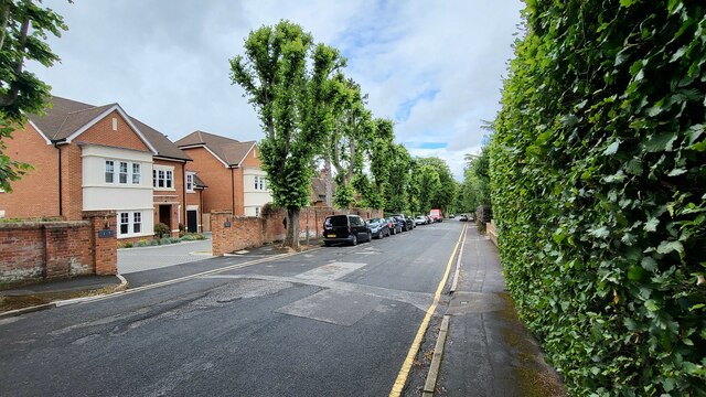
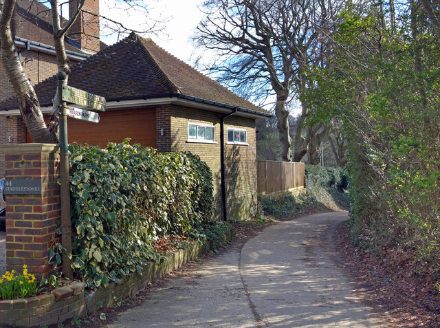
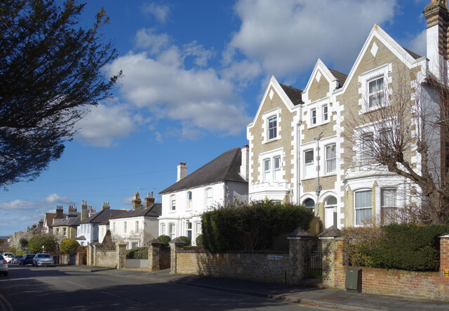
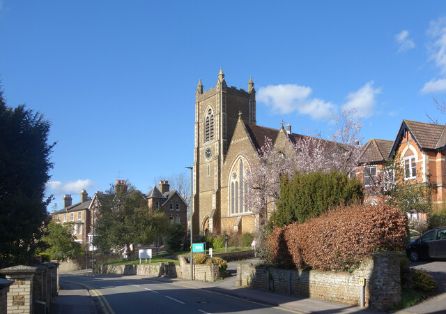
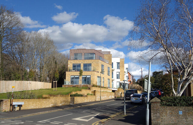
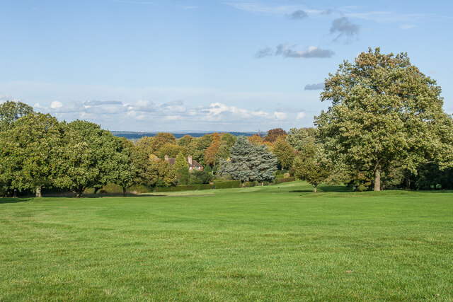
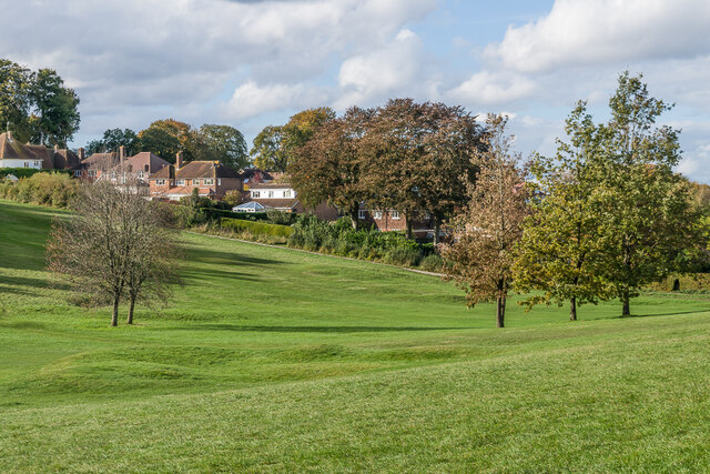
The village is renowned for its picturesque beauty, featuring a delightful mix of historic buildings, traditional cottages, and stunning countryside views. The center of Merrow is dominated by the impressive St. John the Evangelist Church, a Grade II listed building dating back to the 19th century.

Local amenities in Merrow cater to the needs of its residents, including a range of independent shops, cafes, and pubs. The village also boasts excellent educational facilities, with several primary schools and a secondary school within its boundaries.

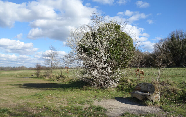
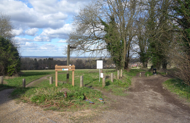
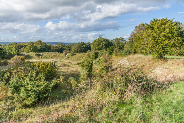
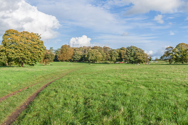
Nature enthusiasts are drawn to Merrow for its proximity to the Surrey Hills Area of Outstanding Natural Beauty, offering an array of walking and cycling routes. The nearby Pewley Down and Newlands Corner offer breathtaking panoramic views over the surrounding countryside.

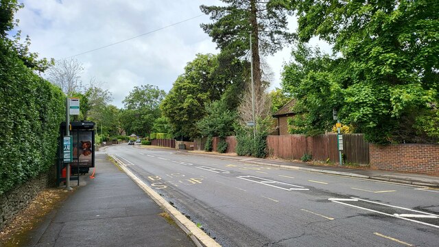
Transport links are convenient in Merrow, with regular bus services connecting the village to Guildford and other nearby towns. The A3 road is easily accessible, providing a direct route to London and Portsmouth.

Overall, Merrow offers a delightful blend of rural charm, community spirit, and access to amenities, making it an appealing place to live for those seeking a tranquil yet well-connected location in Surrey.

If you have any feedback on the listing, please let us know in the comments section below.

Merrow Images

Images are sourced within 2km of 51.24573/-0.537161 or Grid Reference TQ0250. Thanks to Geograph Open Source API. All images are credited.

Bus stops on Epsom Road The A246 main road to Guildford centre.
Bus stops on Epsom Road
The A246 main road to Guildford centre.
Maori Road New houses in a residential street.
Maori Road
New houses in a residential street.
Log Seat and Blossom, Merrow Downs A large park like area of grassy open space where countryside begins again beyond the southern edge of town.
Log Seat and Blossom, Merrow Downs
A large park like area of grassy open space where countryside begins again beyond the southern edge of town.
Site of the Prison Camp Almost nothing now remains of the WW2 camp on this open space which once housed over 800 prisoners. After the war the buildings were used as emergency housing up until the mid 1950s and then the site was cleared.
The notice board tells you all about it.
Site of the Prison Camp
Almost nothing now remains of the WW2 camp on this open space which once housed over 800 prisoners. After the war the buildings were used as emergency housing up until the mid 1950s and then the site was cleared. The notice board tells you all about it.
Paths onto Merrow Downs A tract of grassy hillside access land on the edge of Guildford.
Paths onto Merrow Downs
A tract of grassy hillside access land on the edge of Guildford.
Footpath to Warren Farm An old cast iron signpost points along a path to Warren Farm and on up to Pewley Down.
Footpath to Warren Farm
An old cast iron signpost points along a path to Warren Farm and on up to Pewley Down.
Austen Road, Guildford A residential street with smart Victorian villas in an assortment of designs.
Austen Road, Guildford
A residential street with smart Victorian villas in an assortment of designs.
Waterden Road, Guildford In an area of large Victorian houses the Gothic style Christ Church dates from around 1870.
Waterden Road, Guildford
In an area of large Victorian houses the Gothic style Christ Church dates from around 1870.
Clandon Road, Guildford A more recent development in an area of mainly Victorian housing.
Clandon Road, Guildford
A more recent development in an area of mainly Victorian housing.
Golfers and a Dog on Merrow Downs Near the Club House at Guildford Golf Club.
Golfers and a Dog on Merrow Downs
Near the Club House at Guildford Golf Club.
Trig point Trig point on Merrow Downs, situated by the green for hole 7 at Guildford Golf Club.
Trig point
Trig point on Merrow Downs, situated by the green for hole 7 at Guildford Golf Club.
Guildford Golf Club Looking along the fairway of hole 17 at Guildford Golf Club.
Guildford Golf Club
Looking along the fairway of hole 17 at Guildford Golf Club.
Guildford Golf Club Looking across the fairway of hole 14 at Guildford Golf Club with houses in Downsway in the background.
Guildford Golf Club
Looking across the fairway of hole 14 at Guildford Golf Club with houses in Downsway in the background.
Old chalk pit Looking across an old chalk pit on Merrow Downs, now a used as a hazard on hole 15 of Guildford Golf Club.
Old chalk pit
Looking across an old chalk pit on Merrow Downs, now a used as a hazard on hole 15 of Guildford Golf Club.
Guildford Golf Club Looking across the fairways of holes 17 and 1 at Guildford Golf Club with houses in Longmead in the background.
Guildford Golf Club
Looking across the fairways of holes 17 and 1 at Guildford Golf Club with houses in Longmead in the background.
Guildford Golf Club Track across the practice ground at Guildford Golf Club.
Guildford Golf Club
Track across the practice ground at Guildford Golf Club.
Clubhouse, Guildford Golf Club The clubhouse at Guildford Golf Club.
Clubhouse, Guildford Golf Club
The clubhouse at Guildford Golf Club.
Merrow Downs Open grassland at the west end of Merrow Downs.
Merrow Downs
Open grassland at the west end of Merrow Downs.
Show me another place!

Merrow is located at Grid Ref: TQ0250 (Lat: 51.24573, Lng: -0.537161)

Administrative County: Surrey

District: Guildford

Police Authority: Surrey

What 3 Words

///boost.flown.mock. Near Guildford, Surrey

Nearby Locations

Bushy Hill Merrow

Related Wikis

St Peter's Catholic School, Guildford

St Peter's Catholic School, colloquially known as St Peter's, is a co-educational secondary school and sixth form located in Guildford, Surrey, England...
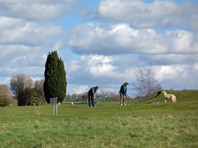
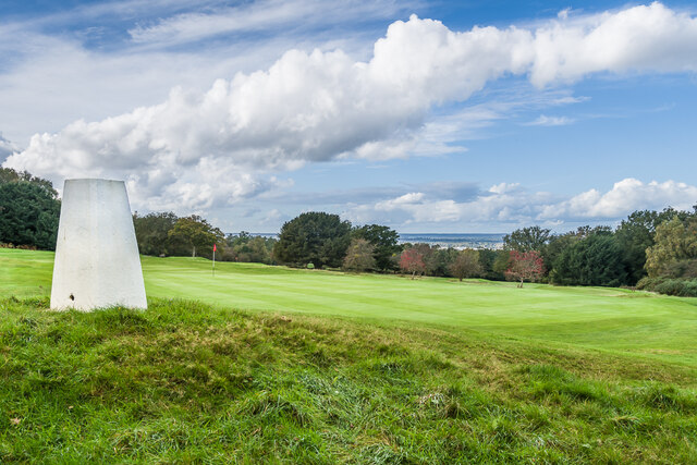
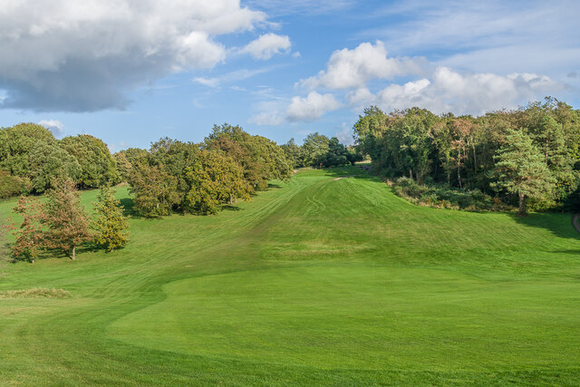
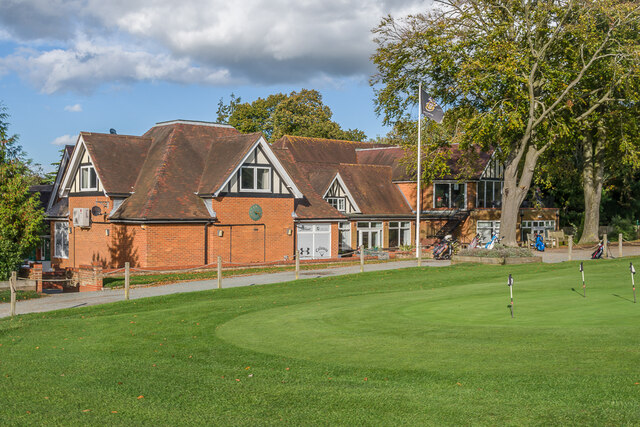
Guildford Golf Club

Guildford Golf Club is a private members' golf club in Merrow, near Guildford, England. The club was founded in 1886 and the course was opened in June...

Merrow, Surrey

The village of Merrow in Surrey, England, is a suburb in the north-east of Guildford. It is 2 miles (3.2 km) from the town's centre, on the edge of the...

Merrow F.C.

Merrow Football Club is a football club based in Merrow, near Guildford, Surrey, England. They play at the Urnfield. == History == Merrow were founded...

Borough of Guildford

The Borough of Guildford is a local government district with borough status in Surrey, England. With around half of the borough's population, Guildford...

Guildford (UK Parliament constituency)

Guildford is a constituency in Surrey represented in the House of Commons of the UK Parliament since 2019 by Angela Richardson, a Conservative. == Constituency... ==

Guildford Bason

Guildford Bason (or Basin) is a former cricket ground on Merrow Down, on the outskirts of Guildford, Surrey. Cricket was played on the ground between 1730...
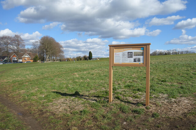
Merrow Downs

Merrow Downs, in Surrey, England is an area of common land at the edge of the former village of Merrow, now a suburb of Guildford. It forms part of Surrey...

Nearby Amenities

Located within 500m of 51.24573,-0.537161
Merrow
Is In: Guildford, Surrey
Note: Location of Merrow Sign
Place: suburb
Wikidata: Q6820382
Lat/Long: 51.2443481/-0.5335147
Traffic Signals
Source: voice
Lat/Long: 51.2456545/-0.5309432
Post Box
Collection Plate: CP1D
Collection Times: Mo-Fr 09:00; Sa 07:00
Last Checked: 2021-03-05
Old Ref: GU1 227
Operator: Royal Mail
Post Box Type: pillar
Ref: GU1 227D
Royal Cypher: GVIR
Royal Cypher Wikidata: Q33102169
Source: voice; survey
Lat/Long: 51.2438133/-0.536356
Parking
Created By: Potlatch 0.8a
Source: voice
Lat/Long: 51.246177/-0.5308738
Costcutter
Addr City: Guildford
Addr Country: GB
Addr Housenumber: 61
Addr Postcode: GU1 2UQ
Addr Street: Bushy Hill Drive
Brand: Costcutter
Brand Wikidata: Q5175072
Contact Website: https://store-locator.costcutter.co.uk/costcutter-44b56bef833b
Fhrs Authority: Guildford
Fhrs Id: 649624
Fhrs Local Authority Id: 3863
Shop: convenience
Source: voice
Lat/Long: 51.2494378/-0.5401796
Bus Stop
Sheeplands Avenue
Naptan AtcoCode: 40004407272B
Naptan Bearing: SE
Naptan CommonName: Sheeplands Avenue
Naptan Indicator: Just Before
Naptan Landmark: Sheeplands Avenue
Naptan NaptanCode: suraptwj
Naptan PlusbusZoneRef: GUILDFD
Naptan Street: Bushy Hill Drive
Naptan Verified: yes
Public Transport: platform
Source: naptan_import;voice
Lat/Long: 51.2477876/-0.5345153
Bus Stop
Sheeplands Avenue
Naptan AtcoCode: 40004407272A
Naptan Bearing: NW
Naptan CommonName: Sheeplands Avenue
Naptan Indicator: Just after
Naptan Landmark: Sheeplands Avenue
Naptan NaptanCode: suraptwg
Naptan PlusbusZoneRef: GUILDFD
Naptan Street: Bushy Hill Drive
Naptan Verified: yes
Public Transport: platform
Source: naptan_import;voice
Lat/Long: 51.247574/-0.5342101
Bus Stop
High Path Road
Bench: no
Bin: yes
Lit: yes
Naptan AtcoCode: 40004407319B
Naptan Bearing: NE
Naptan CommonName: High Path Road
Naptan Indicator: Opp
Naptan Landmark: High Path Road
Naptan NaptanCode: suratamj
Naptan PlusbusZoneRef: GUILDFD
Naptan Street: Epsom Road
Naptan Verified: yes
Public Transport: platform
Shelter: yes
Source: naptan_import;voice
Tactile Paving: yes
Lat/Long: 51.2434771/-0.5377464
Bus Stop
High Path Road
Bench: yes
Bin: yes
Naptan AtcoCode: 40004407319A
Naptan Bearing: SW
Naptan CommonName: High Path Road
Naptan Indicator: Just after
Naptan Landmark: High Path Road
Naptan NaptanCode: suratamg
Naptan PlusbusZoneRef: GUILDFD
Naptan Street: Epsom Road
Naptan Verified: yes
Public Transport: platform
Shelter: yes
Source: naptan_import;voice
Tactile Paving: no
Lat/Long: 51.2431681/-0.5390628
Mini Roundabout
Lat/Long: 51.2454522/-0.5399873
Recycling
Merrow Village Hall
Lat/Long: 51.2451433/-0.5333769
Post Box
Post Box Type: lamp
Postal Code: GU1
Ref: GU1 255
Source: photo
Lat/Long: 51.2481864/-0.5362236
Old Phone: +44 1483 567485
Removed Amenity: telephone
Source: photo
Lat/Long: 51.2481946/-0.536265
Post Box
Collection Plate: CP7D
Collection Times: Mo-Fr 09:00; Sa 07:00
Last Checked: 2021-03-05
Old Ref: GU1 259
Operator: Royal Mail
Post Box Type: lamp
Ref: GU1 259D
Royal Cypher: EIIR
Royal Cypher Wikidata: Q33102113
Source: survey
Lat/Long: 51.2426982/-0.5322797
Dentist
Merrow Dental Practice
Lat/Long: 51.2458555/-0.5307816
Power: substation
Lat/Long: 51.2462762/-0.5310501
Bus Stop
Finches Rise
Naptan AtcoCode: 40004407268A
Naptan Bearing: NW
Naptan CommonName: Finches Rise
Naptan Indicator: Just Before
Naptan Landmark: Finches Rise
Naptan NaptanCode: suraptpt
Naptan PlusbusZoneRef: GUILDFD
Naptan Street: Bushy Hill Drive
Naptan Verified: no
Public Transport: platform
Source: naptan_import
Lat/Long: 51.2488593/-0.5386016
Bus Stop
Bushy Hill Drive
Naptan AtcoCode: 40004407271A
Naptan Bearing: S
Naptan CommonName: Bushy Hill Drive
Naptan Indicator: S-bound
Naptan Landmark: Bushy Hill Drive
Naptan NaptanCode: suraptwd
Naptan PlusbusZoneRef: GUILDFD
Naptan Street: Bushy Hill Drive
Naptan Verified: no
Public Transport: platform
Source: naptan_import
Lat/Long: 51.2494676/-0.5375013
Bus Stop
Wykeham Road
Naptan AtcoCode: 40004407273A
Naptan Bearing: SE
Naptan CommonName: Wykeham Road
Naptan Indicator: Just after
Naptan Landmark: Wykeham Road
Naptan NaptanCode: suraptwm
Naptan PlusbusZoneRef: GUILDFD
Naptan Street: Bushy Hill Drive
Naptan Verified: yes
Public Transport: platform
Source: naptan_import;voice
Lat/Long: 51.2461457/-0.5312723
Bus Stop
Levylsdene
Bench: yes
Bin: yes
Naptan AtcoCode: 40004407318A
Naptan Bearing: SW
Naptan CommonName: Levylsdene
Naptan Indicator: adj
Naptan Landmark: Levylsdene
Naptan NaptanCode: suratama
Naptan Street: Epsom Road
Naptan Verified: no
Public Transport: platform
Shelter: yes
Source: naptan_import
Tactile Paving: no
Lat/Long: 51.2444395/-0.5335328
Bus Stop
Levylsdene
Naptan AtcoCode: 40004407318B
Naptan Bearing: NE
Naptan CommonName: Levylsdene
Naptan Indicator: Just after
Naptan Landmark: Levylsdene
Naptan NaptanCode: suratamd
Naptan Street: Epsom Road
Naptan Verified: yes
Public Transport: platform
Shelter: no
Source: naptan_import;voice
Lat/Long: 51.2453697/-0.531975
St Peters School
Naptan AtcoCode: 40004407319C
Naptan Bearing: N
Naptan BusStopType: CUS
Naptan CommonName: St Peters School
Naptan Indicator: Grounds
Naptan Landmark: St Peters School
Naptan NaptanCode: surgmwtw
Naptan PlusbusZoneRef: GUILDFD
Naptan Street: Horseshoe Lane East
Naptan Verified: no
Source: naptan_import
Lat/Long: 51.2465723/-0.5380717
Bus Stop
Wykeham Road
Naptan AtcoCode: 40004407334A
Naptan Bearing: NW
Naptan CommonName: Wykeham Road
Naptan Indicator: Opp
Naptan Landmark: Wykeham Road
Naptan NaptanCode: suratawm
Naptan PlusbusZoneRef: GUILDFD
Naptan Street: Bushy Hill Drive
Naptan Verified: no
Public Transport: platform
Source: naptan_import
Lat/Long: 51.2463636/-0.531712
St Thomas of Canterbury School Grounds
Naptan AtcoCode: 40004407549A
Naptan Bearing: N
Naptan BusStopType: CUS
Naptan CommonName: St Thomas of Canterbury School Grounds
Naptan Indicator: adj
Naptan Landmark: St Thomas of Canterbury School
Naptan NaptanCode: surgwawj
Naptan PlusbusZoneRef: GUILDFD
Naptan Street: School Grounds
Naptan Verified: no
Source: naptan_import
Lat/Long: 51.2433721/-0.5417693
Bicycle Parking
Source: local knowledge
Lat/Long: 51.2451432/-0.5381562
Waste Basket
Check Date: 2021-12-20
Lat/Long: 51.246139/-0.5441128
Crossing
Crossing: uncontrolled
Kerb: raised
Lat/Long: 51.2461877/-0.5300759
Atm
Addr City: Guildford
Addr Street: Epsom Road
Note: 2 machines
Wheelchair Description: On outside wall of M&S. Access obstructed by bollards and bins of goods on my Nov'17 visit.
Lat/Long: 51.2461274/-0.5303407
Addr City: Merrow
Addr Postcode: GU1 2SQ
Addr Street: Bushy Hill Drive
Building: yes
Lat/Long: 51.2476803/-0.533533
Addr City: Merrow
Addr Postcode: GU1 2SQ
Addr Street: Bushy Hill Drive
Building: yes
Lat/Long: 51.2477919/-0.5340868
Addr City: Merrow
Addr Postcode: GU1 2SQ
Addr Street: Bushy Hill Drive
Building: yes
Lat/Long: 51.247734/-0.5338139
Addr City: Merrow
Addr Postcode: GU1 2SW
Addr Street: Banders Rise
Building: yes
Lat/Long: 51.2491067/-0.5338223
Telephone
Lat/Long: 51.2435679/-0.5423787
Boxgrove
Place: suburb
Lat/Long: 51.2446311/-0.5431296
Generator Method: photovoltaic
Generator Source: solar
Generator Type: solar_photovoltaic_panel
Location: roof
Power: generator
Lat/Long: 51.2467512/-0.5335812
Generator Method: photovoltaic
Generator Source: solar
Generator Type: solar_photovoltaic_panel
Location: roof
Power: generator
Lat/Long: 51.247798/-0.5316179
Generator Method: photovoltaic
Generator Source: solar
Generator Type: solar_photovoltaic_panel
Location: roof
Power: generator
Lat/Long: 51.2472951/-0.5309339
Generator Method: photovoltaic
Generator Source: solar
Generator Type: solar_photovoltaic_panel
Location: roof
Power: generator
Lat/Long: 51.2499545/-0.5352509
Generator Method: photovoltaic
Generator Source: solar
Generator Type: solar_photovoltaic_panel
Location: roof
Power: generator
Lat/Long: 51.2499999/-0.5355714
Generator Method: photovoltaic
Generator Source: solar
Generator Type: solar_photovoltaic_panel
Location: roof
Power: generator
Lat/Long: 51.2468771/-0.5397919
Merrow News
Addr City: Guildford
Addr Country: GB
Addr Housenumber: 172
Addr Postcode: GU1 2RR
Addr Street: Epsom Road
Fhrs Authority: Guildford
Fhrs Id: 649970
Fhrs Local Authority Id: 4945
Shop: newsagent
Lat/Long: 51.2432327/-0.5384079
Fast Food
Domino's
Addr City: Guildford
Addr Country: GB
Addr Housenumber: 207
Addr Postcode: GU1 2RB
Addr Street: Epsom Road
Brand: Domino's
Brand Wikidata: Q839466
Brand Wikipedia: en:Domino's Pizza
Contact Website: https://www.dominos.co.uk/pizza-near-me/guildford/207-epsom-road
Cuisine: pizza
Fhrs Authority: Guildford
Fhrs Id: 1044949
Lat/Long: 51.2458898/-0.5306737
School
St Peter's Catholic School
Denomination: catholic
Religion: christian
Lat/Long: 51.2468987/-0.5383296
Defibrillator
Access: yes
Check Date: 2023-04-17
Defibrillator Location: Merrow Village Hall
Emergency: defibrillator
Indoor: no
Operator: Beating Hearts Merrow
Ref GB The Circuit: 2CEB11A4-E222-4C13-9073-AF25011B9D3B
Lat/Long: 51.2448387/-0.5337349
The data included in this document is from www.openstreetmap.org. The data is made available under ODbL.

Have you been to Merrow?

Leave your review of Merrow below (or comments, questions and feedback).