Cross & Hand

Heritage Site in Dorset

England

Cross & Hand

Hilfield: pasture land, looking towards Batcombe Hill
Hilfield: pasture land, looking towards Batcombe Hill Credit: Keith Salvesen

Cross & Hand is a historic heritage site located in the county of Dorset, England. Situated near the village of Yetminster, it holds a significant place in the region's history and is a popular attraction for tourists and history enthusiasts.

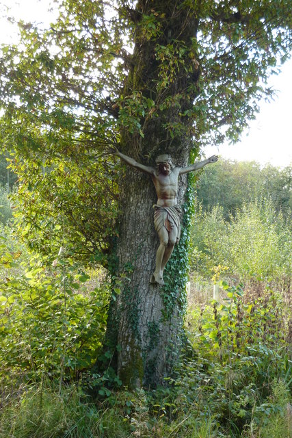
The site gets its name from the presence of a stone cross and a hand-shaped stone, both of which are believed to date back to the medieval period. These ancient relics are thought to serve as markers or boundary stones, indicating the limits of the local parish. The cross stands at an impressive height and showcases intricate carvings, depicting religious symbols and motifs of the era.

In addition to the cross and hand, Cross & Hand offers visitors a glimpse into the past through the remains of a medieval settlement. The site features the foundations of several buildings, including a small chapel and a manor house. These structures provide valuable insights into the architecture and daily life of the people who resided here centuries ago.

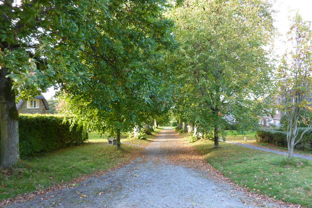
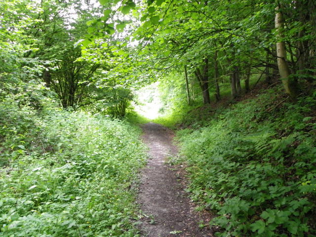
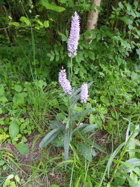
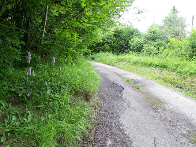
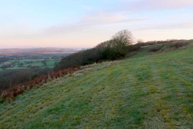
The heritage site is surrounded by picturesque countryside, offering visitors a tranquil and scenic experience. It also serves as a starting point for various walking and hiking trails, allowing visitors to explore the natural beauty of the area.

Cross & Hand is managed and maintained by the local authorities, who ensure its preservation and provide informative signage for visitors. It is accessible throughout the year, and there is no admission fee, making it an accessible destination for all. Whether one is interested in history, architecture, or simply enjoys the serenity of the countryside, Cross & Hand in Dorset offers a unique and fascinating experience.

If you have any feedback on the listing, please let us know in the comments section below.
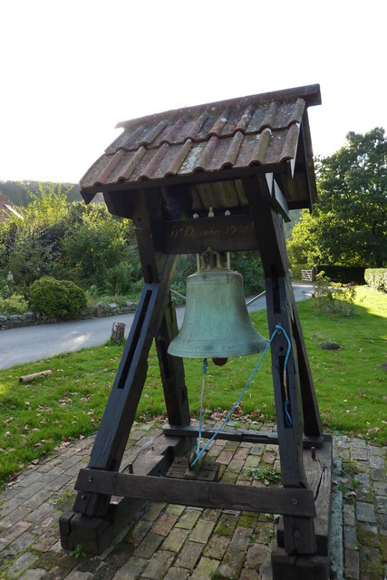
Cross & Hand Images

Images are sourced within 2km of 50.83/-2.518 or Grid Reference ST6303. Thanks to Geograph Open Source API. All images are credited.

Hilfield: pasture land, looking towards Batcombe Hill
Sheep pasture on Gore Hill (co-ordinated grazing)
Footpath on Gore Hill
Crucifix beyond the Hidden Garden of Hilfield Friary Hilfield Friary is set on the edge of the Dorset Downs with magnificent views across the Blackmore Vale – rural England at its greenest, the countryside of Thomas Hardy’s novels.  There have been Franciscan brothers living here in a collection of what were once farm buildings since 1921, providing refuge for the homeless, the experience of community, and a place for prayer, reflection and renewal.
Crucifix beyond the Hidden Garden of Hilfield Friary
Hilfield Friary is set on the edge of the Dorset Downs with magnificent views across the Blackmore Vale – rural England at its greenest, the countryside of Thomas Hardy’s novels. There have been Franciscan brothers living here in a collection of what were once farm buildings since 1921, providing refuge for the homeless, the experience of community, and a place for prayer, reflection and renewal.
The Bell at Hilfield Friary The Society of St Francis is a Religious Order in the Anglican
Communion, committed to following Christ in the way of Saint
Francis of Assisi in humility, love and joy.
The Bell at Hilfield Friary
The Society of St Francis is a Religious Order in the Anglican Communion, committed to following Christ in the way of Saint Francis of Assisi in humility, love and joy.
Hilfield, the Friary of Saint Francis
Inside the Chapel at the Friary of Saint Francis
Woodland path near Hilfield This path is one of many that allow walkers to access Hilfield Woods.
Woodland path near Hilfield
This path is one of many that allow walkers to access Hilfield Woods.
Common spotted orchid (Dactylorhiza fuchsii), Hilfield Common spotted orchids have dense cone-shaped flower spikes, with narrow, spotted leaves.
Common spotted orchid (Dactylorhiza fuchsii), Hilfield
Common spotted orchids have dense cone-shaped flower spikes, with narrow, spotted leaves.
Common spotted orchid (Dactylorhiza fuchsii), Hilfield The Common spotted orchid can be found almost anywhere, in dune slacks, meadows, roadside verges and woodland edges.  For a close-up <a href="https://www.geograph.org.uk/photo/2476015">ST6304 : Common spotted orchid (Dactylorhiza fuchsii), Hilfield</a>
Common spotted orchid (Dactylorhiza fuchsii), Hilfield
The Common spotted orchid can be found almost anywhere, in dune slacks, meadows, roadside verges and woodland edges. For a close-up ST6304 : Common spotted orchid (Dactylorhiza fuchsii), Hilfield
Minor road near Hilfield The minor road heads towards Batcombe.  There are Common spotted orchids on the verge.  For a closer view of the orchids <a href="https://www.geograph.org.uk/photo/2476020">ST6304 : Common spotted orchid (Dactylorhiza fuchsii), Hilfield</a>
Minor road near Hilfield
The minor road heads towards Batcombe. There are Common spotted orchids on the verge. For a closer view of the orchids ST6304 : Common spotted orchid (Dactylorhiza fuchsii), Hilfield
Minterne Magna: Mintern Seat Coppice of Bluebells Pathway through this coppice
Minterne Magna: Mintern Seat Coppice of Bluebells
Pathway through this coppice
Hilfield Hill View at sunset across misty fields
Hilfield Hill
View at sunset across misty fields
Batcombe: Panoramic View of the Down
Minterne: View towards East Hill
Hilfield: Bluebells in Woods nearby
Dreamy days in Dorset 12: Hilfield Built in 1848 this remote church was tricky to find coming from the A37; but having overshot it, far easier from the other direction.
Dreamy days in Dorset 12: Hilfield
Built in 1848 this remote church was tricky to find coming from the A37; but having overshot it, far easier from the other direction.
Dreamy days in Dorset 17: Batcombe There was an identical sign to this on the door of St Mary's, but being brave (or stupid) I still went in!
Dreamy days in Dorset 17: Batcombe
There was an identical sign to this on the door of St Mary's, but being brave (or stupid) I still went in!
Show me another place!

Cross & Hand is located at Grid Ref: ST6303 (Lat: 50.83, Lng: -2.518)

Unitary Authority: Dorset

Police Authority: Dorset

What 3 Words

///snuck.erupted.diet. Near Maiden Newton, Dorset

Related Wikis

Batcombe Down

Batcombe Down (grid reference ST623040) is an 18.6 hectare biological Site of Special Scientific Interest in Dorset, England: notified in 1952. == Sources... ==

Hilfield

Hilfield is a small, scattered village and civil parish in west Dorset, England, situated under the scarp face of the Dorset Downs 7 miles (11 km) south...

Cerne, Totcombe and Modbury Hundred

Cerne, Totcombe and Modbury Hundred was a hundred in the county of Dorset, England. Some of its tithings and parishes were exclaves which indicates that...

Telegraph Hill, Dorset

Telegraph Hill (267 metres, 876 feet high) is a hill about 1 mile northwest of Minterne Magna and about 10 miles north of Dorchester in the county of Dorset...

Nearby Amenities

Located within 500m of 50.83,-2.518
Gore Hill
Place: locality
Lat/Long: 50.8322713/-2.5171432
Ele: 263
Man Made: survey_point
Lat/Long: 50.8331149/-2.5162795
Barrier: bollard
Lat/Long: 50.8336968/-2.5174537
Barrier: bollard
Lat/Long: 50.8336748/-2.5175241
The data included in this document is from www.openstreetmap.org. The data is made available under ODbL.

Have you been to Cross & Hand?

Leave your review of Cross & Hand below (or comments, questions and feedback).