Belah

Settlement in Cumberland Carlisle

England

Belah

Carlisle Castle Viewed across the A595 from grid ref NY 398 561 or thereabouts.
Carlisle Castle Credit: Tom Pullman

Belah is a small village located in the district of Cumberland, in the county of Cumbria, England. Situated approximately 3 miles south of the town of Brampton, Belah falls within the civil parish of Brampton. The village lies close to the border with Scotland, with the Scottish town of Gretna Green just a short distance to the north.

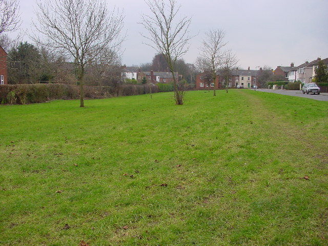
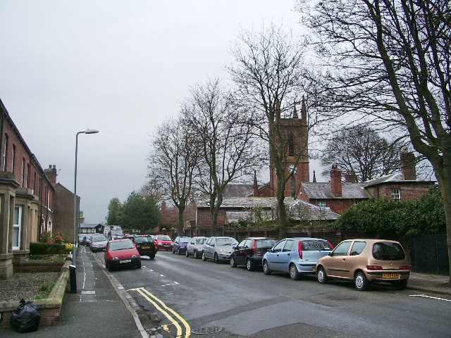
Belah is a picturesque village, surrounded by rolling countryside and farmland. It is known for its quaint and charming atmosphere, with traditional stone-built houses and a sense of tranquility. The local community is tight-knit and friendly, with a population of around 200 residents.

Despite its small size, Belah offers a range of amenities to its residents. These include a primary school, a village hall, and a local pub. The village is well-connected to the surrounding areas, with good road links to Brampton and other nearby towns.

The village is also situated in close proximity to several notable landmarks and attractions. Just a short drive away is Hadrian's Wall, a UNESCO World Heritage Site that served as the northernmost frontier of the Roman Empire. Additionally, the beautiful Lake District National Park, known for its stunning landscapes and outdoor activities, is within easy reach.

Overall, Belah is a charming village in the heart of the English countryside, offering a peaceful retreat for its residents and visitors alike.

If you have any feedback on the listing, please let us know in the comments section below.

Belah Images

Images are sourced within 2km of 54.911121/-2.950216 or Grid Reference NY3957. Thanks to Geograph Open Source API. All images are credited.

Carlisle Castle Viewed across the A595 from grid ref NY 398 561 or thereabouts.
Carlisle Castle
Viewed across the A595 from grid ref NY 398 561 or thereabouts.
Eden Benchmarks, Bitts Park, Carlisle This sculpture is one of 10 positioned along the River Eden to mark the new millennium.
Eden Benchmarks, Bitts Park, Carlisle
This sculpture is one of 10 positioned along the River Eden to mark the new millennium.
Carlisle Castle England's finest border fortress. 900 years of history
Carlisle Castle
England's finest border fortress. 900 years of history
Cumberland Infirmary, Carlisle The flagship of the national PFI programme was officially opened by the Rt. Hon. Tony Blair, Prime Minister, in June 2000.
<span class="nowrap"><a title="http://www.visitcumbria.com/hospitals.htm" rel="nofollow ugc noopener" href="http://www.visitcumbria.com/hospitals.htm">Link</a><img style="margin-left:2px;" alt="External link" title="External link - shift click to open in new window" src="https://s1.geograph.org.uk/img/external.png" width="10" height="10"/></span>
Cumberland Infirmary, Carlisle
The flagship of the national PFI programme was officially opened by the Rt. Hon. Tony Blair, Prime Minister, in June 2000. LinkExternal link
Cumberland Infirmary, Carlisle
Carlisle Kingmoor Railway Depot It's the end of the line for Class 31175
Carlisle Kingmoor Railway Depot
It's the end of the line for Class 31175
Motel, Kingstown, Carlisle Sandwiched between retail parks, a main road and the motorway.
Motel, Kingstown, Carlisle
Sandwiched between retail parks, a main road and the motorway.
Public Open Space, Moorville, Carlisle
St Peter's Church, Kingsmoor Next to a retail Park...
St Peter's Church, Kingsmoor
Next to a retail Park...
St Augustine's RC Church
Belah Primary School Flat roofed post-war construction.
Belah Primary School
Flat roofed post-war construction.
River Eden The River Caldew joins from right in the top of the shot.
River Eden
The River Caldew joins from right in the top of the shot.
Old-School Barber Shop Defiantly anachronistic barber shop on the corner of Castle Street.  Now that's what I call a frontage.
Old-School Barber Shop
Defiantly anachronistic barber shop on the corner of Castle Street. Now that's what I call a frontage.
Carlisle Working Men's Club & Institute This building on Fisher Street sports one of the most elegant frontages I've ever seen on a CIU building.
Carlisle Working Men's Club & Institute
This building on Fisher Street sports one of the most elegant frontages I've ever seen on a CIU building.
St Kentigern's Church, Grinsdale Small country church accessible only by foot, with views over the River Eden.
St Kentigern's Church, Grinsdale
Small country church accessible only by foot, with views over the River Eden.
Devonshire Walk Car Park The car park for the castle, with a freight train passing.
Devonshire Walk Car Park
The car park for the castle, with a freight train passing.
Carlisle Castle
Carlisle Castle
Carlisle Castle The two cannons on the castle's wall walk date from the Napoleonic period.
Carlisle Castle
The two cannons on the castle's wall walk date from the Napoleonic period.
Show me another place!

Belah is located at Grid Ref: NY3957 (Lat: 54.911121, Lng: -2.950216)

Administrative County: Cumbria

District: Carlisle

Police Authority: Cumbria

What 3 Words

///jets.note.zones. Near Carlisle, Cumbria

Related Wikis

Austin Friars

Austin Friars is a coeducational private day school located in Carlisle, England. The Senior School provides secondary education for 350 boys and girls...

Etterby

Etterby is a former village in Cumbria, England. It is now a northwestern suburb of Carlisle, on the northern side of the River Eden. The Redfern Inn...

Carlisle Kingmoor TMD

Carlisle Kingmoor TMD is a railway traction maintenance depot situated in Carlisle, England. The depot is operated by the Direct Rail Services (DRS). The...

Petriana

Uxelodunum (with the alternative Roman name of Petriana and the modern name of Stanwix Fort) was a Roman fort. It was the largest fort on Hadrian's Wall...

River Caldew

The River Caldew is a river running through Cumbria in England. The river rises high up on the northern flanks of Skiddaw, in the Northern Fells area...

Milecastle 66

Milecastle 66 (Stanwix Bank) was a milecastle on Hadrian's Wall (grid reference NY39735678). == Description == Milecastle 66 was on the north, Stanwix...

Belah

Belah is a suburb of Carlisle in the City of Carlisle district, in the county of Cumbria, England. == References ==
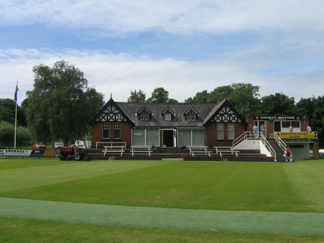
Edenside

Edenside is a cricket ground in Carlisle, Cumbria. The ground is the primary home ground of Cumbria County Cricket Club. The first recorded match on the...

Related Videos

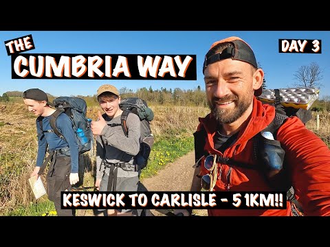
My hardest day hiking | 51KM to the finish | The Cumbria Way

The Cumbria Way - 73 Miles from Ulverston to Carlisle. Join me on my epic journey to complete the Cumbria Way in just three ...

Carlisle Castle | Our first vlog | Malayalam | Travel Bugs

Carlisle Castle | Our first vlog | Malayalam | Travel Bugs # Linto Thomas # My first vlog # Uk malluz# Travelling vlog # castle Uk ...

Saturday Walk | Carlisle city | City center. 4K

Amazing city walk around Carlisle city center in a Saturday. 4K video. Starting from the train station to the city center. Recorded: ...

Carlisle Sunday walk around the city!

Amazing walk around Carlisle city - Cumbria. 4K video Thanks for watching and sharing, please Like and subscribe to this ...

Nearby Amenities

Located within 500m of 54.911121,-2.950216
Etterby
Is In: Cumbria, England, UK
Place: suburb
Source: npe
Lat/Long: 54.9088023/-2.9532884
Belah
Created By: Potlatch 0.5d
Is In: Carlisle, Cumbria, England, UK
Place: suburb
Source: npe
Lat/Long: 54.9113588/-2.9480255
Bus Stop
Hartley Avenue out
Bench: no
Bin: no
Lit: no
Naptan AtcoCode: 090033102003
Naptan Bearing: N
Naptan CommonName: Hartley Avenue out
Naptan Indicator: Opp
Naptan Landmark: no. 16
Naptan NaptanCode: cumamtwj
Naptan PlusbusZoneRef: CARLILE
Naptan Street: Hartley Avenue
Naptan Verified: no
Shelter: no
Source: naptan_import
Tactile Paving: no
Lat/Long: 54.9107126/-2.9536796
Bus Stop
Belah Rd Playing Field
Naptan AtcoCode: 090033102024
Naptan Bearing: W
Naptan CommonName: Belah Rd Playing Field
Naptan Indicator: opp
Naptan Landmark: no. 51
Naptan NaptanCode: cumamwaw
Naptan PlusbusZoneRef: CARLILE
Naptan Street: Belah Road
Naptan Verified: no
Source: naptan_import
Lat/Long: 54.9113107/-2.9472981
Bus Stop
Bracken Ridge
Naptan AtcoCode: 090033102035
Naptan Bearing: W
Naptan CommonName: Bracken Ridge
Naptan Indicator: opp
Naptan Landmark: no. 91
Naptan NaptanCode: cumamwdm
Naptan PlusbusZoneRef: CARLILE
Naptan Street: Bracken Ridge
Naptan Verified: no
Source: naptan_import
Lat/Long: 54.9122152/-2.9442463
Bus Stop
Briar Bank Community Centre
Bench: yes
Bin: yes
Bus: yes
Covered: yes
Lit: yes
Naptan AtcoCode: 090033102180
Naptan Bearing: E
Naptan CommonName: Briar Bank Community Centre
Naptan Indicator: o/s
Naptan Landmark: Belah Community Centre
Naptan NaptanCode: cumamwmt
Naptan PlusbusZoneRef: CARLILE
Naptan Street: Briar Bank
Naptan Verified: no
Public Transport: platform
Shelter: yes
Source: naptan_import
Tactile Paving: no
Lat/Long: 54.912829/-2.9440239
Bus Stop
Redfern
Bench: yes
Bin: yes
Lit: yes
Naptan AtcoCode: 090033102282
Naptan Bearing: S
Naptan CommonName: Redfern in
Naptan Indicator: o/s
Naptan Landmark: Etterby Close
Naptan NaptanCode: cumapadg
Naptan PlusbusZoneRef: CARLILE
Naptan Street: Etterby Scaur
Naptan Verified: no
Shelter: yes
Source: naptan_import
Tactile Paving: no
Lat/Long: 54.9072039/-2.9520803
Bus Stop
Caird Avenue
Naptan AtcoCode: 090033102435
Naptan Bearing: S
Naptan CommonName: Caird Avenue
Naptan Indicator: o/s
Naptan Landmark: no. 11
Naptan NaptanCode: cumapamw
Naptan PlusbusZoneRef: CARLILE
Naptan Street: Caird Avenue
Naptan Verified: no
Source: naptan_import
Lat/Long: 54.9106559/-2.951744
Bus Stop
Ashgrove
Naptan AtcoCode: 090033102446
Naptan Bearing: S
Naptan CommonName: Ashgrove
Naptan Indicator: o/s
Naptan Landmark: no.s 12 to 10
Naptan NaptanCode: cumapatd
Naptan PlusbusZoneRef: CARLILE
Naptan Street: Belah Road
Naptan Verified: no
Source: naptan_import
Lat/Long: 54.9102633/-2.9490829
Bus Stop
Briar Bank
Naptan AtcoCode: 090033102565
Naptan Bearing: E
Naptan CommonName: Briar Bank
Naptan Indicator: o/s
Naptan Landmark: no. 49 to 51
Naptan NaptanCode: cumapgdm
Naptan PlusbusZoneRef: CARLILE
Naptan Street: Briar Bank
Naptan Verified: no
Source: naptan_import
Lat/Long: 54.9127883/-2.9479724
Bus Stop
Bowscale Close
Bench: yes
Bin: no
Lit: yes
Naptan AtcoCode: 090033102601
Naptan Bearing: W
Naptan CommonName: Bowscale Close
Naptan Indicator: o/s
Naptan Landmark: no. 7
Naptan NaptanCode: cumapgpa
Naptan PlusbusZoneRef: CARLILE
Naptan Street: Bowscale Close
Naptan Verified: no
Shelter: yes
Source: naptan_import
Tactile Paving: no
Lat/Long: 54.9081313/-2.9458976
Bus Stop
Hartley Avenue in
Naptan AtcoCode: 090033102611
Naptan Bearing: S
Naptan CommonName: Hartley Avenue in
Naptan Indicator: o/s
Naptan Landmark: no. 8
Naptan NaptanCode: cumapgpt
Naptan PlusbusZoneRef: CARLILE
Naptan Street: Hartley Avenue
Naptan Verified: no
Source: naptan_import
Lat/Long: 54.9104693/-2.9537674
Bus Stop
Enterprise
Naptan AtcoCode: 090033102822
Naptan Bearing: E
Naptan CommonName: Enterprise
Naptan Indicator: o/s
Naptan Landmark: The Enterprise Pub
Naptan NaptanCode: cumapjta
Naptan PlusbusZoneRef: CARLILE
Naptan Street: Briar Bank
Naptan Verified: no
Source: naptan_import
Lat/Long: 54.91215/-2.9514516
Bus Stop
Redfern out
Naptan AtcoCode: 090033103185
Naptan Bearing: NW
Naptan CommonName: Redfern out
Naptan Indicator: o/s
Naptan Landmark: The Redfern Inn
Naptan NaptanCode: cumapmat
Naptan PlusbusZoneRef: CARLILE
Naptan Street: Etterby Scaur
Naptan Verified: no
Source: naptan_import
Lat/Long: 54.9073519/-2.9524771
Bus Stop
Esk Road
Local Ref: AT
Naptan AtcoCode: 090033103977
Naptan Bearing: E
Naptan CommonName: Esk Road
Naptan Indicator: at
Naptan Landmark: junction Lowry Hill Road
Naptan NaptanCode: cumdmwtm
Naptan PlusbusZoneRef: CARLILE
Naptan Street: Esk Road
Naptan Verified: no
Source: naptan_import
Lat/Long: 54.9142884/-2.9526721
Crossing
Lat/Long: 54.9125906/-2.9524626
Post Office
Kingmoor Road Post Office
Addr City: Carlisle
Addr Country: GB
Addr Postcode: CA3 9PS
Addr Street: Kingmoor Road
Addr Village: Stanwix
Brand: Post Office
Brand Wikidata: Q1783168
Check Date: 2022-05-27
Contact Website: https://www.postoffice.co.uk/branch-finder/1934104/kingmoor-road
Operator: Premier Stores
Ref Pol Id: 6340
Lat/Long: 54.9074649/-2.9526543
Post Box
Ref: CA3 158
Source: survey
Lat/Long: 54.9075341/-2.9526679
Turning Circle
Lat/Long: 54.909661/-2.9522342
Turning Circle
Lat/Long: 54.9093462/-2.9514763
Turning Circle
Lat/Long: 54.9111652/-2.9541099
Turning Circle
Lat/Long: 54.9098777/-2.9471052
St Ann's Hill
Place: suburb
Lat/Long: 54.9124015/-2.9447489
Waste Basket
Check Date: 2022-01-01
Lat/Long: 54.9129496/-2.9446133
Bench
Lat/Long: 54.9106813/-2.9488328
Post Box
Ref: CA3 371
Lat/Long: 54.912404/-2.9469821
Post Box
Ref: CA3 479
Lat/Long: 54.9133244/-2.9529915
Post Box
Ref: CA3 467
Lat/Long: 54.9154413/-2.9484391
Street Lamp
Lamp Type: electric
Ref: 1
Lat/Long: 54.9111908/-2.9550849
Grit Bin
Lat/Long: 54.908262/-2.9455464
Generator Method: photovoltaic
Generator Output Electricity: yes
Generator Source: solar
Generator Type: solar_photovoltaic_panel
Power: generator
Lat/Long: 54.9116909/-2.9464075
Bicycle Parking
Bicycle Parking: stands
Capacity: 18
Covered: yes
Lat/Long: 54.9102736/-2.9427455
Waste Basket
Lat/Long: 54.9091082/-2.9529146
Parking
Parking: street_side
Lat/Long: 54.9081025/-2.9459478
Parking
Parking: street_side
Lat/Long: 54.908253/-2.9457378
Parking
Parking: street_side
Lat/Long: 54.9078599/-2.9461319
Parking
Parking: street_side
Lat/Long: 54.9077644/-2.9458479
Parking
Parking: street_side
Lat/Long: 54.907937/-2.9455308
Direction: both
Traffic Calming: cushion
Lat/Long: 54.9128545/-2.9443397
Give Way
Direction: forward
Lat/Long: 54.9125716/-2.9431904
Direction: both
Traffic Calming: cushion
Lat/Long: 54.9125612/-2.9428194
Entrance: main
Lat/Long: 54.9130824/-2.9442236
Generator Method: photovoltaic
Generator Output Electricity: yes
Generator Source: solar
Generator Type: solar_photovoltaic_panel
Location: roof
Power: generator
Lat/Long: 54.9125908/-2.9438815
Generator Method: photovoltaic
Generator Output Electricity: yes
Generator Source: solar
Generator Type: solar_photovoltaic_panel
Location: roof
Power: generator
Lat/Long: 54.912293/-2.9435745
Charging Station
Authentication App: yes
Capacity: 1
Fee: yes
Motorcar: yes
Network: Charge My Street
Operator: The Belah Community Centre
Payment App: yes
Ref: EG-07720
Socket Type2: 1
Socket Type2 Current: 33
Socket Type2 Output: 7kW
Socket Type2 Voltage: 230
Lat/Long: 54.9130635/-2.9440896
Charging Station
Authentication App: yes
Capacity: 1
Fee: yes
Motorcar: yes
Network: Charge My Street
Operator: The Belah Community Centre
Payment App: yes
Ref: EG-07721
Socket Type2: 1
Socket Type2 Current: 33
Socket Type2 Output: 7kW
Socket Type2 Voltage: 230
Lat/Long: 54.913063/-2.9440798
Crossing
Lat/Long: 54.9106977/-2.9485436
Bench
Backrest: yes
Lat/Long: 54.9108288/-2.9464296
Bench
Backrest: yes
Lat/Long: 54.9107007/-2.9470278
Waste Basket
Lat/Long: 54.9109621/-2.9459766
Waste Basket
Lat/Long: 54.9107149/-2.948647
Natural: beach
Lat/Long: 54.9130501/-2.9561796
Natural: beach
Lat/Long: 54.9129271/-2.9558306
Tourism: picnic_site
Lat/Long: 54.9118114/-2.9562972
Leisure: picnic_table
Lat/Long: 54.9118332/-2.9562412
Bench
Lat/Long: 54.9118306/-2.9563522
The data included in this document is from www.openstreetmap.org. The data is made available under ODbL.

Have you been to Belah?

Leave your review of Belah below (or comments, questions and feedback).