Cerrig Cedny
Heritage Site in Carmarthenshire
Wales
Cerrig Cedny

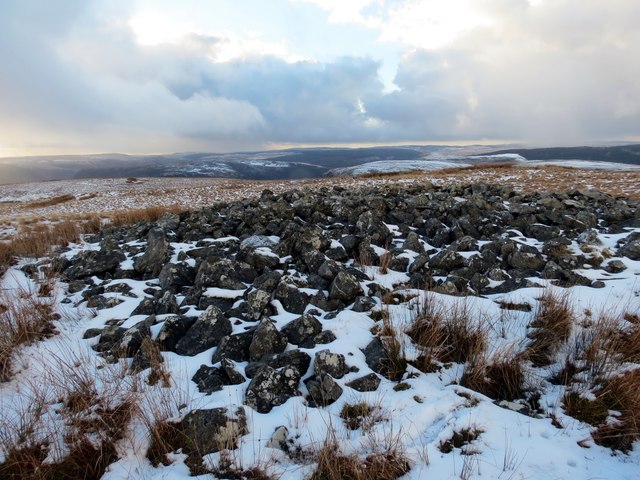
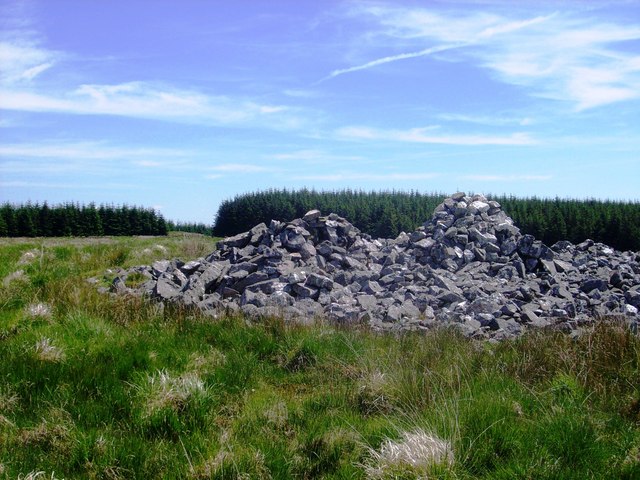
Cerrig Cedny is a historical heritage site located in Carmarthenshire, Wales. It is a collection of ancient standing stones that hold great significance in Welsh history and culture. The site is situated in a serene and picturesque countryside setting, surrounded by rolling hills and lush greenery.
The standing stones at Cerrig Cedny are believed to have been erected during the Bronze Age, between 2500 and 1500 BCE. The stones are of varying sizes and shapes, with some reaching up to 3 meters in height. Their original purpose and meaning are still open to interpretation, but they are thought to have served as markers for important rituals or as memorials for notable individuals.
Visitors to Cerrig Cedny can explore the site and marvel at the impressive craftsmanship and engineering techniques employed by the ancient inhabitants. The stones are carefully aligned, suggesting a level of precision and intention in their placement. The surrounding landscape adds to the ethereal ambiance, providing a sense of timelessness and connection to the past.
Cerrig Cedny is a protected heritage site, ensuring its preservation for future generations. It offers a unique opportunity for visitors to immerse themselves in Welsh history and gain a deeper understanding of the region's ancient past. The site is easily accessible, with parking facilities and informative signage available for visitors. It is a popular destination for tourists, history enthusiasts, and those seeking a tranquil escape in the heart of Carmarthenshire.
If you have any feedback on the listing, please let us know in the comments section below.
Cerrig Cedny Images
Images are sourced within 2km of 52.103/-3.745 or Grid Reference SN8046. Thanks to Geograph Open Source API. All images are credited.


Cerrig Cedny is located at Grid Ref: SN8046 (Lat: 52.103, Lng: -3.745)
Unitary Authority: Carmarthenshire
Police Authority: Dyfed Powys
What 3 Words
///resettle.paving.shoving. Near Abergwesyn, Powys
Nearby Locations
Related Wikis

Llyn Brianne
Llyn Brianne is a man-made lake or reservoir in the headwaters of the River Towy in Wales. == Construction == The reservoir was constructed by Wimpey Construction...

Rhandirmwyn
Rhandirmwyn (or Rhandir-mwyn) is a small village in the north east of Carmarthenshire, Wales. Located in the upper Towy valley, 3 km north of Cilycwm village...

Pwllpriddog Oak
The Pwllpriddog Oak (Welsh: Derwen Pwllpriddog), also known as the Rhandirmwyn Oak, is a 600–700-year-old tree located in farmland near Rhandirmwyn in...
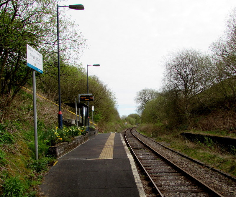
Sugar Loaf railway station
Sugar Loaf railway station is a railway station in Powys,Wales, and is part of the Heart of Wales Line. It is the most geographically remote station in...
Nearby Amenities
Located within 500m of 52.103,-3.745Have you been to Cerrig Cedny?
Leave your review of Cerrig Cedny below (or comments, questions and feedback).