Cayton Village

Heritage Site in Yorkshire Harrogate

England

Cayton Village

South Stainley - Manor Farm
South Stainley - Manor Farm Credit: Colin Park

Cayton Village, located in the county of Yorkshire, England, is a renowned heritage site known for its rich history and charming beauty. Situated near the North Sea coast, the village offers a picturesque setting and a tranquil atmosphere that attracts visitors from far and wide.

The origin of Cayton Village can be traced back to ancient times, with evidence of human habitation in the area dating back to the Iron Age. The village has witnessed various historical events and has been influenced by different cultures throughout its existence.

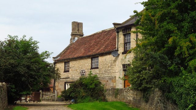
The architecture of Cayton Village is a delightful blend of different periods, showcasing its evolution over the centuries. Visitors can explore narrow winding streets lined with traditional stone houses, adorned with colorful flowers and quaint gardens. The village square, surrounded by historic buildings, serves as the heart of the community and is a hub of activity.

One of the prominent landmarks in Cayton Village is the St. John the Baptist Church, an impressive medieval structure boasting intricate stone carvings and a stunning stained glass window. The church stands as a testament to the religious heritage of the village.

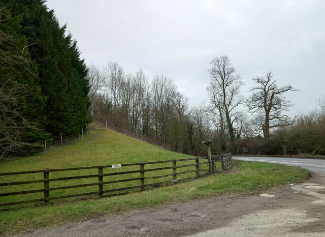
Nature enthusiasts will be enthralled by the surrounding countryside, with rolling hills, lush meadows, and breathtaking coastal views. The village is also in close proximity to Cayton Bay, a popular beach destination known for its golden sands and excellent surfing conditions.

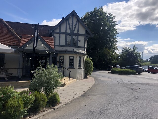
Cayton Village offers a range of amenities for visitors, including charming tearooms, traditional pubs, and local shops selling handmade crafts and souvenirs. The village hosts regular events and festivals, celebrating its cultural heritage and providing entertainment for both residents and tourists.

In conclusion, Cayton Village in Yorkshire is a captivating heritage site, offering a glimpse into the past with its historic architecture, natural beauty, and warm community spirit.

If you have any feedback on the listing, please let us know in the comments section below.

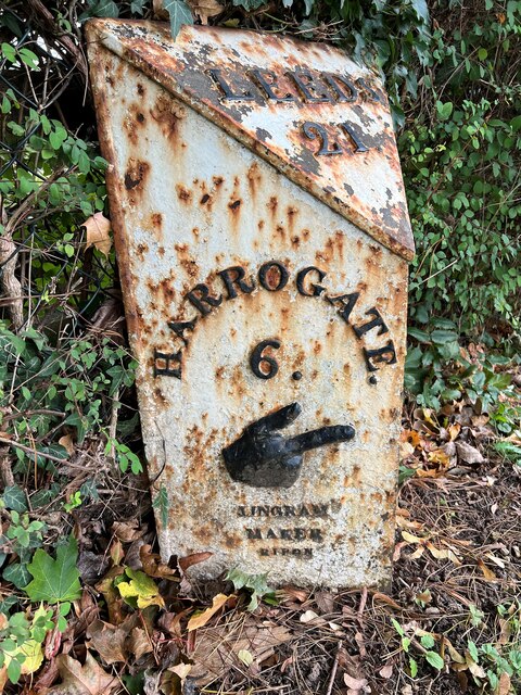
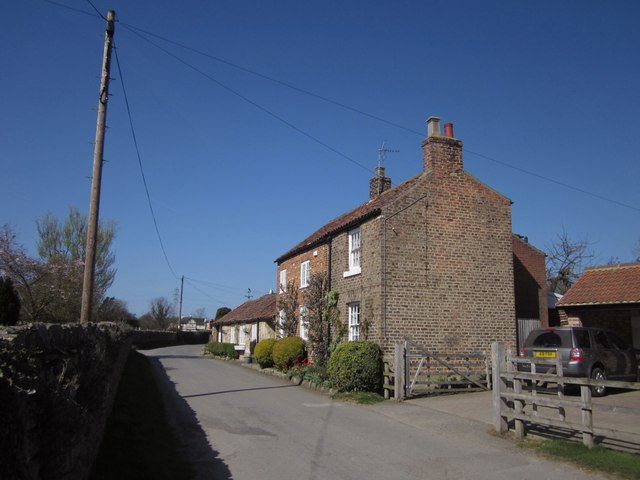
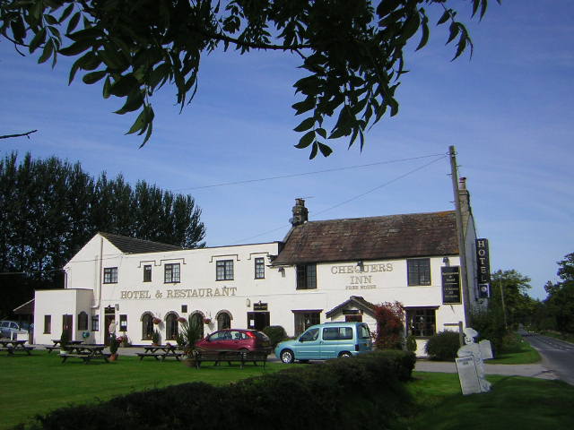
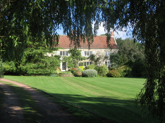
Cayton Village Images

Images are sourced within 2km of 54.067/-1.565 or Grid Reference SE2863. Thanks to Geograph Open Source API. All images are credited.

South Stainley - Manor Farm
The Inn, South Stainley Restaurant and accommodation, six miles south of Ripon
The Inn, South Stainley
Restaurant and accommodation, six miles south of Ripon
South Stainley, embankment According to the OS benchmark database there was a benchmark cut into the wall of the railway bridge on the east side of the A61. All stonework has been removed and a grassy bank remains.
South Stainley, embankment
According to the OS benchmark database there was a benchmark cut into the wall of the railway bridge on the east side of the A61. All stonework has been removed and a grassy bank remains.
Milestone - A61 Ripon Road - South Stainley (1) Milepost at the side of the A61 Ripon Road at South Stainley. It is situated just to the North of the former Red Lion Inn.
Ingram Casting:
Inscriptions read:
Leeds 21
Harrogate 6 / Ingram Maker Ripon / 1322 (perhaps 1822)?
Ripon 5 / Ingram Maker Ripon
Links to other views of this Milepost can be seen below.
<a href="https://www.geograph.org.uk/photo/7620035">SE3063 : Milestone - A61 Ripon Road - South Stainley (3)</a>
<a href="https://www.geograph.org.uk/photo/7620034">SE3063 : Milestone - A61 Ripon Road - South Stainley (2)</a>
Milestone - A61 Ripon Road - South Stainley (1)
Milepost at the side of the A61 Ripon Road at South Stainley. It is situated just to the North of the former Red Lion Inn. Ingram Casting: Inscriptions read: Leeds 21 Harrogate 6 / Ingram Maker Ripon / 1322 (perhaps 1822)? Ripon 5 / Ingram Maker Ripon Links to other views of this Milepost can be seen below. SE3063 : Milestone - A61 Ripon Road - South Stainley (3) SE3063 : Milestone - A61 Ripon Road - South Stainley (2)
Milestone - A61 Ripon Road - South Stainley (2) Milepost at the side of the A61 Ripon Road at South Stainley. It is situated just to the North of the former Red Lion Inn.
Ingram Casting:
Inscriptions read:
Leeds 21
Harrogate 6 / Ingram Maker Ripon
Links to other views of this Milepost can be seen below.
<a href="https://www.geograph.org.uk/photo/7620035">SE3063 : Milestone - A61 Ripon Road - South Stainley (3)</a>
<a href="https://www.geograph.org.uk/photo/7620029">SE3063 : Milestone - A61 Ripon Road - South Stainley (1)</a>
Milestone - A61 Ripon Road - South Stainley (2)
Milepost at the side of the A61 Ripon Road at South Stainley. It is situated just to the North of the former Red Lion Inn. Ingram Casting: Inscriptions read: Leeds 21 Harrogate 6 / Ingram Maker Ripon Links to other views of this Milepost can be seen below. SE3063 : Milestone - A61 Ripon Road - South Stainley (3) SE3063 : Milestone - A61 Ripon Road - South Stainley (1)
Milestone - A61 Ripon Road - South Stainley (3) Milepost at the side of the A61 Ripon Road at South Stainley. It is situated just to the North of the former Red Lion Inn.
Ingram Casting:
Inscriptions read:
Leeds 21
Ripon 5 / Ingram Maker Ripon / 1322 (possibly 1822?)
Links to other views of this Milepost can be seen below.
<a href="https://www.geograph.org.uk/photo/7620034">SE3063 : Milestone - A61 Ripon Road - South Stainley (2)</a>
<a href="https://www.geograph.org.uk/photo/7620029">SE3063 : Milestone - A61 Ripon Road - South Stainley (1)</a>
Milestone - A61 Ripon Road - South Stainley (3)
Milepost at the side of the A61 Ripon Road at South Stainley. It is situated just to the North of the former Red Lion Inn. Ingram Casting: Inscriptions read: Leeds 21 Ripon 5 / Ingram Maker Ripon / 1322 (possibly 1822?) Links to other views of this Milepost can be seen below. SE3063 : Milestone - A61 Ripon Road - South Stainley (2) SE3063 : Milestone - A61 Ripon Road - South Stainley (1)
The Red Lion, South Stainley
Disused railway bridge over Water Lane
Cottage, South Stainley By Church Lane. The brick is of differing colour and the design is different; the further part looks much older and the outhouses beyond may be relevant to the name "Blacksmith's Cottage".
Cottage, South Stainley
By Church Lane. The brick is of differing colour and the design is different; the further part looks much older and the outhouses beyond may be relevant to the name "Blacksmith's Cottage".
Field, South Stainley The Ripon Rowel Walk follows 15 121/11/1 across this field of grass, heading towards the pylon. The valley is that of the Markington Beck, which hereabouts become the Stainley Beck. View from Church Lane.
Field, South Stainley
The Ripon Rowel Walk follows 15 121/11/1 across this field of grass, heading towards the pylon. The valley is that of the Markington Beck, which hereabouts become the Stainley Beck. View from Church Lane.
Water Lane Bridleway 15 121/4/1 follows this traffic-free lane west of the A61. The notice on the left warns thieves to beware. Viewed from just west of <a title="https://www.geograph.org.uk/search.php?i=31006289" href="https://www.geograph.org.uk/search.php?i=31006289">Link</a> .
Water Lane
Bridleway 15 121/4/1 follows this traffic-free lane west of the A61. The notice on the left warns thieves to beware. Viewed from just west of Link .
Field boundary by Water Lane Looking past the edge of Shrog Wood (left) from the lane shown in <a href="https://www.geograph.org.uk/photo/2927016">SE3063 : Water Lane</a>, with a rather intermittent hedge.
Field boundary by Water Lane
Looking past the edge of Shrog Wood (left) from the lane shown in SE3063 : Water Lane, with a rather intermittent hedge.
Narrowing of A61 near Yew Bank Quarry
The Red Lion Inn, South Stainley
Ploughed Field by Water Lane Country to the west of South Stainley
Ploughed Field by Water Lane
Country to the west of South Stainley
South Stainley The Red Lion Inn on the A61, a very popular venue for family eating out days.
South Stainley
The Red Lion Inn on the A61, a very popular venue for family eating out days.
Water Pump This water pump is set against the bridge over Stainley Beck in the hamlet of South Stainley.
Water Pump
This water pump is set against the bridge over Stainley Beck in the hamlet of South Stainley.
Village Institute Without going back on to the busy and dangerous A61 South Stainley's former village institute is only connected to the rest of the hamlet by a footpath.
Village Institute
Without going back on to the busy and dangerous A61 South Stainley's former village institute is only connected to the rest of the hamlet by a footpath.
Show me another place!

Cayton Village is located at Grid Ref: SE2863 (Lat: 54.067, Lng: -1.565)

Division: West Riding

Administrative County: North Yorkshire

District: Harrogate

Police Authority: North Yorkshire
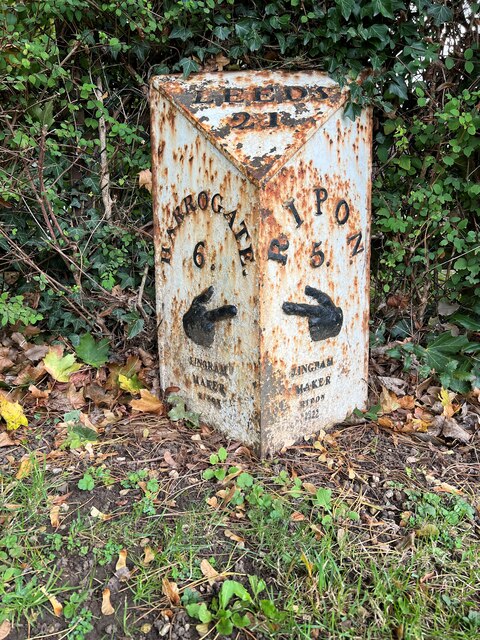
What 3 Words

///escorting.pothole.tadpoles. Near Ripon, North Yorkshire

Related Wikis

Markington

Markington is a village in the Harrogate district, in the English county of North Yorkshire. The population of the civil parish (including Markenfield...

Wormald Green railway station

Wormald Green railway station served the village of Wormald Green, Harrogate, England from 1848 to 1964 on the Leeds-Northallerton Railway. == History... ==

South Stainley

South Stainley is a small village in the Harrogate District, in the county of North Yorkshire, England. Nearby settlements include the city of Ripon, the...

Wormald Green

Wormald Green is a village in the civil parish of Markington with Wallerthwaite in the district of Harrogate, North Yorkshire, England. In 2016, Harrogate...

Bishop Thornton

Bishop Thornton is a village in the civil parish of Bishop Thornton, Shaw Mills and Warsill, in the Harrogate district of North Yorkshire, England. According...

Bedlam, North Yorkshire

Bedlam is a small village in the Harrogate district of North Yorkshire, England situated north of Harrogate.Its name most likely came from Old English...

Ingerthorpe

Ingerthorpe is a hamlet and former civil parish about 7 miles (11 km) from Harrogate, now in the parish of Markington with Wallerthwaite, in the Harrogate...

Ripley, North Yorkshire

Ripley is a town and civil parish in North Yorkshire in England, a few miles north of Harrogate on the A61 road towards Ripon. The town name derives from...

Nearby Amenities

Located within 500m of 54.067,-1.565
Power: pole
Lat/Long: 54.0646111/-1.5694302
Power: pole
Lat/Long: 54.0649023/-1.5681615
Power: pole
Lat/Long: 54.0651998/-1.5667909
Power: pole
Lat/Long: 54.0654958/-1.5654337
Power: pole
Lat/Long: 54.0657917/-1.5640819
Power: pole
Lat/Long: 54.0660467/-1.5627891
Power: pole
Lat/Long: 54.0663458/-1.561448
Power: pole
Lat/Long: 54.0668998/-1.5587604
Power: pole
Lat/Long: 54.0671517/-1.5575212
The data included in this document is from www.openstreetmap.org. The data is made available under ODbL.

Have you been to Cayton Village?

Leave your review of Cayton Village below (or comments, questions and feedback).