Castle Sween

Heritage Site in Argyllshire

Scotland

Castle Sween

Well in Castle Sween Looking down the rock-cut well in Castle Sween. The well has been lined for most of its depth.
Well in Castle Sween Credit: Patrick Mackie

Castle Sween is a historic fortress located in Argyllshire, Scotland. Situated on the eastern shore of Loch Sween, it stands as one of the oldest stone castles in Scotland, with origins dating back to the late 12th century. The castle was built by Suibhne, a Gaelic lord, and it served as the seat of the MacSween family for several centuries.

The castle is strategically positioned on a rocky promontory, offering commanding views of the surrounding landscape. Its architecture showcases a mix of medieval defensive features, including a curtain wall, a tower house, and a gatehouse. The tower house, known as the MacSween Keep, is the most prominent feature of the castle, rising four stories high and featuring narrow windows and a steeply pitched roof.

Over the centuries, Castle Sween witnessed numerous conflicts and sieges. It changed hands multiple times between rival clans, including the MacDonalds, the Campbells, and the MacNeills. The castle's turbulent history is evident in the scars left by cannonballs on its walls.

Today, Castle Sween stands as a popular heritage site, attracting visitors who are interested in Scotland's medieval history. Managed by Historic Environment Scotland, the castle welcomes tourists who can explore its ruins and learn about its intriguing past. The stunning location and the castle's well-preserved architectural features make it a picturesque spot for photography and a remarkable glimpse into Scotland's rich historical heritage.

If you have any feedback on the listing, please let us know in the comments section below.
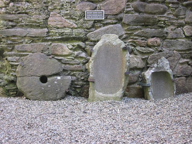
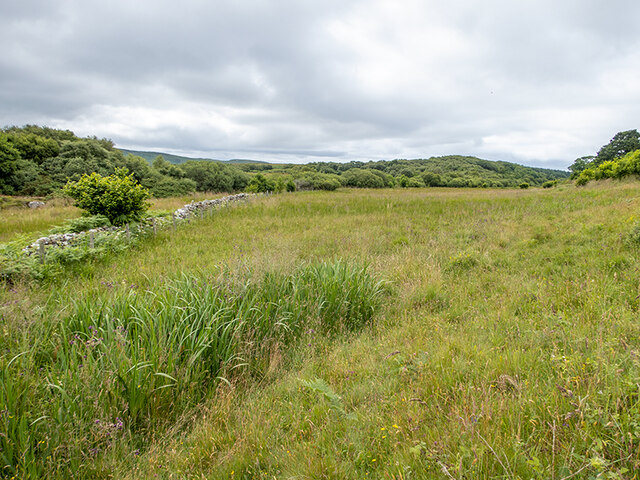
Castle Sween Images

Images are sourced within 2km of 55.945/-5.66 or Grid Reference NR7178. Thanks to Geograph Open Source API. All images are credited.

Well in Castle Sween Looking down the rock-cut well in Castle Sween. The well has been lined for most of its depth.
Well in Castle Sween
Looking down the rock-cut well in Castle Sween. The well has been lined for most of its depth.
Inside the bread oven A typical bread oven set in the corner of MacMillan's tower at Castle Sween.
Inside the bread oven
A typical bread oven set in the corner of MacMillan's tower at Castle Sween.
Bread oven at Castle Sween The bread oven is set into the corner of MacMillan's tower. The opening on the left appears to be a cupboard and is one of a row of three similar structures.
Bread oven at Castle Sween
The bread oven is set into the corner of MacMillan's tower. The opening on the left appears to be a cupboard and is one of a row of three similar structures.
Querns on display at Castle Sween One rotary and two saddle querns on display inside MacMilla's tower at Castle Sween. No information was provided as to their provenance.
Querns on display at Castle Sween
One rotary and two saddle querns on display inside MacMilla's tower at Castle Sween. No information was provided as to their provenance.
An isolated cottage at Doide
Castle Sween
Castle Sween
Caisteal Suaine from the loch
Castle Sween Seen from the shore of Loch Sween, looking South.
Castle Sween
Seen from the shore of Loch Sween, looking South.
The lane from Kilmory to Achnamara
Castle Sween explanatory plaque
Loch Sween from the castle
Looking towards Ceann an t-Sàilein Ceann an t-Sàilein is an inlet of Loch Sween between the Ulva peninsula and Rubha Bhreatanich on the Island of Damma.
Looking towards Ceann an t-Sàilein
Ceann an t-Sàilein is an inlet of Loch Sween between the Ulva peninsula and Rubha Bhreatanich on the Island of Damma.
Rough grazing on the Island of Danna Between Druim Sandys on the left and Druim Clachan on the right.
Rough grazing on the Island of Danna
Between Druim Sandys on the left and Druim Clachan on the right.
Bog asphodel and red clover Wild flowers on the grassy margin of the Island of Danna.
Bog asphodel and red clover
Wild flowers on the grassy margin of the Island of Danna.
Ceann an t-Sàilein and Rubha Bhreatanich Rubha Bhreatanich is a long point thursting out into Loch Sween and forms the northernmost part of the Island of Danna. Curiously, Rubha Bhreatanich translates roughly as the Point of the Britons or the British Cape.
Ceann an t-Sàilein and Rubha Bhreatanich
Rubha Bhreatanich is a long point thursting out into Loch Sween and forms the northernmost part of the Island of Danna. Curiously, Rubha Bhreatanich translates roughly as the Point of the Britons or the British Cape.
Looking south along Rubha Bhreatanich Ceann an t-Sàilein is the body of water to the right.
Looking south along Rubha Bhreatanich
Ceann an t-Sàilein is the body of water to the right.
Boulders on the shore of the Island of Danna Loch Sween to the left.
Boulders on the shore of the Island of Danna
Loch Sween to the left.
Show me another place!

Castle Sween is located at Grid Ref: NR7178 (Lat: 55.945, Lng: -5.66)

Unitary Authority: Argyll and Bute

Police Authority: Argyll and West Dunbartonshire

What 3 Words

///fuss.apartment.winded. Near Ardrishaig, Argyll & Bute

Related Wikis

Island of Danna

The Island of Danna or Danna (Scottish Gaelic: Danna), is an inhabited tidal island in Argyll and Bute. == Geography == It is connected to the mainland...

Loch Sween

Loch Sween (Scottish Gaelic: Loch Suain or Loch Suibhne) is a sea loch located near Lochgilphead, Argyll and Bute, Scotland. Castle Sween is located on...

Keills Chapel

Keills Chapel is a small chapel located in the west Highlands, Scotland, near the village of Tayvallich, Knapdale.The chapel dates from the 11th century...

Kilmory, Knapdale

Kilmory (Scottish Gaelic: Cill Mhoire) is a hamlet in the civil parish of South Knapdale, on Knapdale, Argyll and Bute, Scotland. It is situated near the...

Kilmory Knap Chapel

Kilmory Knap Chapel is a 13th-century Christian chapel, located at the tiny hamlet of Kilmory, in Knapdale, Argyll and Bute, on the west coast of Scotland...

Eilean Mòr, MacCormaig Isles

Eilean Mòr ("Big Isle") is one of the MacCormaig Isles situated near the entrance to Loch Sween in the Sound of Jura, Argyll and Bute, Scotland. Eilean...

Ormsary

Ormsary (Scottish Gaelic: Ormsaraidh) is a hamlet in Knapdale, Argyll and Bute, Scotland. == References ==

Baile Boidheach

Baile Boidheach (Scottish Gaelic: Am Baile Bòidheach) is a hamlet in Argyll and Bute, Scotland.

Nearby Amenities

Located within 500m of 55.945,-5.66
Source: PGS
Lat/Long: 55.9474715/-5.6664853
Source: PGS
Lat/Long: 55.9472013/-5.6667667
Source: PGS
Lat/Long: 55.946628/-5.6670945
Source: PGS
Lat/Long: 55.9465458/-5.6667581
Source: PGS
Lat/Long: 55.945777/-5.665918
Source: PGS
Lat/Long: 55.9452723/-5.6657381
Source: PGS
Lat/Long: 55.944813/-5.6659119
Source: PGS
Lat/Long: 55.9443412/-5.6668426
Source: PGS
Lat/Long: 55.9440207/-5.6672836
Source: PGS
Lat/Long: 55.9437139/-5.6675869
Barrier: cattle_grid
Lat/Long: 55.9463782/-5.659215
Source: PGS
Lat/Long: 55.946897/-5.6670274
Passing Place
Lat/Long: 55.9447882/-5.6615673
Passing Place
Lat/Long: 55.9431259/-5.663747
Telephone
Booth: K6
Covered: booth
Lat/Long: 55.9465069/-5.6582409
Passing Place
Lat/Long: 55.9425151/-5.6643282
Castle Well
Man Made: water_well
Lat/Long: 55.9479391/-5.665366
Power: pole
Lat/Long: 55.9491385/-5.6594749
Power: pole
Lat/Long: 55.9482172/-5.6608499
Power: pole
Lat/Long: 55.9477758/-5.661542
Power: pole
Lat/Long: 55.9464681/-5.6624312
Power: pole
Lat/Long: 55.9444443/-5.6637579
Power: pole
Lat/Long: 55.9432111/-5.6645756
Power: pole
Lat/Long: 55.9425987/-5.6649936
Power: pole
Lat/Long: 55.9419863/-5.6654116
Power: pole
Lat/Long: 55.9438367/-5.6641608
Power: pole
Lat/Long: 55.9448655/-5.6634818
Power: pole
Lat/Long: 55.945337/-5.6631727
Power: pole
Lat/Long: 55.9459746/-5.6627547
Power: pole
Lat/Long: 55.9471145/-5.6619917
Power: pole
Lat/Long: 55.9486718/-5.6601715
Passing Place
Lat/Long: 55.9453008/-5.660626
Passing Place
Lat/Long: 55.9437988/-5.6628616
Passing Place
Lat/Long: 55.9417189/-5.665185
The data included in this document is from www.openstreetmap.org. The data is made available under ODbL.

Have you been to Castle Sween?

Leave your review of Castle Sween below (or comments, questions and feedback).