Castle Hill

Heritage Site in Surrey Epsom and Ewell

England

Castle Hill
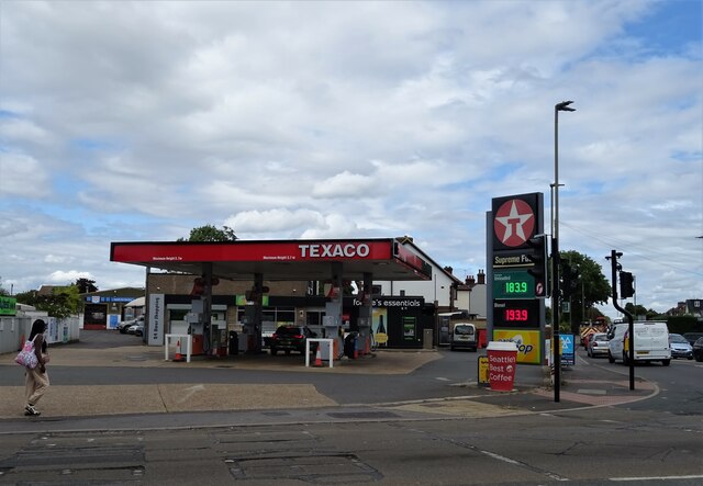
Service station on Chessington Road / Ruxley Lane Petrol 183.9p
Diesel 193.9p.
Service station on Chessington Road / Ruxley Lane Credit: JThomas

Castle Hill is a historical site located in the county of Surrey, England. It is situated in the town of Farnham and is renowned for its rich heritage and archaeological significance. The site is named after the prominent hill on which it stands, providing a commanding view of the surrounding area.

The history of Castle Hill dates back over 4,000 years, with evidence of human activity from the Neolithic period. The site was later occupied by the Romans, who built a fortification during their occupation of Britain. Over the centuries, Castle Hill has witnessed various developments and changes, serving as a defensive structure, a royal residence, and a hunting lodge.

Today, the remains of Castle Hill consist of earthworks, ramparts, and a motte. The motte is a large mound that once supported a wooden keep, offering a glimpse into the architectural techniques of the medieval era. The site is now a designated heritage site, protected by law to preserve its cultural and historical significance.

Visitors to Castle Hill can explore the extensive grounds, taking in the scenic views and immersing themselves in the ancient history of the area. Interpretive panels provide information about the site's past, allowing visitors to visualize the castle's former grandeur. The site also hosts occasional events and guided tours, providing a deeper understanding of its historical context.

Castle Hill in Surrey is a captivating destination for history enthusiasts, offering a unique opportunity to connect with the past and explore the architectural remnants of ancient civilizations.

If you have any feedback on the listing, please let us know in the comments section below.

Castle Hill Images

Images are sourced within 2km of 51.357/-0.283 or Grid Reference TQ1963. Thanks to Geograph Open Source API. All images are credited.

Service station on Chessington Road / Ruxley Lane Petrol 183.9p
Diesel 193.9p.
Service station on Chessington Road / Ruxley Lane
Petrol 183.9p Diesel 193.9p.
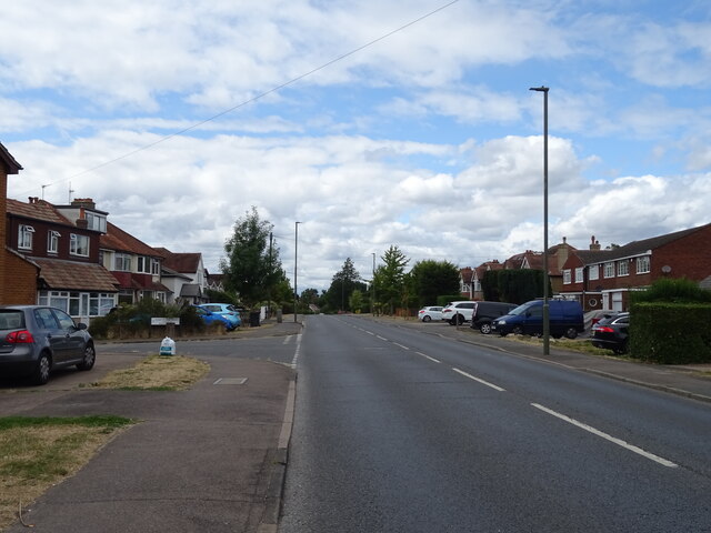
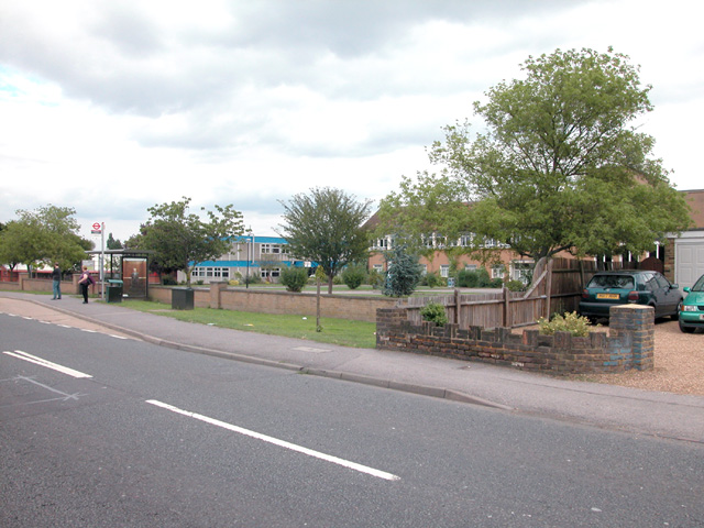
Chessington Road
Chessington Road
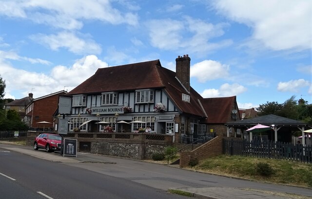
The William Bourne, Chessington Formerly The Bonesgate - on Moor Lane.
The William Bourne, Chessington
Formerly The Bonesgate - on Moor Lane.
Moor Lane, Chessington
Houses on Padley Close, Chessington
Padley Close, Chessington
Chessington Methodist Church
Moor Lane, Chessington
The Chessington Oak
The Chessington Oak
The Chessington Oak On Moor Lane.
The Chessington Oak
On Moor Lane.
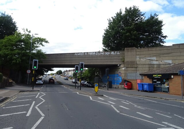
Railway bridge over Bridge Road
House on Leatherhead Road, Chessington
Leatherhead Road (A243), Chessington
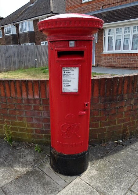
George VI postbox on Moor Lane, Chessington Postbox No. KT9 305.
George VI postbox on Moor Lane, Chessington
Postbox No. KT9 305.
Chessington South station The station building at Chessington South railway station.
Chessington South station
The station building at Chessington South railway station.
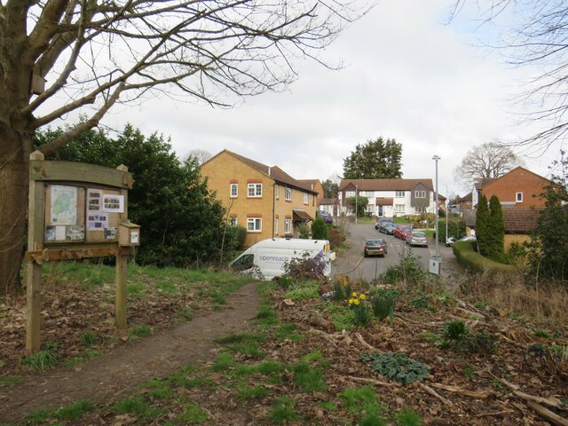
Vivien Close, Chessington Vivien Close is a residential cul-de-sac in Chessington, on the fringe of south west London.  This photo was taken from a nearby public footpath.
Vivien Close, Chessington
Vivien Close is a residential cul-de-sac in Chessington, on the fringe of south west London. This photo was taken from a nearby public footpath.
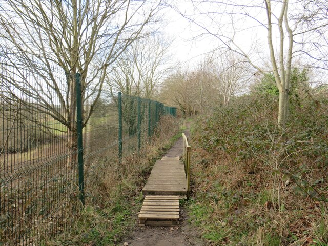
Public footpath, Chessington A short wooden bridge on a public footpath in Chessington, on the fringe of south west London.
Public footpath, Chessington
A short wooden bridge on a public footpath in Chessington, on the fringe of south west London.
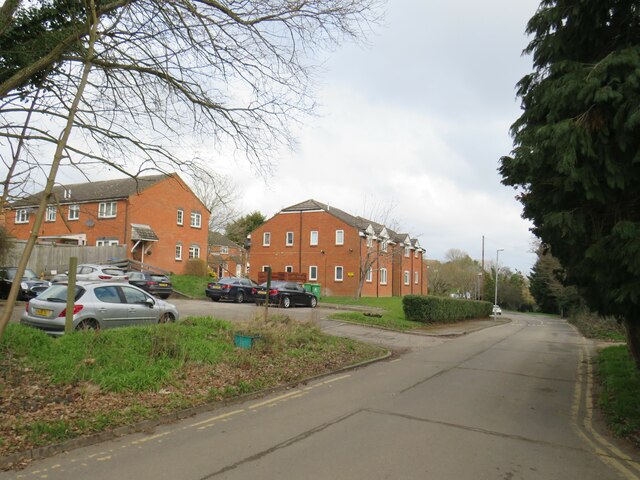
Green Lane, Chessington Green Lane in Chessington, on the outer fringe of south west London, passing a modern housing development.
Green Lane, Chessington
Green Lane in Chessington, on the outer fringe of south west London, passing a modern housing development.
Show me another place!

Castle Hill is located at Grid Ref: TQ1963 (Lat: 51.357, Lng: -0.283)

Administrative County: Surrey

District: Epsom and Ewell

Police Authority: Surrey

What 3 Words

///frock.cape.regard. Near Chessington, London

Related Wikis

Castle Hill, Chessington

Castle Hill is a 3.5-hectare (8.6-acre) scheduled monument, local nature reserve and Site of Borough Importance for Nature Conservation, Grade 1, in Chessington...

Bonesgate Open Space

Bonesgate Open Space is a public park, Local Nature Reserve (LNR) and Site of Borough Importance for Nature Conservation, Grade 1, in Chessington in the...

Horton Country Park

Horton Country Park is a 152.3-hectare (376-acre) Local Nature Reserve north-west of Epsom in Surrey. It is owned and managed by Epsom and Ewell Borough...

Epsom and Ewell High School

Epsom and Ewell High School is a secondary school located at Ruxley Lane, Epsom, Surrey, England that opened in 1989. It is a coeducational, academy that...

Nearby Amenities

Located within 500m of 51.357,-0.283
Turning Circle
Lat/Long: 51.3595959/-0.2863907
Turning Circle
Lat/Long: 51.360036/-0.2858984
Ref GB Tflcid: RWG134342
Traffic Calming: hump
Lat/Long: 51.3596774/-0.2877521
Bus Stop
Chessington Close
Bench: no
Bin: no
Bus: yes
Naptan AtcoCode: 40004406085A
Naptan Bearing: SE
Naptan CommonName: Chessington Close
Naptan Indicator: Just after
Naptan Landmark: Chessington Close
Naptan NaptanCode: surajtpt
Naptan Street: Chessington Road
Naptan Verified: no
Public Transport: platform
Shelter: no
Source: naptan_import
Tactile Paving: no
Lat/Long: 51.3580596/-0.2762603
Bus Stop
Chessington Close
Bus: yes
Naptan AtcoCode: 40004406085B
Naptan Bearing: NW
Naptan CommonName: Chessington Close
Naptan Indicator: Opp
Naptan Landmark: Chessington Close
Naptan NaptanCode: surajtpw
Naptan Street: Chessington Road
Naptan Verified: no
Public Transport: platform
Source: naptan_import
Lat/Long: 51.3585518/-0.2777863
Bus Stop
Nightingale Drive
Bus: yes
Naptan AtcoCode: 40004406086A
Naptan Bearing: NW
Naptan CommonName: Chessington Road
Naptan Indicator: Just Before
Naptan Landmark: Chessington Road
Naptan NaptanCode: surajtwa
Naptan Street: Ruxley Lane
Naptan Verified: no
Public Transport: platform
Source: naptan_import
Lat/Long: 51.3599139/-0.2809474
Bus Stop
Nightingale Drive
Bench: yes
Bin: no
Bus: yes
Naptan AtcoCode: 40004406086B
Naptan Bearing: SE
Naptan CommonName: Chessington Road
Naptan Indicator: Just after
Naptan Landmark: Chessington Road
Naptan NaptanCode: surajwaw
Naptan Street: Chessington Road
Naptan Verified: no
Public Transport: platform
Shelter: yes
Source: naptan_import
Lat/Long: 51.3600655/-0.2802118
Dentist
Horton Dental Practice
Healthcare: dentist
Wheelchair: limited
Lat/Long: 51.3606128/-0.2804887
Telephone
Booth: KXPlus
Covered: booth
Lat/Long: 51.3606975/-0.2805519
Post Box
Post Box Type: pillar
Ref: KT19 52
Royal Cypher: GR
Royal Cypher Wikidata: Q33102273
Lat/Long: 51.3606861/-0.2805346
Traffic Signals
Crossing: no
Traffic Signals: traffic_lights
Traffic Signals Direction: backward
Lat/Long: 51.3605275/-0.2808853
Traffic Signals
Crossing: no
Traffic Signals: traffic_lights
Traffic Signals Direction: forward
Lat/Long: 51.3602237/-0.2812189
Crossing
Bicycle: yes
Button Operated: yes
Crossing: traffic_signals
Crossing Markings: dots
Crossing Signals: yes
Crossing Ref: toucan
Lat/Long: 51.3583292/-0.2773433
Crossing
Bicycle: yes
Button Operated: yes
Crossing: traffic_signals
Crossing Markings: dots
Crossing Signals: yes
Crossing Ref: toucan
Tactile Paving: yes
Lat/Long: 51.3597281/-0.2801915
Crossing
Bicycle: yes
Button Operated: yes
Crossing: traffic_signals
Crossing Markings: dots
Crossing Signals: yes
Crossing Ref: toucan
Lat/Long: 51.3585049/-0.2772443
Crossing
Bicycle: yes
Button Operated: yes
Crossing: traffic_signals
Crossing Markings: dots
Crossing Signals: yes
Crossing Ref: toucan
Tactile Paving: yes
Lat/Long: 51.3599183/-0.2801166
Bus: yes
Public Transport: stop_position
Lat/Long: 51.3600753/-0.2804157
Cycleway: asl
Direction: forward
Lat/Long: 51.3602979/-0.2810737
Traffic Signals
Crossing: no
Traffic Signals: traffic_lights
Traffic Signals Direction: forward
Lat/Long: 51.3601778/-0.2809307
Golf: pin
Lat/Long: 51.3557068/-0.2783243
Tactile Paving: yes
Lat/Long: 51.3599329/-0.2800943
Tactile Paving: yes
Lat/Long: 51.3597545/-0.2801666
Crossing
Crossing: unmarked
Crossing Island: no
Crossing Markings: no
Tactile Paving: yes
Lat/Long: 51.3599935/-0.2801397
Tactile Paving: yes
Lat/Long: 51.3598994/-0.28014
Crossing
Button Operated: yes
Crossing: traffic_signals
Crossing Markings: dots
Crossing Signals: yes
Crossing Ref: pelican
Lat/Long: 51.3602922/-0.2812414
Traffic Signals
Traffic Signals Direction: forward
Lat/Long: 51.3602634/-0.2810854
Crossing: no
Lat/Long: 51.3602771/-0.2810815
Traffic Signals
Crossing: no
Traffic Signals: traffic_lights
Traffic Signals Direction: forward
Lat/Long: 51.3604289/-0.281192
Crossing
Crossing: traffic_signals
Crossing Island: yes
Crossing Markings: dots
Crossing Signals: yes
Crossing Ref: pelican
Lat/Long: 51.360416/-0.2811364
Give Way
Direction: forward
Lat/Long: 51.3603159/-0.280744
Golf: pin
Lat/Long: 51.3573764/-0.2776058
Golf: pin
Lat/Long: 51.357847/-0.2809586
Golf: pin
Lat/Long: 51.3589491/-0.2843033
Golf: pin
Lat/Long: 51.3596144/-0.2821955
Golf: pin
Lat/Long: 51.359007/-0.2801342
Golf: pin
Lat/Long: 51.3580647/-0.2814689
Golf: pin
Lat/Long: 51.3583942/-0.278533
Golf: pin
Lat/Long: 51.3577524/-0.2786548
Golf: pin
Lat/Long: 51.3568918/-0.276471
Bus: yes
Public Transport: stop_position
Lat/Long: 51.3599141/-0.2807451
Cycleway: asl
Direction: forward
Lat/Long: 51.3602542/-0.2812314
Ref GB Tflcid: RWG134341
Traffic Calming: hump
Lat/Long: 51.3592232/-0.2891197
Ref GB Tflcid: RWG134343
Traffic Calming: hump
Lat/Long: 51.3600997/-0.2872545
Bench
Lat/Long: 51.3574787/-0.2897724
Tactile Paving: yes
Lat/Long: 51.3597018/-0.2802164
Tactile Paving: yes
Lat/Long: 51.3599746/-0.280103
Tactile Paving: yes
Lat/Long: 51.3600202/-0.2801885
Traffic Signals
Crossing: no
Traffic Signals: pedestrian_crossing
Traffic Signals Direction: forward
Lat/Long: 51.3597053/-0.2801283
Traffic Signals
Crossing: no
Traffic Signals: pedestrian_crossing
Traffic Signals Direction: forward
Lat/Long: 51.3599381/-0.2801486
Give Way
Direction: forward
Lat/Long: 51.3582531/-0.2767744
Bus: yes
Public Transport: stop_position
Lat/Long: 51.3585822/-0.2777409
Traffic Signals
Crossing: no
Traffic Signals: pedestrian_crossing
Traffic Signals Direction: forward
Lat/Long: 51.3582974/-0.2772895
Traffic Signals
Crossing: no
Traffic Signals: pedestrian_crossing
Traffic Signals Direction: forward
Lat/Long: 51.3585332/-0.2772864
The data included in this document is from www.openstreetmap.org. The data is made available under ODbL.

Have you been to Castle Hill?

Leave your review of Castle Hill below (or comments, questions and feedback).