Castle
Heritage Site in Monmouthshire
Wales
Castle

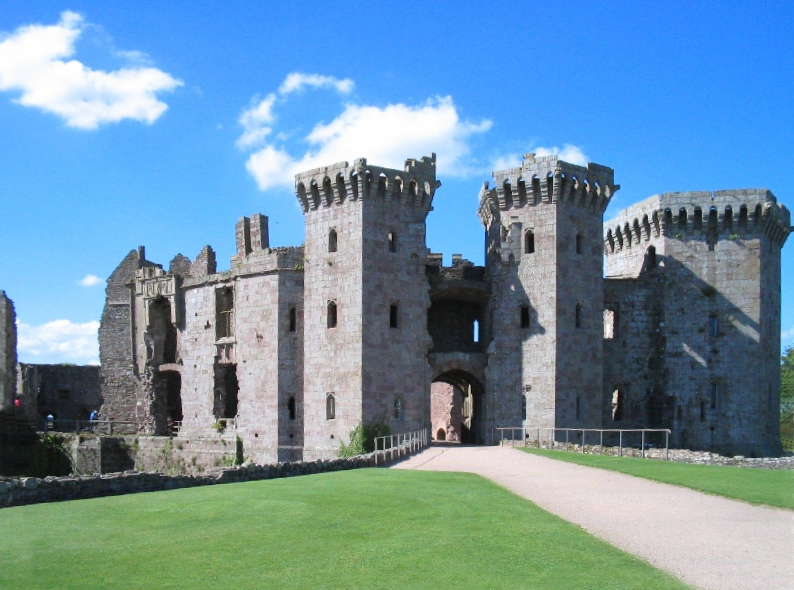
Castle, Monmouthshire is a historic heritage site located in the town of Monmouthshire, Wales. Situated on a steep hill overlooking the town, the castle holds great historical and architectural significance.
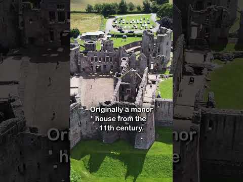
Originally built in the 11th century, the castle was strategically constructed by the Normans to defend the border between England and Wales. Over the centuries, it underwent various renovations and expansions, resulting in a unique blend of architectural styles. The castle's ruins showcase elements of Norman, Gothic, and Romanesque architecture.
The site comprises a large central keep, surrounded by a series of curtain walls and towers. The keep itself is a massive stone structure, providing breathtaking panoramic views of the surrounding countryside. Within the castle walls, visitors can explore the remains of the Great Hall, the chapel, and other domestic buildings that once housed the castle's inhabitants.
Castle, Monmouthshire played a significant role in several historical events. It was the birthplace of King Henry V of England, the renowned military leader who achieved victory at the Battle of Agincourt. The castle also witnessed conflicts during the English Civil War and was partially destroyed during the Siege of Monmouth in 1645.
Today, the castle is a popular tourist destination, attracting history enthusiasts, architecture admirers, and nature lovers alike. Visitors can wander through the ruins, imagining the castle's former grandeur and experiencing a sense of medieval life. Interpretive displays, guided tours, and educational programs are available to provide a deeper understanding of the site's rich history.
Castle, Monmouthshire stands as a testament to Wales' medieval past and is a must-visit destination for anyone interested in the country's heritage and architecture.
If you have any feedback on the listing, please let us know in the comments section below.
Castle Images
Images are sourced within 2km of 51.772/-2.848 or Grid Reference SO4108. Thanks to Geograph Open Source API. All images are credited.


Castle is located at Grid Ref: SO4108 (Lat: 51.772, Lng: -2.848)
Unitary Authority: Monmouthshire
Police Authority: Gwent
What 3 Words
///youths.minimums.owners. Near Raglan, Monmouthshire
Nearby Locations
Related Wikis
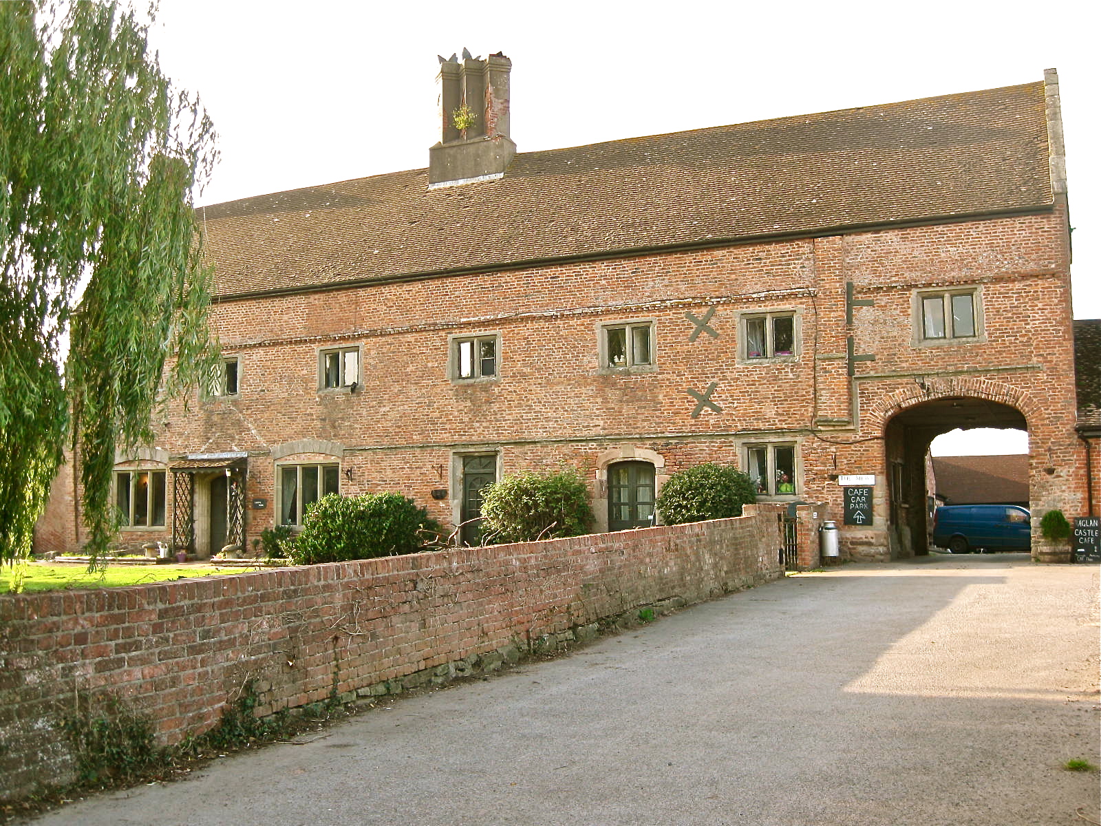
Castle Farmhouse, Raglan
Castle Farm, Raglan, in the county of Monmouth, is prominently sited 100 yards (91 m) east of Raglan Castle. The farm is approached from its own drive...

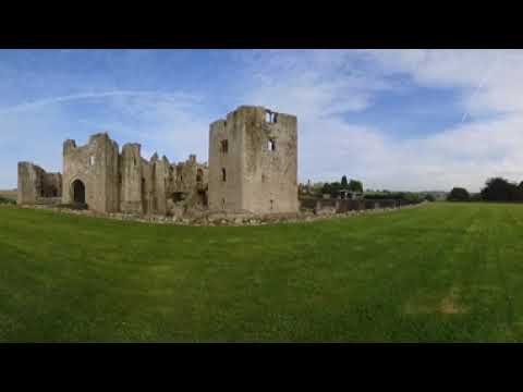
Raglan Castle
Raglan Castle (Welsh: Castell Rhaglan) is a late medieval castle located just north of the village of Raglan in the county of Monmouthshire in south east...
Raglan, Monmouthshire
Raglan (; (Welsh: Rhaglan) is a village and community in Monmouthshire, south east Wales, United Kingdom. It is located some 9 miles south-west of Monmouth...

St Cadoc's Church, Raglan
St Cadoc's Church, Raglan, Monmouthshire, south east Wales, is the parish church of the village of Raglan. The church is situated at a cross-roads in the...

Raglan railway station
Raglan railway station was a station on the Coleford, Monmouth, Usk and Pontypool Railway. It was not opened when the line was originally built, but constructed...

Elms Bridge Halt railway station
Elms Bridge Halt was a request stop on the former Coleford, Monmouth, Usk and Pontypool Railway. It was opened on 27 November 1933 to serve the villages...
Raglan Footpath railway station
Raglan Footpath was a station on the former Coleford, Monmouth, Usk and Pontypool Railway. It was opened in October 1857 with the rest of the line and...
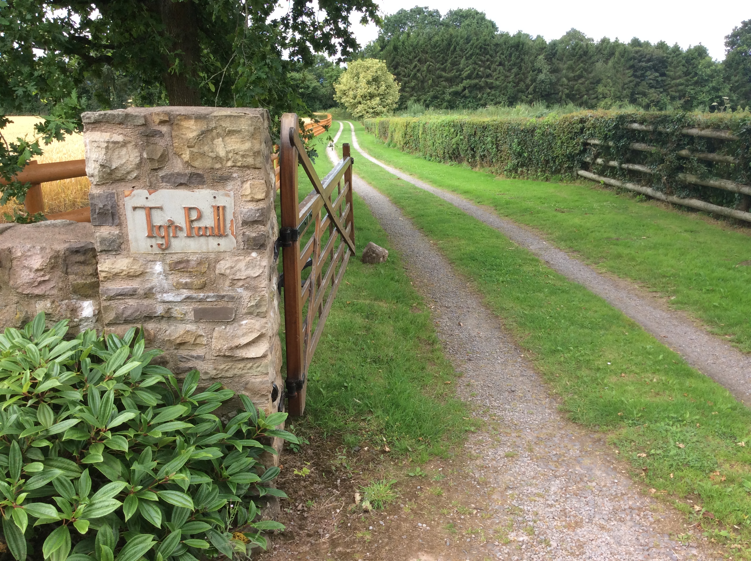
Pwll, Tregare
Pwll, Tregare, Monmouthshire is a medieval cruck-house dating from the late 14th century, with additions in the 17th century. An "extremely rare survival...
Related Videos
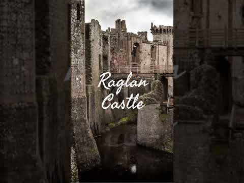
Raglan Castle - Wales
Welcome to my series of Castle Shorts! In each video I tell you a small nugget of information about each Castle. In this Short I tell ...
Raglan Castle #shorts
Raglan Castle: https://youtu.be/rWmPtW1PfEM To donate and support our channel: https://www.buymeacoffee.com/TheyhadadaA ...
Five Castles in Wales | History & Hiking | Adventure Ep 08 | HD Quality.
Went to Wales last weekend and saw some awesome castles! There are some sound issues in this video but I hope you'll bear ...
Nearby Amenities
Located within 500m of 51.772,-2.848Have you been to Castle?
Leave your review of Castle below (or comments, questions and feedback).