Castell Prysor

Heritage Site in Merionethshire

Wales

Castell Prysor

A4212 by Dol-haidd
A4212 by Dol-haidd Credit: Steven Brown

Castell Prysor is a historic fortress located in the county of Merionethshire, Wales. Situated near the village of Trawsfynydd, this heritage site holds great significance in Welsh history. The castle was originally built in the 13th century by Llywelyn the Great, the Prince of Gwynedd, as a strategic stronghold to control the surrounding area.

The castellated structure is nestled on a hilltop, providing a commanding view of the surrounding landscape. It was constructed using local stone, giving it a rugged and imposing appearance. The castle's design features a rectangular layout with four corner towers, offering a formidable defense against potential attacks.

Throughout its history, Castell Prysor witnessed several conflicts and sieges. It played a crucial role during the Welsh Wars of Independence, being one of the key fortresses defending the Welsh against English invasions. Its strategic location and sturdy construction made it a formidable obstacle for any would-be conquerors.

Unfortunately, the castle fell into disrepair over the centuries and now stands as a ruin. Visitors to the site can explore the remnants of the walls and towers, which still convey a sense of the castle's former grandeur. The surrounding landscape provides a picturesque backdrop, making it a popular spot for photographers and history enthusiasts.

Castell Prysor is a fascinating heritage site that offers a glimpse into the medieval history of Wales. Its strategic importance and architectural features make it a captivating destination for those interested in exploring the country's rich heritage.

If you have any feedback on the listing, please let us know in the comments section below.

Castell Prysor Images

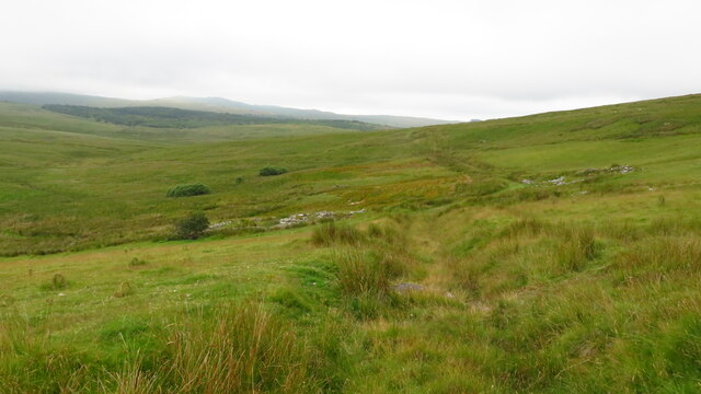
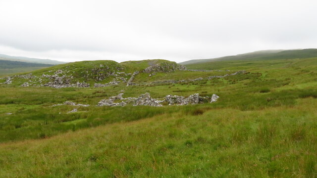
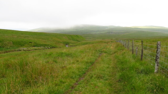
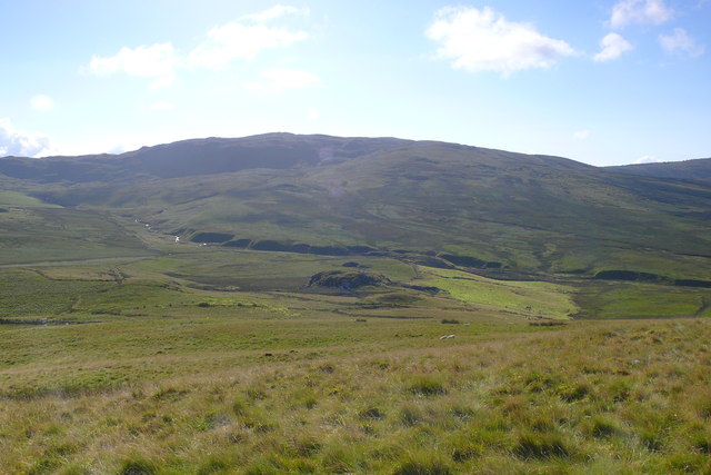
Images are sourced within 2km of 52.912/-3.852 or Grid Reference SH7536. Thanks to Geograph Open Source API. All images are credited.

A4212 by Dol-haidd
A4212 by Dol-haidd
Rough moorland track, S of Hafod-y-gareg near Bronaber
Slight ruins at Buarth-brwynog near Bronaber
View W along track E of Buarth-brwynog near Bronaber
Trackbed near Cwm Prysor Disused trackbed of the GWR line from Bala Junction to Blaenau Ffestiniog.
Trackbed near Cwm Prysor
Disused trackbed of the GWR line from Bala Junction to Blaenau Ffestiniog.
Caeau ger Glynllafar / Fields near Glynllafar Golygfa dros gaeau tuag at Bwlch Drws Ardudwy / A view over fields towards Bwlch Drws Ardudwy.
Caeau ger Glynllafar / Fields near Glynllafar
Golygfa dros gaeau tuag at Bwlch Drws Ardudwy / A view over fields towards Bwlch Drws Ardudwy.
Nurse Bryn Celynog Coed bob ochr i'r hen reilffordd / Trees both sides of the old railway.
Nurse Bryn Celynog
Coed bob ochr i'r hen reilffordd / Trees both sides of the old railway.
Hen rheilffordd ger Bryn-Celynog / Old railway near Bryn-Celynog Darn gwlyb o'r hen rheilffordd / Waterlogged stretch of the old railway.
Hen rheilffordd ger Bryn-Celynog / Old railway near Bryn-Celynog
Darn gwlyb o'r hen rheilffordd / Waterlogged stretch of the old railway.
Ger Bryn Celynog / Near Bryn Celynog Pont yn croesi'r hen reilffordd / Bridge crossing the old railway.
Ger Bryn Celynog / Near Bryn Celynog
Pont yn croesi'r hen reilffordd / Bridge crossing the old railway.
Cwm Prysor Caeau rhwng yr hen rheilffordd a Chastell Prysor / Fields between the old railway and Castell Prysor.
Cwm Prysor
Caeau rhwng yr hen rheilffordd a Chastell Prysor / Fields between the old railway and Castell Prysor.
Craig Aderyn Hen adeilad rheilffordd / Old railway building.
Craig Aderyn
Hen adeilad rheilffordd / Old railway building.
Craig y Deryn Hen rheilffordd islaw Craig y Deryn / Old railway below Craig y Deryn.
Craig y Deryn
Hen rheilffordd islaw Craig y Deryn / Old railway below Craig y Deryn.
Cwm Prysor Hen reilffordd / Old railway.
Cwm Prysor
Hen reilffordd / Old railway.
Tanrallt Hen rheilffordd uwchben Tanrallt / Old railway above Tanrallt.
Tanrallt
Hen rheilffordd uwchben Tanrallt / Old railway above Tanrallt.
Nant Budr Golygfa lawr Nant Budr i Gwm Prysor / A view down Nant Budr to Cwm Prysor
Nant Budr
Golygfa lawr Nant Budr i Gwm Prysor / A view down Nant Budr to Cwm Prysor
Y- Foel Cwm Prysor o'r Foel / Cwm Prysor from Y- Foel.
Y- Foel
Cwm Prysor o'r Foel / Cwm Prysor from Y- Foel.
Y Gors Golygfa lawr i'r fferm Y Gors oddi ar Y-Foel / A view down to Y Gors farm from Y-Foel.
Y Gors
Golygfa lawr i'r fferm Y Gors oddi ar Y-Foel / A view down to Y Gors farm from Y-Foel.
Llethrau Y-Foel / The slopes of Y-Foel Golygfa lawr i Fuarth Brwynog / A view down to Buarth Brwynog.
Llethrau Y-Foel / The slopes of Y-Foel
Golygfa lawr i Fuarth Brwynog / A view down to Buarth Brwynog.
Show me another place!

Castell Prysor is located at Grid Ref: SH7536 (Lat: 52.912, Lng: -3.852)

What 3 Words

///sake.shape.compelled. Near Trawsfynydd, Gwynedd

Nearby Locations

Castell Prysor

Related Wikis

Bryn-Celynog Halt railway station

Bryn-Celynog Halt (sometimes written as Bryncelynog Halt) was an unstaffed solely passenger railway station which served the rural area of Bryn-Celynog...

Snowdonia

Snowdonia, or Eryri (pronounced [ɛrəri] ), is a mountainous region and national park in northwestern Wales. It contains all 15 mountains in Wales over...

Llafar Halt railway station

Llafar Halt was an unstaffed solely passenger railway station which served the rural area of Glanllafar, east of Trawsfynydd, Gwynedd, Wales. == Origins... ==

Moel Oernant

Moel Oernant is a 503-metre (1,650 ft) high hill in the community of Trawsfynydd in the county of Gwynedd in North Wales. It has a number of western tops...

Nearby Amenities

Located within 500m of 52.912,-3.852
Settlement
Historic: archaeological_site
Lat/Long: 52.908684/-3.8540672
Power: pole
Lat/Long: 52.9106085/-3.8516575
Power: pole
Lat/Long: 52.9118272/-3.8524584
Power: pole
Lat/Long: 52.9121797/-3.8510052
Power: pole
Lat/Long: 52.9123993/-3.8501183
Power: pole
Lat/Long: 52.9132028/-3.8476191
Power: pole
Lat/Long: 52.9136164/-3.8465884
Power: pole
Lat/Long: 52.9127729/-3.8489422
Power: pole
Lat/Long: 52.9102873/-3.8582662
Power: pole
Lat/Long: 52.9106674/-3.8568398
Power: pole
Lat/Long: 52.9110885/-3.8554007
Power: pole
Lat/Long: 52.9114017/-3.8541234
Power: pole
Lat/Long: 52.9116302/-3.8532463
Direction: 185
Generator Method: photovoltaic
Generator Output Electricity: yes
Generator Solar Modules: 17
Generator Source: solar
Generator Type: solar_photovoltaic_panel
Location: roof
Power: generator
Lat/Long: 52.9150347/-3.8559705
The data included in this document is from www.openstreetmap.org. The data is made available under ODbL.

Have you been to Castell Prysor?

Leave your review of Castell Prysor below (or comments, questions and feedback).