Castell Coch

Heritage Site in Glamorgan

Wales

Castell Coch

Ripening field of wheat
Ripening field of wheat Credit: Alan Hughes

Castell Coch, located in the county of Glamorgan, Wales, is a picturesque medieval castle with a rich history and stunning architecture. Nestled on a hillside in the village of Tongwynlais, just a few miles north of Cardiff, Castell Coch is a popular tourist destination and a recognized heritage site.

Originally built in the 13th century, the castle was initially a strategic fortification used to protect the region. However, it fell into ruin over time until the 19th century, when the Marquess of Bute, a wealthy industrialist, commissioned the renowned architect William Burges to restore and reconstruct the castle.

The result of this restoration is a magnificent and romantic structure. Castell Coch showcases a unique blend of Gothic Revival and Victorian architecture, with its distinctive red-stone walls, tall towers, and intricate detailing. The interiors are equally impressive, featuring elaborate woodwork, stained glass windows, and vibrant murals depicting scenes from Welsh folklore and history.

Visitors to Castell Coch can explore the castle's many rooms, including the Drawing Room, the Banqueting Hall, and the Lord Bute Suite, which provides a glimpse into the luxurious lifestyle of the castle's former inhabitants. The castle also offers beautiful views of the surrounding countryside, making it a popular spot for walks and picnics.

Today, Castell Coch is managed by Cadw, the historic environment service of the Welsh Government, and is open to the public. It hosts various events and exhibitions throughout the year, allowing visitors to immerse themselves in the history and beauty of this enchanting castle.

If you have any feedback on the listing, please let us know in the comments section below.

Castell Coch Images

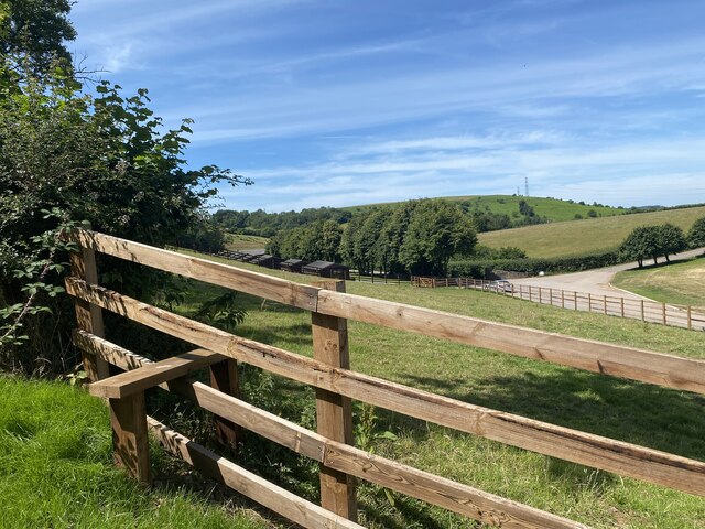
Images are sourced within 2km of 51.46/-3.403 or Grid Reference ST0274. Thanks to Geograph Open Source API. All images are credited.

Ripening field of wheat
Private land - or public footpath?
Derelict farm buildings at Maes y Ward
Path alongside wheat field
Golden barley
Golden barley
Manure heap and leachate
Waymarker with no sign
Overgrown stone stile
Overgrown wooden stile
Corner of a wheat field Approaching Coed Mynydd Coch.
Corner of a wheat field
Approaching Coed Mynydd Coch.
Brambles, a sign - and a cowbell! Marked on OS maps as a public footpath, someone rightly or wrongly thinks otherwise and has attached a novel warning device.

See also <a href="https://www.geograph.org.uk/photo/7220922">ST0475 : Private land - or public footpath?</a> of which this image is a detail.
Brambles, a sign - and a cowbell!
Marked on OS maps as a public footpath, someone rightly or wrongly thinks otherwise and has attached a novel warning device. See also ST0475 : Private land - or public footpath? of which this image is a detail.
Fredwell Café and Patisserie Business on the Pant Wilkin estate.
Fredwell Café and Patisserie
Business on the Pant Wilkin estate.
New stile on an ancient path The path appears to go in stages from Cowbridge to Pendoylan and beyond, passing the Iron Age hillforts at Llanquian and Castell Coch.  Much of the footpath is at present unpassable.
New stile on an ancient path
The path appears to go in stages from Cowbridge to Pendoylan and beyond, passing the Iron Age hillforts at Llanquian and Castell Coch. Much of the footpath is at present unpassable.
Ditch, path and track
Mown path This mown section of the footpath looks promising … so far!
Mown path
This mown section of the footpath looks promising … so far!
Impenetrable footpath See <a href="https://www.geograph.org.uk/photo/7224446">ST0274 : Mown path</a>

… but soon degenerates into an impenetrable jungle.
Impenetrable footpath
See ST0274 : Mown path … but soon degenerates into an impenetrable jungle.
Fallen tree and undergrowth A fallen tree and dense undergrowth make the public footpath impassable.
Fallen tree and undergrowth
A fallen tree and dense undergrowth make the public footpath impassable.
A path of chippings over a culvert It would seem that the only reason for this path of chippings is to give access to the footpath. But after just a few yards the public footpath is impenetrable.
A path of chippings over a culvert
It would seem that the only reason for this path of chippings is to give access to the footpath. But after just a few yards the public footpath is impenetrable.
Show me another place!

Castell Coch is located at Grid Ref: ST0274 (Lat: 51.46, Lng: -3.403)

Unitary Authority: The Vale of Glamorgan

Police Authority: South Wales

What 3 Words

///garden.jobs.sometimes. Near Cowbridge, Vale of Glamorgan

Related Wikis

St Hilary transmitting station

The St Hilary transmitting station is a facility for telecommunications situated close to the village of St Hilary, Glamorgan in the Vale of Glamorgan...

Battle of Stalling Down

The Battle of Stalling Down, also known as the Battle of Bryn Owain, is a battle reputed to have taken place between late autumn or early winter of 1403...

The Bush Inn

The Bush Inn is a Grade II listed public house in St Hilary, near Cowbridge, Vale of Glamorgan, south Wales. The current inn dates to the 16th century...

St Hilary, Vale of Glamorgan

St Hilary (Welsh: Saint Hilari ) is a village in the Vale of Glamorgan, Wales. It is located just south of the A48, about a mile southeast of the market...

Nearby Amenities

Located within 500m of 51.46,-3.403
St Hilary transmitter
Communication Radio: yes
Height: 227.1
Man Made: mast
Tower Construction: guyed_lattice
Lat/Long: 51.4574259/-3.4029662
Seamark Information: Obstruction light.4 F.R. (vert.)
Seamark Landmark Category: mast
Seamark Landmark Height: 229
Seamark Light Category: aero
Seamark Light Character: Q
Seamark Light Colour: red
Seamark Light Height: 346
Seamark Light Range: 11
Seamark Light Reference: A 5406.6
Seamark Name: St. Hilary
Seamark Type: landmark
Source: US NGA Pub. 114. 2011-05-26.
Lat/Long: 51.4571833/-3.4025667
Power: pole
Lat/Long: 51.4563671/-3.3994373
Power: pole
Lat/Long: 51.4567164/-3.3983296
Material: wood
Power: pole
Lat/Long: 51.4562217/-3.4002769
Power: pole
Lat/Long: 51.4567769/-3.4073978
The data included in this document is from www.openstreetmap.org. The data is made available under ODbL.

Have you been to Castell Coch?

Leave your review of Castell Coch below (or comments, questions and feedback).