Cassillis House

Heritage Site in Ayrshire

Scotland

Cassillis House

By the Low Road Rich farmland beside the B7045, known locally as "the Low Road".
By the Low Road Credit: Mary and Angus Hogg

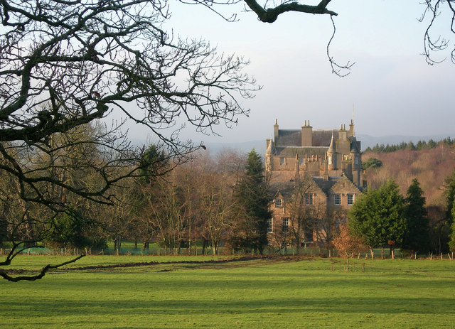
Cassillis House, located in Ayrshire, Scotland, is a renowned heritage site that has been steeped in history for centuries. This stately home, situated on a picturesque estate, is a prime example of Scottish baronial architecture, showcasing its grandeur and elegance.

Originally built in the 15th century, Cassillis House has undergone several renovations and additions over the years, resulting in the stunning structure we see today. The house features a distinctive tower and turreted design, with its exterior adorned with ornate carvings, intricate stone work, and a prominent entrance portico.

The interior of Cassillis House is equally impressive, with its opulent reception rooms, lavish drawing rooms, and impressive dining halls. Visitors can marvel at the beautiful wood paneling, intricate plasterwork, and exquisite chandeliers that grace the rooms. The house also boasts an extensive collection of antique furniture, fine artwork, and historical artifacts, providing a glimpse into the luxurious lifestyle of the former occupants.

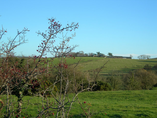
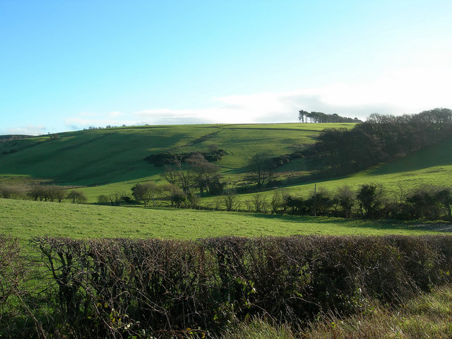
As visitors explore the grounds of Cassillis House, they are treated to breathtaking views of the surrounding countryside. The estate features manicured gardens, serene woodland areas, and a charming walled garden. Additionally, a nearby river adds to the tranquility of the setting.

Cassillis House is not only a stunning architectural gem but also a significant historical site. It has been associated with notable figures throughout history, including Robert the Bruce and King James VI. Today, it stands as a testament to Scotland's rich heritage and offers visitors a unique opportunity to experience the grandeur of a bygone era.

If you have any feedback on the listing, please let us know in the comments section below.

Cassillis House Images

Images are sourced within 2km of 55.378/-4.612 or Grid Reference NS3412. Thanks to Geograph Open Source API. All images are credited.

By the Low Road Rich farmland beside the B7045, known locally as "the Low Road".
By the Low Road
Rich farmland beside the B7045, known locally as "the Low Road".
Burnmouth Farm Typical lowland Ayrshire farmland, a mix of grazing, silage and cereals (mostly barley).
Burnmouth Farm
Typical lowland Ayrshire farmland, a mix of grazing, silage and cereals (mostly barley).
Pastureland Looking NE across the B7045.  South Ayrshire's rolling countryside was formed by drumlins, deposited during the last Ice Age.
Pastureland
Looking NE across the B7045. South Ayrshire's rolling countryside was formed by drumlins, deposited during the last Ice Age.
Fingerpost Old fingerpost at the intersection of the B742 and the B7045 near Maybole.  It shows the old spelling of Minishant and gives distances in quarter miles.
Fingerpost
Old fingerpost at the intersection of the B742 and the B7045 near Maybole. It shows the old spelling of Minishant and gives distances in quarter miles.
WSW View Looking WSW from the Triangulation pillar on Guiltree Hill.  In the distance are Maybole, Mochrum Hill and, just visible on the left, Ailsa Craig.
WSW View
Looking WSW from the Triangulation pillar on Guiltree Hill. In the distance are Maybole, Mochrum Hill and, just visible on the left, Ailsa Craig.
NW View Looking NW from the Triangulation Pillar on Guiltree Hill.  The communication masts on the skyline mark the position of Brown Carrick Hill.
NW View
Looking NW from the Triangulation Pillar on Guiltree Hill. The communication masts on the skyline mark the position of Brown Carrick Hill.
NNE View Looking NNE from Guiltree Hill on a fine November morning, with Dalrymple and the viaduct showing in the distance.
NNE View
Looking NNE from Guiltree Hill on a fine November morning, with Dalrymple and the viaduct showing in the distance.
Montgomerieston Farm Looking east from the minor road on a fine November morning.
Montgomerieston Farm
Looking east from the minor road on a fine November morning.
Guiltree Hill The northern edge of Guiltree Hill on a fine November morning.
Guiltree Hill
The northern edge of Guiltree Hill on a fine November morning.
Looking Towards Dowan's Hill Looking WSW across rich farmland near Dalrymple.
Looking Towards Dowan's Hill
Looking WSW across rich farmland near Dalrymple.
Burnbank Farm Looking west from the minor road which links Dalrymple with Guiltree Hill.
Burnbank Farm
Looking west from the minor road which links Dalrymple with Guiltree Hill.
Barnford Farm view Looking down into the Doon Valley, with Holms Farm in the background, and the Firth of Clyde in the far distance.
Barnford Farm view
Looking down into the Doon Valley, with Holms Farm in the background, and the Firth of Clyde in the far distance.
Doon Valley Farmlands Looking SW towards Lindsayston Farm.  In this part of the valley, the River Doon winds its way round drumlins, deposited during the last Ice Age.
Doon Valley Farmlands
Looking SW towards Lindsayston Farm. In this part of the valley, the River Doon winds its way round drumlins, deposited during the last Ice Age.
Dalrymple Wood and Woodland Farm Looking NW across the River Doon, with Brown Carrick Hill in the distance.
Dalrymple Wood and Woodland Farm
Looking NW across the River Doon, with Brown Carrick Hill in the distance.
Cassillis House Located close to the River Doon, near Dalrymple, Cassillis House is the setting for the famous ballad "Johnnie Faa" - <span class="nowrap"><a title="http://books.google.co.uk/books?id=2XACAAAAQAAJ&printsec=frontcover&dq=Miscellany+by+Allan+Ramsay#PPA427,M1" rel="nofollow ugc noopener" href="http://books.google.co.uk/books?id=2XACAAAAQAAJ&printsec=frontcover&dq=Miscellany+by+Allan+Ramsay#PPA427,M1">Link</a><img style="margin-left:2px;" alt="External link" title="External link - shift click to open in new window" src="https://s1.geograph.org.uk/img/external.png" width="10" height="10"/></span>
Before her marriage to the powerful chief of the Kennedys, the countess had loved a young knight, Sir John Fall.  She eloped with him, disguised as the gypsy, "Johnnie Faa".  The Earl brought them back and made her watch the gypsy band and her disguised lover being hanged from the Dule Tree in front of Cassillis House.  The Earl imprisoned the Countess for life in his town house, Maybole Castle <a href="https://www.geograph.org.uk/photo/241392">NS3010 : The Countess's Window</a>. He then divorced her and remarried.  No human rights in those days!
Cassillis House
Located close to the River Doon, near Dalrymple, Cassillis House is the setting for the famous ballad "Johnnie Faa" - LinkExternal link Before her marriage to the powerful chief of the Kennedys, the countess had loved a young knight, Sir John Fall. She eloped with him, disguised as the gypsy, "Johnnie Faa". The Earl brought them back and made her watch the gypsy band and her disguised lover being hanged from the Dule Tree in front of Cassillis House. The Earl imprisoned the Countess for life in his town house, Maybole Castle NS3010 : The Countess's Window. He then divorced her and remarried. No human rights in those days!
Rolling Farmland The rolling farmland is made from drumlins, deposited during the last Ice Age.  Mochrum Hill is visible on the skyline.
Rolling Farmland
The rolling farmland is made from drumlins, deposited during the last Ice Age. Mochrum Hill is visible on the skyline.
Woodland Farm Viewed from the farm track on a bright February morning.
Woodland Farm
Viewed from the farm track on a bright February morning.
New Fencing Old wall and old fence.
New Fencing
Old wall and old fence.
Show me another place!

Cassillis House is located at Grid Ref: NS3412 (Lat: 55.378, Lng: -4.612)

Unitary Authority: South Ayrshire

Police Authority: Ayrshire

What 3 Words

///judges.inquest.lifeguard. Near Dalrymple, East Ayrshire

Related Wikis

Cassillis railway station

Cassillis railway station was a railway station serving the village of Minishant, South Ayrshire, Scotland. The station was originally part of the Ayr...

Minishant

Minishant is a village bordering the A77 in the old county of Carrick, South Ayrshire, Scotland. It is located in Maybole Parish, 3+1⁄2 miles (5.5 kilometres...

Dalrymple, East Ayrshire

Dalrymple (Scots: Drumple) is a village and parish in East Ayrshire, Scotland, lying in the Doon Valley on the north bank of the River Doon. The population...

Dalrymple railway station

Dalrymple railway station was a railway station serving the village of Dalrymple, East Ayrshire, Scotland. The station was originally part of the Ayr and...

Nearby Amenities

Located within 500m of 55.378,-4.612
Power: pole
Lat/Long: 55.3787935/-4.6188406
Power: pole
Lat/Long: 55.3800012/-4.6163831
Power: pole
Lat/Long: 55.3807435/-4.6149165
Power: pole
Lat/Long: 55.3811047/-4.6141739
Power: pole
Lat/Long: 55.3814699/-4.6134174
Power: pole
Lat/Long: 55.3818153/-4.6126818
Power: pole
Lat/Long: 55.3821594/-4.6119577
Power: pole
Lat/Long: 55.3818904/-4.6113219
Power: pole
Lat/Long: 55.3815108/-4.6104285
Power: pole
Lat/Long: 55.3813881/-4.6090013
Power: pole
Lat/Long: 55.3812719/-4.6077366
Power: pole
Lat/Long: 55.3811667/-4.6065925
Power: pole
Lat/Long: 55.3816334/-4.6077505
Power: pole
Lat/Long: 55.3817349/-4.6151555
Power: pole
Lat/Long: 55.3822952/-4.6112941
The data included in this document is from www.openstreetmap.org. The data is made available under ODbL.

Have you been to Cassillis House?

Leave your review of Cassillis House below (or comments, questions and feedback).