Menherion

Settlement in Cornwall

England

Menherion

Farm buildings at Penmarth, Wendron The wooded area is Polhigey Moor with Menerlue Farm seen beyond.  In the foreground is a crop of beets for fodder.
Farm buildings at Penmarth, Wendron Credit: Andrew Smith

Menherion is a small village located in the western part of Cornwall, England. Situated approximately 2 miles north of Redruth, it falls within the civil parish of Gwennap. With a population of around 200 residents, Menherion offers a peaceful and rural setting for its inhabitants.

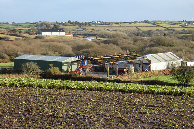
The village is renowned for its historical significance, particularly its rich mining heritage. Menherion was a prominent mining village during the 18th and 19th centuries, with copper and tin being the primary minerals extracted from the local mines. Today, remnants of the mining industry can still be seen in the form of engine houses and mining shafts scattered across the landscape.

The picturesque countryside surrounding Menherion provides ample opportunities for outdoor activities and exploration. The nearby Great Flat Lode Trail, a popular walking and cycling path, allows visitors to appreciate Cornwall's beautiful scenery while learning about the area's mining history. The village is also close to other attractions, including the National Trust's Trelissick Garden and the Redruth and District Museum.

Amenities in Menherion are limited, with only a few local businesses and services available. However, residents can easily access a wider range of amenities in Redruth, which offers a variety of shops, supermarkets, schools, and healthcare facilities.

Menherion's tranquil atmosphere, combined with its mining heritage and proximity to Cornwall's natural beauty, makes it an appealing destination for those seeking a peaceful retreat in the heart of this historic region.

If you have any feedback on the listing, please let us know in the comments section below.
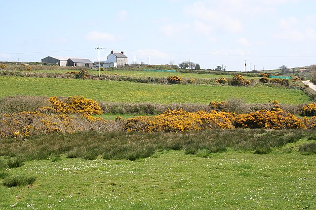
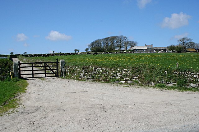
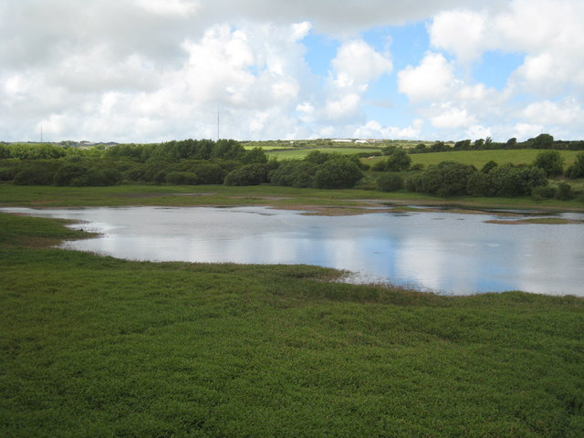
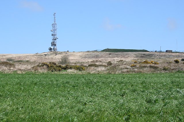
Menherion Images

Images are sourced within 2km of 50.187016/-5.217142 or Grid Reference SW7036. Thanks to Geograph Open Source API. All images are credited.

Farm buildings at Penmarth, Wendron The wooded area is Polhigey Moor with Menerlue Farm seen beyond.  In the foreground is a crop of beets for fodder.
Farm buildings at Penmarth, Wendron
The wooded area is Polhigey Moor with Menerlue Farm seen beyond. In the foreground is a crop of beets for fodder.
Pasture and the reservoir, Stithians Despite a wetter than average autumn and early winter, water levels are yet to be fully replenished and brown beaches are still exposed.  Large farm buildings at Menherion and the mast at Carn Brea are seen in the background.
Pasture and the reservoir, Stithians
Despite a wetter than average autumn and early winter, water levels are yet to be fully replenished and brown beaches are still exposed. Large farm buildings at Menherion and the mast at Carn Brea are seen in the background.
Fingerpost Milestone Society National ID: CW_SW7035A
Fingerpost
Milestone Society National ID: CW_SW7035A
Penmarth Methodist Church
Penmarth Methodist Hall
Carmenellis Churchyard
Penmennor Methodist Church
Old Direction Sign - Signpost by Penmarth, Wendron parish Cone finial - arm 3 has rivetted repair; Visick Cone by the UC road, in parish of Wendron (Kerrier District), Penmarth, behind hedge on raised field.

Grade II listed.
List Entry Number: 1142040 <span class="nowrap"><a title="https://historicengland.org.uk/listing/the-list/list-entry/1142040" rel="nofollow ugc noopener" href="https://historicengland.org.uk/listing/the-list/list-entry/1142040">Link</a><img style="margin-left:2px;" alt="External link" title="External link - shift click to open in new window" src="https://s1.geograph.org.uk/img/external.png" width="10" height="10"/></span>

Surveyed.

Milestone Society National ID: CW_SW7035A
Old Direction Sign - Signpost by Penmarth, Wendron parish
Cone finial - arm 3 has rivetted repair; Visick Cone by the UC road, in parish of Wendron (Kerrier District), Penmarth, behind hedge on raised field. Grade II listed. List Entry Number: 1142040 LinkExternal link Surveyed. Milestone Society National ID: CW_SW7035A
Stithian Dam Wikipedia: <span class="nowrap"><a title="http://en.wikipedia.org/wiki/Stithians_Reservoir" rel="nofollow ugc noopener" href="http://en.wikipedia.org/wiki/Stithians_Reservoir">Link</a><img style="margin-left:2px;" alt="External link" title="External link - shift click to open in new window" src="https://s1.geograph.org.uk/img/external.png" width="10" height="10"/></span>
Stithian Dam
Wikipedia: LinkExternal link
Stithian Dam
Stithian Dam
The Golden Lion Inn near Stithians
Carnmenellis Down Almost all the high points in this area of Cornwall appear to have some form of telecommunications mast on them and this is no exception.  The mound to the right is a covered reservoir according to the OS map.
Carnmenellis Down
Almost all the high points in this area of Cornwall appear to have some form of telecommunications mast on them and this is no exception. The mound to the right is a covered reservoir according to the OS map.
Fields near Carnmenellis With a yellow coating of dandelion flowers.
Fields near Carnmenellis
With a yellow coating of dandelion flowers.
Polgear Farm This is typical of the farmland in this area with some quite small fields and almost all pasture.  As it is Spring the golden flowers of common gorse are at their peak.
Polgear Farm
This is typical of the farmland in this area with some quite small fields and almost all pasture. As it is Spring the golden flowers of common gorse are at their peak.
Farm Buildings near Carnmenellis
Derelict Barn
Derelict Barn
Show me another place!

Menherion is located at Grid Ref: SW7036 (Lat: 50.187016, Lng: -5.217142)

Unitary Authority: Cornwall

Police Authority: Devon and Cornwall

What 3 Words

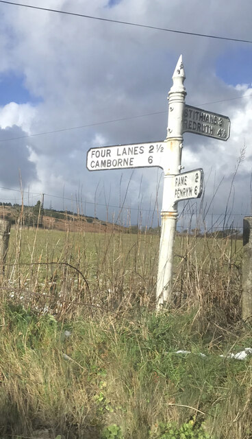
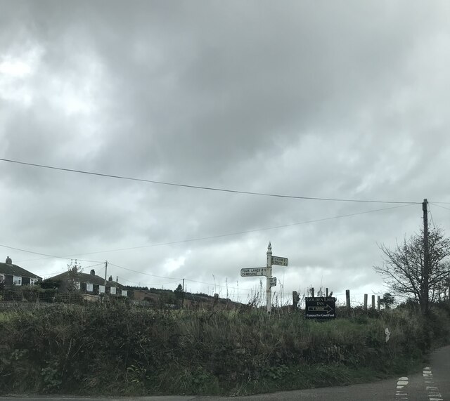
///restrict.curable.overused. Near Four Lanes, Cornwall

Nearby Locations

Menherion

Related Wikis

Menherion

Menherion is a farm in the parish of Stithians in Cornwall, England. Menherion is west of Stithians churchtown. Menherion is also the name of a hamlet...

Camborne and Redruth (UK Parliament constituency)

Camborne and Redruth () is a constituency in Cornwall represented in the House of Commons of the UK Parliament since its creation for the 2010 general...

Penhalvean

Penhalvean (Cornish: Pennhal Vian) is a hamlet in the civil parish of Stithians in Cornwall, England, UK. == References ==
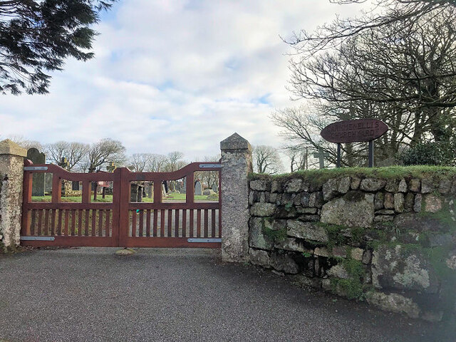
Carnmenellis

Carnmenellis Hill (or just Carnmenellis) gives its name to the area of west Cornwall in England, between Redruth, Helston and Penryn. The hill itself...

Nearby Amenities

Located within 500m of 50.187016,-5.217142
Source: Yahoo Aerial Imaging
Lat/Long: 50.1868959/-5.2106613
Pub
The Golden Lion Inn
Source: survey
Lat/Long: 50.1897483/-5.2116018
Tourism: picnic_site
Lat/Long: 50.1871136/-5.2107871
Tourism: caravan_site
Lat/Long: 50.1884685/-5.210822
The data included in this document is from www.openstreetmap.org. The data is made available under ODbL.

Have you been to Menherion?

Leave your review of Menherion below (or comments, questions and feedback).