Cartmel Priory Gatehouse

Heritage Site in Lancashire South Lakeland

England

Cartmel Priory Gatehouse

Old signpost and milestone At the junction of Green Lane (A590) and Pease Close Lane
Old signpost and milestone Credit: Eirian Evans

Cartmel Priory Gatehouse, located in the village of Cartmel in Lancashire, is a historic heritage site that dates back to the 12th century. The gatehouse is the only remaining structure of the original Cartmel Priory, a medieval Augustinian foundation.

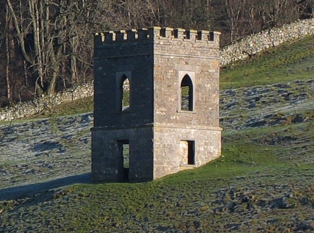
The gatehouse is an impressive stone structure that stands at the entrance to what was once a large monastic complex. It features a grand archway with a pointed Gothic arch, adorned with intricate carvings and decorative moldings. Above the archway, there is a large window with elegant tracery and stone mullions.

The gatehouse is a beautiful example of medieval architecture and is well-preserved, showcasing the craftsmanship and skill of the builders of that time. It is made of local limestone, which gives it a distinctive appearance.

Inside the gatehouse, there are a few remaining original features, including a vaulted ceiling and a spiral stone staircase that leads to an upper floor. Although the upper floor is no longer accessible to the public, it is believed to have served as living quarters for the gatekeeper.

The Cartmel Priory Gatehouse is a popular tourist attraction and is a significant part of the village's history. It stands as a reminder of the once-thriving monastic community that existed in Cartmel and offers visitors a glimpse into the past. The gatehouse is managed by English Heritage and is open to the public, allowing visitors to explore its architectural beauty and learn about its historical significance.

If you have any feedback on the listing, please let us know in the comments section below.

Cartmel Priory Gatehouse Images

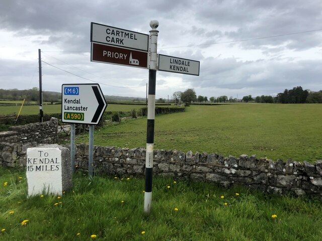
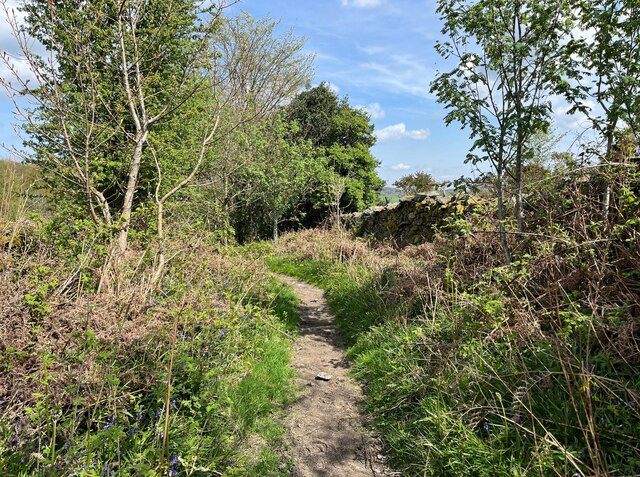
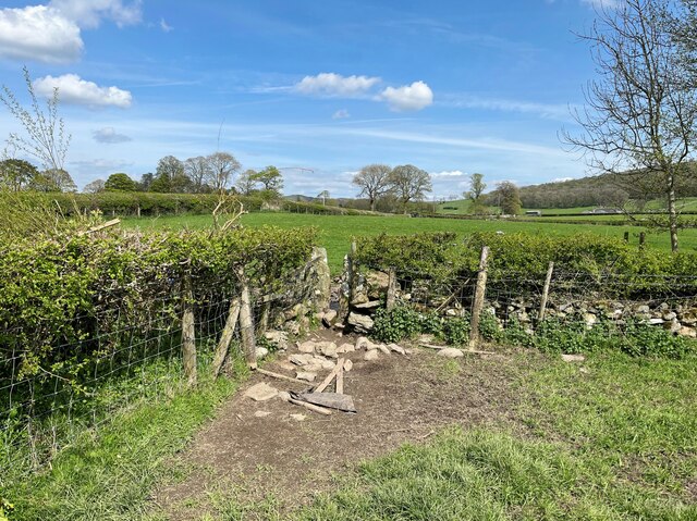
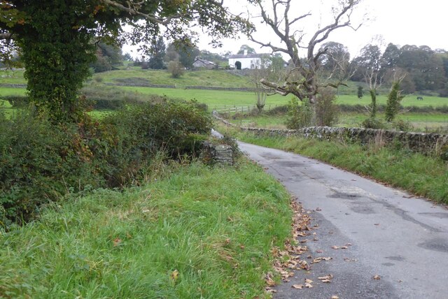
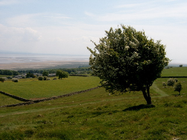
Images are sourced within 2km of 54.2023/-2.9521 or Grid Reference SD3778. Thanks to Geograph Open Source API. All images are credited.

Old signpost and milestone At the junction of Green Lane (A590) and Pease Close Lane
Old signpost and milestone
At the junction of Green Lane (A590) and Pease Close Lane
The Bigland road near Beck Side Also known as Croftside, this is the minor road from Cartmel to Haverthwaite.
The Bigland road near Beck Side
Also known as Croftside, this is the minor road from Cartmel to Haverthwaite.
Public footpath at Wall Nook Beside the garden wall of Wall Nook Farm Cottage, this is the public footpath from Hill to Beck Side.
Public footpath at Wall Nook
Beside the garden wall of Wall Nook Farm Cottage, this is the public footpath from Hill to Beck Side.
Old kiln at Beck Side This kiln is shown on the 1890 edition of the Ordnance Survey map as an old limekiln.
Old kiln at Beck Side
This kiln is shown on the 1890 edition of the Ordnance Survey map as an old limekiln.
Lane near Beck Side The lane gives access to fields and is also a public bridleway from Beck Side to Wood Broughton.
Lane near Beck Side
The lane gives access to fields and is also a public bridleway from Beck Side to Wood Broughton.
Track near Beck Side The track a public bridleway from Beck Side to Wood Broughton.
The gate marks the boundary between the civil parishes of Lower Allithwaite and Broughton East beyond the gate; it is also the boundary of the Lake District National Park.
Track near Beck Side
The track a public bridleway from Beck Side to Wood Broughton. The gate marks the boundary between the civil parishes of Lower Allithwaite and Broughton East beyond the gate; it is also the boundary of the Lake District National Park.
Lane near Beck Side The lane is a public bridleway from Beck Side to Wood Broughton.
Lane near Beck Side
The lane is a public bridleway from Beck Side to Wood Broughton.
Garden near Old House Wood This commercial garden supplies produce for local restaurants.
Garden near Old House Wood
This commercial garden supplies produce for local restaurants.
Field corner and stile The stile is on the public footpath from Aynsome Manor to Hampsfield.
Field corner and stile
The stile is on the public footpath from Aynsome Manor to Hampsfield.
View to Green Bank View to Green Bank along a country road to the north of Cartmel.
View to Green Bank
View to Green Bank along a country road to the north of Cartmel.
Cartmel Priory The construction of Cartmel Priory began in c 1188. The priory church was saved from destruction by King Henry VIII, during the Reformation, because the villagers of Cartmel had nowhere else to worship.

The village of Cartmel has, therefore, one of the finest churches in England. A rare example of a medieval monastic place of worship. The village contains relics of other monastic buildings, most significantly the priory gatehouse. As a consequence Cartmel is visited by tourists from all over the world.
Cartmel Priory
The construction of Cartmel Priory began in c 1188. The priory church was saved from destruction by King Henry VIII, during the Reformation, because the villagers of Cartmel had nowhere else to worship. The village of Cartmel has, therefore, one of the finest churches in England. A rare example of a medieval monastic place of worship. The village contains relics of other monastic buildings, most significantly the priory gatehouse. As a consequence Cartmel is visited by tourists from all over the world.
Cartmel village
Cartmel village
Footpath Under Fell End Taken close to Fell End looking back over Morecambe Bay.
Footpath Under Fell End
Taken close to Fell End looking back over Morecambe Bay.
Geese Near Aynsome Mill farm
Geese
Near Aynsome Mill farm
Cartmel Priory The modern OS map puts  this lovely old church just in the square.
Cartmel Priory
The modern OS map puts this lovely old church just in the square.
Cattery Near Templand
Cattery
Near Templand
Tree Middle Fell Gate One good thing about winter is the shapes of old roadside trees like this one.
Tree Middle Fell Gate
One good thing about winter is the shapes of old roadside trees like this one.
The "Hospice" on Hampsfell
Show me another place!

Cartmel Priory Gatehouse is located at Grid Ref: SD3778 (Lat: 54.2023, Lng: -2.9521)

Administrative County: Cumbria

District: South Lakeland

Police Authority: Cumbria

What 3 Words

///feasting.cotton.diamond. Near Grange-over-Sands, Cumbria

Related Wikis

Cartmel Priory

Cartmel Priory church serves as the parish church of Cartmel, Cumbria, England (formerly in Lancashire). == Priory == === Foundation === The priory was founded...
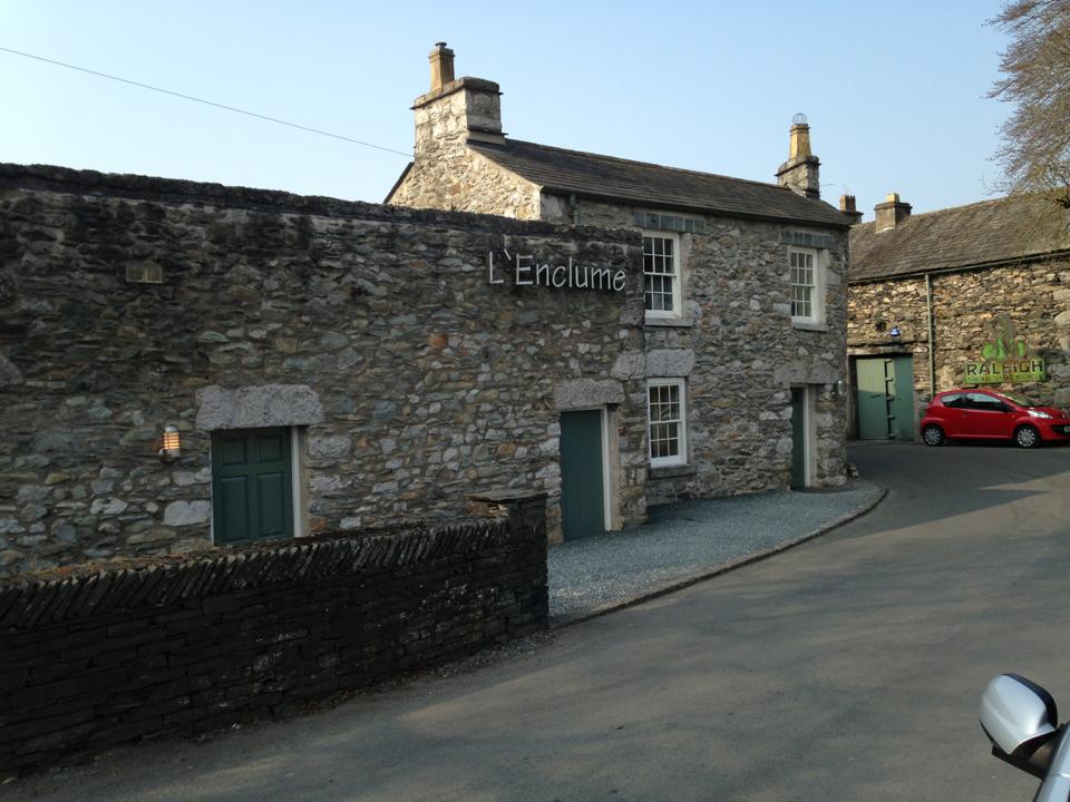
L'Enclume

L'Enclume (pronounced [lɑ̃.klym], French for "the anvil") is a restaurant opened in 2002 in Cartmel, Cumbria, England, run by chef Simon Rogan and his...

Cartmel Priory Gatehouse

Cartmel Priory Gatehouse is a medieval building located at Cartmel, Grange-over-Sands, Cumbria, England. It is listed Grade II* and is part of a scheduled...

Cartmel Racecourse

Cartmel Racecourse is a small national hunt racecourse in the village of Cartmel, now in the ceremonial county of Cumbria, historically in Lancashire....

Cartmel

Cartmel is a village in Cumbria, England, 2+1⁄4 miles (3.5 kilometres) northwest of Grange-over-Sands close to the River Eea. The village takes its name...

Cartmel Priory School

Cartmel Priory CofE School is a mixed 11-16 secondary school and academy in Cartmel, Cumbria, England. == History == The school was opened in 1958 on land...

Aynsome Manor

Aynsome Manor is a country house hotel in Cartmel, Cumbria, northwestern England, in the Lake District. It is set in the Vale of Cartmel, with views of...

Broughton East

Broughton East is a civil parish in the South Lakeland district of Cumbria, England. In the 2001 census the parish had a population of 173, increasing...

Nearby Amenities

Located within 500m of 54.2023,-2.9521
Cartmel
Place: village
Wikidata: Q379216
Lat/Long: 54.2009158/-2.9529069
Post Office
Created By: Potlatch 0.10f
Lat/Long: 54.201458/-2.9538629
Pub
Cavendish Arms
Addr City: Cartmel
Addr Postcode: LA11 6QA
Addr Street: Cavendish Street
Fhrs Id: 328887
Phone: +44 15395 36240
Website: https://www.thecavendisharms.co.uk/
Wikidata: Q26391268
Lat/Long: 54.2012837/-2.954249
Cafe
Cartmel Coffee
Addr City: Cartmel
Addr Postcode: LA11 6QB
Addr Street: The Square
Fhrs Id: 328613
Phone: +44 15395 35353
Lat/Long: 54.2009449/-2.9540699
Bus Stop
Ford Road
Naptan AtcoCode: 090079020747
Naptan Bearing: S
Naptan CommonName: Ford Road
Naptan Indicator: opp
Naptan Landmark: playground
Naptan NaptanCode: cumdgmpd
Naptan Street: Ford Road
Naptan Verified: no
Source: naptan_import
Lat/Long: 54.1998947/-2.9522913
Bus Stop
Clogger Beck
Local Ref: AT
Naptan AtcoCode: 090079021139
Naptan Bearing: N
Naptan CommonName: Clogger Beck
Naptan Indicator: at
Naptan Landmark: playground
Naptan NaptanCode: cumdgmpj
Naptan Street: Ford Road
Naptan Verified: no
Seats: yes
Shelter: yes
Source: naptan_import
Lat/Long: 54.1998756/-2.9524288
Newlands
Naptan AtcoCode: 090079021989
Naptan Bearing: N
Naptan BusStopType: CUS
Naptan CommonName: Newlands
Naptan Indicator: opp
Naptan Landmark: Newlands
Naptan NaptanCode: cumdgmpw
Naptan Street: No name
Naptan Verified: no
Source: naptan_import
Lat/Long: 54.2010514/-2.9492211
Priory C of E School (1)
Local Ref: AT
Naptan AtcoCode: 090079022219
Naptan Bearing: S
Naptan BusStopType: CUS
Naptan CommonName: Priory C of E School (1)
Naptan Indicator: at
Naptan Landmark: Cartmel Priory C of E School
Naptan NaptanCode: cumdgmta
Naptan Street: No name
Naptan Verified: no
Source: naptan_import
Lat/Long: 54.1981075/-2.9509778
Priory C of E School (2)
Naptan AtcoCode: 090079022220
Naptan Bearing: S
Naptan BusStopType: CUS
Naptan CommonName: Priory C of E School (2)
Naptan Indicator: o/s
Naptan Landmark: Cartmel Priory C of E School
Naptan NaptanCode: cumdgmtd
Naptan Street: No name
Naptan Verified: no
Source: naptan_import
Lat/Long: 54.1986063/-2.9504068
Priory View
Naptan AtcoCode: 090079022727
Naptan Bearing: S
Naptan BusStopType: CUS
Naptan CommonName: Priory View
Naptan Indicator: o/s
Naptan Landmark: Priory View
Naptan NaptanCode: cumdgmtg
Naptan Street: No name
Naptan Verified: no
Source: naptan_import
Lat/Long: 54.200809/-2.9491849
Turning Circle
Lat/Long: 54.1997267/-2.9491856
Post Box
Drive Through: no
Operator: Royal Mail
Post Box Type: wall
Ref: LA11 124
Source: LK
Lat/Long: 54.2004054/-2.9502654
Cafe
The Mallard Tea Shop
Addr City: Cartmel
Addr Postcode: LA11 6PN
Fhrs Id: 298875
Phone: +44 15395 36800
Lat/Long: 54.2004184/-2.9527517
Restaurant
Rogan and Company
FIXME: Check exact position.
Addr City: Cartmel
Addr Postcode: LA11 6QD
Addr Street: The Square
Fhrs Id: 328584
Source: survey;website
Url: http://www.roganandcompany.co.uk/home.html
Lat/Long: 54.2008533/-2.9535307
Post Box
Post Box Type: wall
Ref: LA11 130
Royal Cypher: GR
Royal Cypher Wikidata: Q33102273
Lat/Long: 54.2009893/-2.9549461
Telephone
Booth: KX100
Covered: booth
Operator: British Telecom
Payment Coins: yes
Lat/Long: 54.2009552/-2.954923
Recycling
Fixme: moved?
Lat/Long: 54.2003954/-2.9573216
Restaurant
L'Enclume
Addr City: Cartmel
Addr Postcode: LA11 6QA
Addr Street: Cavendish Street
Contact Facebook: https://www.facebook.com/lenclumerestaurant
Contact Twitter: https://twitter.com/lenclume
Email: info@lenclume.co.uk
Fhrs Id: 299711
Not Addr Postcode: LA11 6PZ
Phone: +44 15395 36362
Website: https://www.lenclume.co.uk/
Wikidata: Q6455662
Wikipedia: en:L'Enclume
Lat/Long: 54.2017645/-2.9538118
Cafe
Cartmel Village Shop
Addr City: Cartmel
Addr Postcode: LA11 6QB
Addr Street: The Square
Fhrs Id: 298983
Image: https://www.geograph.org.uk/photo/7291845
Phone: +44 15395 36280
Shop: deli
Website: www.cartmelvillageshop.co.uk
Lat/Long: 54.20097/-2.955002
Barrier: kissing_gate
Bicycle: no
Foot: yes
Lat/Long: 54.2014558/-2.9517023
The Larch Tree
Addr City: Cartmel
Addr Street: The Square
Shop: gift
Lat/Long: 54.2009749/-2.9532115
Shop: confectionery
Lat/Long: 54.2009702/-2.9530935
Shop: toys
Lat/Long: 54.2009389/-2.9534207
Shop: clothes
Lat/Long: 54.2009498/-2.9533214
Cartmel Bakery
Addr Housename: Unsworth's Yard
Shop: bakery
Source: Survey
Lat/Long: 54.2006071/-2.953207
Cartmel Cheeses
Addr City: Cartmel
Addr Housename: Unsworth's Yard
Addr Housenumber: 1
Addr Postcode: LA11 6PG
Addr Street: Unsworth's Yard
Fhrs Id: 299072
Not Addr Postcode: LA11 6PN
Phone: +44 15395 58623
Shop: cheese
Source: survey
Website: https://www.cartmelcheeses.co.uk/
Lat/Long: 54.2005835/-2.9531255
Pub
Royal Oak
Addr City: Cartmel
Addr Postcode: LA11 6QB
Addr Street: The Square
Fhrs Id: 328830
Outdoor Seating: yes
Phone: +44 15395 36259
Website: www.theroyaloakinncartmel.com
Wikidata: Q26392488
Lat/Long: 54.2007223/-2.9542026
Unsworth's Yard Brewery
Addr City: Cartmel
Addr Housenumber: 4
Addr Postcode: LA11 6PG
Addr Street: Unsworth's Yard
Craft: brewery
Fhrs Id: 299325
Not Addr Postcode: LA11 6PN
Phone: +44 7810 461313
Website: https://www.unsworthsyardbrewery.co.uk/
Lat/Long: 54.2005573/-2.9533162
Historic: memorial
Lat/Long: 54.1992578/-2.9495616
Sweeny Bobs Barbers
Addr City: Cartmel
Addr Postcode: LA11 6PN
Phone: +44 15395 35586
Shop: hairdresser
Lat/Long: 54.2003276/-2.9525957
Mrs Lovetts Ladies Hairdressers
Addr City: Cartmel
Addr Postcode: LA11 6PN
Phone: +44 15395 35586
Shop: hairdresser
Lat/Long: 54.2003549/-2.952633
The Red Pepper
Addr City: Cartmel
Addr Housenumber: 5a
Addr Postcode: LA11 6PG
Addr Street: Unsworth's Yard
Fixme: Now Cartmel Drinkshop?
Phone: +44 15395 36025
Shop: yes
Lat/Long: 54.2005247/-2.9529475
Addr City: Cartmel
Shop: yes
Lat/Long: 54.2004833/-2.9528608
Information: office
Tourism: information
Lat/Long: 54.2007553/-2.9530294
Historic: memorial
Image: https://www.geograph.org.uk/photo/3231641
Wikidata: Q26379631
Lat/Long: 54.2009088/-2.9546975
Bench
Lat/Long: 54.2009052/-2.9546602
Waste Basket
Lat/Long: 54.2008899/-2.9546586
Harmony - Professional Makeup & Beauty Therapy
Addr City: Cartmel
Addr Postcode: LA11 6QB
Addr Street: The Square
Phone: +44 15395 36881
Shop: beauty
Lat/Long: 54.2008674/-2.9551223
The Gatehouse Bookshop
Addr City: Cartmel
Addr Street: The Square
Phone: +44 15395 36247
Shop: books
Website: https://www.kerrbooks.co.uk/
Lat/Long: 54.2009854/-2.9545008
Waste Basket
Lat/Long: 54.200971/-2.9549162
Chamberlain Collectables
Addr City: Cartmel
Addr Postcode: LA11 6QA
Addr Street: Cavendish Street
Phone: +44 15395 33252
Shop: gift
Lat/Long: 54.2013989/-2.9541838
Post Box
Ref: LA11 109
Lat/Long: 54.2016157/-2.9540197
Bench
Backrest: yes
Lat/Long: 54.2019107/-2.9535629
Barrier: kissing_gate
Lat/Long: 54.20093/-2.9527353
Bench
Lat/Long: 54.2002898/-2.9538928
Fast Food
Well Bread
Addr City: Cartmel
Cuisine: sandwich
Lat/Long: 54.1996926/-2.9499247
Cartmel War Memorial
Historic: memorial
Material: stone
Memorial: celtic_cross
Wikidata: Q66479722
Lat/Long: 54.2009994/-2.9525718
Parking
Capacity Disabled: yes
Parking: surface
Lat/Long: 54.1985524/-2.9499244
Generator Method: photovoltaic
Generator Output Electricity: yes
Generator Source: solar
Generator Type: solar_photovoltaic_panel
Location: roof
Power: generator
Lat/Long: 54.1989492/-2.9489341
Generator Method: photovoltaic
Generator Output Electricity: yes
Generator Source: solar
Generator Type: solar_photovoltaic_panel
Location: roof
Power: generator
Lat/Long: 54.1994068/-2.9481589
Generator Method: photovoltaic
Generator Output Electricity: yes
Generator Source: solar
Generator Type: solar_photovoltaic_panel
Location: roof
Power: generator
Lat/Long: 54.1999121/-2.9492989
Generator Method: photovoltaic
Generator Output Electricity: yes
Generator Source: solar
Generator Type: solar_photovoltaic_panel
Location: roof
Power: generator
Lat/Long: 54.2014763/-2.9499641
Power: pole
Lat/Long: 54.2064792/-2.9505801
Power: pole
Lat/Long: 54.2058141/-2.9494482
Power: pole
Lat/Long: 54.2051426/-2.9482842
Power: pole
Lat/Long: 54.2044367/-2.9471067
Power: pole
Lat/Long: 54.2044476/-2.9453552
Leisure: outdoor_seating
Lat/Long: 54.2003497/-2.9542655
Give Way
Lat/Long: 54.1992263/-2.9492162
Village Lock-Up
Historic: memorial
Memorial: plaque
Lat/Long: 54.2012677/-2.9550547
Power: pole
Lat/Long: 54.2022551/-2.9518208
Power: pole
Lat/Long: 54.2030319/-2.9511969
Power: pole
Lat/Long: 54.2036885/-2.9506757
Power: pole
Lat/Long: 54.2043553/-2.9501771
Power: pole
Lat/Long: 54.2045122/-2.9502573
Power: pole
Lat/Long: 54.2051805/-2.9511067
Power: pole
Lat/Long: 54.2058575/-2.9519386
Power: pole
Lat/Long: 54.2058429/-2.9488566
Power: pole
Lat/Long: 54.2065361/-2.9528156
Leisure: pitch
Sport: cricket
Surface: grass
Lat/Long: 54.2018539/-2.9572141
The data included in this document is from www.openstreetmap.org. The data is made available under ODbL.

Have you been to Cartmel Priory Gatehouse?

Leave your review of Cartmel Priory Gatehouse below (or comments, questions and feedback).