Carreg Wen

Heritage Site in Montgomeryshire

Wales

Carreg Wen

Boundary marker stone and small cairn Above Hafren Forest.
Boundary marker stone and small cairn Credit: John Lucas

Carreg Wen is a notable heritage site located in Montgomeryshire, a county in Wales. Situated on a picturesque hillside, it is a well-preserved example of a Bronze Age burial cairn. The site is of great historical significance and attracts a large number of visitors each year.

The cairn at Carreg Wen is approximately 20 meters in diameter and stands at a height of 3 meters. It is constructed from locally sourced stones, which were carefully arranged to create a circular mound. The cairn is surrounded by a ring of smaller stones, enhancing its visual impact and adding to its archaeological importance.

Archaeological excavations conducted at Carreg Wen have revealed that it dates back to around 2000-1500 BC, making it over 3,000 years old. The cairn is believed to have been used as a burial site during the Bronze Age, with human remains and grave goods discovered during the excavations. These findings provide valuable insights into the burial practices and rituals of the ancient inhabitants of Montgomeryshire.

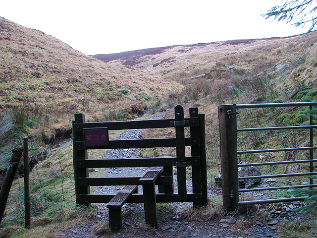
The site is easily accessible to the public, with a designated pathway leading to the cairn. Interpretive signage provides information about the history and significance of Carreg Wen, allowing visitors to gain a deeper understanding of the site. The surrounding landscape offers stunning views of the Welsh countryside, adding to the overall appeal of the site.

Carreg Wen is not only a testament to the ancient past of Montgomeryshire but also serves as a reminder of the rich cultural heritage of the region. Its well-preserved condition and historical importance make it an invaluable heritage site that continues to captivate and educate visitors.

If you have any feedback on the listing, please let us know in the comments section below.

Carreg Wen Images

Images are sourced within 2km of 52.482/-3.73 or Grid Reference SN8288. Thanks to Geograph Open Source API. All images are credited.

Boundary marker stone and small cairn Above Hafren Forest.
Boundary marker stone and small cairn
Above Hafren Forest.
Carreg derfyn a charn fach / A boundary stone and small cairn Carreg derfyn a charn fach yn dynodi ffin Ceredigion a Phowys. Y fan yn y pellter yw Pumlumon Arwystli.

A boundary stone and small cairn denoting the boundary between Ceredigion and Powys. The peak in the distance is Pumlumon Arwystli.
Carreg derfyn a charn fach / A boundary stone and small cairn
Carreg derfyn a charn fach yn dynodi ffin Ceredigion a Phowys. Y fan yn y pellter yw Pumlumon Arwystli. A boundary stone and small cairn denoting the boundary between Ceredigion and Powys. The peak in the distance is Pumlumon Arwystli.
Looking towards Pen Pumlumon Arwystli One of the 'WWW' boundary markers on the left.
Looking towards Pen Pumlumon Arwystli
One of the 'WWW' boundary markers on the left.
A view over Hafren Forest From Pen Pumlumon Arwystli with Llyn Clywedog in the distance on the left.
A view over Hafren Forest
From Pen Pumlumon Arwystli with Llyn Clywedog in the distance on the left.
Hafren Forest Viewed from the slopes of Pen Pumlumon Arwystli.
Hafren Forest
Viewed from the slopes of Pen Pumlumon Arwystli.
On Bryn Cras
On Bryn Cras
Cairn, Pumlumon Arwystli
Ffordd Hafren / The Severn Way Cerddwyr yn dilyn Ffordd Hafren.

Walkers following the Severn Way.
Ffordd Hafren / The Severn Way
Cerddwyr yn dilyn Ffordd Hafren. Walkers following the Severn Way.
Ffordd Hafren / The Severn Way Cerddwyr yn dilyn Ffordd Hafren mewn lleoLiad a elwir Graig Wen. 

Walkers following the Severn Way at a location known as Graig Wen (trans. white rock).
Ffordd Hafren / The Severn Way
Cerddwyr yn dilyn Ffordd Hafren mewn lleoLiad a elwir Graig Wen. Walkers following the Severn Way at a location known as Graig Wen (trans. white rock).
Pombren ar Ffordd Hafren / A footbridge on the Severn Way Pompren fach ar Ffordd Hafren.

A small footbridge on the Severn Way.
Pombren ar Ffordd Hafren / A footbridge on the Severn Way
Pompren fach ar Ffordd Hafren. A small footbridge on the Severn Way.
Ffordd Hafren / The Severn Way Cerddwyr yn dilyn Ffordd Hafren.

Walkers following the Severn Way.
Ffordd Hafren / The Severn Way
Cerddwyr yn dilyn Ffordd Hafren. Walkers following the Severn Way.
Llwybr Hafren / The Severn Way Llwybr Hafren yn mynd tuag at y blanhigfa goniferaidd, y mae llawer ohoni yn y pellter wedi'i dymchwel.

The Severn Way heading towards the conifer Plantation, much of it in the distance has been felled.
Llwybr Hafren / The Severn Way
Llwybr Hafren yn mynd tuag at y blanhigfa goniferaidd, y mae llawer ohoni yn y pellter wedi'i dymchwel. The Severn Way heading towards the conifer Plantation, much of it in the distance has been felled.
Blaen Hafren / Source of the Severn River Yn y pellter mae postyn yn nodi'n fras lleoliad blaen Hafren.

The post in the distance marks the approximate location of the source of the Severn River.
Blaen Hafren / Source of the Severn River
Yn y pellter mae postyn yn nodi'n fras lleoliad blaen Hafren. The post in the distance marks the approximate location of the source of the Severn River.
Llwybr ger Blaen Hafren / Path near source of the Severn Llwybr yn dilyn ffens ger Blaen Hafren. 

A path following a fence near the source of the Severn.
Llwybr ger Blaen Hafren / Path near source of the Severn
Llwybr yn dilyn ffens ger Blaen Hafren. A path following a fence near the source of the Severn.
Llyn dienw  ar Fryn Cras / Unnamed lake on Bryn Cras Llyn dienw ar Fryn Cras. Ar y llyn y mae dau wydd Canadaidd. 


An unnamed lake on Bryn Cras (trans. scorched hill). On the lake are two Canadian geese.
Llyn dienw ar Fryn Cras / Unnamed lake on Bryn Cras
Llyn dienw ar Fryn Cras. Ar y llyn y mae dau wydd Canadaidd. An unnamed lake on Bryn Cras (trans. scorched hill). On the lake are two Canadian geese.
Dringo Pumlumon Arwystli / Ascending Pumlumon Arwystli Cerddwyr yn dringo Pumlumon Arwystli.

Walkers ascending Pumlumon Arwystli.
Dringo Pumlumon Arwystli / Ascending Pumlumon Arwystli
Cerddwyr yn dringo Pumlumon Arwystli. Walkers ascending Pumlumon Arwystli.
Dringo Pumlumon Arwystli / Ascending Pumlumon Arwystli Cerddwyr yn dringo Pumlumon Arwystli.

Walkers ascending Pumlumon Arwystli.
Dringo Pumlumon Arwystli / Ascending Pumlumon Arwystli
Cerddwyr yn dringo Pumlumon Arwystli. Walkers ascending Pumlumon Arwystli.
Carnau ar Bumlumon Arwystli / Cairns on Pumlumon Arwystli Cerddwyr wrth ymyl carnau ar Bumlumon Arwystli.

Walkers at the cairns on Pumlumon Arwystli.
Carnau ar Bumlumon Arwystli / Cairns on Pumlumon Arwystli
Cerddwyr wrth ymyl carnau ar Bumlumon Arwystli. Walkers at the cairns on Pumlumon Arwystli.
Show me another place!

Carreg Wen is located at Grid Ref: SN8288 (Lat: 52.482, Lng: -3.73)

What 3 Words

///flap.sapping.written. Near Staylittle, Powys

Nearby Locations

Carreg Wen

Related Wikis

Pumlumon Cwmbiga

Pumlumon Cwmbiga is a summit of the Pumlumon mountain range in Ceredigion, Wales. It is 620 metres (2,034) feet above sea level and is a deleted Nuttall...

Pen Pumlumon Arwystli

Pen Pumlumon Arwystli is the second highest summit on the Plynlimon massif, a part of the Cambrian Mountains in the county of Ceredigion, Wales. The summit...

Mwyngloddfa Nantiago

Mwyngloddfa Nantiago is a Site of Special Scientific Interest in Brecknock, Powys, Wales. It is located on the eastern flank of the Plynlimon range of...

Hafren Forest

Hafren Forest lies north-west of Llanidloes, an ancient market town in Mid Wales. == Overview == The forest covers around 40 square kilometres (15 square...

Nearby Amenities

Located within 500m of 52.482,-3.73
Carreg Wen
Place: hamlet
Lat/Long: 52.4822495/-3.7258843
The data included in this document is from www.openstreetmap.org. The data is made available under ODbL.

Have you been to Carreg Wen?

Leave your review of Carreg Wen below (or comments, questions and feedback).