Carreg Samson

Heritage Site in Cardiganshire

Wales

Carreg Samson

Craig y Foelallt near Llanddewi Brefi in Ceredigion Looking north-east from near Foelallt Farm. There is a bench seat (and parking) here where you can sit and admire the views across the Afon Brefi valley.
Craig y Foelallt near Llanddewi Brefi in Ceredigion Credit: Roger D Kidd

Carreg Samson is a significant heritage site located in Cardiganshire, Wales. This ancient monument is a prehistoric dolmen, which dates back to the Neolithic period, around 4,000-3,000 BCE. It is situated on the cliffs of the Pembrokeshire Coast National Park, near the small village of Abercastle.

The dolmen consists of three massive stones. Two large upright stones support a massive capstone, creating a chamber-like structure. The capstone measures approximately 4 meters in length and weighs around 25 tons, making it one of the largest in Wales.

Carreg Samson is believed to have been a communal burial site, where multiple individuals were laid to rest during the Neolithic era. The monument's name, "Samson's Stone," stems from a local legend that claims the biblical strongman, Samson, placed the capstone on the upright stones with his incredible strength.

Visitors to Carreg Samson can marvel at the ancient engineering and craftsmanship that went into creating this megalithic structure. The dolmen is surrounded by scenic coastal views, providing a stunning backdrop for photographers and nature enthusiasts alike.

As a heritage site, Carreg Samson is protected by law, ensuring its preservation for future generations. It serves as a tangible connection to our Neolithic ancestors, offering valuable insights into their burial customs and societal practices. Visitors are encouraged to respect the site, adhering to any preservation guidelines and regulations in place.

If you have any feedback on the listing, please let us know in the comments section below.

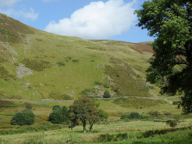
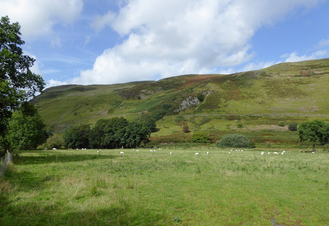
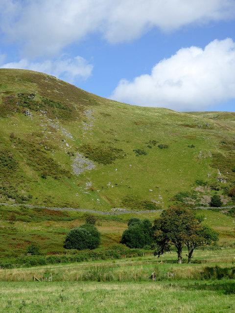
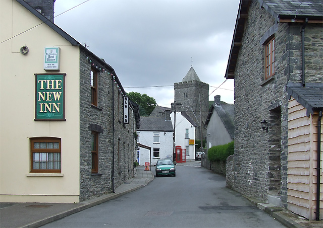
Carreg Samson Images

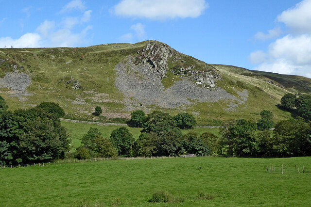
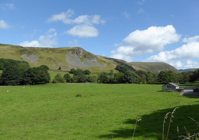
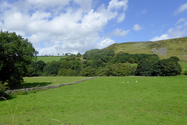
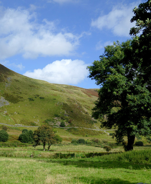
Images are sourced within 2km of 52.163/-3.937 or Grid Reference SN6753. Thanks to Geograph Open Source API. All images are credited.

Craig y Foelallt near Llanddewi Brefi in Ceredigion Looking north-east from near Foelallt Farm. There is a bench seat (and parking) here where you can sit and admire the views across the Afon Brefi valley.
Craig y Foelallt near Llanddewi Brefi in Ceredigion
Looking north-east from near Foelallt Farm. There is a bench seat (and parking) here where you can sit and admire the views across the Afon Brefi valley.
Lane south-east of Llanddewi Brefi in Ceredigion Looking east as the former drove road climbs towards Cwm Dulas and Blaendoethie. Beyond that it is unsurfaced in the Doethie valley as far as Soar-y-Mynydd.
Lane south-east of Llanddewi Brefi in Ceredigion
Looking east as the former drove road climbs towards Cwm Dulas and Blaendoethie. Beyond that it is unsurfaced in the Doethie valley as far as Soar-y-Mynydd.
Trac yn gadael yr heol / Track exiting the road Trac coedwigaeth ar y dde yn gadael heol fach sy'n mynd i gyfeiriad Llanddewi Brefi.

A forestry track on the right exits a minor road heading towards Llanddewi Brefi (trans. St David's church on the banks of the river Brefi).
Trac yn gadael yr heol / Track exiting the road
Trac coedwigaeth ar y dde yn gadael heol fach sy'n mynd i gyfeiriad Llanddewi Brefi. A forestry track on the right exits a minor road heading towards Llanddewi Brefi (trans. St David's church on the banks of the river Brefi).
Pasture in Cwm Brefi, Ceredigion Looking across the valley of the Afon Brefi towards the crags of Craig y Foelallt.
Pasture in Cwm Brefi, Ceredigion
Looking across the valley of the Afon Brefi towards the crags of Craig y Foelallt.
Pasture in Cwm Brefi, Ceredigion Looking across the valley of the Afon Brefi west of the crags on Craig y Foelallt.
Pasture in Cwm Brefi, Ceredigion
Looking across the valley of the Afon Brefi west of the crags on Craig y Foelallt.
Cwm Brefi in Ceredigion This is about a mile south-east of Llanddewi-Brefi, seen from the former drovers' road to Abergwesyn via Cwm Doethie and Soar-y-mynydd.
Cwm Brefi in Ceredigion
This is about a mile south-east of Llanddewi-Brefi, seen from the former drovers' road to Abergwesyn via Cwm Doethie and Soar-y-mynydd.
Pasture and hillside in Cwm Brefi, Ceredigion This is about a mile south-east of Llanddewi-Brefi, seen from the former drovers' road to Abergwesyn via Cwm Doethie and Soar-y-Mynydd. Caig y Lefel is the rocky outcrop in the middle of the image.
Pasture and hillside in Cwm Brefi, Ceredigion
This is about a mile south-east of Llanddewi-Brefi, seen from the former drovers' road to Abergwesyn via Cwm Doethie and Soar-y-Mynydd. Caig y Lefel is the rocky outcrop in the middle of the image.
Pasture and hillside in Cwm Brefi, Ceredigion This is about a mile south-east of Llanddewi-Brefi, seen from the former drovers' road to Abergwesyn via Cwm Doethie and Soar-y-mynydd.
Pasture and hillside in Cwm Brefi, Ceredigion
This is about a mile south-east of Llanddewi-Brefi, seen from the former drovers' road to Abergwesyn via Cwm Doethie and Soar-y-mynydd.
Narrow lane in Cwm Brefi, Ceredigion This former drovers' road to Abergwesyn via Cwm Doethie Fawr and Soar-y-Mynydd is surfaced as far as Blaendoethie. The following three miles is rough, as far as Soar.
Ahead is the craggy bulk of Craig Ifan.
Narrow lane in Cwm Brefi, Ceredigion
This former drovers' road to Abergwesyn via Cwm Doethie Fawr and Soar-y-Mynydd is surfaced as far as Blaendoethie. The following three miles is rough, as far as Soar. Ahead is the craggy bulk of Craig Ifan.
Narrow lane in Cwm Brefi, Ceredigion This former drovers' road to Abergwesyn via Cwm Doethie Fawr and Soar-y-Mynydd is surfaced as far as Blaendoethie. The following as far as  Soar is not. 
Ahead is the craggy bulk of Craig Ifan.
Narrow lane in Cwm Brefi, Ceredigion
This former drovers' road to Abergwesyn via Cwm Doethie Fawr and Soar-y-Mynydd is surfaced as far as Blaendoethie. The following as far as Soar is not. Ahead is the craggy bulk of Craig Ifan.
Road to Llanddewi-Brefi in Ceredigion Looking north towards Llanddewi-Brefi. The road has come from Llanycrwys and Ffarmers.
Road to Llanddewi-Brefi in Ceredigion
Looking north towards Llanddewi-Brefi. The road has come from Llanycrwys and Ffarmers.
Road to Llanddewi-Brefi in Ceredigion Looking north towards Llanddewi-Brefi. The road has come from Llanycrwys and Ffarmers.
Road to Llanddewi-Brefi in Ceredigion
Looking north towards Llanddewi-Brefi. The road has come from Llanycrwys and Ffarmers.
Forestry road east of Llanfair Clydogau in Ceredigion Looking south-west towards Llyn y Gwaith from the Llanddewi-Brefi to Ffarmers road.
Forestry road east of Llanfair Clydogau in Ceredigion
Looking south-west towards Llyn y Gwaith from the Llanddewi-Brefi to Ffarmers road.
Road to Llanddewi-Brefi in Ceredigion Looking north-west towards Llanddewi-Brefi. The road has come from Llanycrwys and Ffarmers.
Road to Llanddewi-Brefi in Ceredigion
Looking north-west towards Llanddewi-Brefi. The road has come from Llanycrwys and Ffarmers.
Coniferous forest entrance south-east of Llanddewi-Brefi, Ceredigion Looking south-west towards Llyn y Gwaith from the Llanddewi-Brefi to Ffarmers road.
Coniferous forest entrance south-east of Llanddewi-Brefi, Ceredigion
Looking south-west towards Llyn y Gwaith from the Llanddewi-Brefi to Ffarmers road.
Forestry road south-east of Llanddewi-Brefi, Ceredigion Looking south-west towards Llyn y Gwaith and the Clywedog Plantation.
Forestry road south-east of Llanddewi-Brefi, Ceredigion
Looking south-west towards Llyn y Gwaith and the Clywedog Plantation.
Forestry road south-east of Llanddewi-Brefi, Ceredigion Looking west-south-west towards Llyn y Gwaith and the Clywedog Plantation.
Forestry road south-east of Llanddewi-Brefi, Ceredigion
Looking west-south-west towards Llyn y Gwaith and the Clywedog Plantation.
Show me another place!

Carreg Samson is located at Grid Ref: SN6753 (Lat: 52.163, Lng: -3.937)

Unitary Authority: Ceredigion

Police Authority: Dyfed Powys

What 3 Words

///image.absorb.sunset. Near Tregaron, Ceredigion

Nearby Locations

Carreg Samson

Related Wikis

Pentre-rhew

Pentre-rhew is a hamlet in the community of Llanddewibrefi, Ceredigion, Wales, which is 58.3 miles (93.9 km) from Cardiff and 169.6 miles (272.9 km) from...

St David's Church, Llanddewi Brefi

St David's Church is a Grade II* listed medieval church in the Welsh village of Llanddewi Brefi, 3 miles south of Tregaron in the county of Ceredigion...

Llanddewi Brefi

Llanddewi Brefi (Welsh pronunciation: [ɬanˈðɛwi ˈbrɛvi]) is a village, parish and community of approximately 500 people in Ceredigion, Wales. The village...

Gogoyan

Gogoyan is a hamlet in the community of Llanddewibrefi, Ceredigion, Wales, which is 58.9 miles (94.8 km) from Cardiff and 171.1 miles (275.3 km) from...

Nearby Amenities

Located within 500m of 52.163,-3.937
The data included in this document is from www.openstreetmap.org. The data is made available under ODbL.

Have you been to Carreg Samson?

Leave your review of Carreg Samson below (or comments, questions and feedback).