Carnedd Penyborth-goch

Heritage Site in Caernarfonshire

Wales

Carnedd Penyborth-goch

Slatey rock outcrop Volcanic rock belonging to the Conwy Rhyolite Formation underlies much of the final stages of the path to the summit of Drum. Here, however, is one of the many enclaves of mudstone which are interleaved between parts of the erupted sequence of tuff and lava. Like the volcanic rocks, a strong cleavage has been impressed by the tectonic stresses imposed during the Caledonian mountain-building period. The image does not do justice to the freezing wind flying across the ridge from the east.
Slatey rock outcrop Credit: Jonathan Wilkins

Carnedd Penyborth-goch is a prominent heritage site located in Caernarfonshire, Wales. Situated in the Snowdonia National Park, it is renowned for its historical significance and breathtaking natural beauty.

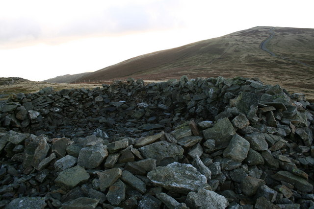
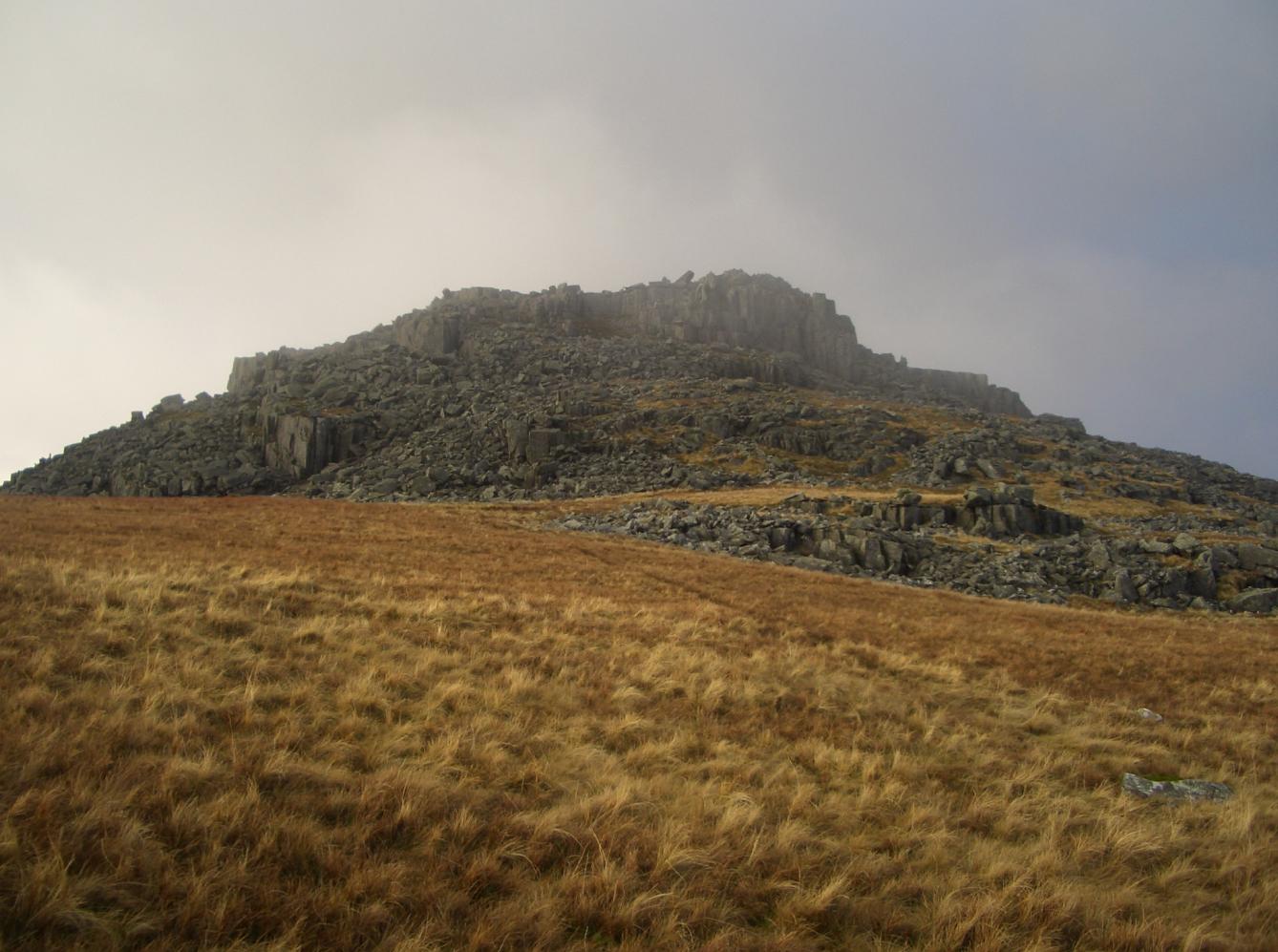
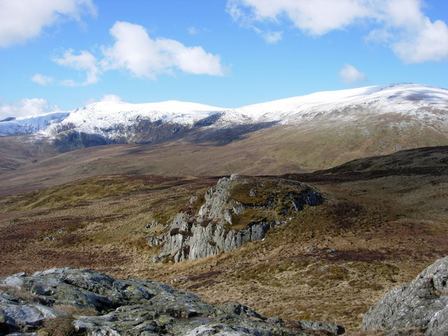
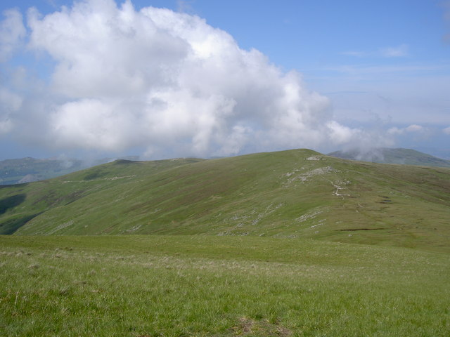
The site is dominated by the Carneddau mountain range, with Carnedd Penyborth-goch being one of its most notable peaks. Standing at an impressive height of 2,760 feet (841 meters), it offers panoramic views of the surrounding landscape, including the valleys, lakes, and other peaks of Snowdonia.

Carnedd Penyborth-goch holds great historical significance as it is believed to have been an important site during the Bronze Age. Archaeological evidence suggests that the area was inhabited by early settlers who left behind burial sites, stone circles, and other remnants of their ancient civilization.

The heritage site is also known for its rich biodiversity. The Carneddau range is home to various species of flora and fauna, including rare mountain plants, birds, and mammals. Wildlife enthusiasts often visit the area to observe and study these unique ecosystems.

Access to Carnedd Penyborth-goch is facilitated by well-maintained hiking trails that offer visitors an opportunity to explore the mountainous terrain. The ascent to the summit requires a moderate level of fitness and offers a rewarding experience for outdoor enthusiasts.

Overall, Carnedd Penyborth-goch is a site of great historical and natural importance. Its stunning landscapes, ancient history, and diverse wildlife make it a must-visit destination for individuals interested in both cultural heritage and outdoor adventure.

If you have any feedback on the listing, please let us know in the comments section below.

Carnedd Penyborth-goch Images

Images are sourced within 2km of 53.207/-3.938 or Grid Reference SH7069. Thanks to Geograph Open Source API. All images are credited.

Slatey rock outcrop Volcanic rock belonging to the Conwy Rhyolite Formation underlies much of the final stages of the path to the summit of Drum. Here, however, is one of the many enclaves of mudstone which are interleaved between parts of the erupted sequence of tuff and lava. Like the volcanic rocks, a strong cleavage has been impressed by the tectonic stresses imposed during the Caledonian mountain-building period. The image does not do justice to the freezing wind flying across the ridge from the east.
Slatey rock outcrop
Volcanic rock belonging to the Conwy Rhyolite Formation underlies much of the final stages of the path to the summit of Drum. Here, however, is one of the many enclaves of mudstone which are interleaved between parts of the erupted sequence of tuff and lava. Like the volcanic rocks, a strong cleavage has been impressed by the tectonic stresses imposed during the Caledonian mountain-building period. The image does not do justice to the freezing wind flying across the ridge from the east.
Bleached moorland The Cambrian Way long-distance path follows the fence marking the boundary between Conwy and Gwynedd counties. The colours of the season are sublime. It is a joy in winter, when the sheep are not loose on the hills, that the assistants can make their own way without a lead.
Bleached moorland
The Cambrian Way long-distance path follows the fence marking the boundary between Conwy and Gwynedd counties. The colours of the season are sublime. It is a joy in winter, when the sheep are not loose on the hills, that the assistants can make their own way without a lead.
Ascending Foel Lwyd
Ascending Foel Lwyd
Earthwork On Drum
Earthwork On Drum
Above Cwm Bychan
Above Cwm Bychan
Rock Outcrop Below Foel Fras
Enclosure Below Foel Fras
Moorland Below Cwm Bychan
View from Drum summit
Jagged outcrop Slatey rock outcrop above Foel Lwyd has weathered into sharp pinnacles, making a strong contrast with the featureless moorland.
Jagged outcrop
Slatey rock outcrop above Foel Lwyd has weathered into sharp pinnacles, making a strong contrast with the featureless moorland.
Moorland with ponies Almost featureless moorland is enlivened by grazing ponies and sheep.
Moorland with ponies
Almost featureless moorland is enlivened by grazing ponies and sheep.
Peat hag It is curious that peat is being lost from parts of the slope of Foel Lwyd, enabling grass to grow on the better-drained areas.
Peat hag
It is curious that peat is being lost from parts of the slope of Foel Lwyd, enabling grass to grow on the better-drained areas.
Nothing to see here My assistant, despite having no apparent concern with the interested pony, will not admit its presence by looking at it.
Nothing to see here
My assistant, despite having no apparent concern with the interested pony, will not admit its presence by looking at it.
Carneddau ponies No zoom here! The mountain ponies definitely seem to be tamer these days. Perhaps they are becoming more used to cameras, what with television appearances and all.
Carneddau ponies
No zoom here! The mountain ponies definitely seem to be tamer these days. Perhaps they are becoming more used to cameras, what with television appearances and all.
Rock garden The edge of Foel Lwyd has a scattering of glacially-derived boulders in clumps. Here is an easterly view over Penygadair into Denbighshire.
Rock garden
The edge of Foel Lwyd has a scattering of glacially-derived boulders in clumps. Here is an easterly view over Penygadair into Denbighshire.
View over Tafolog A view from the northern flank of Foel Lwyd, looking over the featureless moorland to Tafolog, a glaciated wilderness below the Bwlch y Ddeufaen. From here the power lines are almost invisible.
View over Tafolog
A view from the northern flank of Foel Lwyd, looking over the featureless moorland to Tafolog, a glaciated wilderness below the Bwlch y Ddeufaen. From here the power lines are almost invisible.
Heather and bilberry Land which is better drained has a better vegetation than the sodden, mossy grass and rushes which make progress difficult at times.
Heather and bilberry
Land which is better drained has a better vegetation than the sodden, mossy grass and rushes which make progress difficult at times.
Fence, Foel Fras Descending the ridge to Drum.
Fence, Foel Fras
Descending the ridge to Drum.
Show me another place!

Carnedd Penyborth-goch is located at Grid Ref: SH7069 (Lat: 53.207, Lng: -3.938)

Unitary Authority: Conwy/ Gwynedd

Police Authority: North Wales

What 3 Words

///grief.line.dispose. Near Aber, Gwynedd

Related Wikis

Carnedd y Ddelw

Carnedd y Ddelw is a summit in the Carneddau mountains in north Wales, north-east of Foel-fras. It is the Nuttall top of Drum (Wales). Its eastern slopes...

Bera Mawr

Bera Mawr is a summit in the Carneddau mountains in north Wales, height 794 metres. It and Bera Bach are together known as the Berau, or northern Carneddau...

Pen y Castell

Pen y Castell is a summit in the Carneddau mountains in north Wales. It tops the east ridge of Drum (Wales). The summit consists of rocky outcrops amid...

Drum (Wales)

Drum (Welsh pronunciation: [ˈdrɨm]) (Welsh: Y Drum = the ridge) is a summit in the Carneddau mountains in north Wales, 2 km north-east of Foel-fras. It...

Bera Bach

Bera Bach is a summit, height 807 metres, in the Carneddau mountains in north Wales. It is part of a ridge leading west from Garnedd Uchaf. The summit...

Foel-fras

Foel-fras (944 m) is a mountain in the Carneddau range, about 10 km east of Bethesda in North Wales. It lies on the border between the counties of Gwynedd...

Llwytmor

Llwytmor is a satellite peak of Foel-fras, and forms a part of the Carneddau range. The summit is 849 metres (2,785 ft) above sea level and it contains...

Bwlch-y-Ddeufaen

Bwlch-y-Ddeufaen (Welsh: Gap/Pass of the Two Stones) is a mountain pass in Conwy county borough, north Wales, traversable only on foot or horseback, following...

Nearby Amenities

Located within 500m of 53.207,-3.938
Drum
Alt Name: Carnedd Penydorth-Goch
Ele: 770
Natural: peak
Wikidata: Q5309044
Wikipedia: en:Drum (Wales)
Lat/Long: 53.2076133/-3.9353106
Barrier: stile
Lat/Long: 53.2036691/-3.9371527
The data included in this document is from www.openstreetmap.org. The data is made available under ODbL.

Have you been to Carnedd Penyborth-goch?

Leave your review of Carnedd Penyborth-goch below (or comments, questions and feedback).