Carn Fawr

Heritage Site in Cardiganshire

Wales

Carn Fawr

Boundary marker stone and small cairn Above Hafren Forest.
Boundary marker stone and small cairn Credit: John Lucas

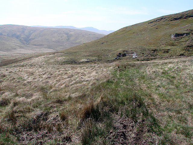
Carn Fawr is a prominent heritage site in the county of Cardiganshire, located in Wales. Situated near the village of Tregaron, it is a large prehistoric burial mound with significant historical and archaeological importance. The site is known for its commanding presence, as it stands on a hilltop, offering impressive panoramic views of the surrounding countryside.

Dating back to the Bronze Age, Carn Fawr is believed to have been constructed around 2000-1600 BC. It measures approximately 30 meters in diameter and 4 meters in height, making it one of the largest known burial mounds of its kind in the region. The mound is thought to have been used as a communal burial site, possibly for important members of the local community or tribal leaders.

The construction of Carn Fawr showcases the impressive engineering skills of the Bronze Age people, as it required the movement of large quantities of earth and stones to create its distinct shape. The mound is composed of layers of stones and earth, which have been carefully stacked to form a solid structure.

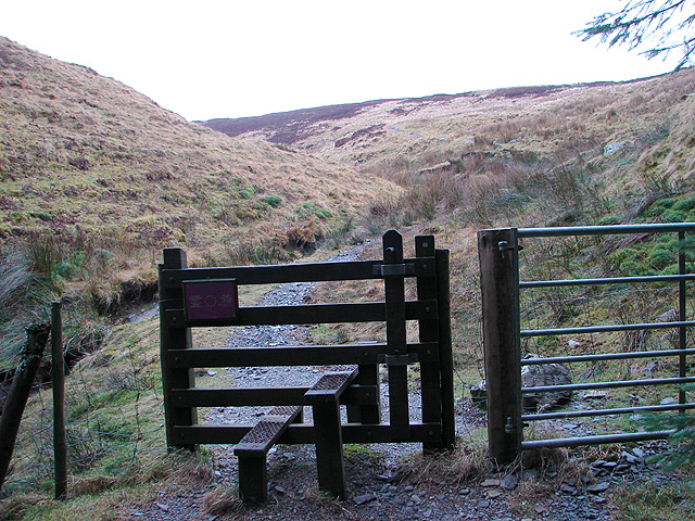
Today, Carn Fawr is a protected heritage site, managed by local authorities and open to the public. Visitors can explore the site and learn about its historical significance through informational signage. The panoramic views from the hilltop offer a glimpse into the ancient landscape that would have been familiar to the Bronze Age inhabitants.

Carn Fawr serves as a reminder of the rich cultural heritage of Cardiganshire and provides valuable insights into the lives and practices of its ancient inhabitants.

If you have any feedback on the listing, please let us know in the comments section below.

Carn Fawr Images

Images are sourced within 2km of 52.498/-3.747 or Grid Reference SN8190. Thanks to Geograph Open Source API. All images are credited.

Boundary marker stone and small cairn Above Hafren Forest.
Boundary marker stone and small cairn
Above Hafren Forest.
Carreg derfyn a charn fach / A boundary stone and small cairn Carreg derfyn a charn fach yn dynodi ffin Ceredigion a Phowys. Y fan yn y pellter yw Pumlumon Arwystli.

A boundary stone and small cairn denoting the boundary between Ceredigion and Powys. The peak in the distance is Pumlumon Arwystli.
Carreg derfyn a charn fach / A boundary stone and small cairn
Carreg derfyn a charn fach yn dynodi ffin Ceredigion a Phowys. Y fan yn y pellter yw Pumlumon Arwystli. A boundary stone and small cairn denoting the boundary between Ceredigion and Powys. The peak in the distance is Pumlumon Arwystli.
On Bryn Cras
On Bryn Cras
Ffordd Hafren / The Severn Way Cerddwyr yn dilyn Ffordd Hafren.

Walkers following the Severn Way.
Ffordd Hafren / The Severn Way
Cerddwyr yn dilyn Ffordd Hafren. Walkers following the Severn Way.
Llwybr Hafren / The Severn Way Llwybr Hafren yn mynd tuag at y blanhigfa goniferaidd, y mae llawer ohoni yn y pellter wedi'i dymchwel.

The Severn Way heading towards the conifer Plantation, much of it in the distance has been felled.
Llwybr Hafren / The Severn Way
Llwybr Hafren yn mynd tuag at y blanhigfa goniferaidd, y mae llawer ohoni yn y pellter wedi'i dymchwel. The Severn Way heading towards the conifer Plantation, much of it in the distance has been felled.
Blaen Hafren / Source of the Severn River Yn y pellter mae postyn yn nodi'n fras lleoliad blaen Hafren.

The post in the distance marks the approximate location of the source of the Severn River.
Blaen Hafren / Source of the Severn River
Yn y pellter mae postyn yn nodi'n fras lleoliad blaen Hafren. The post in the distance marks the approximate location of the source of the Severn River.
Llwybr ger Blaen Hafren / Path near source of the Severn Llwybr yn dilyn ffens ger Blaen Hafren. 

A path following a fence near the source of the Severn.
Llwybr ger Blaen Hafren / Path near source of the Severn
Llwybr yn dilyn ffens ger Blaen Hafren. A path following a fence near the source of the Severn.
Llyn dienw  ar Fryn Cras / Unnamed lake on Bryn Cras Llyn dienw ar Fryn Cras. Ar y llyn y mae dau wydd Canadaidd. 


An unnamed lake on Bryn Cras (trans. scorched hill). On the lake are two Canadian geese.
Llyn dienw ar Fryn Cras / Unnamed lake on Bryn Cras
Llyn dienw ar Fryn Cras. Ar y llyn y mae dau wydd Canadaidd. An unnamed lake on Bryn Cras (trans. scorched hill). On the lake are two Canadian geese.
Dringo Pumlumon Arwystli / Ascending Pumlumon Arwystli Cerddwyr yn dringo Pumlumon Arwystli.

Walkers ascending Pumlumon Arwystli.
Dringo Pumlumon Arwystli / Ascending Pumlumon Arwystli
Cerddwyr yn dringo Pumlumon Arwystli. Walkers ascending Pumlumon Arwystli.
A long view towards the hidden valley of Cwm Gwerin With Craig yr Eglwys beyond.
A long view towards the hidden valley of Cwm Gwerin
With Craig yr Eglwys beyond.
Stone marker on the county boundary The WWW refers to Sir Watkin Williams-Wynn, a Baronet and major landowner in Victorian Wales who had this and presemably many other boundary markers erected in 1865 along the boundary of his vast estates. Some great old graffiti too.
Stone marker on the county boundary
The WWW refers to Sir Watkin Williams-Wynn, a Baronet and major landowner in Victorian Wales who had this and presemably many other boundary markers erected in 1865 along the boundary of his vast estates. Some great old graffiti too.
Improvised stile beside Afon Hengwm A wooden stump has been thoughtfully placed to help get your leg over and avoid damaging the crown jewels!
Improvised stile beside Afon Hengwm
A wooden stump has been thoughtfully placed to help get your leg over and avoid damaging the crown jewels!
Looking towards Foel Uchaf The footpath here (such as it is) is well above the valley floor because of the boggy ground that is found beside the river. Even at this height, wet feet and 'that sinking feeling' are a hazard for the unwary!
Looking towards Foel Uchaf
The footpath here (such as it is) is well above the valley floor because of the boggy ground that is found beside the river. Even at this height, wet feet and 'that sinking feeling' are a hazard for the unwary!
Where does the path go? The map has the right of way passing over the top of this hill (which seems to have escaped being named). In practice, most people appear to skirt the base of the hill to the right to join the water board track which ends at <a href="https://www.geograph.org.uk/gridref/SN81899162">SN81899162</a>.

My thanks to David Williams for the following tale:

The path goes from Dylife to Cardiganshire! My father, William David Williams, took this very path with a farm-horse named "Bess", starting before dawn on 25th December 1938 from Gwartew, Staylittle and arrived at Llawrcwm-bach in the upper valley of the River Leri at lunchtime. He had lunch with his sister Margaretta Evans, her husband and family. He then started his return journey to Staylittle with his nephew, Gareth Evans (now a retired pensioner living at Swn-y-Ffrwd, Bontgoch) sitting on horseback. They passed the farmers at Nant-y-moch feeding some sheep with hay and by the time they reached the Pumlimon water-shed, it was dark. My father had to dismount and check that they were on the correct side of a cairn of stones (to avoid taking them between some water-filled peat trenches). Half an hour later the moon had risen and they arrived home safely in Gwartew, to be greeted by my mother the same day! A wonderful, true account of life in Wales, bringing Christmas Greetings to a little boy!

Afternote: Gwartew is at grid ref <a href="https://www.geograph.org.uk/gridref/SN89899194">SN89899194</a> and Llawrcwm-bach is at grid ref <a href="https://www.geograph.org.uk/gridref/SN70818538">SN70818538</a>
Where does the path go?
The map has the right of way passing over the top of this hill (which seems to have escaped being named). In practice, most people appear to skirt the base of the hill to the right to join the water board track which ends at SN81899162. My thanks to David Williams for the following tale: The path goes from Dylife to Cardiganshire! My father, William David Williams, took this very path with a farm-horse named "Bess", starting before dawn on 25th December 1938 from Gwartew, Staylittle and arrived at Llawrcwm-bach in the upper valley of the River Leri at lunchtime. He had lunch with his sister Margaretta Evans, her husband and family. He then started his return journey to Staylittle with his nephew, Gareth Evans (now a retired pensioner living at Swn-y-Ffrwd, Bontgoch) sitting on horseback. They passed the farmers at Nant-y-moch feeding some sheep with hay and by the time they reached the Pumlimon water-shed, it was dark. My father had to dismount and check that they were on the correct side of a cairn of stones (to avoid taking them between some water-filled peat trenches). Half an hour later the moon had risen and they arrived home safely in Gwartew, to be greeted by my mother the same day! A wonderful, true account of life in Wales, bringing Christmas Greetings to a little boy! Afternote: Gwartew is at grid ref SN89899194 and Llawrcwm-bach is at grid ref SN70818538
End of the water board track in the upper Hengwm Valley
The southern extent of Bugeilyn The forestry on the hill in the distance sits on the northern face of Cefn Llwyd at Bryn yr wyn.
The southern extent of Bugeilyn
The forestry on the hill in the distance sits on the northern face of Cefn Llwyd at Bryn yr wyn.
The summit of Carn Fawr My GPS is on the nearby pillar because I contribute to a database which records positions at known 'highest points'. I did know where I was!
The summit of Carn Fawr
My GPS is on the nearby pillar because I contribute to a database which records positions at known 'highest points'. I did know where I was!
Afon Hengwm Pumlumon Fawr in the far distance.
Afon Hengwm
Pumlumon Fawr in the far distance.
Show me another place!

Carn Fawr is located at Grid Ref: SN8190 (Lat: 52.498, Lng: -3.747)

Unitary Authority: Ceredigion

Police Authority: Dyfed Powys

What 3 Words

///shampoo.troubled.rebel. Near Staylittle, Powys

Nearby Locations

Esgair Fuwch-wen Carn Fawr

Related Wikis

Pumlumon Cwmbiga

Pumlumon Cwmbiga is a summit of the Pumlumon mountain range in Ceredigion, Wales. It is 620 metres (2,034) feet above sea level and is a deleted Nuttall...

Pen Pumlumon Arwystli

Pen Pumlumon Arwystli is the second highest summit on the Plynlimon massif, a part of the Cambrian Mountains in the county of Ceredigion, Wales. The summit...

Banc Bugeilyn

Banc Bugeilyn is a hill found in Plynlimon between Aberystwyth and Welshpool in the United Kingdom; grid reference SN826925.The summit is class as a Dewey...

Siambr Trawsfynydd

Siambr Trawsfynydd is a mountain in Ceredigion, Wales, located to the north of Pumlumon. It is 582 m (1,910 ft) above sea level and one of the higher summits...

Nearby Amenities

Located within 500m of 52.498,-3.747
Historic: boundary_stone
Source: Bing
Lat/Long: 52.4955695/-3.7411357
Carn Fawr
Place: hamlet
Lat/Long: 52.4995832/-3.7428867
Fuwch-wen-a-llo
Place: hamlet
Lat/Long: 52.4968269/-3.7441098
The data included in this document is from www.openstreetmap.org. The data is made available under ODbL.

Have you been to Carn Fawr?

Leave your review of Carn Fawr below (or comments, questions and feedback).