Caer Engan

Heritage Site in Caernarfonshire

Wales

Caer Engan

Old Milestone by the former A487, Llanllyfni Carnarvon chamfered slate by the UC road, was A487, in parish of Llanllyfni (Gwynedd District), Felin Gerrig, Ffordd Rhedyw (Rhedyw Road), set into stone wall.

Inscription reads:-
MILES
CARNARVON 7
PENYGROES ⅝
TREMADOG 12

Grade II listed by Cadw. Reference Number: 23664
<span class="nowrap"><a title="https://cadwpublic-api.azurewebsites.net/reports/listedbuilding/FullReport?lang=&id=23664" rel="nofollow ugc noopener" href="https://cadwpublic-api.azurewebsites.net/reports/listedbuilding/FullReport?lang=&id=23664">Link</a><img style="margin-left:2px;" alt="External link" title="External link - shift click to open in new window" src="https://s1.geograph.org.uk/img/external.png" width="10" height="10"/></span>

Surveyed

Milestone Society National ID: CAE_CVTM07.
Old Milestone by the former A487, Llanllyfni Credit: Christopher Leather

Caer Engan is a significant heritage site located in the county of Caernarfonshire, Wales. This ancient hillfort dates back to the Iron Age, and its historical importance makes it a popular attraction for visitors and history enthusiasts.

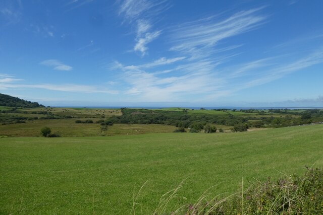
Situated on the eastern outskirts of the town of Caernarfon, Caer Engan occupies a prominent position overlooking the Menai Strait and the Isle of Anglesey. The hillfort covers an area of approximately 2 hectares and is surrounded by multiple defensive earthworks, including ramparts and ditches. These fortifications were likely constructed as a means of protection against potential invaders during ancient times.

Excavations carried out at Caer Engan have revealed evidence of human occupation dating as far back as the 2nd century BC. The remains of roundhouses and storage pits have been discovered, suggesting that this site was once a thriving settlement. Additionally, archaeological findings have unveiled artifacts such as pottery, tools, and even human remains, shedding light on the lifestyle and practices of the Iron Age inhabitants.

The strategic location of Caer Engan, overlooking the Menai Strait, indicates its significance as a trading and communication center during ancient times. It is believed that the hillfort played a crucial role in facilitating the exchange of goods and ideas between different communities in the region.

Today, Caer Engan provides a glimpse into Wales' ancient past. Visitors can explore the site, walk along the ramparts, and learn about the history and significance of this Iron Age hillfort. The site also offers breathtaking panoramic views of the surrounding landscape, including the nearby Snowdonia National Park.

If you have any feedback on the listing, please let us know in the comments section below.

Caer Engan Images

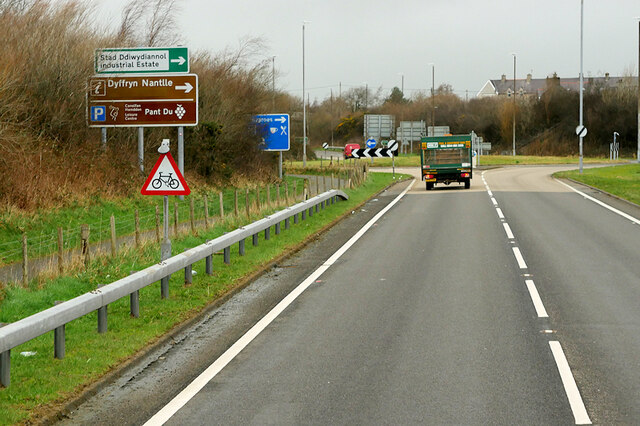
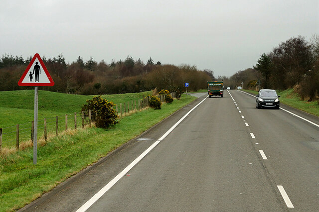
Images are sourced within 2km of 53.047/-4.275 or Grid Reference SH4752. Thanks to Geograph Open Source API. All images are credited.

Old Milestone by the former A487, Llanllyfni Carnarvon chamfered slate by the UC road, was A487, in parish of Llanllyfni (Gwynedd District), Felin Gerrig, Ffordd Rhedyw (Rhedyw Road), set into stone wall.

Inscription reads:-
MILES
CARNARVON 7
PENYGROES ⅝
TREMADOG 12

Grade II listed by Cadw. Reference Number: 23664
<span class="nowrap"><a title="https://cadwpublic-api.azurewebsites.net/reports/listedbuilding/FullReport?lang=&id=23664" rel="nofollow ugc noopener" href="https://cadwpublic-api.azurewebsites.net/reports/listedbuilding/FullReport?lang=&id=23664">Link</a><img style="margin-left:2px;" alt="External link" title="External link - shift click to open in new window" src="https://s1.geograph.org.uk/img/external.png" width="10" height="10"/></span>

Surveyed

Milestone Society National ID: CAE_CVTM07.
Old Milestone by the former A487, Llanllyfni
Carnarvon chamfered slate by the UC road, was A487, in parish of Llanllyfni (Gwynedd District), Felin Gerrig, Ffordd Rhedyw (Rhedyw Road), set into stone wall. Inscription reads:- MILES CARNARVON 7 PENYGROES ⅝ TREMADOG 12 Grade II listed by Cadw. Reference Number: 23664 LinkExternal link Surveyed Milestone Society National ID: CAE_CVTM07.
Old Milestone by the former A487, Gwynfa, Penygroes, Llanllyfni Parish By the UC road (was the A487), in parish of Llanllyfni (Gwynedd District), Gwynfa, northern edge of Penygroes, set into stone wall, East side of road.

Inscription reads:-
TO { CARNARVON 6 M 
.. { TREMADOC 13 M

Grade II listed by Cadw. Reference Number: 23696
<span class="nowrap"><a title="https://cadwpublic-api.azurewebsites.net/reports/listedbuilding/FullReport?lang=&id=23696" rel="nofollow ugc noopener" href="https://cadwpublic-api.azurewebsites.net/reports/listedbuilding/FullReport?lang=&id=23696">Link</a><img style="margin-left:2px;" alt="External link" title="External link - shift click to open in new window" src="https://s1.geograph.org.uk/img/external.png" width="10" height="10"/></span>

Surveyed

Milestone Society National ID: CAE_CVTM06
Old Milestone by the former A487, Gwynfa, Penygroes, Llanllyfni Parish
By the UC road (was the A487), in parish of Llanllyfni (Gwynedd District), Gwynfa, northern edge of Penygroes, set into stone wall, East side of road. Inscription reads:- TO { CARNARVON 6 M .. { TREMADOC 13 M Grade II listed by Cadw. Reference Number: 23696 LinkExternal link Surveyed Milestone Society National ID: CAE_CVTM06
Bridge over the A487 at Berth Bridge carrying a minor road across the A487.
Bridge over the A487 at Berth
Bridge carrying a minor road across the A487.
A487 near Llanllyfni The A487 is one of the most important roads in Wales. It covers the majority of the west coast from St Davids to Menai Bridge, and is a primary route for most of its length, including a section where it multiplexes with the A470, another important north-south road. Along the way, it runs through two national parks: Snowdonia and Pembrokeshire Coast. Despite its length and importance, it is predominantly single carriageway, although the road has been upgraded in numerous places. It is 174 miles long.
<span class="nowrap"><a title="http://www.sabre-roads.org.uk/wiki/index.php?title=A487" rel="nofollow ugc noopener" href="http://www.sabre-roads.org.uk/wiki/index.php?title=A487">Link</a><img style="margin-left:2px;" alt="External link" title="External link - shift click to open in new window" src="https://s1.geograph.org.uk/img/external.png" width="10" height="10"/></span>
A487 near Llanllyfni
The A487 is one of the most important roads in Wales. It covers the majority of the west coast from St Davids to Menai Bridge, and is a primary route for most of its length, including a section where it multiplexes with the A470, another important north-south road. Along the way, it runs through two national parks: Snowdonia and Pembrokeshire Coast. Despite its length and importance, it is predominantly single carriageway, although the road has been upgraded in numerous places. It is 174 miles long. LinkExternal link
A487 at Penygroes Roundabout The A487 is one of the most important roads in Wales. It covers the majority of the west coast from St Davids to Menai Bridge, and is a primary route for most of its length, including a section where it multiplexes with the A470, another important north-south road. Along the way, it runs through two national parks: Snowdonia and Pembrokeshire Coast. Despite its length and importance, it is predominantly single carriageway, although the road has been upgraded in numerous places. It is 174 miles long.
<span class="nowrap"><a title="http://www.sabre-roads.org.uk/wiki/index.php?title=A487" rel="nofollow ugc noopener" href="http://www.sabre-roads.org.uk/wiki/index.php?title=A487">Link</a><img style="margin-left:2px;" alt="External link" title="External link - shift click to open in new window" src="https://s1.geograph.org.uk/img/external.png" width="10" height="10"/></span>
A487 at Penygroes Roundabout
The A487 is one of the most important roads in Wales. It covers the majority of the west coast from St Davids to Menai Bridge, and is a primary route for most of its length, including a section where it multiplexes with the A470, another important north-south road. Along the way, it runs through two national parks: Snowdonia and Pembrokeshire Coast. Despite its length and importance, it is predominantly single carriageway, although the road has been upgraded in numerous places. It is 174 miles long. LinkExternal link
A487 near Penygroes The A487 is one of the most important roads in Wales. It covers the majority of the west coast from St Davids to Menai Bridge, and is a primary route for most of its length, including a section where it multiplexes with the A470, another important north-south road. Along the way, it runs through two national parks: Snowdonia and Pembrokeshire Coast. Despite its length and importance, it is predominantly single carriageway, although the road has been upgraded in numerous places. It is 174 miles long.
<span class="nowrap"><a title="http://www.sabre-roads.org.uk/wiki/index.php?title=A487" rel="nofollow ugc noopener" href="http://www.sabre-roads.org.uk/wiki/index.php?title=A487">Link</a><img style="margin-left:2px;" alt="External link" title="External link - shift click to open in new window" src="https://s1.geograph.org.uk/img/external.png" width="10" height="10"/></span>
A487 near Penygroes
The A487 is one of the most important roads in Wales. It covers the majority of the west coast from St Davids to Menai Bridge, and is a primary route for most of its length, including a section where it multiplexes with the A470, another important north-south road. Along the way, it runs through two national parks: Snowdonia and Pembrokeshire Coast. Despite its length and importance, it is predominantly single carriageway, although the road has been upgraded in numerous places. It is 174 miles long. LinkExternal link
Remains of a guidepost, Talysarn
GPO Cross Connection Cabinet on the B4418, Pen-y-groes
Benchmark at Trem-yr-Wyddfa, Pen-y-groes For more details see: <span class="nowrap"><a title="https://www.bench-marks.org.uk/bm165418" rel="nofollow ugc noopener" href="https://www.bench-marks.org.uk/bm165418">Link</a><img style="margin-left:2px;" alt="External link" title="External link - shift click to open in new window" src="https://s1.geograph.org.uk/img/external.png" width="10" height="10"/></span>
Benchmark at Trem-yr-Wyddfa, Pen-y-groes
For more details see: LinkExternal link
E.R.OWEN PORTHMADOG drain cover, Pen-y-groes
Cycle path running beside the A487 Part of the former Carnarvonshire Railway trackbed has been converted to a shared use path which forms part of National Cycle Network route 8 between Bryncir and Caernarfon.
Cycle path running beside the A487
Part of the former Carnarvonshire Railway trackbed has been converted to a shared use path which forms part of National Cycle Network route 8 between Bryncir and Caernarfon.
Farmland west of NCN8 Part of the former Carnarvonshire Railway trackbed has been converted to a shared use path which forms part of National Cycle Network route 8 between Bryncir and Caernarfon.
Farmland west of NCN8
Part of the former Carnarvonshire Railway trackbed has been converted to a shared use path which forms part of National Cycle Network route 8 between Bryncir and Caernarfon.
Cycle path south of Gellibach Part of the former Carnarvonshire Railway trackbed has been converted to a shared use path which forms part of National Cycle Network route 8 between Bryncir and Caernarfon.
Cycle path south of Gellibach
Part of the former Carnarvonshire Railway trackbed has been converted to a shared use path which forms part of National Cycle Network route 8 between Bryncir and Caernarfon.
Cycle path north of Gellibach Part of the former Carnarvonshire Railway trackbed has been converted to a shared use path which forms part of National Cycle Network route 8 between Bryncir and Caernarfon.
Cycle path north of Gellibach
Part of the former Carnarvonshire Railway trackbed has been converted to a shared use path which forms part of National Cycle Network route 8 between Bryncir and Caernarfon.
Path towards Gellibach Part of the former Carnarvonshire Railway trackbed has been converted to a shared use path which forms part of National Cycle Network route 8 between Bryncir and Caernarfon.
Path towards Gellibach
Part of the former Carnarvonshire Railway trackbed has been converted to a shared use path which forms part of National Cycle Network route 8 between Bryncir and Caernarfon.
Field and barn beside the cycle path Part of the former Carnarvonshire Railway trackbed has been converted to a shared use path which forms part of National Cycle Network route 8 between Bryncir and Caernarfon.
Field and barn beside the cycle path
Part of the former Carnarvonshire Railway trackbed has been converted to a shared use path which forms part of National Cycle Network route 8 between Bryncir and Caernarfon.
Cycle path above the A487 Part of the former Carnarvonshire Railway trackbed has been converted to a shared use path which forms part of National Cycle Network route 8 between Bryncir and Caernarfon. The A487 runs below.
Cycle path above the A487
Part of the former Carnarvonshire Railway trackbed has been converted to a shared use path which forms part of National Cycle Network route 8 between Bryncir and Caernarfon. The A487 runs below.
Cycle path running above the road Part of the former Carnarvonshire Railway trackbed has been converted to a shared use path which forms part of National Cycle Network route 8 between Bryncir and Caernarfon. The A487 runs below on the right.
Cycle path running above the road
Part of the former Carnarvonshire Railway trackbed has been converted to a shared use path which forms part of National Cycle Network route 8 between Bryncir and Caernarfon. The A487 runs below on the right.
Show me another place!

Caer Engan is located at Grid Ref: SH4752 (Lat: 53.047, Lng: -4.275)

Unitary Authority: Gwynedd

Police Authority: North Wales

What 3 Words

///covertly.cushy.node. Near Penygroes, Gwynedd

Related Wikis

Llanllyfni

Llanllyfni () is a village and a community in Gwynedd, Wales. It is in the historic county of Caernarfonshire. The community consists of the villages of...

Nantlle Vale F.C.

Nantlle Vale F.C (Welsh: Clwb Pêl-droed Dyffryn Nantlle) are a Welsh football club from Penygroes, near Caernarfon, formed around 1920. They play in the...

Penygroes, Gwynedd

Penygroes (Welsh pronunciation: [ˌpɛnəˈɡroːɨs] ) is a village in Gwynedd, Wales. The village is located to the south of Caernarfon, and north of Porthmadog...

Ysgol Dyffryn Nantlle

Ysgol Dyffryn Nantlle is a bilingual secondary school for pupils aged between 11 and 18 years. It is situated in Penygroes, Gwynedd in Gwynedd, North Wales...

Nearby Amenities

Located within 500m of 53.047,-4.275
Power: tower
Source: Bing
Lat/Long: 53.0440967/-4.2755534
Power: tower
Source: Bing
Lat/Long: 53.047499/-4.2736222
Power: tower
Source: Bing
Lat/Long: 53.0495401/-4.2724903
Turning Circle
Lat/Long: 53.0456742/-4.2807105
Caer Engan Hillfort
Access: permissive
Archaeological Site: fortification
Historic: archaeological_site
Lat/Long: 53.048993/-4.2738714
Direction: SSE
Generator Method: photovoltaic
Generator Output Electricity: yes
Generator Solar Modules: 14
Generator Source: solar
Generator Type: solar_photovoltaic_panel
Location: roof
Power: generator
Lat/Long: 53.0507726/-4.2785458
Direction: S
Generator Method: photovoltaic
Generator Output Electricity: yes
Generator Solar Modules: 16
Generator Source: solar
Generator Type: solar_photovoltaic_panel
Location: roof
Power: generator
Lat/Long: 53.0508351/-4.2779973
Direction: 165
Generator Method: photovoltaic
Generator Output Electricity: yes
Generator Solar Modules: 12
Generator Source: solar
Generator Type: solar_photovoltaic_panel
Location: roof
Power: generator
Lat/Long: 53.0443197/-4.2727925
Direction: 175
Generator Method: photovoltaic
Generator Output Electricity: yes
Generator Solar Modules: 21
Generator Source: solar
Generator Type: solar_photovoltaic_panel
Location: roof
Power: generator
Lat/Long: 53.0441109/-4.2710182
Post Box
Collection Times: Mo-Fr 09:00; Sa 07:00
Operator: Royal Mail
Operator Wikidata: Q638098
Post Box Type: wall
Ref: LL54 105D
Royal Cypher: EVIIR
Lat/Long: 53.0460328/-4.2817681
The data included in this document is from www.openstreetmap.org. The data is made available under ODbL.

Have you been to Caer Engan?

Leave your review of Caer Engan below (or comments, questions and feedback).