Beili-glas

Settlement in Monmouthshire

Wales

Beili-glas

Old Milestone by the A4042, Llanover parish Milestone by the A4042, in parish of Llanover (Monmouthshire District), near junction with UC road to Llansabbath.

Inscription reads:-
ABERGAVENNY
3
PONTYPOOL
7

Grade II listed by Cadw.
Reference Number: 87173 <span class="nowrap"><a title="https://cadwpublic-api.azurewebsites.net/reports/listedbuilding/FullReport?lang=&id=87173" rel="nofollow ugc noopener" href="https://cadwpublic-api.azurewebsites.net/reports/listedbuilding/FullReport?lang=&id=87173">Link</a><img style="margin-left:2px;" alt="External link" title="External link - shift click to open in new window" src="https://s1.geograph.org.uk/img/external.png" width="10" height="10"/></span>

Surveyed

Milestone Society National ID: MON_AGPP03
Old Milestone by the A4042, Llanover parish Credit: Sue Hogan

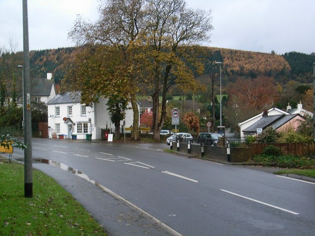
Beili-glas is a small village located in Monmouthshire, Wales. Situated in the southeastern part of the country, it lies approximately 5 miles north of the town of Usk and 10 miles west of the city of Newport. The village is nestled in a picturesque countryside setting, surrounded by rolling hills and green fields.

Beili-glas is a predominantly rural area, characterized by its tranquil atmosphere and idyllic landscapes. The village is home to a close-knit community, with a population of around 200 residents. The local economy is primarily focused on agriculture, with farming and livestock rearing being the main sources of income for many residents.

The village itself consists of a small cluster of houses, a local pub, and a village hall that serves as a central gathering place for community events and activities. The architecture in Beili-glas is traditional and reflects the area's rich historical heritage.

Nature enthusiasts will find plenty to explore in the surrounding area, as Beili-glas is situated near the Brecon Beacons National Park, offering a range of outdoor activities such as hiking, cycling, and wildlife spotting. The village also benefits from its proximity to the River Usk, which provides opportunities for fishing and boating.

Overall, Beili-glas offers a peaceful and scenic retreat, perfect for those seeking a quiet escape in the Welsh countryside.

If you have any feedback on the listing, please let us know in the comments section below.

Beili-glas Images

Images are sourced within 2km of 51.784263/-3.016171 or Grid Reference SO3010. Thanks to Geograph Open Source API. All images are credited.

Old Milestone by the A4042, Llanover parish Milestone by the A4042, in parish of Llanover (Monmouthshire District), near junction with UC road to Llansabbath.

Inscription reads:-
ABERGAVENNY
3
PONTYPOOL
7

Grade II listed by Cadw.
Reference Number: 87173 <span class="nowrap"><a title="https://cadwpublic-api.azurewebsites.net/reports/listedbuilding/FullReport?lang=&id=87173" rel="nofollow ugc noopener" href="https://cadwpublic-api.azurewebsites.net/reports/listedbuilding/FullReport?lang=&id=87173">Link</a><img style="margin-left:2px;" alt="External link" title="External link - shift click to open in new window" src="https://s1.geograph.org.uk/img/external.png" width="10" height="10"/></span>

Surveyed

Milestone Society National ID: MON_AGPP03
Old Milestone by the A4042, Llanover parish
Milestone by the A4042, in parish of Llanover (Monmouthshire District), near junction with UC road to Llansabbath. Inscription reads:- ABERGAVENNY 3 PONTYPOOL 7 Grade II listed by Cadw. Reference Number: 87173 LinkExternal link Surveyed Milestone Society National ID: MON_AGPP03
Stubble field towards Great Hardwick
The A40 south of Abergavenny We all know how useful these bushes can be.
The A40 south of Abergavenny
We all know how useful these bushes can be.
The A40 south of Abergavenny
A4042 11 miles from Cwmbran Viewed from the B4269 in Llanellen.
A4042 11 miles from Cwmbran
Viewed from the B4269 in Llanellen.
Llanellen Village Hall, Monmouthshire Located between the B4269 and the A4042 (ahead).
Llanellen Village Hall, Monmouthshire
Located between the B4269 and the A4042 (ahead).
A4042 directions in Llanellen, Monmouthshire Alongside the B4269.
A4042 directions in Llanellen, Monmouthshire
Alongside the B4269.
Bilingual Welcome sign, Llanellen, Monmouthshire In Welsh, Llanellen is Llanelen and Welcome is Croeso.
The Welsh for PLEASE DRIVE CAREFULLY is also shown.
The National Speed Limit on the B4269 here drops to 30mph.
Bilingual Welcome sign, Llanellen, Monmouthshire
In Welsh, Llanellen is Llanelen and Welcome is Croeso. The Welsh for PLEASE DRIVE CAREFULLY is also shown. The National Speed Limit on the B4269 here drops to 30mph.
Village hall entrance, Llanellen, Monmouthshire On the west side of Llanellen Village Hall located between the B4269 and the A4042.
Village hall entrance, Llanellen, Monmouthshire
On the west side of Llanellen Village Hall located between the B4269 and the A4042.
Plaque outside Llanellen Village Hall, Monmouthshire The plaque on the low wall here <a title="https://www.geograph.org.uk/photo/7586294" href="https://www.geograph.org.uk/photo/7586294">Link</a> records

Overall Gwent Winner
National Village
of the Year 1997.

Best Kept Village
Competition Winners :
1993 - 1994 - 1995 - 
1997 - 1998
Plaque outside Llanellen Village Hall, Monmouthshire
The plaque on the low wall here Link records Overall Gwent Winner National Village of the Year 1997. Best Kept Village Competition Winners : 1993 - 1994 - 1995 - 1997 - 1998
Houses and hillside, Llanellen, Monmouthshire Looking along St Helen's Crescent from the B4269.
Houses and hillside, Llanellen, Monmouthshire
Looking along St Helen's Crescent from the B4269.
Hedge-lined lane, Llanellen, Monmouthshire Viewed from the B4269.
Hedge-lined lane, Llanellen, Monmouthshire
Viewed from the B4269.
Welsh-only name sign, Heol Gerrig, Llanellen, Monmouthshire The sign facing the B4269 shows that  Heol Gerrig is not a through route.
Welsh-only name sign, Heol Gerrig, Llanellen, Monmouthshire
The sign facing the B4269 shows that Heol Gerrig is not a through route.
Path past the edge of the churchyard, Llanellen, Monmouthshire The stone wall is at the perimeter of St Helen's churchyard.
Path past the edge of the churchyard, Llanellen, Monmouthshire
The stone wall is at the perimeter of St Helen's churchyard.
Church nameboard, Llanellen, Monmouthshire Text on the board in September 2023 includes
"THE CHURCH IN WALES" and "St Helen's Church, Llanellen"
Church nameboard, Llanellen, Monmouthshire
Text on the board in September 2023 includes "THE CHURCH IN WALES" and "St Helen's Church, Llanellen"
Churchyard entrance gates, Llanellen, Monmouthshire In September 2023 a Heritage Watch notice is on one of the two gates at an
entrance to St Helen's churchyard in the Church in Wales Diocese of Monmouth.
Churchyard entrance gates, Llanellen, Monmouthshire
In September 2023 a Heritage Watch notice is on one of the two gates at an entrance to St Helen's churchyard in the Church in Wales Diocese of Monmouth.
Churchyard tree and headstones, Llanellen, Monmouthshire In St Helen's churchyard in the Church in Wales Diocese of Monmouth.
Churchyard tree and headstones, Llanellen, Monmouthshire
In St Helen's churchyard in the Church in Wales Diocese of Monmouth.
Path towards St Helen's Church, Llanellen, Monmouthshire Grade II Listed church in the Church in Wales Diocese of Monmouth.
Path towards St Helen's Church, Llanellen, Monmouthshire
Grade II Listed church in the Church in Wales Diocese of Monmouth.
Show me another place!

Beili-glas is located at Grid Ref: SO3010 (Lat: 51.784263, Lng: -3.016171)

Unitary Authority: Monmouthshire

Police Authority: Gwent

What 3 Words

///shunning.afflict.protect. Near Abergavenny, Monmouthshire

Nearby Locations

Beili-glas

Related Wikis

Llanellen

Llanellen (Welsh: Llanelen) is a village in Monmouthshire, south-east Wales, United Kingdom. It is located three miles (4.8 km) south of Abergavenny. The...

Gwent (county)

Gwent is a preserved county and former local government county in southeast Wales. A county of Gwent was formed on 1 April 1974, under the Local Government...

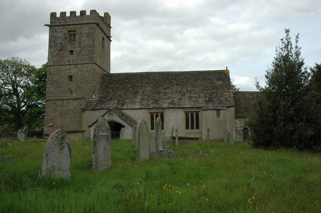
St Bartholomew's Church, Llanover

The Church of St Bartholomew, Llanover, Monmouthshire is a parish church with its origins in the period following the Norman Conquest. The nave appears...
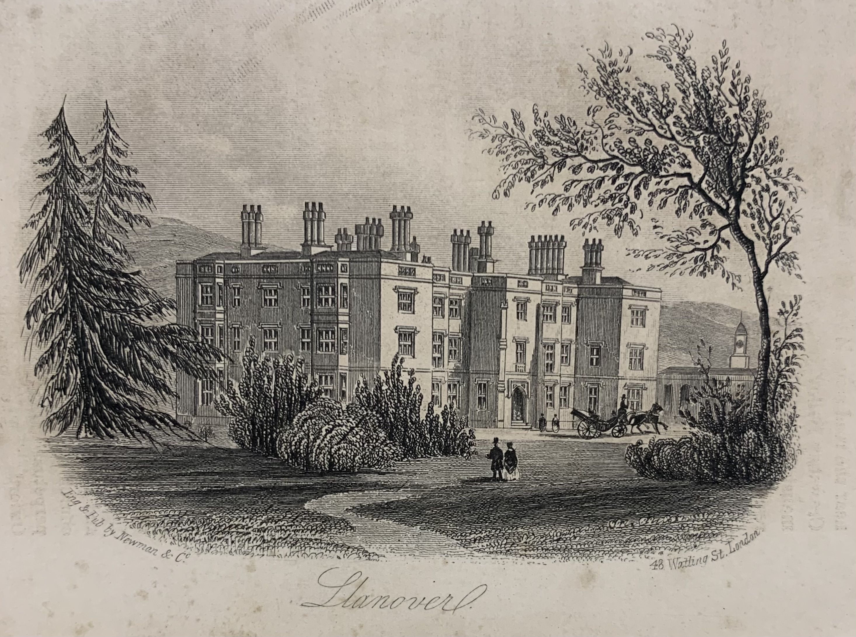
Llanover House

Llanover House, Llanover, Monmouthshire, Wales, was a country house dating from the mid-19th century. Commissioned by Augusta Waddington, and her husband...

Nearby Amenities

Located within 500m of 51.784263,-3.016171
The data included in this document is from www.openstreetmap.org. The data is made available under ODbL.

Have you been to Beili-glas?

Leave your review of Beili-glas below (or comments, questions and feedback).