Broad Stone

Heritage Site in Gloucestershire Forest of Dean

England

Broad Stone

A48 at Stroat Looking north-east towards Lydney and Gloucester.
A48 at Stroat Credit: Jonathan Billinger

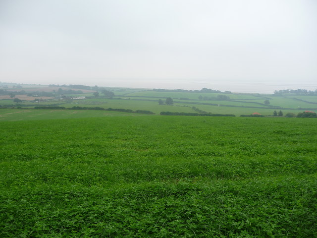
Broad Stone is a historic heritage site located in Gloucestershire, England. Situated on the outskirts of the village of Broadwell, the site holds significant cultural and historical importance. The main feature of the site is a large stone monolith that stands tall in the center of a field, hence the name "Broad Stone."

The monolith, made of local Cotswold limestone, stands at an impressive height of 4 meters and is believed to date back to the Neolithic period, around 2500 BC. The stone itself is rectangular in shape, with smooth and weathered surfaces. The purpose and significance of the Broad Stone remain a mystery, as there is no consensus among archaeologists and historians.

Surrounding the monolith are traces of an ancient settlement, indicating that the site was once inhabited. Archaeological excavations have revealed pottery fragments, flint tools, and evidence of dwellings, suggesting that it was a thriving community during the Bronze Age and Iron Age.

Broad Stone has been designated as a Scheduled Ancient Monument by English Heritage, recognizing its historical and cultural value. Visitors can explore the site and marvel at the ancient monolith, imagining the lives of the people who once called this place home.

The site is easily accessible, with a nearby parking area and footpath leading to the monument. Interpretive panels provide information about the history and significance of Broad Stone, allowing visitors to delve deeper into its mysteries. It is a popular destination for history enthusiasts, archaeology students, and curious tourists seeking to connect with the ancient past of Gloucestershire.

If you have any feedback on the listing, please let us know in the comments section below.

Broad Stone Images

Images are sourced within 2km of 51.675/-2.615 or Grid Reference ST5797. Thanks to Geograph Open Source API. All images are credited.

A48 at Stroat Looking north-east towards Lydney and Gloucester.
A48 at Stroat
Looking north-east towards Lydney and Gloucester.
Track into woodland off Rosemary Lane A barrier prevents unwelcome vehicular access.
Track into woodland off Rosemary Lane
A barrier prevents unwelcome vehicular access.
Woodland path through Parson's Allotment Soggy, slippery path after a night of rain, made trickier by the odd obstacle.
Woodland path through Parson's Allotment
Soggy, slippery path after a night of rain, made trickier by the odd obstacle.
Woodland stile The stile gets me out of the woods. Great.
Woodland stile
The stile gets me out of the woods. Great.
Part of Boughspring on a wet August morning Overnight rain showers have left the landscape damp but muggy. No one stirs.
Part of Boughspring on a wet August morning
Overnight rain showers have left the landscape damp but muggy. No one stirs.
View to the Severn from a field near Boughspring I was attempting to get to a 'Roman building (site of)' located in dense woodland adjacent. I didn't get to the site but I could instantly see why the Romans selcted this site for what may well have been a villa.
View to the Severn from a field near Boughspring
I was attempting to get to a 'Roman building (site of)' located in dense woodland adjacent. I didn't get to the site but I could instantly see why the Romans selcted this site for what may well have been a villa.
Boughspring Cottage A healthy Clematis in the garden arch adds a touch of colour to a greyish August morning. Nice one.
Boughspring Cottage
A healthy Clematis in the garden arch adds a touch of colour to a greyish August morning. Nice one.
View to the Severn from a field near Boughspring Not the clearest conditions (a few overnight showers have made for a cloudy, muggy start to the day) but the sandbanks are just visible.
View to the Severn from a field near Boughspring
Not the clearest conditions (a few overnight showers have made for a cloudy, muggy start to the day) but the sandbanks are just visible.
SW boundary of Stroat The A48 between Chepstow and Lydney reaches the SW edge of the Gloucestershire hamlet of Stroat.
SW boundary of Stroat
The A48 between Chepstow and Lydney reaches the SW edge of the Gloucestershire hamlet of Stroat.
Stroat layby This 200-metre long layby is adjacent to Hanley Court in the SW of Stroat, Gloucestershire.
It is alongside the A48. Lydney is about 6 miles ahead. Chepstow is about 3 miles behind the camera.
Stroat layby
This 200-metre long layby is adjacent to Hanley Court in the SW of Stroat, Gloucestershire. It is alongside the A48. Lydney is about 6 miles ahead. Chepstow is about 3 miles behind the camera.
Hanley Court Business Centre, Stroat Located on the north side of the A48, about 6 miles from Lydney and 3 miles from Chepstow. Opened in 2008, Hanley Court Business Centre provides modern business accommodation in a secure environment with active management from the on-site team. There are also conference and meeting rooms available for hire.
Hanley Court Business Centre, Stroat
Located on the north side of the A48, about 6 miles from Lydney and 3 miles from Chepstow. Opened in 2008, Hanley Court Business Centre provides modern business accommodation in a secure environment with active management from the on-site team. There are also conference and meeting rooms available for hire.
Half a side wall, Hanley Court, Stroat Is this stone building in a fenced-off area next to 
Hanley Court Business Centre <a title="https://www.geograph.org.uk/photo/3230187" href="https://www.geograph.org.uk/photo/3230187">Link</a> being demolished or repaired?
Half a side wall, Hanley Court, Stroat
Is this stone building in a fenced-off area next to Hanley Court Business Centre Link being demolished or repaired?
Hanley House, Stroat Former farmhouse, converted into flats. Located alongside the A48, about 6 miles from Lydney and 3 miles from Chepstow. Hanley Court Business Centre <a title="https://www.geograph.org.uk/photo/3230187" href="https://www.geograph.org.uk/photo/3230187">Link</a> is nearby.
Hanley House, Stroat
Former farmhouse, converted into flats. Located alongside the A48, about 6 miles from Lydney and 3 miles from Chepstow. Hanley Court Business Centre Link is nearby.
Surface water on Hanley Lane, Stroat Viewed from the edge of the A48. Hanley House <a title="https://www.geograph.org.uk/photo/3230220" href="https://www.geograph.org.uk/photo/3230220">Link</a> is on the left.
There is also surface water <a title="https://www.geograph.org.uk/photo/3230236" href="https://www.geograph.org.uk/photo/3230236">Link</a> at the field entrance just out of shot on the right.
Surface water on Hanley Lane, Stroat
Viewed from the edge of the A48. Hanley House Link is on the left. There is also surface water Link at the field entrance just out of shot on the right.
Flooded field entrance, Stroat The field entrance is alongside Hanley Lane, which also has standing water. <a title="https://www.geograph.org.uk/photo/3230232" href="https://www.geograph.org.uk/photo/3230232">Link</a>
Flooded field entrance, Stroat
The field entrance is alongside Hanley Lane, which also has standing water. Link
Stroat bus stop The bus stop on this side is for services from Lydney (about 6 miles away) towards Chepstow (about 3 miles ahead). Hanley Court Business Centre <a title="https://www.geograph.org.uk/photo/3230187" href="https://www.geograph.org.uk/photo/3230187">Link</a> is on the opposite side of the road, ahead.
Stroat bus stop
The bus stop on this side is for services from Lydney (about 6 miles away) towards Chepstow (about 3 miles ahead). Hanley Court Business Centre Link is on the opposite side of the road, ahead.
Mid November in rural Gloucestershire A view from the A48 in Stroat, near Hanley Lane. <a title="https://www.geograph.org.uk/photo/3230232" href="https://www.geograph.org.uk/photo/3230232">Link</a>
Mid November in rural Gloucestershire
A view from the A48 in Stroat, near Hanley Lane. Link
A48 at Wibdon
A48 at Wibdon
Show me another place!

Broad Stone is located at Grid Ref: ST5797 (Lat: 51.675, Lng: -2.615)

Administrative County: Gloucestershire

District: Forest of Dean

Police Authority: Gloucestershire

What 3 Words

///nipping.exists.health. Near Tintern, Monmouthshire

Nearby Locations

Broad Stone Stroat

Related Wikis

Ridley Bottom, Tidenham

Ridley Bottom (grid reference ST563985) is a 1.1-hectare (2.7-acre) nature reserve in Gloucestershire. The site is listed in the 'Forest of Dean Local...

Boughspring

Boughspring is a hamlet in Gloucestershire, England. == History == Settlement at Boughspring dates back to Roman times when a villa was built nearby. Boughspring...

Poor's Allotment

Poor's Allotment (grid reference ST560990) is a 28.57-hectare (70.6-acre) biological Site of Special Scientific Interest in Gloucestershire, notified in...

Tidenham

Tidenham () is a village and civil parish in the Forest of Dean of west Gloucestershire, England, adjoining the Welsh border. Tidenham is bounded by the...

Church of St Mary and St Peter, Tidenham

The Church of St Mary and St Peter, Tidenham, is a parish church of the Diocese of Gloucester, England. It dates from the 13th and 14th centuries, and...

Netherhope Halt railway station

Netherhope Halt was a railway station on the former Wye Valley Railway. It was opened in 1932 and closed in 1959; it was demolished soon afterwards....

Miss Grace's Lane

Miss Grace's Lane (also known as Miss Grace's Lane Swallett), near Tidenham in the Forest of Dean, Gloucestershire, England, is a natural cave system,...

Woolaston

Woolaston is a village and civil parish in the Forest of Dean district of Gloucestershire in South West England. It lies on the north side of the Severn...

Nearby Amenities

Located within 500m of 51.675,-2.615
Source: PGS
Lat/Long: 51.6724376/-2.6100065
Source: PGS
Lat/Long: 51.6725891/-2.6097304
Source: PGS
Lat/Long: 51.672934/-2.608567
Source: Landsat photo
Lat/Long: 51.6727808/-2.6100923
Stroat
Is In: Gloucestershire, UK
Place: hamlet
Source: NPE
Lat/Long: 51.6780057/-2.617472
Bus Stop
Stroat Farm
Bench: no
Bin: no
Lit: no
Naptan AtcoCode: 1600GLF243
Naptan Bearing: SW
Naptan CommonName: Stroat Farm
Naptan Indicator: Opp
Naptan NaptanCode: gloadpjw
Naptan Street: A48
Naptan Verified: no
Shelter: no
Source: naptan_import
Tactile Paving: no
Lat/Long: 51.6785545/-2.617135
Bus Stop
Stroat Farm
Bench: no
Bin: no
Lit: no
Naptan AtcoCode: 1600GLF244
Naptan Bearing: NE
Naptan CommonName: Stroat Farm
Naptan NaptanCode: gloadpjp
Naptan Street: A48
Naptan Verified: no
Shelter: no
Source: naptan_import
Tactile Paving: no
Lat/Long: 51.6785767/-2.6172087
Stroat Farm
Landuse: farm
Note Retag: CS #48756035
Source: NPE + NaPTAN
Lat/Long: 51.6791352/-2.6174818
Place Of Worship
Stroat Church
Check Date: 2023-12-20
Denomination: evangelical
Religion: christian
Source: OS OpenData StreetView
Source Name: Local knowledge
Lat/Long: 51.675125/-2.6201542
Post Box
Collection Times: Mo-Fr 16:30; Sa 10:30
Collection Times Checked: 2015-07-28
Operator: Royal Mail
Post Box Type: lamp
Ref: NP16 423
Royal Cypher: EIIR
Royal Cypher Wikidata: Q33102113
Lat/Long: 51.67521/-2.6207128
The data included in this document is from www.openstreetmap.org. The data is made available under ODbL.

Have you been to Broad Stone?

Leave your review of Broad Stone below (or comments, questions and feedback).