Boreham House

Heritage Site in Essex

England

Boreham House

White Hart Lane, Chelmsford
White Hart Lane, Chelmsford Credit: David Howard

Boreham House is a historic mansion located in the village of Boreham, Essex, England. It is a Grade I listed building and is recognized as a significant heritage site due to its architectural and historical importance.

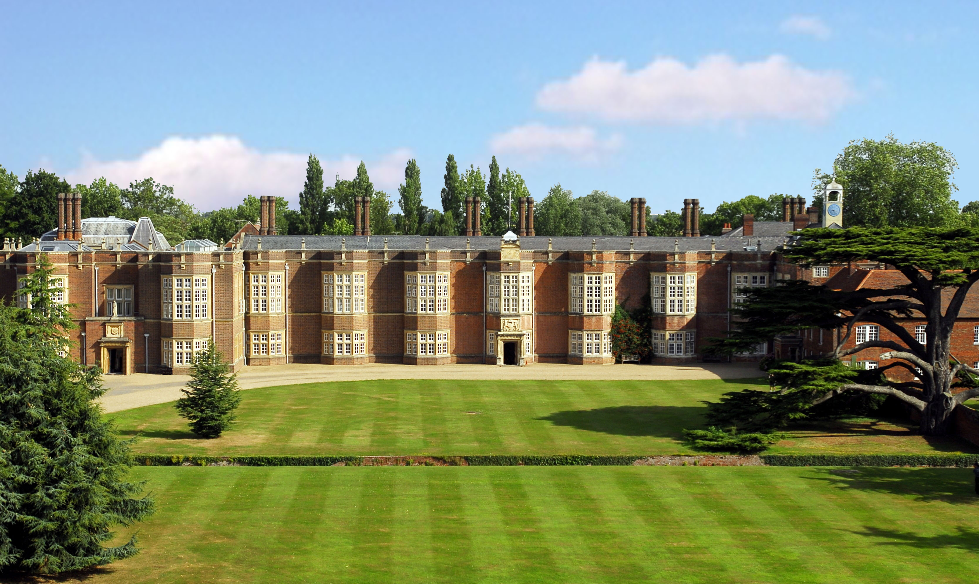
The house was originally built in the 18th century, with subsequent additions and alterations made in the 19th and 20th centuries. It is an excellent example of Georgian architecture, characterized by its symmetrical design, elegant proportions, and grand facade. The exterior features red brickwork, sash windows, and a hipped roof.

Inside, Boreham House boasts a wealth of original features, including ornate plasterwork, marble fireplaces, and a stunning central staircase. The rooms are spacious and well-preserved, showcasing the opulence and grandeur of the era.

The house is set within extensive grounds, which include beautifully landscaped gardens, parkland, and a serene lake. The gardens are meticulously maintained and feature a variety of plant species, including ancient trees, shrubs, and flower beds. The tranquil lake adds to the picturesque setting and provides a habitat for various wildlife.

Over the years, Boreham House has been associated with several notable figures, including politicians, artists, and wealthy landowners. It has also served different purposes, such as a private residence, a military hospital during World War II, and a venue for events and weddings.

Today, Boreham House is open to the public for guided tours and private events. Its rich history, stunning architecture, and idyllic surroundings make it a popular destination for visitors, history enthusiasts, and those seeking a unique venue for special occasions.

If you have any feedback on the listing, please let us know in the comments section below.

Boreham House Images

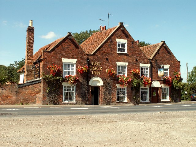
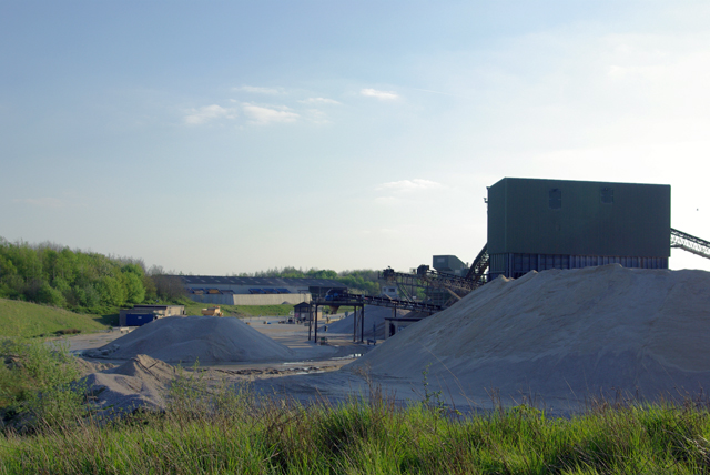
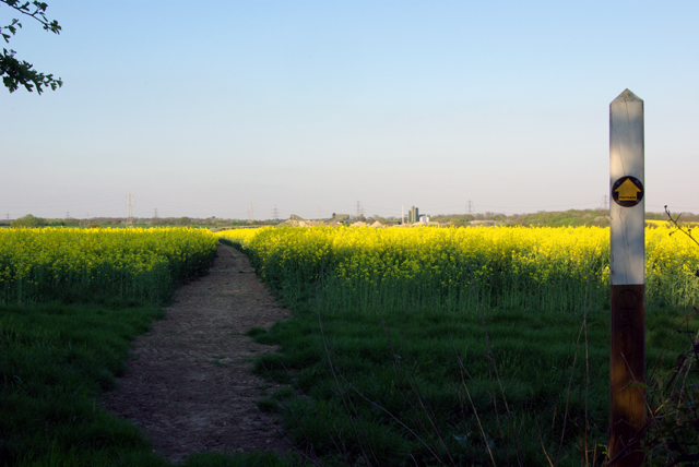
Images are sourced within 2km of 51.757/0.528 or Grid Reference TL7409. Thanks to Geograph Open Source API. All images are credited.

White Hart Lane, Chelmsford
Pedestrian crossing on White Hart Lane, Chelmsford
Inchcape BMW on Colchester Road, Chelmsford
Car boot sale near Boreham House Car boot sale at Boreham house, one lazy Sunday in 2021
Car boot sale near Boreham House
Car boot sale at Boreham house, one lazy Sunday in 2021
New road under construction near Boreham Believed to be part of the A130 / Chelmsford North East Bypass.
New road under construction near Boreham
Believed to be part of the A130 / Chelmsford North East Bypass.
Grassland near Chelmsford
The Cock Inn, Boreham, Essex The Cock Inn dates back to the 15th century and stands on the old A12 London to Ipswich road.
The Cock Inn, Boreham, Essex
The Cock Inn dates back to the 15th century and stands on the old A12 London to Ipswich road.
'The Cock Inn' at Boreham, Essex This inn is said to date back to the early part of the 15th century. It stands alongside the old Roman road between London and Colchester, which became the A.12 until it was changed to the new trunk road close by.
'The Cock Inn' at Boreham, Essex
This inn is said to date back to the early part of the 15th century. It stands alongside the old Roman road between London and Colchester, which became the A.12 until it was changed to the new trunk road close by.
Clock House, Boreham, Essex This is a fine timber-framed building that stands alongside the old A.12 road. It probably dates back to the early 15th century.
Clock House, Boreham, Essex
This is a fine timber-framed building that stands alongside the old A.12 road. It probably dates back to the early 15th century.
Gravel processing plant A large scale operation now using gravel from part of the old Boreham airfield site.
Gravel processing plant
A large scale operation now using gravel from part of the old Boreham airfield site.
Gravel conveyor Taken from the footpath bridge over the feed belt.
Gravel conveyor
Taken from the footpath bridge over the feed belt.
Walford House On the edge of the old Boreham airfield site.
Walford House
On the edge of the old Boreham airfield site.
Footpath through the Rape A very well cleared footpath route through a crop which otherwise is almost impassable at this stage of growth.
Footpath through the Rape
A very well cleared footpath route through a crop which otherwise is almost impassable at this stage of growth.
Power line junction The nearest pylon is on the spur off the main route whose pylon is a little further away. The three left hand conductors of the spur and the top earth are connected directly. The three right hand cables are taken under the main route via the wooden posts to reach the far three conductors of the main route. The furthest pylon is on a separate route.
Power line junction
The nearest pylon is on the spur off the main route whose pylon is a little further away. The three left hand conductors of the spur and the top earth are connected directly. The three right hand cables are taken under the main route via the wooden posts to reach the far three conductors of the main route. The furthest pylon is on a separate route.
Footpath through the gravel workings The extraction area is now on the left, and the processing area on the right.
Footpath through the gravel workings
The extraction area is now on the left, and the processing area on the right.
Generals Lane A private road now, but public footpath. Shafts of evening light at 6:34 p.m.on a perfect spring day.
Generals Lane
A private road now, but public footpath. Shafts of evening light at 6:34 p.m.on a perfect spring day.
A pleasant track Just over the bank on the right is a huge gravel processing installation. The track is a public footpath. The woodland on the left is The Grove.
A pleasant track
Just over the bank on the right is a huge gravel processing installation. The track is a public footpath. The woodland on the left is The Grove.
Waltham Road Bridge, A12 The A12 is a 129 mile long trunk road from London to Great Yarmouth. It runs through Greater London, Essex, Suffolk and Norfolk. It passes by Brentwood, Colchester and Ipswich as well as passing through Lowestoft.
<span class="nowrap"><a title="http://www.sabre-roads.org.uk/wiki/index.php?title=A12" rel="nofollow ugc noopener" href="http://www.sabre-roads.org.uk/wiki/index.php?title=A12">Link</a><img style="margin-left:2px;" alt="External link" title="External link - shift click to open in new window" src="https://s1.geograph.org.uk/img/external.png" width="10" height="10"/></span> 
Wikipedia: <span class="nowrap"><a title="http://en.wikipedia.org/wiki/A12_road_(England)" rel="nofollow ugc noopener" href="http://en.wikipedia.org/wiki/A12_road_(England)">Link</a><img style="margin-left:2px;" alt="External link" title="External link - shift click to open in new window" src="https://s1.geograph.org.uk/img/external.png" width="10" height="10"/></span>
Waltham Road Bridge, A12
The A12 is a 129 mile long trunk road from London to Great Yarmouth. It runs through Greater London, Essex, Suffolk and Norfolk. It passes by Brentwood, Colchester and Ipswich as well as passing through Lowestoft. LinkExternal link Wikipedia: LinkExternal link
Show me another place!

Boreham House is located at Grid Ref: TL7409 (Lat: 51.757, Lng: 0.528)

What 3 Words

///began.struck.quiet. Near Boreham, Essex

Nearby Locations

Boreham House

Related Wikis

Boreham House

Boreham House is a Grade I Listed mansion set in 35 acres (140,000 m2) of Boreham, Chelmsford, Essex, England. Boreham House was built from 1728 to 1733...

Beaulieu Park railway station

Beaulieu Park railway station is a planned station on the Great Eastern Main Line in the East of England that will serve a new development in Boreham,...
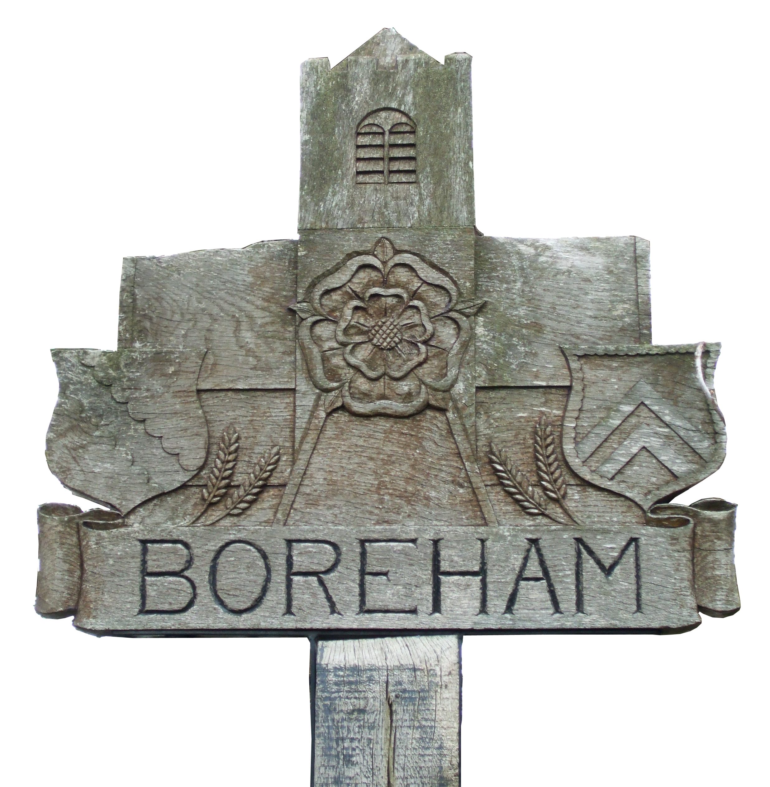
Boreham

Boreham is a village and civil parish in Essex, England. The parish is in the City of Chelmsford and Chelmsford Parliament constituency. The village is...

New Hall School

New Hall School is a Catholic co-educational private boarding and day school in the village of Boreham near Chelmsford, Essex, England. It was founded...

Nearby Amenities

Located within 500m of 51.757,0.528
Motorway Junction
Boreham
Ref: 19
Lat/Long: 51.7595835/0.5260734
Crossing
Crossing: unmarked
Crossing Island: no
Crossing Markings: no
Tactile Paving: yes
Lat/Long: 51.755721/0.5224597
Crossing
Button Operated: yes
Crossing: traffic_signals
Crossing Island: no
Crossing Markings: dots
Tactile Paving: yes
Lat/Long: 51.7563688/0.5230361
Power: tower
Lat/Long: 51.7542666/0.5332017
Power: tower
Lat/Long: 51.7583045/0.5334377
Bus Stop
Boreham House
Bus: yes
Naptan AtcoCode: 15000100501
Naptan Bearing: SW
Naptan CommonName: Boreham House
Naptan Indicator: o/s
Naptan Landmark: Boreham House
Naptan NaptanCode: esxdtjpg
Naptan Street: Main Road
Naptan Verified: no
Public Transport: platform
Source: naptan_import
Lat/Long: 51.7571687/0.5269036
Bus Stop
Boreham House
Bus: yes
Naptan AtcoCode: 15000100502
Naptan Bearing: NE
Naptan CommonName: Boreham House
Naptan Indicator: Opp
Naptan Landmark: Boreham House
Naptan NaptanCode: esxdtjpj
Naptan Street: Main Road
Naptan Verified: no
Public Transport: platform
Source: naptan_import
Lat/Long: 51.7578328/0.5282395
Power: tower
Lat/Long: 51.758623/0.5323651
Traffic Signals
Traffic Signals: traffic_lights
Traffic Signals Direction: forward
Lat/Long: 51.7558591/0.5226157
Traffic Signals
Traffic Signals: traffic_lights
Traffic Signals Direction: forward
Lat/Long: 51.7560546/0.5234007
Crossing
Button Operated: yes
Crossing: traffic_signals
Crossing Island: no
Crossing Markings: dots
Tactile Paving: yes
Lat/Long: 51.7562688/0.5228541
Traffic Signals
Traffic Signals: traffic_lights
Traffic Signals Direction: forward
Lat/Long: 51.7562495/0.5227759
Design: barrel
Power: tower
Source: bing
Lat/Long: 51.7558225/0.5324437
Post Box
Brand: Royal Mail
Brand Wikidata: Q638098
Brand Wikipedia: en:Royal Mail
Drive Through: no
Operator: Royal Mail
Operator Wikidata: Q638098
Post Box Type: lamp
Ref: CM3 448D
Royal Cypher: EIIR
Royal Cypher Wikidata: Q33102113
Lat/Long: 51.7563061/0.5248359
Fast Food
Boss Hoggs
Addr City: Chelmsford
Addr Postcode: CM3 3HJ
Addr Street: Main Road
Drive Through: no
Email: info@bosshoggs.co.uk
Fhrs Id: 551410
Website: https://bosshoggs.co.uk/
Lat/Long: 51.7554692/0.5234064
Traffic Signals
Note: Part time signals
Traffic Signals: traffic_lights
Traffic Signals Direction: forward
Lat/Long: 51.7564681/0.5229908
Crossing
Crossing: unmarked
Crossing Island: no
Crossing Markings: no
Tactile Paving: yes
Lat/Long: 51.7560487/0.5223134
Crossing
Button Operated: yes
Crossing: traffic_signals
Crossing Island: no
Crossing Markings: dots
Tactile Paving: yes
Lat/Long: 51.7563678/0.5229913
Crossing
Crossing: unmarked
Crossing Island: no
Crossing Markings: no
Tactile Paving: yes
Lat/Long: 51.756158/0.5236259
Crossing
Button Operated: yes
Crossing: traffic_signals
Crossing Island: no
Crossing Markings: dots
Tactile Paving: yes
Lat/Long: 51.7559929/0.5235413
Traffic Signals
Traffic Signals: traffic_lights
Traffic Signals Direction: forward
Lat/Long: 51.7559497/0.5226536
Traffic Signals
Traffic Signals: traffic_lights
Traffic Signals Direction: forward
Lat/Long: 51.7560209/0.5236386
The data included in this document is from www.openstreetmap.org. The data is made available under ODbL.

Have you been to Boreham House?

Leave your review of Boreham House below (or comments, questions and feedback).