Berney Arms Mill
Heritage Site in Norfolk South Norfolk
England
Berney Arms Mill

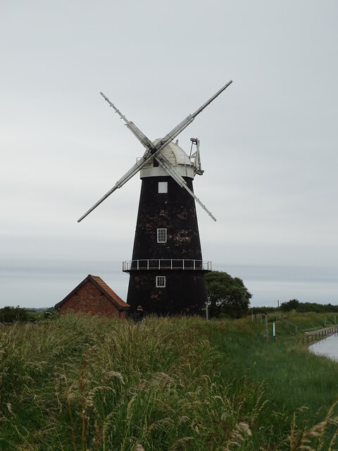
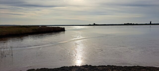
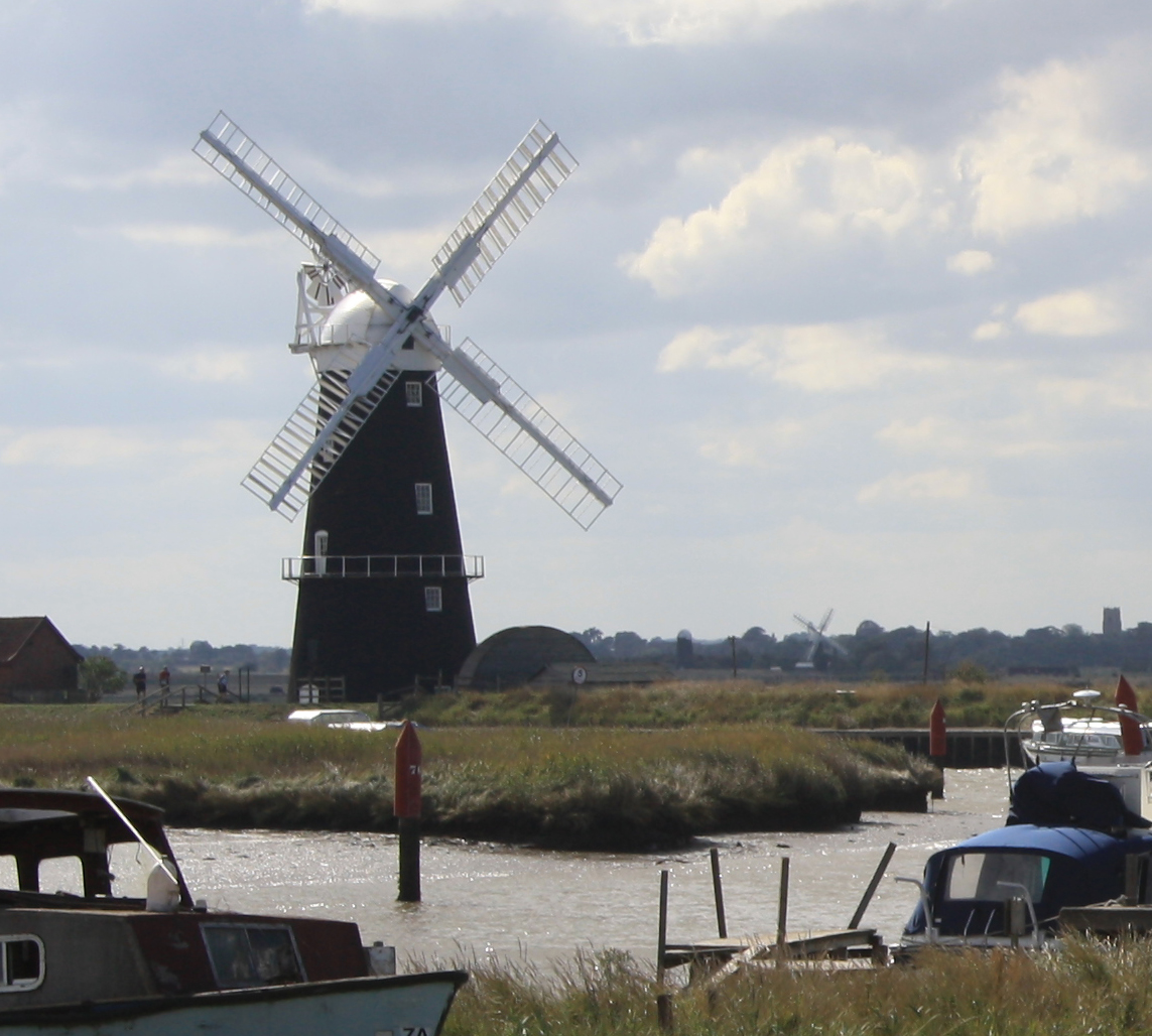
Berney Arms Mill is a historic windmill located in Norfolk, England. Situated within the Norfolk Broads National Park, it stands on a remote spot at the mouth of the River Yare. This Grade II listed mill is an iconic landmark that has played a significant role in the region's history.
Built in 1865, Berney Arms Mill served as a drainage mill, playing a vital role in managing water levels in the surrounding marshland. Its purpose was to protect the fertile agricultural land from flooding, as well as to ensure water transportation in the area. The mill features a distinctive red brick tower, standing at an impressive height of 74 feet, making it one of the tallest windmills in the United Kingdom.
Although no longer operational, the mill stands as a testament to the importance of wind power and the area's agricultural heritage. Despite its remote location, the mill attracts visitors who appreciate its architectural beauty, panoramic views, and the opportunity to immerse themselves in the tranquil surroundings.
The mill is also a popular spot for birdwatchers, as the surrounding marshes and reed beds provide a haven for a wide variety of bird species. Additionally, the area offers numerous walking and cycling trails, allowing visitors to explore the diverse landscape and observe the unique flora and fauna.
Berney Arms Mill is not easily accessible by road, adding to its charm and maintaining its secluded atmosphere. Visitors typically reach the mill via train or by boat, with a small footpath leading to the site. This hidden gem of Norfolk's heritage offers a glimpse into the region's past and a peaceful retreat for nature enthusiasts.
If you have any feedback on the listing, please let us know in the comments section below.
Berney Arms Mill Images
Images are sourced within 2km of 52.582/1.638 or Grid Reference TG4604. Thanks to Geograph Open Source API. All images are credited.


Berney Arms Mill is located at Grid Ref: TG4604 (Lat: 52.582, Lng: 1.638)
Administrative County: Norfolk
District: South Norfolk
Police Authority: Norfolk
What 3 Words
///drags.affirming.tried. Near Bradwell, Norfolk
Nearby Locations
Related Wikis

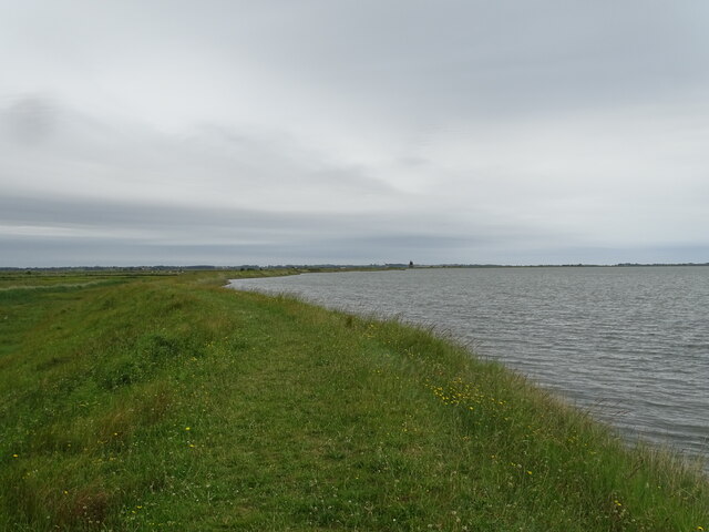
Berney Marshes & Breydon Water RSPB reserve
Berney Marshes and Breydon Water RSPB reserve is a nature reserve managed by the Royal Society for the Protection of Birds (RSPB). Berney Marshes is situated...
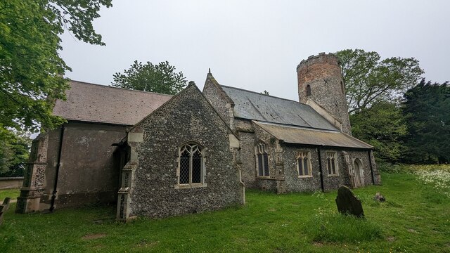
Berney Arms Windmill
Berney Arms Windmill is a tower mill located at Berney Arms alongside the River Yare at the south-western end of Breydon Water in the English county of...
River Waveney
The River Waveney is a river which forms the boundary between Suffolk and Norfolk, England, for much of its length within The Broads. The "ey" part of...

River Yare
The River Yare is a river in the English county of Norfolk. In its lower reaches it is one of the principal navigable waterways of The Broads and connects...

Berney Arms
Berney Arms is a settlement on the north bank of the River Yare, close to Breydon Water in the English county of Norfolk. It is part of the civil parish...

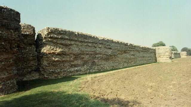
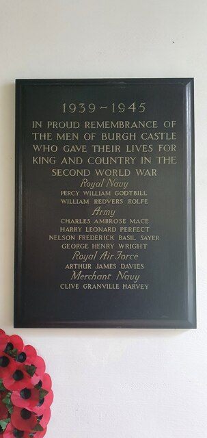
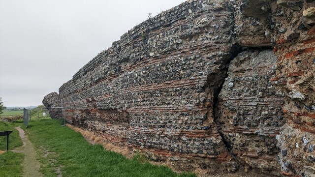
Burgh Castle (Roman fortification)
Burgh Castle is the site of one of nine Roman Saxon Shore forts constructed in England around the 3rd century AD, to hold troops as a defence against Saxon...
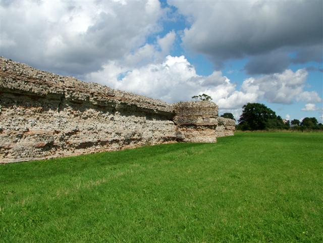
Gariannonum
Gariannonum, or Gariannum, was a Roman Saxon Shore fort in Norfolk, England. The Notitia Dignitatum, a Roman Army "order of battle" from about AD 400,...

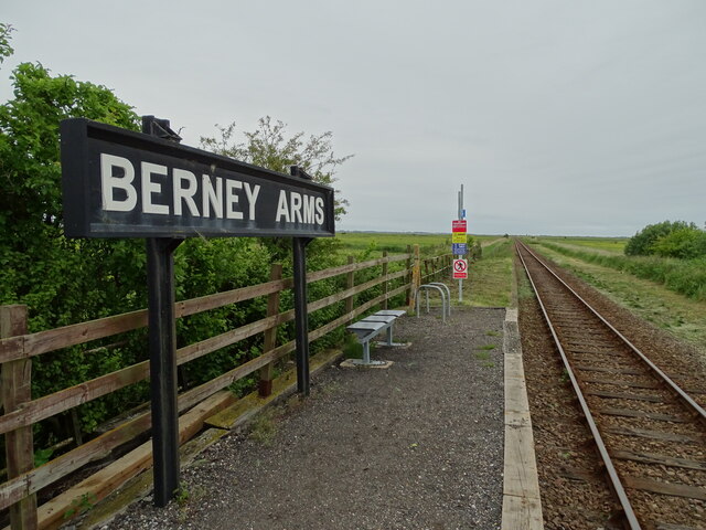
Berney Arms railway station
Berney Arms railway station is on the Wherry Lines in the East of England, serving the settlement of Berney Arms on the Halvergate Marshes in Norfolk....
Nearby Amenities
Located within 500m of 52.582,1.638Have you been to Berney Arms Mill?
Leave your review of Berney Arms Mill below (or comments, questions and feedback).