Belton House

Heritage Site in Lincolnshire South Kesteven

England

Belton House

Green Lane, Syston, Grantham Running by the estate wall of the former Syston Park, on the edge of the Jurassic limestone scarpment overlooking Grantham
Green Lane, Syston, Grantham Credit: Tim Heaton

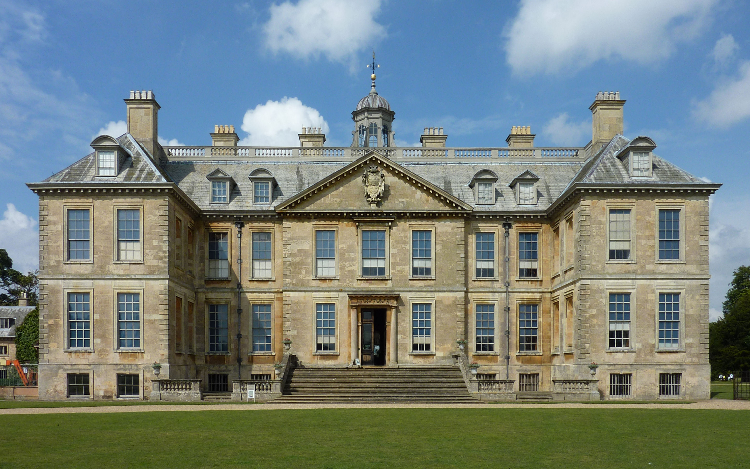
Belton House is a magnificent country mansion located in Lincolnshire, England. It is a renowned heritage site that attracts visitors from all over the world. Built in the late 17th century, the house showcases the grandeur and opulence of the high society during the era.

The architecture of Belton House is a perfect blend of classical and Baroque styles, designed by the famous architect Sir Christopher Wren. The exterior features an imposing façade with symmetrical wings, large sash windows, and a stunning central dome. The house is surrounded by sprawling gardens and a beautiful parkland, which adds to its charm.

Inside, Belton House is adorned with exquisite artwork, fine furniture, and intricate tapestries, reflecting the wealth and taste of its previous owners. The saloon, drawing room, and library are among the most impressive rooms, boasting ornate ceilings, marble fireplaces, and elaborate woodwork.

The estate also offers a glimpse into the lives of the servants who worked at Belton House. The below-stairs area includes a kitchen, scullery, and servant's hall, providing a fascinating insight into the daily routines and working conditions of the staff.

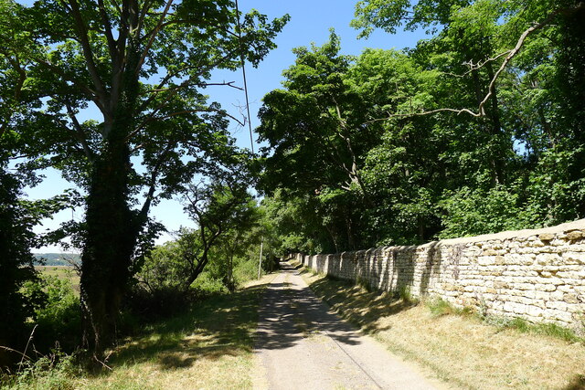
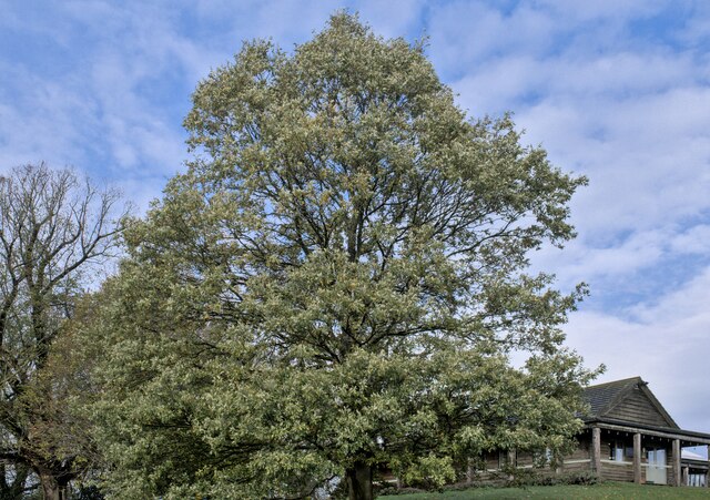
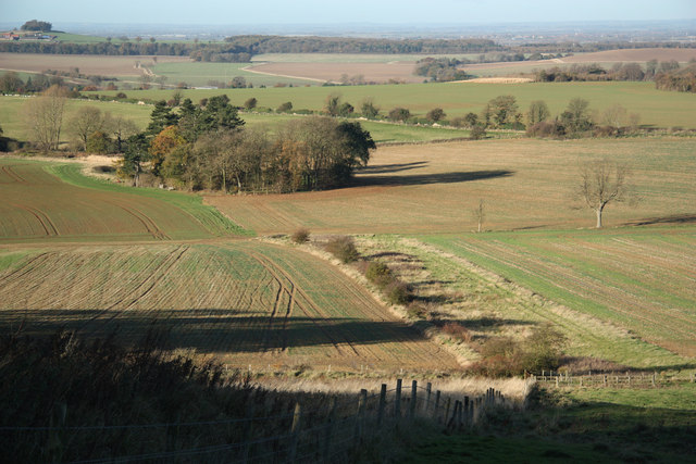
Visitors to Belton House can explore the vast grounds, which span over 1,300 acres. The formal gardens are meticulously designed and feature terraces, fountains, and a picturesque Orangery. The parkland offers tranquil walks, lakes, and an adventure playground for children.

Belton House is not only a captivating architectural gem but also hosts various events and exhibitions throughout the year, making it a popular destination for history enthusiasts, art lovers, and families alike.

If you have any feedback on the listing, please let us know in the comments section below.

Belton House Images

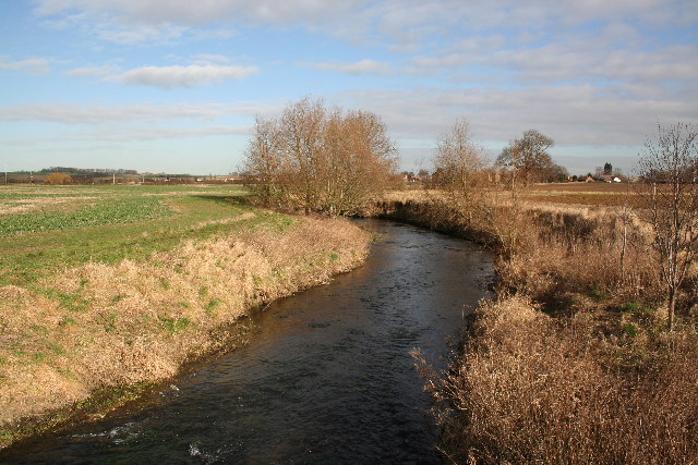
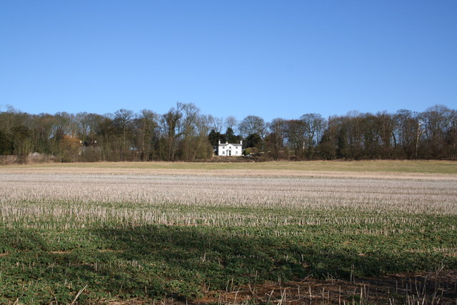
Images are sourced within 2km of 52.945/-0.619 or Grid Reference SK9239. Thanks to Geograph Open Source API. All images are credited.

Green Lane, Syston, Grantham Running by the estate wall of the former Syston Park, on the edge of the Jurassic limestone scarpment overlooking Grantham
Green Lane, Syston, Grantham
Running by the estate wall of the former Syston Park, on the edge of the Jurassic limestone scarpment overlooking Grantham
Turkey Oak Quercus cerris, the Turkey Oak was introduced in 1700.
Turkey Oak
Quercus cerris, the Turkey Oak was introduced in 1700.
Quercus cerris The trunk of the tree seen in <a href="https://www.geograph.org.uk/photo/7339767">SK9340 : Turkey Oak</a>.
Quercus cerris
The trunk of the tree seen in SK9340 : Turkey Oak.
Always look up The crown and upper parts of the tree seen in <a href="https://www.geograph.org.uk/photo/7339767">SK9340 : Turkey Oak</a>.
Always look up
The crown and upper parts of the tree seen in SK9340 : Turkey Oak.
Quercus cerris, Turkey Oak The bark of the tree seen in <a href="https://www.geograph.org.uk/photo/7339767">SK9340 : Turkey Oak</a> and <a href="https://www.geograph.org.uk/photo/7339769">SK9340 : Quercus cerris</a>.
Quercus cerris, Turkey Oak
The bark of the tree seen in SK9340 : Turkey Oak and SK9340 : Quercus cerris.
Stag Inn, Barkston At the junction of Church Street and the A607
Stag Inn, Barkston
At the junction of Church Street and the A607
The main road through Barkston
Church of St Mary, Syston Listed Grade II, from the 11th century <span class="nowrap"><a title="https://historicengland.org.uk/listing/the-list/list-entry/1147012?section=official-list-entry" rel="nofollow ugc noopener" href="https://historicengland.org.uk/listing/the-list/list-entry/1147012?section=official-list-entry">Link</a><img style="margin-left:2px;" alt="External link" title="External link - shift click to open in new window" src="https://s1.geograph.org.uk/img/external.png" width="10" height="10"/></span>
Church of St Mary, Syston
Listed Grade II, from the 11th century LinkExternal link
Churchyard wall, Syston Listed Grade II, early 19th century. The opening, which now allows access to the extended graveyard, was originally made to frame the vista of the church when seen from Syston Park to the east   <span class="nowrap"><a title="https://historicengland.org.uk/listing/the-list/list-entry/1360319?section=official-list-entry" rel="nofollow ugc noopener" href="https://historicengland.org.uk/listing/the-list/list-entry/1360319?section=official-list-entry">Link</a><img style="margin-left:2px;" alt="External link" title="External link - shift click to open in new window" src="https://s1.geograph.org.uk/img/external.png" width="10" height="10"/></span>
Churchyard wall, Syston
Listed Grade II, early 19th century. The opening, which now allows access to the extended graveyard, was originally made to frame the vista of the church when seen from Syston Park to the east LinkExternal link
South door, Church of St Mary, Syston "South door has a restored Saxon lintel with standing figures of saints under an architectural arcade. Above is a C12 tympanum with a billet moulded hood mould, a double order of star motifs and a central panel filled with diagonal trellis lines. The central parts of the lintel and the tympanum were cut by the insertion of a pointed arch during the C13, but this was removed during the C19 and an approximation of the original design substituted." <span class="nowrap"><a title="https://historicengland.org.uk/listing/the-list/list-entry/1147012?section=official-list-entry" rel="nofollow ugc noopener" href="https://historicengland.org.uk/listing/the-list/list-entry/1147012?section=official-list-entry">Link</a><img style="margin-left:2px;" alt="External link" title="External link - shift click to open in new window" src="https://s1.geograph.org.uk/img/external.png" width="10" height="10"/></span>
South door, Church of St Mary, Syston
"South door has a restored Saxon lintel with standing figures of saints under an architectural arcade. Above is a C12 tympanum with a billet moulded hood mould, a double order of star motifs and a central panel filled with diagonal trellis lines. The central parts of the lintel and the tympanum were cut by the insertion of a pointed arch during the C13, but this was removed during the C19 and an approximation of the original design substituted." LinkExternal link
St.Nicholas' church, Barkston, Lincs. A fine, crocketed Perpendicular spire on a 13th century tower.
St.Nicholas' church, Barkston, Lincs.
A fine, crocketed Perpendicular spire on a 13th century tower.
St.Mary's church, Syston, Lincs. A Norman tower, nave and chancel arch, also, a restored tympanum over the south door. A fine church tucked away by the old hall.
St.Mary's church, Syston, Lincs.
A Norman tower, nave and chancel arch, also, a restored tympanum over the south door. A fine church tucked away by the old hall.
River Witham Looking north towards Barkston from Hambleton Bridge
River Witham
Looking north towards Barkston from Hambleton Bridge
St Mary's Church, Syston
Barkston Village
Barkston Village
Gashouse Plantation A handsome house with a wonderful view in Gashouse Plantation, Syston Park. Syston Hall, home of the Thorold family has gone but the splendid parkland remains.
Gashouse Plantation
A handsome house with a wonderful view in Gashouse Plantation, Syston Park. Syston Hall, home of the Thorold family has gone but the splendid parkland remains.
Whipperstall Hill View towards Grantham from Whipperstall Hill
Whipperstall Hill
View towards Grantham from Whipperstall Hill
The Lake, Syston Park A well established 10 acre spring fed lake in parkland on the old Syston Park Estate. Managed by Syston Park Farm, the lake is stocked with both rainbow and brown trout. Even on a dull October afternoon the lake looks beautiful.
The Lake, Syston Park
A well established 10 acre spring fed lake in parkland on the old Syston Park Estate. Managed by Syston Park Farm, the lake is stocked with both rainbow and brown trout. Even on a dull October afternoon the lake looks beautiful.
Show me another place!

Belton House is located at Grid Ref: SK9239 (Lat: 52.945, Lng: -0.619)

Division: Parts of Kesteven

Administrative County: Lincolnshire

District: South Kesteven

Police Authority: Lincolnshire

What 3 Words

///lower.sneezed.sprinter. Near Great Gonerby, Lincolnshire

Related Wikis

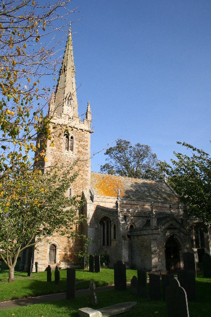
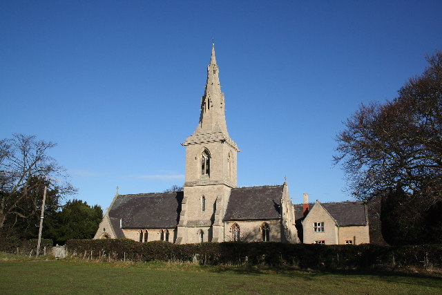
St Peter and St Paul's Church, Belton

The Church of St Peter and St Paul, Belton, South Kesteven, Lincolnshire is a functioning parish church and a Grade I listed building. Since the 17th century...

Belton, South Kesteven

Belton is a village in the civil parish of Belton and Manthorpe, in the South Kesteven district of Lincolnshire, England. It is situated on the A607 road...

Belton House

Belton House is a Grade I listed country house in the parish of Belton near Grantham in Lincolnshire, England, built between 1685 and 1687 by Sir John...

Belton House Boathouse

The Boathouse on Boathouse Pond, Belton House, Belton, Lincolnshire was designed by Anthony Salvin in 1838–1839. It is a Grade II listed building. ��2...

Syston, Lincolnshire

Syston is a village and civil parish in the South Kesteven district of Lincolnshire, England. The population of the civil parish was 162 at the 2011 census...

Belton and Manthorpe

Belton and Manthorpe is a civil parish in the South Kesteven district of Lincolnshire, England, consisting of Belton and Manthorpe, just north of Grantham...

Barkston

Barkston is an English village and civil parish in the South Kesteven district of Lincolnshire. The parish population was 497 at the 2001 census and 493...

Manthorpe, Grantham

Manthorpe is a village in the South Kesteven district of Lincolnshire, England. It is on the northern edge of the town of Grantham and on the Grantham...

Nearby Amenities

Located within 500m of 52.945,-0.619
Belton
Is In: Lincolnshire, England, UK
Place: village
Source: NPE
Lat/Long: 52.9458483/-0.6170959
Washdyke Lane
Naptan AtcoCode: 270000008415
Naptan Bearing: SW
Naptan BusStopType: CUS
Naptan CommonName: Washdyke Lane
Naptan Indicator: opp
Naptan Landmark: Washdyke Lane
Naptan NaptanCode: lingpwjg
Naptan Street: Main Street
Naptan Verified: no
Public Transport: platform
Source: naptan_import
Lat/Long: 52.9467704/-0.616247
Bus Stop
Washdyke Lane
Bus: yes
Naptan AtcoCode: 270000008416
Naptan Bearing: NE
Naptan BusStopType: CUS
Naptan CommonName: Washdyke Lane
Naptan Indicator: adj
Naptan Landmark: Washdyke Lane
Naptan NaptanCode: lingpwjm
Naptan Street: Main Street
Naptan Verified: no
Public Transport: platform
Source: naptan_import
Lat/Long: 52.9466475/-0.6165039
Bus Stop
Belton Hall Gates
Bus: yes
Naptan AtcoCode: 270000008417
Naptan Bearing: SW
Naptan CommonName: Belton Hall Gates
Naptan Indicator: adj
Naptan Landmark: Belton Hall Gates
Naptan NaptanCode: lingpwjp
Naptan Street: Main Street
Public Transport: platform
Source: naptan_import;survey
Lat/Long: 52.9453107/-0.6188941
Bus Stop
Belton Garden Centre
Bus: yes
Naptan AtcoCode: 270000010433
Naptan Bearing: N
Naptan BusStopType: CUS
Naptan CommonName: Belton Garden Centre
Naptan Indicator: adj
Naptan Landmark: Belton Garden Centre
Naptan NaptanCode: linjmpmj
Naptan Street: Grantham Road
Naptan Verified: no
Public Transport: platform
Source: naptan_import
Lat/Long: 52.9452271/-0.6219221
Bus Stop
Belton Garden Centre
Bus: yes
Naptan AtcoCode: 2700LBN00205
Naptan Bearing: S
Naptan BusStopType: CUS
Naptan CommonName: Belton Garden Centre
Naptan Indicator: opp
Naptan Landmark: Belton Garden Centre
Naptan NaptanCode: linadgwj
Naptan Street: Grantham Road
Naptan Verified: no
Public Transport: platform
Source: naptan_import
Lat/Long: 52.9452136/-0.6215355
Bus Stop
Belton Hall Gates
Bus: yes
Departures Board: timetable
Naptan AtcoCode: 2700LBP00479
Naptan Bearing: NE
Naptan CommonName: Belton Hall Gates
Naptan Indicator: opp
Naptan Landmark: Belton Hall Gates
Naptan NaptanCode: linadtdj
Naptan Street: Main Street
Operator: Stagecoach
Public Transport: platform
Shelter: no
Source: naptan_import;survey;local knowledge
Lat/Long: 52.9453364/-0.6190888
Construction Amenity: restaurant
Note: Building under repair Spring 2019
Old Name: Stables Restaurant
Source: Bing
Wheelchair: yes
Lat/Long: 52.9439218/-0.6195708
Coach House Shop
Shop: gift
Wheelchair: yes
Lat/Long: 52.9436599/-0.6197004
Garden Shop
Shop: garden_centre
Wheelchair: yes
Lat/Long: 52.9438782/-0.6190451
Toilets
Source: Bing
Wheelchair: yes
Lat/Long: 52.9430748/-0.6193654
Entrance: yes
Lat/Long: 52.9440516/-0.6189813
Entrance: yes
Lat/Long: 52.9439738/-0.6189764
Entrance: yes
Lat/Long: 52.9436161/-0.6193791
Entrance: yes
Lat/Long: 52.9438718/-0.6190986
Toilets
Source: Bing
Wheelchair: yes
Lat/Long: 52.9440206/-0.6188897
Entrance: yes
Lat/Long: 52.9436021/-0.619298
Entrance: yes
Lat/Long: 52.9436961/-0.6196929
Entrance: yes
Lat/Long: 52.9439949/-0.6194175
Second-Hand Book Shop
Shop: books
Source: Bing
Lat/Long: 52.9439622/-0.6190252
Toilets
Female: yes
Male: no
Source: Bing
Lat/Long: 52.9435858/-0.6193457
Bench
Source: Bing
Lat/Long: 52.9447361/-0.6169907
Bench
Source: Bing
Lat/Long: 52.94534/-0.6183405
Barrier: cattle_grid
Lat/Long: 52.942032/-0.62039
Fountain
Lat/Long: 52.9444857/-0.618486
The Wilderness
Place: locality
Source: Bing
Lat/Long: 52.9412921/-0.621943
Waterloo Cottages
Place: isolated_dwelling
Source: Bing
Lat/Long: 52.9422786/-0.6243218
Belton Garden Centre
Addr City: Belton
Addr Postcode: NG32 2LN
Addr Street: Grantham Road
Fhrs Authority: South Kesteven
Fhrs Id: 238021
Fhrs Local Authority Id: 3874
Shop: garden_centre
Lat/Long: 52.9450434/-0.624633
Post Box
Collection Times: Mo-Fr 17:00; Sa 08:15
Drive Through: no
Operator: Royal Mail
Operator Type: private
Operator Wikidata: Q638098
Post Box Mounting: building
Post Box Type: wall
Ref: NG32 63
Royal Cypher: GR
Royal Cypher Wikidata: Q33102273
Lat/Long: 52.9454684/-0.6189312
Toilets
Female: yes
Male: no
Lat/Long: 52.9433419/-0.6183327
Shop: kiosk
Lat/Long: 52.943625/-0.6185273
Entrance: yes
Lat/Long: 52.9434713/-0.6185114
Tourism: artwork
Lat/Long: 52.9434127/-0.6183565
Barrier: entrance
Lat/Long: 52.9434404/-0.6184874
Fixme: incomplete
Lat/Long: 52.943451/-0.6182979
Entrance: yes
Lat/Long: 52.9433512/-0.618324
Barrier: entrance
Lat/Long: 52.9434661/-0.6184758
Entrance: yes
Lat/Long: 52.9434454/-0.6185231
Entrance: exit
Lat/Long: 52.943363/-0.6183948
Bellow stairs entrance
Entrance: yes
Source: Bing
Lat/Long: 52.943292/-0.618363
House Entrance
Entrance: yes
Lat/Long: 52.9431316/-0.6180754
Gothic Sham Castle
Historic: ruins
Lat/Long: 52.9442506/-0.6206933
Barrier: cattle_grid
Lat/Long: 52.9420993/-0.6209633
Ice House
Historic: ruins
Historic Civilization: modern
Inscription: Historic brick-lined ice storage bunker.
Lat/Long: 52.9437173/-0.6146361
Telephone
Booth: K6
Covered: booth
Listed Status: Grade II
Operator: BT
Operator Wikidata: Q593786
Phone: +44 1476 567519
Lat/Long: 52.9460864/-0.6164469
Man Made: water_well
Lat/Long: 52.9460894/-0.6164083
Toilets
Lat/Long: 52.9426456/-0.6234069
Belton House Maze
Attraction: maze
Tourism: attraction
Lat/Long: 52.9429012/-0.6136938
Bicycle Parking
Access: permissive
Bicycle Parking: cycle_hoops
Capacity: 5
Lat/Long: 52.9421669/-0.6208813
Railway: crossing
Lat/Long: 52.942421/-0.6231961
The data included in this document is from www.openstreetmap.org. The data is made available under ODbL.

Have you been to Belton House?

Leave your review of Belton House below (or comments, questions and feedback).