Bede's Well

Heritage Site in Durham

England

Bede's Well
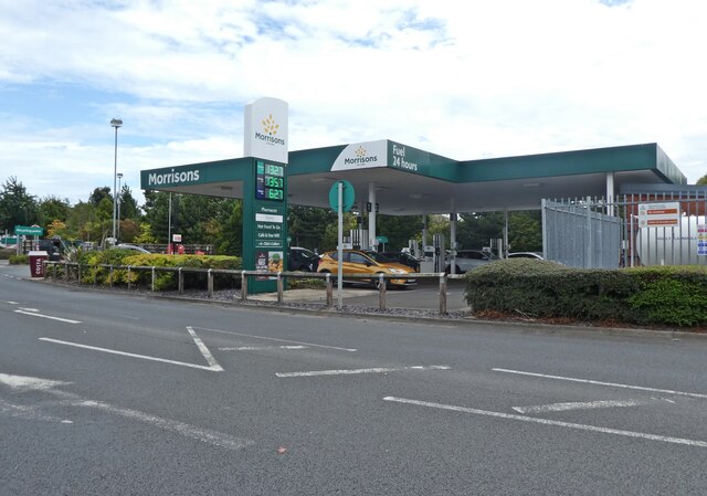
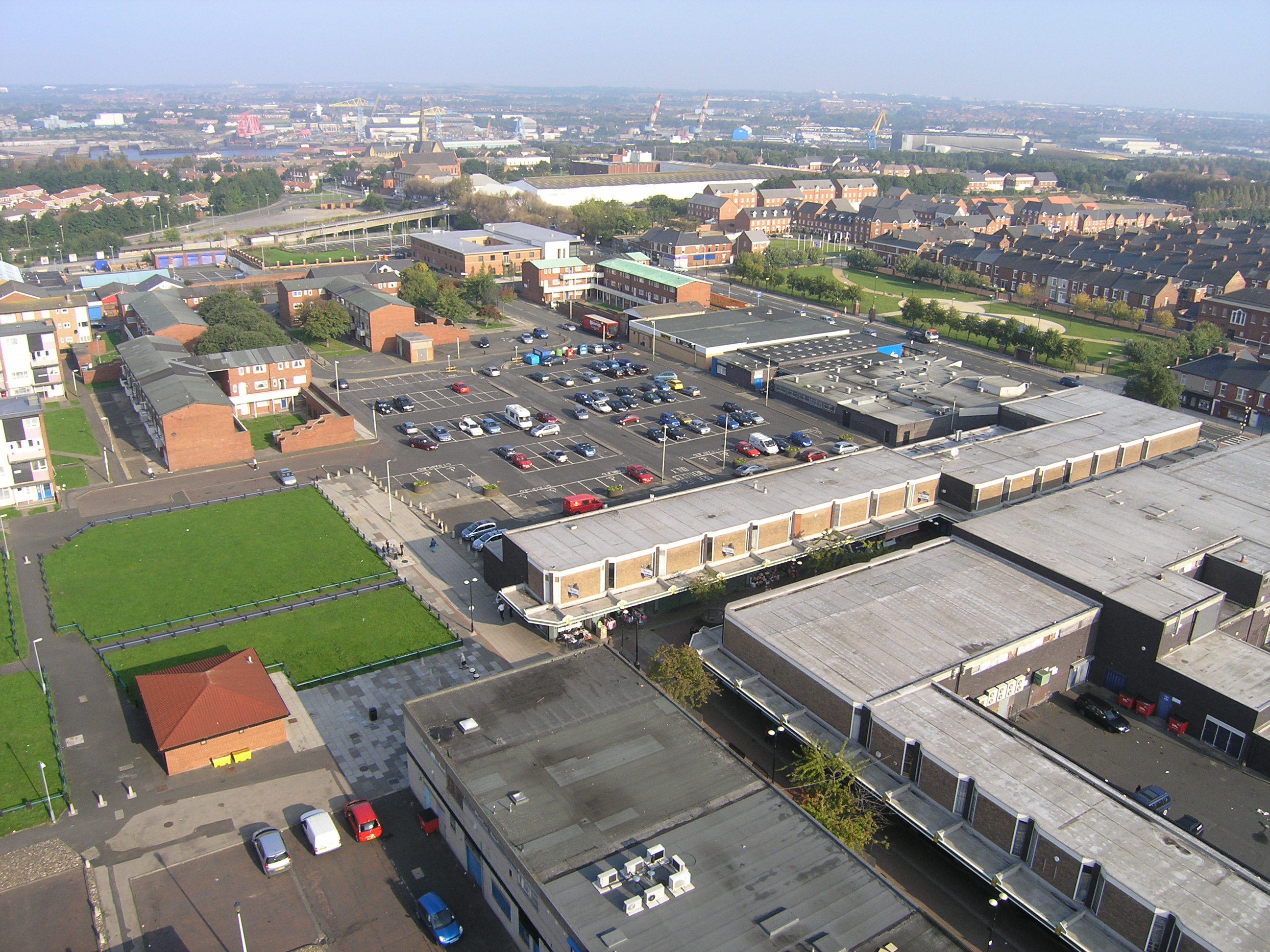
Petrol station at Morrisons
Petrol station at Morrisons Credit: Roger Cornfoot

Bede's Well, located in Durham, England, is a renowned heritage site with historical and cultural significance. This well is named after the famous Anglo-Saxon scholar and monk, Bede, who resided in the area during the 7th and 8th centuries. Bede's Well is believed to have been a crucial source of freshwater for the local community during Bede's time.

The well is situated near the banks of the River Wear, close to the city center of Durham. It is a small, stone-built structure, surrounded by a protective iron fence. The original wellhead, featuring a carved stone font, is still intact, although it has been restored over the years. Visitors can observe the inscriptions and carvings on the font, which provide a glimpse into the historical and religious significance of the site.

Bede's Well attracts tourists and scholars interested in the life and works of Bede, who is often referred to as the "Father of English History." Some believe that the water from the well possesses healing properties due to its association with Bede. As a result, many people visit the well to collect the water, hoping for its curative effects.

In addition to its historical significance, Bede's Well offers visitors a tranquil and serene setting. Surrounded by lush greenery and overlooking the river, it serves as a peaceful spot for reflection and contemplation. The site also provides interpretive signs and information boards that offer insights into Bede's life and the role of the well in the local community.

Overall, Bede's Well in Durham stands as a testament to the historical and cultural legacy of Bede, attracting both history enthusiasts and those seeking a peaceful retreat.

If you have any feedback on the listing, please let us know in the comments section below.

Bede's Well Images

Images are sourced within 2km of 54.973/-1.508 or Grid Reference NZ3164. Thanks to Geograph Open Source API. All images are credited.
Petrol station at Morrisons
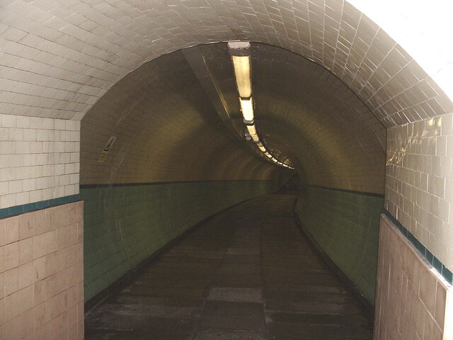
Cyclist  tunnel under the Tyne The twin cyclist and pedestrian tunnels under the Tyne linking Jarrow and Wallsend was opened in 1951. After more than half a century of neglect it was closed for minor repairs in 2013. The minor repairs turned into major refurbishment and the work was not completed and the tunnels not reopened until 2019. This image predates the closure and refurbishment.
Cyclist tunnel under the Tyne
The twin cyclist and pedestrian tunnels under the Tyne linking Jarrow and Wallsend was opened in 1951. After more than half a century of neglect it was closed for minor repairs in 2013. The minor repairs turned into major refurbishment and the work was not completed and the tunnels not reopened until 2019. This image predates the closure and refurbishment.
Decorated Post Box Celebrating spring and the end of Covid.
Decorated Post Box
Celebrating spring and the end of Covid.
Decorated Post Box Celebrating spring and the end of Covid
Decorated Post Box
Celebrating spring and the end of Covid
Sunset over Hebburn
Sunset over Hebburn
Sunset above the River Tyne
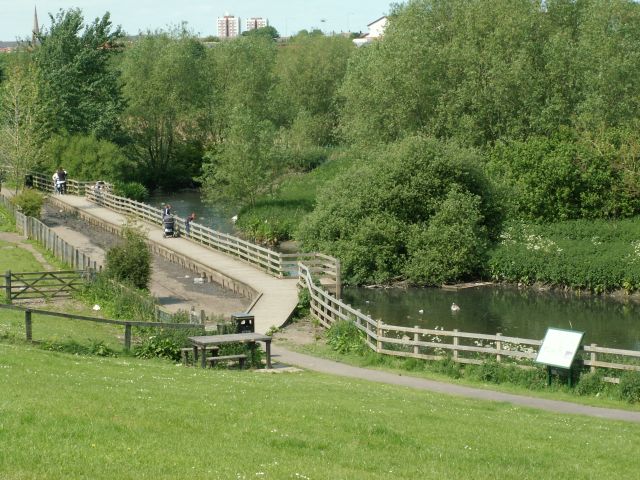
Primrose Local Nature Reserve The Nature Reserve was created in 1990 by excavating a series of ponds and ditches where there had previously been amenity grassland. prone to occasional flooding. Planting them up resulted in a mosaic of marsh and open water habitats, which offers shelter and sustenance to a wide range of wetland wildlife.
Primrose Local Nature Reserve
The Nature Reserve was created in 1990 by excavating a series of ponds and ditches where there had previously been amenity grassland. prone to occasional flooding. Planting them up resulted in a mosaic of marsh and open water habitats, which offers shelter and sustenance to a wide range of wetland wildlife.
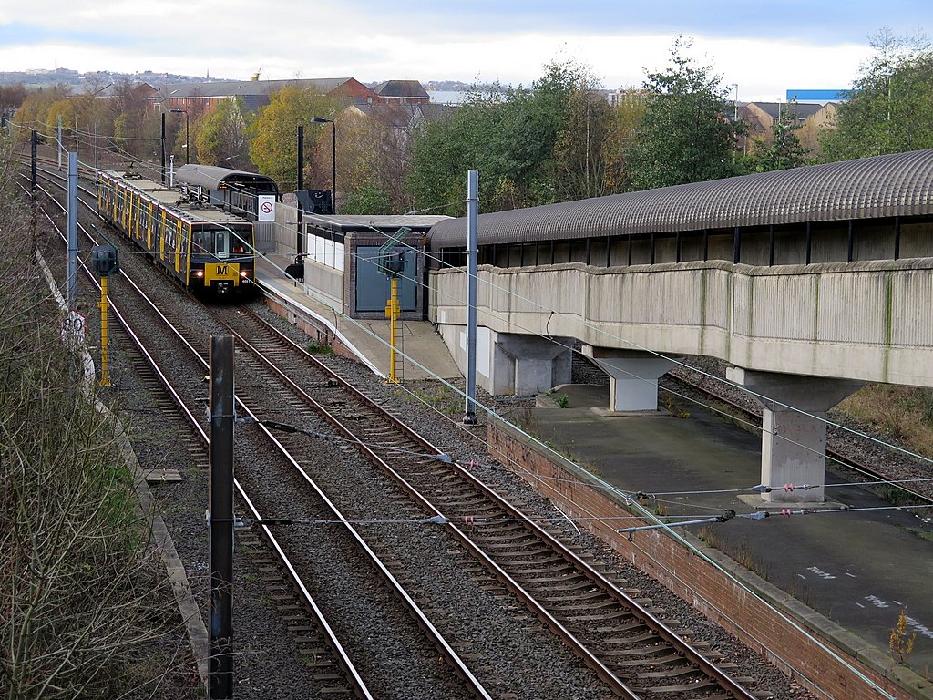
Hebburn Metro Station and Reyrolle offices Converted branch line station with 1950s office block.
Hebburn Metro Station and Reyrolle offices
Converted branch line station with 1950s office block.
Red Brick Factory, Hebburn Colliery Wonderful example of old-time industry near banks of the Tyne.
Red Brick Factory, Hebburn Colliery
Wonderful example of old-time industry near banks of the Tyne.
Wagonway Road Aptly titled road in the middle of Hebburn Colliery.
Wagonway Road
Aptly titled road in the middle of Hebburn Colliery.
Park Road Back Lane This is the perfect example of a Tyneside terrace back lane.
Park Road Back Lane
This is the perfect example of a Tyneside terrace back lane.
Reyrolle Factory This photo doesn't do this structure's bold immensity any favours-more to follow.
Reyrolle Factory
This photo doesn't do this structure's bold immensity any favours-more to follow.
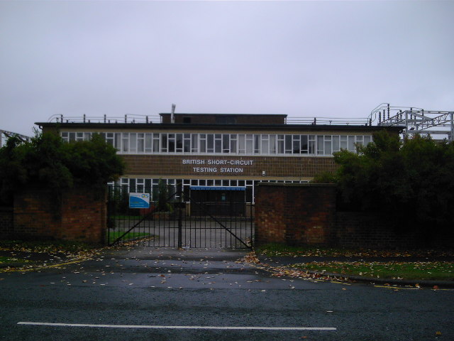
Testing Station A part of the Reyrolle complex with exciting title.
Testing Station
A part of the Reyrolle complex with exciting title.
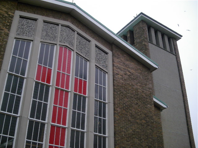
St James's RC Church This church was built at the same time as the school which surrounds it. However, the school was named St Joseph's.
St James's RC Church
This church was built at the same time as the school which surrounds it. However, the school was named St Joseph's.
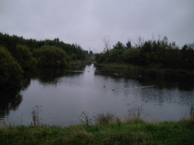
Lake near Mill Lane/Monkton Lane This area was a quarry 20 years ago and has now been landscaped into a pleasant area of greenery and water.
Lake near Mill Lane/Monkton Lane
This area was a quarry 20 years ago and has now been landscaped into a pleasant area of greenery and water.
Carr Ellison Park A well kept scenic park in suburban South Tyneside.
Carr Ellison Park
A well kept scenic park in suburban South Tyneside.
St John's Avenue A very suburban tract near Carr Ellison Park.
St John's Avenue
A very suburban tract near Carr Ellison Park.
Reyrolle Factory (1km Away) This photo gives you some idea what a colossal monolith Reyrolle is.
Reyrolle Factory (1km Away)
This photo gives you some idea what a colossal monolith Reyrolle is.
Show me another place!

Bede's Well is located at Grid Ref: NZ3164 (Lat: 54.973, Lng: -1.508)

Unitary Authority: South Tyneside

Police Authority: Northumbria

What 3 Words

///spoke.ruled.print. Near Hebburn, Tyne & Wear

Nearby Locations

Campbell Park Bede's Well

Related Wikis

Hebburn

Hebburn is a town in the South Tyneside borough of Tyne and Wear, England. It was formerly in County Durham until 1974 with its own urban district from...

Hebburn Hall

Hebburn Hall also known as Ellison Hall is a 17th-century country mansion, which has been converted into residential apartments and houses, situated at...

Hebburn Comprehensive School

Hebburn Comprehensive School is a coeducational secondary school located in Hebburn, Tyne and Wear, England, with pupils aged from 11 to 16.The school...

Hebburn Metro station

Hebburn is a Tyne and Wear Metro station, serving the town of Hebburn, South Tyneside in Tyne and Wear, England. It joined the network on 24 March 1984...

Hebburn Town F.C.

Hebburn Town Football Club is a football club based in Hebburn, Tyne and Wear, England. The club are currently members of the Northern Premier League Division...

Jarrow Metro station

Jarrow is a Tyne and Wear Metro station, serving the town of Jarrow, South Tyneside in Tyne and Wear, England. It joined the network on 24 March 1984,...

Willington Quay

Willington Quay is an area in the borough of North Tyneside in Tyne and Wear in northern England. It is on the north bank of the River Tyne, facing Jarrow...

Jarrow March

The Jarrow March of 5–31 October 1936, also known as the Jarrow Crusade, was an organised protest against the unemployment and poverty suffered in the...

Nearby Amenities

Located within 500m of 54.973,-1.508
Bus Stop
BEDEWELL JMI. SCHOOL
Local Ref: W
Naptan AtcoCode: 410000000050
Naptan Bearing: W
Naptan CommonName: BEDEWELL JMI. SCHOOL
Naptan Indicator: W
Naptan Landmark: BEDEWELL JMI. SCHOOL
Naptan NaptanCode: twrgtwjm
Naptan Street: CAMPBELL PARK ROAD
Naptan Verified: no
Source: naptan_import
Lat/Long: 54.9754674/-1.5105408
Bus Stop
Hebburn
Bench: no
Bin: yes
Bus: yes
Departures Board: timetable
Local Ref: E
Naptan AtcoCode: 410000016133
Naptan Bearing: E
Naptan CommonName: HEBBURN (M)
Naptan Indicator: E
Naptan Landmark: OUTSIDE WILLOW DENE NURSING HOME
Naptan NaptanCode: twrdjpta
Naptan Street: VICTORIA ROAD EAST
Naptan Verified: no
Public Transport: platform
Shelter: yes
Source: naptan_import
Lat/Long: 54.9732024/-1.514927
Bus Stop
HEBBURN BATHS
Bench: no
Local Ref: E
Naptan AtcoCode: 410000016134
Naptan Bearing: E
Naptan CommonName: HEBBURN BATHS
Naptan Indicator: E
Naptan Landmark: OPPOSITE COUNCIL OFFICES / HEBBURN BATHS
Naptan NaptanCode: twrdjptd
Naptan Street: VICTORIA ROAD WEST
Naptan Verified: no
Shelter: yes
Source: naptan_import
Lat/Long: 54.9743928/-1.5092415
Bus Stop
HEBBURN BATHS
Bench: no
Covered: yes
Local Ref: S
Naptan AtcoCode: 410000016135
Naptan Bearing: S
Naptan CommonName: HEBBURN BATHS
Naptan Indicator: S
Naptan Landmark: OPPOSITE VICTORIA PARK PUBLIC HOUSE
Naptan NaptanCode: twrdjptg
Naptan Street: CAMPBELL PARK ROAD
Naptan Verified: no
Shelter: yes
Source: naptan_import
Lat/Long: 54.9735417/-1.5095896
Bus Stop
Campbell Park Road
Bus: yes
Departures Board: timetable
Local Ref: S
Naptan AtcoCode: 410000016136
Naptan Bearing: S
Naptan CommonName: CAMPBELL PARK ROAD-CAMBRIDGE AVENUE-S/B
Naptan Indicator: S
Naptan Landmark: OPPOSITE HEBBURN COMPREHENSIVE SCHOOL
Naptan NaptanCode: twrdjptj
Naptan Street: CAMPBELL PARK ROAD
Naptan Verified: no
Public Transport: platform
Shelter: yes
Source: naptan_import
Lat/Long: 54.9707885/-1.5070025
Bus Stop
Campbell Park Road
Bench: yes
Bus: yes
Departures Board: timetable
Local Ref: N
Naptan AtcoCode: 410000016144
Naptan Bearing: N
Naptan CommonName: CAMPBELL PARK ROAD-PENRITH ROAD-N/B
Naptan Indicator: N
Naptan Landmark: OUTSIDE ST JAMES RC PRIMARY SCHOOL
Naptan NaptanCode: twrdjpwm
Naptan Street: CAMPBELL PARK ROAD
Naptan Verified: no
Public Transport: platform
Shelter: yes
Source: naptan_import
Lat/Long: 54.9686194/-1.5067379
Bus Stop
Campbell Park Road
Bus: yes
Departures Board: timetable
Local Ref: N
Naptan AtcoCode: 410000016145
Naptan Bearing: N
Naptan CommonName: CAMPBELL PARK ROAD-CAMBRIDGE AVENUE-N/B
Naptan Indicator: N
Naptan Landmark: OUTSIDE HEBBURN COMPREHENSIVE SCHOOL
Naptan NaptanCode: twrdjpwp
Naptan Street: CAMPBELL PARK ROAD
Naptan Verified: no
Public Transport: platform
Shelter: yes
Source: naptan_import
Lat/Long: 54.9713508/-1.5075913
Bus Stop
Hebburn Baths
Bench: no
Bus: yes
Covered: yes
Departures Board: timetable
Local Ref: N
Naptan AtcoCode: 410000016146
Naptan Bearing: N
Naptan CommonName: HEBBURN BATHS
Naptan Indicator: N
Naptan Landmark: OUTSIDE VICTORIA PARK PUBLIC HOUSE
Naptan NaptanCode: twrdjpwt
Naptan Street: CAMPBELL PARK ROAD
Naptan Verified: no
Public Transport: platform
Shelter: yes
Source: naptan_import
Lat/Long: 54.9736314/-1.5099415
Bus Stop
VICTORIA ROAD EAST-CAMPBELL PARK ROAD
Local Ref: SW
Naptan AtcoCode: 410000016147
Naptan Bearing: SW
Naptan CommonName: VICTORIA ROAD EAST-CAMPBELL PARK ROAD
Naptan Indicator: SW
Naptan Landmark: WEST OF CAMPBELL PARK ROAD ROUNDABOUT
Naptan NaptanCode: twrdjtad
Naptan Street: VICTORIA ROAD
Naptan Verified: no
Source: naptan_import
Lat/Long: 54.9734003/-1.5133192
Bus Stop
CAMPBELL PARK ROAD-WORDSWORTH AVENUE-S/B
Local Ref: S
Naptan AtcoCode: 410000016251
Naptan Bearing: S
Naptan CommonName: CAMPBELL PARK ROAD-WORDSWORTH AVENUE-S/B
Naptan Indicator: S
Naptan Landmark: JUNCTION WITH WORDSWORTH AVENUE
Naptan NaptanCode: twrdjwtw
Naptan Street: CAMPBELL PARK ROAD
Naptan Verified: no
Source: naptan_import
Lat/Long: 54.9754827/-1.5121185
Bus Stop
Victoria Road East-Byron Avenue
Bench: no
Bus: yes
Local Ref: NE
Naptan AtcoCode: 410000016252
Naptan Bearing: NE
Naptan CommonName: VICTORIA ROAD EAST-BYRON AVENUE-NE/B
Naptan Indicator: NE
Naptan Landmark: OPPOSITE THE LONGSHIP PUBLIC HOUSE
Naptan NaptanCode: twrdmada
Naptan Street: VICTORIA ROAD EAST
Naptan Verified: no
Public Transport: platform
Shelter: yes
Source: naptan_import
Lat/Long: 54.9754128/-1.5059169
Bus Stop
HEBBURN BATHS
Bench: yes
Bus: yes
Covered: yes
Local Ref: W
Naptan AtcoCode: 410000016253
Naptan Bearing: W
Naptan CommonName: HEBBURN BATHS
Naptan Indicator: W
Naptan Landmark: OUTSIDE POLICE STATION AND THE LONGSHIP PUB
Naptan NaptanCode: twrdmadg
Naptan Street: VICTORIA ROAD EAST
Naptan Verified: no
Public Transport: platform
Shelter: yes
Source: naptan_import
Lat/Long: 54.9747633/-1.5069466
Bus Stop
CAMPBELL PARK ROAD-VERDUN AVENUE-N/B
Local Ref: N
Naptan AtcoCode: 410000016254
Naptan Bearing: N
Naptan CommonName: CAMPBELL PARK ROAD-VERDUN AVENUE-N/B
Naptan Indicator: N
Naptan Landmark: JUNCTION WITH VERDUN AVENUE
Naptan NaptanCode: twrdmadj
Naptan Street: CAMPBELL PARK ROAD
Naptan Verified: no
Source: naptan_import
Lat/Long: 54.9757817/-1.5127242
Turning Circle
Lat/Long: 54.9700585/-1.5064044
Turning Circle
Lat/Long: 54.9722921/-1.5130146
Turning Circle
Lat/Long: 54.9762425/-1.5055075
Clinic
Hebburn Health Centre
Addr City: Hebburn
Addr Postcode: NE31 2SP
Addr Street: Campbell Park Road
Phone: +44 191 283 1610
Lat/Long: 54.9733694/-1.5076355
Pharmacy
Ashchem Chemist
Addr City: Hebburn
Addr Street: Campbell Park Road
Lat/Long: 54.973639/-1.5078715
Post Box
Ref: NE31 72
Lat/Long: 54.9723753/-1.5035402
Post Box
Drive Through: no
Operator: Royal Mail
Operator Wikidata: Q638098
Post Box Type: pillar
Ref: NE31 657
Lat/Long: 54.9736796/-1.5097069
Post Box
Ref: NE31 301
Lat/Long: 54.9751734/-1.5147978
Gatepost Art
Tourism: artwork
Lat/Long: 54.9719443/-1.5144837
Cricket Carving
Tourism: artwork
Lat/Long: 54.9708085/-1.5130662
Bede's Well
Access: yes
Archaeological Site: well
Historic: archaeological_site
Tourism: yes
Lat/Long: 54.9710372/-1.5018318
Barrier: block
Motor Vehicle: no
Lat/Long: 54.9749022/-1.5014248
Entrance: yes
Lat/Long: 54.9696455/-1.5101127
Crossing
Crossing: marked
Lat/Long: 54.9705437/-1.5083706
Crossing
Crossing: marked
Crossing Island: yes
Lat/Long: 54.9755642/-1.5055497
Crossing
Crossing: marked
Crossing Island: no
Crossing Ref: zebra
Lat/Long: 54.9747082/-1.5111466
Metal cannon
Artwork Type: sculpture
Tourism: artwork
Lat/Long: 54.9711435/-1.5141084
Boer War Memorial
Historic: memorial
Memorial: war_memorial
Memorial Conflict: Boer_Wars
Memorial Conflict Wikidata: Q1676845
Lat/Long: 54.9711179/-1.5141927
Hebburn Mini Mart
Shop: convenience
Lat/Long: 54.9731302/-1.5157265
Addr Housenumber: 94
Lat/Long: 54.9741372/-1.5111185
Tanning Station
Beauty: tanning
Shop: beauty
Lat/Long: 54.9691779/-1.5059924
Shop: pet_grooming
Lat/Long: 54.9693457/-1.5060451
Addr Housenumber: 96
Lat/Long: 54.9741972/-1.5109878
Crossing
Crossing: unmarked
Crossing Island: yes
Tactile Paving: yes
Lat/Long: 54.9736725/-1.5125068
Shop: hairdresser
Lat/Long: 54.9692542/-1.5060269
Addr Housenumber: 30
Lat/Long: 54.9732757/-1.5154293
Noexit: yes
Lat/Long: 54.9734574/-1.5016738
Noexit: yes
Lat/Long: 54.9734619/-1.5016729
The data included in this document is from www.openstreetmap.org. The data is made available under ODbL.

Have you been to Bede's Well?

Leave your review of Bede's Well below (or comments, questions and feedback).