Battle Stone

Heritage Site in Northumberland

England

Battle Stone

River Glen Restoration and Flood Risk Management Project works on the Yeavering Burn The aim of the project is 'to encourage the River Glen to continue to naturalise whilst managing the risk to land, property and infrastructure'.  

In this shot, Coupland Bridge/culvert has been removed and replaced with a gravel ford through the Yeavering Burn.  Further information on the project can be found at <span class="nowrap"><a title="https://tweedforum.org/our-work/projects/river-till-restoration-strategy/" rel="nofollow ugc noopener" href="https://tweedforum.org/our-work/projects/river-till-restoration-strategy/">Link</a><img style="margin-left:2px;" alt="External link" title="External link - shift click to open in new window" src="https://s1.geograph.org.uk/img/external.png" width="10" height="10"/></span>

This photograph was taken during the Coronavirus (COVID-19) pandemic of 2020/21/22.
River Glen Restoration and Flood Risk Management Project works on the Yeavering Burn Credit: James T M Towill

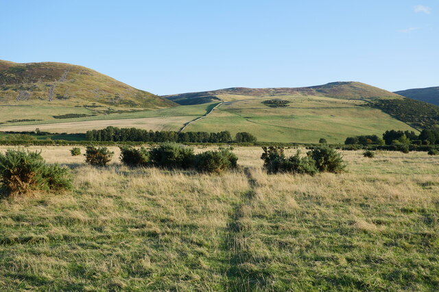
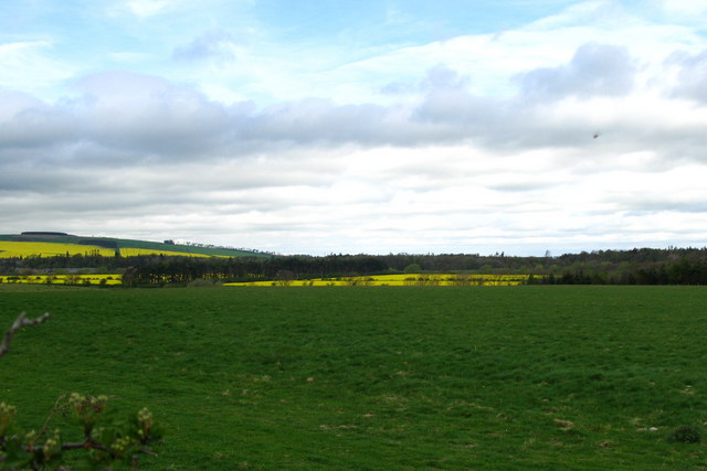
Battle Stone is a significant heritage site located in the county of Northumberland, England. Situated atop a prominent hill, the site offers panoramic views of the surrounding landscape and holds great historical importance. The stone itself is a large standing stone, measuring approximately 4 meters in height and believed to date back to the Bronze Age, around 2000 BCE.

This ancient monument has long been a subject of intrigue and speculation among archaeologists and historians. Its purpose and significance remain somewhat elusive, with various theories suggesting religious, ceremonial, or even astronomical associations. The stone's imposing presence and its alignment with the sun during certain times of the year have contributed to these theories.

In addition to its prehistoric allure, Battle Stone is also linked to more recent history. It is believed to have played a role as a boundary marker during medieval times, demarcating the border between two historic territories – Northumberland and Scotland. This connection to the region's turbulent past adds to the site's historical value.

Today, Battle Stone continues to draw visitors who are captivated by its enigmatic nature and breathtaking views. It offers an opportunity to experience a tangible link to the past and immerse oneself in the rich heritage of Northumberland. The site is well-maintained and accessible, with interpretive panels providing information to visitors about its history and significance.

Overall, Battle Stone is a remarkable heritage site that stands as a testament to Northumberland's ancient and medieval history. It offers an intriguing glimpse into the past and provides a unique experience for those interested in exploring the region's rich cultural heritage.

If you have any feedback on the listing, please let us know in the comments section below.

Battle Stone Images

Images are sourced within 2km of 55.568/-2.118 or Grid Reference NT9230. Thanks to Geograph Open Source API. All images are credited.
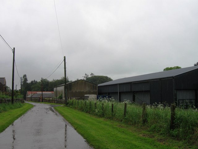
River Glen Restoration and Flood Risk Management Project works on the Yeavering Burn The aim of the project is 'to encourage the River Glen to continue to naturalise whilst managing the risk to land, property and infrastructure'.  

In this shot, Coupland Bridge/culvert has been removed and replaced with a gravel ford through the Yeavering Burn.  Further information on the project can be found at <span class="nowrap"><a title="https://tweedforum.org/our-work/projects/river-till-restoration-strategy/" rel="nofollow ugc noopener" href="https://tweedforum.org/our-work/projects/river-till-restoration-strategy/">Link</a><img style="margin-left:2px;" alt="External link" title="External link - shift click to open in new window" src="https://s1.geograph.org.uk/img/external.png" width="10" height="10"/></span>

This photograph was taken during the Coronavirus (COVID-19) pandemic of 2020/21/22.
River Glen Restoration and Flood Risk Management Project works on the Yeavering Burn
The aim of the project is 'to encourage the River Glen to continue to naturalise whilst managing the risk to land, property and infrastructure'. In this shot, Coupland Bridge/culvert has been removed and replaced with a gravel ford through the Yeavering Burn. Further information on the project can be found at LinkExternal link This photograph was taken during the Coronavirus (COVID-19) pandemic of 2020/21/22.
Medieval Pele Tower "A long quadrangular house at Old Yeavering has walls five feet thick and is probably a medieval pele.

The building is now used as a farm outbuilding and is in reasonable condition."

Hence the reason for the independently supported roof.

Source: Heritagegateway.org.uk. (2012). Heritage Gateway - Results. Monument Number 3875. [online] Available at: <span class="nowrap"><a title="https://www.heritagegateway.org.uk/Gateway/Results_Single.aspx?uid=c4c0a494-2a11-418f-8a59-907a52a8cc6c&resourceID=19191" rel="nofollow ugc noopener" href="https://www.heritagegateway.org.uk/Gateway/Results_Single.aspx?uid=c4c0a494-2a11-418f-8a59-907a52a8cc6c&resourceID=19191">Link</a><img style="margin-left:2px;" alt="External link" title="External link - shift click to open in new window" src="https://s1.geograph.org.uk/img/external.png" width="10" height="10"/></span> [Accessed 21 Jun. 2022].
Medieval Pele Tower
"A long quadrangular house at Old Yeavering has walls five feet thick and is probably a medieval pele. The building is now used as a farm outbuilding and is in reasonable condition." Hence the reason for the independently supported roof. Source: Heritagegateway.org.uk. (2012). Heritage Gateway - Results. Monument Number 3875. [online] Available at: LinkExternal link [Accessed 21 Jun. 2022].
Bound for Kirknewton An early autumn evening on the River Glen floodplain between Lanton and Kirknewton.

This photograph was taken during the Coronavirus (COVID-19) pandemic of 2020/21/22.
Bound for Kirknewton
An early autumn evening on the River Glen floodplain between Lanton and Kirknewton. This photograph was taken during the Coronavirus (COVID-19) pandemic of 2020/21/22.
Ford and footbridge on the Yeavering Burn near Coupland This site was photographed in May 2022, prior to installation of the footbridge: <a title="https://www.geograph.org.uk/photo/7178475" href="https://www.geograph.org.uk/photo/7178475">Link</a>
Ford and footbridge on the Yeavering Burn near Coupland
This site was photographed in May 2022, prior to installation of the footbridge: Link
Old Yeavering A map of 1584 showed a tower at Yeavering. This is a long rectangular building with very thick walls, which is now used as a farm outbuilding.

Just beyond this building is the site of the old mediaeval village of Yeavering.
Old Yeavering
A map of 1584 showed a tower at Yeavering. This is a long rectangular building with very thick walls, which is now used as a farm outbuilding. Just beyond this building is the site of the old mediaeval village of Yeavering.
College Burn & Bowmont Water College Burn & Bowmont Water meet to form the River Glen, this flows into the River Till then River Tweed.
Follow Bowmont Water <a href="https://www.geograph.org.uk/photo/165374">NT9030 : Bowmont Water</a>
College Burn & Bowmont Water
College Burn & Bowmont Water meet to form the River Glen, this flows into the River Till then River Tweed. Follow Bowmont Water NT9030 : Bowmont Water
Cottages near Sandy House
Farmland at Sandy House
St. Gregory's Church, Kirknewton. Northumberland. A place of Christian worship has stood on this site since the eleventh century – or earlier.
St. Gregory's Church, Kirknewton. Northumberland.
A place of Christian worship has stood on this site since the eleventh century – or earlier.
Lanton Recently ploughed field and view towards Lanton Hill. There is a monument on top of the hill.
Lanton
Recently ploughed field and view towards Lanton Hill. There is a monument on top of the hill.
Coupland Castle A tower house, probably built at the end of the 16th century. It has been added to over the years and was restored in the 19th century. The tower has three storeys with an attic on top and a small projecting tower carried up the south wall. The entrance door has a date of 1594 inscribed on one side. It was once the home of Matthew Culley, the agricultural reformer who with his brother George set about improving methods of soil cultivation in the nineteenth century. Today, the Earl of Durham occasionally resides at Copeland Castle.
Coupland Castle
A tower house, probably built at the end of the 16th century. It has been added to over the years and was restored in the 19th century. The tower has three storeys with an attic on top and a small projecting tower carried up the south wall. The entrance door has a date of 1594 inscribed on one side. It was once the home of Matthew Culley, the agricultural reformer who with his brother George set about improving methods of soil cultivation in the nineteenth century. Today, the Earl of Durham occasionally resides at Copeland Castle.
Lanton Hill The memorial on Lanton Hill is an obelisk in <a href="https://www.geograph.org.uk/gridref/NT9189">NT9189</a> and was erected in about 1827 in memory of John Davison, by his brother Alexander Davison of Swarland.
Lanton Hill
The memorial on Lanton Hill is an obelisk in NT9189 and was erected in about 1827 in memory of John Davison, by his brother Alexander Davison of Swarland.
River Glen
River Glen
Lanton Mill
Lanton Mill
And...? A fine speciment! View towards Westnewton. The Cheviot hills are very old, having been formed about 400 million years ago from magma. They have been smoothed and rounded by the action of ice and the characteristic rolling hills can be seen here.
And...?
A fine speciment! View towards Westnewton. The Cheviot hills are very old, having been formed about 400 million years ago from magma. They have been smoothed and rounded by the action of ice and the characteristic rolling hills can be seen here.
Coupland View to grazing fields surrounding the more manicured grounds of Coupland Castle.
Coupland
View to grazing fields surrounding the more manicured grounds of Coupland Castle.
Bridge over the River Glen at Coupland River Glen is formed at Kirknewton by the confluence of the College Burn and Bowmont Water.
Bridge over the River Glen at Coupland
River Glen is formed at Kirknewton by the confluence of the College Burn and Bowmont Water.
River Glen Valley at Yeavering A number of rape fields in this Northumbrian river valley.
River Glen Valley at Yeavering
A number of rape fields in this Northumbrian river valley.
Show me another place!

Battle Stone is located at Grid Ref: NT9230 (Lat: 55.568, Lng: -2.118)

What 3 Words

///variation.sides.thinks. Near Kirknewton, Northumberland

Nearby Locations

Battle Stone

Related Wikis

Nearby Amenities

Located within 500m of 55.568,-2.118
Old Yeavering
Name Br: Gefrin
Name En: Old Yeavering
Place: locality
Lat/Long: 55.5661533/-2.1220836
Ad Gefrin Plaque and Information
Historic: memorial
Lat/Long: 55.5679866/-2.1172001
Information: guidepost
Tourism: information
Lat/Long: 55.5652711/-2.1218203
Barrier: stile
Lat/Long: 55.5652645/-2.1217575
The data included in this document is from www.openstreetmap.org. The data is made available under ODbL.

Have you been to Battle Stone?

Leave your review of Battle Stone below (or comments, questions and feedback).