Balfour

Heritage Site in Fife

Scotland

Balfour

Byresloan A vicious looking cumulonimbus behind Byresloan.
Byresloan Credit: Richard Webb

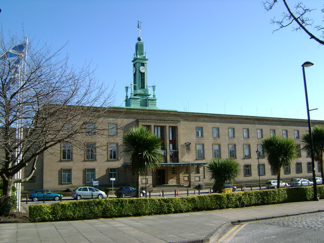
Balfour, Fife is a small town located in the eastern part of Scotland, renowned for its historical significance and its designation as a heritage site. The town is situated in the Kingdom of Fife, on the southern shores of the Firth of Forth, offering breathtaking views of the water and surrounding landscapes.

One of the key attractions in Balfour is the Balfour Castle, a grand estate that dates back to the 19th century. The castle, built in a Scottish Baronial style, stands tall amidst lush green gardens and picturesque woodlands. It is a prominent example of architectural excellence and is known for its beautiful interiors and stunning gardens, which are open to the public for exploration.

In addition to the castle, Balfour is also home to several other historical landmarks. Balfour Parish Church, with its striking spire, is a prominent feature of the town's skyline. The church, built in the 18th century, showcases stunning stained glass windows and houses a rich collection of religious artifacts.

Nature lovers can also find solace in Balfour, as the town is surrounded by beautiful countryside and offers various walking trails. The nearby coastline provides opportunities for scenic walks and birdwatching, with a diverse range of bird species inhabiting the area.

Balfour, Fife is a fascinating destination for history enthusiasts, nature lovers, and those looking to immerse themselves in Scotland's rich cultural heritage. The town's charming architecture, beautiful landscapes, and historical landmarks make it a must-visit location for anyone exploring the Kingdom of Fife.

If you have any feedback on the listing, please let us know in the comments section below.
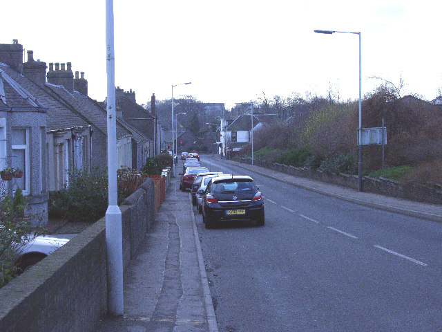
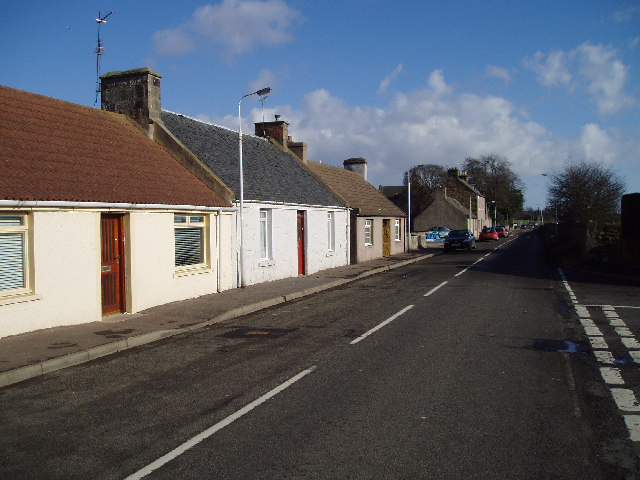
Balfour Images

Images are sourced within 2km of 56.192/-3.088 or Grid Reference NO3200. Thanks to Geograph Open Source API. All images are credited.

Byresloan A vicious looking cumulonimbus behind Byresloan.
Byresloan
A vicious looking cumulonimbus behind Byresloan.
Arable land, Balfour A long view towards Largo Law.
Arable land, Balfour
A long view towards Largo Law.
Oilseed rape, Balgonie A view of the Lomond Hills from the east.
Oilseed rape, Balgonie
A view of the Lomond Hills from the east.
Polytunnels, Woodbank The soft fruit season has come round again and of course it was cold and wet.
Polytunnels, Woodbank
The soft fruit season has come round again and of course it was cold and wet.
Balfour Mains The farm buildings appear to have been abandoned since <a href="https://www.geograph.org.uk/photo/406497">NT3299 : Cattle</a> was taken.
Balfour Mains
The farm buildings appear to have been abandoned since NT3299 : Cattle was taken.
Abandoned farm Derelict buildings at Balfour Mains Farm.
Abandoned farm
Derelict buildings at Balfour Mains Farm.
Ripening wheat An arable field near Balfour Mains farm with Largo Law in the distance.
Ripening wheat
An arable field near Balfour Mains farm with Largo Law in the distance.
Little Lun Farm
Little Lun Farm
Byresloan Farm Seen from the west
Byresloan Farm
Seen from the west
Farmland Looking eastwards towards Windygates
Farmland
Looking eastwards towards Windygates
Cattle At Balfour Mains.
Cattle
At Balfour Mains.
Farmland A view northwest to West and East Lomond.
Farmland
A view northwest to West and East Lomond.
Track Leads to Byresloan Farm
Track
Leads to Byresloan Farm
Spot the railway! The Methil Power Station branch ceased to be used regularly during the 1990s when the power station was effectively closed and put on a care and maintenance basis.  A trial train was run to Cameron Bridge (Windygates) a few years ago in the hope of distillery traffic but a contract failed to materialise.  More recently the line has been disconnected from the national network, though the track has remained in place.  Here, alongside a spur of Wemyss Wood near Grantsfield, about a mile west of Windygates, Nature is successfully doing her best to hide the rails and sleepers.
Spot the railway!
The Methil Power Station branch ceased to be used regularly during the 1990s when the power station was effectively closed and put on a care and maintenance basis. A trial train was run to Cameron Bridge (Windygates) a few years ago in the hope of distillery traffic but a contract failed to materialise. More recently the line has been disconnected from the national network, though the track has remained in place. Here, alongside a spur of Wemyss Wood near Grantsfield, about a mile west of Windygates, Nature is successfully doing her best to hide the rails and sleepers.
Haig House Known also as Cameron House or Cameron Bridge House this house was built in 1849 by the Haig family, owners of nearby Cameron Bridge Distillery. It was the home of Field Marshal Earl Haig, who was born in 1861. The moulded panel above the front door is dated 1911 and worded 'INFECTIOUS DISEASES HOSPITAL'. When the first four wards of Cameron Hospital were built, Haig house was retained as administrative premises but replaced in 1940 by a new administration building and is now used as nurses' accommodation.
Haig House
Known also as Cameron House or Cameron Bridge House this house was built in 1849 by the Haig family, owners of nearby Cameron Bridge Distillery. It was the home of Field Marshal Earl Haig, who was born in 1861. The moulded panel above the front door is dated 1911 and worded 'INFECTIOUS DISEASES HOSPITAL'. When the first four wards of Cameron Hospital were built, Haig house was retained as administrative premises but replaced in 1940 by a new administration building and is now used as nurses' accommodation.
Balgonie Castle Balgonie Castle near Glenrothes
Balgonie Castle
Balgonie Castle near Glenrothes
Looking down Kennoway road to Windygates Cross This is the A916, a busy link between Kirkcaldy and Cupar.
Looking down Kennoway road to Windygates Cross
This is the A916, a busy link between Kirkcaldy and Cupar.
Cameron Bridge Distillery This Diageo distillery is the birthplace of Cameron Brig pure grain whisky, and it is also where Gordons Gin, Smirnoff Vodka and other 'exotic' spirits are distilled
Cameron Bridge Distillery
This Diageo distillery is the birthplace of Cameron Brig pure grain whisky, and it is also where Gordons Gin, Smirnoff Vodka and other 'exotic' spirits are distilled
Show me another place!

Balfour is located at Grid Ref: NO3200 (Lat: 56.192, Lng: -3.088)

What 3 Words

///builder.aboard.petulant. Near Windygates, Fife

Nearby Locations

Balfour

Related Wikis

Milton of Balgonie

Milton of Balgonie () is a small village in central Fife, Scotland. It is situated 2 miles (3.2 km) east of Glenrothes between the nearby villages of Markinch...
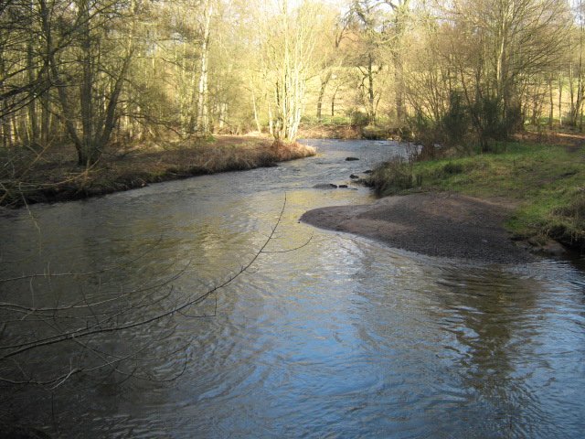
River Leven, Fife

The River Leven (Scottish Gaelic: Lìobhann / Abhainn Lìobhann) is a river in Fife, Scotland. It flows from Loch Leven into the Firth of Forth at the town...
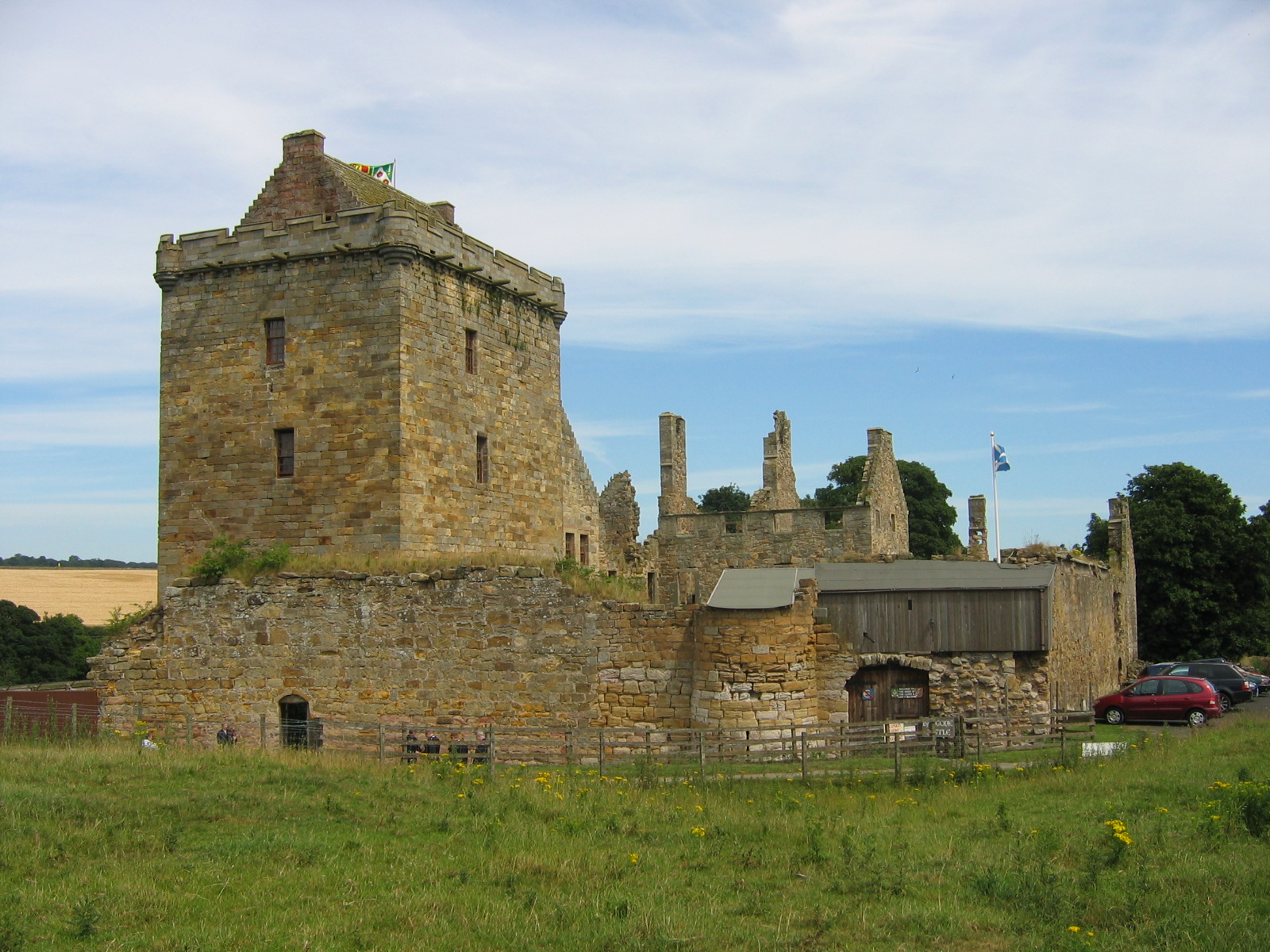
Balgonie Castle

Balgonie Castle is located on the south bank of the River Leven near Milton of Balgonie, 3.5 kilometres (2.2 mi) east of Glenrothes, Fife, Scotland. The...

Kirkcaldy (district)

Kirkcaldy (Scottish Gaelic: Dùn Phàrlain, Scots: Dunfaurlin) was a local government district in the Fife region of Scotland from 1975 to 1996. The district...

Nearby Amenities

Located within 500m of 56.192,-3.088
Turning Circle
Lat/Long: 56.1947644/-3.0907202
Post Box
Collection Times: Mo-Fr 16:15; Sa 12:00
Operator: Royal Mail
Ref: KY7 112
Source: survey
Lat/Long: 56.1940957/-3.091056
Balfour House
Historic: ruins
Lat/Long: 56.1900444/-3.090638
Crossing
Crossing: uncontrolled
Crossing Island: no
Kerb: lowered
Note: Dedicated Cycle Crossing
Tactile Paving: no
Lat/Long: 56.1942439/-3.0838719
Bus Stop
Naptan AtcoCode: 6500K0607
Naptan NaptanCode: 34328759
Shelter: yes
Lat/Long: 56.194065/-3.091056
Bus Stop
Naptan AtcoCode: 6500K0606
Naptan NaptanCode: 34328762
Lat/Long: 56.1940807/-3.0920072
Balfour Mill
Historic: ruins
Lat/Long: 56.1920887/-3.0871669
Traffic Calming: cushion
Lat/Long: 56.1939534/-3.0929631
Traffic Calming: cushion
Lat/Long: 56.1941834/-3.0907921
Traffic Calming: cushion
Lat/Long: 56.1942934/-3.0897016
Traffic Calming: cushion
Lat/Long: 56.1940288/-3.0922555
Traffic Calming: cushion
Lat/Long: 56.193854/-3.0938972
Material: wood
Power: pole
Lat/Long: 56.1949899/-3.084495
Material: wood
Power: pole
Lat/Long: 56.1957736/-3.0850418
Material: wood
Power: pole
Lat/Long: 56.1957335/-3.0863171
Material: wood
Power: pole
Lat/Long: 56.1956787/-3.0875903
Material: wood
Power: pole
Lat/Long: 56.1955984/-3.0885637
Material: wood
Power: pole
Lat/Long: 56.1954609/-3.0901977
Material: wood
Power: pole
Lat/Long: 56.195417/-3.0913111
Material: wood
Power: pole
Lat/Long: 56.1953708/-3.0925121
Material: wood
Power: pole
Lat/Long: 56.1947805/-3.0922846
Power: pole
Lat/Long: 56.1883179/-3.0849293
Power: pole
Lat/Long: 56.1889777/-3.0848493
Power: pole
Lat/Long: 56.1896929/-3.0847627
Power: pole
Lat/Long: 56.1904357/-3.0846762
Power: pole
Lat/Long: 56.1910136/-3.0846243
Power: pole
Lat/Long: 56.1916974/-3.0845356
Material: wood
Power: pole
Lat/Long: 56.1924896/-3.0844404
Material: wood
Power: pole
Lat/Long: 56.1932047/-3.0843538
Material: wood
Power: pole
Lat/Long: 56.1937633/-3.0842932
Material: wood
Power: pole
Lat/Long: 56.194199/-3.0842413
Traffic Calming: cushion
Lat/Long: 56.193896/-3.0935024
The data included in this document is from www.openstreetmap.org. The data is made available under ODbL.

Have you been to Balfour?

Leave your review of Balfour below (or comments, questions and feedback).