Bailiffscourt Estate, Climping

Heritage Site in Sussex Arun

England

Bailiffscourt Estate, Climping

Climping Windmill A poor quality photo, but the mill had sails 70 years ago.
Climping Windmill Credit: Peter Jeffery

Bailiffscourt Estate, located in Climping, Sussex, is a historic heritage site that offers visitors a glimpse into the rich history and natural beauty of the region. The estate is situated on 30 acres of picturesque grounds, which include a mix of well-manicured gardens, rolling lawns, and woodland areas.

The centerpiece of the estate is Bailiffscourt Hotel, a stunning medieval-style manor house that dates back to the 1920s. The hotel features a unique blend of traditional and contemporary design elements, with its original timbered ceilings, open fireplaces, and luxurious furnishings. The hotel offers comfortable accommodation in its 39 individually-designed rooms, each offering a unique charm and character.

The estate also boasts a tranquil spa, known as the Bailiffscourt Spa, which is housed in a beautiful thatched-roof building. The spa offers a range of relaxing treatments and therapies, including massages, facials, and beauty treatments. Visitors can also enjoy the spa's outdoor heated swimming pool, steam room, and sauna, as well as the peaceful sun terrace and gardens.

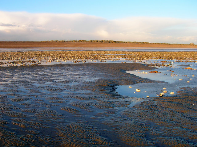
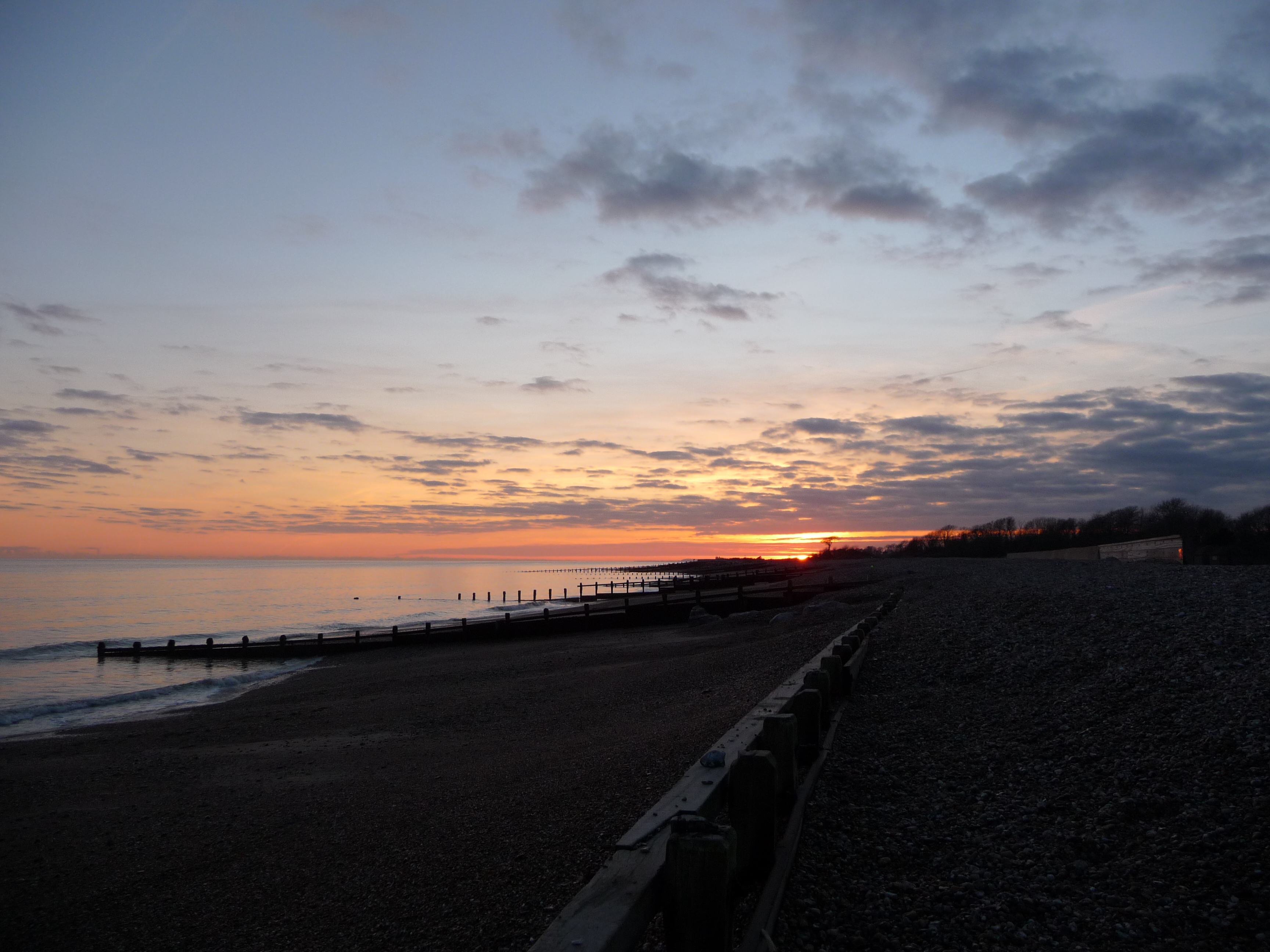
Nature enthusiasts will appreciate the estate's close proximity to the stunning Climping Beach, which is just a short walk away. The beach is known for its unspoiled beauty, with its golden sand dunes, grassy banks, and panoramic views of the coastline. It is a popular spot for picnicking, sunbathing, and beach walks.

Bailiffscourt Estate is not only a luxurious hotel and spa but also a place where history, nature, and relaxation converge, offering visitors a truly memorable experience in the heart of Sussex.

If you have any feedback on the listing, please let us know in the comments section below.

Bailiffscourt Estate, Climping Images

Images are sourced within 2km of 50.798/-0.578 or Grid Reference TQ0000. Thanks to Geograph Open Source API. All images are credited.

Climping Windmill A poor quality photo, but the mill had sails 70 years ago.
Climping Windmill
A poor quality photo, but the mill had sails 70 years ago.
Along the coast from Atherington to Elmer (39)
Me and my shadow looking across beach to shingle from edge of rock island The rock island is the fourth along travelling west to east.  All the buildings are in the next grid square to the north.
Me and my shadow looking across beach to shingle from edge of rock island
The rock island is the fourth along travelling west to east. All the buildings are in the next grid square to the north.
Looking across beach from Elmer Sea Defences The camera is at the western edge of the fifth rock island, counting from west to east.  The eastern end of the fourth island is just caught on the left of the picture.  The prominent buildings are those of Villa Plage.  All buildings are in the next grid square to the north.
Looking across beach from Elmer Sea Defences
The camera is at the western edge of the fifth rock island, counting from west to east. The eastern end of the fourth island is just caught on the left of the picture. The prominent buildings are those of Villa Plage. All buildings are in the next grid square to the north.
Elmer Sea Defences Here the camera is at the eastern edge of the fifth rock island counting from the west.  The sixth island is seen edge on.  The wooded area is in the next grid square to the north east.
Elmer Sea Defences
Here the camera is at the eastern edge of the fifth rock island counting from the west. The sixth island is seen edge on. The wooded area is in the next grid square to the north east.
Sixth rock island from the west This shot was possible due to a very low tide; there had been a solar eclipse a few hours before. This southern side of the island stretches across three grid squares.  The land on the right of the photograph is in SU9900.  The first geograph for this square was taken in 2007.  See <a title="https://www.geograph.org.uk/photo/638250" href="https://www.geograph.org.uk/photo/638250">Link</a>.
Sixth rock island from the west
This shot was possible due to a very low tide; there had been a solar eclipse a few hours before. This southern side of the island stretches across three grid squares. The land on the right of the photograph is in SU9900. The first geograph for this square was taken in 2007. See Link.
France is out there somewhere! 80 odd paces behind the camera is the sixth rock island from the west of the Elmer Sea Defences.  Low tide had been a quarter of an hour before this at 0.1 metres below Chart Datum.
France is out there somewhere!
80 odd paces behind the camera is the sixth rock island from the west of the Elmer Sea Defences. Low tide had been a quarter of an hour before this at 0.1 metres below Chart Datum.
Water draining from rock island
Grevatt's Lane The A259 is a busy route along the south coast of England. It runs 120 miles from Havant in Hampshire to Folkestone in Kent, via West and East Sussex.
<span class="nowrap"><a title="http://www.sabre-roads.org.uk/wiki/index.php?title=A259" rel="nofollow ugc noopener" href="http://www.sabre-roads.org.uk/wiki/index.php?title=A259">Link</a><img style="margin-left:2px;" alt="External link" title="External link - shift click to open in new window" src="https://s1.geograph.org.uk/img/external.png" width="10" height="10"/></span>
Grevatt's Lane
The A259 is a busy route along the south coast of England. It runs 120 miles from Havant in Hampshire to Folkestone in Kent, via West and East Sussex. LinkExternal link
A259 The A259 is a busy route along the south coast of England. It runs 120 miles from Havant in Hampshire to Folkestone in Kent, via West and East Sussex.
<span class="nowrap"><a title="http://www.sabre-roads.org.uk/wiki/index.php?title=A259" rel="nofollow ugc noopener" href="http://www.sabre-roads.org.uk/wiki/index.php?title=A259">Link</a><img style="margin-left:2px;" alt="External link" title="External link - shift click to open in new window" src="https://s1.geograph.org.uk/img/external.png" width="10" height="10"/></span>
A259
The A259 is a busy route along the south coast of England. It runs 120 miles from Havant in Hampshire to Folkestone in Kent, via West and East Sussex. LinkExternal link
A259, eastbound The A259 is a busy route along the south coast of England. It runs 120 miles from Havant in Hampshire to Folkestone in Kent, via West and East Sussex.
<span class="nowrap"><a title="http://www.sabre-roads.org.uk/wiki/index.php?title=A259" rel="nofollow ugc noopener" href="http://www.sabre-roads.org.uk/wiki/index.php?title=A259">Link</a><img style="margin-left:2px;" alt="External link" title="External link - shift click to open in new window" src="https://s1.geograph.org.uk/img/external.png" width="10" height="10"/></span>
A259, eastbound
The A259 is a busy route along the south coast of England. It runs 120 miles from Havant in Hampshire to Folkestone in Kent, via West and East Sussex. LinkExternal link
Coastal path near Climping This view is taken looking west along the path from Climping Beach (although Atherington Beach is probably a more accurate name).
Coastal path near Climping
This view is taken looking west along the path from Climping Beach (although Atherington Beach is probably a more accurate name).
Individual House, Elmer, West Sussex
Warning Submerged Outfall At Elmer, West Sussex
Warning Submerged Outfall
At Elmer, West Sussex
End of the Houses At Elmer, West Sussex
End of the Houses
At Elmer, West Sussex
Steps to the Beach, Elmer Sands, West Sussex
Another sewage outfall at Elmer Sands, West Sussex
Near the end of the B2233
Show me another place!

Bailiffscourt Estate, Climping is located at Grid Ref: TQ0000 (Lat: 50.798, Lng: -0.578)

Administrative County: West Sussex

District: Arun

Police Authority: Sussex

What 3 Words

///abode.theme.regime. Near Littlehampton, West Sussex

Related Wikis

Bailiffscourt Chapel

Bailiffscourt Chapel is a deconsecrated chapel in the grounds of Bailiffscourt Hotel, a luxury hotel near the hamlet of Atherington in West Sussex, England...

Climping Beach

Climping Beach is a 32.1-hectare (79-acre) biological Site of Special Scientific Interest west of Littlehampton in West Sussex. The eastern half is designated...

Bognor Regis and Littlehampton (UK Parliament constituency)

Bognor Regis and Littlehampton (contemp. RP [/ˈbɒɡnə ɹʷiːd͡ʒɪs ænd lɪtl̩hæmptn̩/, /-æmtn̩/]) is a constituency in West Sussex represented in the House...

Climping

Climping (also spelt as Clymping) is a village and civil parish containing agricultural and natural sandy land in the Arun District of West Sussex, England...

Nearby Amenities

Located within 500m of 50.798,-0.578
Source: PGS
Lat/Long: 50.7949946/-0.5825044
Created By: almien_coastlines
Source: PGS
Lat/Long: 50.79488/-0.581009
Created By: almien_coastlines
Source: PGS
Lat/Long: 50.795119/-0.580188
Created By: almien_coastlines
Source: PGS
Lat/Long: 50.795111/-0.579784
Created By: almien_coastlines
Source: PGS
Lat/Long: 50.795102/-0.57938
Created By: almien_coastlines
Source: PGS
Lat/Long: 50.795342/-0.578558
Created By: almien_coastlines
Source: PGS
Lat/Long: 50.795573/-0.577333
Created By: almien_coastlines
Source: PGS
Lat/Long: 50.795944/-0.576708
Created By: almien_coastlines
Source: PGS
Lat/Long: 50.796192/-0.576291
Created By: almien_coastlines
Source: PGS
Lat/Long: 50.796315/-0.576081
Created By: almien_coastlines
Source: PGS
Lat/Long: 50.796555/-0.57526
Created By: almien_coastlines
Source: PGS
Lat/Long: 50.796794/-0.574439
Source: PGS
Lat/Long: 50.796918/-0.574231
Source: PGS
Lat/Long: 50.797042/-0.574022
Source: PGS
Lat/Long: 50.797033/-0.573617
Source: PGS
Lat/Long: 50.797264/-0.572392
Source: PGS
Lat/Long: 50.797495/-0.571167
Restaurant
Bailiffscourt Restaurant
Tourism: hotel
Lat/Long: 50.7983029/-0.5801271
Post Box
Operator: Royal Mail
Operator Wikidata: Q638098
Post Box Type: wall
Ref: BN17 1427D
Royal Cypher: GR
Royal Cypher Wikidata: Q33102273
Lat/Long: 50.8024132/-0.5788918
The data included in this document is from www.openstreetmap.org. The data is made available under ODbL.

Have you been to Bailiffscourt Estate, Climping?

Leave your review of Bailiffscourt Estate, Climping below (or comments, questions and feedback).