Ashdown Park

Heritage Site in Berkshire Vale of White Horse

England

Ashdown Park

Avenue to Ashdown House
Avenue to Ashdown House Credit: Matthew Chadwick

Ashdown Park, located in Berkshire, England, is an esteemed heritage site that attracts visitors from near and far. Nestled amidst picturesque surroundings, the park covers an expansive area of lush greenery, encompassing both natural and man-made features.

The park boasts a rich history that dates back centuries. Originally a hunting ground for kings and nobles, it later transformed into a grand estate. Today, Ashdown Park is known for its stunning architecture, with the main highlight being the impressive Ashdown House. This Jacobean mansion was built in the early 17th century and showcases intricate design elements that reflect the opulence of the era.

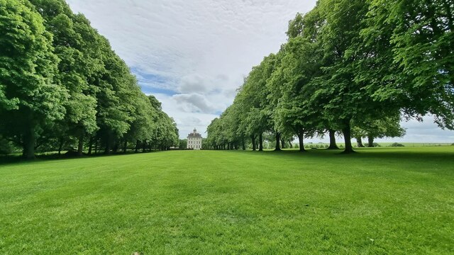
Visitors to Ashdown Park can explore the elegant gardens, which are meticulously maintained and offer a tranquil atmosphere. The gardens feature an array of vibrant flowers, well-manicured lawns, and charming pathways that wind through the estate. Additionally, there are several ponds and fountains that add to the overall beauty of the landscape.

Nature enthusiasts will appreciate the diverse wildlife that inhabits the park. Ashdown Park is home to numerous species of birds, including rare and protected ones. It also provides a habitat for various mammals, such as deer and foxes, which can be spotted roaming freely within the park.

The park offers a range of recreational activities for visitors to enjoy. From leisurely strolls to picnicking on the grounds, there is something for everyone. Guided tours of Ashdown House are available, allowing visitors to delve into the history and architectural marvels of the mansion.

Ashdown Park is a true gem in Berkshire, offering a captivating blend of natural beauty, historical significance, and recreational opportunities. It continues to be cherished as one of the region's most beloved heritage sites, attracting visitors who seek a glimpse into the past and an escape into nature.

If you have any feedback on the listing, please let us know in the comments section below.

Ashdown Park Images

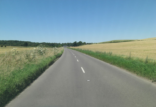
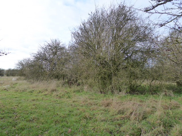
Images are sourced within 2km of 51.532/-1.588 or Grid Reference SU2881. Thanks to Geograph Open Source API. All images are credited.

Avenue to Ashdown House
Ashdown House
Ashdown House
Ashdown House A view of the north face of Ashdown House.
Ashdown House
A view of the north face of Ashdown House.
Fields West of Middle Wood A view of fields to the west of Middle Wood, part of Ashdown House's grounds in Lambourn.
Fields West of Middle Wood
A view of fields to the west of Middle Wood, part of Ashdown House's grounds in Lambourn.
Ashdown House, Lambourn Ashdown House is a 17th century hunting lodge now owned by the National Trust. It is set in beautiful parkland and is well worth a visit. For a closer view see <a title="https://www.geograph.org.uk/photo/1875004" href="https://www.geograph.org.uk/photo/1875004">Link</a>
Ashdown House, Lambourn
Ashdown House is a 17th century hunting lodge now owned by the National Trust. It is set in beautiful parkland and is well worth a visit. For a closer view see Link
Sarsen Stones in the Afternoon A late light shot of some of the Sarsen stones, or Grey Wethers as they're sometimes called, near Ashdown House on the Berkshire Downs.
Sarsens are the broken up remnants of a post glacial era silica sandstone layer which formed above the chalk. More info on Sarsen on <span class="nowrap"><a title="http://en.wikipedia.org/wiki/Sarsen" rel="nofollow ugc noopener" href="http://en.wikipedia.org/wiki/Sarsen">Link</a><img style="margin-left:2px;" alt="External link" title="External link - shift click to open in new window" src="https://s1.geograph.org.uk/img/external.png" width="10" height="10"/></span>
The undulation in the field surface is marked on the map as Park Pale in antique script, so is presumably of ancient origin. It looks to be part of a roughly square enclosure around what is now Upper Wood.
Scanned from a print.
Sarsen Stones in the Afternoon
A late light shot of some of the Sarsen stones, or Grey Wethers as they're sometimes called, near Ashdown House on the Berkshire Downs. Sarsens are the broken up remnants of a post glacial era silica sandstone layer which formed above the chalk. More info on Sarsen on LinkExternal link The undulation in the field surface is marked on the map as Park Pale in antique script, so is presumably of ancient origin. It looks to be part of a roughly square enclosure around what is now Upper Wood. Scanned from a print.
Farmland, Ashbury A field of stubble rising to Idstone Down. This is just inside the former county of Berkshire, now part of Oxfordshire. The boundary with Wiltshire is to the left of picture.
Farmland, Ashbury
A field of stubble rising to Idstone Down. This is just inside the former county of Berkshire, now part of Oxfordshire. The boundary with Wiltshire is to the left of picture.
The driveway to Park Farm, Upper Lambourn A more imposing entrance and drive than that for your average farm!
The driveway to Park Farm, Upper Lambourn
A more imposing entrance and drive than that for your average farm!
Paddocks at Ashdown Farm About 400 metres south of Ashdown House which, at the time of my visit to the area, was undergoing major roof repairs and was swathed in plastic sheeting.
Paddocks at Ashdown Farm
About 400 metres south of Ashdown House which, at the time of my visit to the area, was undergoing major roof repairs and was swathed in plastic sheeting.
B4000 north of Fognam Farm Ahead is a crossroads but it doesn't appear so to the motorist on the 'B' road. Straight on is a byway open to all traffic and perpendicularly a private road to Park Farm.
B4000 north of Fognam Farm
Ahead is a crossroads but it doesn't appear so to the motorist on the 'B' road. Straight on is a byway open to all traffic and perpendicularly a private road to Park Farm.
B4000 climbs Fognam Down
B4000 crosses the border The border between Berkshire (behind) and Oxfordshire is delineated by a bridleway which can be seen to the right of shot. This part of the downs is called Lambourn Corner and sees the conjunction of road, bridleway and by-way.
B4000 crosses the border
The border between Berkshire (behind) and Oxfordshire is delineated by a bridleway which can be seen to the right of shot. This part of the downs is called Lambourn Corner and sees the conjunction of road, bridleway and by-way.
B4000 passes pumping station What type of pumping station LPG, sewage? BP McKeefry has a fleet of 200 lorries transporting bulk and the one in the picture looks like a liquid waste carrier. So slurry might be the load??
B4000 passes pumping station
What type of pumping station LPG, sewage? BP McKeefry has a fleet of 200 lorries transporting bulk and the one in the picture looks like a liquid waste carrier. So slurry might be the load??
B4000 skirts Weathercock Hill The road is some 50 metres below the 219 m. summit of the hill, which is on the right, and this bend loops around its shoulder.
B4000 skirts Weathercock Hill
The road is some 50 metres below the 219 m. summit of the hill, which is on the right, and this bend loops around its shoulder.
B4000 passes entrance to Ashdown House
Kingstone Down from the B4000 The down ascends to 227 metres at Crowberry Tump out of the picture but we can see the wood clinging to the side of the hill. In Southern England this is often called a hanger.
Kingstone Down from the B4000
The down ascends to 227 metres at Crowberry Tump out of the picture but we can see the wood clinging to the side of the hill. In Southern England this is often called a hanger.
B4000 east of Hailey Wood
Sarsens Beside The Road A field full of Sarsen stones, or Grey Wethers as they're sometimes called, near Ashdown House on the Berkshire Downs.
Sarsens are the broken up remnants of a post glacial era silica sandstone layer which formed above the chalk. <span class="nowrap"><a title="http://en.wikipedia.org/wiki/Sarsen" rel="nofollow ugc noopener" href="http://en.wikipedia.org/wiki/Sarsen">Link</a><img style="margin-left:2px;" alt="External link" title="External link - shift click to open in new window" src="https://s1.geograph.org.uk/img/external.png" width="10" height="10"/></span>
Sarsens Beside The Road
A field full of Sarsen stones, or Grey Wethers as they're sometimes called, near Ashdown House on the Berkshire Downs. Sarsens are the broken up remnants of a post glacial era silica sandstone layer which formed above the chalk. LinkExternal link
Show me another place!

Ashdown Park is located at Grid Ref: SU2881 (Lat: 51.532, Lng: -1.588)

Administrative County: Oxfordshire

District: Vale of White Horse

Police Authority: Thames Valley

What 3 Words

///tips.robes.junction. Near Bishopstone, Wiltshire

Related Wikis

Ashdown Park

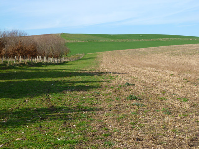
Ashdown Park is a 9.3-hectare (23-acre) biological Site of Special Scientific Interest (SSSI) south of Ashbury in Oxfordshire. The SSSI is part of the...

Ashdown House, Oxfordshire

Ashdown House (also known as Ashdown Park) is a 17th-century country house in the civil parish of Ashbury in the English county of Oxfordshire. Until 1974...

Alfred's Castle

Alfred's Castle is a small Iron Age hill fort, situated at grid reference SU277822, behind Ashdown Park in the civil parish of Ashbury in Oxfordshire...

Park Farm Down

Park Farm Down or Parkfarm Down is a 3.3-hectare (8.2-acre) biological Site of Special Scientific Interest north-west of Lambourn in Berkshire. It is in...

Nearby Amenities

Located within 500m of 51.532,-1.588
Barrier: stile
Source: GPS
Lat/Long: 51.5347692/-1.5897547
Post Box
Collection Times: Mo-Fr 16:30; Sa 08:15
Post Box Type: wall
Ref: RG17 220
Royal Cypher: GR
Royal Cypher Wikidata: Q33102273
Lat/Long: 51.5332417/-1.5941183
The data included in this document is from www.openstreetmap.org. The data is made available under ODbL.

Have you been to Ashdown Park?

Leave your review of Ashdown Park below (or comments, questions and feedback).