Annait

Heritage Site in Inverness-shire

Scotland

Annait

Traffic along the B886 Taken near the Bay junction. View over Loch Bay with Sgurr a' Bhagh rising to the left, the isles of Isay, Mingay and Clett and the peninsula of Ard Mor in the distance. Behind the latter, the mountains of Harris rise at the horizon.
Traffic along the B886 Credit: Hilmar Ilgenfritz

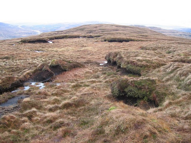
Annait, located in Inverness-shire, Scotland, is a heritage site that holds significant historical and cultural importance. The site is known for its well-preserved ancient ruins dating back to the 12th century, including a medieval church and graveyard.

Annait is believed to have been a key religious center in the region, with the church serving as a place of worship and community gathering. The site offers visitors a glimpse into the past, with its stone walls, arches, and intricate carvings showcasing the craftsmanship of the time.

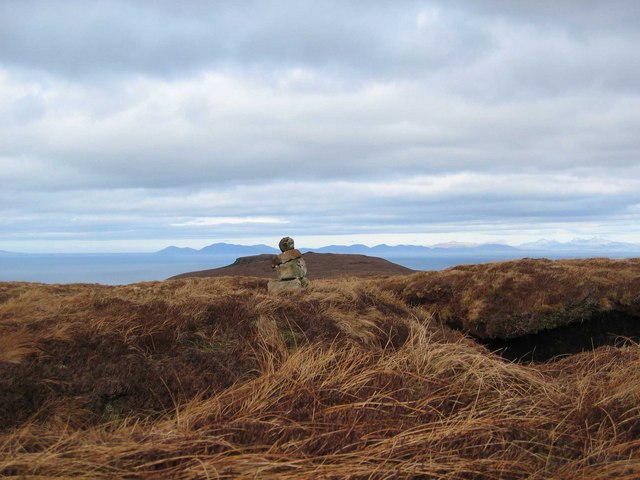
In addition to its historical significance, Annait is surrounded by stunning natural beauty, with views of the Scottish Highlands and nearby Loch Ness. Visitors can explore the site on foot, taking in the peaceful atmosphere and learning about the history of the area through interpretive displays and guided tours.

Overall, Annait in Inverness-shire is a must-visit destination for history buffs, nature enthusiasts, and anyone looking to experience the rich heritage of Scotland.

If you have any feedback on the listing, please let us know in the comments section below.
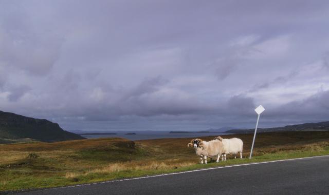
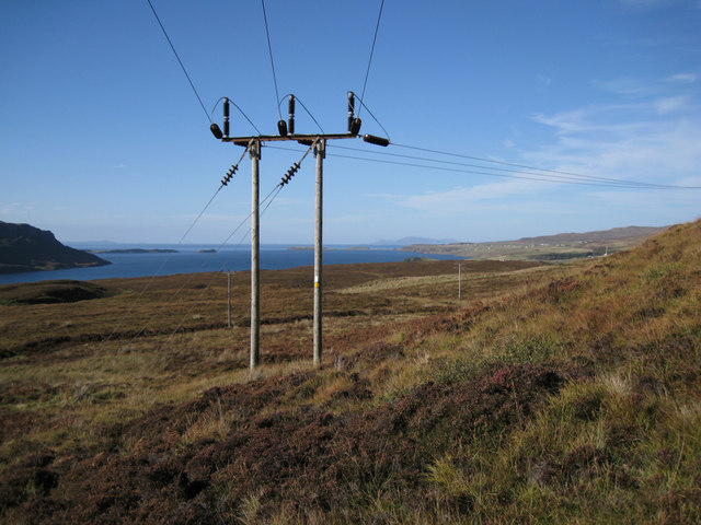
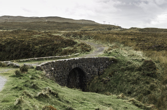
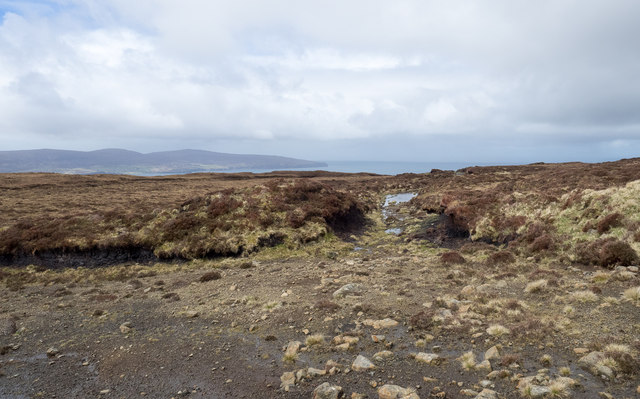
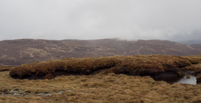
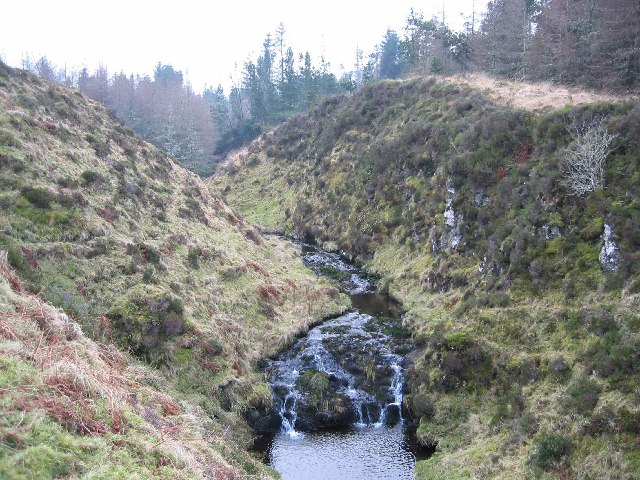
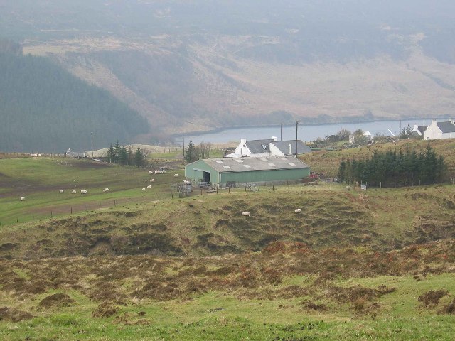
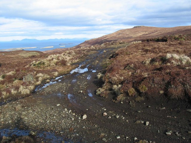
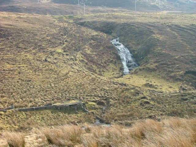
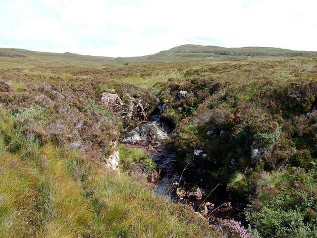
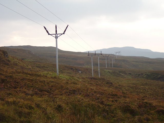
Annait Images

Images are sourced within 2km of 57.48/-6.563 or Grid Reference NG2652. Thanks to Geograph Open Source API. All images are credited.

Traffic along the B886 Taken near the Bay junction. View over Loch Bay with Sgurr a' Bhagh rising to the left, the isles of Isay, Mingay and Clett and the peninsula of Ard Mor in the distance. Behind the latter, the mountains of Harris rise at the horizon.
Traffic along the B886
Taken near the Bay junction. View over Loch Bay with Sgurr a' Bhagh rising to the left, the isles of Isay, Mingay and Clett and the peninsula of Ard Mor in the distance. Behind the latter, the mountains of Harris rise at the horizon.
Power line in Waternish Overhead electricity cables are carried on wooden poles throughout most of Skye. This line continues to Trumpan, at the tip of the Waternish Peninsula where it then goes under the sea to emerge in the Outer Hebrides.
Power line in Waternish
Overhead electricity cables are carried on wooden poles throughout most of Skye. This line continues to Trumpan, at the tip of the Waternish Peninsula where it then goes under the sea to emerge in the Outer Hebrides.
Rocks by the B886 The B886 runs past Loch Bay with a lot of wild scenery to be enjoyed
Rocks by the B886
The B886 runs past Loch Bay with a lot of wild scenery to be enjoyed
Fairy Bridge
Fairy Bridge
Scarred area of estate road on slope of Beinn Bhreac An estate road climbs from Claigan to the area named as Creag-a' Ghuail, on the west side of Beinn Bhreac. It begins as a decent hill road but high on the slope it deteriorates significantly.
Scarred area of estate road on slope of Beinn Bhreac
An estate road climbs from Claigan to the area named as Creag-a' Ghuail, on the west side of Beinn Bhreac. It begins as a decent hill road but high on the slope it deteriorates significantly.
Peat bank near to summit of Beinn Bhreac The peat bank lies just to the south of Beinn Bhreac's summit. Beinn Chreagach lies in the distance to the west, partly misted.
Peat bank near to summit of Beinn Bhreac
The peat bank lies just to the south of Beinn Bhreac's summit. Beinn Chreagach lies in the distance to the west, partly misted.
Boundaries over summit ridge of Beinn Bhreac Boundaries across land generally come in the form of walls, fences and hedges. OS mapping shows a number of lines across the summit ridge of Beinn Bhreac which might be expected to be fences or dry stone walls but these are not. The dark line seen in the centre of the image running away towards the obvious hill top is in fact a turfed rib, presumably with peats lain over a low boulder line - the dark horizontal band at the left side is certainly of that nature. The demarcation is surely to mark a boundary line.
Boundaries over summit ridge of Beinn Bhreac
Boundaries across land generally come in the form of walls, fences and hedges. OS mapping shows a number of lines across the summit ridge of Beinn Bhreac which might be expected to be fences or dry stone walls but these are not. The dark line seen in the centre of the image running away towards the obvious hill top is in fact a turfed rib, presumably with peats lain over a low boulder line - the dark horizontal band at the left side is certainly of that nature. The demarcation is surely to mark a boundary line.
Annait Interesting place, Annait. It is marked 'Annait' on the OS map but I have seen it spelt 'anait' elsewhere. Possibly it should be 'the Annait' or 'an anait', I'm not sure.
It is also difficult to give a decent impression of what it looks like in a photograph. You need to stand on it and look all around to really appreciate it. It is a pointed piece of ground between two small rivers, immediately above their confluence. Each of the rivers flows in a gorge. The photograph here shows the gorge on the left as you look downstream. A quite excellent defensive position. It is not that easy to reach even when nobody is defending it!
There are signs of ruined walls on the top, including one heavy wall that would have once barred access to the point other than by a single entranceway.
What was its purpose? How old is it? Who knows? I have come across some contradictory theories.
The one I tend to believe is that Annat sites, of which there are several in the north west of Scotland, appear to be pre-Christian and apparently relate to the worship of Anaitis, the Mother Goddess of the ancient East. In the old Hebrew-Phoenician pantheon, Anaitis or Anath was the sister of the sun god Baal or Bel who was also worshipped in Scotland and Ireland, by the lighting of Beltane fires. Anaitis, from whence, in all probability, is derived the gaelic term annat, was a pre-Christian female deity or goddess who was worshipped not only in Egypt but also in Palestine and Asia Minor.
Alexander Forbes (Place-Names of Skye -1923) comments: "Many of the ‘Annats’ are claimed—and it is believed correctly—as pre-Christian.
Annait
Interesting place, Annait. It is marked 'Annait' on the OS map but I have seen it spelt 'anait' elsewhere. Possibly it should be 'the Annait' or 'an anait', I'm not sure. It is also difficult to give a decent impression of what it looks like in a photograph. You need to stand on it and look all around to really appreciate it. It is a pointed piece of ground between two small rivers, immediately above their confluence. Each of the rivers flows in a gorge. The photograph here shows the gorge on the left as you look downstream. A quite excellent defensive position. It is not that easy to reach even when nobody is defending it! There are signs of ruined walls on the top, including one heavy wall that would have once barred access to the point other than by a single entranceway. What was its purpose? How old is it? Who knows? I have come across some contradictory theories. The one I tend to believe is that Annat sites, of which there are several in the north west of Scotland, appear to be pre-Christian and apparently relate to the worship of Anaitis, the Mother Goddess of the ancient East. In the old Hebrew-Phoenician pantheon, Anaitis or Anath was the sister of the sun god Baal or Bel who was also worshipped in Scotland and Ireland, by the lighting of Beltane fires. Anaitis, from whence, in all probability, is derived the gaelic term annat, was a pre-Christian female deity or goddess who was worshipped not only in Egypt but also in Palestine and Asia Minor. Alexander Forbes (Place-Names of Skye -1923) comments: "Many of the ‘Annats’ are claimed—and it is believed correctly—as pre-Christian.
Bay Barn at the top of Bay village.
Bay
Barn at the top of Bay village.
Track on Creag a' Ghuail Looking north, with the Outer Hebrides on the horizon.
Track on Creag a' Ghuail
Looking north, with the Outer Hebrides on the horizon.
Beinn Bhreac Deep peat at the south west end of the very long summit ridge.
Beinn Bhreac
Deep peat at the south west end of the very long summit ridge.
Beinn Bhreac - The Marilyn Summit About a mile south of the trigpoint (just visible), this small cairn marks the true summit of the hill.
Beinn Bhreac - The Marilyn Summit
About a mile south of the trigpoint (just visible), this small cairn marks the true summit of the hill.
Croft in the Settlement of Bay With Sgùrr a' Bhàigh beyond.
Croft in the Settlement of Bay
With Sgùrr a' Bhàigh beyond.
Croft on the road to Bay Looking towards the slopes of Sgùrr a' Bhàigh.
Croft on the road to Bay
Looking towards the slopes of Sgùrr a' Bhàigh.
Waterfall Flowing into the Allt Bò-lòin. Near the settlement of Bay.
Waterfall
Flowing into the Allt Bò-lòin. Near the settlement of Bay.
Allt nam Maighdean A tributary of the Bay River. The summit on the horizon is Beinn na Boineide <a href="https://www.geograph.org.uk/gridref/NG2952">NG2952</a>.
Allt nam Maighdean
A tributary of the Bay River. The summit on the horizon is Beinn na Boineide NG2952.
Bay River Downstream of the Fairy Bridge.
Bay River
Downstream of the Fairy Bridge.
Power lines The link to the Western Isles, carried across much of Skye on wooden poles.
Power lines
The link to the Western Isles, carried across much of Skye on wooden poles.
Show me another place!

Annait is located at Grid Ref: NG2652 (Lat: 57.48, Lng: -6.563)

What 3 Words

///socket.coasters.bundles. Near Dunvegan, Highland

Nearby Locations

Annait

Related Wikis

Claigan

Claigan (Scottish Gaelic: An Claigeann) is a small coastal settlement on the north east shore of the sea loch, Loch Dunvegan, on the Waternish peninsula...

Stein, Skye

Stein (Scottish Gaelic: Steinn) is a crofting township, situated on the north eastern shore of Loch Bay, in the west of the Waternish peninsula, on the...

Dunvegan Castle

Dunvegan Castle (Caisteal Dhùn Bheagain) is located 1 mile (1.6 km) to the north of Dunvegan on the Isle of Skye, off the west coast of Scotland. It is...

Dun Fiadhairt

Dun Fiadhairt is an Iron Age broch located on the north coast of the island of Skye, in Scotland (grid reference NG23115042). == Location == Dun Fiadhairt...

Related Videos

Waternish

Our small but perfectly formed corner of the world. To discover, rediscover or add to your bucket list #visitwaternish.

The Lookout Skye.

A great morning to wake to this view ! Luxury Holiday Let For 2 wwwthelookoutskye.co.uk.

Have you been to Annait?

Leave your review of Annait below (or comments, questions and feedback).