Ankerwycke

Heritage Site in Buckinghamshire

England

Ankerwycke

The Beehive Pub sign: Fuller's pub on Middle Hill
The Beehive Credit: John Myers

Ankerwycke is a historical site located in Buckinghamshire, England. Nestled along the banks of the River Thames, it holds significant cultural and historical importance. The site is renowned for its lush green meadows, ancient trees, and the remnants of a medieval priory.

At the heart of Ankerwycke is the Ankerwycke Yew, a majestic tree estimated to be over 2,500 years old. This ancient yew is believed to have been witness to several historic events, including the signing of the Magna Carta in 1215. Surrounding the yew, visitors can explore the remains of the Ankerwycke Priory, a former religious house founded in the 12th century.

The site offers a peaceful and picturesque setting, perfect for leisurely walks and picnics. Visitors can stroll along the riverbank, admiring the scenic beauty and observing the diverse wildlife. The area is home to a variety of bird species, making it a popular spot for birdwatchers.

Ankerwycke is also a site of historical intrigue, with connections to notable figures such as Henry VIII and Anne Boleyn. It is believed that the couple met and courted in the shadow of the Ankerwycke Yew, adding a touch of romantic allure to the site.

For those interested in history and nature, Ankerwycke provides a captivating experience. Its rich heritage and natural beauty make it a must-visit destination for both locals and tourists alike.

If you have any feedback on the listing, please let us know in the comments section below.
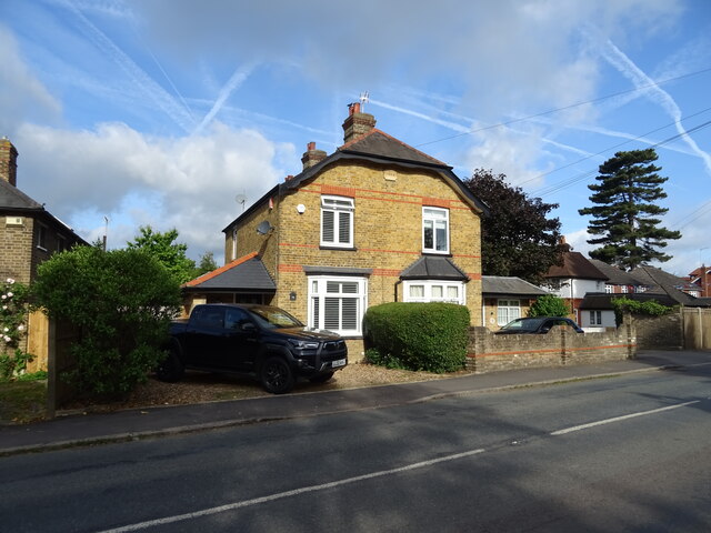
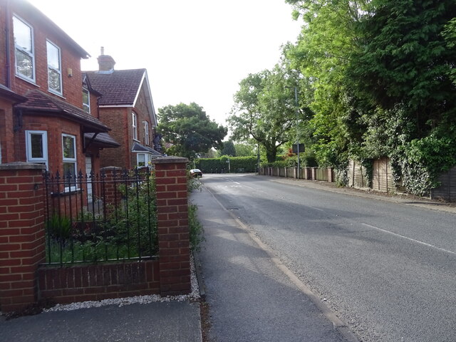
Ankerwycke Images

Images are sourced within 2km of 51.446/-0.555 or Grid Reference TQ0072. Thanks to Geograph Open Source API. All images are credited.

The Beehive Pub sign: Fuller's pub on Middle Hill
The Beehive
Pub sign: Fuller's pub on Middle Hill
Egham station This shows the up-side frontage as rebuilt in 1985.
Egham station
This shows the up-side frontage as rebuilt in 1985.
St John the Baptist, Egham - south elevation
St John the Baptist, Egham - north elevation
High Street, Egham This is the north side looking east.
High Street, Egham
This is the north side looking east.
Ongoing construction work, Egham This was taken where Church Road (running left-right) is met by Station Road (foreground).
Ongoing construction work, Egham
This was taken where Church Road (running left-right) is met by Station Road (foreground).
Reeds Service Station On Welley Road.
Reeds Service Station
On Welley Road.
The George Inn, Wraysbury On Windsor Road.
See <a href="https://www.geograph.org.uk/photo/7297906">TQ0074 : Sign for the George Inn, Wraysbury</a> for sign.
The George Inn, Wraysbury
On Windsor Road. See TQ0074 : Sign for the George Inn, Wraysbury for sign.
Sign for the George Inn, Wraysbury See <a href="https://www.geograph.org.uk/photo/7297905">TQ0074 : The George Inn, Wraysbury</a> for public house.
Sign for the George Inn, Wraysbury
See TQ0074 : The George Inn, Wraysbury for public house.
House on Windsor Road, Wraysbury
House on Staines Road, Wraysbury
Bus stop on Staines Road (B376), Wraysbury
Staines Road (B376)
Staines Road (B376)
Road to sailing club Off Staines Road (B376).
Road to sailing club
Off Staines Road (B376).
Houses on Staines Road (B376)
B376 towards Staines
Spice Village Indian Restaurant & Bar, Hythe End
Sign for the Spice Village Indian Restaurant & Bar, Hythe End
Show me another place!

Ankerwycke is located at Grid Ref: TQ0072 (Lat: 51.446, Lng: -0.555)

What 3 Words

///bands.stuck.smiles. Near Egham, Surrey

Nearby Locations

Ankerwycke Langham's Pond

Related Wikis

Ankerwycke Yew

The Ankerwycke Yew is an ancient yew tree close to the ruins of St Mary's Priory, the site of a Benedictine nunnery built in the 12th century, near Wraysbury...

Ankerwycke Priory

Ankerwycke Priory was a priory of Benedictine nuns in Buckinghamshire, England. It was established around 1160 and dissolved in 1536. Excavations were...

Magna Carta Island

Magna Carta Island is an ait in the River Thames in England, on the reach above Bell Weir Lock. It is in Berkshire facing water-meadows forming Runnymede...

Wraysbury Skiff and Punting Club

Wraysbury Skiff and Punting Club (WSPC) is an English skiff and punting club founded in 1931 based on the River Thames at the start of the Surrey section...

The Island, Hythe End

The Island is an inhabited island in the River Thames in England on the reach above Bell Weir Lock, a part of the Hythe End part of Wraysbury village...

Runnymede

Runnymede is a water-meadow alongside the River Thames in the English county of Surrey, and just over 20 miles (32 km) west of central London. It is notable...
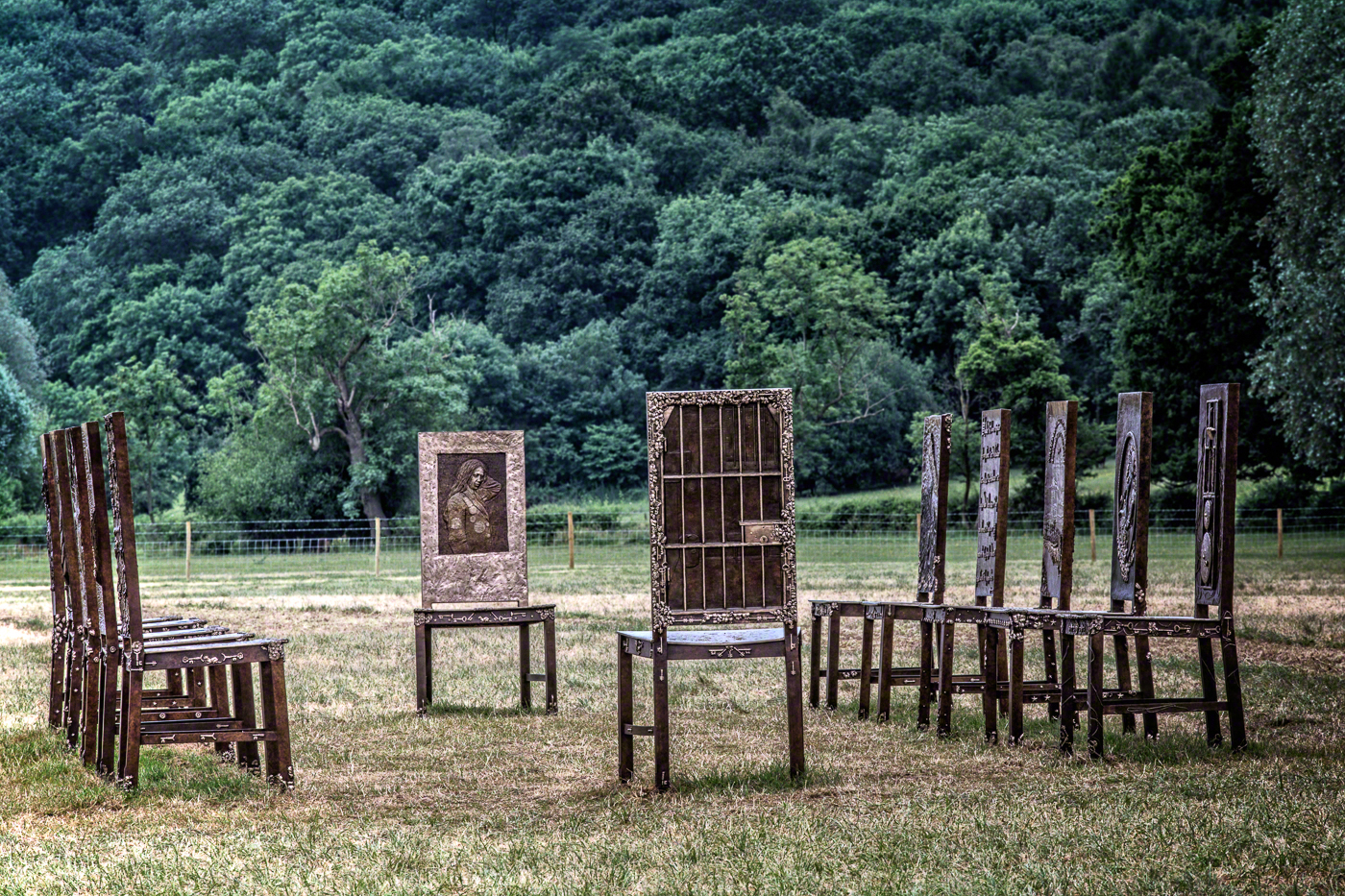
The Jurors

The Jurors is an artwork by Hew Locke, installed at Runnymede in Surrey in 2015 to commemorate the 800th anniversary of the sealing of Magna Carta. Commissioned...

Pats Croft Eyot

Pats Croft Eyot is a small island in the River Thames in England on the reach above Bell Weir Lock, near Wraysbury, Berkshire and Runnymede, Surrey. The...

Nearby Amenities

Located within 500m of 51.446,-0.555
Created By: Merkaartor 0.13
Lat/Long: 51.4442529/-0.561375
Created By: Merkaartor 0.13
Lat/Long: 51.4432084/-0.5509042
Bus Stop
Vicarage Lane
Bus: yes
Naptan AtcoCode: 036006001208
Naptan Bearing: NW
Naptan BusStopType: CUS
Naptan CommonName: Vicarage Lane
Naptan Indicator: Opp Vicarage Lane
Naptan Landmark: Opp Jn Vicarage Lane
Naptan NaptanCode: winadgm
Naptan Street: Staines Road
Naptan Verified: no
Public Transport: platform
Source: naptan_import
Lat/Long: 51.4503468/-0.5542273
Bus Stop
Vicarage Lane
Bus: yes
Naptan AtcoCode: 036006467468
Naptan Bearing: SE
Naptan CommonName: Vicarage Lane
Naptan Indicator: Opp jct Vicarage Lane
Naptan Landmark: Vicarage Lane
Naptan NaptanCode: windpmj
Naptan Street: Staines Road
Naptan Verified: no
Public Transport: platform
Source: naptan_import
Lat/Long: 51.4503896/-0.5540662
Kerb: no
Lat/Long: 51.4436094/-0.5599779
Barrier: kissing_gate
Lat/Long: 51.448865/-0.5548911
Ankerwycke Farm
Place: farm
Lat/Long: 51.4484134/-0.5546995
Longfield Farm
Place: farm
Lat/Long: 51.4462554/-0.5481762
Vicarage Farm
Historic Place: farm
Lat/Long: 51.4496875/-0.5554607
Arkenwycke
Addr Street: Magna Carta Lane
Information: board
Tourism: information
Lat/Long: 51.4488567/-0.5546119
Bench
Backrest: yes
Source: GPS survey
Lat/Long: 51.4421819/-0.5528274
Bench
Source: GPS survey
Lat/Long: 51.4430822/-0.551784
Bench
Source: GPS survey
Lat/Long: 51.4431407/-0.5516432
Bench
Source: GPS survey
Lat/Long: 51.4431766/-0.5515413
Bench
Source: GPS survey
Lat/Long: 51.4432025/-0.5514032
Bench
Source: GPS survey
Lat/Long: 51.4432151/-0.5512422
Bench
Source: GPS survey
Lat/Long: 51.4432142/-0.5510961
Bench
Source: GPS survey
Lat/Long: 51.4431975/-0.5509458
Bench
Source: GPS survey
Lat/Long: 51.4431816/-0.5508144
Bench
Source: GPS survey
Lat/Long: 51.4428891/-0.5502069
Ferry: yes
Operator: French Brothers Ltd
Public Transport: stop_position
Lat/Long: 51.4416801/-0.5533713
Bench
Backrest: yes
Material: concrete
Seats: 5
Lat/Long: 51.4417044/-0.5533029
Bench
Backrest: yes
Material: concrete
Seats: 5
Lat/Long: 51.4417099/-0.5531042
Direction: 200
Generator Method: photovoltaic
Generator Output Electricity: yes
Generator Solar Modules: 32
Generator Source: solar
Generator Type: solar_photovoltaic_panel
Location: ground
Power: generator
Lat/Long: 51.447078/-0.5516931
Direction: 150
Generator Method: photovoltaic
Generator Output Electricity: yes
Generator Solar Modules: 12
Generator Source: solar
Generator Type: solar_photovoltaic_panel
Location: roof
Power: generator
Lat/Long: 51.4502196/-0.5548596
Bench
Lat/Long: 51.4462217/-0.5573174
Bench
Lat/Long: 51.4466965/-0.5571699
Ice Cream
Check Date: 2022-09-25
Diet Vegan: yes
Lat/Long: 51.442948/-0.5505515
The data included in this document is from www.openstreetmap.org. The data is made available under ODbL.

Have you been to Ankerwycke?

Leave your review of Ankerwycke below (or comments, questions and feedback).