Zeals Row

Settlement in Wiltshire

England

Zeals Row

Road junction near Stourhead The car is moving south along Bells Lane, which passes the access road to Stourhead 1 km north. Deep in the hedge opposite is a benchmark <a href="https://www.geograph.org.uk/photo/6935231">ST7733 : A hard fought-for benchmark</a>.
Road junction near Stourhead Credit: Neville Goodman

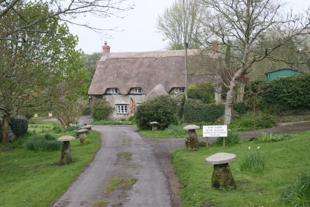
Zeals Row is a small village located in the county of Wiltshire, England. Situated in the southwestern part of the country, this rural settlement is known for its idyllic countryside, charming cottages, and rich historical heritage.

The village is nestled within the scenic Blackmore Vale, surrounded by rolling hills and lush green fields. With a population of around 500 residents, Zeals Row offers a tranquil and close-knit community atmosphere. The architecture of the village is characterized by traditional stone buildings and thatched-roof cottages, giving it a quintessentially English countryside feel.

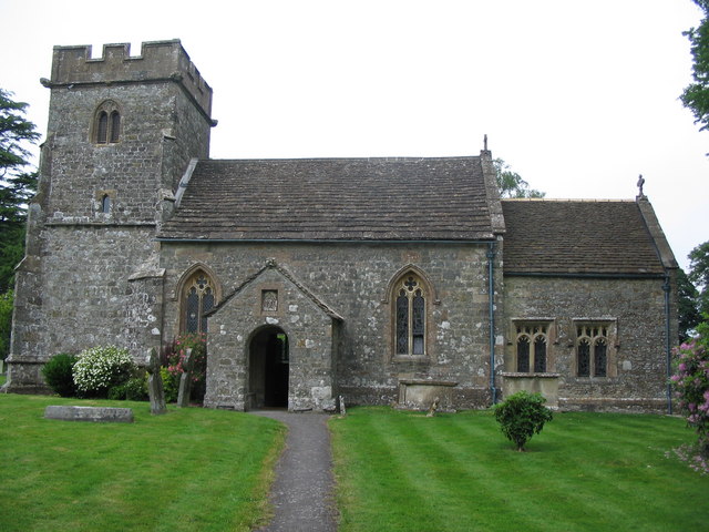
Zeals Row has a long history, with evidence of human settlement dating back to the Iron Age. The village is home to several historical landmarks, including the Grade II listed St. Martin's Church, which dates back to the 13th century. This beautiful church features a striking tower and stained glass windows.

Despite its rural setting, Zeals Row benefits from good transport links. The nearby town of Gillingham, just a few miles away, provides access to amenities such as shops, schools, and medical facilities. The village also benefits from a strong sense of community, with regular events and activities organized by local residents.

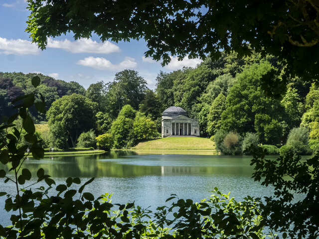
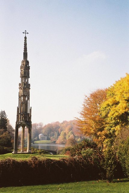
Surrounded by the natural beauty of the Wiltshire countryside, Zeals Row offers a peaceful and picturesque setting for those seeking a quieter way of life. Whether it's exploring the historic sites, taking leisurely walks in the rolling hills, or simply enjoying the tranquility of village life, Zeals Row has something to offer for everyone.

If you have any feedback on the listing, please let us know in the comments section below.
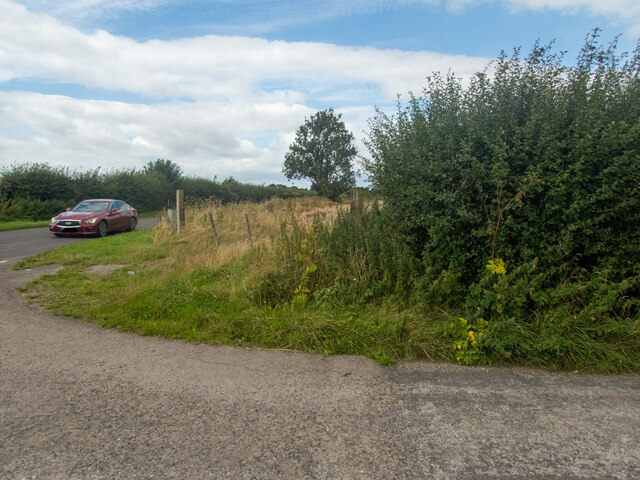
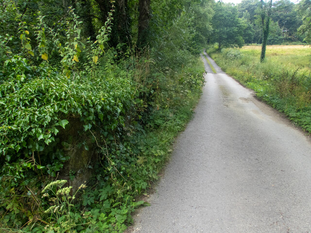
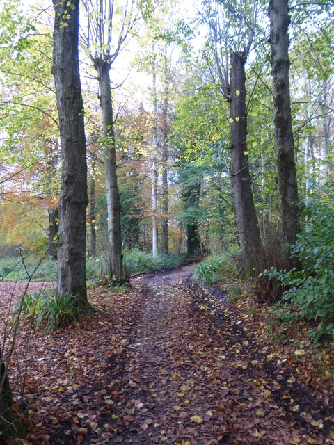
Zeals Row Images

Images are sourced within 2km of 51.08688/-2.3250331 or Grid Reference ST7732. Thanks to Geograph Open Source API. All images are credited.

Road junction near Stourhead The car is moving south along Bells Lane, which passes the access road to Stourhead 1 km north. Deep in the hedge opposite is a benchmark <a href="https://www.geograph.org.uk/photo/6935231">ST7733 : A hard fought-for benchmark</a>.
Road junction near Stourhead
The car is moving south along Bells Lane, which passes the access road to Stourhead 1 km north. Deep in the hedge opposite is a benchmark ST7733 : A hard fought-for benchmark.
A hard fought-for benchmark This benchmark (OS description: NBM CONCRETE P FENCE JUNC N SIDE CRAB LANE, see <a href="https://www.geograph.org.uk/photo/6935227">ST7733 : Road junction near Stourhead</a>) took some finding. Once the nettles had been beaten out of the way, I was able to take the photograph.
A hard fought-for benchmark
This benchmark (OS description: NBM CONCRETE P FENCE JUNC N SIDE CRAB LANE, see ST7733 : Road junction near Stourhead) took some finding. Once the nettles had been beaten out of the way, I was able to take the photograph.
A lane into the estate The view is along Top Lane, which is in the Stourhead estate. There is a benchmark on the left which took some effort to free from the undergrowth. The wall mentioned in the OS description (see <a href="https://www.geograph.org.uk/photo/6935237">ST7633 : Benchmark freed from nettles and ivy</a>) is actually the lower parapet over the stream connecting the various ornamental lakes – the headwaters of the River Stour.
A lane into the estate
The view is along Top Lane, which is in the Stourhead estate. There is a benchmark on the left which took some effort to free from the undergrowth. The wall mentioned in the OS description (see ST7633 : Benchmark freed from nettles and ivy) is actually the lower parapet over the stream connecting the various ornamental lakes – the headwaters of the River Stour.
Benchmark freed from nettles and ivy Once the ivy, nettles, brambles, moss and various other bits and pieces had been scraped aside <a href="https://www.geograph.org.uk/photo/6935234">ST7633 : A lane into the estate</a>, the benchmark (NBM WALL SW SIDE TOP LANE NE FACE E ANG) was revealed as remarkably undamaged.
Benchmark freed from nettles and ivy
Once the ivy, nettles, brambles, moss and various other bits and pieces had been scraped aside ST7633 : A lane into the estate, the benchmark (NBM WALL SW SIDE TOP LANE NE FACE E ANG) was revealed as remarkably undamaged.
Path through the woods west of Iron Bridge
The Palladian Bridge Inspired by the work of 16th-century architect Palladio, this five-arched stone bridge was built in 1762. Although ornamental, the bridge was intended to look practical. It was designed to create the illusion that a river flows through the village and under the bridge.
The Palladian Bridge
Inspired by the work of 16th-century architect Palladio, this five-arched stone bridge was built in 1762. Although ornamental, the bridge was intended to look practical. It was designed to create the illusion that a river flows through the village and under the bridge.
St. Peter's Church Stourhead The medieval church of St Peter stands immediately outside Stourhead Gardens.
St. Peter's Church Stourhead
The medieval church of St Peter stands immediately outside Stourhead Gardens.
The Temple of Apollo This circular temple was built in 1765, by the architect Henry Flitcroft, to outdo William Chamber's earlier Temple of the Sun at Kew. It is dedicated to Apollo.
The Temple of Apollo
This circular temple was built in 1765, by the architect Henry Flitcroft, to outdo William Chamber's earlier Temple of the Sun at Kew. It is dedicated to Apollo.
Entrance to the Temple of Apollo The table just inside was set up for a Wedding.
Entrance to the Temple of Apollo
The table just inside was set up for a Wedding.
Detail inside the Temple of Apollo Apollo was a Sun god.
Detail inside the Temple of Apollo
Apollo was a Sun god.
The Pantheon
The Pantheon
The Palladian Bridge One of the many Stourhead Garden picturesque follies
The Palladian Bridge
One of the many Stourhead Garden picturesque follies
Garden Lake, Stourhead Similar views are at <a title="https://www.geograph.org.uk/search.php?i=158226279" href="https://www.geograph.org.uk/search.php?i=158226279">Link</a> . The gardens are described at <span class="nowrap"><a title="https://historicengland.org.uk/listing/the-list/list-entry/1000471?section=official-list-entry" rel="nofollow ugc noopener" href="https://historicengland.org.uk/listing/the-list/list-entry/1000471?section=official-list-entry">Link</a><img style="margin-left:2px;" alt="External link" title="External link - shift click to open in new window" src="https://s1.geograph.org.uk/img/external.png" width="10" height="10"/></span> , the stone bridge at <span class="nowrap"><a title="https://historicengland.org.uk/listing/the-list/list-entry/1131099?section=official-list-entry" rel="nofollow ugc noopener" href="https://historicengland.org.uk/listing/the-list/list-entry/1131099?section=official-list-entry">Link</a><img style="margin-left:2px;" alt="External link" title="External link - shift click to open in new window" src="https://s1.geograph.org.uk/img/external.png" width="10" height="10"/></span> and the Pantheon (by Flitcroft) across the lake at <span class="nowrap"><a title="https://historicengland.org.uk/listing/the-list/list-entry/1131102?section=official-list-entry" rel="nofollow ugc noopener" href="https://historicengland.org.uk/listing/the-list/list-entry/1131102?section=official-list-entry">Link</a><img style="margin-left:2px;" alt="External link" title="External link - shift click to open in new window" src="https://s1.geograph.org.uk/img/external.png" width="10" height="10"/></span> . All are grade I listed.
Garden Lake, Stourhead
Similar views are at Link . The gardens are described at LinkExternal link , the stone bridge at LinkExternal link and the Pantheon (by Flitcroft) across the lake at LinkExternal link . All are grade I listed.
Palladian Bridge at Stourhead The reverse view of <a href="https://www.geograph.org.uk/photo/7222444">ST7733 : Palladian Bridge and Pantheon, Stourhead</a>.
Palladian Bridge at Stourhead
The Pantheon View from across the Garden Lake at Stourhead.
The Pantheon
View from across the Garden Lake at Stourhead.
Path to The Pantheon, Stourhead A beautiful Friday morning in July.
Path to The Pantheon, Stourhead
A beautiful Friday morning in July.
Original Bristol High Cross, Stourhead, Wiltshire High Cross erected at Bristol, c1373, relocated to Stourhead in 1764.
Original Bristol High Cross, Stourhead, Wiltshire
High Cross erected at Bristol, c1373, relocated to Stourhead in 1764.
Show me another place!

Zeals Row is located at Grid Ref: ST7732 (Lat: 51.08688, Lng: -2.3250331)

Unitary Authority: Wiltshire

Police Authority: Wiltshire

What 3 Words

///december.twitching.firelight. Near Bourton, Dorset

Nearby Locations

White Cross Zeals Row

Related Wikis

Zeals

Zeals is a village and civil parish in southwest Wiltshire, England. The village is about 2.2 miles (3.5 km) west of Mere, next to the A303 road towards...

RAF Zeals

Royal Air Force Zeals, or more simply RAF Zeals, is a former Royal Air Force station in Wiltshire, sited to the north of the village of Zeals, next to...

Bourton, Dorset

Bourton is a village and civil parish in north Dorset, England, situated north of the A303 road on the border with Somerset and Wiltshire between Mere...

Church of St Michael and All Angels, Penselwood

The Anglican Church of St Michael and All Angels in Penselwood, Somerset, England was built in the 15th century. It is a Grade II* listed building. �...

Penselwood

Penselwood is a village and civil parish in the English county of Somerset. It is located 4 miles (6.4 km) north east of Wincanton, 4 miles (6.4 km) south...

Bristol High Cross

Bristol High Cross is a monumental market cross erected in 1373 in the centre of Bristol. It was built in Decorated Gothic style on the site of an earlier...

Heath Hill Farm

Heath Hill Farm (grid reference ST757336) is a 20.73 hectare biological Site of Special Scientific Interest near Stourton in Wiltshire, notified in 1997...

Stourton with Gasper

Stourton with Gasper is a civil parish in the southwest of the English county of Wiltshire. Its main settlement is the village of Stourton, along with...

Nearby Amenities

Located within 500m of 51.08688,-2.3250331
Barrier: stile
Lat/Long: 51.0883977/-2.3269964
Barrier: stile
Lat/Long: 51.0873643/-2.3277617
Post Box
Operator: Royal Mail
Post Box Type: lamp
Ref: BA12 71D
Royal Cypher: EIIR
Lat/Long: 51.0875311/-2.3243916
The data included in this document is from www.openstreetmap.org. The data is made available under ODbL.

Have you been to Zeals Row?

Leave your review of Zeals Row below (or comments, questions and feedback).