Yeavering

Settlement in Northumberland

England

Yeavering

River Glen Restoration and Flood Risk Management Project works on the Yeavering Burn The aim of the project is 'to encourage the River Glen to continue to naturalise whilst managing the risk to land, property and infrastructure'.  

In this shot, Coupland Bridge/culvert has been removed and replaced with a gravel ford through the Yeavering Burn.  Further information on the project can be found at <span class="nowrap"><a title="https://tweedforum.org/our-work/projects/river-till-restoration-strategy/" rel="nofollow ugc noopener" href="https://tweedforum.org/our-work/projects/river-till-restoration-strategy/">Link</a><img style="margin-left:2px;" alt="External link" title="External link - shift click to open in new window" src="https://s1.geograph.org.uk/img/external.png" width="10" height="10"/></span>

This photograph was taken during the Coronavirus (COVID-19) pandemic of 2020/21/22.
River Glen Restoration and Flood Risk Management Project works on the Yeavering Burn Credit: James T M Towill

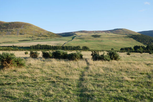
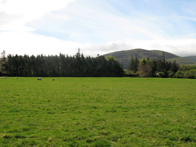
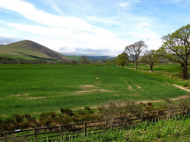
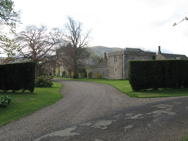
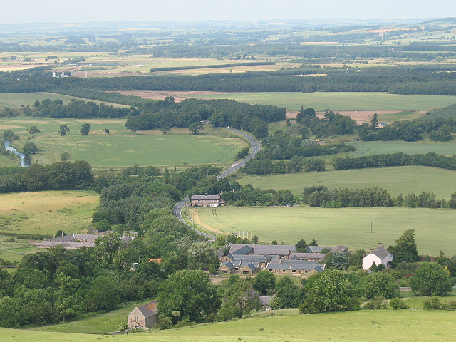
Yeavering is a small village located in the county of Northumberland, in the northeastern part of England. Situated near the River Glen, it is approximately 12 miles north of Wooler and 15 miles south of Berwick-upon-Tweed. The village is nestled within the scenic landscape of the Northumberland National Park, renowned for its natural beauty and historic sites.

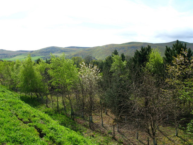
One of the notable features of Yeavering is Yeavering Bell, a prominent hill standing at 361 meters above sea level. This hill is home to the remains of an ancient hillfort, which dates back to the Iron Age. The hillfort, known as Yeavering Bell Hillfort, is considered one of the largest and most important in Northumberland, covering an impressive area of 5 hectares.

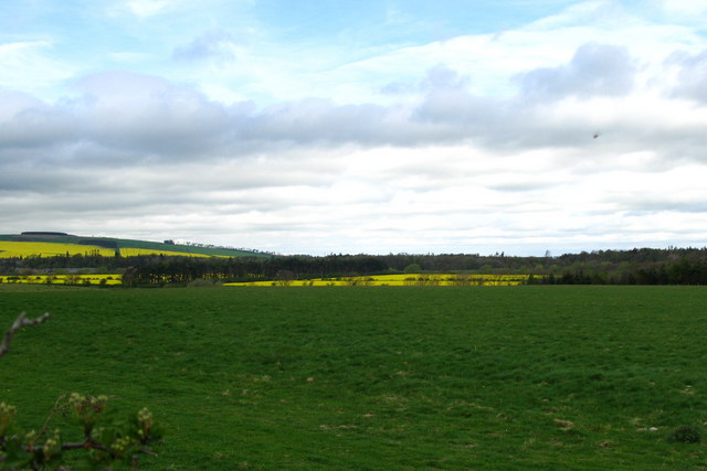
The village itself is small and picturesque, with a population of just a few hundred residents. It primarily consists of a cluster of houses and cottages, showcasing traditional Northumberland architecture. The surrounding area is predominantly agricultural, with rolling hills and farmland stretching as far as the eye can see.

While the village is relatively secluded, it offers a tranquil and peaceful atmosphere for residents and visitors alike. It is a popular destination for those seeking outdoor activities such as hiking, cycling, and birdwatching. The nearby Northumberland National Park provides ample opportunities for exploring the stunning natural landscapes, including the Cheviot Hills and the River Glen.

In summary, Yeavering is a charming village in Northumberland, known for its ancient hillfort and idyllic countryside setting. It attracts nature enthusiasts and those seeking a peaceful retreat amidst the beauty of the Northumberland National Park.

If you have any feedback on the listing, please let us know in the comments section below.

Yeavering Images

Images are sourced within 2km of 55.566179/-2.1021985 or Grid Reference NT9330. Thanks to Geograph Open Source API. All images are credited.

River Glen Restoration and Flood Risk Management Project works on the Yeavering Burn The aim of the project is 'to encourage the River Glen to continue to naturalise whilst managing the risk to land, property and infrastructure'.  

In this shot, Coupland Bridge/culvert has been removed and replaced with a gravel ford through the Yeavering Burn.  Further information on the project can be found at <span class="nowrap"><a title="https://tweedforum.org/our-work/projects/river-till-restoration-strategy/" rel="nofollow ugc noopener" href="https://tweedforum.org/our-work/projects/river-till-restoration-strategy/">Link</a><img style="margin-left:2px;" alt="External link" title="External link - shift click to open in new window" src="https://s1.geograph.org.uk/img/external.png" width="10" height="10"/></span>

This photograph was taken during the Coronavirus (COVID-19) pandemic of 2020/21/22.
River Glen Restoration and Flood Risk Management Project works on the Yeavering Burn
The aim of the project is 'to encourage the River Glen to continue to naturalise whilst managing the risk to land, property and infrastructure'. In this shot, Coupland Bridge/culvert has been removed and replaced with a gravel ford through the Yeavering Burn. Further information on the project can be found at LinkExternal link This photograph was taken during the Coronavirus (COVID-19) pandemic of 2020/21/22.
Medieval Pele Tower "A long quadrangular house at Old Yeavering has walls five feet thick and is probably a medieval pele.

The building is now used as a farm outbuilding and is in reasonable condition."

Hence the reason for the independently supported roof.

Source: Heritagegateway.org.uk. (2012). Heritage Gateway - Results. Monument Number 3875. [online] Available at: <span class="nowrap"><a title="https://www.heritagegateway.org.uk/Gateway/Results_Single.aspx?uid=c4c0a494-2a11-418f-8a59-907a52a8cc6c&resourceID=19191" rel="nofollow ugc noopener" href="https://www.heritagegateway.org.uk/Gateway/Results_Single.aspx?uid=c4c0a494-2a11-418f-8a59-907a52a8cc6c&resourceID=19191">Link</a><img style="margin-left:2px;" alt="External link" title="External link - shift click to open in new window" src="https://s1.geograph.org.uk/img/external.png" width="10" height="10"/></span> [Accessed 21 Jun. 2022].
Medieval Pele Tower
"A long quadrangular house at Old Yeavering has walls five feet thick and is probably a medieval pele. The building is now used as a farm outbuilding and is in reasonable condition." Hence the reason for the independently supported roof. Source: Heritagegateway.org.uk. (2012). Heritage Gateway - Results. Monument Number 3875. [online] Available at: LinkExternal link [Accessed 21 Jun. 2022].
Bound for Kirknewton An early autumn evening on the River Glen floodplain between Lanton and Kirknewton.

This photograph was taken during the Coronavirus (COVID-19) pandemic of 2020/21/22.
Bound for Kirknewton
An early autumn evening on the River Glen floodplain between Lanton and Kirknewton. This photograph was taken during the Coronavirus (COVID-19) pandemic of 2020/21/22.
Down  into  the  valley  toward  Akeld  Bridge  on  A697 Sand and gravel pits behind trees on the left
Down into the valley toward Akeld Bridge on A697
Sand and gravel pits behind trees on the left
Minor  road  junction  to  Cheviot  Quarry  access road Cheviot Quarry, part of Tarmac, is a sand and gravel quarry
Minor road junction to Cheviot Quarry access road
Cheviot Quarry, part of Tarmac, is a sand and gravel quarry
Akeld  Bridge  over  the  River  Glen.  A697  southbound The River Glen runs into the River Till a couple of miles downstream from here
Akeld Bridge over the River Glen. A697 southbound
The River Glen runs into the River Till a couple of miles downstream from here
Ford and footbridge on the Yeavering Burn near Coupland This site was photographed in May 2022, prior to installation of the footbridge: <a title="https://www.geograph.org.uk/photo/7178475" href="https://www.geograph.org.uk/photo/7178475">Link</a>
Ford and footbridge on the Yeavering Burn near Coupland
This site was photographed in May 2022, prior to installation of the footbridge: Link
Old Yeavering A map of 1584 showed a tower at Yeavering. This is a long rectangular building with very thick walls, which is now used as a farm outbuilding.

Just beyond this building is the site of the old mediaeval village of Yeavering.
Old Yeavering
A map of 1584 showed a tower at Yeavering. This is a long rectangular building with very thick walls, which is now used as a farm outbuilding. Just beyond this building is the site of the old mediaeval village of Yeavering.
Lanton Recently ploughed field and view towards Lanton Hill. There is a monument on top of the hill.
Lanton
Recently ploughed field and view towards Lanton Hill. There is a monument on top of the hill.
Coupland Castle A tower house, probably built at the end of the 16th century. It has been added to over the years and was restored in the 19th century. The tower has three storeys with an attic on top and a small projecting tower carried up the south wall. The entrance door has a date of 1594 inscribed on one side. It was once the home of Matthew Culley, the agricultural reformer who with his brother George set about improving methods of soil cultivation in the nineteenth century. Today, the Earl of Durham occasionally resides at Copeland Castle.
Coupland Castle
A tower house, probably built at the end of the 16th century. It has been added to over the years and was restored in the 19th century. The tower has three storeys with an attic on top and a small projecting tower carried up the south wall. The entrance door has a date of 1594 inscribed on one side. It was once the home of Matthew Culley, the agricultural reformer who with his brother George set about improving methods of soil cultivation in the nineteenth century. Today, the Earl of Durham occasionally resides at Copeland Castle.
Lanton Hill The memorial on Lanton Hill is an obelisk in <a href="https://www.geograph.org.uk/gridref/NT9189">NT9189</a> and was erected in about 1827 in memory of John Davison, by his brother Alexander Davison of Swarland.
Lanton Hill
The memorial on Lanton Hill is an obelisk in NT9189 and was erected in about 1827 in memory of John Davison, by his brother Alexander Davison of Swarland.
River Glen
River Glen
Coupland View to grazing fields surrounding the more manicured grounds of Coupland Castle.
Coupland
View to grazing fields surrounding the more manicured grounds of Coupland Castle.
Akeld Newly planted crop with view to Akeld Hill behind.
Akeld
Newly planted crop with view to Akeld Hill behind.
Embankment to east of A697, near Akeld Newly planted trees on roadside embankment on the edge of the A697 to Wooler. The embankment appeared to be newly formed. See also <a href="https://www.geograph.org.uk/photo/411301">NT9531 : Cleared area, near to Akeld</a>.
Embankment to east of A697, near Akeld
Newly planted trees on roadside embankment on the edge of the A697 to Wooler. The embankment appeared to be newly formed. See also NT9531 : Cleared area, near to Akeld.
Bridge over the River Glen at Coupland River Glen is formed at Kirknewton by the confluence of the College Burn and Bowmont Water.
Bridge over the River Glen at Coupland
River Glen is formed at Kirknewton by the confluence of the College Burn and Bowmont Water.
River Glen Valley at Yeavering A number of rape fields in this Northumbrian river valley.
River Glen Valley at Yeavering
A number of rape fields in this Northumbrian river valley.
Horses on Lanton Hill The memorial on Lanton Hill is an obelisk and was erected in about 1827 in memory of John Davison, by his brother Alexander Davison of Swarland.
Horses on Lanton Hill
The memorial on Lanton Hill is an obelisk and was erected in about 1827 in memory of John Davison, by his brother Alexander Davison of Swarland.
Show me another place!

Yeavering is located at Grid Ref: NT9330 (Lat: 55.566179, Lng: -2.1021985)

Unitary Authority: Northumberland

Police Authority: Northumbria

What 3 Words

///reprints.snooping.decide. Near Kirknewton, Northumberland

Nearby Locations

Yeavering

Related Wikis

Yeavering

Yeavering () is a hamlet in the north-east corner of the civil parish of Kirknewton in the English county of Northumberland. It is located on the River...

Battle of Yeavering

The Battle of Yeavering (or Battle of Geteryne) was fought in 1415 between English and Scottish forces near Yeavering in Northumberland. A small English...

Coupland Castle

Coupland Castle is situated in the village of Coupland, 4 miles (6 km) to the north-west of Wooler, Northumberland, England. It is a Grade I listed building...

Coupland, Northumberland

Coupland is a village and former civil parish, now in the parish of Ewart, in Northumberland, England. It is on the north bank of the River Glen about...

Yeavering Bell

Yeavering Bell is a twin-peaked hill near the River Glen in north Northumberland, England, to the west of Wooler, and forming part of the Cheviot Hills...

Lanton, Northumberland

Lanton is a hamlet and former civil parish, now in the parish of Ewart, in the north of the county of Northumberland, near the town of Wooler, the Cheviots...

Akeld railway station

Akeld was a stone built railway station serving the hamlet of Akeld in Northumberland, England. It was on the Alnwick to Cornhill Branch which ran from...

Akeld

Akeld is a village and civil parish in Northumberland, England. It is situated around 2.7 miles (4.3 km) to the west of Wooler and 9.3 miles (15.0 km)...

Nearby Amenities

Located within 500m of 55.566179,-2.1021985
Yeavering
Place: hamlet
Wikidata: Q3039629
Lat/Long: 55.5662278/-2.1020886
Building: yes
Lat/Long: 55.5674082/-2.103749
The Levers
Place: isolated_dwelling
Lat/Long: 55.5685787/-2.0991963
Side: right
Traffic Sign Forward: GB:816
Lat/Long: 55.5664335/-2.1020574
Direction: 175
Generator Method: photovoltaic
Generator Output Electricity: yes
Generator Solar Modules: 16
Generator Source: solar
Generator Type: solar_photovoltaic_panel
Location: roof
Power: generator
Lat/Long: 55.5659228/-2.1026722
Direction: 175
Generator Method: photovoltaic
Generator Output Electricity: yes
Generator Solar Modules: 16
Generator Source: solar
Generator Type: solar_photovoltaic_panel
Location: roof
Power: generator
Lat/Long: 55.5659334/-2.102357
Direction: SSW
Generator Method: photovoltaic
Generator Output Electricity: yes
Generator Solar Modules: 16
Generator Source: solar
Generator Type: solar_photovoltaic_panel
Location: roof
Power: generator
Lat/Long: 55.5673473/-2.1029343
Direction: 190
Generator Method: photovoltaic
Generator Output Electricity: yes
Generator Solar Modules: 12
Generator Source: solar
Generator Type: solar_photovoltaic_panel
Location: roof
Power: generator
Lat/Long: 55.5685689/-2.0991642
Public Byway
Bicycle: yes
Hiking: yes
Horse: yes
Information: guidepost
Mtb: yes
Tourism: information
Lat/Long: 55.5689439/-2.0992309
Side: right
Traffic Sign Forward: GB:820
Lat/Long: 55.5662667/-2.1021768
Entrance: yes
Lat/Long: 55.5661457/-2.1015811
The data included in this document is from www.openstreetmap.org. The data is made available under ODbL.

Have you been to Yeavering?

Leave your review of Yeavering below (or comments, questions and feedback).