Yanwath

Settlement in Westmorland Eden

England

Yanwath

Dry stone wall bounding field The wall with its gate bounds a field between the A592 and the River Eamont; it's just south of the Rheged visitor attraction.
Dry stone wall bounding field Credit: Trevor Littlewood

Yanwath is a small village located in the county of Westmorland, in the North West of England. It lies approximately 4 miles south east of Penrith, a historic market town, and is situated near the River Eamont.

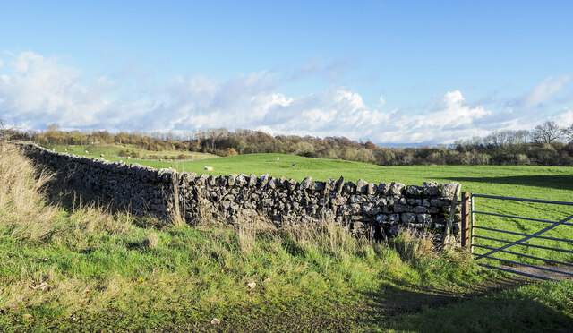
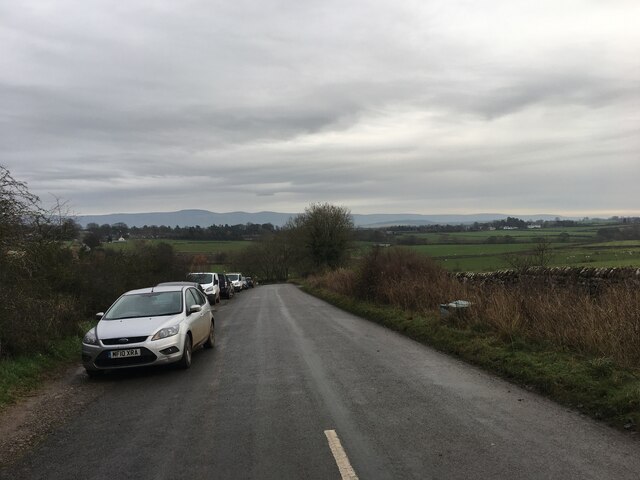
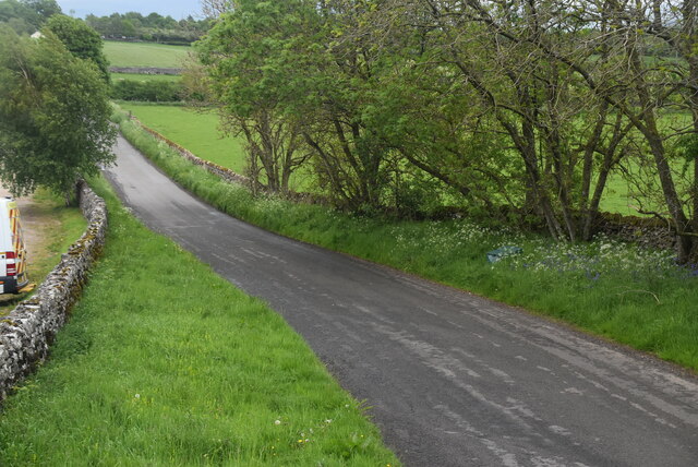
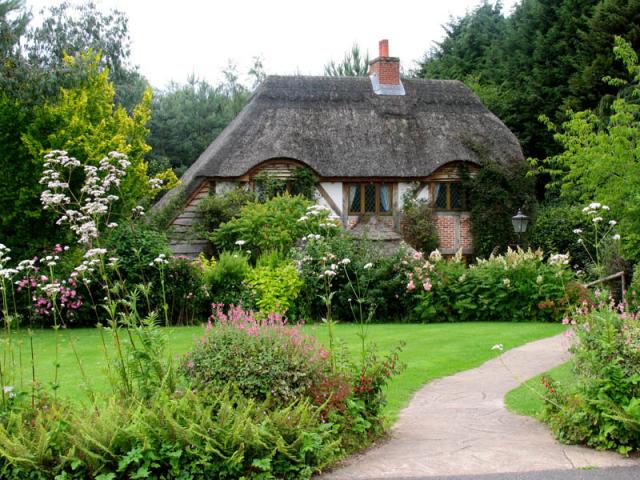
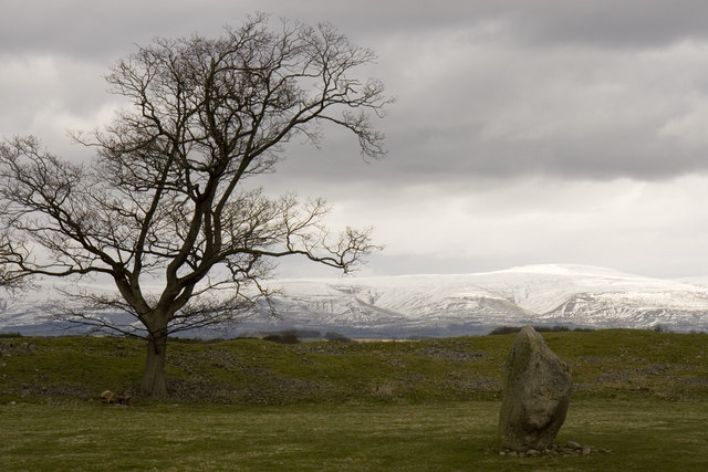
The village is characterized by its picturesque rural setting, surrounded by rolling hills and farmland. It is known for its charming, traditional stone-built houses and cottages, which contribute to its quaint and idyllic atmosphere.

Yanwath is home to St. Michael and All Angels Church, a beautiful medieval church that dates back to the 12th century. The church is a prominent landmark in the village and is known for its stunning stained glass windows and intricate architecture.

The village also boasts a popular pub, The Yanwath Gate Inn, which offers a warm and welcoming atmosphere for locals and visitors alike. The pub is renowned for its traditional British cuisine and selection of local ales.

Yanwath is surrounded by natural beauty, making it a haven for outdoor enthusiasts. The nearby Lake District National Park offers opportunities for hiking, cycling, and exploring the stunning landscapes that the region is famous for.

Overall, Yanwath is a charming and peaceful village, offering a glimpse into the rural beauty of Westmorland. Its historic buildings, scenic surroundings, and welcoming community make it a delightful destination for both residents and tourists.

If you have any feedback on the listing, please let us know in the comments section below.

Yanwath Images

Images are sourced within 2km of 54.642206/-2.758469 or Grid Reference NY5127. Thanks to Geograph Open Source API. All images are credited.

Dry stone wall bounding field The wall with its gate bounds a field between the A592 and the River Eamont; it's just south of the Rheged visitor attraction.
Dry stone wall bounding field
The wall with its gate bounds a field between the A592 and the River Eamont; it's just south of the Rheged visitor attraction.
Minor road towards Redhills
A66 near Red Hills
A66 near Red Hills
Farmland
Farmland
Filling station, Rheged Centre
Rheged Centre
Rheged Centre
Slapstones
Slapstones
Sheep grazing
Sheep grazing
A592 The A592 runs 32 miles across the Lake District from Newby Bridge to Penrith, a very scenic route.
<span class="nowrap"><a title="http://www.sabre-roads.org.uk/wiki/index.php?title=A592" rel="nofollow ugc noopener" href="http://www.sabre-roads.org.uk/wiki/index.php?title=A592">Link</a><img style="margin-left:2px;" alt="External link" title="External link - shift click to open in new window" src="https://s1.geograph.org.uk/img/external.png" width="10" height="10"/></span>
A592
The A592 runs 32 miles across the Lake District from Newby Bridge to Penrith, a very scenic route. LinkExternal link
Slapstone Villa
Slapstone Villa
Pasture
Pasture
A66, looking west The A66 is a major road in northern England running from near Middlesbrough to Workington. The section between Scotch Corner and Penrith is a Trans-Pennine route between the A1 and M6, following an old Roman Road.
Wikipedia: <span class="nowrap"><a title="http://en.wikipedia.org/wiki/A66_road" rel="nofollow ugc noopener" href="http://en.wikipedia.org/wiki/A66_road">Link</a><img style="margin-left:2px;" alt="External link" title="External link - shift click to open in new window" src="https://s1.geograph.org.uk/img/external.png" width="10" height="10"/></span>
A66, looking west
The A66 is a major road in northern England running from near Middlesbrough to Workington. The section between Scotch Corner and Penrith is a Trans-Pennine route between the A1 and M6, following an old Roman Road. Wikipedia: LinkExternal link
A66, looking east The A66 is a major road in northern England running from near Middlesbrough to Workington. The section between Scotch Corner and Penrith is a Trans-Pennine route between the A1 and M6, following an old Roman Road.
Wikipedia: <span class="nowrap"><a title="http://en.wikipedia.org/wiki/A66_road" rel="nofollow ugc noopener" href="http://en.wikipedia.org/wiki/A66_road">Link</a><img style="margin-left:2px;" alt="External link" title="External link - shift click to open in new window" src="https://s1.geograph.org.uk/img/external.png" width="10" height="10"/></span>
A66, looking east
The A66 is a major road in northern England running from near Middlesbrough to Workington. The section between Scotch Corner and Penrith is a Trans-Pennine route between the A1 and M6, following an old Roman Road. Wikipedia: LinkExternal link
Rheged Centre
Rheged Centre
Brougham Hall This Manor House situated in the south eastern corner of the square, has seen all sorts of troubled times. It is now a craft centre and produces delicious smoked cheese.
Brougham Hall
This Manor House situated in the south eastern corner of the square, has seen all sorts of troubled times. It is now a craft centre and produces delicious smoked cheese.
One of a pair This photograph of the knocker on the door at Brougham Hall, is submitted as a supplementary photo, as it is of some interest. Its partner is to be found on the door of Durham Cathedral <a title="https://www.geograph.org.uk/photo/2532705" href="https://www.geograph.org.uk/photo/2532705">Link</a>.
One of a pair
This photograph of the knocker on the door at Brougham Hall, is submitted as a supplementary photo, as it is of some interest. Its partner is to be found on the door of Durham Cathedral Link.
Honeysuckle Cottage Visitor Centre This is a photograph of the visitors' centre for Lilliput Lane Miniature Cottages. The exact grid reference is NY510288.
Honeysuckle Cottage Visitor Centre
This is a photograph of the visitors' centre for Lilliput Lane Miniature Cottages. The exact grid reference is NY510288.
Penrith Castle Penrith Castle freely open to the public. Located across the road from the railway station so worth a browse whilst you await a train
Penrith Castle
Penrith Castle freely open to the public. Located across the road from the railway station so worth a browse whilst you await a train
Show me another place!

Yanwath is located at Grid Ref: NY5127 (Lat: 54.642206, Lng: -2.758469)

Administrative County: Cumbria

District: Eden

Police Authority: Cumbria

What 3 Words

///snore.upwards.reworked. Near Penrith, Cumbria

Nearby Locations

Yanwath

Related Wikis

Yanwath

Yanwath is a village in the Westmorland and Furness District of Cumbria, England, 1 mile south of Penrith. There is a primary school at Yanwath, with 192...
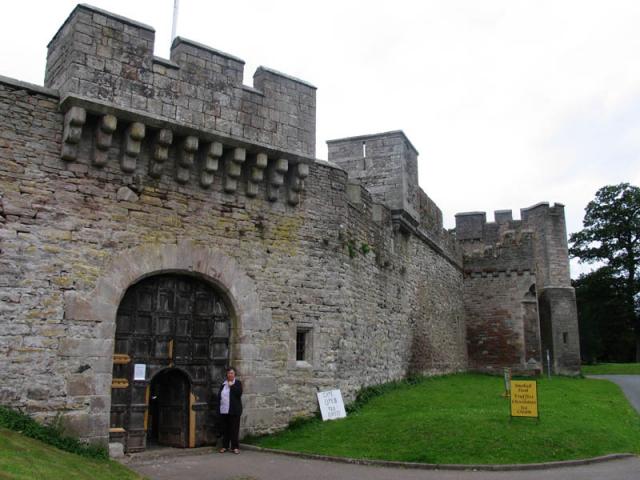
Yanwath Hall

Yanwath Hall is a 14th-century and later tower house in Yanwath, Cumbria, England. It is a grade I listed building.Early owners included the Salkeld family...

Redhills, Cumbria

Redhills (sometimes spelt Red Hills) is a hamlet in the civil parish of Dacre, in the Eden district, in the English county of Cumbria. == Location == It...

Mayburgh Henge

Mayburgh Henge is a large prehistoric monument in the county of Cumbria in northern England. The henge is in the care of English Heritage and is a Scheduled...

Nearby Amenities

Located within 500m of 54.642206,-2.758469
Bus Stop
Askham Road End
Local Ref: AT
Naptan AtcoCode: 090074721312
Naptan Bearing: S
Naptan CommonName: Askham Road End
Naptan Indicator: at
Naptan Landmark: Askham Road End
Naptan NaptanCode: cumdgmag
Naptan Street: B5320
Naptan Verified: no
Source: naptan_import
Lat/Long: 54.6405645/-2.7597009
Bus Stop
Cottages
Local Ref: AT
Naptan AtcoCode: 090074723001
Naptan Bearing: N
Naptan CommonName: Cottages
Naptan Indicator: at
Naptan Landmark: Yanwath Road End
Naptan NaptanCode: cumdgmam
Naptan Street: B5320
Naptan Verified: yes
Source: naptan_import
Lat/Long: 54.6430087/-2.7554541
Telephone
Defibrillator
Booth: KX100
Covered: booth
Defibrillator Location: inside phone box in Yanwath
Emergency: defibrillator
Man Made: telephone_box
Source: survey
Lat/Long: 54.6425418/-2.7588012
Post Box
Post Box Type: wall
Ref: CA10 86
Royal Cypher: GVIR
Royal Cypher Wikidata: Q33102169
Source: survey
Lat/Long: 54.6428625/-2.758891
Waste Basket
Lat/Long: 54.642523/-2.7587361
Grit Bin
Lat/Long: 54.6424971/-2.7587118
Barrier: kissing_gate
Source: survey;gps
Lat/Long: 54.6448989/-2.7602619
Barrier: stile
Material: stone
Source: survey;gps
Stile: squeezer
Lat/Long: 54.6443583/-2.7616125
Barrier: stile
Material: wood
Source: survey;gps
Stile: stepover
Lat/Long: 54.6457442/-2.7539873
Direction: SSW
Generator Method: photovoltaic
Generator Output Electricity: yes
Generator Source: solar
Generator Type: solar_photovoltaic_panel
Location: roof
Power: generator
Lat/Long: 54.6430491/-2.75668
Direction: SSE
Generator Method: photovoltaic
Generator Output Electricity: yes
Generator Source: solar
Generator Type: solar_photovoltaic_panel
Location: roof
Power: generator
Lat/Long: 54.6437213/-2.7580144
Direction: WSW
Generator Method: photovoltaic
Generator Output Electricity: yes
Generator Source: solar
Generator Type: solar_photovoltaic_panel
Location: roof
Power: generator
Lat/Long: 54.6437151/-2.7580922
Direction: WSW
Generator Method: photovoltaic
Generator Output Electricity: yes
Generator Source: solar
Generator Type: solar_photovoltaic_panel
Location: roof
Power: generator
Lat/Long: 54.6435692/-2.757368
Direction: SSE
Generator Method: photovoltaic
Generator Output Electricity: yes
Generator Source: solar
Generator Type: solar_photovoltaic_panel
Location: roof
Power: generator
Lat/Long: 54.6436282/-2.7582639
Give Way
Direction: forward
Lat/Long: 54.6425629/-2.7586258
Turning Circle
Lat/Long: 54.6439474/-2.7592461
Direction: SE
Generator Method: photovoltaic
Generator Output Electricity: yes
Generator Source: solar
Generator Type: solar_photovoltaic_panel
Location: roof
Power: generator
Lat/Long: 54.6436564/-2.7593046
Noexit: yes
Lat/Long: 54.6442013/-2.758843
Noexit: yes
Lat/Long: 54.6440222/-2.7586658
Power: pole
Lat/Long: 54.6409081/-2.7584249
Power: pole
Lat/Long: 54.6402014/-2.7584629
Power: pole
Lat/Long: 54.639179/-2.7576981
Power: pole
Lat/Long: 54.6383467/-2.7571345
Power: pole
Lat/Long: 54.6400409/-2.7591786
Power: pole
Lat/Long: 54.63994/-2.7596683
The data included in this document is from www.openstreetmap.org. The data is made available under ODbL.

Have you been to Yanwath?

Leave your review of Yanwath below (or comments, questions and feedback).