Wyham

Settlement in Lincolnshire East Lindsey

England

Wyham

Beesby DMV: aerial 2021 (1) Mentioned in "Beresford's Lost Villages": <span class="nowrap"><a title="http://www.dmvhull.org/dmvDetail.cfm?dbkey=3727&county=true" rel="nofollow ugc noopener" href="http://www.dmvhull.org/dmvDetail.cfm?dbkey=3727&county=true">Link</a><img style="margin-left:2px;" alt="External link" title="External link - shift click to open in new window" src="https://s1.geograph.org.uk/img/external.png" width="10" height="10"/></span>

Otherwise seems to be undocumented.
Beesby DMV: aerial 2021 (1) Credit: Chris

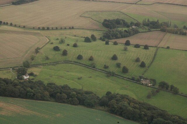
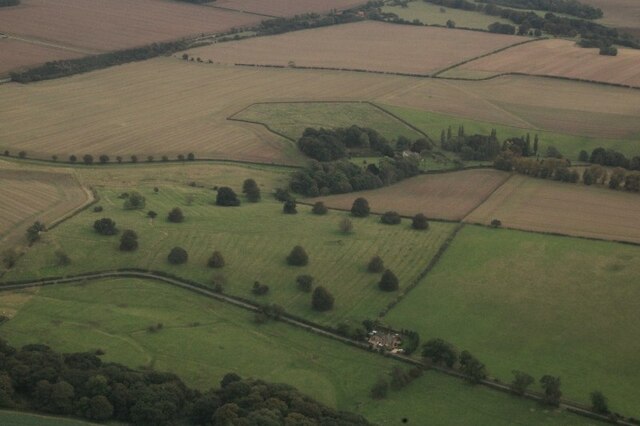
Wyham is a small village located in the East Lindsey district of Lincolnshire, England. Situated approximately 6 miles north-east of the market town of Louth, Wyham is nestled in the picturesque Lincolnshire Wolds, an Area of Outstanding Natural Beauty.

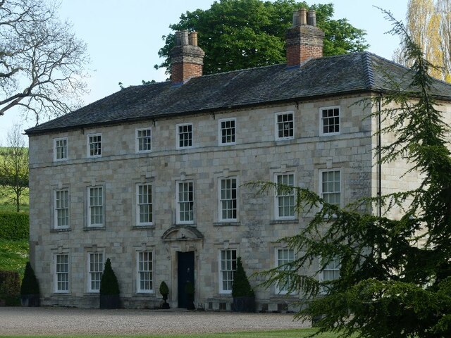
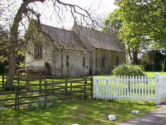
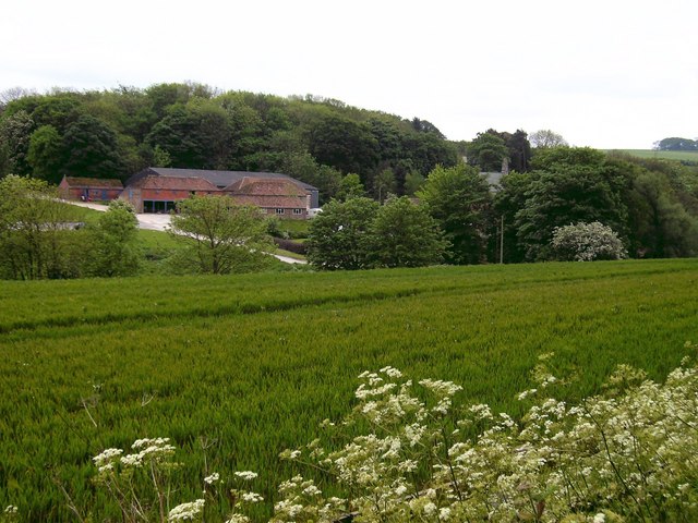
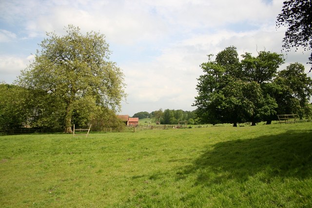
With a population of around 150 residents, Wyham exudes a peaceful and rural charm. The village is characterized by its quaint cottages, many of which date back to the 18th and 19th centuries, showcasing traditional Lincolnshire architecture. The surrounding countryside is predominantly agricultural, with rolling hills and fields creating a scenic backdrop.

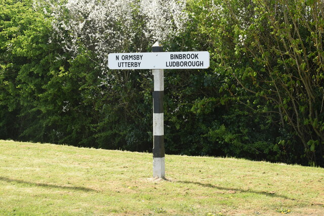
Wyham benefits from its proximity to various amenities and attractions. The nearby town of Louth offers a range of shops, restaurants, and services, as well as weekly markets and annual events. The village is also within easy reach of the Lincolnshire coast, providing opportunities for seaside walks and exploration.

For nature enthusiasts, the Lincolnshire Wolds offer numerous trails and footpaths, allowing residents and visitors to appreciate the stunning rural landscapes. The area is home to an array of wildlife, including birds of prey and rare flora and fauna.

In terms of transportation, Wyham is served by a network of roads connecting it to neighboring towns and villages. The A16 road runs close to the village, providing convenient access to Louth and other nearby locations. Public transportation options include bus services connecting Wyham to Louth and surrounding areas.

Overall, Wyham offers a tranquil and idyllic setting, making it an attractive destination for those seeking a peaceful retreat amidst the beauty of the Lincolnshire countryside.

If you have any feedback on the listing, please let us know in the comments section below.

Wyham Images

Images are sourced within 2km of 53.436929/-0.074604788 or Grid Reference TF2895. Thanks to Geograph Open Source API. All images are credited.

Beesby DMV: aerial 2021 (1) Mentioned in "Beresford's Lost Villages": <span class="nowrap"><a title="http://www.dmvhull.org/dmvDetail.cfm?dbkey=3727&county=true" rel="nofollow ugc noopener" href="http://www.dmvhull.org/dmvDetail.cfm?dbkey=3727&county=true">Link</a><img style="margin-left:2px;" alt="External link" title="External link - shift click to open in new window" src="https://s1.geograph.org.uk/img/external.png" width="10" height="10"/></span>

Otherwise seems to be undocumented.
Beesby DMV: aerial 2021 (1)
Mentioned in "Beresford's Lost Villages": LinkExternal link Otherwise seems to be undocumented.
Beesby DMV: aerial 2021 (2) Mentioned in "Beresford's Lost Villages": <span class="nowrap"><a title="http://www.dmvhull.org/dmvDetail.cfm?dbkey=3727&county=true" rel="nofollow ugc noopener" href="http://www.dmvhull.org/dmvDetail.cfm?dbkey=3727&county=true">Link</a><img style="margin-left:2px;" alt="External link" title="External link - shift click to open in new window" src="https://s1.geograph.org.uk/img/external.png" width="10" height="10"/></span>

Otherwise seems to be undocumented.
Beesby DMV: aerial 2021 (2)
Mentioned in "Beresford's Lost Villages": LinkExternal link Otherwise seems to be undocumented.
Wyham DMV: aerial 2022 See: <span class="nowrap"><a title="https://www.heritagegateway.org.uk/Gateway/Results_Single.aspx?uid=MLI40796&resourceID=1006" rel="nofollow ugc noopener" href="https://www.heritagegateway.org.uk/Gateway/Results_Single.aspx?uid=MLI40796&resourceID=1006">Link</a><img style="margin-left:2px;" alt="External link" title="External link - shift click to open in new window" src="https://s1.geograph.org.uk/img/external.png" width="10" height="10"/></span>
Wyham DMV: aerial 2022
See: LinkExternal link
Cadeby DMV: aerial 2022 See: <span class="nowrap"><a title="https://www.heritagegateway.org.uk/Gateway/Results_Single.aspx?uid=MLI43622&resourceID=1006" rel="nofollow ugc noopener" href="https://www.heritagegateway.org.uk/Gateway/Results_Single.aspx?uid=MLI43622&resourceID=1006">Link</a><img style="margin-left:2px;" alt="External link" title="External link - shift click to open in new window" src="https://s1.geograph.org.uk/img/external.png" width="10" height="10"/></span>
Cadeby DMV: aerial 2022
See: LinkExternal link
Historic settlement of Beesby: aerial 2022 (1) See: <span class="nowrap"><a title="https://www.heritagegateway.org.uk/Gateway/Results_Single.aspx?uid=MNL234&resourceID=1039" rel="nofollow ugc noopener" href="https://www.heritagegateway.org.uk/Gateway/Results_Single.aspx?uid=MNL234&resourceID=1039">Link</a><img style="margin-left:2px;" alt="External link" title="External link - shift click to open in new window" src="https://s1.geograph.org.uk/img/external.png" width="10" height="10"/></span>
Historic settlement of Beesby: aerial 2022 (1)
See: LinkExternal link
Historic settlement of Beesby: aerial 2022 (2) See: <span class="nowrap"><a title="https://www.heritagegateway.org.uk/Gateway/Results_Single.aspx?uid=MNL234&resourceID=1039" rel="nofollow ugc noopener" href="https://www.heritagegateway.org.uk/Gateway/Results_Single.aspx?uid=MNL234&resourceID=1039">Link</a><img style="margin-left:2px;" alt="External link" title="External link - shift click to open in new window" src="https://s1.geograph.org.uk/img/external.png" width="10" height="10"/></span>
Historic settlement of Beesby: aerial 2022 (2)
See: LinkExternal link
Cadeby Hall (1) See <span class="nowrap"><a title="https://www.heritagegateway.org.uk/Gateway/Results_Single.aspx?uid=MLI83090&resourceID=1006" rel="nofollow ugc noopener" href="https://www.heritagegateway.org.uk/Gateway/Results_Single.aspx?uid=MLI83090&resourceID=1006">Link</a><img style="margin-left:2px;" alt="External link" title="External link - shift click to open in new window" src="https://s1.geograph.org.uk/img/external.png" width="10" height="10"/></span>
Cadeby Hall (1)
See LinkExternal link
Cadeby Hall (2) See <span class="nowrap"><a title="https://www.heritagegateway.org.uk/Gateway/Results_Single.aspx?uid=MLI83090&resourceID=1006" rel="nofollow ugc noopener" href="https://www.heritagegateway.org.uk/Gateway/Results_Single.aspx?uid=MLI83090&resourceID=1006">Link</a><img style="margin-left:2px;" alt="External link" title="External link - shift click to open in new window" src="https://s1.geograph.org.uk/img/external.png" width="10" height="10"/></span>
Cadeby Hall (2)
See LinkExternal link
Dovecote, Cadeby Hall Farm 2022 (1) See also <a href="https://www.geograph.org.uk/photo/3037426">TF2695 : Dovecote by Cadeby Hall Farm (2)</a>.
Dovecote, Cadeby Hall Farm 2022 (1)
Dovecote, Cadeby Hall Farm 2022 (2) See also <a href="https://www.geograph.org.uk/photo/3037426">TF2695 : Dovecote by Cadeby Hall Farm (2)</a>.
Dovecote, Cadeby Hall Farm 2022 (2)
Dovecote, Cadeby Hall Farm 2022 (3) See also <a href="https://www.geograph.org.uk/photo/3037426">TF2695 : Dovecote by Cadeby Hall Farm (2)</a>.
Dovecote, Cadeby Hall Farm 2022 (3)
Direction Sign – Signpost on Barton Street, Utterby Located on the northeast side of the junction on Barton Street at The Slates, in Utterby parish. 3 arms but no finial.

Milestone Society National ID: LI_TF2993
Direction Sign – Signpost on Barton Street, Utterby
Located on the northeast side of the junction on Barton Street at The Slates, in Utterby parish. 3 arms but no finial. Milestone Society National ID: LI_TF2993
Direction Sign – Signpost on Barton Street, North Ormsby Located on the west side of the junction of Barton Street and Pear Tree Lane, in North Ormsby parish. 2 arms but no finial. See also <a title="https://www.geograph.org.uk/photo/460927" href="https://www.geograph.org.uk/photo/460927">Link</a>.

Milestone Society National ID: LI_TF2994
Direction Sign – Signpost on Barton Street, North Ormsby
Located on the west side of the junction of Barton Street and Pear Tree Lane, in North Ormsby parish. 2 arms but no finial. See also Link. Milestone Society National ID: LI_TF2994
St Mary's church, Ludborough From the south east.
St Mary's church, Ludborough
From the south east.
Interior, St Mary's church, Ludborough Looking east to the chancel, with curtains installed across the arch.
Interior, St Mary's church, Ludborough
Looking east to the chancel, with curtains installed across the arch.
Stained glass window, St Mary's church, Ludborough Depicting Faith and Charity, with Hope in the tracery.
The windows is from 1910 in memory of Rev. Augustus Gedge d.1909, rector for 56 years, and his wife Lucy d.1899, and their daughter Ada d.1905.
Stained glass window, St Mary's church, Ludborough
Depicting Faith and Charity, with Hope in the tracery. The windows is from 1910 in memory of Rev. Augustus Gedge d.1909, rector for 56 years, and his wife Lucy d.1899, and their daughter Ada d.1905.
Nave looking west, St Mary's church, Ludborough 
Grade I listed.
The church dates from the thirteenth century onwards and was restored in 1858 by Fowler.
It is built of squared ironstone and chalk rubble with limestone dressings, slate and tiled roofs.

There is a tall fifteenth century three stage tower with embattled parapet. The stone is quite eroded.
The nave is of three bays, the arcades being Early English. There are small round arched clerestory windows.

The south aisle dates from the nineteenth century and was one time used as the village school. The north aisle is much restored.

The north wall of the chancel has a thirteenth century doorway, the south wall has three windows from the fourteenth century, the east wall has 2 lancets.
The chancel arch is thirteenth century, and there is a double piscina (damaged) of that time in the south wall.
On the north side of the chancel in a window sill there is a 13th Century floral painted mural design in red and black.

The east window of the south aisle is of the fifteenth century there are other windows of that age in the south aisle.

The font is a plain octagonal bowl on a pedestal from the fifteenth century. 

There is no pipe organ.

In 1858 the roof blew off doing much damage to the roof and old benching. It was restored by James Fowler, costing £930.

Internal and external alterations were made to the church in 1999 and 2000, for the installation of new services and a new heating system.
Nave looking west, St Mary's church, Ludborough
Grade I listed. The church dates from the thirteenth century onwards and was restored in 1858 by Fowler. It is built of squared ironstone and chalk rubble with limestone dressings, slate and tiled roofs. There is a tall fifteenth century three stage tower with embattled parapet. The stone is quite eroded. The nave is of three bays, the arcades being Early English. There are small round arched clerestory windows. The south aisle dates from the nineteenth century and was one time used as the village school. The north aisle is much restored. The north wall of the chancel has a thirteenth century doorway, the south wall has three windows from the fourteenth century, the east wall has 2 lancets. The chancel arch is thirteenth century, and there is a double piscina (damaged) of that time in the south wall. On the north side of the chancel in a window sill there is a 13th Century floral painted mural design in red and black. The east window of the south aisle is of the fifteenth century there are other windows of that age in the south aisle. The font is a plain octagonal bowl on a pedestal from the fifteenth century. There is no pipe organ. In 1858 the roof blew off doing much damage to the roof and old benching. It was restored by James Fowler, costing £930. Internal and external alterations were made to the church in 1999 and 2000, for the installation of new services and a new heating system.
Wall painting, St Mary's church, Ludborough A floral design from Circa 1300.
Wall painting, St Mary's church, Ludborough
A floral design from Circa 1300.
Show me another place!

Wyham is located at Grid Ref: TF2895 (Lat: 53.436929, Lng: -0.074604788)

Division: Parts of Lindsey

Administrative County: Lincolnshire

District: East Lindsey

Police Authority: Lincolnshire

What 3 Words

///mastering.pulps.baroness. Near North Thoresby, Lincolnshire

Nearby Locations

Wyham

Related Wikis

Wyham cum Cadeby

Wyham cum Cadeby (otherwise Wyham with Caldeby) is a depopulated civil parish in the East Lindsey district of Lincolnshire, England. The nearest village...

Ludborough

Ludborough is a village and civil parish in the East Lindsey district of Lincolnshire, England. It is situated approximately 5 miles (8 km) north from...

North Ormsby

North Ormsby (sometimes Ormesby) is a village and civil parish in the East Lindsey district of Lincolnshire, England. It is situated approximately 7 miles...

North Ormsby Priory

North Ormsby Priory was a Gilbertine priory in North Ormsby, Lincolnshire, England. It was founded by Gilbert son of Robert of Ormsby with the consent...

Nearby Amenities

Located within 500m of 53.436929,-0.074604788
Wyham
Is In: Lincolnshire, England, UK
Is In District: East Lindsey
Place: hamlet
Source: npe
Lat/Long: 53.4375684/-0.0781559
Power: pole
Lat/Long: 53.4328302/-0.0772501
Power: pole
Lat/Long: 53.4341224/-0.0782425
Power: pole
Lat/Long: 53.4352282/-0.0796904
Power: pole
Lat/Long: 53.436403/-0.0811779
Wyham Lodge
Place: isolated_dwelling
Source: Bing
Lat/Long: 53.4365905/-0.070703
Power: pole
Lat/Long: 53.4383268/-0.0770599
Power: pole
Lat/Long: 53.439196/-0.0780979
Power: pole
Lat/Long: 53.4397808/-0.0789414
Power: pole
Lat/Long: 53.4400428/-0.0793076
The data included in this document is from www.openstreetmap.org. The data is made available under ODbL.

Have you been to Wyham?

Leave your review of Wyham below (or comments, questions and feedback).