Willington Square

Settlement in Northumberland

England

Willington Square

Silverlink Park Sundial View from the Silverlink Park Sundial looking in a North easterly direction towards Whitley Bay and Blyth.
Silverlink Park Sundial Credit: Ken Brown

Willington Square is a small village located in the county of Northumberland, in the northeast of England. It is situated approximately 8 miles west of the town of Morpeth and 20 miles north of Newcastle upon Tyne. The village is nestled within the picturesque Northumberland countryside, surrounded by rolling hills and farmland.

Willington Square is known for its charming and idyllic atmosphere, with a population of around 500 residents. The village is predominantly residential, with a mix of traditional stone houses and more modern properties. The architectural style reflects the village's rich history, with some buildings dating back to the 18th century.

The heart of the village is its square, which serves as a meeting point for locals and visitors alike. The square features a small green space with benches, where residents can relax and enjoy the peaceful surroundings. The square also boasts a few shops, including a convenience store and a local pub, which provide essential services and a sense of community.

Nature enthusiasts will appreciate the village's proximity to stunning natural landscapes, such as the Northumberland National Park and the Northumberland Coast Area of Outstanding Natural Beauty. These areas offer opportunities for outdoor activities such as hiking, cycling, and birdwatching.

Overall, Willington Square offers a tranquil and welcoming environment, perfect for those seeking a peaceful retreat in the beautiful Northumberland countryside.

If you have any feedback on the listing, please let us know in the comments section below.

Willington Square Images

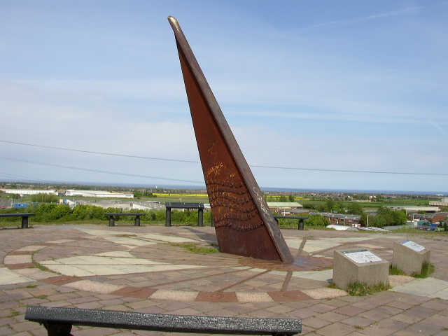
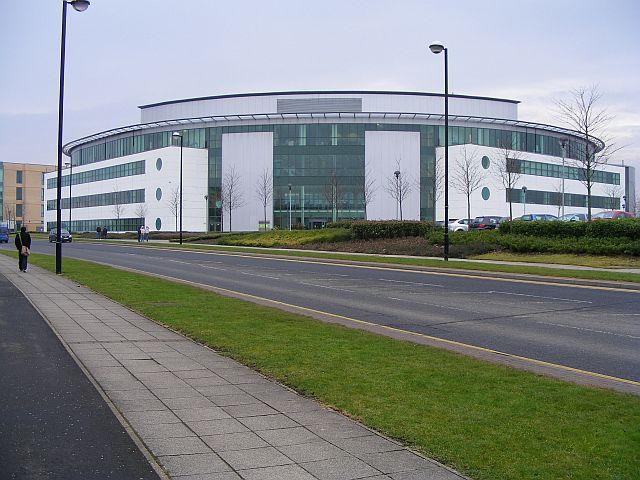
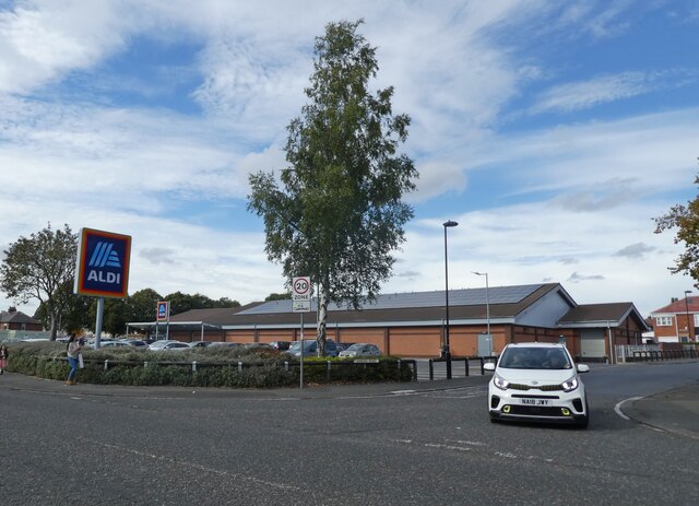
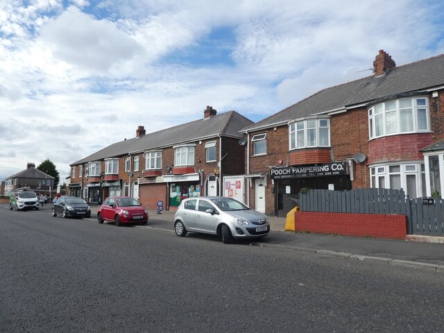
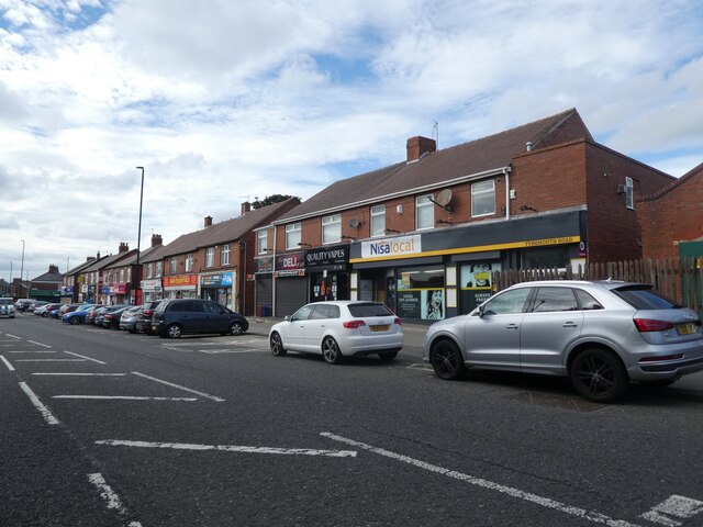
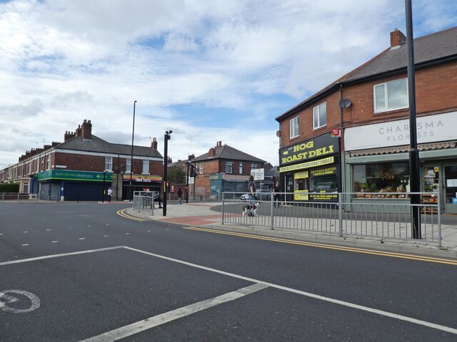
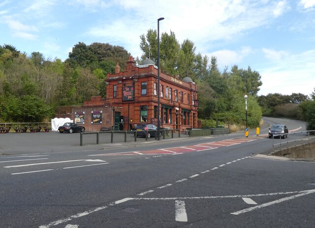
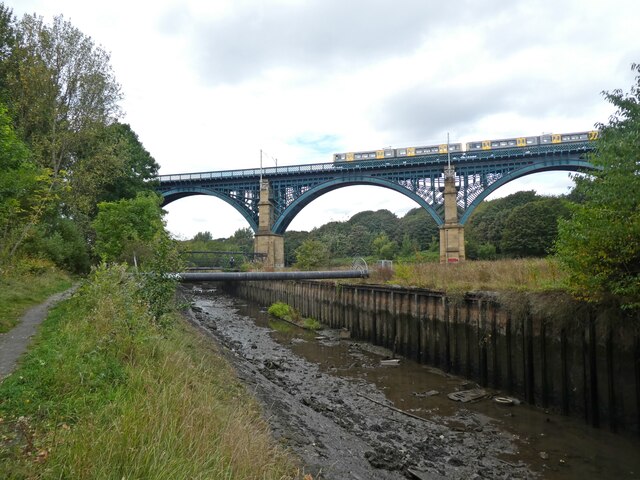
Images are sourced within 2km of 55.007429/-1.5075555 or Grid Reference NZ3168. Thanks to Geograph Open Source API. All images are credited.

Silverlink Park Sundial View from the Silverlink Park Sundial looking in a North easterly direction towards Whitley Bay and Blyth.
Silverlink Park Sundial
View from the Silverlink Park Sundial looking in a North easterly direction towards Whitley Bay and Blyth.
Cobalt Business Park - West end of Jobcentreplus
Cobalt Business Park - Jobcentreplus The building is named Cobalt House.
Cobalt Business Park - Jobcentreplus
The building is named Cobalt House.
Sundial Monument
Sundial Monument
Sundial Monument 2
Sundial Monument 2
Base of sundial
Base of sundial
Sundial in Silverlink Park
Steps up to the Sundial in Silverlink Park
Aldi, Howdon
Aldi, Howdon
Parade of shops on Tynemouth Road
Junction with Churchill Street
The Rose Inn
The Rose Inn
Richardson Dees Primary School
An eastbound Metro train crosses Willington Viaduct
Willington Viaduct
Willington Viaduct
Wallsend Burn
Wallsend Burn
Bewicke Road
Bewicke Road
Show me another place!

Willington Square is located at Grid Ref: NZ3168 (Lat: 55.007429, Lng: -1.5075555)

Unitary Authority: North Tyneside

Police Authority: Northumbria

What 3 Words

///thickens.yarn.charm. Near Wallsend, Tyne & Wear

Nearby Locations

Willington Square

Related Wikis

Churchill Community College

Churchill Community College is a mixed secondary school in Wallsend, Tyne and Wear, England. The College teaches students between the ages of 11-18 and...

Tyne Metropolitan College

Tyne Metropolitan College is a college of further education in North Tyneside, England. == About Tyne Metropolitan College == Tyne Metropolitan College...

Willington, Tyne and Wear

Willington is an area in the North Tyneside district, in the county of Tyne and Wear, England. It has an industrial estate. The place-name derives from...

Silverlink Shopping Park

The Silverlink Shopping Park is a retail park in North Tyneside, England containing more than 20 stores with retail accommodation of 208,000 square feet...

Nearby Amenities

Located within 500m of 55.007429,-1.5075555
Motorway Junction
Silverlink Interchange
Lat/Long: 55.0084075/-1.5016251
Motorway Junction
Lat/Long: 55.0061005/-1.512916
Crossing
Button Operated: yes
Crossing: traffic_signals
Crossing Island: no
Tactile Paving: yes
Traffic Signals: pedestrian_crossing
Traffic Signals Direction: both
Lat/Long: 55.0082393/-1.5081485
Bus: yes
Bus Bay: right
Public Transport: stop_position
Lat/Long: 55.0113062/-1.5094229
Crossing
Crossing: marked
Crossing Island: no
Crossing Ref: zebra
Tactile Paving: yes
Lat/Long: 55.0110694/-1.5093581
Bicycle Parking
Fee: no
Lat/Long: 55.0091641/-1.5029467
Crossing
Crossing: marked
Crossing Ref: zebra
Lat/Long: 55.0092697/-1.5016821
Turning Circle
Lat/Long: 55.0111482/-1.5100556
Traffic Calming: cushion
Lat/Long: 55.0066478/-1.5040459
Crossing
Lat/Long: 55.0068895/-1.5070387
Motorway Junction
Lat/Long: 55.0057473/-1.5139671
Crossing
Crossing: marked
Crossing Ref: zebra
Lat/Long: 55.0066019/-1.5081314
Crossing
Crossing: unmarked
Lat/Long: 55.0078939/-1.5048993
Entrance: yes
Lat/Long: 55.0100177/-1.5025408
Bus Stop
CHURCHILL COMMUNITY COLLEGE
Local Ref: N
Naptan AtcoCode: 410000000038
Naptan Bearing: N
Naptan CommonName: CHURCHILL COMMUNITY COLLEGE
Naptan Indicator: N
Naptan Landmark: OUTSIDE CHURCHILL COMMUNITY COLLEGE
Naptan NaptanCode: twrgwdmj
Naptan Street: INSIDE SCHOOL GROUNDS CHURCHILL STREET
Naptan Verified: no
Source: naptan_import
Lat/Long: 55.0047888/-1.5062536
Bus Stop
BATTLE HILL DRIVE-BODMIN CLOSE-E/B
Bench: yes
Bin: no
Bus: yes
Departures Board: timetable
Lit: yes
Local Ref: E
Naptan AtcoCode: 410000010088
Naptan Bearing: E
Naptan CommonName: BATTLE HILL DRIVE-BODMIN CLOSE-E/B
Naptan Indicator: E
Naptan Landmark: OPPOSITE NORTH TYNESIDE COLLEGE BONCHESTER COURT
Naptan NaptanCode: twrapwaj
Naptan Street: BATTLE HILL DRIVE
Naptan Verified: no
Passenger Information Display: no
Public Transport: platform
Shelter: yes
Source: naptan_import
Tactile Paving: no
Lat/Long: 55.0092026/-1.5118708
Bus Stop
Tyne Met COAST ROAD CAMPUS
Bench: yes
Bus: yes
Departures Board: timetable
Local Ref: S
Naptan AtcoCode: 410000010089
Naptan Bearing: S
Naptan CommonName: TYNE MET COAST ROAD CAMPUS
Naptan Indicator: S
Naptan Landmark: OUTSIDE KWIK SAVE
Naptan NaptanCode: twrapwam
Naptan Street: BATTLE HILL DRIVE
Naptan Verified: no
Passenger Information Display: no
Public Transport: platform
Shelter: yes
Source: naptan_import
Lat/Long: 55.0079858/-1.5079541
Bus Stop
CHURCHILL STREET-ENGINE INN ROAD-N/B
Bench: no
Bus: yes
Local Ref: N
Naptan AtcoCode: 410000010093
Naptan Bearing: N
Naptan CommonName: CHURCHILL STREET-ENGINE INN ROAD-N/B
Naptan Indicator: N
Naptan Landmark: SOUTH OF WILLINGTON HIGH SCHOOL
Naptan NaptanCode: twrapwda
Naptan Street: CHURCHILL STREET
Naptan Verified: no
Public Transport: platform
Shelter: no
Source: naptan_import
Lat/Long: 55.0035923/-1.5053674
Bus Stop
Tyne Met College
Bench: yes
Bin: yes
Bus: yes
Departures Board: timetable
Lit: yes
Local Ref: W
Naptan AtcoCode: 410000010094
Naptan Bearing: W
Naptan CommonName: TYNE MET COAST ROAD CAMPUS
Naptan Indicator: W
Naptan Landmark: BATHGATE CLOSE JUNCTION
Naptan NaptanCode: twrapwdg
Naptan Street: BATTLE HILL DRIVE
Naptan Verified: no
Public Transport: platform
Shelter: yes
Source: naptan_import
Tactile Paving: no
Lat/Long: 55.0090396/-1.5097357
Bus Stop
BATTLE HILL DRIVE-BODMIN CLOSE-W/B
Bench: yes
Bin: no
Bus: yes
Departures Board: timetable
Lit: yes
Local Ref: W
Naptan AtcoCode: 410000010095
Naptan Bearing: W
Naptan CommonName: BATTLE HILL DRIVE-BODMIN CLOSE-W/B
Naptan Indicator: W
Naptan Landmark: NORTH TYNESIDE COLLEGE / BONCHESTER COURT
Naptan NaptanCode: twrapwdj
Naptan Street: BATTLE HILL DRIVE
Naptan Verified: no
Public Transport: platform
Shelter: yes
Source: naptan_import
Tactile Paving: no
Lat/Long: 55.0091311/-1.5127064
Bus Stop
CONISTON RD-MATFEN GARDENS-E/B
Bench: yes
Bus: yes
Local Ref: E
Naptan AtcoCode: 410000010098
Naptan Bearing: E
Naptan CommonName: CONISTON RD-MATFEN GARDENS-E/B
Naptan Indicator: E
Naptan Landmark: OPPOSITE HOLYCROSS PRIMARY SCHOOL
Naptan NaptanCode: twrapwdt
Naptan Street: CONISTON ROAD
Naptan Verified: no
Public Transport: platform
Shelter: yes
Source: naptan_import
Lat/Long: 55.0052414/-1.5042683
Bus Stop
High Howdon
Bench: yes
Bin: yes
Bus: yes
Departures Board: timetable
Local Ref: E
Naptan AtcoCode: 410000010099
Naptan Bearing: E
Naptan CommonName: HIGH HOWDON
Naptan Indicator: E
Naptan Landmark: OPPOSITE SANDOWN GARDENS
Naptan NaptanCode: twrapwdw
Naptan Street: CONISTON ROAD
Naptan Verified: no
Public Transport: platform
Shelter: yes
Source: naptan_import
Lat/Long: 55.0057676/-1.5011035
Bus Stop
HIGH HOWDON
Bench: no
Bin: no
Bus: yes
Departures Board: timetable
Local Ref: W
Naptan AtcoCode: 410000010106
Naptan Bearing: W
Naptan CommonName: HIGH HOWDON
Naptan Indicator: W
Naptan Landmark: EAST OF SANDOWN GARDENS JUNCTION
Naptan NaptanCode: twrapwgw
Naptan Street: CONISTON ROAD
Naptan Verified: no
Public Transport: platform
Shelter: no
Source: naptan_import
Lat/Long: 55.005667/-1.500667
Bus Stop
CONISTON ROAD-CHURCH-W/B
Local Ref: SW
Naptan AtcoCode: 410000010107
Naptan Bearing: SW
Naptan CommonName: CONISTON ROAD-CHURCH-W/B
Naptan Indicator: SW
Naptan Landmark: OUTSIDE HOLY CROSS CHURCH
Naptan NaptanCode: twrapwja
Naptan Street: CONISTON ROAD
Naptan Verified: no
Source: naptan_import
Lat/Long: 55.0054789/-1.5030146
Bus Stop
Middle Engine Lane / Bewick Park
Bench: yes
Bin: yes
Bus: yes
Departures Board: timetable
Lit: yes
Local Ref: E
Naptan AtcoCode: 410000010301
Naptan Bearing: E
Naptan CommonName: TYNE MET COAST ROAD CAMPUS
Naptan Indicator: E
Naptan Landmark: OPPOSITE WICKES AND GALA BINGO
Naptan NaptanCode: twratdga
Naptan Street: MIDDLE ENGINE LANE
Naptan Verified: no
Public Transport: platform
Shelter: yes
Source: naptan_import
Lat/Long: 55.0089434/-1.5061816
Bus Stop
Middle Engine Lane / Bewick Park
Bench: yes
Bus: yes
Local Ref: W
Naptan AtcoCode: 410000010302
Naptan Bearing: W
Naptan CommonName: MIDDLE ENGINE LANE-GALA BINGO-W/B
Naptan Indicator: W
Naptan Landmark: OUTSIDE WICKS AND GALA BINGO
Naptan NaptanCode: twratdgd
Naptan Street: MIDDLE ENGINE LANE
Naptan Verified: no
Public Transport: platform
Shelter: yes
Source: naptan_import
Lat/Long: 55.0089483/-1.5055925
Bus Stop
Bewick Park
Bench: no
Bin: no
Bus: yes
Departures Board: timetable
Local Ref: N
Naptan AtcoCode: 410000010310
Naptan Bearing: N
Naptan CommonName: TYNE MET COAST ROAD CAMPUS
Naptan Indicator: N
Naptan Landmark: OPPOSITE BEWICK PARK
Naptan NaptanCode: twratdjd
Naptan Street: ADDINGTON DRIVE
Naptan Verified: no
Public Transport: platform
Shelter: no
Source: naptan_import
Lat/Long: 55.0104898/-1.5090857
Bus Stop
Addington Drive
Bench: yes
Bin: yes
Bus: yes
Departures Board: timetable
Local Ref: S
Naptan AtcoCode: 410000010319
Naptan Bearing: S
Naptan CommonName: ADDINGTON DRIVE-ALDER ROAD-S/B
Naptan Indicator: S
Naptan Landmark: 50M OPPOSITE ASHBURN ROAD JUNCTION
Naptan NaptanCode: twratdmj
Naptan Street: ADDINGTON DRIVE
Naptan Verified: no
Public Transport: platform
Shelter: yes
Source: naptan_import
Lat/Long: 55.0113457/-1.509322
Bus Stop
CHURCHILL STREET-SCHOOL
Bench: no
Bus: yes
Local Ref: S
Naptan AtcoCode: 410000010975
Naptan Bearing: S
Naptan CommonName: CHURCHILL STREET-SCHOOL
Naptan Indicator: S
Naptan Landmark: OUTSIDE HOLY CROSS R.C.PRIMARY SCHOOL
Naptan NaptanCode: twratjaj
Naptan Street: CHURCHILL STREET
Naptan Verified: no
Public Transport: platform
Shelter: no
Source: naptan_import
Lat/Long: 55.0042489/-1.5055
Bus Stop
COAST ROAD-EMBLETON AVENUE-E/B
Bench: yes
Bus: yes
Departures Board: timetable
Local Ref: E
Naptan AtcoCode: 410000010003
Naptan Bearing: E
Naptan CommonName: COAST ROAD-EMBLETON AVENUE-E/B
Naptan Indicator: E
Naptan Landmark: OUTSIDE NORTH TYNESIDE COLLEGE/TRAINING CENTRE
Naptan NaptanCode: twrapmja
Naptan Street: COAST ROAD
Naptan Verified: no
Public Transport: platform
Shelter: yes
Source: naptan_import
Lat/Long: 55.0069958/-1.5098927
Bus Stop
Willington Square
Bench: yes
Bus: yes
Departures Board: timetable
Lit: yes
Local Ref: E
Naptan AtcoCode: 410000010004
Naptan Bearing: E
Naptan CommonName: TYNE MET COAST ROAD CAMPUS
Naptan Indicator: E
Naptan Landmark: OUTSIDE KWIK SAVE
Naptan NaptanCode: twrapmjd
Naptan Street: COAST ROAD
Naptan Verified: no
Passenger Information Display: no
Public Transport: platform
Shelter: yes
Source: naptan_import
Lat/Long: 55.0078347/-1.5058267
Bus Stop
Willington Square
Bench: yes
Bin: yes
Bus: yes
Departures Board: timetable
Lit: yes
Local Ref: SW
Naptan AtcoCode: 410000010016
Naptan Bearing: SW
Naptan CommonName: TYNE MET COAST ROAD CAMPUS
Naptan Indicator: SW
Naptan Landmark: SLIP ROAD OPPOSITE KWIK SAVE
Naptan NaptanCode: twrapmpw
Naptan Street: COAST ROAD
Naptan Verified: no
Public Transport: platform
Shelter: yes
Source: naptan_import
Tactile Paving: no
Lat/Long: 55.0071963/-1.5054481
Bus Stop
Coast Road Gibson Street
Bench: yes
Bus: yes
Departures Board: timetable
Local Ref: W
Naptan AtcoCode: 410000010017
Naptan Bearing: W
Naptan CommonName: COAST ROAD-GIBSON STREET-W/B
Naptan Indicator: W
Naptan Landmark: OPPOSITE NORTH TYNESIDE COLLEGE
Naptan NaptanCode: twrapmta
Naptan Street: COAST ROAD
Naptan Verified: no
Public Transport: platform
Shelter: yes
Source: naptan_import
Lat/Long: 55.006342/-1.5097584
Traffic Signals
Crossing: traffic_signals
Tactile Paving: yes
Traffic Signals: signal
Lat/Long: 55.0060886/-1.5065763
Cafe
Cookie's Kitchen
Description: mobile
Lat/Long: 55.0085599/-1.5066909
Camera Mount: building
Camera Type: fixed
Man Made: surveillance
Surveillance Type: camera
Lat/Long: 55.0080862/-1.5043822
Camera Mount: building
Camera Type: fixed
Man Made: surveillance
Surveillance Type: camera
Lat/Long: 55.0084693/-1.5053377
Camera Mount: building
Camera Type: dome
Man Made: surveillance
Surveillance Type: camera
Lat/Long: 55.0085711/-1.5045804
Crossing
Button Operated: yes
Crossing: traffic_signals
Crossing Ref: pelican
Tactile Paving: yes
Lat/Long: 55.0086772/-1.5072374
Post Box
Ref: NE28 313
Lat/Long: 55.0058855/-1.5062569
Crossing
Crossing: marked
Crossing Ref: zebra
Lit: yes
Tactile Paving: yes
Lat/Long: 55.0074856/-1.5073969
Crossing
Crossing: marked
Crossing Ref: zebra
Lit: yes
Tactile Paving: yes
Lat/Long: 55.0072791/-1.5085765
Motorway Junction
Lat/Long: 55.007875/-1.5035382
Entrance: main
Lat/Long: 55.0092467/-1.5019283
Crossing
Crossing: marked
Crossing Ref: zebra
Lat/Long: 55.0094908/-1.5035237
Crossing
Crossing: marked
Crossing Ref: zebra
Lat/Long: 55.0088749/-1.5014173
Source: Bing
Traffic Calming: cushion
Lat/Long: 55.0072756/-1.5005796
Tyne News
Addr City: Wallsend
Addr County: Tyne And Wear
Addr Housenumber: 294
Addr Postcode: NE28 7TL
Addr Street: Churchill Street
Fhrs Id: 43184
Shop: newsagent
Lat/Long: 55.0067266/-1.5063842
Rai Stores
Addr City: Wallsend
Addr Street: Churchill Street
Shop: newsagent
Lat/Long: 55.0068538/-1.5064403
Post Box
Ref: NE28 701
Lat/Long: 55.0072246/-1.5007257
Cafe
Lat/Long: 55.0095152/-1.5008908
Post Box
Operator: Royal Mail
Operator Wikidata: Q638098
Ref: NE28 633
Royal Cypher: EIIR
Royal Cypher Wikidata: Q33102113
Lat/Long: 55.0111989/-1.5092347
Post Box
Collection Times: Mo-Fr 09:00; Sa 07:00
Drive Through: no
Operator: Royal Mail
Operator Wikidata: Q638098
Post Box Type: lamp
Ref: NE28 247
Royal Cypher: EIIR
Royal Cypher Wikidata: Q33102113
Lat/Long: 55.0092964/-1.5139774
Street Lamp
Lat/Long: 55.0087614/-1.5080895
Bus: yes
Bus Bay: left
Public Transport: stop_position
Lat/Long: 55.0088989/-1.5059785
Bus: yes
Bus Bay: left
Public Transport: stop_position
Lat/Long: 55.0077958/-1.5055996
Bicycle Parking
Bicycle Parking: stands
Covered: yes
Lat/Long: 55.0065537/-1.5129527
Camera Mount: pole
Camera Type: panning
Man Made: surveillance
Surveillance Type: camera
Lat/Long: 55.0070232/-1.5112179
Waste Basket
Lat/Long: 55.0078262/-1.5056891
Bus: yes
Bus Bay: left
Public Transport: stop_position
Lat/Long: 55.006389/-1.5099194
Waste Basket
Lat/Long: 55.0069542/-1.5099207
Waste Basket
Lat/Long: 55.0063419/-1.5096964
Camera Mount: pole
Camera Type: dome
Man Made: surveillance
Surveillance Type: camera
Lat/Long: 55.0059395/-1.5066574
Addr Housenumber: 80
Lat/Long: 55.0089695/-1.5099554
Generator Method: photovoltaic
Generator Output Electricity: yes
Generator Source: solar
Generator Type: solar_photovoltaic_panel
Location: roof
Power: generator
Lat/Long: 55.0117945/-1.5084835
Generator Method: photovoltaic
Generator Output Electricity: yes
Generator Source: solar
Generator Type: solar_photovoltaic_panel
Location: roof
Power: generator
Lat/Long: 55.0118098/-1.5083226
Generator Method: photovoltaic
Generator Output Electricity: yes
Generator Source: solar
Generator Type: solar_photovoltaic_panel
Location: roof
Power: generator
Lat/Long: 55.0118329/-1.5081616
Generator Method: photovoltaic
Generator Output Electricity: yes
Generator Source: solar
Generator Type: solar_photovoltaic_panel
Location: roof
Power: generator
Lat/Long: 55.0118329/-1.5080973
Generator Method: photovoltaic
Generator Output Electricity: yes
Generator Source: solar
Generator Type: solar_photovoltaic_panel
Location: roof
Power: generator
Lat/Long: 55.0118406/-1.5080302
Generator Method: photovoltaic
Generator Output Electricity: yes
Generator Source: solar
Generator Type: solar_photovoltaic_panel
Location: roof
Power: generator
Lat/Long: 55.011876/-1.5073355
Generator Method: photovoltaic
Generator Output Electricity: yes
Generator Source: solar
Generator Type: solar_photovoltaic_panel
Location: roof
Power: generator
Lat/Long: 55.011876/-1.5072604
Generator Method: photovoltaic
Generator Output Electricity: yes
Generator Source: solar
Generator Type: solar_photovoltaic_panel
Location: roof
Power: generator
Lat/Long: 55.0115791/-1.5074857
Generator Method: photovoltaic
Generator Output Electricity: yes
Generator Source: solar
Generator Type: solar_photovoltaic_panel
Location: roof
Power: generator
Lat/Long: 55.0115991/-1.507247
Generator Method: photovoltaic
Generator Output Electricity: yes
Generator Source: solar
Generator Type: solar_photovoltaic_panel
Location: roof
Power: generator
Lat/Long: 55.0116022/-1.5071853
Generator Method: photovoltaic
Generator Output Electricity: yes
Generator Source: solar
Generator Type: solar_photovoltaic_panel
Location: roof
Power: generator
Lat/Long: 55.0058532/-1.501801
Generator Method: photovoltaic
Generator Output Electricity: yes
Generator Source: solar
Generator Type: solar_photovoltaic_panel
Location: roof
Power: generator
Lat/Long: 55.0058624/-1.5016803
Generator Method: photovoltaic
Generator Output Electricity: yes
Generator Source: solar
Generator Type: solar_photovoltaic_panel
Location: roof
Power: generator
Lat/Long: 55.0058701/-1.5015623
Generator Method: photovoltaic
Generator Output Electricity: yes
Generator Source: solar
Generator Type: solar_photovoltaic_panel
Location: roof
Power: generator
Lat/Long: 55.0063346/-1.5004733
Generator Method: photovoltaic
Generator Output Electricity: yes
Generator Source: solar
Generator Type: solar_photovoltaic_panel
Location: roof
Power: generator
Lat/Long: 55.0058778/-1.5007898
Generator Method: photovoltaic
Generator Output Electricity: yes
Generator Source: solar
Generator Type: solar_photovoltaic_panel
Location: roof
Power: generator
Lat/Long: 55.0058424/-1.5005001
Crossing
Crossing: marked
Lat/Long: 55.0094708/-1.5039107
Crossing
Crossing: marked
Lat/Long: 55.0089784/-1.5043491
Crossing
Crossing: marked
Lat/Long: 55.009033/-1.5044548
Barrier: kerb
Kerb: lowered
Lat/Long: 55.0072434/-1.5085424
Barrier: kerb
Kerb: lowered
Lat/Long: 55.0073068/-1.5085992
Barrier: kerb
Kerb: lowered
Lat/Long: 55.008642/-1.5072424
Barrier: kerb
Kerb: lowered
Lat/Long: 55.0087029/-1.5072338
Noexit: yes
Lat/Long: 55.0075379/-1.5123907
Noexit: yes
Lat/Long: 55.0075541/-1.512227
Noexit: yes
Lat/Long: 55.0075779/-1.5119773
Noexit: yes
Lat/Long: 55.0076081/-1.5117165
Noexit: yes
Lat/Long: 55.0076299/-1.5114566
Noexit: yes
Lat/Long: 55.0081999/-1.5110806
Noexit: yes
Lat/Long: 55.0082121/-1.5113079
Noexit: yes
Lat/Long: 55.0082251/-1.5115435
Noexit: yes
Lat/Long: 55.0082371/-1.511781
Noexit: yes
Lat/Long: 55.0082496/-1.5120228
Noexit: yes
Lat/Long: 55.0082635/-1.5122602
Crossing
Crossing: marked
Lat/Long: 55.0076187/-1.5125513
Noexit: yes
Lat/Long: 55.0082778/-1.5124964
Noexit: yes
Lat/Long: 55.0082903/-1.5127478
Crossing
Crossing: marked
Lat/Long: 55.0077789/-1.5147601
Crossing
Crossing: marked
Lat/Long: 55.0076898/-1.5147628
Bus Stop
Middle Engine Lane
Bus: yes
Departures Board: timetable
Lit: yes
Public Transport: platform
Shelter: yes
Lat/Long: 55.0104694/-1.5041002
Generator Method: photovoltaic
Generator Source: solar
Location: roof
Power: generator
Lat/Long: 55.0086343/-1.508817
Generator Method: photovoltaic
Generator Source: solar
Location: roof
Power: generator
Lat/Long: 55.0086/-1.5088863
Generator Method: photovoltaic
Generator Source: solar
Location: roof
Power: generator
Lat/Long: 55.0085338/-1.5090069
Generator Method: photovoltaic
Generator Source: solar
Location: roof
Power: generator
Lat/Long: 55.0098018/-1.5094452
Generator Method: photovoltaic
Generator Source: solar
Location: roof
Power: generator
Lat/Long: 55.0098786/-1.5122813
Generator Method: photovoltaic
Generator Source: solar
Location: roof
Power: generator
Lat/Long: 55.0097836/-1.509019
Generator Method: photovoltaic
Generator Source: solar
Location: roof
Power: generator
Lat/Long: 55.0098845/-1.5123533
Generator Method: photovoltaic
Generator Source: solar
Location: roof
Power: generator
Lat/Long: 55.0097981/-1.5093682
Generator Method: photovoltaic
Generator Source: solar
Location: roof
Power: generator
Lat/Long: 55.0097863/-1.5090934
Generator Method: photovoltaic
Generator Solar Modules: 8
Generator Source: solar
Location: roof
Power: generator
Lat/Long: 55.0092679/-1.5103179
Generator Method: photovoltaic
Generator Source: solar
Location: roof
Power: generator
Lat/Long: 55.0097867/-1.5091735
Generator Method: photovoltaic
Generator Solar Modules: 8
Generator Source: solar
Location: roof
Power: generator
Lat/Long: 55.0092637/-1.5103929
Generator Method: photovoltaic
Generator Source: solar
Location: roof
Power: generator
Lat/Long: 55.0098778/-1.5121983
Generator Method: photovoltaic
Generator Source: solar
Power: generator
Lat/Long: 55.0087332/-1.5150522
Generator Method: photovoltaic
Generator Source: solar
Power: generator
Lat/Long: 55.0087153/-1.514799
Generator Method: photovoltaic
Generator Source: solar
Power: generator
Lat/Long: 55.0087265/-1.5149417
Bus: yes
Bus Bay: right
Public Transport: stop_position
Lat/Long: 55.0089822/-1.505733
Addr Housenumber: 15
Lat/Long: 55.0093145/-1.5122557
Bus: yes
Public Transport: stop_position
Lat/Long: 55.0091083/-1.5098532
Waste Basket
Lat/Long: 55.0090402/-1.5097106
Street Lamp
Lat/Long: 55.0095435/-1.5120028
Generator Method: photovoltaic
Generator Solar Modules: 7
Generator Source: solar
Generator Type: solar_photovoltaic_panel
Location: roof
Power: generator
Lat/Long: 55.0100323/-1.5116481
Generator Method: photovoltaic
Generator Solar Modules: 8
Generator Source: solar
Generator Type: solar_photovoltaic_panel
Location: roof
Power: generator
Lat/Long: 55.0100288/-1.5114905
Generator Method: photovoltaic
Generator Solar Modules: 8
Generator Source: solar
Generator Type: solar_photovoltaic_panel
Location: roof
Power: generator
Lat/Long: 55.0100311/-1.5115569
Generator Method: photovoltaic
Generator Solar Modules: 8
Generator Source: solar
Generator Type: solar_photovoltaic_panel
Location: roof
Power: generator
Lat/Long: 55.010035/-1.5117339
Generator Method: photovoltaic
Generator Solar Modules: 8
Generator Source: solar
Generator Type: solar_photovoltaic_panel
Location: roof
Power: generator
Lat/Long: 55.0100365/-1.5118117
Generator Method: photovoltaic
Generator Solar Modules: 10
Generator Source: solar
Generator Type: solar_photovoltaic_panel
Location: roof
Power: generator
Lat/Long: 55.0103261/-1.5120967
Generator Method: photovoltaic
Generator Solar Modules: 10
Generator Source: solar
Generator Type: solar_photovoltaic_panel
Location: roof
Power: generator
Lat/Long: 55.0103234/-1.5120155
Generator Method: photovoltaic
Generator Solar Modules: 10
Generator Source: solar
Generator Type: solar_photovoltaic_panel
Location: roof
Power: generator
Lat/Long: 55.0103234/-1.5119304
Generator Method: photovoltaic
Generator Solar Modules: 10
Generator Source: solar
Generator Type: solar_photovoltaic_panel
Location: roof
Power: generator
Lat/Long: 55.0103218/-1.511758
Generator Method: photovoltaic
Generator Solar Modules: 10
Generator Source: solar
Generator Type: solar_photovoltaic_panel
Location: roof
Power: generator
Lat/Long: 55.010571/-1.5114985
Generator Method: photovoltaic
Generator Solar Modules: 13
Generator Source: solar
Generator Type: solar_photovoltaic_panel
Location: roof
Power: generator
Lat/Long: 55.0105922/-1.5111639
Generator Method: photovoltaic
Generator Solar Modules: 18
Generator Source: solar
Generator Type: solar_photovoltaic_panel
Location: roof
Power: generator
Lat/Long: 55.0105852/-1.5110868
Generator Method: photovoltaic
Generator Solar Modules: 10
Generator Source: solar
Generator Type: solar_photovoltaic_panel
Location: roof
Power: generator
Lat/Long: 55.0102938/-1.510938
Generator Method: photovoltaic
Generator Solar Modules: 10
Generator Source: solar
Generator Type: solar_photovoltaic_panel
Location: roof
Power: generator
Lat/Long: 55.0102861/-1.5106067
Generator Method: photovoltaic
Generator Solar Modules: 10
Generator Source: solar
Generator Type: solar_photovoltaic_panel
Location: roof
Power: generator
Lat/Long: 55.0102876/-1.5105101
Generator Method: photovoltaic
Generator Solar Modules: 9
Generator Source: solar
Generator Type: solar_photovoltaic_panel
Location: roof
Power: generator
Lat/Long: 55.0099992/-1.5105987
Generator Method: photovoltaic
Generator Solar Modules: 9
Generator Source: solar
Generator Type: solar_photovoltaic_panel
Location: roof
Power: generator
Lat/Long: 55.0099969/-1.5105262
Generator Method: photovoltaic
Generator Solar Modules: 9
Generator Source: solar
Generator Type: solar_photovoltaic_panel
Location: roof
Power: generator
Lat/Long: 55.0099962/-1.5103439
Generator Method: photovoltaic
Generator Solar Modules: 9
Generator Source: solar
Generator Type: solar_photovoltaic_panel
Location: roof
Power: generator
Lat/Long: 55.0099931/-1.5102728
Generator Method: photovoltaic
Generator Solar Modules: 18
Generator Source: solar
Generator Type: solar_photovoltaic_panel
Location: roof
Power: generator
Lat/Long: 55.0100423/-1.5096894
Generator Method: photovoltaic
Generator Solar Modules: 8
Generator Source: solar
Generator Type: solar_photovoltaic_panel
Location: roof
Power: generator
Lat/Long: 55.0097801/-1.5135075
Generator Method: photovoltaic
Generator Solar Modules: 7
Generator Source: solar
Generator Type: solar_photovoltaic_panel
Location: roof
Power: generator
Lat/Long: 55.0097831/-1.5136081
Generator Method: photovoltaic
Generator Solar Modules: 9
Generator Source: solar
Generator Type: solar_photovoltaic_panel
Location: roof
Power: generator
Lat/Long: 55.0097316/-1.5129443
Generator Method: photovoltaic
Generator Solar Modules: 9
Generator Source: solar
Generator Type: solar_photovoltaic_panel
Location: roof
Power: generator
Lat/Long: 55.0097385/-1.5132004
Generator Method: photovoltaic
Generator Solar Modules: 9
Generator Source: solar
Generator Type: solar_photovoltaic_panel
Location: roof
Power: generator
Lat/Long: 55.0097355/-1.5131186
Generator Method: photovoltaic
Generator Solar Modules: 9
Generator Source: solar
Generator Type: solar_photovoltaic_panel
Location: roof
Power: generator
Lat/Long: 55.0098962/-1.5127511
Generator Method: photovoltaic
Generator Solar Modules: 9
Generator Source: solar
Generator Type: solar_photovoltaic_panel
Location: roof
Power: generator
Lat/Long: 55.0098893/-1.5126559
Generator Method: photovoltaic
Generator Solar Modules: 9
Generator Source: solar
Generator Type: solar_photovoltaic_panel
Location: roof
Power: generator
Lat/Long: 55.009597/-1.5120444
Generator Method: photovoltaic
Generator Solar Modules: 9
Generator Source: solar
Generator Type: solar_photovoltaic_panel
Location: roof
Power: generator
Lat/Long: 55.0095924/-1.5118834
Bus: yes
Public Transport: stop_position
Lat/Long: 55.0105041/-1.5090115
Crossing
Crossing: uncontrolled
Crossing Island: yes
Lat/Long: 55.0091979/-1.5133734
Bus: yes
Public Transport: stop_position
Lat/Long: 55.0091825/-1.5127538
Bus: yes
Public Transport: stop_position
Lat/Long: 55.0079259/-1.5080693
Bus: yes
Bus Bay: left
Public Transport: stop_position
Lat/Long: 55.0069784/-1.5096344
Bus: yes
Bus Bay: left
Public Transport: stop_position
Lat/Long: 55.0072322/-1.5055682
Bus: yes
Public Transport: stop_position
Lat/Long: 55.0091502/-1.5118379
College
Queen Alexandra Sixth Form College
Addr City: Wallsend
Addr Country: GB
Addr Postcode: NE28 9NL
Addr Street: Battle Hill Drive
Email: enquiries@queenalex.co.uk
Phone: +44 191 229 5000
Website: https://www.queenalex.co.uk/
Lat/Long: 55.0072314/-1.5144879
Crossing
Crossing: uncontrolled
Crossing Island: yes
Lat/Long: 55.0091179/-1.5103197
Traffic Calming: cushion
Lat/Long: 55.0057101/-1.5021779
Bus: yes
Public Transport: stop_position
Lat/Long: 55.0055024/-1.5030925
Traffic Calming: hump
Lat/Long: 55.0062208/-1.5028337
Traffic Calming: cushion
Lat/Long: 55.0070699/-1.5014792
Generator Method: photovoltaic
Generator Output Electricity: yes
Generator Source: solar
Generator Type: solar_photovoltaic_panel
Location: roof
Power: generator
Lat/Long: 55.0036795/-1.5035148
Bus: yes
Bus Bay: left
Public Transport: stop_position
Lat/Long: 55.0104753/-1.5039642
Addr Housenumber: 16
Lat/Long: 55.0093518/-1.5122547
Addr Housenumber: 17
Lat/Long: 55.0094038/-1.5122564
Traffic Calming: cushion
Lat/Long: 55.0054317/-1.5033594
Direction: both
Traffic Calming: cushion
Lat/Long: 55.0054812/-1.5013757
Addr Housenumber: 6
Lat/Long: 55.0115778/-1.5091077
Crossing
Crossing: unmarked
Crossing Island: no
Crossing Markings: no
Tactile Paving: no
Lat/Long: 55.0073049/-1.5090007
Barrier: lift_gate
Lat/Long: 55.0044702/-1.5058585
Crossing
Crossing: traffic_signals
Lat/Long: 55.0046047/-1.5057197
Generator Method: photovoltaic
Generator Output Electricity: yes
Generator Source: solar
Generator Type: solar_photovoltaic_panel
Location: roof
Power: generator
Lat/Long: 55.0083672/-1.511694
Generator Method: photovoltaic
Generator Output Electricity: yes
Generator Source: solar
Generator Type: solar_photovoltaic_panel
Location: roof
Power: generator
Lat/Long: 55.008358/-1.5115272
Generator Method: photovoltaic
Generator Output Electricity: yes
Generator Source: solar
Generator Type: solar_photovoltaic_panel
Location: roof
Power: generator
Lat/Long: 55.0083517/-1.5113501
Generator Method: photovoltaic
Generator Output Electricity: yes
Generator Source: solar
Generator Type: solar_photovoltaic_panel
Location: roof
Power: generator
Lat/Long: 55.0086884/-1.5111083
Generator Method: photovoltaic
Generator Output Electricity: yes
Generator Source: solar
Generator Type: solar_photovoltaic_panel
Location: roof
Power: generator
Lat/Long: 55.0087119/-1.5119687
Generator Method: photovoltaic
Generator Output Electricity: yes
Generator Source: solar
Generator Type: solar_photovoltaic_panel
Location: roof
Power: generator
Lat/Long: 55.0087183/-1.5122747
Generator Method: photovoltaic
Generator Output Electricity: yes
Generator Source: solar
Generator Type: solar_photovoltaic_panel
Location: roof
Power: generator
Lat/Long: 55.0087166/-1.5121987
The data included in this document is from www.openstreetmap.org. The data is made available under ODbL.

Have you been to Willington Square?

Leave your review of Willington Square below (or comments, questions and feedback).