Weston Village

Settlement in Somerset

England

Weston Village

West End farm Caravan Park Here at the edge of the park is the Rhyne that runs eventually down to Uphill village
West End farm Caravan Park Credit: Ant Basterfield

Weston Village is a charming rural community located in the county of Somerset, England. Situated on the outskirts of the historic city of Bath, Weston Village offers a serene and picturesque setting for its residents and visitors alike.

The village is known for its beautiful countryside, with rolling hills, lush green meadows, and quaint farmlands surrounding the area. It is a popular destination for outdoor enthusiasts, offering numerous walking and cycling trails that showcase the region's natural beauty.

Despite its rural location, Weston Village boasts a range of amenities for its residents. The village has a small, but thriving, local economy with a few shops, cafes, and pubs that cater to the needs of the community. Additionally, there is a primary school that provides quality education for the village's children.

One of the highlights of Weston Village is its close proximity to the city of Bath. Just a short drive away, residents can easily access the vibrant city with its rich history, stunning architecture, and cultural attractions. Bath offers a wide range of amenities, including shopping centers, restaurants, and entertainment venues, providing residents with the best of both worlds - a peaceful rural lifestyle with easy access to urban conveniences.

Overall, Weston Village provides a tranquil and idyllic setting for those seeking a peaceful retreat from the bustling city life. With its natural beauty, community spirit, and close proximity to Bath, it truly offers the best of both worlds for residents and visitors alike.

If you have any feedback on the listing, please let us know in the comments section below.

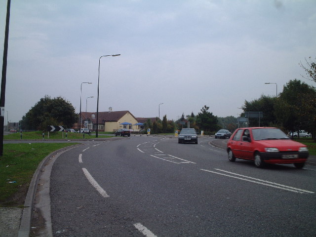
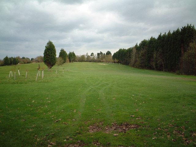
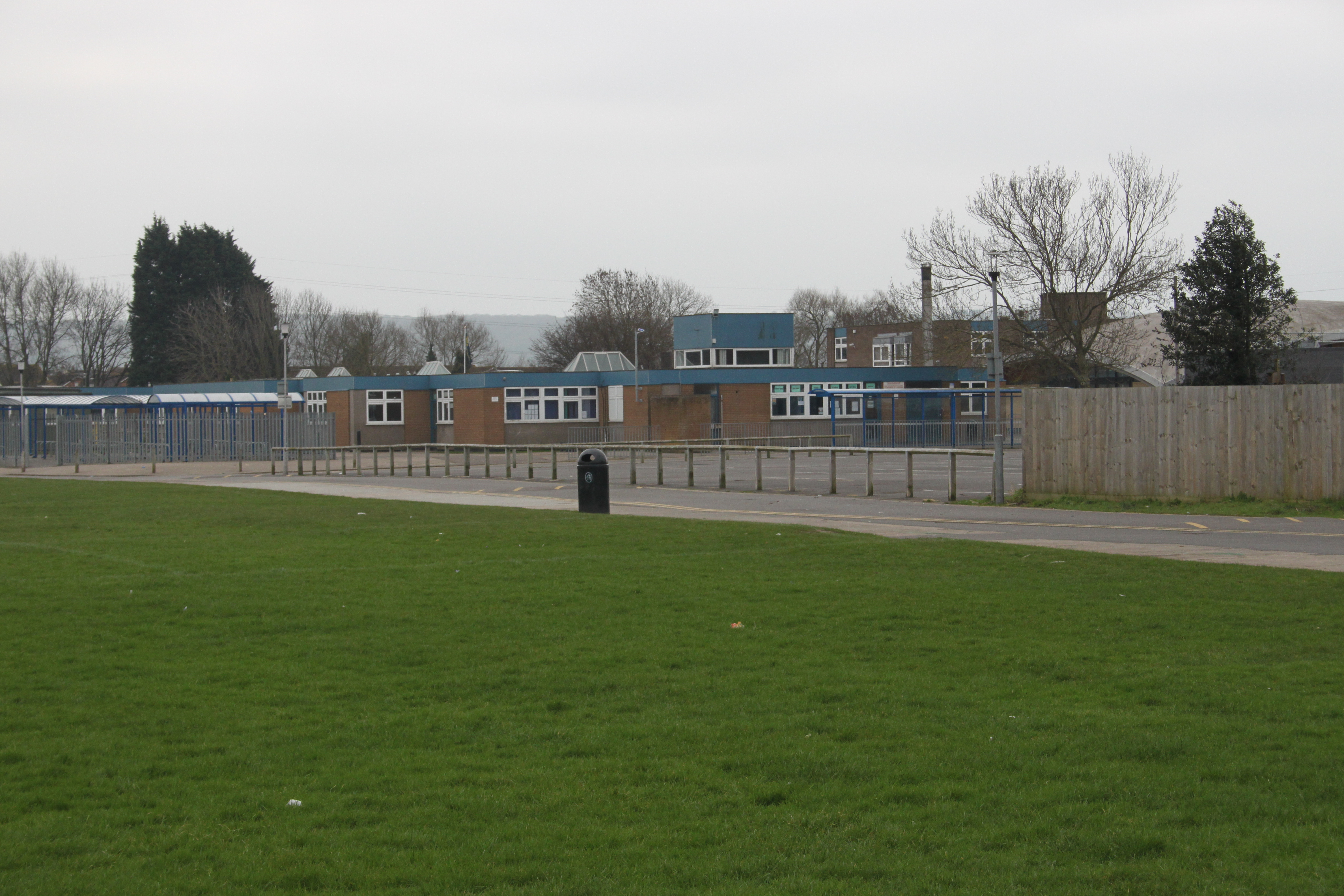
Weston Village Images

Images are sourced within 2km of 51.34917/-2.9277684 or Grid Reference ST3561. Thanks to Geograph Open Source API. All images are credited.

West End farm Caravan Park Here at the edge of the park is the Rhyne that runs eventually down to Uphill village
West End farm Caravan Park
Here at the edge of the park is the Rhyne that runs eventually down to Uphill village
Baytree Road Looking down Baytree Road
Baytree Road
Looking down Baytree Road
Worle High Street
Worle High Street
Summer House Public House
Helicopter Museum Advertised as 'Britains only Helicopter Museum'.
Helicopter Museum
Advertised as 'Britains only Helicopter Museum'.
Weston Airport (disused)
A371 from Banwell to Weston Super Mare
Locking Castle Golf Course
Road Junction Roundabout at Morrisons viewed from Woolvers Hill Road
Road Junction
Roundabout at Morrisons viewed from Woolvers Hill Road
Longridge Way, Weston Village Part of the ever growing 'suburbia' of Weston Super Mare
Longridge Way, Weston Village
Part of the ever growing 'suburbia' of Weston Super Mare
Hornets Rugby Ground
Locking Road, Weston Super Mare
Worlebury Golf Course Looking out from the 4th Tee
Worlebury Golf Course
Looking out from the 4th Tee
Golfers on the 4th Tee Worlebury Golf course
Golfers on the 4th Tee
Worlebury Golf course
Weston-super-Mare: Worlebury golf course Looking north
Weston-super-Mare: Worlebury golf course
Looking north
Weston-super-Mare: The Observatory At the east end of Worlebury Hill, and now part of a private residence. This structure was originally a windmill, at work in 1867, but converted to an observatory in the 1870s
Weston-super-Mare: The Observatory
At the east end of Worlebury Hill, and now part of a private residence. This structure was originally a windmill, at work in 1867, but converted to an observatory in the 1870s
Wartime Pillbox This ex WW2 pillbox is well preserved and adjacent to the roundabout entering Moor Park, near the Helicopter Museum.
Wartime Pillbox
This ex WW2 pillbox is well preserved and adjacent to the roundabout entering Moor Park, near the Helicopter Museum.
Locking Head Drove, Look towards Drove Farm Picture looking at the gates of the new Drove Farm. Original farm buildings shown on the left of the lane.
Locking Head Drove, Look towards Drove Farm
Picture looking at the gates of the new Drove Farm. Original farm buildings shown on the left of the lane.
Show me another place!

Weston Village is located at Grid Ref: ST3561 (Lat: 51.34917, Lng: -2.9277684)

Unitary Authority: North Somerset

Police Authority: Avon and Somerset

What 3 Words

///holly.rings.lamp. Near Locking, Somerset

Nearby Locations

Weston Village

Related Wikis

Worle Community School

Worle Community School - an Academy (often shortened to WCSA) is a coeducational secondary school academy located in Worle, a suburb of Weston-super-Mare...

Bristol Road railway station

Bristol Road railway station served the village of Worle, North Somerset, England, from 1912 to 1940 on the Weston, Clevedon and Portishead Railway....

Winterstoke Hundred Academy

Winterstoke Hundred Academy (formerly North Somerset Enterprise and Technology College) is a coeducational secondary school and sixth form located in Weston...

Worle

Worle ( WURL) is a large village in North Somerset which is joined to the seaside town of Weston-super-Mare on its western edge. It, however, maintains...

Nearby Amenities

Located within 500m of 51.34917,-2.9277684
Traffic Calming: choker
Lat/Long: 51.349593/-2.9326246
Railway: level_crossing
Lat/Long: 51.3510132/-2.9301503
Bench
Lat/Long: 51.3490366/-2.9332547
Kerb: raised
Lat/Long: 51.3503576/-2.9247498
Bench
Backrest: yes
Lat/Long: 51.3498967/-2.9259606
Kerb: raised
Lat/Long: 51.3501869/-2.9237447
Bench
Backrest: yes
Lat/Long: 51.3490067/-2.9239402
Mini Roundabout
Direction: clockwise
Lat/Long: 51.3459326/-2.9311484
Access: foot
Barrier: bollard
Lat/Long: 51.3479411/-2.9264888
Noexit: yes
Lat/Long: 51.3468388/-2.9289467
Noexit: yes
Lat/Long: 51.3484786/-2.9242135
Access: foot
Barrier: cycle_barrier
Lat/Long: 51.3480011/-2.9258628
Noexit: yes
Lat/Long: 51.3488731/-2.9228552
Barrier: cycle_barrier
Lat/Long: 51.3519362/-2.9333378
003FP
Wpt Description: 09-JUL-09 10:04
Wpt Symbol: Waypoint
Lat/Long: 51.3535707/-2.9288977
Bus Stop
Montecute Circus
Bench: no
Bin: no
Bus: yes
Lit: no
Naptan AtcoCode: 0190NSA01298
Naptan Bearing: W
Naptan CommonName: Montecute Circus
Naptan Crossing: Montecute Circus
Naptan NaptanCode: wsmjtjp
Naptan Street: Worle Moor Road
Naptan Verified: no
Public Transport: platform
Shelter: no
Source: naptan_import
Tactile Paving: no
Lat/Long: 51.3491365/-2.9244319
Bus Stop
Montecute Circus
Bench: no
Bin: no
Bus: yes
Lit: no
Naptan AtcoCode: 0190NSA01299
Naptan Bearing: E
Naptan CommonName: Montecute Circus
Naptan Crossing: Montecute Circus
Naptan NaptanCode: wsmjtjt
Naptan Street: Worle Moor Road
Naptan Verified: no
Public Transport: platform
Shelter: no
Source: naptan_import
Tactile Paving: no
Lat/Long: 51.3493007/-2.9243782
Bus Stop
Howitt Way
Bus: yes
Naptan AtcoCode: 0190NSA01300
Naptan Bearing: SW
Naptan CommonName: Howitt Way
Naptan Crossing: Howitt Way
Naptan NaptanCode: wsmjtjw
Naptan Street: Worle Moor Road
Naptan Verified: no
Public Transport: platform
Source: naptan_import
Lat/Long: 51.3491901/-2.9264435
Bus Stop
Howitt Way
Bus: yes
Naptan AtcoCode: 0190NSA01301
Naptan Bearing: NW
Naptan CommonName: Howitt Way
Naptan Crossing: Howitt Way
Naptan NaptanCode: wsmjtma
Naptan Street: Worle Moor Road
Naptan Verified: no
Public Transport: platform
Source: naptan_import
Lat/Long: 51.3490863/-2.9265723
Bus Stop
Eden Croft
Bus: yes
Naptan AtcoCode: 0190NSA01302
Naptan Bearing: N
Naptan CommonName: Eden Croft
Naptan Crossing: Eden Croft
Naptan NaptanCode: wsmjtmd
Naptan Street: Worle Moor Road
Naptan Verified: no
Public Transport: platform
Source: naptan_import
Lat/Long: 51.3487646/-2.9288253
Bus Stop
Eden Croft
Bus: yes
Naptan AtcoCode: 0190NSA01303
Naptan Bearing: N
Naptan CommonName: Eden Croft
Naptan Crossing: Eden Croft
Naptan NaptanCode: wsmjtmg
Naptan Street: Worle Moor Road
Naptan Verified: no
Public Transport: platform
Source: naptan_import
Lat/Long: 51.3485502/-2.9287985
Bus Stop
Plumley Park
Bus: yes
Naptan AtcoCode: 0190NSA01304
Naptan Bearing: NE
Naptan CommonName: Plumley Park
Naptan NaptanCode: wsmjtmj
Naptan Street: Moor Lane
Naptan Verified: no
Public Transport: platform
Source: naptan_import
Lat/Long: 51.3479108/-2.926331
Bus Stop
Plumley Park
Bus: yes
Naptan AtcoCode: 0190NSA01305
Naptan Bearing: SW
Naptan CommonName: Plumley Park
Naptan NaptanCode: wsmjtmp
Naptan Street: Moor Lane
Naptan Verified: no
Public Transport: platform
Source: naptan_import
Lat/Long: 51.3477868/-2.9261969
Bus Stop
Kempe Road
Bus: yes
Naptan AtcoCode: 0190NSC01247
Naptan Bearing: N
Naptan CommonName: Kempe Road
Naptan Crossing: Kempe Road
Naptan NaptanCode: wsmjpmj
Naptan PlusbusZoneRef: WSMARE
Naptan Street: Griffin Road
Naptan Verified: no
Public Transport: platform
Source: naptan_import
Lat/Long: 51.3477849/-2.9287921
Bus Stop
Kempe Road
Bus: yes
Naptan AtcoCode: 0190NSC01248
Naptan Bearing: SW
Naptan BusStopType: CUS
Naptan CommonName: Kempe Road
Naptan Crossing: Kempe Road
Naptan NaptanCode: wsmjpmp
Naptan PlusbusZoneRef: WSMARE
Naptan Street: Griffin Road
Naptan Verified: no
Public Transport: platform
Source: naptan_import
Lat/Long: 51.3478583/-2.9286069
Bus Stop
Vale Mill Way
Bus: yes
Naptan AtcoCode: 0190NSC01257
Naptan Bearing: NE
Naptan CommonName: Vale Mill Way
Naptan Crossing: Vale Mill Way
Naptan NaptanCode: wsmjptw
Naptan Street: Moor Lane
Naptan Verified: no
Public Transport: platform
Source: naptan_import
Lat/Long: 51.3493113/-2.9218034
Bus Stop
Vale Mill Way
Bus: yes
Naptan AtcoCode: 0190NSC01258
Naptan Bearing: SW
Naptan BusStopType: CUS
Naptan CommonName: Vale Mill Way
Naptan Crossing: Vale Mill Way
Naptan NaptanCode: wsmjpwa
Naptan Street: Moor Lane
Naptan Verified: no
Public Transport: platform
Source: naptan_import
Lat/Long: 51.3491773/-2.9217069
Bus Stop
Woodpecker Drive
Bus: yes
Naptan AtcoCode: 0190NSC30165
Naptan Bearing: NE
Naptan CommonName: Woodpecker Drive
Naptan Crossing: Woodpecker Drive
Naptan NaptanCode: wsmdapd
Naptan PlusbusZoneRef: WSMARE
Naptan Street: Mead Vale
Naptan Verified: no
Public Transport: platform
Source: naptan_import
Lat/Long: 51.3524232/-2.930053
Bus Stop
The Nightjar
Bus: yes
Naptan AtcoCode: 0190NSC30166
Naptan Bearing: SW
Naptan CommonName: The Nightjar
Naptan Crossing: Thrush Close
Naptan NaptanCode: wsmdata
Naptan PlusbusZoneRef: WSMARE
Naptan Street: Mead Vale
Naptan Verified: no
Public Transport: platform
Source: naptan_import
Lat/Long: 51.3527248/-2.9289855
Bus Stop
The Nightjar
Bus: yes
Naptan AtcoCode: 0190NSC30167
Naptan Bearing: N
Naptan CommonName: The Nightjar
Naptan Crossing: Mead Vale
Naptan NaptanCode: wsmdatd
Naptan PlusbusZoneRef: WSMARE
Naptan Street: Redwing Drive
Naptan Verified: no
Public Transport: platform
Source: naptan_import
Lat/Long: 51.3535121/-2.9275318
Bus Stop
Greengage Close
Bus: yes
Naptan AtcoCode: 0190NSC30446
Naptan Bearing: E
Naptan CommonName: Greengage Close
Naptan Crossing: Greengage Close
Naptan NaptanCode: wsmdadt
Naptan PlusbusZoneRef: WSMARE
Naptan Street: Maltlands
Naptan Verified: no
Public Transport: platform
Source: naptan_import
Lat/Long: 51.3497497/-2.9328004
Bus Stop
Greengage Close
Bus: yes
Naptan AtcoCode: 0190NSC30447
Naptan Bearing: W
Naptan CommonName: Greengage Close
Naptan Crossing: Plumtree Road
Naptan NaptanCode: wsmdagp
Naptan PlusbusZoneRef: WSMARE
Naptan Street: Maltlands
Naptan Verified: no
Public Transport: platform
Source: naptan_import
Lat/Long: 51.3497186/-2.9332684
Bus Stop
Lombardy Close
Bus: yes
Naptan AtcoCode: 0190NSC30448
Naptan Bearing: SW
Naptan CommonName: Lombardy Close
Naptan Crossing: Aspen Park Road
Naptan NaptanCode: wsmdajt
Naptan PlusbusZoneRef: WSMARE
Naptan Street: Aspen Park Road
Naptan Verified: no
Public Transport: platform
Source: naptan_import
Lat/Long: 51.3495754/-2.9318884
Bus Stop
Lombardy Close
Bus: yes
Naptan AtcoCode: 0190NSC30449
Naptan Bearing: N
Naptan CommonName: Lombardy Close
Naptan Crossing: Lombardy Close
Naptan NaptanCode: wsmdajg
Naptan PlusbusZoneRef: WSMARE
Naptan Street: Aspen Park Road
Naptan Verified: no
Public Transport: platform
Source: naptan_import
Lat/Long: 51.3502713/-2.9316285
Bus Stop
Bailey Close
Bus: yes
Naptan AtcoCode: 0190NSC30450
Naptan Bearing: SE
Naptan CommonName: Bailey Close
Naptan Crossing: Bailey Close
Naptan NaptanCode: wsmdapg
Naptan PlusbusZoneRef: WSMARE
Naptan Street: Aspen Park Road
Naptan Verified: no
Public Transport: platform
Source: naptan_import
Lat/Long: 51.3504468/-2.9299218
Bus Stop
Vale Mill Way
Bus: yes
Naptan AtcoCode: 0190NSZ01247
Naptan Bearing: W
Naptan CommonName: Vale Mill Way
Naptan Crossing: Vale Mill Way
Naptan NaptanCode: wsmjgwa
Naptan PlusbusZoneRef: WSMARE
Naptan Street: Old Mill Way
Naptan Verified: no
Public Transport: platform
Source: naptan_import
Lat/Long: 51.3501383/-2.9214761
Bus Stop
Spruce Way
Bus: yes
Naptan AtcoCode: 0190NSZ01254
Naptan Bearing: NE
Naptan CommonName: Spruce Way
Naptan Crossing: Spruce Way
Naptan NaptanCode: wsmjmad
Naptan PlusbusZoneRef: WSMARE
Naptan Street: Aspen Park Road
Naptan Verified: no
Public Transport: platform
Source: naptan_import
Lat/Long: 51.3506543/-2.9282031
Bus Stop
Spruce Way
Bus: yes
Naptan AtcoCode: 0190NSZ01256
Naptan Bearing: SW
Naptan CommonName: Spruce Way
Naptan Crossing: Spruce Way
Naptan NaptanCode: wsmjmaj
Naptan PlusbusZoneRef: WSMARE
Naptan Street: Aspen Park Road
Naptan Verified: no
Public Transport: platform
Source: naptan_import
Lat/Long: 51.3508586/-2.9276291
Bus Stop
Bailey Close
Bus: yes
Naptan AtcoCode: 0190NSZ01257
Naptan Bearing: SE
Naptan CommonName: Bailey Close
Naptan Crossing: Bailey Close
Naptan NaptanCode: wsmjmam
Naptan PlusbusZoneRef: WSMARE
Naptan Street: Aspen Park Road
Naptan Verified: no
Public Transport: platform
Source: naptan_import
Lat/Long: 51.3504231/-2.930027
Bus Stop
Plumley Park
Bench: yes
Bin: no
Bus: yes
Lit: yes
Naptan AtcoCode: 0190NSZ01258
Naptan Bearing: NW
Naptan CommonName: Plumley Park
Naptan NaptanCode: wsmjmap
Naptan PlusbusZoneRef: WSMARE
Naptan Street: Old Mill Way
Naptan Verified: no
Public Transport: platform
Shelter: yes
Source: naptan_import
Tactile Paving: no
Lat/Long: 51.3503165/-2.9247794
Bus Stop
Plumley Park
Bench: no
Bin: no
Bus: yes
Lit: no
Naptan AtcoCode: 0190NSZ01259
Naptan Bearing: W
Naptan CommonName: Plumley Park
Naptan NaptanCode: wsmjmat
Naptan PlusbusZoneRef: WSMARE
Naptan Street: Old Mill Way
Naptan Verified: no
Public Transport: platform
Shelter: no
Source: naptan_import
Tactile Paving: no
Lat/Long: 51.3503975/-2.9247159
Bus Stop
Vale Mill Way
Bus: yes
Naptan AtcoCode: 0190NSZ01260
Naptan Bearing: E
Naptan CommonName: Vale Mill Way
Naptan Crossing: Castle View
Naptan NaptanCode: wsmjmaw
Naptan PlusbusZoneRef: WSMARE
Naptan Street: Old Mill Way
Naptan Verified: no
Public Transport: platform
Source: naptan_import
Lat/Long: 51.350336/-2.9213259
Power: tower
Lat/Long: 51.3512281/-2.9278849
Power: tower
Lat/Long: 51.3520986/-2.9236783
Traffic Calming: choker
Lat/Long: 51.3503367/-2.9295859
Traffic Calming: choker
Lat/Long: 51.3504239/-2.9284139
Power: tower
Source: Bing
Lat/Long: 51.3503633/-2.9320816
Weston Village
Place: suburb
Source: OS Open Names
Lat/Long: 51.3491673/-2.9277739
Street Lamp
Direction: 225
Lamp Mount: cast steel mast
Lamp Type: electric
Support: ground
Lat/Long: 51.3478015/-2.9230639
Street Lamp
Direction: 230
Lamp Mount: straight_mast
Lamp Type: electric
Support: ground
Lat/Long: 51.347998/-2.9234639
Total Bounce
Addr City: Weston-super-Mare
Addr Housenumber: 77
Addr Postcode: BS24 7HB
Addr Street: Longridge Way
Name En: equipment rental for parties
Phone: +44 1934203123
Shop: rental
Lat/Long: 51.3478318/-2.9235684
Fiona Mayne - Synergie Financial
Addr City: Weston-super-Mare
Addr Housenumber: 77
Addr Postcode: BS24 7EX
Addr Street: Longridge Way
Office: financial_advisor
Opening Hours: Mo-Fr 09:00-17:30
Phone: +44 1934518641
Lat/Long: 51.3480572/-2.9233753
Street Lamp
Lamp Type: electric
Lat/Long: 51.3474603/-2.9228916
Street Lamp
Lamp Type: electric
Lat/Long: 51.3476976/-2.9230691
Street Lamp
Direction: 45
Lamp Mount: mast
Lamp Type: electric
Support: ground
Lat/Long: 51.3478571/-2.9234273
Street Lamp
Direction: 135
Lamp Mount: mast
Lamp Type: electric
Support: ground
Lat/Long: 51.3480141/-2.9232538
Garage Door Supplier
Addr City: Weston-super-Mare
Addr Housenumber: 10
Addr Postcode: BS24 7BU
Addr Street: The Seven Acres
Fixme: The name=* tag seems more like a description
Phone: +44 7543350223
Shop: doors
Lat/Long: 51.3486445/-2.9225767
Street Lamp
Lamp Type: electric
Lat/Long: 51.3477839/-2.9238457
Bench
Material: metal
Lat/Long: 51.3481627/-2.9285572
Bench
Material: metal
Lat/Long: 51.3481131/-2.9288109
The Macaroom
Addr City: Weston-super-Mare
Addr Housenumber: 130
Addr Postcode: BS24 7HA
Addr Street: Longridge Way
Craft: confectionery
Note: na wynos
Phone: +44 7833 477219
Website: https://www.macaroom.co.uk/
Lat/Long: 51.3475005/-2.9251
Barrier: bollard
Bicycle: yes
Foot: yes
Horse: no
Material: stone
Motor Vehicle: no
Lat/Long: 51.3472788/-2.9242965
Street Lamp
Direction: 260
Support: ground
Lat/Long: 51.3471541/-2.926242
Street Lamp
Direction: 87
Lamp Type: led
Support: ground
Lat/Long: 51.3482714/-2.9227029
Street Lamp
Direction: 245
Lamp Type: led
Support: ground
Lat/Long: 51.3485853/-2.922683
Street Lamp
Direction: 140
Support: ground
Lat/Long: 51.3481486/-2.922895
Street Lamp
Direction: 140
Lamp Type: electric
Support: ground
Lat/Long: 51.3481891/-2.9222947
Entrance: main
Lat/Long: 51.3470427/-2.9273669
Entrance: main
Lat/Long: 51.3469307/-2.9274603
Entrance: main
Lat/Long: 51.3480499/-2.9234796
Access: private
Addr City: Weston-super-Mare
Addr Housenumber: 22
Addr Postcode: BS24 7HL
Addr Street: Walkers Drive
Entrance: main
Lat/Long: 51.3472593/-2.9262718
Barrier: bollard
Material: wood
Lat/Long: 51.3475497/-2.9242724
Barrier: bollard
Material: wood
Lat/Long: 51.3475833/-2.9242772
Barrier: bollard
Material: wood
Lat/Long: 51.3476169/-2.9242584
Barrier: bollard
Material: wood
Lat/Long: 51.3475152/-2.9242563
Barrier: bollard
Material: wood
Lat/Long: 51.3474812/-2.9242531
Barrier: bollard
Material: wood
Lat/Long: 51.347443/-2.9242651
Barrier: bollard
Material: wood
Lat/Long: 51.3474036/-2.9242713
Barrier: bollard
Material: wood
Lat/Long: 51.3480327/-2.9235522
Barrier: bollard
Material: wood
Lat/Long: 51.3479817/-2.9234526
Barrier: bollard
Material: wood
Lat/Long: 51.3479717/-2.9234232
Barrier: bollard
Material: wood
Lat/Long: 51.3479656/-2.9233817
Barrier: bollard
Material: wood
Lat/Long: 51.3479731/-2.9233453
Barrier: bollard
Material: wood
Lat/Long: 51.3479846/-2.9233077
Barrier: bollard
Material: wood
Lat/Long: 51.3478819/-2.9232318
Barrier: bollard
Material: wood
Lat/Long: 51.3479098/-2.9232467
Barrier: bollard
Material: wood
Lat/Long: 51.3479333/-2.9232321
The data included in this document is from www.openstreetmap.org. The data is made available under ODbL.

Have you been to Weston Village?

Leave your review of Weston Village below (or comments, questions and feedback).