West Laroch

Settlement in Argyllshire

Scotland

West Laroch

Steep Cliff into an old Quarry Pit Large pit in the ground which is partially boggy under ground with lots of vegetation. Photographed edge as a steep cliff approx. 4m high. Water ran down the cliff.
Steep Cliff into an old Quarry Pit Credit: Thoma

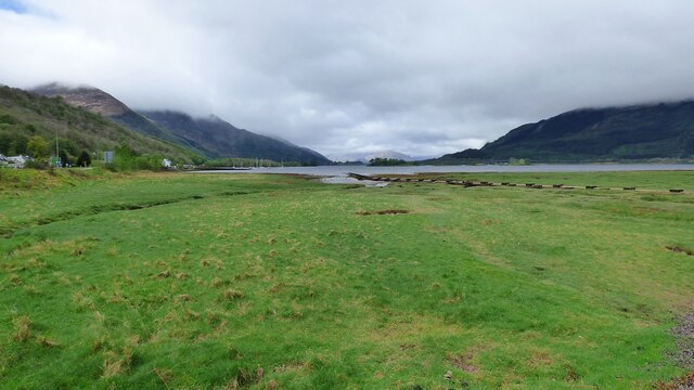
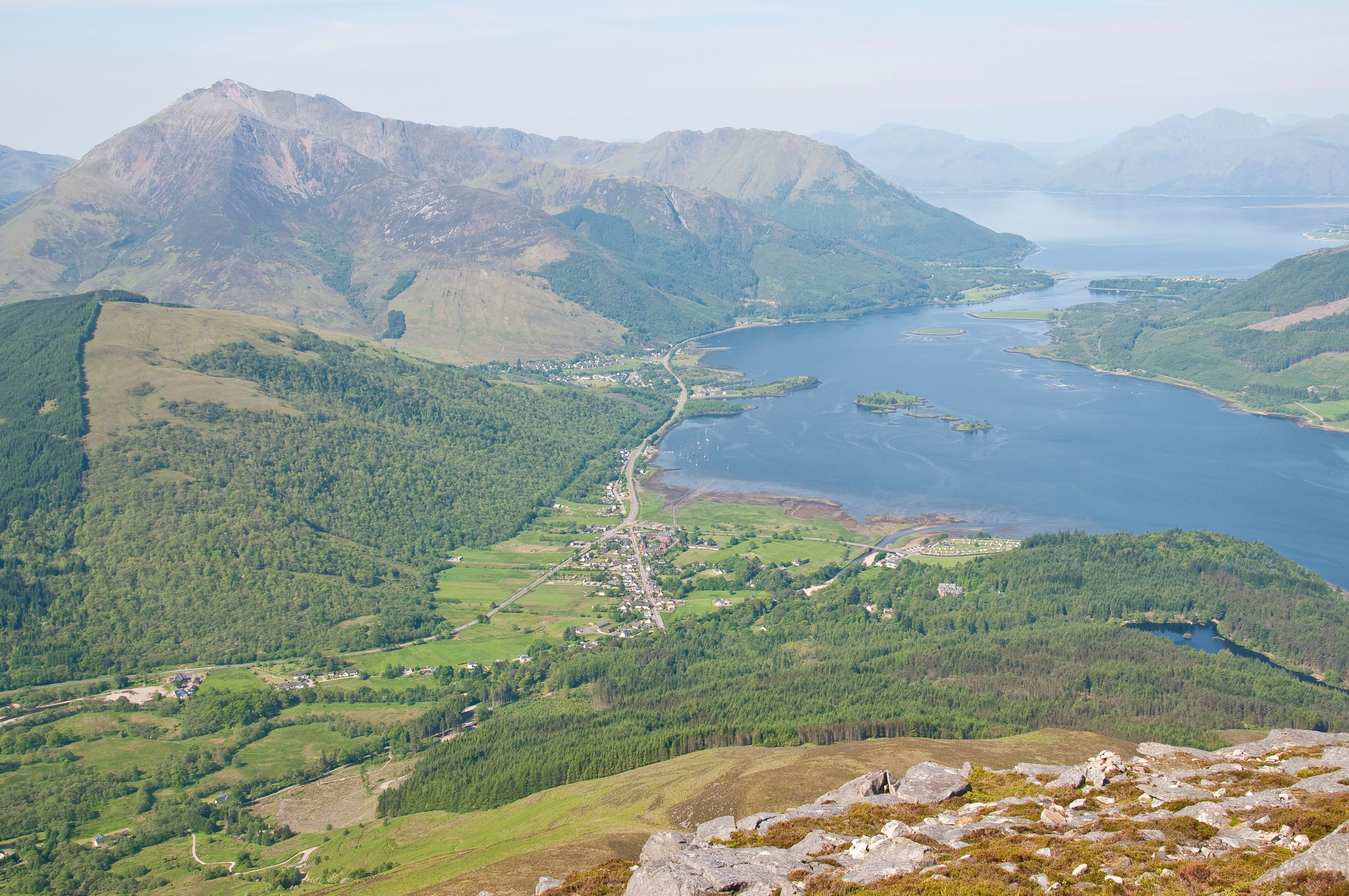
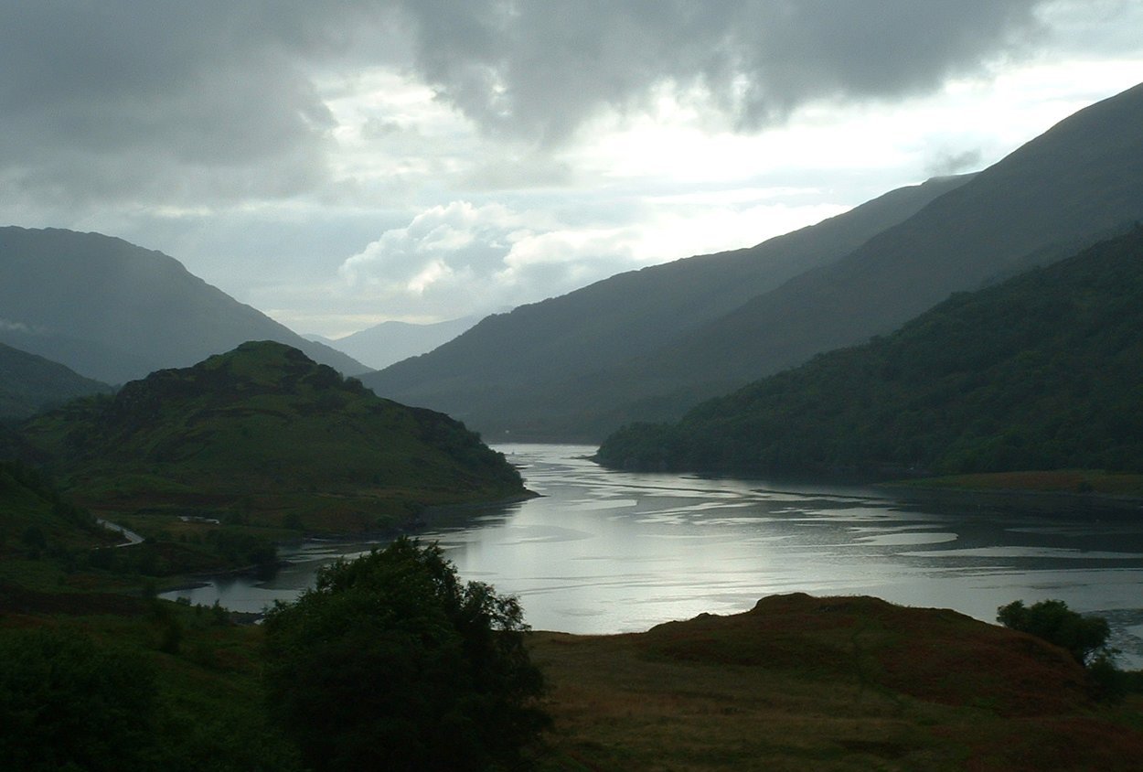
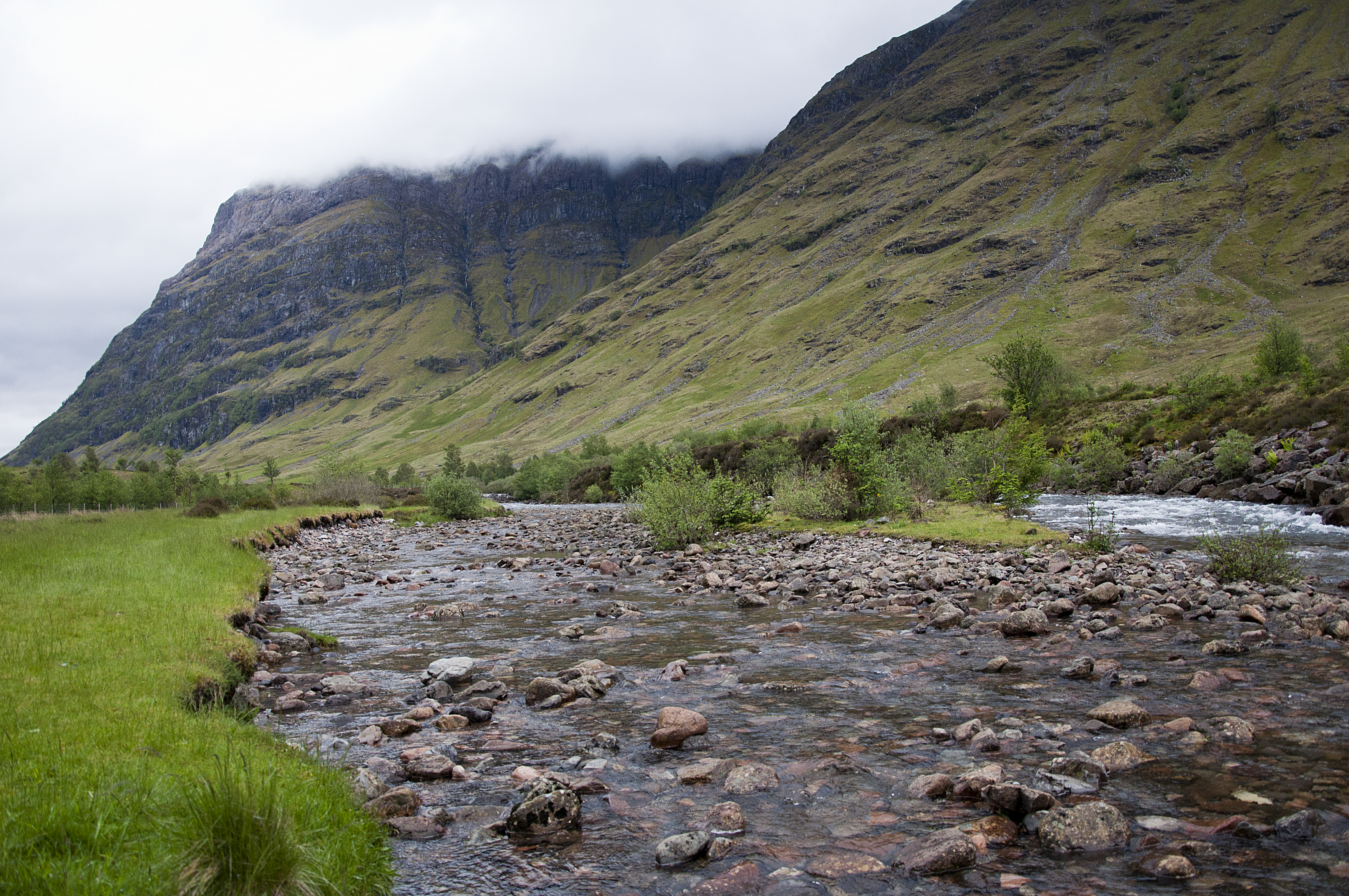
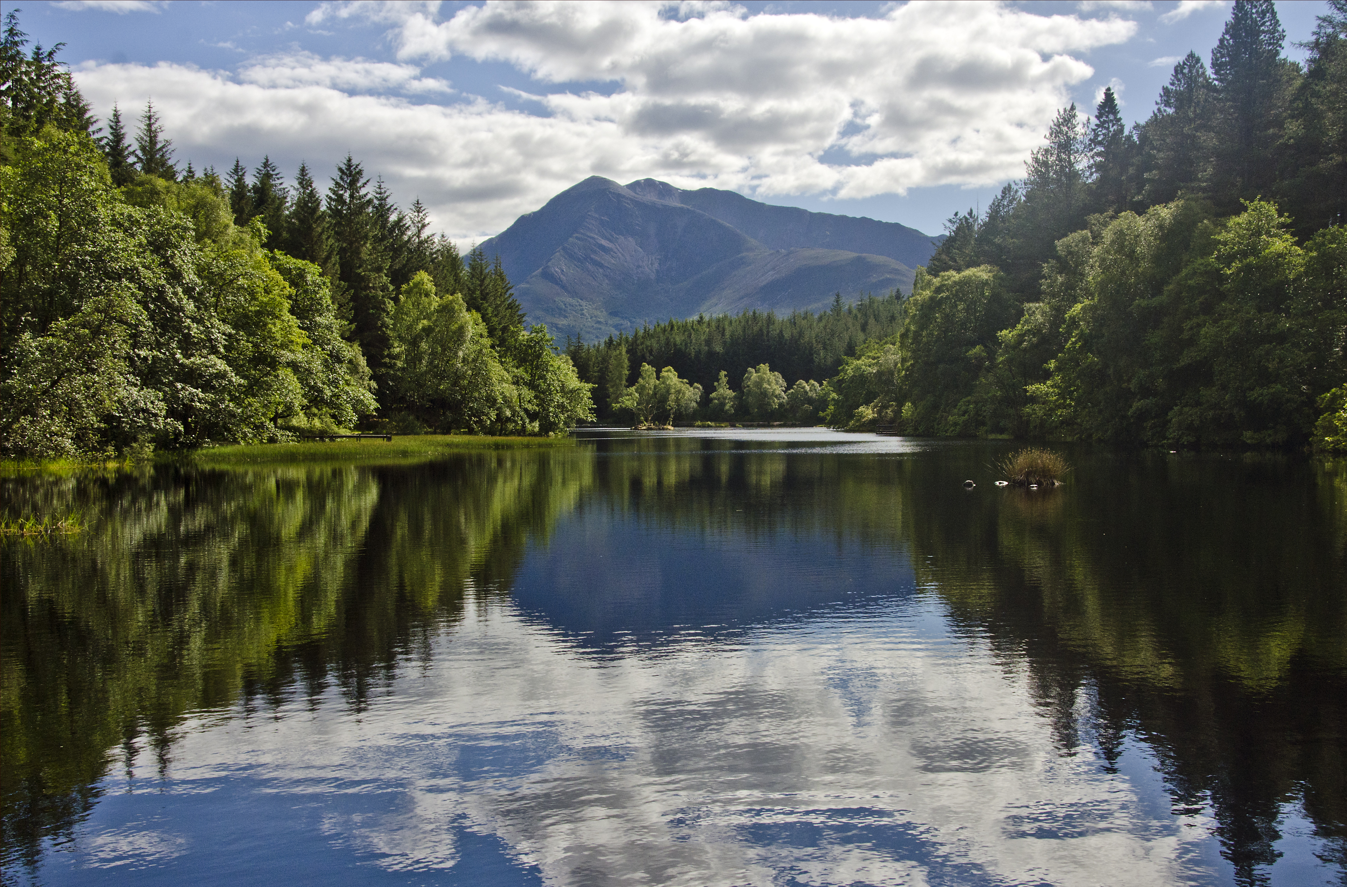
West Laroch is a small settlement located in the western region of Argyllshire, Scotland. Situated on the banks of Loch Awe, it is surrounded by stunning natural beauty and offers a peaceful retreat for visitors and residents alike. The area is known for its picturesque landscapes, with rolling hills, dense forests, and the majestic loch, creating a postcard-worthy backdrop.

Despite its small size, West Laroch boasts a strong sense of community and a welcoming atmosphere. The village is home to a tight-knit population, who takes great pride in preserving the area's rich history and heritage. Traditional Scottish culture is celebrated through various events and festivals held throughout the year.

The main industry in West Laroch is tourism, with visitors attracted to the area's scenic beauty and outdoor activities. Loch Awe, which stretches over 25 kilometers, offers opportunities for fishing, boating, and water sports. Hiking and biking trails are abundant, allowing visitors to explore the surrounding countryside and take in the breathtaking views.

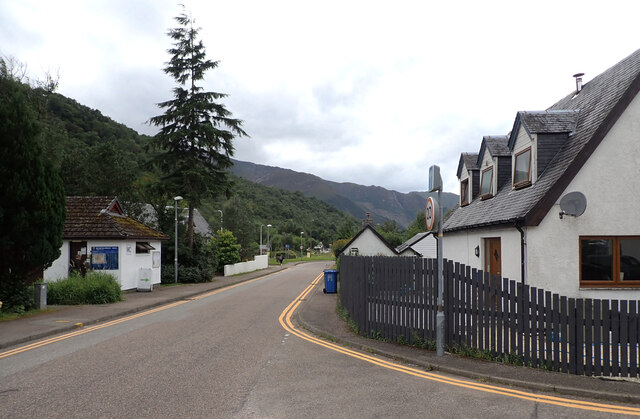
In terms of amenities, West Laroch offers a range of services to cater to both locals and tourists. There are a few small shops and local businesses, as well as several accommodation options, including bed and breakfasts and self-catering cottages. Additionally, there are a couple of charming pubs and restaurants where visitors can sample traditional Scottish cuisine and enjoy a friendly atmosphere.

Overall, West Laroch is a hidden gem in Argyllshire, offering a tranquil escape amidst stunning natural landscapes, rich cultural heritage, and a warm community spirit.

If you have any feedback on the listing, please let us know in the comments section below.
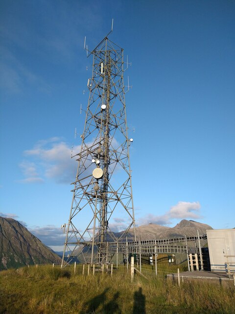
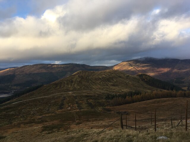
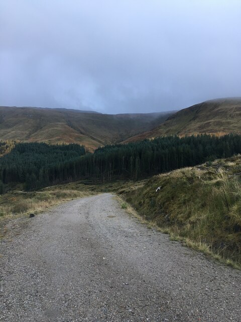
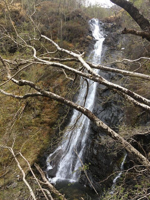
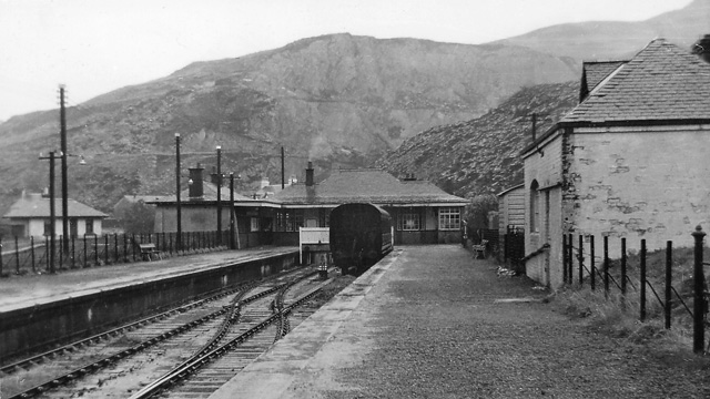
West Laroch Images

Images are sourced within 2km of 56.674288/-5.1353884 or Grid Reference NN0858. Thanks to Geograph Open Source API. All images are credited.

Steep Cliff into an old Quarry Pit Large pit in the ground which is partially boggy under ground with lots of vegetation. Photographed edge as a steep cliff approx. 4m high. Water ran down the cliff.
Steep Cliff into an old Quarry Pit
Large pit in the ground which is partially boggy under ground with lots of vegetation. Photographed edge as a steep cliff approx. 4m high. Water ran down the cliff.
Radio Tower Large Radio Tower on top of hill
Radio Tower
Large Radio Tower on top of hill
Clear-felled slopes of Meall Mor
Forestry road, Coire Fhiodhan
Waterfall on Allt a' Choire Riabhaich
Boggy ground near Am Meall
Shoreline of Loch Leven at Glencoe village
Albert Road, Ballachulish
Looking towards the mountains
Path from Ballachulish to Glens Creran or Duror
Co-op, Ballachulish
Co-op, Ballachulish
Glencoe Mountain Rescue
Loch Leven View from Glencoe Village.
Loch Leven
View from Glencoe Village.
The Carnoch, Glencoe Glencoe's public toilets are on the left.
The Carnoch, Glencoe
Glencoe's public toilets are on the left.
The Glencoe Inn, Tyndrum Road (A82), Glencoe The A82 runs from Glasgow to Fort William and Inverness, passing along the shores of Loch Lomond and Loch Ness and in the shadow of Ben Nevis along the way. The majority of the route is a trunk road and hence managed by Transport Scotland, who view the road as a vitally important link through the Scottish Highlands and beyond. 

At 167 miles, the road is the second longest A-road in Scotland (after the A9) and along its route uses pieces of road first built in the 1750s.
The Glencoe Inn, Tyndrum Road (A82), Glencoe
The A82 runs from Glasgow to Fort William and Inverness, passing along the shores of Loch Lomond and Loch Ness and in the shadow of Ben Nevis along the way. The majority of the route is a trunk road and hence managed by Transport Scotland, who view the road as a vitally important link through the Scottish Highlands and beyond. At 167 miles, the road is the second longest A-road in Scotland (after the A9) and along its route uses pieces of road first built in the 1750s.
Bus stop,  Tyndrum Road (A82), Glencoe The A82 runs from Glasgow to Fort William and Inverness, passing along the shores of Loch Lomond and Loch Ness and in the shadow of Ben Nevis along the way. The majority of the route is a trunk road and hence managed by Transport Scotland, who view the road as a vitally important link through the Scottish Highlands and beyond. 

At 167 miles, the road is the second longest A-road in Scotland (after the A9) and along its route uses pieces of road first built in the 1750s.
Bus stop, Tyndrum Road (A82), Glencoe
The A82 runs from Glasgow to Fort William and Inverness, passing along the shores of Loch Lomond and Loch Ness and in the shadow of Ben Nevis along the way. The majority of the route is a trunk road and hence managed by Transport Scotland, who view the road as a vitally important link through the Scottish Highlands and beyond. At 167 miles, the road is the second longest A-road in Scotland (after the A9) and along its route uses pieces of road first built in the 1750s.
Loch Leven from Tigh-phuirt A view down Loch Leven from Tigh-phuirt on the A82 near Glencoe.  Eilean Munde is in the middle distance.
Loch Leven from Tigh-phuirt
A view down Loch Leven from Tigh-phuirt on the A82 near Glencoe. Eilean Munde is in the middle distance.
Show me another place!

West Laroch is located at Grid Ref: NN0858 (Lat: 56.674288, Lng: -5.1353884)

Unitary Authority: Highland

Police Authority: Highlands and Islands

What 3 Words

///financial.ends.brick. Near Glencoe, Highland

Related Wikis

Nearby Amenities

Located within 500m of 56.674288,-5.1353884
Ballachulish
Name Gd: Baile a’ Chaolais
Place: village
Population: 610
Wikidata: Q60558183
Wikipedia: en:Ballachulish
Lat/Long: 56.6767553/-5.1325011
Created By: Merkaartor 0.12
Lat/Long: 56.6771523/-5.1354659
Created By: Merkaartor 0.12
Lat/Long: 56.6768556/-5.139211
Created By: Merkaartor 0.12
Lat/Long: 56.676142/-5.140475
Created By: Merkaartor 0.12
Lat/Long: 56.6758559/-5.131792
Created By: Merkaartor 0.12
Lat/Long: 56.6724859/-5.13222
Created By: Merkaartor 0.12
Lat/Long: 56.671991/-5.131733
Created By: Merkaartor 0.12
Lat/Long: 56.6709195/-5.1317524
Place Of Worship
Saint Munda
Denomination: church_of_scotland
Religion: christian
Lat/Long: 56.672676/-5.1320328
Created By: Merkaartor 0.12
Lat/Long: 56.6766784/-5.1357489
Created By: Merkaartor 0.12
Lat/Long: 56.6765178/-5.1353305
Created By: Merkaartor 0.12
Lat/Long: 56.6763306/-5.1348718
Created By: Merkaartor 0.12
Lat/Long: 56.6760212/-5.1345097
Created By: Merkaartor 0.12
Lat/Long: 56.6759461/-5.1331659
Created By: Merkaartor 0.12
Lat/Long: 56.6750693/-5.1339626
Created By: Merkaartor 0.12
Lat/Long: 56.67703/-5.132971
Created By: Merkaartor 0.12
Lat/Long: 56.6776659/-5.133434
Telephone
Booth: KX100
Covered: booth
Lat/Long: 56.6760615/-5.1332634
Bus Stop
Ballachulish Square
Naptan AtcoCode: 670010031
Naptan Bearing: SW
Naptan CommonName: Ballachulish Square
Naptan Indicator: opp Jubilee Park
Naptan Landmark: Ballachulish Square
Naptan NaptanCode: 45323789
Naptan PlusbusZoneRef: FRTWLM
Naptan Street: Ballachulish Square
Naptan Verified: no
Source: naptan_import
Lat/Long: 56.6766618/-5.1312217
Bus Stop
West Laroch
Bus: yes
Local Ref: AT
Naptan AtcoCode: 670010032
Naptan Bearing: NW
Naptan CommonName: MacColl Terrace
Naptan Indicator: at
Naptan Landmark: MacColl Terrace
Naptan NaptanCode: 45323828
Naptan PlusbusZoneRef: FRTWLM
Naptan Street: Leven Terrace
Naptan Verified: no
Public Transport: platform
Shelter: yes
Source: naptan_import
Lat/Long: 56.6743364/-5.1356964
Bus Stop
Croft Road
Local Ref: AT
Naptan AtcoCode: 670010033
Naptan Bearing: SE
Naptan CommonName: Croft Road
Naptan Indicator: at
Naptan Landmark: Croft Road
Naptan NaptanCode: 45323757
Naptan PlusbusZoneRef: FRTWLM
Naptan Street: Leven Terrace
Naptan Verified: no
Source: naptan_import
Lat/Long: 56.675742/-5.1391621
Bus Stop
Ballachulish Square
Naptan AtcoCode: 670010038
Naptan Bearing: NE
Naptan CommonName: Ballachulish Square
Naptan Indicator: at Jubilee Park
Naptan Landmark: Ballachulish Square
Naptan NaptanCode: 45323748
Naptan PlusbusZoneRef: FRTWLM
Naptan Street: Ballachulish Square
Naptan Verified: no
Source: naptan_import
Lat/Long: 56.6767451/-5.1314563
Bus Stop
Chisholm's Garage
Naptan AtcoCode: 670085101
Naptan Bearing: E
Naptan CommonName: Chisholm's Garage
Naptan Indicator: Albert Road (Eastbound)
Naptan Landmark: Ballachulish Square
Naptan NaptanCode: 45323727
Naptan PlusbusZoneRef: FRTWLM
Naptan Street: Albert Road
Naptan Verified: no
Source: naptan_import
Lat/Long: 56.6769398/-5.1385206
Bus Stop
Chisholm's Garage
Naptan AtcoCode: 670085101A
Naptan Bearing: W
Naptan CommonName: Chisholm's Garage
Naptan Indicator: Albert Road (Eastbound)
Naptan Landmark: Ballachulish Square
Naptan NaptanCode: 45329749
Naptan PlusbusZoneRef: FRTWLM
Naptan Street: Albert Road
Naptan Verified: no
Source: naptan_import
Lat/Long: 56.6768779/-5.1384938
West Laroch
Name Gd: An Làrach an Iar
Place: hamlet
Lat/Long: 56.6758403/-5.1407182
Joint Service Mountain Training Wing
Addr City: Ballachulish
Addr Street: Loanfern
Landuse: military
Military: base
Military Service: army
Operator: Joint Service Mountain Training Wing
Lat/Long: 56.6764556/-5.130721
Place Of Worship
St Mun's
Denomination: roman_catholic
Religion: christian
Lat/Long: 56.6730896/-5.1324541
Post Box
Collection Times: Mo-Fr 15:15; Sa 12:15
Post Box Type: lamp
Ref: PH49 122
Source: survey
Lat/Long: 56.6774326/-5.1305682
Post Box
Collection Times: Mo-Fr 12:00; Sa 12:00
Post Box Type: wall
Ref: PH49 117
Source: survey
Lat/Long: 56.6740856/-5.1348967
Ballachulish
Historic Railway: station
Railway: site
Wikidata: Q4851313
Wikipedia: en:Ballachulish railway station
Lat/Long: 56.6777555/-5.1309921
Barrier: bollard
Lat/Long: 56.6754903/-5.138522
Entrance: main
Lat/Long: 56.6727175/-5.1343222
Fern Villa Guest House
Name En: Fern Villa Guest House
Tourism: guest_house
Lat/Long: 56.6757963/-5.1321495
Cafe
Quarriers Kitchen
Opening Hours: Fr-Sa 16:30-21:30
Lat/Long: 56.677413/-5.1306582
Fast Food
Quarriers
Cuisine: fish_and_chips
Opening Hours: Fr-Sa 16:30-21:30
Lat/Long: 56.6774347/-5.1306332
Defibrillator
Defibrillator Location: On outside wall of medical centre. Available 24/7.
Emergency: defibrillator
Lat/Long: 56.6777109/-5.1308686
Parkview Bed and Breakfast
Tourism: guest_house
Lat/Long: 56.6760245/-5.1337925
Quarry Cottages
Tourism: chalet
Lat/Long: 56.6758572/-5.1326527
Tourism: viewpoint
Lat/Long: 56.674817/-5.1292426
Pub
The Laroch
Lat/Long: 56.6774581/-5.1307638
Restaurant
The Laroch
Lat/Long: 56.677419/-5.1309585
Tourism: viewpoint
Lat/Long: 56.6756138/-5.1285599
Generator Method: photovoltaic
Generator Output Electricity: yes
Generator Source: solar
Generator Type: solar_photovoltaic_panel
Location: roof
Power: generator
Lat/Long: 56.6722797/-5.1315889
Generator Method: photovoltaic
Generator Output Electricity: yes
Generator Source: solar
Generator Type: solar_photovoltaic_panel
Location: roof
Power: generator
Lat/Long: 56.6748144/-5.1335174
Generator Method: photovoltaic
Generator Output Electricity: yes
Generator Source: solar
Generator Type: solar_photovoltaic_panel
Location: roof
Power: generator
Lat/Long: 56.676131/-5.1336502
Generator Method: photovoltaic
Generator Output Electricity: yes
Generator Source: solar
Generator Type: solar_photovoltaic_panel
Location: roof
Power: generator
Lat/Long: 56.6778579/-5.1319952
Bench
Lat/Long: 56.6738849/-5.1338922
Power: pole
Lat/Long: 56.6727956/-5.1358337
Power: pole
Lat/Long: 56.6722176/-5.1352602
Power: pole
Lat/Long: 56.6728725/-5.1310624
Power: pole
Lat/Long: 56.6723965/-5.1320879
Power: pole
Lat/Long: 56.6719573/-5.1334252
Power: pole
Lat/Long: 56.6713793/-5.1332258
Power: pole
Lat/Long: 56.6709199/-5.1330685
Give Way
Direction: forward
Lat/Long: 56.6757589/-5.1393528
Give Way
Direction: forward
Lat/Long: 56.6756524/-5.1392899
Defibrillator
Defibrillator Location: On outside wall of Ballachulish Shinty Club. Available 24/7.
Emergency: defibrillator
Lat/Long: 56.6764607/-5.1316692
The data included in this document is from www.openstreetmap.org. The data is made available under ODbL.

Have you been to West Laroch?

Leave your review of West Laroch below (or comments, questions and feedback).