West Field

Settlement in Nottinghamshire Bassetlaw

England

West Field

All Hallows' Church All Hallows' Church, Grade II* listed, 13thC with tower added 15thC
All Hallows' Church Credit: thejackrustles

West Field is a small village located in the county of Nottinghamshire, England. Situated approximately 7 miles north of the city of Nottingham, it is nestled within the picturesque countryside of the East Midlands region. With a population of around 500 residents, West Field exudes a distinct charm and tranquility that attracts both locals and visitors alike.

The village is predominantly residential, with a scattering of traditional cottages and houses dotting its landscape. The area is characterized by its lush green fields, rolling hills, and meandering streams, offering residents a peaceful and idyllic setting to call home. The community is tight-knit and friendly, fostering a sense of belonging and community spirit.

Despite its small size, West Field benefits from excellent transport links. The A614 road runs close by, providing easy access to nearby towns and cities. The local bus service also offers convenient connections to Nottingham and other neighboring areas. The village is served by a few local amenities, including a village hall and a primary school, which caters to the educational needs of the local children.

Nature lovers will find plenty to explore in the surrounding area, with several nature reserves and walking trails nearby. The beautiful Sherwood Forest, famous for its association with the legendary Robin Hood, is a short drive away and offers a wealth of outdoor activities and historical attractions.

Overall, West Field is a picturesque village that offers a peaceful and rural lifestyle within easy reach of the vibrant city of Nottingham. Its natural beauty and strong sense of community make it a highly desirable place to live.

If you have any feedback on the listing, please let us know in the comments section below.
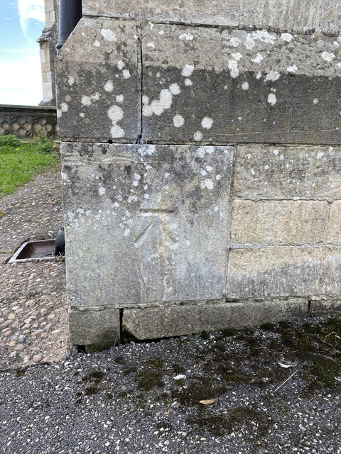
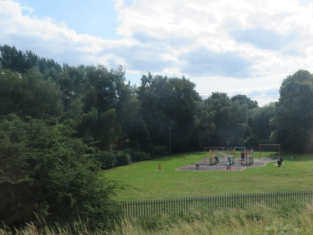
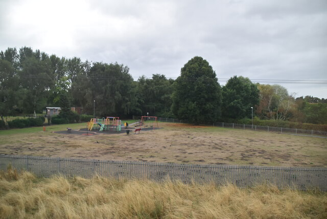
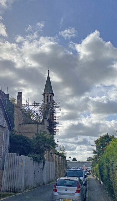
West Field Images

Images are sourced within 2km of 53.317159/-0.95013143 or Grid Reference SK7080. Thanks to Geograph Open Source API. All images are credited.

All Hallows' Church All Hallows' Church, Grade II* listed, 13thC with tower added 15thC
All Hallows' Church
All Hallows' Church, Grade II* listed, 13thC with tower added 15thC
OS Cut Mark - Ordsall, All Hallows Church <span class="nowrap"><a title="https://www.bench-marks.org.uk/bm29487" rel="nofollow ugc noopener" href="https://www.bench-marks.org.uk/bm29487">Link</a><img style="margin-left:2px;" alt="External link" title="External link - shift click to open in new window" src="https://s1.geograph.org.uk/img/external.png" width="10" height="10"/></span>
OS Cut Mark - Ordsall, All Hallows Church
Location of OS Cut Mark - Ordsall, All Hallows Church <span class="nowrap"><a title="https://www.bench-marks.org.uk/bm29487" rel="nofollow ugc noopener" href="https://www.bench-marks.org.uk/bm29487">Link</a><img style="margin-left:2px;" alt="External link" title="External link - shift click to open in new window" src="https://s1.geograph.org.uk/img/external.png" width="10" height="10"/></span>
Location of OS Cut Mark - Ordsall, All Hallows Church
Graveyard, Retford
Graveyard, Retford
Houses on Bridon Close, South Retford Rough grassland on the edge of an expanding housing estate. Seen from the East Coast Mainline.
Houses on Bridon Close, South Retford
Rough grassland on the edge of an expanding housing estate. Seen from the East Coast Mainline.
Bridge over the River Idle Looking southwest to All Hallow's Church at Ordsall.
Bridge over the River Idle
Looking southwest to All Hallow's Church at Ordsall.
Weedy lake at Ordsall An inlet of a larger lake, surrounded by trees and other vegetation.
Weedy lake at Ordsall
An inlet of a larger lake, surrounded by trees and other vegetation.
Lake at Ordsall, south of Repton Seen from the East Coast Mainline, and east of the River Idle.
Lake at Ordsall, south of Repton
Seen from the East Coast Mainline, and east of the River Idle.
Play space at Ordsall Seen from the East Coast Mainline, so good for trainspotting.
Play space at Ordsall
Seen from the East Coast Mainline, so good for trainspotting.
Goosemoor Park
Goosemoor Park
River Idle The River Idle is a 26 mile long river in Nottinghamshire. Its source is the confluence of the River Maun and River Meden, near Markham Moor. From there, it flows north through Retford and Bawtry before entering the River Trent at Stockwith near Misterton.
Wikipedia: <span class="nowrap"><a title="http://en.wikipedia.org/wiki/River_Idle" rel="nofollow ugc noopener" href="http://en.wikipedia.org/wiki/River_Idle">Link</a><img style="margin-left:2px;" alt="External link" title="External link - shift click to open in new window" src="https://s1.geograph.org.uk/img/external.png" width="10" height="10"/></span>
River Idle
The River Idle is a 26 mile long river in Nottinghamshire. Its source is the confluence of the River Maun and River Meden, near Markham Moor. From there, it flows north through Retford and Bawtry before entering the River Trent at Stockwith near Misterton. Wikipedia: LinkExternal link
Chesterfield Canal E of Retford Town Lock
Chesterfield Canal & Retford Town Lock
Chesterfield Canal & West Retford Lock
Entrance to Bracken Lane Farm
Remains of burnt out St Alban's Church
Show me another place!

West Field is located at Grid Ref: SK7080 (Lat: 53.317159, Lng: -0.95013143)

Administrative County: Nottinghamshire

District: Bassetlaw

Police Authority: Nottinghamshire

What 3 Words

///hills.unless.flips. Near Retford, Nottinghamshire

Nearby Locations

West Field South Retford

Related Wikis

Retford railway station

Retford railway station is on the East Coast Main Line serving the town of Retford, Nottinghamshire, England. It is 138 miles 49 chains (223.1 km) down...

Albert Road drill hall, Retford

The Albert Road drill hall is a former military installation in Retford. == History == The building was designed as a mission hall for All Hallows' Church...

Retford Oaks Academy

Retford Oaks Academy is a coeducational secondary school and sixth form located in the market town of Retford, Nottinghamshire, England, situated in the...

Ordsall Hall School

Ordsall Hall Comprehensive School was a comprehensive school situated on Ordsall Road in the market town of East Retford in the district of Bassetlaw,...

Nearby Amenities

Located within 500m of 53.317159,-0.95013143
Crossing
Lat/Long: 53.319518/-0.9540139
Turning Circle
Lat/Long: 53.316966/-0.943083
Lock Name: West Retford Lock 58
Seamark Type: gate
Waterway: lock_gate
Lat/Long: 53.321489/-0.9501604
Lock Name: West Retford Lock 58
Seamark Type: gate
Waterway: lock_gate
Lat/Long: 53.321613/-0.950467
Barrier: toll_booth
Lat/Long: 53.3157763/-0.9483577
Mini Roundabout
Direction: clockwise
Lat/Long: 53.3193526/-0.9442456
Barrier: bollard
Lat/Long: 53.3199344/-0.9468041
Turning Circle
Lat/Long: 53.3169781/-0.9511078
Turning Circle
Lat/Long: 53.3135933/-0.9525621
Bus Stop
Silver Street
Bus: yes
Naptan AtcoCode: 3300BA0066
Naptan Bearing: SW
Naptan CommonName: Silver Street
Naptan Crossing: Silver Street
Naptan Indicator: adj
Naptan NaptanCode: ntsgatmj
Naptan Notes: none
Naptan Street: Ordsall Park Road
Naptan Verified: no
Public Transport: platform
Source: naptan_import
Lat/Long: 53.3172459/-0.9574047
Bus Stop
Devonshire Road
Bus: yes
Naptan AtcoCode: 3300BA0067
Naptan Bearing: SW
Naptan CommonName: Devonshire Road
Naptan Crossing: Devonshire Road
Naptan Indicator: adj
Naptan NaptanCode: ntsgatmp
Naptan Notes: none
Naptan Street: Ordsall Park Road
Naptan Verified: no
Public Transport: platform
Source: naptan_import
Lat/Long: 53.318907/-0.9541066
Bus Stop
Queen Street
Bus: yes
Naptan AtcoCode: 3300BA0721
Naptan Bearing: S
Naptan CommonName: Queen Street
Naptan Crossing: The Crescent
Naptan Indicator: S-bound
Naptan NaptanCode: ntsdajtm
Naptan Street: Queen Street
Naptan Verified: no
Public Transport: platform
Source: naptan_import
Lat/Long: 53.3198694/-0.9510955
Bus Stop
Railway Station
Bus: yes
Naptan AtcoCode: 3300BA0723
Naptan Bearing: NE
Naptan CommonName: Railway Station
Naptan Crossing: Station Road
Naptan Indicator: adj
Naptan Landmark: Railway Station
Naptan NaptanCode: ntsdajtw
Naptan Notes: BW--3300BA0991
Naptan Street: Victoria Road
Naptan Verified: no
Public Transport: platform
Source: naptan_import
Lat/Long: 53.315877/-0.9479059
Retford Post 16 Centre
Local Ref: IN
Naptan AtcoCode: 3300BA0768
Naptan Bearing: SW
Naptan BusStopType: CUS
Naptan CommonName: Retford Post 16 Centre
Naptan Indicator: in
Naptan Landmark: Retford Post 16 Centre
Naptan NaptanCode: ntsgdwda
Naptan Notes: CUS
Naptan Street: Bus Park
Naptan Verified: no
Source: naptan_import
Lat/Long: 53.3191366/-0.9567131
Bus Stop
Duke Street
Bus: yes
Naptan AtcoCode: 3300BA0977
Naptan Bearing: W
Naptan CommonName: Duke Street
Naptan Crossing: Duke Street
Naptan Indicator: adj
Naptan NaptanCode: ntsgmjgd
Naptan Notes: BW--3300BA0978
Naptan Street: Albert Road
Naptan Verified: no
Public Transport: platform
Source: naptan_import
Lat/Long: 53.3183255/-0.9439857
Bus Stop
Duke Street
Bus: yes
Naptan AtcoCode: 3300BA0978
Naptan Bearing: E
Naptan BusStopType: CUS
Naptan CommonName: Duke Street
Naptan Crossing: Duke Street
Naptan Indicator: opp
Naptan NaptanCode: ntsgmjgj
Naptan Notes: CUS--3300BA0977
Naptan Street: Albert Road
Naptan Verified: no
Public Transport: platform
Source: naptan_import
Lat/Long: 53.3184248/-0.9440283
Bus Stop
Queen Street
Bus: yes
Naptan AtcoCode: 3300BA0990
Naptan Bearing: N
Naptan CommonName: Queen Street
Naptan Crossing: The Crescent
Naptan Indicator: N-bound
Naptan NaptanCode: ntsgmwdg
Naptan Street: Queen Street
Naptan Verified: no
Public Transport: platform
Source: naptan_import
Lat/Long: 53.3198707/-0.9512456
Bus Stop
Railway Station
Bus: yes
Naptan AtcoCode: 3300BA0991
Naptan Bearing: SW
Naptan BusStopType: CUS
Naptan CommonName: Railway Station
Naptan Crossing: Station Road
Naptan Indicator: opp
Naptan Landmark: Railway Station
Naptan NaptanCode: ntsgmwdj
Naptan Notes: CUS--3300BA0723
Naptan Street: Victoria Road
Naptan Verified: no
Public Transport: platform
Source: naptan_import
Lat/Long: 53.3158486/-0.9477415
Bus Stop
Stirling Road
Bus: yes
Naptan AtcoCode: 3300BA1016
Naptan Bearing: NW
Naptan CommonName: Stirling Road
Naptan Crossing: Stirling Road
Naptan Indicator: adj
Naptan NaptanCode: ntsgpgdg
Naptan Street: West Carr Road
Naptan Verified: no
Public Transport: platform
Source: naptan_import
Lat/Long: 53.3151/-0.9504824
Turning Circle
Lat/Long: 53.3175032/-0.9433125
Turning Circle
Lat/Long: 53.3165362/-0.9429051
Turning Circle
Lat/Long: 53.3181538/-0.956616
Atm
Drive Through: no
Wheelchair: yes
Lat/Long: 53.3199785/-0.9451953
Post Box
Lat/Long: 53.3198513/-0.9498901
Post Box
Brand: Royal Mail
Brand Wikidata: Q638098
Brand Wikipedia: en:Royal Mail
Collection Times: Mo-Fr 16:00; Sa 11:00
Operator: Royal Mail
Operator Wikidata: Q638098
Post Box Mounting: building
Post Box Type: wall
Ref: DN22 4
Royal Cypher: EIIR
Royal Cypher Wikidata: Q33102113
Lat/Long: 53.3153053/-0.9479034
Retford Western Junction
Railway: switch
Lat/Long: 53.315911/-0.9493404
Railway: switch
Lat/Long: 53.317571/-0.9512935
Railway: switch
Lat/Long: 53.3159396/-0.948988
Railway: switch
Lat/Long: 53.3167872/-0.9499174
Railway: switch
Lat/Long: 53.3175584/-0.9509008
Railway: buffer_stop
Lat/Long: 53.3189843/-0.9527003
Railway: switch
Lat/Long: 53.3150806/-0.9484776
Railway: buffer_stop
Lat/Long: 53.3143344/-0.9472832
Railway: switch
Lat/Long: 53.3169103/-0.9505625
Retford
Public Transport: stop_position
Railway: stop
Train: yes
Lat/Long: 53.3151079/-0.948355
Retford
Public Transport: stop_position
Railway: stop
Train: yes
Lat/Long: 53.3150203/-0.9477854
Railway: switch
Lat/Long: 53.3148263/-0.952962
Railway: switch
Lat/Long: 53.3151732/-0.9527501
Railway: switch
Lat/Long: 53.3205858/-0.954929
Addr City: Retford
Addr Housename: Rossington Business Park
Addr Postcode: DN22 7SW
Addr Street: West Carr Road
Addr Unit: 22
Lat/Long: 53.315073/-0.9501134
Crossing
Zebra Crossing
Crossing: uncontrolled
Crossing Ref: zebra
Kerb: lowered
Tactile Paving: yes
Wheelchair: yes
Lat/Long: 53.3200418/-0.9453929
Crossing
Zebra Crossing
Crossing: uncontrolled
Crossing Ref: zebra
Kerb: lowered
Tactile Paving: yes
Wheelchair: yes
Lat/Long: 53.320206/-0.945864
Crossing
Zebra Crossing
Crossing: uncontrolled
Crossing Ref: zebra
Kerb: lowered
Tactile Paving: yes
Wheelchair: yes
Lat/Long: 53.3202815/-0.9459573
Retford
Naptan AtcoCode: 9100RTFD
Network: National Rail
Network Website: https://www.nationalrail.co.uk/stations/ret/
Network Wikidata: Q26334
Operator: East Coast
Public Transport: station
Railway: station
Ref Crs: RET
Source: wikipedia
Train: yes
Wikidata: Q5259666
Wikipedia: en:Retford railway station
Lat/Long: 53.3151982/-0.9481044
Generator Method: photovoltaic
Generator Output Electricity: yes
Generator Source: solar
Generator Type: solar_photovoltaic_panel
Location: roof
Power: generator
Lat/Long: 53.3171911/-0.9540885
Generator Method: photovoltaic
Generator Output Electricity: yes
Generator Source: solar
Generator Type: solar_photovoltaic_panel
Location: roof
Power: generator
Lat/Long: 53.3206095/-0.9499981
Generator Method: photovoltaic
Generator Output Electricity: yes
Generator Source: solar
Generator Type: solar_photovoltaic_panel
Location: roof
Power: generator
Lat/Long: 53.3177823/-0.9446184
Generator Method: photovoltaic
Generator Output Electricity: yes
Generator Source: solar
Generator Type: solar_photovoltaic_panel
Location: roof
Power: generator
Lat/Long: 53.3194232/-0.9512676
Generator Method: photovoltaic
Generator Output Electricity: yes
Generator Source: solar
Generator Type: solar_photovoltaic_panel
Location: roof
Power: generator
Lat/Long: 53.319484/-0.9513856
Elevator
Lat/Long: 53.3152333/-0.947828
Elevator
Lat/Long: 53.3150578/-0.9481398
Noexit: yes
Lat/Long: 53.3196234/-0.9445254
Noexit: yes
Lat/Long: 53.3198474/-0.9448103
Noexit: yes
Lat/Long: 53.3199734/-0.9450706
Noexit: yes
Lat/Long: 53.3195038/-0.9437582
Noexit: yes
Lat/Long: 53.3195175/-0.943994
Crossing
Crossing: marked
Crossing Markings: yes
Lat/Long: 53.3196423/-0.9447594
Crossing
Crossing: marked
Crossing Markings: yes
Lat/Long: 53.3196222/-0.9449919
Generator Method: photovoltaic
Generator Output Electricity: yes
Generator Source: solar
Generator Type: solar_photovoltaic_panel
Location: roof
Power: generator
Lat/Long: 53.3187522/-0.9447732
Generator Method: photovoltaic
Generator Output Electricity: yes
Generator Source: solar
Generator Type: solar_photovoltaic_panel
Location: roof
Power: generator
Lat/Long: 53.3187537/-0.9447063
Power: transformer
Lat/Long: 53.3127588/-0.949553
Power: transformer
Lat/Long: 53.312748/-0.9497803
Retford South Curve Junction
Historic Railway: junction
Railway: site
Lat/Long: 53.3143797/-0.9467817
Retford Heating & Plumbing Supplies
Craft: plumber
Lat/Long: 53.3164183/-0.9476084
Retford Western Junction
Railway: junction
Lat/Long: 53.3162309/-0.9498282
Post Box
Lat/Long: 53.3188042/-0.9542274
Barrier: bollard
Bollard: fixed
Lat/Long: 53.3194795/-0.9528145
Barrier: bollard
Bollard: fixed
Lat/Long: 53.3195003/-0.9528293
Barrier: bollard
Bollard: fixed
Lat/Long: 53.319526/-0.9528413
Barrier: bollard
Bollard: fixed
Lat/Long: 53.3195396/-0.952848
Railway: buffer_stop
Lat/Long: 53.3152374/-0.9527698
The data included in this document is from www.openstreetmap.org. The data is made available under ODbL.

Have you been to West Field?

Leave your review of West Field below (or comments, questions and feedback).