West End

Settlement in Bedfordshire

England

West End

The De Grey Mausoleum, Flitton Mausoleum of the De Grey family, Flitton Church. Memorial to the 6th Earl of Kent.
The De Grey Mausoleum, Flitton Credit: N Avery

West End is a small village located in the county of Bedfordshire, England. Situated approximately 7 miles west of the county town of Bedford, it is a primarily residential area with a population of around 1,000 residents.

The village is known for its picturesque countryside surroundings and offers a peaceful and tranquil setting for its inhabitants. West End is characterized by its charming traditional cottages and well-maintained gardens, which contribute to its overall aesthetic appeal.

Despite its small size, West End provides its residents with essential amenities such as a village hall, a primary school, and a local convenience store, ensuring that daily needs are met within the community itself. For additional services and facilities, residents can easily access nearby towns such as Bedford, which offers a wider range of shops, restaurants, and leisure activities.

The village benefits from its proximity to the beautiful Bedfordshire countryside, with several walking and cycling paths available for outdoor enthusiasts. The nearby River Great Ouse provides opportunities for boating and fishing, adding to the recreational options available to residents.

Transport links in West End are convenient, with regular bus services connecting the village to neighboring towns and villages. The A428 road runs close to the village, allowing easy access to major highways and facilitating travel to larger cities such as Milton Keynes and Cambridge.

Overall, West End, Bedfordshire offers a charming and idyllic lifestyle for its residents, combining the tranquility of rural living with the convenience of nearby amenities and transport connections.

If you have any feedback on the listing, please let us know in the comments section below.

West End Images

Images are sourced within 2km of 52.007834/-0.43007714 or Grid Reference TL0735. Thanks to Geograph Open Source API. All images are credited.

The De Grey Mausoleum, Flitton Mausoleum of the De Grey family, Flitton Church. Memorial to the 6th Earl of Kent.
The De Grey Mausoleum, Flitton
Mausoleum of the De Grey family, Flitton Church. Memorial to the 6th Earl of Kent.
A6 southbound at Warren Lane
The Bath House A rustic folly at Wrest Park
The Bath House
A rustic folly at Wrest Park
Wrest House The south frontage
Wrest House
The south frontage
Archer Pavilion On the Wrest Park estate, a baroque entertaining folly
Archer Pavilion
On the Wrest Park estate, a baroque entertaining folly
Wrest Park Statue Near the Serpentine and one of the few statues without a Historic England listing
Wrest Park Statue
Near the Serpentine and one of the few statues without a Historic England listing
The Italian Garden At Wrest House
The Italian Garden
At Wrest House
Silsoe, Wrest Park: English Heritage Tearoom
Silsoe, Wrest Park: Plants and garden requisites sales area
Silsoe, Wrest Park: Wyvern sculpture
Silsoe, Wrest Park: Gateway
Silsoe, Wrest Park: The Italian Garden and west aspect of the Country House
Silsoe, Wrest Park: Plants in The Italian Garden
Silsoe, Wrest Park: The Italian Garden
Silsoe, Wrest Park: The statue of Pomona in The Italian Garden
Silsoe, Wrest Park Country House: West window detail
Silsoe, Wrest Park Country House: Inside the Conservatory
Show me another place!

West End is located at Grid Ref: TL0735 (Lat: 52.007834, Lng: -0.43007714)

Unitary Authority: Central Bedfordshire

Police Authority: Bedfordshire

What 3 Words

///mended.comedy.blunders. Near Silsoe, Bedfordshire

Nearby Locations

West End Thrift Wood

Related Wikis

Silsoe

Silsoe is a village and civil parish in Bedfordshire, England. The village used to be on the main A6 road but a bypass around the village was opened in...
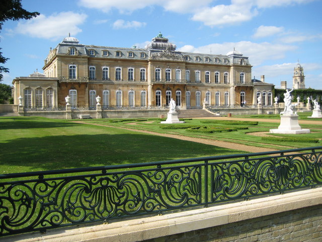
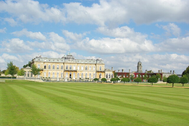
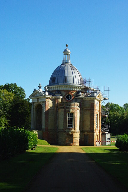
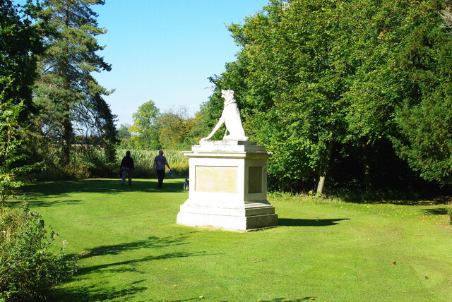
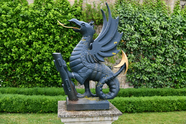
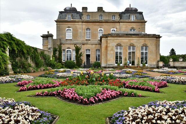
Wrest Park

Wrest Park is a country estate located in Silsoe, Bedfordshire, England. It comprises Wrest Park, a Grade I listed country house, and Wrest Park Gardens...

Flitton

Flitton (Flichtam, Fllite, Flute) is a village and former civil parish, now in the parish of Flitton and Greenfield, in the Central Bedfordshire district...
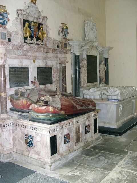
De Grey Mausoleum

The de Grey Mausoleum in Flitton, Bedfordshire, England, is one of the largest sepulchral chapels in the country. The mausoleum contains over twenty monuments...

Nearby Amenities

Located within 500m of 52.007834,-0.43007714
Turning Circle
Turning Circle: square
Lat/Long: 52.0120955/-0.4308197
Turning Circle
Turning Circle: square
Lat/Long: 52.0092876/-0.4263005
Entrance: yes
Lat/Long: 52.0097813/-0.424151
Silsoe
Place: village
Wikidata: Q1521909
Lat/Long: 52.0112746/-0.4285688
Stop
Direction: backward
Lat/Long: 52.0097806/-0.4251797
Silsoe Newsagency
Addr City: Silsoe
Addr Country: GB
Addr Housenumber: 24
Addr Postcode: MK45 4EP
Addr Street: High Street
Fhrs Authority: Central Bedfordshire
Fhrs Id: 546553
Fhrs Local Authority Id: 152071
Shop: newsagent
Source: Bing
Lat/Long: 52.0089912/-0.4247356
Post Box
Collection Times: Mo-Fr 09:00; Sa 07:00
Operator: Royal Mail
Post Box Type: lamp
Ref: MK45 304D
Royal Cypher: EIIR
Royal Cypher Wikidata: Q33102113
Source: Bing
Survey Date: 2016-12-23
Lat/Long: 52.0097639/-0.4258202
Route 66
Addr Housenumber: 22
Addr Postcode: MK45 4EP
Addr Street: High Street
Shop: hairdresser
Lat/Long: 52.0089391/-0.4247174
The George
Addr Postcode: MK45 4EP
Addr Street: High Street
Disused Amenity: pub
Source: Bing;previous name "The George - Now Closed Down"
Wheelchair: no
Lat/Long: 52.0106071/-0.4256011
Crossing
Lat/Long: 52.0081196/-0.4304859
Turning Circle
Turning Circle: knuckle
Lat/Long: 52.011625/-0.4315553
Silsoe Community Sports Centre
Addr City: Silsoe
Addr Country: GB
Addr Postcode: MK45 4GP
Addr Street: Chestnut Avenue
Fhrs Authority: Central Bedfordshire
Fhrs Id: 862698
Fhrs Local Authority Id: 159085
Leisure: sports_centre
Lat/Long: 52.0037721/-0.4294324
Direction: 165
Generator Method: photovoltaic
Generator Output Electricity: yes
Generator Solar Modules: 7
Generator Source: solar
Generator Type: solar_photovoltaic_panel
Location: roof
Power: generator
Lat/Long: 52.0121367/-0.4296468
Direction: 140
Generator Method: photovoltaic
Generator Output Electricity: yes
Generator Solar Modules: 10
Generator Source: solar
Generator Type: solar_photovoltaic_panel
Location: roof
Power: generator
Lat/Long: 52.0121292/-0.4304522
Direction: 235
Generator Method: photovoltaic
Generator Output Electricity: yes
Generator Solar Modules: 12
Generator Source: solar
Generator Type: solar_photovoltaic_panel
Location: roof
Power: generator
Lat/Long: 52.0113608/-0.4316044
Turning Circle
Turning Circle: knuckle
Lat/Long: 52.0096507/-0.4306385
Direction: 175
Generator Method: photovoltaic
Generator Output Electricity: yes
Generator Solar Modules: 16
Generator Source: solar
Generator Type: solar_photovoltaic_panel
Location: roof
Power: generator
Lat/Long: 52.0088582/-0.4284432
Direction: 165
Generator Method: photovoltaic
Generator Output Electricity: yes
Generator Solar Modules: 16
Generator Source: solar
Generator Type: solar_photovoltaic_panel
Location: roof
Power: generator
Lat/Long: 52.0096937/-0.4272655
Direction: 255
Generator Method: photovoltaic
Generator Output Electricity: yes
Generator Solar Modules: 16
Generator Source: solar
Generator Type: solar_photovoltaic_panel
Location: roof
Power: generator
Lat/Long: 52.0092943/-0.4270826
Turning Circle
Turning Circle: knuckle
Lat/Long: 52.0082563/-0.4275027
Turning Circle
Turning Circle: knuckle
Lat/Long: 52.0079449/-0.4287915
Direction: 175
Generator Method: photovoltaic
Generator Output Electricity: yes
Generator Solar Modules: 12
Generator Source: solar
Generator Type: solar_photovoltaic_panel
Location: roof
Power: generator
Lat/Long: 52.0079476/-0.4290223
Direction: 160
Generator Method: photovoltaic
Generator Output Electricity: yes
Generator Solar Modules: 16
Generator Source: solar
Generator Type: solar_photovoltaic_panel
Location: roof
Power: generator
Lat/Long: 52.0063945/-0.4281249
Direction: 175
Generator Method: photovoltaic
Generator Output Electricity: yes
Generator Solar Modules: 10
Generator Source: solar
Generator Type: solar_photovoltaic_panel
Location: roof
Power: generator
Lat/Long: 52.0051114/-0.4314104
Direction: 265
Generator Method: photovoltaic
Generator Output Electricity: yes
Generator Solar Modules: 4
Generator Source: solar
Generator Type: solar_photovoltaic_panel
Location: roof
Power: generator
Lat/Long: 52.0051368/-0.4314906
Crossing
Crossing: unmarked
Lat/Long: 52.0061337/-0.4264094
Traffic Calming: island
Lat/Long: 52.0063167/-0.4264551
Direction: 195
Generator Method: photovoltaic
Generator Output Electricity: yes
Generator Solar Modules: 11
Generator Source: solar
Generator Type: solar_photovoltaic_panel
Location: roof
Power: generator
Lat/Long: 52.007017/-0.4258637
Bus Stop
Bus: yes
Public Transport: platform
Shelter: no
Lat/Long: 52.0082954/-0.4247003
Bus Stop
Bus: yes
Public Transport: platform
Shelter: no
Lat/Long: 52.0086188/-0.4248358
Fast Food
Cuisine: fish_and_chips
Lat/Long: 52.0063381/-0.4254189
Shop: convenience
Lat/Long: 52.0065593/-0.4255932
The data included in this document is from www.openstreetmap.org. The data is made available under ODbL.

Have you been to West End?

Leave your review of West End below (or comments, questions and feedback).