Wellgill

Settlement in Cumberland Eden

England

Wellgill

Track beside Craig Nook House Isaac's Tea Trail is a 36 mile circular walk in the North Pennines named after Isaac Holden (c. 1805-57), an itinerant tea seller. Isaac became a familiar figure, out in all weathers, selling tea door to door to the farms, remote hamlets and mining communities scattered over the dales between Alston and Allendale Town. A pious man of humble origin, much involved in charitable work, he gained so much public respect that over 600 people contributed to his memorial. Full details at <span class="nowrap"><a title="https://isaacs-tea-trail.co.uk/" rel="nofollow ugc noopener" href="https://isaacs-tea-trail.co.uk/">Link</a><img style="margin-left:2px;" alt="External link" title="External link - shift click to open in new window" src="https://s1.geograph.org.uk/img/external.png" width="10" height="10"/></span>
Track beside Craig Nook House Credit: Chris Heaton

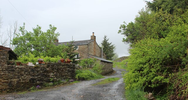
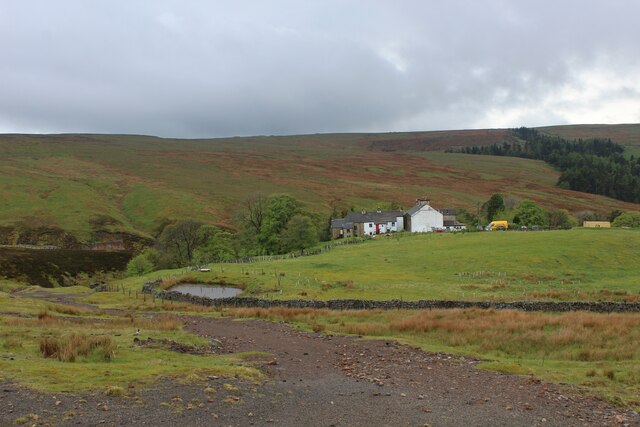
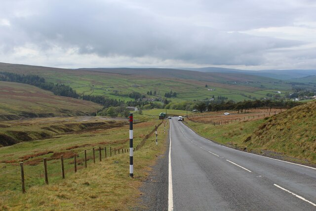
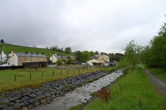
Wellgill is a small village located in the county of Cumberland, in the northwest of England. Situated near the Lake District National Park, it is known for its picturesque surroundings and tranquil atmosphere. The village is nestled in a valley, surrounded by rolling hills and lush greenery, providing residents and visitors with breathtaking views.

Wellgill has a rich history, with evidence of human activity dating back to the Roman era. The village's name is believed to be derived from the Old English words "wella," meaning spring, and "gil," meaning ravine, highlighting the presence of natural water sources in the area.

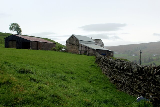
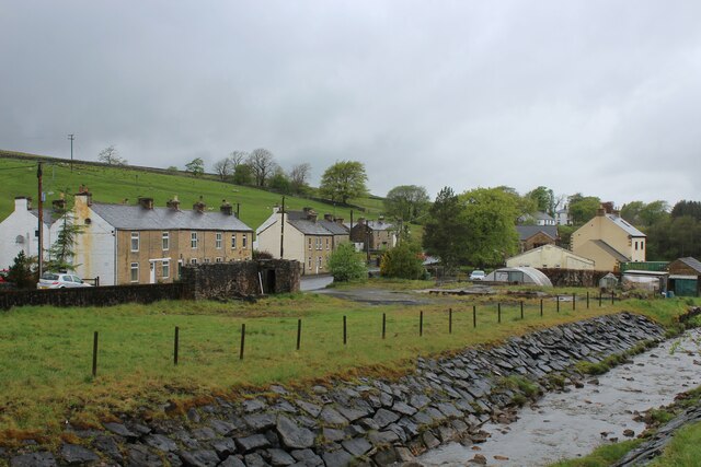
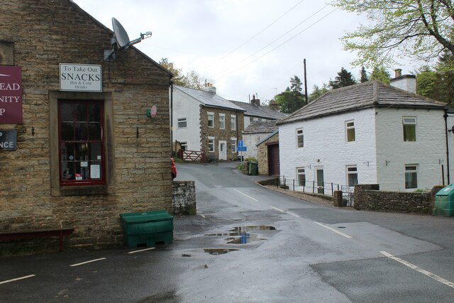
Despite its small size, Wellgill has a close-knit community that takes pride in preserving its heritage. The village features a charming collection of traditional stone cottages, many of which date back several centuries. The local church, St. Mary's, is a notable landmark and showcases stunning architecture.

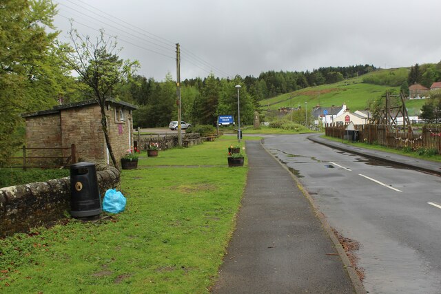
The village is primarily residential, with a small number of amenities such as a local pub, a village hall, and a community center. However, for more extensive services and facilities, residents typically travel to nearby towns and cities.

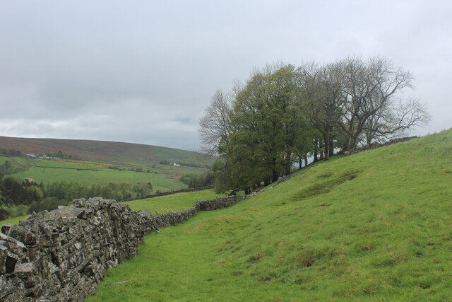
Wellgill's location near the Lake District National Park offers residents and visitors ample opportunities for outdoor activities. Hiking, cycling, and birdwatching are popular pastimes, with numerous trails and paths crisscrossing the surrounding countryside.

In summary, Wellgill is a charming village in Cumberland, boasting a rich history, beautiful landscapes, and a close-knit community. It is an ideal destination for those seeking a peaceful retreat in the heart of the English countryside.

If you have any feedback on the listing, please let us know in the comments section below.

Wellgill Images

Images are sourced within 2km of 54.793929/-2.3465593 or Grid Reference NY7744. Thanks to Geograph Open Source API. All images are credited.

Track beside Craig Nook House Isaac's Tea Trail is a 36 mile circular walk in the North Pennines named after Isaac Holden (c. 1805-57), an itinerant tea seller. Isaac became a familiar figure, out in all weathers, selling tea door to door to the farms, remote hamlets and mining communities scattered over the dales between Alston and Allendale Town. A pious man of humble origin, much involved in charitable work, he gained so much public respect that over 600 people contributed to his memorial. Full details at <span class="nowrap"><a title="https://isaacs-tea-trail.co.uk/" rel="nofollow ugc noopener" href="https://isaacs-tea-trail.co.uk/">Link</a><img style="margin-left:2px;" alt="External link" title="External link - shift click to open in new window" src="https://s1.geograph.org.uk/img/external.png" width="10" height="10"/></span>
Track beside Craig Nook House
Isaac's Tea Trail is a 36 mile circular walk in the North Pennines named after Isaac Holden (c. 1805-57), an itinerant tea seller. Isaac became a familiar figure, out in all weathers, selling tea door to door to the farms, remote hamlets and mining communities scattered over the dales between Alston and Allendale Town. A pious man of humble origin, much involved in charitable work, he gained so much public respect that over 600 people contributed to his memorial. Full details at LinkExternal link
High Nentsberry on a Wet Afternoon Isaac's Tea Trail is a 36 mile circular walk in the North Pennines named after Isaac Holden (c. 1805-57), an itinerant tea seller. Isaac became a familiar figure, out in all weathers, selling tea door to door to the farms, remote hamlets and mining communities scattered over the dales between Alston and Allendale Town. A pious man of humble origin, much involved in charitable work, he gained so much public respect that over 600 people contributed to his memorial. Full details at <span class="nowrap"><a title="https://isaacs-tea-trail.co.uk/" rel="nofollow ugc noopener" href="https://isaacs-tea-trail.co.uk/">Link</a><img style="margin-left:2px;" alt="External link" title="External link - shift click to open in new window" src="https://s1.geograph.org.uk/img/external.png" width="10" height="10"/></span>
High Nentsberry on a Wet Afternoon
Isaac's Tea Trail is a 36 mile circular walk in the North Pennines named after Isaac Holden (c. 1805-57), an itinerant tea seller. Isaac became a familiar figure, out in all weathers, selling tea door to door to the farms, remote hamlets and mining communities scattered over the dales between Alston and Allendale Town. A pious man of humble origin, much involved in charitable work, he gained so much public respect that over 600 people contributed to his memorial. Full details at LinkExternal link
Isaac's Tea Trail above Nentsberry Isaac's Tea Trail is a 36 mile circular walk in the North Pennines named after Isaac Holden (c. 1805-57), an itinerant tea seller. Isaac became a familiar figure, out in all weathers, selling tea door to door to the farms, remote hamlets and mining communities scattered over the dales between Alston and Allendale Town. A pious man of humble origin, much involved in charitable work, he gained so much public respect that over 600 people contributed to his memorial. Full details at <span class="nowrap"><a title="https://isaacs-tea-trail.co.uk/" rel="nofollow ugc noopener" href="https://isaacs-tea-trail.co.uk/">Link</a><img style="margin-left:2px;" alt="External link" title="External link - shift click to open in new window" src="https://s1.geograph.org.uk/img/external.png" width="10" height="10"/></span>
Isaac's Tea Trail above Nentsberry
Isaac's Tea Trail is a 36 mile circular walk in the North Pennines named after Isaac Holden (c. 1805-57), an itinerant tea seller. Isaac became a familiar figure, out in all weathers, selling tea door to door to the farms, remote hamlets and mining communities scattered over the dales between Alston and Allendale Town. A pious man of humble origin, much involved in charitable work, he gained so much public respect that over 600 people contributed to his memorial. Full details at LinkExternal link
Isaac's Tea Trail Fingerpost beside Gudham Gill The long distance footpath follows Gudham Gill, a tributary of the River Nent in Wellgill.
Isaac's Tea Trail Fingerpost beside Gudham Gill
The long distance footpath follows Gudham Gill, a tributary of the River Nent in Wellgill.
Isaac's Tea Trail between Nentsberry and Wellgill Isaac's Tea Trail is a 36 mile circular walk in the North Pennines named after Isaac Holden (c. 1805-57), an itinerant tea seller. Isaac became a familiar figure, out in all weathers, selling tea door to door to the farms, remote hamlets and mining communities scattered over the dales between Alston and Allendale Town. A pious man of humble origin, much involved in charitable work, he gained so much public respect that over 600 people contributed to his memorial. Full details at <span class="nowrap"><a title="https://isaacs-tea-trail.co.uk/" rel="nofollow ugc noopener" href="https://isaacs-tea-trail.co.uk/">Link</a><img style="margin-left:2px;" alt="External link" title="External link - shift click to open in new window" src="https://s1.geograph.org.uk/img/external.png" width="10" height="10"/></span>
Isaac's Tea Trail between Nentsberry and Wellgill
Isaac's Tea Trail is a 36 mile circular walk in the North Pennines named after Isaac Holden (c. 1805-57), an itinerant tea seller. Isaac became a familiar figure, out in all weathers, selling tea door to door to the farms, remote hamlets and mining communities scattered over the dales between Alston and Allendale Town. A pious man of humble origin, much involved in charitable work, he gained so much public respect that over 600 people contributed to his memorial. Full details at LinkExternal link
Wellgill Isaac's Tea Trail is a 36 mile circular walk in the North Pennines named after Isaac Holden (c. 1805-57), an itinerant tea seller. Isaac became a familiar figure, out in all weathers, selling tea door to door to the farms, remote hamlets and mining communities scattered over the dales between Alston and Allendale Town. A pious man of humble origin, much involved in charitable work, he gained so much public respect that over 600 people contributed to his memorial. Full details at <span class="nowrap"><a title="https://isaacs-tea-trail.co.uk/" rel="nofollow ugc noopener" href="https://isaacs-tea-trail.co.uk/">Link</a><img style="margin-left:2px;" alt="External link" title="External link - shift click to open in new window" src="https://s1.geograph.org.uk/img/external.png" width="10" height="10"/></span>
Wellgill
Isaac's Tea Trail is a 36 mile circular walk in the North Pennines named after Isaac Holden (c. 1805-57), an itinerant tea seller. Isaac became a familiar figure, out in all weathers, selling tea door to door to the farms, remote hamlets and mining communities scattered over the dales between Alston and Allendale Town. A pious man of humble origin, much involved in charitable work, he gained so much public respect that over 600 people contributed to his memorial. Full details at LinkExternal link
Holmsfoot on the A689 in Nenthead
Nenthead, beside the Community Shop A corner of Nenthead village.
Nenthead, beside the Community Shop
A corner of Nenthead village.
Hilltop near Nenthead
Road leading off the A689 in Nenthead Leads to public conveniences, surgery, restaurants and the Nenthead Mines Museum
Road leading off the A689 in Nenthead
Leads to public conveniences, surgery, restaurants and the Nenthead Mines Museum
A689 descending Westwards from Killhope Cross Long descent from Killhope Cross towards the Nent Valley in Cumbria
A689 descending Westwards from Killhope Cross
Long descent from Killhope Cross towards the Nent Valley in Cumbria
Isaac's Tea Trail east of Nentsberry Isaac's Tea Trail is a 36 mile circular walk in the North Pennines named after Isaac Holden (c. 1805-57), an itinerant tea seller. Isaac became a familiar figure, out in all weathers, selling tea door to door to the farms, remote hamlets and mining communities scattered over the dales between Alston and Allendale Town. A pious man of humble origin, much involved in charitable work, he gained so much public respect that over 600 people contributed to his memorial. Full details at <span class="nowrap"><a title="https://isaacs-tea-trail.co.uk/" rel="nofollow ugc noopener" href="https://isaacs-tea-trail.co.uk/">Link</a><img style="margin-left:2px;" alt="External link" title="External link - shift click to open in new window" src="https://s1.geograph.org.uk/img/external.png" width="10" height="10"/></span>
Isaac's Tea Trail east of Nentsberry
Isaac's Tea Trail is a 36 mile circular walk in the North Pennines named after Isaac Holden (c. 1805-57), an itinerant tea seller. Isaac became a familiar figure, out in all weathers, selling tea door to door to the farms, remote hamlets and mining communities scattered over the dales between Alston and Allendale Town. A pious man of humble origin, much involved in charitable work, he gained so much public respect that over 600 people contributed to his memorial. Full details at LinkExternal link
Isaac's tea Trail on the north flank of Nentdale Above Nentsberry Bridge
Isaac's tea Trail on the north flank of Nentdale
Above Nentsberry Bridge
Looking down on Gudham Gill Isaac's Tea Trail crosses the gill at the footbridge, where a County Council notice declares:
"THE PUBLIC HAS NO RIGHT TO USE THIS WAY WHICH IS NOT DEDICATED AS A PUBLIC RIGHT WAY [sic]. BUT THE COUNTY COUNCIL AS LANDOWNER IS WILLING TO PERMIT ITS USE ON FOOT ONLY"
Looking down on Gudham Gill
Isaac's Tea Trail crosses the gill at the footbridge, where a County Council notice declares: "THE PUBLIC HAS NO RIGHT TO USE THIS WAY WHICH IS NOT DEDICATED AS A PUBLIC RIGHT WAY [sic]. BUT THE COUNTY COUNCIL AS LANDOWNER IS WILLING TO PERMIT ITS USE ON FOOT ONLY"
The River Nent at the junction of Gudham Gill The river banks, carrying large amounts of lead mine waste, have been reinforced with large stone blocks.
The River Nent at the junction of Gudham Gill
The river banks, carrying large amounts of lead mine waste, have been reinforced with large stone blocks.
Sewage works at Wellgill, Nenthead
The River Nent at Holmsfoot, Nenthead Here, and elsewhere, the river banks have been reinforced. As Nenthead was once the centre of large scale lead mining activity, I assume that much of the ground has been reclaimed from poorly consolidated mine waste.
The River Nent at Holmsfoot, Nenthead
Here, and elsewhere, the river banks have been reinforced. As Nenthead was once the centre of large scale lead mining activity, I assume that much of the ground has been reclaimed from poorly consolidated mine waste.
Wesleyan Methodist Church, Nenthead Listed Grade II, with a date stone for 1873. "The Quaker-owned London Lead Company, lessee of the area’s mines, was keen to encourage nonconformist faith within its mining communities and, in common with many villages in the North Pennines, Nenthead was provided with both a Primitive and a Wesleyan Methodist chapel. John Wesley is known to have preached in the area in the mid and later C18." <span class="nowrap"><a title="https://historicengland.org.uk/listing/the-list/list-entry/1408095?section=official-list-entry" rel="nofollow ugc noopener" href="https://historicengland.org.uk/listing/the-list/list-entry/1408095?section=official-list-entry">Link</a><img style="margin-left:2px;" alt="External link" title="External link - shift click to open in new window" src="https://s1.geograph.org.uk/img/external.png" width="10" height="10"/></span>
Wesleyan Methodist Church, Nenthead
Listed Grade II, with a date stone for 1873. "The Quaker-owned London Lead Company, lessee of the area’s mines, was keen to encourage nonconformist faith within its mining communities and, in common with many villages in the North Pennines, Nenthead was provided with both a Primitive and a Wesleyan Methodist chapel. John Wesley is known to have preached in the area in the mid and later C18." LinkExternal link
Show me another place!

Wellgill is located at Grid Ref: NY7744 (Lat: 54.793929, Lng: -2.3465593)

Administrative County: Cumbria

District: Eden

Police Authority: Cumbria

What 3 Words

///dandelions.domain.pastime. Near Alston, Cumbria

Nearby Locations

Wellgill

Related Wikis

Rampghill mine

Rampgill mine is a disused lead mine at Nenthead, Alston Moor, Cumbria, England UK Grid Reference: NY78184351It was one of the most extensive and productive...

Nenthead

Nenthead ( NENT-hed) in the county of Cumbria is one of England's highest villages, at around 1,437 feet (438 m). It was not built until the middle of...

Killhope Cross

Killhope Cross (elevation 627 m; 2,057 ft) is a mountain pass in the English Pennines. The pass divides Weardale to the east and Cumbria to the west. The...

Coalcleugh

Coalcleugh is a hamlet in Northumberland, England. It is situated in the Pennines between Penrith and Hexham. In the past it was well known as a lead mining...

Nearby Amenities

Located within 500m of 54.793929,-2.3465593
Wellgill
Place: locality
Lat/Long: 54.7955163/-2.3424185
Holmsfoot
Place: locality
Lat/Long: 54.7901636/-2.3478273
Barrier: stile
Lat/Long: 54.7910094/-2.3434408
Post Box
Post Box Type: wall
Ref: CA9 246
Lat/Long: 54.7904815/-2.3475266
Woodbrae Farm
Place: farm
Lat/Long: 54.7929692/-2.3525212
Waterway: waterfall
Lat/Long: 54.7965854/-2.3491751
Wellgill Spelter Works
Abandoned: yes
Historic: yes
Mineral: zinc
Lat/Long: 54.7930567/-2.3482075
Brownley Hill Mine
Abandoned: yes
Man Made: adit
Resource: lead
Lat/Long: 54.7961382/-2.3501575
Dykehead
Place: locality
Lat/Long: 54.7952552/-2.3416428
Man Made: mast
Lat/Long: 54.79758/-2.3447858
Man Made: mast
Lat/Long: 54.7977587/-2.3447669
The Beaches
Place: locality
Lat/Long: 54.7919204/-2.3499856
Abandoned: yes
Man Made: mineshaft
Lat/Long: 54.7920022/-2.3534036
Generator Method: photovoltaic
Generator Output Electricity: yes
Generator Source: solar
Generator Type: solar_photovoltaic_panel
Location: roof
Power: generator
Lat/Long: 54.7904997/-2.3468052
The data included in this document is from www.openstreetmap.org. The data is made available under ODbL.

Have you been to Wellgill?

Leave your review of Wellgill below (or comments, questions and feedback).