Upper Radford

Settlement in Somerset

England

Upper Radford

High Littleton : Grassy Field & Gate A field seen from Bungay's Hill.
High Littleton : Grassy Field & Gate Credit: Lewis Clarke

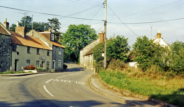
Upper Radford is a small village located in the county of Somerset, England. Situated in the southern part of the county, it is nestled amidst the rolling hills and picturesque countryside that make Somerset renowned for its natural beauty.

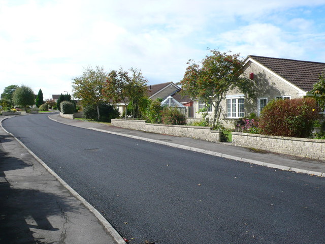
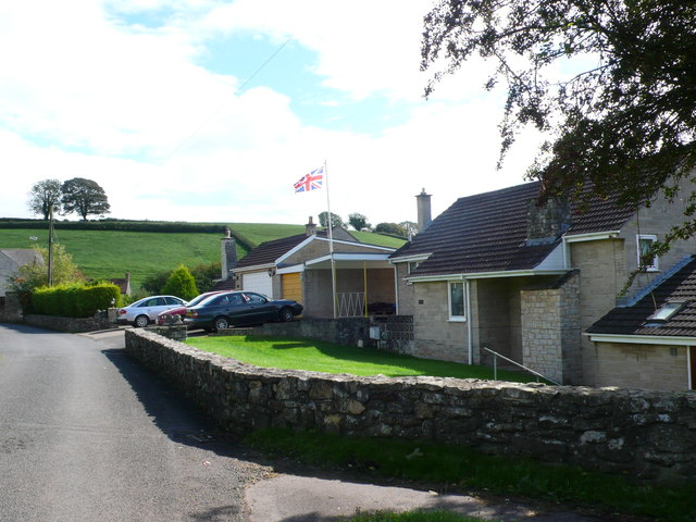
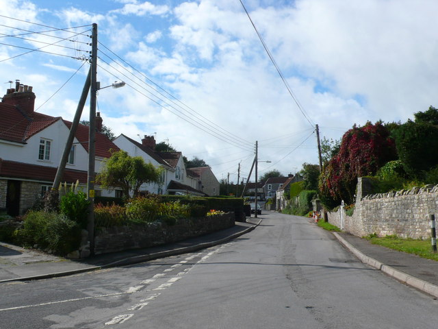
The village is characterized by its charming rural atmosphere and traditional architecture, with a mix of stone cottages and larger farmhouses dotting the landscape. The population of Upper Radford is relatively small, with around 200 residents, creating a close-knit community where neighbors often know each other and socialize regularly.

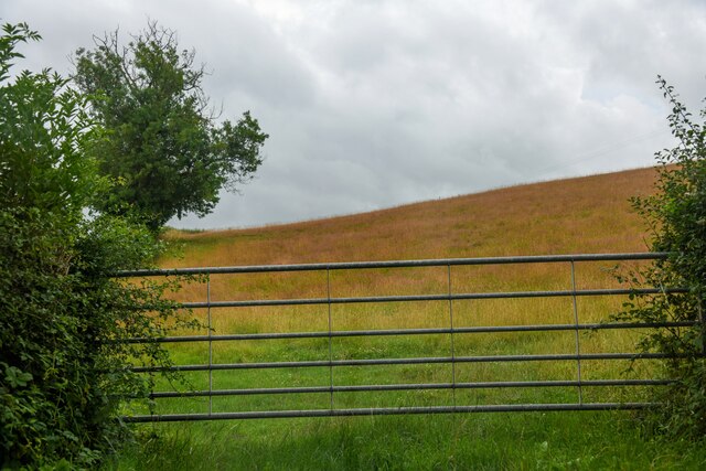
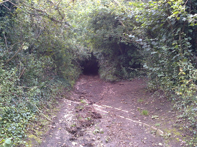
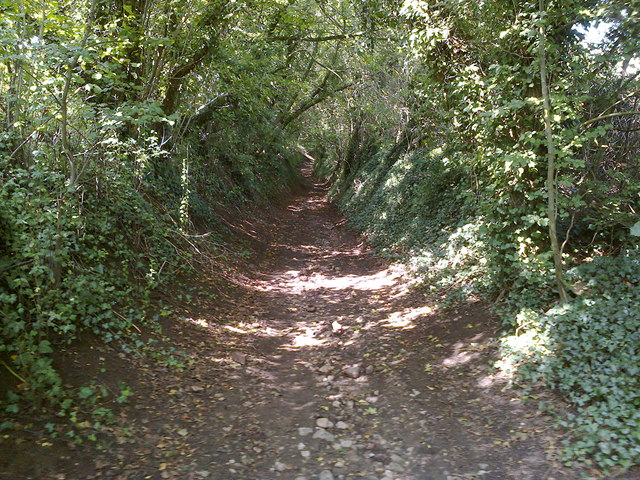
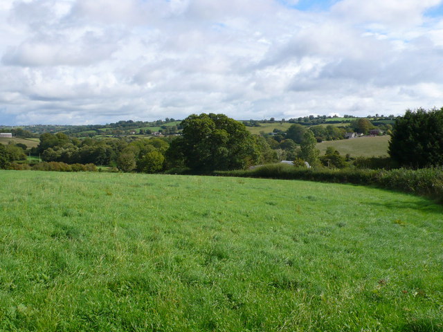
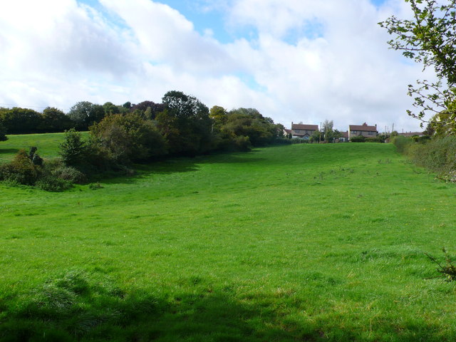
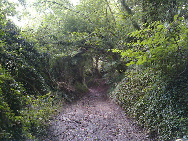
The village is surrounded by lush farmland and offers stunning views of the Somerset Levels, a wetland area known for its unique ecology and diverse birdlife. The countryside surrounding Upper Radford provides ample opportunities for outdoor activities such as walking, cycling, and horseback riding, attracting nature lovers and outdoor enthusiasts.

While primarily an agricultural community, Upper Radford is within close proximity to larger towns and cities. The nearby market town of Taunton is just a short drive away, offering a range of amenities including shops, schools, and leisure facilities.

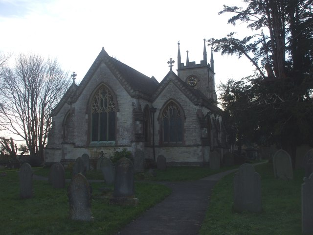
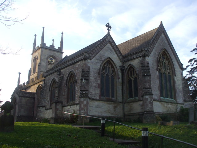
Upper Radford is also known for its historic church, which dates back to the 13th century and is a significant architectural landmark in the area. The church plays an active role in the community, hosting regular services and community events.

Overall, Upper Radford offers a tranquil and idyllic setting for those seeking a peaceful countryside lifestyle, while still providing easy access to nearby towns and cities.

If you have any feedback on the listing, please let us know in the comments section below.

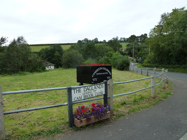
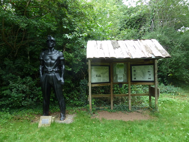
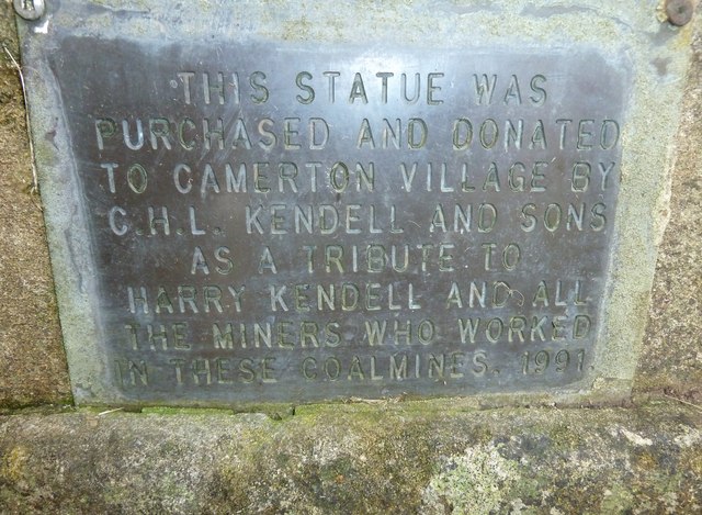
Upper Radford Images

Images are sourced within 2km of 51.315592/-2.4813955 or Grid Reference ST6657. Thanks to Geograph Open Source API. All images are credited.

High Littleton : Grassy Field & Gate A field seen from Bungay's Hill.
High Littleton : Grassy Field & Gate
A field seen from Bungay's Hill.
Mill Lane Looking downhill from close to where the footpath crosses the byway
Mill Lane
Looking downhill from close to where the footpath crosses the byway
Mill Lane BOAT Looking uphill at the point where the footpath crosses the byway
Mill Lane BOAT
Looking uphill at the point where the footpath crosses the byway
St Mary's Church, Timsbury
Somerset Folly Somerset Folly is a twisting residential street consisting mainly of rather boring grey bungalows. It runs west from The Avenue to St Mary's Close.
Somerset Folly
Somerset Folly is a twisting residential street consisting mainly of rather boring grey bungalows. It runs west from The Avenue to St Mary's Close.
Site of Demolished Works This is the site of the former works of the Wheeler Reconstructed Stone Company which produces artificial stone from a mix of cement and crushed Bath stone.This is used in new build house projects as a cheap replacement for natural stone. They appear to have relocated to Marsh Lane, Temple Cloud but it is uncertain if they are still manufacturing. In this image it can be seen that on the remaining site there appears to be evidence of an old kiln , perhaps a lime kiln.
Site of Demolished Works
This is the site of the former works of the Wheeler Reconstructed Stone Company which produces artificial stone from a mix of cement and crushed Bath stone.This is used in new build house projects as a cheap replacement for natural stone. They appear to have relocated to Marsh Lane, Temple Cloud but it is uncertain if they are still manufacturing. In this image it can be seen that on the remaining site there appears to be evidence of an old kiln , perhaps a lime kiln.
Houses on Priorshill These houses are at the bottom of Priorshill where it joins Loves Hill. Priorshill rises up to the hamlet of Tyning
Houses on Priorshill
These houses are at the bottom of Priorshill where it joins Loves Hill. Priorshill rises up to the hamlet of Tyning
Houses on Timsbury Rd View up Timsbury Rd towards its junction with the A39. The road coming in on the left is The Batch leading on to Goosard Lane.
Houses on Timsbury Rd
View up Timsbury Rd towards its junction with the A39. The road coming in on the left is The Batch leading on to Goosard Lane.
Countryside near Paulton These pasture fields are just south of Goosard lane between High Littleton and Paulton.
Countryside near Paulton
These pasture fields are just south of Goosard lane between High Littleton and Paulton.
Fields at High Littleton This is at the southern end of High Littleton looking up from near Goosard Lane. The houses that can be seen at the top of the hill are on Langfords lane at the very northern edge of the grid square.
Fields at High Littleton
This is at the southern end of High Littleton looking up from near Goosard Lane. The houses that can be seen at the top of the hill are on Langfords lane at the very northern edge of the grid square.
Closed Shops in Paulton These  shops on the Bath Road, a baker, a betting shop and a pine furniture shop have all closed. They occupy some old stone buildings. There are sold signs on two of them so perhaps the site will be developed.
Closed Shops in Paulton
These shops on the Bath Road, a baker, a betting shop and a pine furniture shop have all closed. They occupy some old stone buildings. There are sold signs on two of them so perhaps the site will be developed.
New Houses in Paulton These houses have been built on the site of the demolished factory of Polestar Purnell the printing company.
New Houses in Paulton
These houses have been built on the site of the demolished factory of Polestar Purnell the printing company.
Mill Lane Looking downhill just before the byway becomes a sunken lane in a deep gulley.
Mill Lane
Looking downhill just before the byway becomes a sunken lane in a deep gulley.
Camerton: site of station, 1987 View northward, across the course of the GWR Limpley Stoke (right) - Hallatrow (left) branch, which was closed way back on 21/9/25 - after only 15 years, to goods from 15/2/51. No trace seems to be left.
Camerton: site of station, 1987
View northward, across the course of the GWR Limpley Stoke (right) - Hallatrow (left) branch, which was closed way back on 21/9/25 - after only 15 years, to goods from 15/2/51. No trace seems to be left.
Recent addition at Camerton It is dated 2012.
Recent addition at Camerton
It is dated 2012.
Statue of a miner at Camerton
Plaque below the statue of a miner at Camerton See <a title="https://www.geograph.org.uk/photo/3134730" href="https://www.geograph.org.uk/photo/3134730">Link</a>
Plaque below the statue of a miner at Camerton
See Link
Show me another place!

Upper Radford is located at Grid Ref: ST6657 (Lat: 51.315592, Lng: -2.4813955)

Unitary Authority: Bath and North East Somerset

Police Authority: Avon and Somerset

What 3 Words

///snowmen.drizzly.carpeted. Near Timsbury, Somerset

Nearby Locations

Upper Radford Withy Mills

Related Wikis

Radford and Timsbury Halt railway station

Radford and Timsbury Halt railway station was on the Camerton branch of the Great Western Railway in Somerset, England. It was in use from 1910 until 1915...

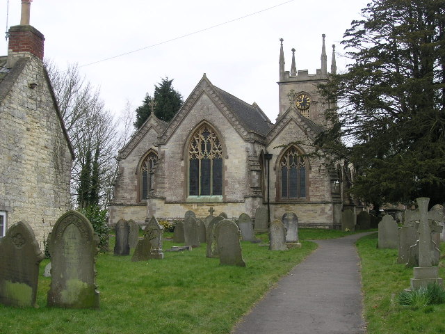
Church of St Mary The Virgin, Timsbury

The Anglican Church of St Mary The Virgin in Timsbury within the English county of Somerset is a Grade II* listed building.An old church on the site had...

Paulton Halt railway station

Paulton Halt railway station was on the Camerton branch of the Great Western Railway in Somerset, England. It was in use from 1914 until 1925, however...

Timsbury, Somerset

Timsbury is a village and civil parish in England, in the Bath and North East Somerset unitary authority of the county of Somerset. It lies 8 miles (13...

Nearby Amenities

Located within 500m of 51.315592,-2.4813955
Barrier: kissing_gate
Lat/Long: 51.3125471/-2.476622
Barrier: kissing_gate
Lat/Long: 51.3152588/-2.4762473
Barrier: stile
Lat/Long: 51.3150586/-2.474479
Barrier: stile
Lat/Long: 51.3169199/-2.477674
Power: pole
Lat/Long: 51.3131127/-2.485395
Power: pole
Lat/Long: 51.3142079/-2.4854745
Power: pole
Lat/Long: 51.3152524/-2.4855556
Power: pole
Lat/Long: 51.3162271/-2.4856311
Power: pole
Lat/Long: 51.3172543/-2.4857272
Power: pole
Lat/Long: 51.317874/-2.4862521
Power: pole
Lat/Long: 51.312077/-2.483328
Power: pole
Lat/Long: 51.3127314/-2.482358
Power: pole
Lat/Long: 51.3128864/-2.4818381
Power: pole
Lat/Long: 51.3132625/-2.4805456
Power: pole
Lat/Long: 51.3135754/-2.4794842
Power: pole
Lat/Long: 51.3139967/-2.4779943
Power: pole
Lat/Long: 51.3142524/-2.477111
Power: pole
Lat/Long: 51.3147579/-2.4753082
Barrier: kissing_gate
Lat/Long: 51.3145112/-2.4879499
Withy Mills
Place: hamlet
Lat/Long: 51.3137694/-2.4849818
Barrier: stile
Lat/Long: 51.313535/-2.4854948
Barrier: kissing_gate
Lat/Long: 51.3129959/-2.4838648
Power: pole
Lat/Long: 51.315464/-2.4747579
Power: pole
Lat/Long: 51.3153274/-2.4757744
Power: pole
Lat/Long: 51.315117/-2.4772886
Power: pole
Lat/Long: 51.314889/-2.4790239
Power: pole
Lat/Long: 51.3151447/-2.4798782
Power: pole
Lat/Long: 51.3156216/-2.4814728
Power: pole
Lat/Long: 51.3159871/-2.482716
Power: pole
Lat/Long: 51.3164951/-2.4844085
Power: pole
Lat/Long: 51.3169754/-2.4860487
Power: pole
Lat/Long: 51.3171111/-2.486518
Power: pole
Lat/Long: 51.3175126/-2.487835
Generator Method: photovoltaic
Generator Output Electricity: yes
Generator Source: solar
Generator Type: solar_photovoltaic_panel
Location: roof
Power: generator
Lat/Long: 51.3187921/-2.4823248
Building: roof
Generator Method: photovoltaic
Generator Output Electricity: yes
Generator Source: solar
Generator Type: solar_photovoltaic_panel
Layer: 1
Power: generator
Lat/Long: 51.3187048/-2.480879
The data included in this document is from www.openstreetmap.org. The data is made available under ODbL.

Have you been to Upper Radford?

Leave your review of Upper Radford below (or comments, questions and feedback).