Upper Pennington

Settlement in Hampshire New Forest

England

Upper Pennington

Flats at the junction A new residential building in place of an earlier building which was demolished.  What was the earlier building? Offices?
Flats at the junction Credit: Robin Webster

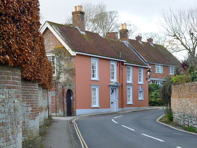
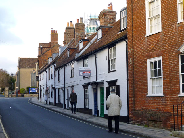
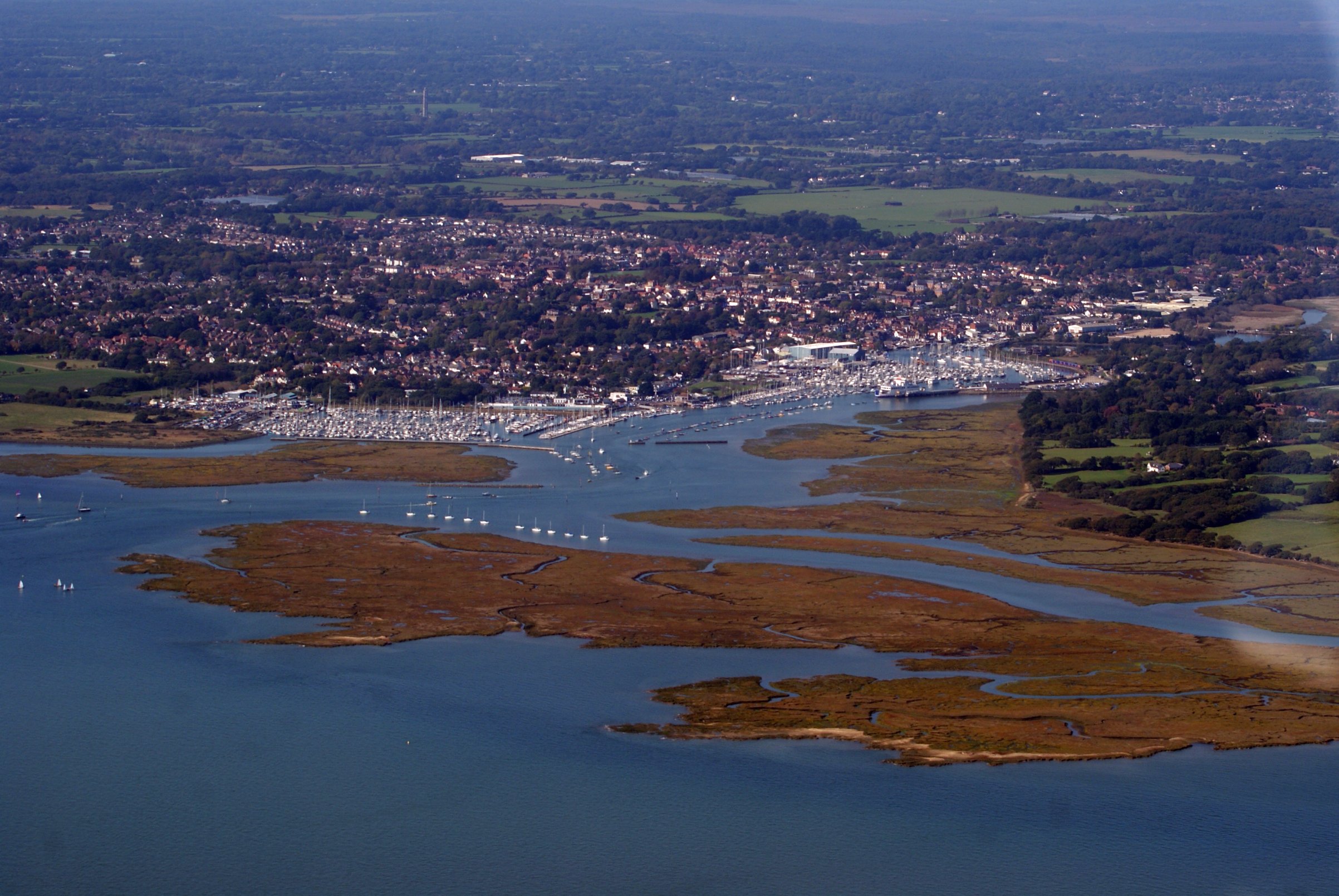
Upper Pennington is a small village located in the county of Hampshire, England. Situated within the New Forest National Park, it is surrounded by picturesque landscapes and offers a peaceful and idyllic setting for its residents. The village is part of the civil parish of Pennington, which also includes the neighboring village of Lower Pennington.

With a population of around 2,000 people, Upper Pennington retains a strong sense of community and rural charm. It boasts a range of amenities, including a primary school, a village hall, and a local convenience store, providing residents with essential services within walking distance. Additionally, the nearby town of Lymington offers a wider range of shops, restaurants, and leisure facilities.

Nature enthusiasts are drawn to Upper Pennington due to its close proximity to the New Forest. This vast national park offers ample opportunities for walking, cycling, and horse riding, with a network of trails and paths to explore. The area is also known for its diverse wildlife, including ponies, deer, and a variety of bird species.

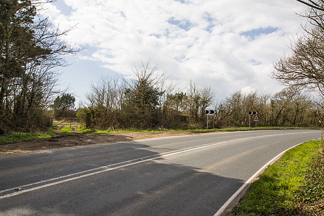
Transport links in Upper Pennington are convenient, with easy access to the A337 road, connecting the village to nearby towns and cities. The closest train station is Lymington Town, providing regular services to Southampton and Brockenhurst.

Overall, Upper Pennington is a charming village that offers a peaceful and scenic setting, making it an attractive place to live for those seeking a rural lifestyle within easy reach of amenities and natural beauty.

If you have any feedback on the listing, please let us know in the comments section below.

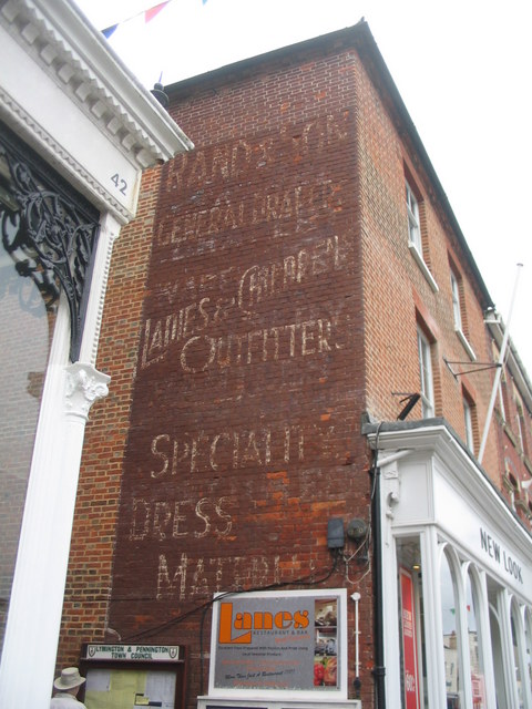
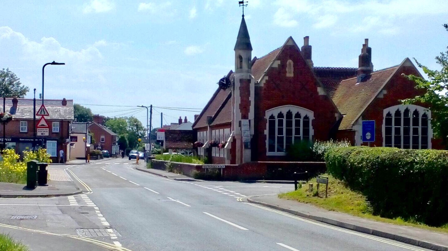
Upper Pennington Images

Images are sourced within 2km of 50.758357/-1.5702913 or Grid Reference SZ3095. Thanks to Geograph Open Source API. All images are credited.

Flats at the junction A new residential building in place of an earlier building which was demolished.  What was the earlier building? Offices?
Flats at the junction
A new residential building in place of an earlier building which was demolished. What was the earlier building? Offices?
The Borough Arms, Lymington On Avenue Road, with Lower Buckland Road to the left.
The Borough Arms, Lymington
On Avenue Road, with Lower Buckland Road to the left.
Inn sign - the Borough Arms, Lymington For the whole pub see <a href="https://www.geograph.org.uk/photo/4761962">SZ3295 : The Borough Arms, Lymington</a>. The arms appear to be an abbreviated version of those of the former borough of Lymington - 'By Sea & Forest Enchanted'.
Inn sign - the Borough Arms, Lymington
For the whole pub see SZ3295 : The Borough Arms, Lymington. The arms appear to be an abbreviated version of those of the former borough of Lymington - 'By Sea & Forest Enchanted'.
Lymington church The church of St Thomas the Apostle is a grade II*(star) listed building. The bit under repair is described as "Timber arcaded cupola with lead dome and weathervane on octagonal base, in place by 1740 and possibly 1680s in origin".
Lymington church
The church of St Thomas the Apostle is a grade II*(star) listed building. The bit under repair is described as "Timber arcaded cupola with lead dome and weathervane on octagonal base, in place by 1740 and possibly 1680s in origin".
36 Church Lane, Lymington Elm Grove House is a grade II listed building from the early to mid 18th century.
36 Church Lane, Lymington
Elm Grove House is a grade II listed building from the early to mid 18th century.
1 - 11 (odds) and 15 Church Lane, Lymington The white row is a grade II listed building. Strangely there is no 13, number 11 being right up against 15 - superstition?
1 - 11 (odds) and 15 Church Lane, Lymington
The white row is a grade II listed building. Strangely there is no 13, number 11 being right up against 15 - superstition?
WWII inland defences of SW Hampshire - Everton pillbox (1) -
Pillbox (unclassified): DoB ID: S0012876

I was assured of the existence of two pillboxes at this location, one a Home Guard section post (essentially hardened trench works), and a conventional pillbox. It was therefore disappointing to only find this specimen with just a corner peeping out at me from beneath the covering of brambles. I'm assuming this is the concrete faced pillbox listed on the Database of Britain Defence Archive. There was no sign of the section post.

<a href="https://www.geograph.org.uk/photo/4897370">SZ2993 : WWII inland defences of SW Hampshire - Everton pillbox (2)</a>
WWII inland defences of SW Hampshire - Everton pillbox (1)
- Pillbox (unclassified): DoB ID: S0012876 I was assured of the existence of two pillboxes at this location, one a Home Guard section post (essentially hardened trench works), and a conventional pillbox. It was therefore disappointing to only find this specimen with just a corner peeping out at me from beneath the covering of brambles. I'm assuming this is the concrete faced pillbox listed on the Database of Britain Defence Archive. There was no sign of the section post. SZ2993 : WWII inland defences of SW Hampshire - Everton pillbox (2)
WWII inland defences of SW Hampshire - Everton pillbox (2) -
Pillbox (unclassified): DoB ID: S0012876

Today this pillbox remains totally hidden in the vegetation to the right of the farm gate (and to the immediate left of the first chevron) on a bend in the main road between Lymington and Barton-on-Sea. Part of the network that extended inland from the coastal defences centred on Taddiford Gap to the south.

<a href="https://www.geograph.org.uk/photo/4897396">SZ2694 : WWII inland defences of SW Hampshire - Ashley pillbox (1)</a>
WWII inland defences of SW Hampshire - Everton pillbox (2)
- Pillbox (unclassified): DoB ID: S0012876 Today this pillbox remains totally hidden in the vegetation to the right of the farm gate (and to the immediate left of the first chevron) on a bend in the main road between Lymington and Barton-on-Sea. Part of the network that extended inland from the coastal defences centred on Taddiford Gap to the south. SZ2694 : WWII inland defences of SW Hampshire - Ashley pillbox (1)
Ghost sign, Ashley Lane A fading painted advertisement on the Ashley Lane side of a building facing High Street. The wording reads: 
"Rand & Son
General Draper
Ladies and Childrens
Outfitters
Speciality
Dress 
Materials" 
(NB. This is as seen, there are no visible apostrophes)
There are also the faint remains of an earlier, slightly different sign.
Ghost sign, Ashley Lane
A fading painted advertisement on the Ashley Lane side of a building facing High Street. The wording reads: "Rand & Son General Draper Ladies and Childrens Outfitters Speciality Dress Materials" (NB. This is as seen, there are no visible apostrophes) There are also the faint remains of an earlier, slightly different sign.
Twynham Place off High Street An interesting structure over the entrance to Twynham Place. It doesn't appear to have any means of access.
Twynham Place off High Street
An interesting structure over the entrance to Twynham Place. It doesn't appear to have any means of access.
Shop fronts, St Thomas Street The furniture and accessories shop displays signs of a previous incarnation, with 'Family Butcher' engraved below the window and the associated white glazed brickwork surrounding it.
Shop fronts, St Thomas Street
The furniture and accessories shop displays signs of a previous incarnation, with 'Family Butcher' engraved below the window and the associated white glazed brickwork surrounding it.
Fallen leaves beside Fox Pound Lane
Big blue door, little yellow door Two rather fine contrasting doors on High Street, Lymington.
Big blue door, little yellow door
Two rather fine contrasting doors on High Street, Lymington.
3 Wishes, Lymington Card shop in the High Street, once Klitz's Music Warehouse and said to have been the White Lion public house at one time.
3 Wishes, Lymington
Card shop in the High Street, once Klitz's Music Warehouse and said to have been the White Lion public house at one time.
Barwicks and Belle Ella, Lymington The Belle Ella shop on the corner of High Street and Grosvenor Gardens was the Waltham Arms public house.
Barwicks and Belle Ella, Lymington
The Belle Ella shop on the corner of High Street and Grosvenor Gardens was the Waltham Arms public house.
North side of Lymington High Street Mountain Warehouse in Lymington High Street.
North side of Lymington High Street
Mountain Warehouse in Lymington High Street.
Lymington High Street, North Side Nationwide, Pizza Express, Caldwells, Specsavers and other shops.
Lymington High Street, North Side
Nationwide, Pizza Express, Caldwells, Specsavers and other shops.
Old Six Bells, new Six Bells The Six Bells, a Wetherspoons pub in St Thomas Street, Lymington, stands next to the location of an earlier pub of the same name. To the left again is the former Dorset Arms.
Old Six Bells, new Six Bells
The Six Bells, a Wetherspoons pub in St Thomas Street, Lymington, stands next to the location of an earlier pub of the same name. To the left again is the former Dorset Arms.
Show me another place!

Upper Pennington is located at Grid Ref: SZ3095 (Lat: 50.758357, Lng: -1.5702913)

Administrative County: Hampshire

District: New Forest

Police Authority: Hampshire

What 3 Words

///mammal.daunted.founders. Near Lymington, Hampshire

Nearby Locations

Upper Pennington

Related Wikis

Priestlands School

Priestlands School is a Mixed-sex education secondary school located in Pennington, Hampshire in southern England. The school serves an area that includes...
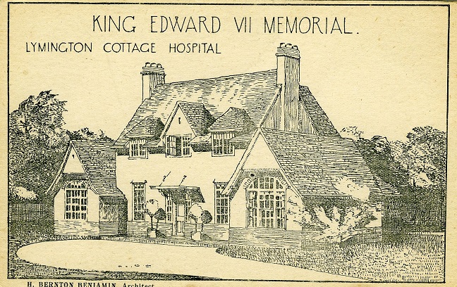
Lymington Hospital

Lymington Hospital was a consultant-led community hospital in Lymington, Hampshire. It was administered by New Forest Primary Care Trust before it was...

Pennington, Hampshire

Pennington is a ward (electoral and ecclesiastical) in the New Forest district of Hampshire, England, which is defined based on the boundaries of the earlier...

Lymington Town F.C.

Lymington Town Football Club is a football club based in the coastal town of Lymington, Hampshire, England. Known as "The Linnets", they are currently...
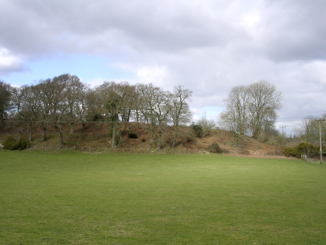
Buckland Rings

Buckland Rings is the site of an Iron Age hill fort in the town of Lymington, Hampshire. Today, the mounds and dykes around the outside which once constituted...

Lymington

Lymington is a port town on the west bank of the Lymington River on the Solent, in the New Forest district of Hampshire, England. The town faces Yarmouth...

Church of St Thomas the Apostle, Lymington

The Church of St Thomas the Apostle in Lymington in Hampshire, is the main Anglican Church of England parish church for the town. There has been a church...

St Barbe Museum & Art Gallery

St Barbe Museum + Art Gallery is a local museum and art gallery in Lymington, Hampshire, England.Enclosed in the building is a small cafe called 'The Old...

Nearby Amenities

Located within 500m of 50.758357,-1.5702913
Bus Stop
Lodge Road
Bus: yes
Naptan AtcoCode: 1900HA080674
Naptan Bearing: W
Naptan CommonName: Lodge Road
Naptan Crossing: Ramley Road
Naptan NaptanCode: hamajmgm
Naptan Street: Lodge Road
Naptan Verified: no
Public Transport: platform
Source: naptan_import
Lat/Long: 50.7566043/-1.5639676
Bus Stop
Pennington Institute
Bench: no
Bin: no
Bus: yes
Lit: yes
Naptan AtcoCode: 1900HA080675
Naptan Bearing: SE
Naptan CommonName: Pennington Institute
Naptan Crossing: Yaldhurst Lane
Naptan NaptanCode: hamajgwt
Naptan Street: Ramley Road
Naptan Verified: no
Public Transport: platform
Shelter: no
Source: naptan_import
Tactile Paving: no
Lat/Long: 50.7559612/-1.5651644
Bus Stop
Pennington Institute
Bench: no
Bin: no
Bus: yes
Lit: yes
Naptan AtcoCode: 1900HA080676
Naptan Bearing: NW
Naptan CommonName: Pennington Institute
Naptan Crossing: Yaldhurst Lane
Naptan NaptanCode: hamajgwp
Naptan Street: Ramley Road
Naptan Verified: no
Public Transport: platform
Shelter: no
Source: naptan_import
Tactile Paving: no
Lat/Long: 50.7559165/-1.5652357
Bus Stop
Hazel Road
Bus: yes
Naptan AtcoCode: 1900HA080731
Naptan Bearing: SW
Naptan CommonName: Hazel Road
Naptan Crossing: Ramley Road
Naptan NaptanCode: hamajdpw
Naptan Street: Hazel Road
Naptan Verified: no
Public Transport: platform
Source: naptan_import
Lat/Long: 50.7593874/-1.571374
Bus Stop
Hazel Road
Bus: yes
Naptan AtcoCode: 1900HA080732
Naptan Bearing: SW
Naptan CommonName: Hazel Road
Naptan Crossing: Ramley Road
Naptan NaptanCode: hamajdpt
Naptan Street: Hazel Road
Naptan Verified: no
Public Transport: platform
Source: naptan_import
Lat/Long: 50.7593453/-1.5714473
Barrier: stile
Foot: yes
Stile: stepover
Wheelchair: no
Lat/Long: 50.7609767/-1.567838
Post Box
Operator: Royal Mail
Operator Wikidata: Q638098
Post Box Mounting: brick_pillar
Post Box Type: wall
Ref: SO41 98
Royal Cypher: EIIR
Lat/Long: 50.7594662/-1.5716227
Telephone
Booth: K6
Covered: booth
Lat/Long: 50.7594271/-1.5715852
Our Bench - New Forest Accessible Accommodation
Addr City: Lymington
Addr Housename: Our Bench Accessible Accommodation
Addr Postcode: SO41 8HH
Addr Street: Lodge Road
Description: Three accessible holiday cottages in the New Forest, with fully accessible wet rooms, profiling beds, riser recliner chair, hoists and additional equipment available, Advance booking recommended.
Email: enquiries@ourbench.co.uk
Internet Access: wlan
Operator: http://www.ourbench.co.uk
Phone: +44 1590 673141
Smoking: no
Tourism: chalet
Website: http://www.ourbench.co.uk
Wheelchair: yes
Lat/Long: 50.7566798/-1.5638542
Generator Method: photovoltaic
Generator Output Electricity: yes
Generator Source: solar
Generator Type: solar_photovoltaic_panel
Location: roof
Power: generator
Lat/Long: 50.7541132/-1.5690379
Generator Method: photovoltaic
Generator Output Electricity: yes
Generator Source: solar
Generator Type: solar_photovoltaic_panel
Location: roof
Power: generator
Lat/Long: 50.7570003/-1.564281
Bench
Backrest: yes
Lat/Long: 50.7558304/-1.5662505
Board Type: wildlife
Information: board
Tourism: information
Lat/Long: 50.7560306/-1.5657038
Bus Stop
Middle Common Road
Bus: yes
Public Transport: platform
Lat/Long: 50.7572793/-1.5684566
Bus Stop
Middle Common Road
Bus: yes
Public Transport: platform
Lat/Long: 50.7571945/-1.5685639
Generator Method: photovoltaic
Generator Output Electricity: yes
Generator Source: solar
Generator Type: solar_photovoltaic_panel
Location: roof
Power: generator
Lat/Long: 50.7573455/-1.5669036
Generator Method: photovoltaic
Generator Output Electricity: yes
Generator Source: solar
Generator Type: solar_photovoltaic_panel
Location: roof
Power: generator
Lat/Long: 50.7581973/-1.5677458
Generator Method: photovoltaic
Generator Output Electricity: yes
Generator Source: solar
Generator Type: solar_photovoltaic_panel
Location: roof
Power: generator
Lat/Long: 50.7592306/-1.5718389
Generator Method: photovoltaic
Generator Output Electricity: yes
Generator Source: solar
Generator Type: solar_photovoltaic_panel
Location: roof
Power: generator
Lat/Long: 50.7591865/-1.5719032
Generator Method: photovoltaic
Generator Output Electricity: yes
Generator Source: solar
Generator Type: solar_photovoltaic_panel
Location: roof
Power: generator
Lat/Long: 50.7585129/-1.5726408
Upper Pennington
Place: suburb
Lat/Long: 50.7583657/-1.5702794
The data included in this document is from www.openstreetmap.org. The data is made available under ODbL.

Have you been to Upper Pennington?

Leave your review of Upper Pennington below (or comments, questions and feedback).