Upper Holme

Settlement in Yorkshire

England

Upper Holme

Lock 30E on the Huddersfield Narrow Canal Lovely weather; lovely walk!
Lock 30E on the Huddersfield Narrow Canal Credit: Andy Beecroft

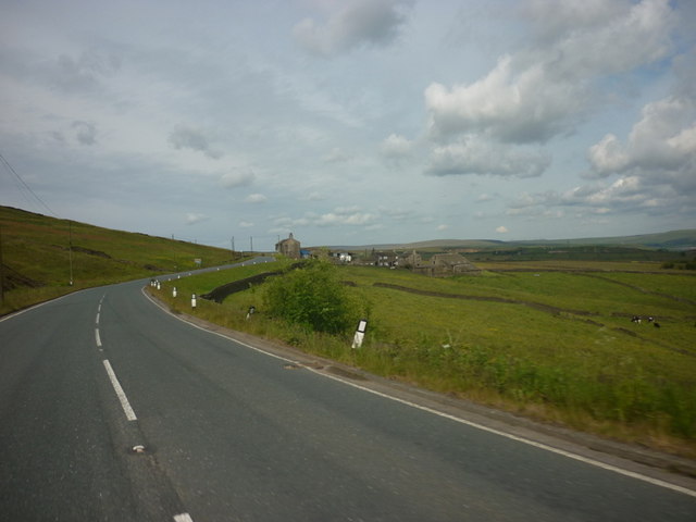
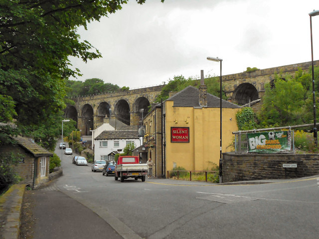
Upper Holme is a small village located in the county of Yorkshire, England. Situated in the picturesque Holme Valley, it lies approximately 4 miles southwest of the market town of Holmfirth. The village is surrounded by stunning countryside, with rolling hills and beautiful landscapes that attract visitors and nature enthusiasts alike.

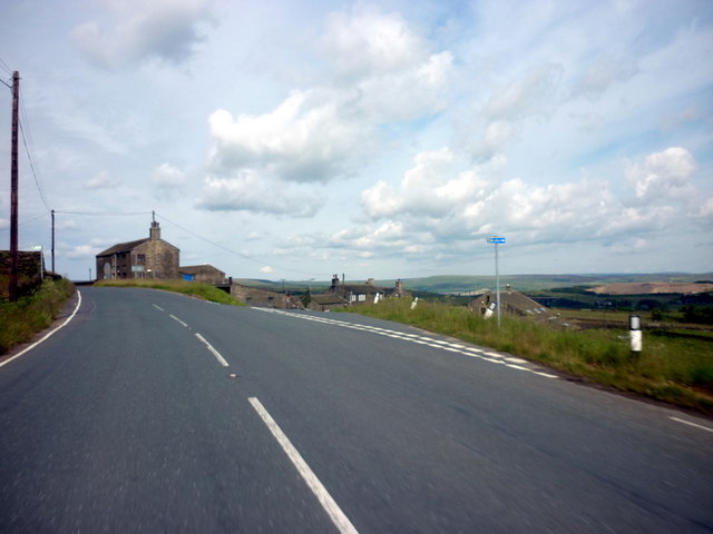
Upper Holme is known for its peaceful and idyllic setting, offering a tranquil retreat away from the hustle and bustle of city life. The village is characterized by a collection of charming stone-built cottages and traditional farmhouses, which add to its rural charm and historical appeal.

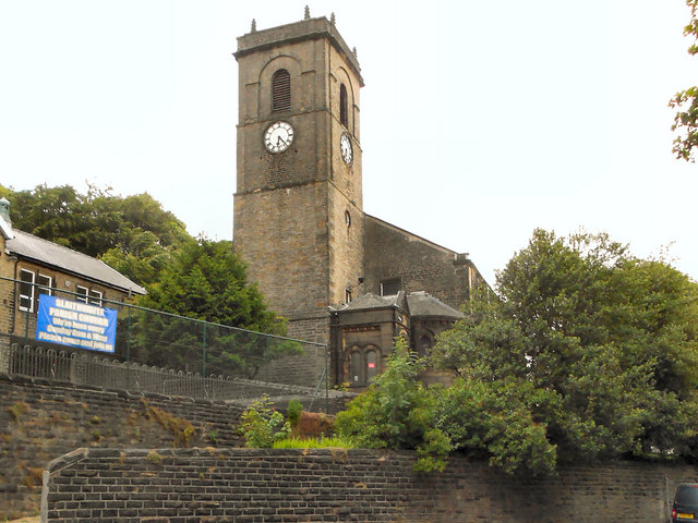
The community of Upper Holme is tightly knit, with a population of around 300 residents. The village boasts a close-knit community spirit, with various local events and gatherings throughout the year that bring people together. The village also has a small church, which serves as a focal point for religious and social activities.

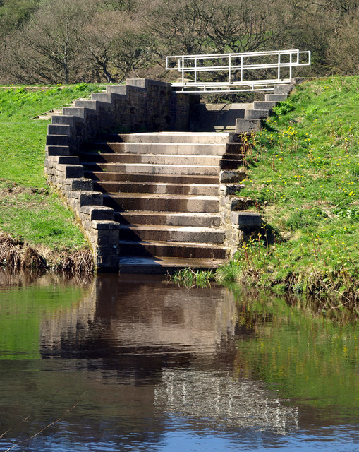
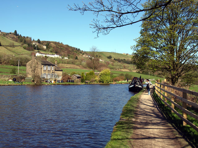
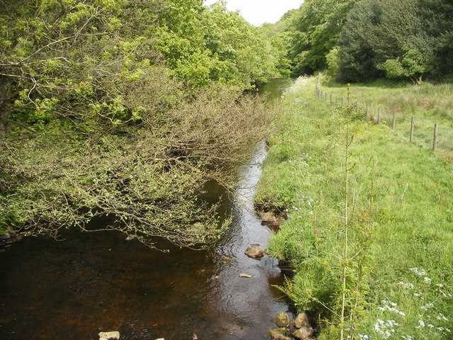
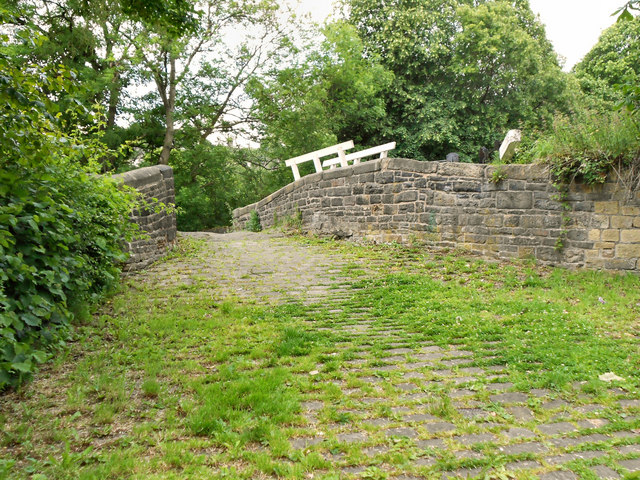
For outdoor enthusiasts, Upper Holme offers numerous walking and hiking trails that provide breathtaking views of the surrounding countryside. The nearby River Holme is also popular for fishing and canoeing activities. Additionally, the village is within close proximity to the Peak District National Park, offering further opportunities for outdoor adventures.

Although Upper Holme is primarily a residential area, it benefits from its close proximity to Holmfirth, where residents can find a range of amenities such as shops, schools, and healthcare facilities.

Overall, Upper Holme is a charming and picturesque village that captures the essence of rural Yorkshire, making it an attractive place to live or visit for those seeking a peaceful and picturesque retreat.

If you have any feedback on the listing, please let us know in the comments section below.
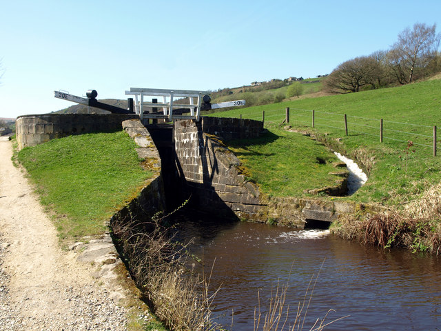
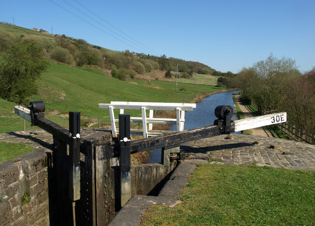
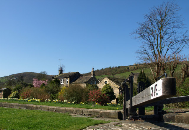
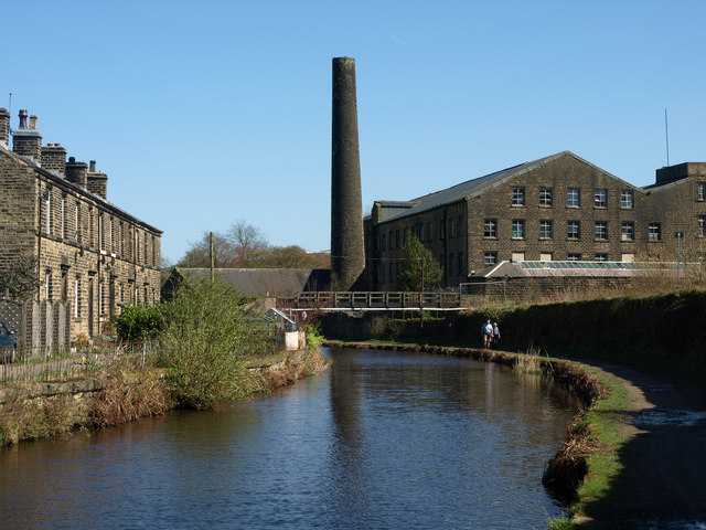
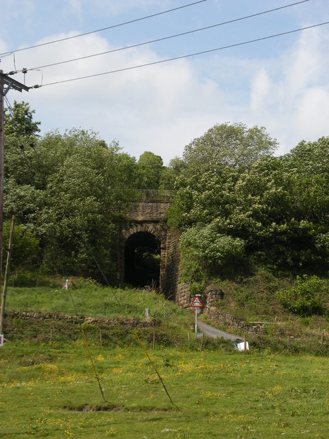
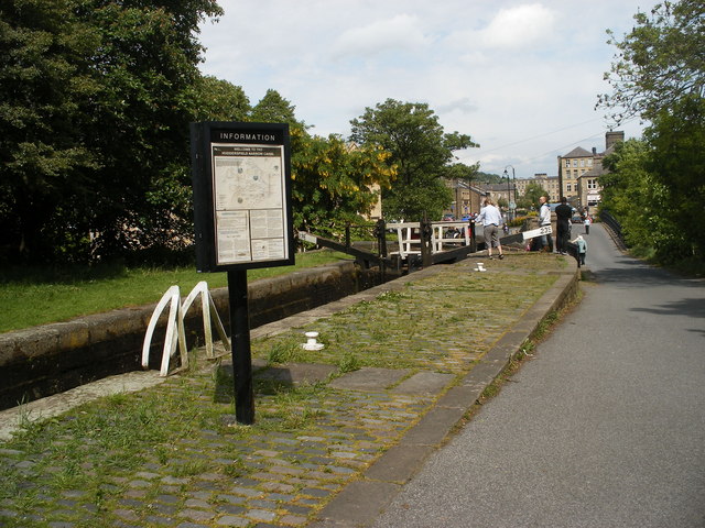
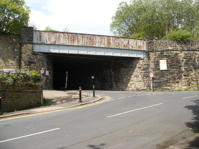
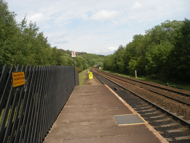
Upper Holme Images

Images are sourced within 2km of 53.622297/-1.8981379 or Grid Reference SE0613. Thanks to Geograph Open Source API. All images are credited.

Lock 30E on the Huddersfield Narrow Canal Lovely weather; lovely walk!
Lock 30E on the Huddersfield Narrow Canal
Lovely weather; lovely walk!
The view from north eastwards from Lock 30E
At Lock 31E on the Huddersfield Narrow Canal
Clough Mill and the Huddersfield Narrow Canal
Canal Feeder Steps
Canal Feeder Steps
The Huddersfield Narrow Canal above Lock 31E There is a winding point (boat turning area) at this point - one of few on this stretch of the Huddersfield Narrow Canal.
The Huddersfield Narrow Canal above Lock 31E
There is a winding point (boat turning area) at this point - one of few on this stretch of the Huddersfield Narrow Canal.
Cellars Clough Mill, Marsden Former textile mill, now reported as derelict. The pond would have supplied a water turbine.
Cellars Clough Mill, Marsden
Former textile mill, now reported as derelict. The pond would have supplied a water turbine.
Sparth Reservoir
Sparth Reservoir
Railway bridge near canal
Approaching Lock 23E Slaithwaite
Bridge near Slaithwaite Station
Looking east from Slaithwaite Station
River Colne looking downstream from a footbridge
New Hey Road at Worts Hill
New Hey Road, at O' Cot Lane
Church of Saint James, Slaithwaite And Marsden St James' church was built by public subscription in 1796, replacing a 16th century chapel of  ease. It is a Grade II listed building (<span class="nowrap"><a title="http://www.britishlistedbuildings.co.uk/en-408960-church-of-saint-james-slaithwaite-and-ma" rel="nofollow ugc noopener" href="http://www.britishlistedbuildings.co.uk/en-408960-church-of-saint-james-slaithwaite-and-ma">Link</a><img style="margin-left:2px;" alt="External link" title="External link - shift click to open in new window" src="https://s1.geograph.org.uk/img/external.png" width="10" height="10"/></span> - British Listed Buildings)
Church of Saint James, Slaithwaite And Marsden
St James' church was built by public subscription in 1796, replacing a 16th century chapel of ease. It is a Grade II listed building (LinkExternal link - British Listed Buildings)
Silent Woman, Slaithwaite The Silent Woman public house on Nabbs Lane. Behind it is the railway viaduct.
Silent Woman, Slaithwaite
The Silent Woman public house on Nabbs Lane. Behind it is the railway viaduct.
Stone Bridge from Old Bank The stone footbridge over the Huddersfield Narrow Canal at Marsden.
Stone Bridge from Old Bank
The stone footbridge over the Huddersfield Narrow Canal at Marsden.
Show me another place!

Upper Holme is located at Grid Ref: SE0613 (Lat: 53.622297, Lng: -1.8981379)

Division: West Riding

Unitary Authority: Kirklees

Police Authority: West Yorkshire

What 3 Words

///orbit.pizza.bulbs. Near Marsden, West Yorkshire

Related Wikis

Wilberlee

Wilberlee is a hamlet in the Colne Valley, in the Kirklees district, in the county of West Yorkshire, England. It is near the town of Huddersfield and...

Slaithwaite railway station

Slaithwaite railway station serves the town of Slaithwaite, West Yorkshire, England. The station is 4 miles (6 km) west of Huddersfield railway station...

Slaithwaite Town Hall

Slaithwaite Town Hall, also known as Empire House is a former municipal building in Lewisham Road in the town of Slaithwaite, West Yorkshire, England....

Slaithwaite

Slaithwaite (, locally 'Slaithwaite' ; Old Norse for "timber-fell thwaite/clearing") is a town and former civil parish in the Colne Valley area of the...

Nearby Amenities

Located within 500m of 53.622297,-1.8981379
Bus Stop
Heys Lane Clough House Lane
Bus: yes
Local Ref: 45021759
Naptan AtcoCode: 450021759
Naptan Bearing: SE
Naptan CommonName: Heys Lane Clough House Lane
Naptan Crossing: Clough House Lane
Naptan Indicator: Stop 45021759
Naptan Notes: OSR taken place 120106
Naptan PlusbusZoneRef: LEEDS
Naptan ShortCommonName: Clough House Lane
Naptan Street: Heys Lane
Naptan Verified: no
Public Transport: platform
Source: naptan_import
Lat/Long: 53.6265455/-1.8964389
Bus Stop
Longlands Road Ing Head
Local Ref: 45021760
Naptan AtcoCode: 450021760
Naptan Bearing: SE
Naptan CommonName: Longlands Road Ing Head
Naptan Crossing: Ing Head
Naptan Indicator: Stop 45021760
Naptan Notes: OSR taken place 120106
Naptan PlusbusZoneRef: LEEDS
Naptan ShortCommonName: Ing Head
Naptan Street: Longlands Road
Naptan Verified: no
Source: naptan_import
Lat/Long: 53.6256533/-1.8938404
Bus Stop
Heys Lane Ing Head
Local Ref: 45021761
Naptan AtcoCode: 450021761
Naptan Bearing: NW
Naptan CommonName: Heys Lane Ing Head
Naptan Crossing: Ing Head
Naptan Indicator: Stop 45021761
Naptan Notes: OSR taken place 120106
Naptan PlusbusZoneRef: LEEDS
Naptan ShortCommonName: Ing Head
Naptan Street: Heys Lane
Naptan Verified: no
Source: naptan_import
Lat/Long: 53.6256265/-1.8940068
Heys Lane Clough House Lane
Local Ref: 45051143
Naptan AtcoCode: 450051143
Naptan Bearing: NW
Naptan BusStopType: CUS
Naptan CommonName: Heys Lane Clough House Lane
Naptan Indicator: Stop 45051143
Naptan PlusbusZoneRef: LEEDS
Naptan ShortCommonName: Clough House Lane
Naptan Street: Heys Lane
Naptan Verified: no
Source: naptan_import
Lat/Long: 53.6264681/-1.8964691
Fixme: Source of stream alongside reservoir not known. Please correct if you know.
Lat/Long: 53.6257626/-1.899852
Noexit: yes
Lat/Long: 53.6243176/-1.9046568
Aeroway: helipad
Lat/Long: 53.6186104/-1.9012074
Upper Rotcher
Place: hamlet
Lat/Long: 53.6203986/-1.8915786
Upper Holme
Place: hamlet
Lat/Long: 53.6223083/-1.8982053
Post Box
Lat/Long: 53.6256393/-1.8937786
Barrier: stile
Dog Gate: yes
Material: wood
Lat/Long: 53.6244477/-1.8954059
Barrier: turnstile
Material: metal
Lat/Long: 53.6202454/-1.8931462
Barrier: stile
Material: stone
Stile: squeezer
Width: 0.2
Lat/Long: 53.6201213/-1.8940393
Barrier: stile
Stile: stepover
Lat/Long: 53.6184079/-1.9000308
Fixme: How does this path cross the wall?
Lat/Long: 53.621192/-1.8975666
Barrier: stile
Lat/Long: 53.62516/-1.9035053
Barrier: stile
Height: 0.5
Material: wood
Stile: stepover
Lat/Long: 53.6191473/-1.8927491
Barrier: stile
Material: wood
Lat/Long: 53.6252705/-1.8980411
Barrier: stile
Dog Gate: yes
Material: wood
Lat/Long: 53.6241872/-1.8945596
Height: 5
Waterway: waterfall
Lat/Long: 53.6257038/-1.8989637
Barrier: kissing_gate
Lat/Long: 53.625253/-1.9030568
Barrier: stile
Material: wood
Lat/Long: 53.6264754/-1.9003545
Barrier: stile
Material: stone
Note: Just a lowered wall at this point - no steps
Lat/Long: 53.6259696/-1.9016272
Barrier: stile
Material: wood
Note: Just a lowered fence - no steps forming part of the stile itself
Lat/Long: 53.6259647/-1.9013421
Lower Holme
Place: hamlet
Lat/Long: 53.6225057/-1.896362
Barrier: cattle_grid
Lat/Long: 53.6188813/-1.9003505
Barrier: stile
Material: wood
Stile: stepover
Lat/Long: 53.6201975/-1.8987796
Barrier: stile
Material: wood
Stile: stepover
Lat/Long: 53.6192972/-1.8984029
Barrier: stile
Material: stone
Stile: stepover
Width: 0.3
Lat/Long: 53.6190059/-1.8972612
Barrier: kissing_gate
Material: metal
Lat/Long: 53.6254773/-1.9007286
Note: There's provision here to restrict the flow down the river and channel it off to the stream
Lat/Long: 53.6254133/-1.8968499
Height: 2
Waterway: waterfall
Lat/Long: 53.6253974/-1.8967896
Bench
Material: wood
Lat/Long: 53.6248053/-1.8937974
Bench
Material: wood
Lat/Long: 53.6256525/-1.8970091
Post Box
Collection Times: Mo-Fr 16:00; Sa 10:45
Operator: Royal Mail
Operator Wikidata: Q638098
Post Box Type: wall
Ref: HD7 380
Lat/Long: 53.6225248/-1.8965404
Barrier: stile
Material: stone
Stile: squeezer
Width: 0.3
Lat/Long: 53.6192945/-1.8984091
Height: 1
Waterway: waterfall
Lat/Long: 53.6257091/-1.8989865
Stile: squeezer
Width: 0.4
Lat/Long: 53.6243319/-1.9043309
Bench
Lat/Long: 53.6222939/-1.8979737
Orchard
Access: permissive
Fee: no
Garden Type: community
Leisure: garden
Operator: MASTT
Operator Type: community
Lat/Long: 53.6183295/-1.8947595
Power: pole
Lat/Long: 53.6235378/-1.9050652
Line Management: transition
Power: pole
Transformer: distribution
Lat/Long: 53.6263384/-1.8995801
Generator Method: photovoltaic
Generator Output Electricity: yes
Generator Source: solar
Generator Type: solar_photovoltaic_panel
Power: generator
Lat/Long: 53.6258734/-1.8952136
Power: pole
Lat/Long: 53.6192869/-1.8995879
Power: pole
Lat/Long: 53.6186553/-1.900035
Power: pole
Lat/Long: 53.6199003/-1.8991445
Power: pole
Lat/Long: 53.6204024/-1.8987936
Power: pole
Lat/Long: 53.620494/-1.8976227
Power: pole
Lat/Long: 53.6206127/-1.8953279
Power: pole
Lat/Long: 53.621017/-1.8983969
Power: pole
Lat/Long: 53.6218211/-1.8978223
Power: pole
Lat/Long: 53.6207228/-1.8986055
Power: pole
Lat/Long: 53.6221743/-1.8975851
Power: pole
Lat/Long: 53.6228188/-1.8979069
Power: pole
Lat/Long: 53.6234821/-1.8982166
Power: pole
Lat/Long: 53.624129/-1.8985402
Power: pole
Lat/Long: 53.6247867/-1.8988784
Power: pole
Lat/Long: 53.6255454/-1.89925
Power: pole
Lat/Long: 53.6245369/-1.9001472
Power: pole
Lat/Long: 53.6242472/-1.9015735
Power: pole
Lat/Long: 53.6239838/-1.9028317
Power: pole
Lat/Long: 53.6237602/-1.9039855
Power: pole
Lat/Long: 53.6222795/-1.8969098
Man Made: water_well
Lat/Long: 53.6225291/-1.8966683
Bench
Lat/Long: 53.6237529/-1.898628
Power: pole
Lat/Long: 53.6206824/-1.8941413
Power: pole
Lat/Long: 53.6208323/-1.8918739
Power: pole
Lat/Long: 53.6207514/-1.8930979
Power: pole
Lat/Long: 53.6205492/-1.8965555
Power: pole
Lat/Long: 53.6212978/-1.8926829
Power: pole
Lat/Long: 53.621959/-1.8921484
Power: pole
Lat/Long: 53.6225229/-1.8922798
Power: pole
Lat/Long: 53.6263588/-1.8976385
Line Management: transition
Power: pole
Lat/Long: 53.6261219/-1.8974479
Line Management: transition
Power: pole
Lat/Long: 53.6260857/-1.8975272
Power: pole
Lat/Long: 53.6265607/-1.8983443
Barrier: bollard
Bollard Count: 1
Material: wood
Lat/Long: 53.619127/-1.8966034
The data included in this document is from www.openstreetmap.org. The data is made available under ODbL.

Have you been to Upper Holme?

Leave your review of Upper Holme below (or comments, questions and feedback).