Upper Hartwell

Settlement in Buckinghamshire

England

Upper Hartwell

Pearl Way A cycle route in Fairford Leys, a suburb of Aylesbury.
Pearl Way Credit: Bill Boaden

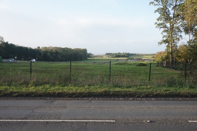
Upper Hartwell is a small village located in the county of Buckinghamshire, England. Situated in the Chiltern Hills, it is surrounded by picturesque countryside and offers a tranquil and idyllic setting for its residents. The village is part of the larger Hartwell parish and is characterized by its charming rural atmosphere.

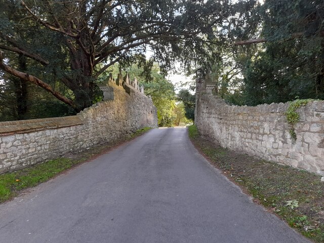
Despite its modest size, Upper Hartwell boasts a rich history that can be traced back to medieval times. It is home to several well-preserved historic buildings, including a 14th-century church known as St. Mary the Virgin. This medieval church serves as a focal point for the community and is a testament to the village's heritage.

The village itself consists mainly of traditional stone cottages and houses, which contribute to its quaint and timeless appeal. It has a close-knit community with a friendly and welcoming atmosphere, where residents often engage in local activities and events.

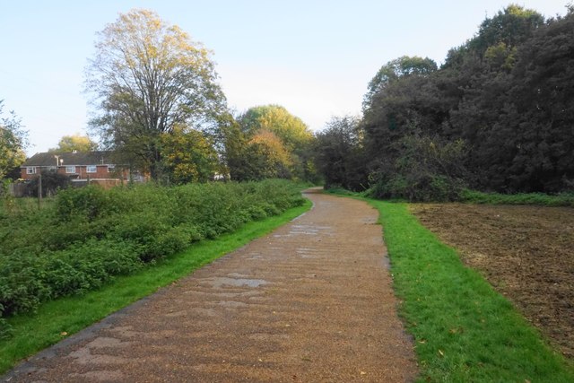
The surrounding countryside offers ample opportunities for outdoor pursuits, with numerous walking trails and scenic spots to explore. Additionally, the nearby Chiltern Hills provide a stunning backdrop for hiking, cycling, and nature enthusiasts.

Although Upper Hartwell is a quiet and peaceful village, it benefits from its proximity to larger towns and cities. The town of Aylesbury is just a short drive away, offering a range of amenities including shops, schools, and healthcare facilities.

Overall, Upper Hartwell offers a charming and picturesque setting, making it an ideal place for those seeking a tranquil rural lifestyle within easy reach of urban conveniences.

If you have any feedback on the listing, please let us know in the comments section below.

Upper Hartwell Images

Images are sourced within 2km of 51.802082/-0.86050957 or Grid Reference SP7812. Thanks to Geograph Open Source API. All images are credited.

Pearl Way A cycle route in Fairford Leys, a suburb of Aylesbury.
Pearl Way
A cycle route in Fairford Leys, a suburb of Aylesbury.
HS2 works near Aylesbury The bridge being constructed will carry the A418 over the new railway. It is viewed from the existing route of the A418.
HS2 works near Aylesbury
The bridge being constructed will carry the A418 over the new railway. It is viewed from the existing route of the A418.
The future route of HS2 past Aylesbury Looking north from the existing course of the A418.
The future route of HS2 past Aylesbury
Looking north from the existing course of the A418.
The road through Lower Hartwell The walls have chess pieces carved on top of them.
The road through Lower Hartwell
The walls have chess pieces carved on top of them.
The road through Lower Hartwell
Chess set on a wall, Lower Hartwell
Oxford Road, Lower Hartwell
Oxford Road at the junction of Badger's Rise
Farmland, Stone A bridleway beside wheat to the south of the River Thame.
Farmland, Stone
A bridleway beside wheat to the south of the River Thame.
The River Thame, Stone Beside a junction of a bridleway and footpath.  The Thame Valley Walk, Midshires Way and North Bucks Way all pass by.
The River Thame, Stone
Beside a junction of a bridleway and footpath. The Thame Valley Walk, Midshires Way and North Bucks Way all pass by.
Steps to the churchyard of St John the Baptist Access to the church is more easily achieved to the right along Church Way.
Steps to the churchyard of St John the Baptist
Access to the church is more easily achieved to the right along Church Way.
Churchyard of St John the Baptist, Stone In line with common practice, most of the gravestones have been removed.
Churchyard of St John the Baptist, Stone
In line with common practice, most of the gravestones have been removed.
The Methodist Chapel The meeting place for Stone Methodist Church.
The Methodist Chapel
The meeting place for Stone Methodist Church.
Footpath to Lower Hartwell The path curls round the northern side of the village.
Footpath to Lower Hartwell
The path curls round the northern side of the village.
Ruined farm building near Stone The land is owned by the Ernest Cook Trust, a charity which improves educational opportunities for young people, particularly in relation to agricultural land. The land is in the valley of the River Tame.
Ruined farm building near Stone
The land is owned by the Ernest Cook Trust, a charity which improves educational opportunities for young people, particularly in relation to agricultural land. The land is in the valley of the River Tame.
Field below The Nursery The Nursery is the woodland at the top. The hills form the southern side of the Tame Valley.
Field below The Nursery
The Nursery is the woodland at the top. The hills form the southern side of the Tame Valley.
Field entrance off Eythrope Road Some flooding of the River Tame can be seen ahead.
Field entrance off Eythrope Road
Some flooding of the River Tame can be seen ahead.
Show me another place!

Upper Hartwell is located at Grid Ref: SP7812 (Lat: 51.802082, Lng: -0.86050957)

Unitary Authority: Buckinghamshire

Police Authority: Thames Valley

What 3 Words

///pack.caves.rots. Near Stone, Buckinghamshire

Nearby Locations

Stone Upper Hartwell

Related Wikis

Stone, Buckinghamshire

Stone is a village and former civil parish, now in the parish of Stone with Bishopstone and Hartwell, in Buckinghamshire, England. It is located southwest...

Bugle Quarry

Bugle Quarry is a 0.08-hectare (0.20-acre) geological Site of Special Scientific Interest in Hartwell in Buckinghamshire. The local planning authority...

Hartwell, Buckinghamshire

Hartwell is a village and former civil parish, now in the parish of Stone with Bishopstone and Hartwell, in central Buckinghamshire, England. It is to...

St Mary's Church, Hartwell

St Mary's Church is a redundant Anglican church in the village of Hartwell, Buckinghamshire, England. It is under the care of the Churches Conservation...

Nearby Amenities

Located within 500m of 51.802082,-0.86050957
Turning Circle
Turning Circle: hammer
Lat/Long: 51.8026441/-0.8580504
Pub
Rose and Crown
Addr Housenumber: 2
Addr Postcode: HP17 8PB
Addr Street: Oxford Road
Brewery: yes;Red_Stripe
Fhrs Id: 636648
Website: https://www.roseandcrownstone.co.uk/
Lat/Long: 51.8040519/-0.854744
Ele NPE: 372 ft
Fixme: ?locate?;metric?
Source: npe
Lat/Long: 51.8055929/-0.8643599
Fixme: ?buildings?
Source: npe
Lat/Long: 51.8044784/-0.8661623
Fixme: ?buildings?
Source: npe
Lat/Long: 51.8029393/-0.867364
Fixme: ?buildings?
Source: npe
Lat/Long: 51.8040538/-0.8631583
Fixme: ?building?
Source: npe
Lat/Long: 51.8039477/-0.8616133
Fixme: ?buildings?
Source: npe
Lat/Long: 51.8034169/-0.8568926
Fixme: ?buildings?
Lat/Long: 51.8035231/-0.8652182
Fixme: ?buildings?
Source: npe
Lat/Long: 51.8034169/-0.8659907
Fixme: ?buildings?
Source: npe
Lat/Long: 51.8030985/-0.8666773
Fixme: ?buildings
Source: npe
Lat/Long: 51.8044253/-0.8583518
Fixme: ?buildings?
Source: npe
Lat/Long: 51.8052214/-0.8557768
Stone House
Building: yes
Fixme: ?buildings?
Lat/Long: 51.7999433/-0.8596231
Fixme: ?building?
Lat/Long: 51.799041/-0.8565332
Fixme: ?building?
Lat/Long: 51.7989348/-0.855589
Place Of Worship
Baptist Chapel
Denomination: baptist
Religion: christian
Lat/Long: 51.8048148/-0.8653879
Description: War memorial
Historic: memorial
Lat/Long: 51.804116/-0.8593545
Post Box
Brand: Royal Mail
Brand Wikidata: Q638098
Brand Wikipedia: en:Royal Mail
Operator: Royal Mail
Operator Wikidata: Q638098
Post Box Mounting: wooden_post
Post Box Type: lamp
Ref: HP17 181
Lat/Long: 51.8014214/-0.8595258
Post Box
Brand: Royal Mail
Brand Wikidata: Q638098
Brand Wikipedia: en:Royal Mail
Collection Times: Mo-Fr 09:00; Sa 07:00
Operator: Royal Mail
Operator Wikidata: Q638098
Post Box Type: wall
Ref: HP17 180D
Royal Cypher: EIIR
Royal Cypher Wikidata: Q33102113
Source: survey
Survey Date: 2015-08-22
Lat/Long: 51.8043874/-0.864889
Post Office
Stone Post Office
Addr Postcode: HP17 8PB
Brand: Post Office
Brand Wikidata: Q1783168
Operator: Your Coop Food
Operator Wikidata: Q121084548
Ref Pol Id: 870
Website: https://www.postoffice.co.uk/branch-finder/0841021/stone
Lat/Long: 51.8042109/-0.8578119
Restaurant
Jeera
Addr Housenumber: 39
Addr Postcode: HP17 8PD
Addr Street: Oxford Road
Cuisine: indian
Fhrs Id: 369678
Takeaway: yes
Lat/Long: 51.8039187/-0.8583816
Bus Stop
280
Bench: no
Bin: no
Bus: yes
Lit: yes
Operator: Aviva
Public Transport: platform
Shelter: yes
Tactile Paving: no
Lat/Long: 51.8038015/-0.8538876
Bus Stop
280
Bench: yes
Bin: yes
Bus: yes
Lit: yes
Operator: Aviva
Public Transport: platform
Shelter: yes
Tactile Paving: no
Lat/Long: 51.8038496/-0.855391
Grit Bin
Access: yes
Lat/Long: 51.8039021/-0.8545373
Post Box
Brand: Royal Mail
Brand Wikidata: Q638098
Brand Wikipedia: en:Royal Mail
Collection Times: Mo-Fr 17:00; Sa 09:30
Operator: Royal Mail
Operator Wikidata: Q638098
Post Box Type: wall
Ref: HP17 182
Royal Cypher: GR
Royal Cypher Wikidata: Q33102273
Source: survey
Survey Date: 2015-08-22
Lat/Long: 51.8041714/-0.8580068
Waste Basket
Waste: trash
Lat/Long: 51.8038272/-0.855453
Bench
Backrest: yes
Lat/Long: 51.803835/-0.8554832
Waste Basket
Waste: trash
Lat/Long: 51.8041633/-0.857889
Waste Basket
Waste: trash
Lat/Long: 51.8041713/-0.858031
Crossing
Button Operated: yes
Crossing: traffic_signals
Crossing Ref: pelican
Tactile Paving: yes
Lat/Long: 51.8040227/-0.8579796
Man Made: pillar
Lat/Long: 51.8040769/-0.8598254
Man Made: pillar
Lat/Long: 51.8040834/-0.8598727
Waste Basket
Waste: trash
Lat/Long: 51.8039254/-0.8592671
Waste Basket
Waste: dog_excrement
Lat/Long: 51.8040336/-0.8592879
Bench
Backrest: yes
Lat/Long: 51.8040166/-0.8596292
Waste Basket
Waste: trash
Lat/Long: 51.8040166/-0.8596601
Waste Basket
Waste: trash
Lat/Long: 51.8039014/-0.8605438
Bench
Backrest: yes
Lat/Long: 51.8038898/-0.8605787
Waste Basket
Waste: trash
Lat/Long: 51.8039437/-0.8601791
Bench
Backrest: yes
Lat/Long: 51.8039486/-0.8601482
Pitch: hoop
Lat/Long: 51.8038209/-0.8605801
Bench
Backrest: yes
Lat/Long: 51.8042638/-0.8647321
Turning Circle
Turning Circle: hammer
Lat/Long: 51.8052656/-0.8593509
Direction: 190
Generator Method: photovoltaic
Generator Output Electricity: yes
Generator Solar Modules: 33
Generator Source: solar
Generator Type: solar_photovoltaic_panel
Location: roof
Power: generator
Lat/Long: 51.8045532/-0.8603907
Direction: S
Generator Method: photovoltaic
Generator Output Electricity: yes
Generator Solar Modules: 18
Generator Source: solar
Generator Type: solar_photovoltaic_panel
Location: roof
Power: generator
Lat/Long: 51.8051541/-0.8581376
Direction: S
Generator Method: photovoltaic
Generator Output Electricity: yes
Generator Solar Modules: 15
Generator Source: solar
Generator Type: solar_photovoltaic_panel
Location: roof
Power: generator
Lat/Long: 51.8051587/-0.8579116
Direction: SW
Generator Method: photovoltaic
Generator Output Electricity: yes
Generator Solar Modules: 16
Generator Source: solar
Generator Type: solar_photovoltaic_panel
Location: roof
Power: generator
Lat/Long: 51.80422/-0.8634598
Crossing
Crossing: unmarked
Crossing Island: yes
Tactile Paving: yes
Lat/Long: 51.8038708/-0.8548248
Direction: 240
Generator Method: photovoltaic
Generator Output Electricity: yes
Generator Solar Modules: 16
Generator Source: solar
Generator Type: solar_photovoltaic_panel
Location: roof
Power: generator
Lat/Long: 51.80104/-0.8599252
Direction: 140
Generator Method: photovoltaic
Generator Output Electricity: yes
Generator Solar Modules: 3
Generator Source: solar
Generator Type: solar_photovoltaic_panel
Location: roof
Power: generator
Lat/Long: 51.8021723/-0.859209
Direction: 140
Generator Method: photovoltaic
Generator Output Electricity: yes
Generator Solar Modules: 3
Generator Source: solar
Generator Type: solar_photovoltaic_panel
Location: roof
Power: generator
Lat/Long: 51.8021286/-0.85929
Direction: 140
Generator Method: photovoltaic
Generator Output Electricity: yes
Generator Solar Modules: 3
Generator Source: solar
Generator Type: solar_photovoltaic_panel
Location: roof
Power: generator
Lat/Long: 51.8020948/-0.859356
Direction: 230
Generator Method: photovoltaic
Generator Output Electricity: yes
Generator Solar Modules: 3
Generator Source: solar
Generator Type: solar_photovoltaic_panel
Location: roof
Power: generator
Lat/Long: 51.8019645/-0.8591439
Direction: 230
Generator Method: photovoltaic
Generator Output Electricity: yes
Generator Solar Modules: 3
Generator Source: solar
Generator Type: solar_photovoltaic_panel
Location: roof
Power: generator
Lat/Long: 51.8019169/-0.8590816
Direction: 230
Generator Method: photovoltaic
Generator Output Electricity: yes
Generator Solar Modules: 12
Generator Source: solar
Generator Type: solar_photovoltaic_panel
Location: roof
Power: generator
Lat/Long: 51.801851/-0.8598043
Direction: 95
Generator Method: photovoltaic
Generator Output Electricity: yes
Generator Solar Modules: 4
Generator Source: solar
Generator Type: solar_photovoltaic_panel
Location: roof
Power: generator
Lat/Long: 51.8047896/-0.8591262
Direction: 95
Generator Method: photovoltaic
Generator Output Electricity: yes
Generator Solar Modules: 4
Generator Source: solar
Generator Type: solar_photovoltaic_panel
Location: roof
Power: generator
Lat/Long: 51.8047381/-0.859138
Crossing
Crossing: unmarked
Crossing Island: yes
Lat/Long: 51.8045879/-0.8635674
Direction: 160
Generator Method: photovoltaic
Generator Output Electricity: yes
Generator Solar Modules: 16
Generator Source: solar
Generator Type: solar_photovoltaic_panel
Location: roof
Power: generator
Lat/Long: 51.8039638/-0.8668272
Noexit: yes
Lat/Long: 51.8036747/-0.8612124
Direction: 175
Generator Method: photovoltaic
Generator Output Electricity: yes
Generator Solar Modules: 3
Generator Source: solar
Generator Type: solar_photovoltaic_panel
Location: roof
Power: generator
Lat/Long: 51.803525/-0.861746
Direction: 270
Generator Method: photovoltaic
Generator Output Electricity: yes
Generator Solar Modules: 2
Generator Source: solar
Generator Type: solar_photovoltaic_panel
Location: roof
Power: generator
Lat/Long: 51.8035007/-0.8614792
Direction: 215
Generator Method: photovoltaic
Generator Output Electricity: yes
Generator Solar Modules: 3
Generator Source: solar
Generator Type: solar_photovoltaic_panel
Location: roof
Power: generator
Lat/Long: 51.8033279/-0.8618432
Direction: 215
Generator Method: photovoltaic
Generator Output Electricity: yes
Generator Solar Modules: 3
Generator Source: solar
Generator Type: solar_photovoltaic_panel
Location: roof
Power: generator
Lat/Long: 51.8032373/-0.861934
Direction: 125
Generator Method: photovoltaic
Generator Output Electricity: yes
Generator Solar Modules: 3
Generator Source: solar
Generator Type: solar_photovoltaic_panel
Location: roof
Power: generator
Lat/Long: 51.8031621/-0.8620668
Direction: 125
Generator Method: photovoltaic
Generator Output Electricity: yes
Generator Solar Modules: 2
Generator Source: solar
Generator Type: solar_photovoltaic_panel
Location: roof
Power: generator
Lat/Long: 51.803265/-0.8623067
Direction: 175
Generator Method: photovoltaic
Generator Output Electricity: yes
Generator Solar Modules: 3
Generator Source: solar
Generator Type: solar_photovoltaic_panel
Location: roof
Power: generator
Lat/Long: 51.803508/-0.8622438
Direction: 190
Generator Method: photovoltaic
Generator Output Electricity: yes
Generator Solar Modules: 3
Generator Source: solar
Generator Type: solar_photovoltaic_panel
Location: roof
Power: generator
Lat/Long: 51.803311/-0.8615287
Direction: 190
Generator Method: photovoltaic
Generator Output Electricity: yes
Generator Solar Modules: 3
Generator Source: solar
Generator Type: solar_photovoltaic_panel
Location: roof
Power: generator
Lat/Long: 51.8032053/-0.8615691
Direction: 195
Generator Method: photovoltaic
Generator Output Electricity: yes
Generator Solar Modules: 3
Generator Source: solar
Generator Type: solar_photovoltaic_panel
Location: roof
Power: generator
Lat/Long: 51.8030884/-0.8616562
Direction: 115
Generator Method: photovoltaic
Generator Output Electricity: yes
Generator Solar Modules: 3
Generator Source: solar
Generator Type: solar_photovoltaic_panel
Location: roof
Power: generator
Lat/Long: 51.8029829/-0.8616737
Direction: 170
Generator Method: photovoltaic
Generator Output Electricity: yes
Generator Solar Modules: 3
Generator Source: solar
Generator Type: solar_photovoltaic_panel
Location: roof
Power: generator
Lat/Long: 51.8034787/-0.8627094
The data included in this document is from www.openstreetmap.org. The data is made available under ODbL.

Have you been to Upper Hartwell?

Leave your review of Upper Hartwell below (or comments, questions and feedback).