Achnacarnin

Settlement in Sutherland

Scotland

Achnacarnin

Icehouses at Culkein The icehouses were filled during the winter and the ice was used during the salmon fishing season to preserve salmon in transit to southern markets.   The salmon fishers' bothy is above the beach.
Icehouses at Culkein Credit: Iain A Robertson

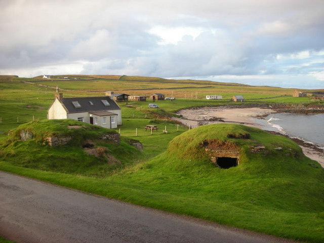
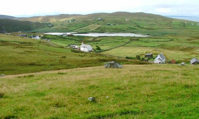
Achnacarnin is a quaint hamlet located in the county of Sutherland, in the northernmost part of the Scottish Highlands. Situated amidst stunning natural surroundings, it is nestled between the majestic mountains and the picturesque shores of Loch Shin. With its tranquil atmosphere and breathtaking landscapes, Achnacarnin is a haven for nature lovers and those seeking an escape from the hustle and bustle of city life.

The hamlet is home to a small population, primarily engaged in agriculture and other rural activities. The traditional stone cottages that dot the landscape add to the charm of the village, giving it an idyllic and timeless appeal. The community is known for its warm and friendly residents, who take pride in their close-knit community and its rich heritage.

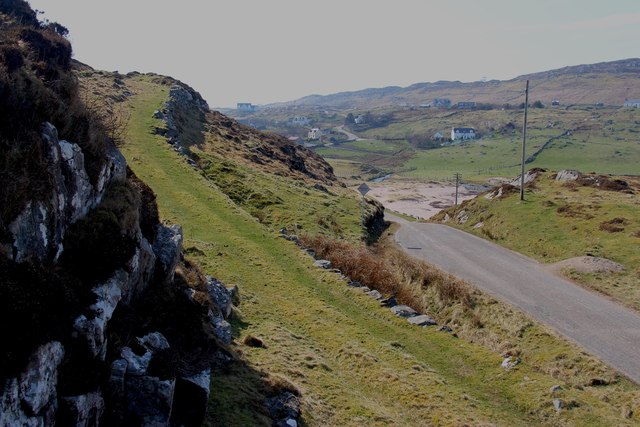
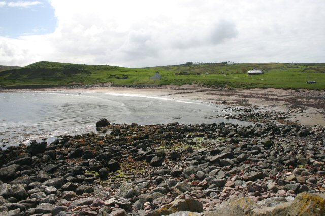
Achnacarnin is a paradise for outdoor enthusiasts, offering a range of activities for visitors to enjoy. The surrounding area provides ample opportunities for hiking, cycling, and fishing, with numerous trails and fishing spots easily accessible. For those interested in wildlife, the nearby Loch Fleet Nature Reserve offers the chance to spot a variety of bird species, seals, and otters.

Despite its small size, Achnacarnin is conveniently located near larger towns and cities, allowing residents and visitors to access necessary amenities without traveling far. The nearby town of Lairg provides a range of services, including shops, restaurants, and accommodation options.

In conclusion, Achnacarnin is a picturesque and welcoming hamlet nestled in the breathtaking Scottish Highlands, offering a peaceful and natural escape for visitors. With its stunning landscapes and charming community, it captures the essence of rural Scotland.

If you have any feedback on the listing, please let us know in the comments section below.

Achnacarnin Images

Images are sourced within 2km of 58.231691/-5.337301 or Grid Reference NC0431. Thanks to Geograph Open Source API. All images are credited.

Icehouses at Culkein The icehouses were filled during the winter and the ice was used during the salmon fishing season to preserve salmon in transit to southern markets.   The salmon fishers' bothy is above the beach.
Icehouses at Culkein
The icehouses were filled during the winter and the ice was used during the salmon fishing season to preserve salmon in transit to southern markets. The salmon fishers' bothy is above the beach.
Clashnessie Bay Looking towards the Stoer peninsula.
Clashnessie Bay
Looking towards the Stoer peninsula.
New cottage overlooking Clashnessie Bay A recently constructed modern cottage designed by Dualchas Architects.
Uses black corrugated sheets, but in a modern interpretation.
New cottage overlooking Clashnessie Bay
A recently constructed modern cottage designed by Dualchas Architects. Uses black corrugated sheets, but in a modern interpretation.
Cattle Grid at Balchladich Tricky things to negotiate on foot! Especially when damp.
Cattle Grid at Balchladich
Tricky things to negotiate on foot! Especially when damp.
Highland Road Road from Balchladich back towards the Stoer road.
Highland Road
Road from Balchladich back towards the Stoer road.
Sunshine on Stoer This is a similar view to this one taken earlier - <a href="https://www.geograph.org.uk/photo/2645770">NC0330 : Highland Road</a> - but with better weather!
Sunshine on Stoer
This is a similar view to this one taken earlier - NC0330 : Highland Road - but with better weather!
Balchladich Road Junction The road to from Balchladich meets the Culkein road.
Balchladich Road Junction
The road to from Balchladich meets the Culkein road.
Sustainably Powered School Stoer Primary School and its controversial wind turbine. Local feeling about it is mixed, according to articles in the local newspapers.
Sustainably Powered School
Stoer Primary School and its controversial wind turbine. Local feeling about it is mixed, according to articles in the local newspapers.
Loch Neil Bhain Maybe if I'd gone to school in such a beautiful spot, I'd have enjoyed it more!
Loch Neil Bhain
Maybe if I'd gone to school in such a beautiful spot, I'd have enjoyed it more!
Stoer Primary School The splendid hand painted tile sign at this important community school. It is signed by all the pupils of 2004. Inspirational.
Stoer Primary School
The splendid hand painted tile sign at this important community school. It is signed by all the pupils of 2004. Inspirational.
Park House A well maintained cottage under a big sky at Clashmore.
Park House
A well maintained cottage under a big sky at Clashmore.
Towards Loch na Claise A shallow loch with adjacent reed-beds near Clashmore.
Towards Loch na Claise
A shallow loch with adjacent reed-beds near Clashmore.
Former Youth Hostel at Stoer I can recall staying a few nights at Stoer School in the 1960s when it was used as a Youth Hostel during the summer holidays. Ah, those were the days...!
Former Youth Hostel at Stoer
I can recall staying a few nights at Stoer School in the 1960s when it was used as a Youth Hostel during the summer holidays. Ah, those were the days...!
Clashnessie Bay
Clashnessie Bay
Grass road to the moor, Clashnessie
Stoer Primary School and Loch Neil Bhàin
Old roadside quarry by the moors of Rubha Stoer
The school at Balchladich Complete with solar panels.
The school at Balchladich
Complete with solar panels.
Show me another place!

Achnacarnin is located at Grid Ref: NC0431 (Lat: 58.231691, Lng: -5.337301)

Unitary Authority: Highland

Police Authority: Highlands and Islands

What 3 Words

///plank.plodding.tribe. Near Clachtoll, Highland

Related Wikis

Achnacarnin

Achnacarnin (Scottish Gaelic: Achadh nan Càrnan) is a village on the headland of Point of Stoer in Lairg, Sutherland, within the Scottish local authority...

Culkein

Culkein Stoer (Scottish Gaelic: An Cùl-cinn) is a remote former fishing village, centred on the Bay of Culkein, in Assynt in Sutherland, Scottish Highlands...

Clashmore, Assynt

Clashmore (Scottish Gaelic: An Clais Mór) is a scattered township in Assynt, in Sutherland, in the Highland council area of Scotland. It is situated on...

Balchladich

Balchladich (Scottish Gaelic: Baile a' Chladaich) is a remote township in the Assynt district of Sutherland, Scottish Highlands and is in the Scottish...

Nearby Amenities

Located within 500m of 58.231691,-5.337301
Power: pole
Lat/Long: 58.2276101/-5.3371648
Power: pole
Lat/Long: 58.2281268/-5.3371298
Power: pole
Lat/Long: 58.2285532/-5.3370908
Power: pole
Lat/Long: 58.2291436/-5.337048
Power: pole
Lat/Long: 58.2296684/-5.3370246
Power: pole
Lat/Long: 58.2301624/-5.3369662
Power: pole
Lat/Long: 58.2305673/-5.3369331
Power: pole
Lat/Long: 58.2310346/-5.3365788
Power: pole
Lat/Long: 58.2314938/-5.3362362
Power: pole
Lat/Long: 58.23224/-5.3356561
Power: pole
Lat/Long: 58.232736/-5.335769
Power: pole
Lat/Long: 58.2330701/-5.3358196
Power: pole
Lat/Long: 58.2335908/-5.335952
Power: pole
Lat/Long: 58.2339987/-5.3360376
Power: pole
Lat/Long: 58.2346464/-5.3361544
Power: pole
Lat/Long: 58.2353197/-5.336281
Power: pole
Lat/Long: 58.2359633/-5.3364095
Power: pole
Lat/Long: 58.2286977/-5.3379474
Power: pole
Lat/Long: 58.2291507/-5.3385801
Power: pole
Lat/Long: 58.2296192/-5.3392381
Power: pole
Lat/Long: 58.2300835/-5.3398785
Power: pole
Lat/Long: 58.2305642/-5.3405307
Power: pole
Lat/Long: 58.2309936/-5.3411244
Power: pole
Lat/Long: 58.2308286/-5.34231
Power: pole
Lat/Long: 58.2306646/-5.3434547
Power: pole
Lat/Long: 58.2305088/-5.3446208
Power: pole
Lat/Long: 58.229735/-5.336645
Power: pole
Lat/Long: 58.2300363/-5.3351071
Power: pole
Lat/Long: 58.2302782/-5.3339079
Power: pole
Lat/Long: 58.2304914/-5.3328333
Power: pole
Lat/Long: 58.2306729/-5.3317749
Power: pole
Lat/Long: 58.2342702/-5.3354672
Power: pole
Lat/Long: 58.2346033/-5.334745
Power: pole
Lat/Long: 58.2350133/-5.3338709
Power: pole
Lat/Long: 58.235417/-5.3329949
Power: pole
Lat/Long: 58.2343994/-5.3309975
The data included in this document is from www.openstreetmap.org. The data is made available under ODbL.

Have you been to Achnacarnin?

Leave your review of Achnacarnin below (or comments, questions and feedback).