Trefrew

Settlement in Cornwall

England

Trefrew

Camelford Methodist Church
Camelford Methodist Church Credit: Paul Barnett

The requested URL returned error: 429 Too Many Requests

If you have any feedback on the listing, please let us know in the comments section below.
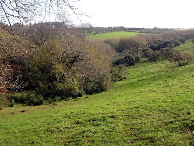
Trefrew Images

Images are sourced within 2km of 50.629774/-4.6752493 or Grid Reference SX1084. Thanks to Geograph Open Source API. All images are credited.

Camelford Methodist Church
Camelford entrance sign
Camelford : Clock on Town Hall A clock on the town hall with a camel on the top.
Camelford : Clock on Town Hall
A clock on the town hall with a camel on the top.
Camelford : Camelford Conservative Club The Con Club on Victoria Road in Camelford with a Union Jack flying on the outside.
Camelford : Camelford Conservative Club
The Con Club on Victoria Road in Camelford with a Union Jack flying on the outside.
Camelford : A39 High Street The High Street through Camelford on the A39.
Camelford : A39 High Street
The High Street through Camelford on the A39.
Camelford : A39 High Street The High Street through Camelford.
Camelford : A39 High Street
The High Street through Camelford.
Bridge on Roughtor Road Bridge over a tributary of the River Camel on the road from Camelford to Rough Tor and Bodmin Moor.
Bridge on Roughtor Road
Bridge over a tributary of the River Camel on the road from Camelford to Rough Tor and Bodmin Moor.
North Cornwall Museum and Gallery North Cornwall Museum and Gallery in Camelford.
North Cornwall Museum and Gallery
North Cornwall Museum and Gallery in Camelford.
Footpath near Camelford This public footpath follows the course of an old lane.
Footpath near Camelford
This public footpath follows the course of an old lane.
Footbridge over a Stream
Valleyside Pasture
Valleyside Pasture
Barn near Treclago The barn lies beside a farm track which is also a public footpath.
Barn near Treclago
The barn lies beside a farm track which is also a public footpath.
Autumnal Country Lane Despite it being mid November there are still some Autumn leaves left on the trees.
Autumnal Country Lane
Despite it being mid November there are still some Autumn leaves left on the trees.
Traffic jam, Camelford The A39 beside Boots.
Traffic jam, Camelford
The A39 beside Boots.
Flats on the High Street (the A39) An imposing block, maybe a former warehouse?
Flats on the High Street (the A39)
An imposing block, maybe a former warehouse?
The Masons Arms, Camelford A fine St Austell house, probably a former coaching inn.  The St Austell Brewery is an outstanding regional brewer (see: <span class="nowrap"><a title="http://www.staustellbrewery.co.uk/" rel="nofollow ugc noopener" href="http://www.staustellbrewery.co.uk/">Link</a><img style="margin-left:2px;" alt="External link" title="External link - shift click to open in new window" src="https://s1.geograph.org.uk/img/external.png" width="10" height="10"/></span> ) with a fair number of tied houses, most of which serve cask (real) ale.  Who needs lager...??
The Masons Arms, Camelford
A fine St Austell house, probably a former coaching inn. The St Austell Brewery is an outstanding regional brewer (see: LinkExternal link ) with a fair number of tied houses, most of which serve cask (real) ale. Who needs lager...??
Former Sunday School, Chapel Street, Camelford Now converted to a house.
Former Sunday School, Chapel Street, Camelford
Now converted to a house.
Camelford Health Centre
Show me another place!

Trefrew is located at Grid Ref: SX1084 (Lat: 50.629774, Lng: -4.6752493)

Unitary Authority: Cornwall

Police Authority: Devon and Cornwall

What 3 Words

///judge.dome.cleanser. Near Camelford, Cornwall

Nearby Locations

Trefrew

Related Wikis

Camelford F.C.

Camelford Football Club is a football club based in Camelford, Cornwall, England. They are currently members of the South West Peninsula League Premier...

St Julitta's Church, Lanteglos-by-Camelford

St Julitta's Church, Lanteglos-by-Camelford is a Grade I listed parish church in the Church of England Diocese of Truro in Lanteglos-by-Camelford, Cornwall...

St Thomas of Canterbury's Church, Camelford

St Thomas of Canterbury's Church, Camelford is a church in the Church of England Diocese of Truro in Camelford, Cornwall. It is a chapel-of-ease in the...
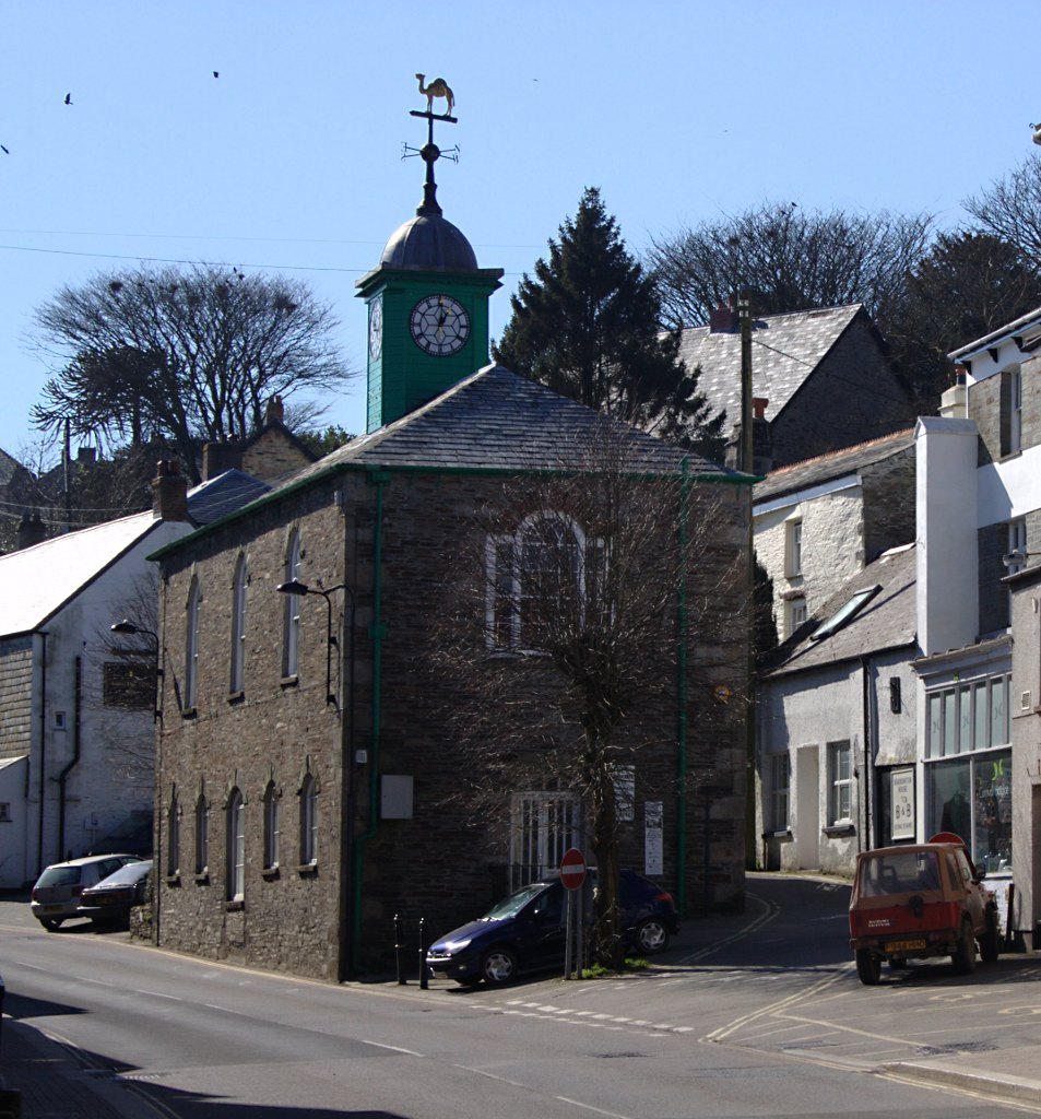
Camelford Town Hall

Camelford Town Hall is a municipal building in the Market Place, Camelford, Cornwall, England. The town hall, which is currently used as a public library...

Nearby Amenities

Located within 500m of 50.629774,-4.6752493
Trefrew
Is In: Cornwall, England, UK
Place: hamlet
Source: NPE
Lat/Long: 50.6305829/-4.6751462
Power: tower
Lat/Long: 50.6297134/-4.6801839
Power: tower
Lat/Long: 50.6338839/-4.6744142
Power: tower
Lat/Long: 50.6325247/-4.6763262
Power: pole
Lat/Long: 50.6299951/-4.6814522
Power: pole
Lat/Long: 50.6299773/-4.6801491
Power: pole
Lat/Long: 50.6299316/-4.6785165
Power: pole
Lat/Long: 50.6297033/-4.6757653
Power: pole
Lat/Long: 50.6296063/-4.6740726
Power: pole
Lat/Long: 50.629511/-4.6725837
Power: pole
Lat/Long: 50.6294157/-4.6710363
Power: pole
Lat/Long: 50.6292123/-4.6683639
Power: pole
Lat/Long: 50.6297878/-4.6766544
Generator Method: photovoltaic
Generator Output Electricity: yes
Generator Source: solar
Generator Type: solar_photovoltaic_panel
Location: roof
Power: generator
Lat/Long: 50.6262075/-4.677632
Generator Method: photovoltaic
Generator Output Electricity: yes
Generator Source: solar
Generator Type: solar_photovoltaic_panel
Location: roof
Power: generator
Lat/Long: 50.6266988/-4.6769495
Generator Method: photovoltaic
Generator Output Electricity: yes
Generator Source: solar
Generator Type: solar_photovoltaic_panel
Location: roof
Power: generator
Lat/Long: 50.625573/-4.6769098
Generator Method: photovoltaic
Generator Output Electricity: yes
Generator Source: solar
Generator Type: solar_photovoltaic_panel
Location: roof
Power: generator
Lat/Long: 50.6259159/-4.6759952
Generator Method: photovoltaic
Generator Output Electricity: yes
Generator Source: solar
Generator Type: solar_photovoltaic_panel
Location: roof
Power: generator
Lat/Long: 50.6259788/-4.6756063
Generator Method: photovoltaic
Generator Output Electricity: yes
Generator Source: solar
Generator Type: solar_photovoltaic_panel
Location: roof
Power: generator
Lat/Long: 50.6254871/-4.6735463
Generator Method: photovoltaic
Generator Output Electricity: yes
Generator Source: solar
Generator Type: solar_photovoltaic_panel
Location: roof
Power: generator
Lat/Long: 50.625322/-4.6748874
Power: pole
Lat/Long: 50.6276885/-4.6772401
Power: pole
Lat/Long: 50.6275114/-4.6764529
Power: pole
Lat/Long: 50.6265126/-4.6740389
Power: pole
Lat/Long: 50.6263969/-4.6709865
Power: pole
Lat/Long: 50.6263293/-4.6725745
Power: pole
Lat/Long: 50.6277672/-4.6777597
Power: pole
Lat/Long: 50.6280171/-4.6793152
Power: pole
Lat/Long: 50.6293178/-4.6695872
The data included in this document is from www.openstreetmap.org. The data is made available under ODbL.

Have you been to Trefrew?

Leave your review of Trefrew below (or comments, questions and feedback).