Topping Fold

Settlement in Lancashire

England

Topping Fold

Footpath deviation around property This public footpath should go on to reach the River Roch but I felt like a trespasser on this section by Brook Cottage. The path away from Brook Cottage that follows Moss Hall Road appeared impassable.
Footpath deviation around property Credit: Kevin Waterhouse

Topping Fold is a small village located in the county of Lancashire, England. Situated in the borough of West Lancashire, it is nestled between the larger towns of Ormskirk and Skelmersdale. The village is known for its picturesque countryside and charming rural setting.

Topping Fold has a rich history, with evidence of human habitation dating back to the medieval period. The village is home to several historic buildings, including a 16th-century farmhouse and a traditional village church. These architectural gems provide a glimpse into the village's past and offer a sense of nostalgia for visitors.

The local community of Topping Fold is tight-knit and friendly, with a strong sense of community spirit. The village hosts various events and activities throughout the year, including summer fairs and Christmas markets, which bring residents together and create a vibrant atmosphere.

Nature lovers will find plenty to explore in Topping Fold, as the village is surrounded by beautiful countryside and rolling hills. The area is popular for walking and hiking, with many scenic trails and footpaths crisscrossing the landscape. The nearby Topping Fold Nature Reserve is a haven for wildlife enthusiasts, boasting a diverse range of flora and fauna.

Despite its rural setting, Topping Fold benefits from good transport links. The village is well-connected to nearby towns and cities, with regular bus services and a nearby train station. This makes it an ideal location for those seeking a peaceful retreat while still being within easy reach of urban amenities.

In summary, Topping Fold offers a charming and idyllic village setting with a rich history, beautiful countryside, and a close-knit community. It is a place where residents and visitors alike can enjoy the tranquility of rural life while being conveniently connected to the wider region.

If you have any feedback on the listing, please let us know in the comments section below.
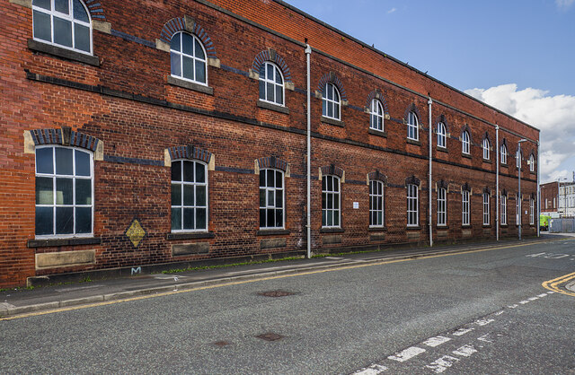
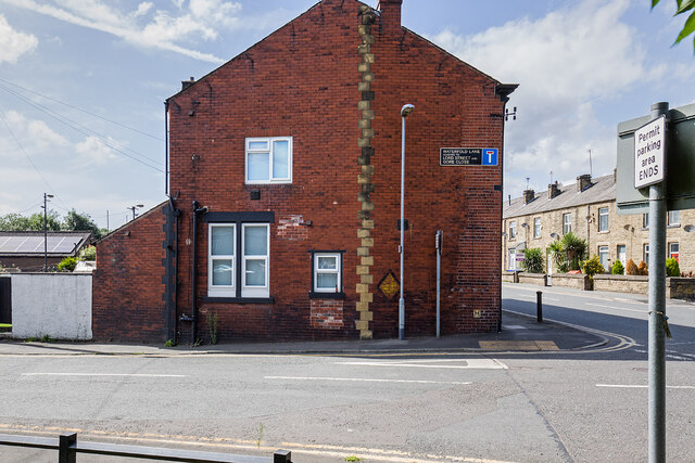
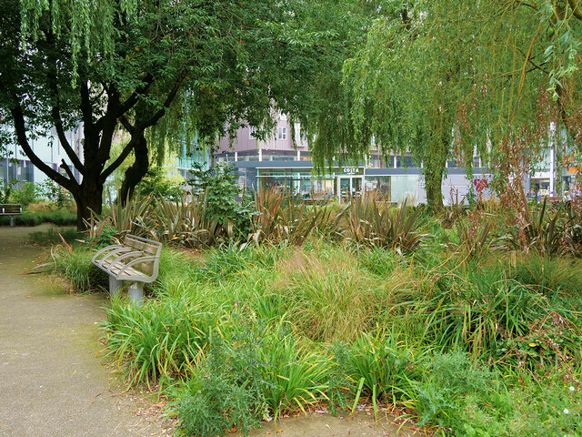
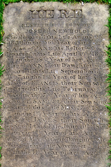
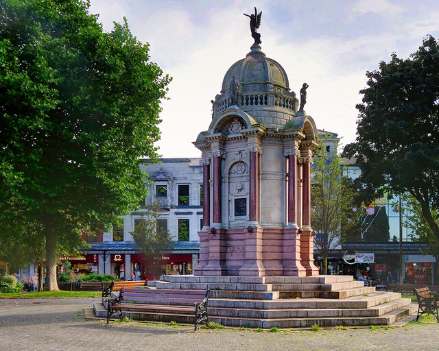
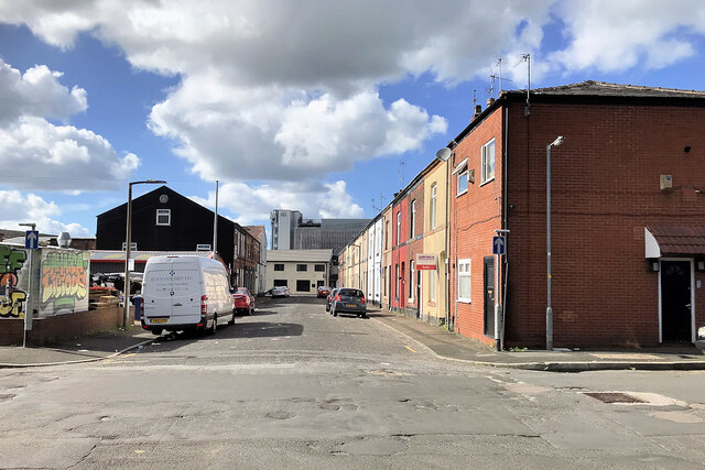
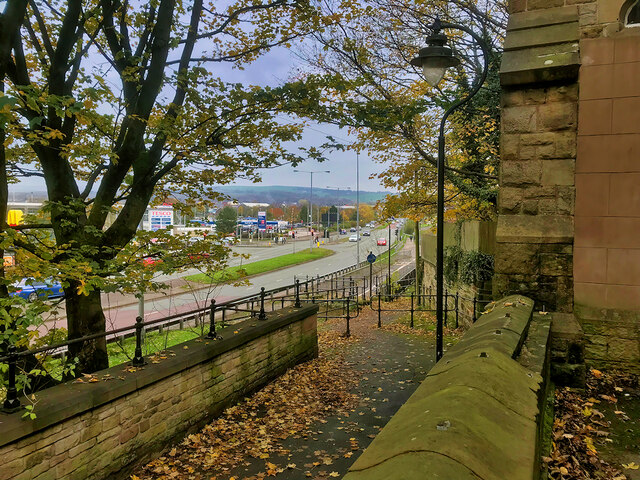
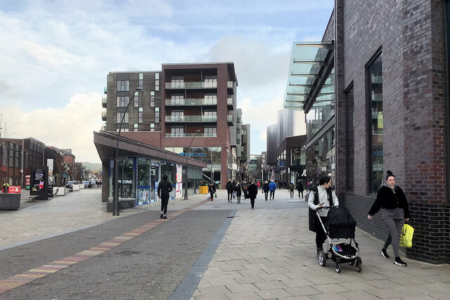
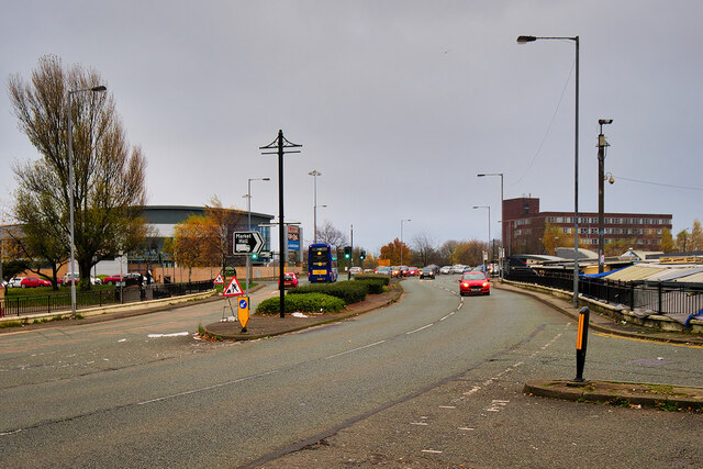
Topping Fold Images

Images are sourced within 2km of 53.597132/-2.2685065 or Grid Reference SD8211. Thanks to Geograph Open Source API. All images are credited.

Footpath deviation around property This public footpath should go on to reach the River Roch but I felt like a trespasser on this section by Brook Cottage. The path away from Brook Cottage that follows Moss Hall Road appeared impassable.
Footpath deviation around property
This public footpath should go on to reach the River Roch but I felt like a trespasser on this section by Brook Cottage. The path away from Brook Cottage that follows Moss Hall Road appeared impassable.
Moss Hall Road One of the roads servicing the distribution park and under clearway restriction.
Moss Hall Road
One of the roads servicing the distribution park and under clearway restriction.
WWII Lancashire: Ghost Signs of the Home Front  (8) -
Emergency Rendezvous Point, Lord Street, Bury (opposite junction with Parker Street)

"ERP 166"

Emergency Rendezvous Points (ERP) were designated places in the locality for the coordination of ARP and emergency services during civil emergencies, particularly for those services arriving from outside the area. The signs appear in a variety of designs, but most are diamond shapes framing the ERP locality number.

<a href="https://www.geograph.org.uk/photo/6945055">SD8110 : WWII Lancashire: Ghost Signs of the Home Front  (9)</a>
WWII Lancashire: Ghost Signs of the Home Front (8)
- Emergency Rendezvous Point, Lord Street, Bury (opposite junction with Parker Street) "ERP 166" Emergency Rendezvous Points (ERP) were designated places in the locality for the coordination of ARP and emergency services during civil emergencies, particularly for those services arriving from outside the area. The signs appear in a variety of designs, but most are diamond shapes framing the ERP locality number. SD8110 : WWII Lancashire: Ghost Signs of the Home Front (9)
WWII Lancashire: Ghost Signs of the Home Front  (9) -
Emergency Rendezvous Point, Lord Street, Bury (opposite junction with Parker Street)

"ERP 166" 

Emergency Rendezvous Points (ERP) were designated places in the locality for the coordination of ARP and emergency services during civil emergencies, particularly for those services arriving from outside the area. The signs appear in a variety of designs, but most are diamond shapes framing the ERP locality number.

<a href="https://www.geograph.org.uk/photo/6945061">SD8210 : WWII Lancashire: Ghost Signs of the Home Front  (10)</a>
WWII Lancashire: Ghost Signs of the Home Front (9)
- Emergency Rendezvous Point, Lord Street, Bury (opposite junction with Parker Street) "ERP 166" Emergency Rendezvous Points (ERP) were designated places in the locality for the coordination of ARP and emergency services during civil emergencies, particularly for those services arriving from outside the area. The signs appear in a variety of designs, but most are diamond shapes framing the ERP locality number. SD8210 : WWII Lancashire: Ghost Signs of the Home Front (10)
WWII Lancashire: Ghost Signs of the Home Front  (10) -
(Emergency Rendezvous Point), Junction of Waterfold Lane and Bury New Road, Heywood, Bury

"ERP ---?"

Emergency Rendezvous Points (ERP) were designated places in the locality for the coordination of ARP and emergency services during civil emergencies, particularly for those services arriving from outside the area. The signs appear in a variety of designs, but most are diamond shapes framing the ERP locality number.

<a href="https://www.geograph.org.uk/photo/6945065">SD8210 : WWII Lancashire: Ghost Signs of the Home Front  (11)</a>
WWII Lancashire: Ghost Signs of the Home Front (10)
- (Emergency Rendezvous Point), Junction of Waterfold Lane and Bury New Road, Heywood, Bury "ERP ---?" Emergency Rendezvous Points (ERP) were designated places in the locality for the coordination of ARP and emergency services during civil emergencies, particularly for those services arriving from outside the area. The signs appear in a variety of designs, but most are diamond shapes framing the ERP locality number. SD8210 : WWII Lancashire: Ghost Signs of the Home Front (11)
WWII Lancashire: Ghost Signs of the Home Front  (11) -
Emergency Rendezvous Point, Junction of Waterfold Lane and Bury New Road, Heywood, Bury

"ERP ---?"

Emergency Rendezvous Points (ERP) were designated places in the locality for the coordination of ARP and emergency services during civil emergencies, particularly for those services arriving from outside the area. The signs appear in a variety of designs, but most are diamond shapes framing the ERP locality number.

<a href="https://www.geograph.org.uk/photo/6945270">SD8410 : WWII Lancashire: Ghost Signs of the Home Front  (12)</a>
WWII Lancashire: Ghost Signs of the Home Front (11)
- Emergency Rendezvous Point, Junction of Waterfold Lane and Bury New Road, Heywood, Bury "ERP ---?" Emergency Rendezvous Points (ERP) were designated places in the locality for the coordination of ARP and emergency services during civil emergencies, particularly for those services arriving from outside the area. The signs appear in a variety of designs, but most are diamond shapes framing the ERP locality number. SD8410 : WWII Lancashire: Ghost Signs of the Home Front (12)
St John's Gardens The former St John's Church was located off The Rock, then named Stanley Street. The church closed in 1964 but the former graveyard remained. Now, this land forms a garden adjacent to the new Rock Triangle retail and entertainment development which opened in 2010. Several of the gravestones have been retained in the design of the garden alongside the paths.
St John's Gardens
The former St John's Church was located off The Rock, then named Stanley Street. The church closed in 1964 but the former graveyard remained. Now, this land forms a garden adjacent to the new Rock Triangle retail and entertainment development which opened in 2010. Several of the gravestones have been retained in the design of the garden alongside the paths.
Joseph Newbold's Gravestone, St John's Gardens The former St John's Church was located off The Rock, then named Stanley Street. The church closed in 1964 but the former graveyard remained. Now, this land forms a garden (<a href="https://www.geograph.org.uk/photo/6959084">SD8011 : St John's Gardens</a>) adjacent to the new Rock Triangle retail and entertainment development which opened in 2010. 

Several of the gravestones have been retained in the design of the garden and lie flat alongside the paths. Most are worn to the point of being illegible but I was able to make out the wording on this one which relates the tragic story of Joseph and Jane Newbold who had 5 children, none of whom survived them. Two died in infancy (not uncommon at that time) and three died between 1830 and 1833 when a cholera pandemic caused 60,000 deaths amongst the population of 14 million in England.

HERE
Resteth the body of 
JOSEPH NEWBOLD
Who departed this life August 20th 1839 in the 56th year of his Age.
Also of JANE his Relict * who departed this life April 16th 1853 in the 68th year of her Age.
Also of ANN their Daughter who departed this life September 1?th 1807 in the first year of her Age.
Also of FRANCIS their Son who departed this life February 1826 in the 7th year of his Age.
Also of SAMUEL their Son who departed this life May 27th 1830 in the 1st year of his Age.
Also of JAMES their son who departed this life June 10th 1833 in the 17th year of his Age
Also of MARY their Daughter who departed this life November 26th 1833 in the 11th year of her Age

* I was unfamiliar with the term relict in this context. On looking it up, I found that it was a term from the 17th and 18th centuries that meant a woman who was the surviving spouse of the marriage and had not remarried (as today we would use the word widow).
Joseph Newbold's Gravestone, St John's Gardens
The former St John's Church was located off The Rock, then named Stanley Street. The church closed in 1964 but the former graveyard remained. Now, this land forms a garden (SD8011 : St John's Gardens) adjacent to the new Rock Triangle retail and entertainment development which opened in 2010. Several of the gravestones have been retained in the design of the garden and lie flat alongside the paths. Most are worn to the point of being illegible but I was able to make out the wording on this one which relates the tragic story of Joseph and Jane Newbold who had 5 children, none of whom survived them. Two died in infancy (not uncommon at that time) and three died between 1830 and 1833 when a cholera pandemic caused 60,000 deaths amongst the population of 14 million in England. HERE Resteth the body of JOSEPH NEWBOLD Who departed this life August 20th 1839 in the 56th year of his Age. Also of JANE his Relict * who departed this life April 16th 1853 in the 68th year of her Age. Also of ANN their Daughter who departed this life September 1?th 1807 in the first year of her Age. Also of FRANCIS their Son who departed this life February 1826 in the 7th year of his Age. Also of SAMUEL their Son who departed this life May 27th 1830 in the 1st year of his Age. Also of JAMES their son who departed this life June 10th 1833 in the 17th year of his Age Also of MARY their Daughter who departed this life November 26th 1833 in the 11th year of her Age * I was unfamiliar with the term relict in this context. On looking it up, I found that it was a term from the 17th and 18th centuries that meant a woman who was the surviving spouse of the marriage and had not remarried (as today we would use the word widow).
Fame on the Kay Monument The Portland stone dome of the Kay monument (<a href="https://www.geograph.org.uk/photo/2752602">SD8010 : Kay Monument, Bury</a>) is surmounted by the bronze figure of Fame.
Fame on the Kay Monument
The Portland stone dome of the Kay monument (SD8010 : Kay Monument, Bury) is surmounted by the bronze figure of Fame.
Bury, The Kay Monument This imposing structure, an ornate, Italianate domed octagon standing more than ten metres in height, is a memorial to John Kay. It stands in the centre of Kay Gardens, an open space created from the former market place when a new market hall was built in 1901. The gardens and this memorial were commissioned and paid for by Henry Whitehead, a local mill owner.

John Kay was born in Bury in 1704. He was a prolific inventor, most famous in Lancashire as the 'Inventor of the flying shuttle' - a mechanism for speeding up the production of cloth on a hand-operated loom. Although he left Bury, emigrating to France in 1747, he has long been regarded as a celebrated son of the town and one of the men responsible for Lancashire's success in the cotton industry. An inscription on one side of the monument reads:

THE GIFT OF HENRY WHITEHEAD OF HASLEM HEY TO HIS NATIVE TOWN
TO PERPETUATE THE NAME AND FAME OF  
JOHN KAY 
OF  
BURY. 
WHOSE INVENTION IN THE YEAR 1733 OF THE FLY SHUTTLE
QUADRUPLED HUMAN POWER IN WEAVING & PLACED ENGLAND IN THE FRONT RANK 
AS THE BEST MARKET IN THE WORLD FOR TEXTILE MANUFACTURES. 
HE WAS BORN IN BURY IN 1704, AND DIED IN EXILE AND POVERTY IN FRANCE, 
WHERE HE LIES IN AN UNKNOWN GRAVE.

Kay Gardens and the Kay Monument were opened in April 1908. Mrs Henry Whitehead opened the gardens and the Earl of Derby unveiled the monument. The monument, which was cleaned and refurbished in 2011, is a Grade II listed structure (List Entry Number: 1163636 <span class="nowrap"><a title="https://historicengland.org.uk/listing/the-list/list-entry/1163636" rel="nofollow ugc noopener" href="https://historicengland.org.uk/listing/the-list/list-entry/1163636">Link</a><img style="margin-left:2px;" alt="External link" title="External link - shift click to open in new window" src="https://s1.geograph.org.uk/img/external.png" width="10" height="10"/></span> Historic England).
 .

(see also <a href="https://www.geograph.org.uk/photo/2752605">SD8010 : Kay Monument  - Relief Portrait</a>, <a href="https://www.geograph.org.uk/photo/2752607">SD8010 : Kay Monument, Inscription</a>,  <a href="https://www.geograph.org.uk/photo/2752612">SD8010 : Kay Monument (detail)</a>  and <a href="https://www.geograph.org.uk/photo/6959132">SD8010 : Fame on the Kay Monument</a>).

<span class="nowrap"><a title="http://www.johncassidy.org.uk/kay.html" rel="nofollow ugc noopener" href="http://www.johncassidy.org.uk/kay.html">Link</a><img style="margin-left:2px;" alt="External link" title="External link - shift click to open in new window" src="https://s1.geograph.org.uk/img/external.png" width="10" height="10"/></span> - John Cassidy, Manchester Sculpture
<span class="nowrap"><a title="http://www.cottontimes.co.uk/JohnKayo.htm" rel="nofollow ugc noopener" href="http://www.cottontimes.co.uk/JohnKayo.htm">Link</a><img style="margin-left:2px;" alt="External link" title="External link - shift click to open in new window" src="https://s1.geograph.org.uk/img/external.png" width="10" height="10"/></span> - Cotton Times, The Life of John Kay

<a href="https://www.geograph.org.uk/photo/1139632">SD8010 : Monument to John Kay Kay Gardens, Bury Town Centre</a> and <a href="https://www.geograph.org.uk/photo/1338262">SD8010 : The John Kay Memorial</a> show the monument before it was cleaned and refurbished).
Bury, The Kay Monument
This imposing structure, an ornate, Italianate domed octagon standing more than ten metres in height, is a memorial to John Kay. It stands in the centre of Kay Gardens, an open space created from the former market place when a new market hall was built in 1901. The gardens and this memorial were commissioned and paid for by Henry Whitehead, a local mill owner. John Kay was born in Bury in 1704. He was a prolific inventor, most famous in Lancashire as the 'Inventor of the flying shuttle' - a mechanism for speeding up the production of cloth on a hand-operated loom. Although he left Bury, emigrating to France in 1747, he has long been regarded as a celebrated son of the town and one of the men responsible for Lancashire's success in the cotton industry. An inscription on one side of the monument reads: THE GIFT OF HENRY WHITEHEAD OF HASLEM HEY TO HIS NATIVE TOWN TO PERPETUATE THE NAME AND FAME OF JOHN KAY OF BURY. WHOSE INVENTION IN THE YEAR 1733 OF THE FLY SHUTTLE QUADRUPLED HUMAN POWER IN WEAVING & PLACED ENGLAND IN THE FRONT RANK AS THE BEST MARKET IN THE WORLD FOR TEXTILE MANUFACTURES. HE WAS BORN IN BURY IN 1704, AND DIED IN EXILE AND POVERTY IN FRANCE, WHERE HE LIES IN AN UNKNOWN GRAVE. Kay Gardens and the Kay Monument were opened in April 1908. Mrs Henry Whitehead opened the gardens and the Earl of Derby unveiled the monument. The monument, which was cleaned and refurbished in 2011, is a Grade II listed structure (List Entry Number: 1163636 LinkExternal link Historic England). . (see also SD8010 : Kay Monument - Relief Portrait, SD8010 : Kay Monument, Inscription, SD8010 : Kay Monument (detail) and SD8010 : Fame on the Kay Monument). LinkExternal link - John Cassidy, Manchester Sculpture LinkExternal link - Cotton Times, The Life of John Kay SD8010 : Monument to John Kay Kay Gardens, Bury Town Centre and SD8010 : The John Kay Memorial show the monument before it was cleaned and refurbished).
Woodfields Retail Park, Peel Way
Bury, Fletcher Street
Path behind St Mary's Parish Rooms, Bury Footpath leading from The Wylde towards Peel Way.
Path behind St Mary's Parish Rooms, Bury
Footpath leading from The Wylde towards Peel Way.
Tributes at Bury War Memorial Some of the wreaths that were laid at Bury's war memorial on Remembrance Sunday 2021.

Bury War Memorial was unveiled in 1924, by the Earl of Derby. It stands at the corner of Market Place and The Rock outside St Mary's, the Parish Church of Bury. The memorial, which is Grade II*-listed (<span class="nowrap"><a title="https://historicengland.org.uk/listing/the-list/list-entry/1444845" rel="nofollow ugc noopener" href="https://historicengland.org.uk/listing/the-list/list-entry/1444845">Link</a><img style="margin-left:2px;" alt="External link" title="External link - shift click to open in new window" src="https://s1.geograph.org.uk/img/external.png" width="10" height="10"/></span> Historic England List Entry Number: 1444845), takes the form of a tall stone cross rising from an octagonal base which is flanked by a curving wall on which are two rectangular bronze panels. The panels have compositions comprising a procession of military and civilian figures.
Tributes at Bury War Memorial
Some of the wreaths that were laid at Bury's war memorial on Remembrance Sunday 2021. Bury War Memorial was unveiled in 1924, by the Earl of Derby. It stands at the corner of Market Place and The Rock outside St Mary's, the Parish Church of Bury. The memorial, which is Grade II*-listed (LinkExternal link Historic England List Entry Number: 1444845), takes the form of a tall stone cross rising from an octagonal base which is flanked by a curving wall on which are two rectangular bronze panels. The panels have compositions comprising a procession of military and civilian figures.
The War Memorial, Market Place, Bury Bury War Memorial was unveiled in 1924, by the Earl of Derby. It stands at the corner of Market Place and The Rock outside St Mary's, the Parish Church of Bury. The memorial, which is Grade II*-listed (<span class="nowrap"><a title="https://historicengland.org.uk/listing/the-list/list-entry/1444845" rel="nofollow ugc noopener" href="https://historicengland.org.uk/listing/the-list/list-entry/1444845">Link</a><img style="margin-left:2px;" alt="External link" title="External link - shift click to open in new window" src="https://s1.geograph.org.uk/img/external.png" width="10" height="10"/></span> Historic England List Entry Number: 1444845), takes the form of a tall stone cross rising from an octagonal base which is flanked by a curving wall on which are two rectangular bronze panels. The panels have compositions comprising a procession of military and civilian figures.

See <a href="https://www.geograph.org.uk/photo/7020418">SD8010 : Tributes at Bury War Memorial</a> for a closer look.
The War Memorial, Market Place, Bury
Bury War Memorial was unveiled in 1924, by the Earl of Derby. It stands at the corner of Market Place and The Rock outside St Mary's, the Parish Church of Bury. The memorial, which is Grade II*-listed (LinkExternal link Historic England List Entry Number: 1444845), takes the form of a tall stone cross rising from an octagonal base which is flanked by a curving wall on which are two rectangular bronze panels. The panels have compositions comprising a procession of military and civilian figures. See SD8010 : Tributes at Bury War Memorial for a closer look.
The Rock, Bury
The Rock, Bury
Santa at the Millgate The giant figure of Father Christmas at the Millgate Shopping Centre in Bury.
Santa at the Millgate
The giant figure of Father Christmas at the Millgate Shopping Centre in Bury.
Bury, Angouleme Way Part of the ring road around Bury town centre.
Bury, Angouleme Way
Part of the ring road around Bury town centre.
Show me another place!

Topping Fold is located at Grid Ref: SD8211 (Lat: 53.597132, Lng: -2.2685065)

Unitary Authority: Bury

Police Authority: Greater Manchester

What 3 Words

///film.dozen.bottle. Near Bury, Manchester

Related Wikis

Hazel Wood High School

Hazel Wood High School, formerly known as Broad Oak Sports College, is a coeducational 11-16 secondary school located on Hazel Avenue about a mile to the...

Fairfield General Hospital

Fairfield General Hospital is a hospital in Bury, Greater Manchester. It is managed by the Northern Care Alliance NHS Foundation Trust. == History == The...

St Paul's Church, Bury

St Paul's Church is in Church Street, Bury, Greater Manchester, England. A former Anglican parish church, it is now redundant and, following fire damage...

Jericho, Bury

Jericho is a district of Bury, Greater Manchester, England. It is thought that the area of Jericho was so named when the reverend John Wesley preached...

Nearby Amenities

Located within 500m of 53.597132,-2.2685065
Fairfield
Name Ur: فیرفیلڈ
Place: suburb
Source: npe
Lat/Long: 53.5982902/-2.2680907
Motorway Junction
Heap Bridge Interchange
Ref: 2
Lat/Long: 53.5964905/-2.2707042
Mini Roundabout
Direction: clockwise
Source: bing
Lat/Long: 53.5974242/-2.2753943
Bus Stop
Rochdale Old Road/M66
Bus: yes
Naptan AtcoCode: 1800NC00701
Naptan Bearing: W
Naptan CommonName: Rochdale Old Road/M66
Naptan Indicator: Under Mway Brgd
Naptan Landmark: MOTORWAY BRIDGE
Naptan NaptanCode: mandmgja
Naptan PlusbusZoneRef: MNCRPIC
Naptan ShortCommonName: M66
Naptan Street: Rochdale Old Road
Naptan Verified: no
Network: TfGM
Public Transport: platform
Source: naptan_import
Lat/Long: 53.598543/-2.2718401
Bus Stop
Rochdale Old Road/Ferngrove
Bus: yes
Naptan AtcoCode: 1800NC00711
Naptan Bearing: E
Naptan CommonName: Rochdale Old Road/Ferngrove
Naptan Indicator: Op House 112
Naptan Landmark: OP HOUSE
Naptan NaptanCode: mandmgjd
Naptan Notes: INDICATOR AMENDED
Naptan PlusbusZoneRef: MNCRPIC
Naptan ShortCommonName: Ferngrove
Naptan Street: Rochdale Old Road
Naptan Verified: no
Network: TfGM
Public Transport: platform
Source: naptan_import
Lat/Long: 53.59886/-2.2707995
Bus Stop
Topping Fold Road/Rochdale Old Road
Bus: yes
Naptan AtcoCode: 1800NC04851
Naptan Bearing: NW
Naptan CommonName: Topping Fold Road/Rochdale Old Road
Naptan Indicator: O/s House 2
Naptan Landmark: HOUSE 2
Naptan NaptanCode: mandmpdp
Naptan PlusbusZoneRef: MNCRPIC
Naptan ShortCommonName: Rochdale Old Road
Naptan Street: Topping Fold Road
Naptan Verified: no
Network: TfGM
Public Transport: platform
Source: naptan_import
Lat/Long: 53.5986555/-2.2698009
Bus Stop
Willow Street/Maxwell Street
Bus: yes
Naptan AtcoCode: 1800NC09571
Naptan Bearing: S
Naptan CommonName: Willow Street/Maxwell Street
Naptan Indicator: House number 124
Naptan Landmark: HOUSE 124
Naptan NaptanCode: mantmwtp
Naptan Notes: NEW STOP
Naptan ShortCommonName: Maxwell Street
Naptan Street: WILLOW STREET
Naptan Verified: no
Network: TfGM
Public Transport: platform
Source: naptan_import
Lat/Long: 53.5961972/-2.2757083
Bus Stop
Bell Lane/Chesham Fold Road
Bus: yes
Naptan AtcoCode: 1800NC21701
Naptan Bearing: W
Naptan CommonName: Bell Lane/Chesham Fold Road
Naptan Indicator: O/s House 234
Naptan Landmark: HOUSE 234
Naptan NaptanCode: mandptaw
Naptan Notes: LOCATION AMENDED
Naptan PlusbusZoneRef: MNCRPIC
Naptan ShortCommonName: Chesham Fold Road
Naptan Street: BELL LANE
Naptan Verified: no
Network: TfGM
Public Transport: platform
Source: naptan_import
Lat/Long: 53.5978235/-2.2759606
Bus Stop
Bell Lane/Chesham Fold Road
Bus: yes
Naptan AtcoCode: 1800NC21711
Naptan Bearing: E
Naptan CommonName: Bell Lane/Chesham Fold Road
Naptan Indicator: Grass Area
Naptan Landmark: GRASS AREA
Naptan NaptanCode: mandptda
Naptan PlusbusZoneRef: MNCRPIC
Naptan ShortCommonName: Chesham Fold Road
Naptan Street: Rochdale Old Road
Naptan Verified: no
Network: TfGM
Public Transport: platform
Source: naptan_import
Lat/Long: 53.5979315/-2.2758858
Bus Stop
Topping Fold Road/Rochdale Old Road
Bus: yes
Naptan AtcoCode: 1800NC48021
Naptan Bearing: SE
Naptan CommonName: Topping Fold Road/Rochdale Old Road
Naptan Indicator: O/s House 3
Naptan Landmark: HOUSE 3
Naptan NaptanCode: mandtwam
Naptan PlusbusZoneRef: MNCRPIC
Naptan ShortCommonName: Rochdale Old Road
Naptan Street: Topping Fold Road
Naptan Verified: no
Network: TfGM
Public Transport: platform
Source: naptan_import
Lat/Long: 53.5986921/-2.2695291
Bus Stop
Topping Fold Road/Woodroyd Drive
Bus: yes
Naptan AtcoCode: 1800NC48041
Naptan Bearing: N
Naptan CommonName: Topping Fold Road/Woodroyd Drive
Naptan Indicator: O/s House 22
Naptan Landmark: HOUSE 22
Naptan NaptanCode: mandtwap
Naptan PlusbusZoneRef: MNCRPIC
Naptan ShortCommonName: Woodroyd Drive
Naptan Street: Topping Fold Road
Naptan Verified: no
Network: TfGM
Public Transport: platform
Source: naptan_import
Lat/Long: 53.5977249/-2.2685798
Bus Stop
Topping Fold Road/Clarkes Croft
Bus: yes
Naptan AtcoCode: 1800NC48051
Naptan Bearing: S
Naptan CommonName: Topping Fold Road/Clarkes Croft
Naptan Indicator: O/s House 37
Naptan Landmark: HOUSE 37
Naptan NaptanCode: mandtwaw
Naptan PlusbusZoneRef: MNCRPIC
Naptan ShortCommonName: Clarkes Croft
Naptan Street: Topping Fold Road
Naptan Verified: no
Network: TfGM
Public Transport: platform
Source: naptan_import
Lat/Long: 53.5968785/-2.2685656
Bus Stop
Thompson Drive/M66
Bus: yes
Naptan AtcoCode: 1800NC48061
Naptan Bearing: S
Naptan CommonName: Thompson Drive/M66
Naptan Indicator: O/s House 28
Naptan Landmark: HOUSE 28
Naptan NaptanCode: mandtwda
Naptan PlusbusZoneRef: MNCRPIC
Naptan ShortCommonName: M66
Naptan Street: THOMPSON DRIVE
Naptan Verified: no
Network: TfGM
Public Transport: platform
Source: naptan_import
Lat/Long: 53.5959314/-2.2700706
Bus Stop
Topping Fold Road/Hewart Drive
Bus: yes
Naptan AtcoCode: 1800NC48071
Naptan Bearing: N
Naptan CommonName: Topping Fold Road/Hewart Drive
Naptan Indicator: O/s House 62
Naptan Landmark: HOUSE 62/64
Naptan NaptanCode: mandtwdg
Naptan Notes: INDICATOR AMENDED
Naptan PlusbusZoneRef: MNCRPIC
Naptan ShortCommonName: Hewart Drive
Naptan Street: Topping Fold Road
Naptan Verified: no
Network: TfGM
Public Transport: platform
Source: naptan_import
Lat/Long: 53.5962576/-2.268879
Bus Stop
Rochdale Old Road/Cuckoo Lane
Bus: yes
Naptan AtcoCode: 1800NC48081
Naptan Bearing: W
Naptan CommonName: Rochdale Old Road/Cuckoo Lane
Naptan Indicator: O/s House 176
Naptan Landmark: HOUSE 176
Naptan NaptanCode: mandtwdj
Naptan PlusbusZoneRef: MNCRPIC
Naptan ShortCommonName: Cuckoo Lane
Naptan Street: Rochdale Old Road
Naptan Verified: no
Network: TfGM
Public Transport: platform
Source: naptan_import
Lat/Long: 53.5995337/-2.2669958
Bus Stop
Rochdale Old Road/Cuckoo Lane
Bus: yes
Naptan AtcoCode: 1800NC48091
Naptan Bearing: E
Naptan CommonName: Rochdale Old Road/Cuckoo Lane
Naptan Indicator: O/s House 203
Naptan Landmark: HOUSE 203
Naptan NaptanCode: mandtwdm
Naptan Notes: LOCATION AMENDED
Naptan PlusbusZoneRef: MNCRPIC
Naptan ShortCommonName: Cuckoo Lane
Naptan Street: Rochdale Old Road
Naptan Verified: no
Network: TfGM
Public Transport: platform
Source: naptan_import
Lat/Long: 53.5997308/-2.2665157
Bus Stop
Rochdale Old Road/Brown Cow Inn
Bus: yes
Naptan AtcoCode: 1800NC48101
Naptan Bearing: W
Naptan CommonName: Rochdale Old Road/Brown Cow Inn
Naptan Indicator: Opp House 267
Naptan Landmark: Fairfield County PS
Naptan NaptanCode: mandtwdp
Naptan Notes: INDICATOR AMENDED
Naptan PlusbusZoneRef: MNCRPIC
Naptan ShortCommonName: Brown Cow Inn
Naptan Street: Rochdale Old Road
Naptan Verified: no
Network: TfGM
Public Transport: platform
Source: naptan_import
Lat/Long: 53.6000791/-2.2642641
Bus Stop
Rochdale Old Road/Brown Cow Inn
Bus: yes
Naptan AtcoCode: 1800NC48111
Naptan Bearing: E
Naptan CommonName: Rochdale Old Road/Brown Cow Inn
Naptan Indicator: Near Brown Cow
Naptan Landmark: Fairfield County PS
Naptan NaptanCode: mandtwdt
Naptan PlusbusZoneRef: MNCRPIC
Naptan ShortCommonName: Brown Cow Inn
Naptan Street: Rochdale Old Road
Naptan Verified: no
Network: TfGM
Public Transport: platform
Source: naptan_import
Lat/Long: 53.6002506/-2.2639176
Barrier: bollard
Motor Vehicle: no
Lat/Long: 53.595088/-2.2675064
Noexit: yes
Lat/Long: 53.6008294/-2.2716314
Noexit: yes
Lat/Long: 53.6009333/-2.271545
The data included in this document is from www.openstreetmap.org. The data is made available under ODbL.

Have you been to Topping Fold?

Leave your review of Topping Fold below (or comments, questions and feedback).