Timbercliffe

Settlement in Lancashire

England

Timbercliffe

Sladen Hill and Longley Hey seen from Halifax Road
Sladen Hill and Longley Hey seen from Halifax Road Credit: Colin Pyle

Timbercliffe is a charming village located in the county of Lancashire, England. Situated on the southern edge of the picturesque Forest of Bowland, the village is surrounded by rolling hills and lush green countryside, offering residents and visitors a tranquil and idyllic setting.

The origins of Timbercliffe can be traced back to the medieval period, with the village retaining much of its historic charm. Characterized by a mix of traditional stone cottages and more modern developments, the village seamlessly blends old-world charm with contemporary amenities.

Despite its small size, Timbercliffe boasts a close-knit community that takes pride in preserving its heritage. The village is home to a quaint parish church, St. Mary's, which dates back to the 12th century and serves as a focal point for religious gatherings and community events.

Nature enthusiasts will find themselves in paradise in Timbercliffe, as the village is a gateway to the stunning Forest of Bowland Area of Outstanding Natural Beauty. With its vast expanses of heather moorland, ancient woodlands, and tranquil reservoirs, the area offers endless opportunities for outdoor activities such as hiking, cycling, birdwatching, and fishing.

Despite its rural location, Timbercliffe benefits from good transport links, with a regular bus service connecting it to the nearby town of Clitheroe, which offers a wider range of amenities including shops, restaurants, and leisure facilities.

In conclusion, Timbercliffe is a charming and historic village nestled in the heart of Lancashire's beautiful countryside. With its picturesque surroundings, friendly community, and easy access to nature, the village offers a peaceful and fulfilling lifestyle for its residents.

If you have any feedback on the listing, please let us know in the comments section below.
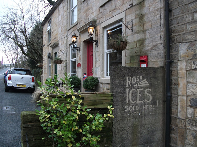
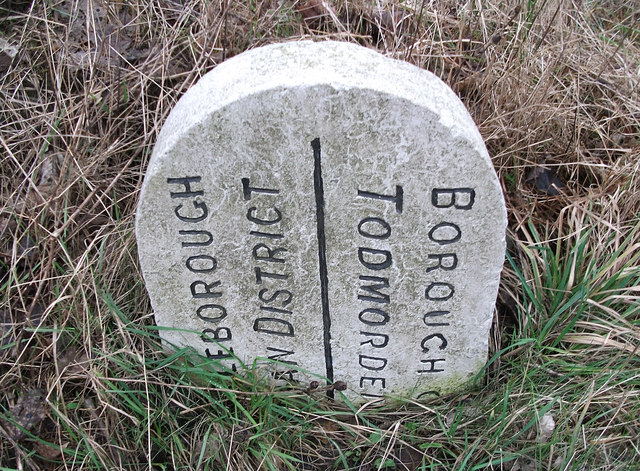
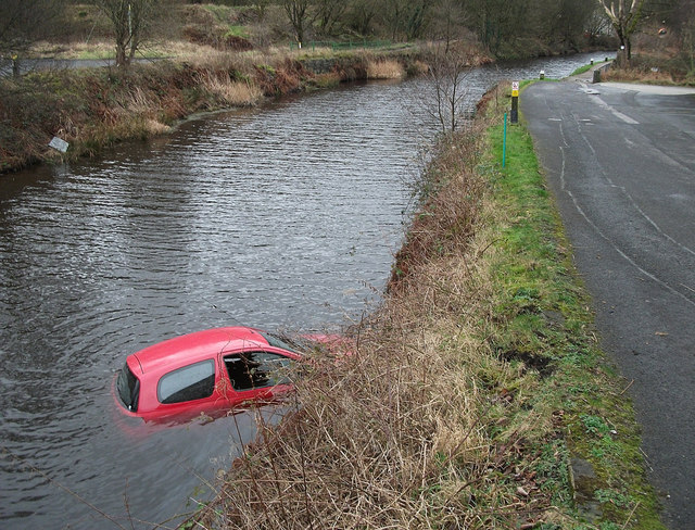
Timbercliffe Images

Images are sourced within 2km of 53.659919/-2.0817514 or Grid Reference SD9418. Thanks to Geograph Open Source API. All images are credited.

Sladen Hill and Longley Hey seen from Halifax Road
Pylon north of the A58 Halifax Road
Ross Ices - old ice cream sign
Boundary stone on Todmorden Road Marks the division of the old Littleborough Urban District and the Borough of Todmorden. Now the local authorities are Rochdale and Calderdale respectively. Or, in tribal terms, the boundary between Lancashire and Yorkshire.
Boundary stone on Todmorden Road
Marks the division of the old Littleborough Urban District and the Borough of Todmorden. Now the local authorities are Rochdale and Calderdale respectively. Or, in tribal terms, the boundary between Lancashire and Yorkshire.
Longlees Lock, Rochdale Canal Lock no 36 and the start of the summit pound.
Longlees Lock, Rochdale Canal
Lock no 36 and the start of the summit pound.
Car in the Rochdale Canal Just below Sladen Lock. Makes a change from seeing supermarket trolleys.
Car in the Rochdale Canal
Just below Sladen Lock. Makes a change from seeing supermarket trolleys.
Red car in Rochdale Canal Just below Sladen Lock (between Summit and Littleborough) on a very windy day.
Red car in Rochdale Canal
Just below Sladen Lock (between Summit and Littleborough) on a very windy day.
Bridge over Castle Clough
Higher Chelburn Reservoir from Leach Hill
The dam at Higher Chelburn Reservoir
Towards Light Hazzles Clough and Chelburn Moor
Light Hazzles Farm across the infant River Roch
Light Hazzles Farm
Light Hazzles Farm
Cow Head The Pennine Way running alongside Cow Head Drain at Vow Head.
Cow Head
The Pennine Way running alongside Cow Head Drain at Vow Head.
Pennine Way The Pennine Way running alongside Cow Head Drain.
Pennine Way
The Pennine Way running alongside Cow Head Drain.
Shore Moor Crook Hill Wind Farm on Shore Moor.
Shore Moor
Crook Hill Wind Farm on Shore Moor.
Bridge over Drain near Blackstone Edge Reservoir
Pennine Way at Utley Edge The Pennine Way is a National Trail in England, with a small section in Scotland. The trail runs 267 miles from Edale, in the northern Derbyshire Peak District, north through the Yorkshire Dales and the Northumberland National Park and ends at Kirk Yetholm, just inside the Scottish border. The path runs along the Pennine hills, sometimes described as the "backbone of England". Although not the United Kingdom's longest National Trail, it is according to the Ramblers' Association "one of Britain's best known and toughest".
Pennine Way at Utley Edge
The Pennine Way is a National Trail in England, with a small section in Scotland. The trail runs 267 miles from Edale, in the northern Derbyshire Peak District, north through the Yorkshire Dales and the Northumberland National Park and ends at Kirk Yetholm, just inside the Scottish border. The path runs along the Pennine hills, sometimes described as the "backbone of England". Although not the United Kingdom's longest National Trail, it is according to the Ramblers' Association "one of Britain's best known and toughest".
Show me another place!

Timbercliffe is located at Grid Ref: SD9418 (Lat: 53.659919, Lng: -2.0817514)

Unitary Authority: Rochdale

Police Authority: Greater Manchester

What 3 Words

///salad.brownish.joins. Near Littleborough, Manchester

Related Wikis

Calderbrook

Calderbrook ( KAWL-dər-bruuk) is a village within the Metropolitan Borough of Rochdale, in Greater Manchester, England. It was originally part of the township...

Greenvale Brook

Greenvale Brook is a watercourse in Greater Manchester and a tributary of the River Roch. == Tributaries == Lydgate Brook Castle Brook Red Brook Lead Mine...

Town House Brook

Town House Brook is a watercourse in Greater Manchester and a tributary of the River Roch. == Tributaries == Long Clough Brook Turn Slack Brook Blue Pot...

Summit Tunnel fire

The Summit Tunnel fire occurred on 20 December 1984, when a dangerous goods train caught fire while passing through the Summit Tunnel on the railway line...

Nearby Amenities

Located within 500m of 53.659919,-2.0817514
Calderbrook
Place: village
Source: npe
Lat/Long: 53.6596447/-2.0861189
Summit
Place: village
Source: npe
Lat/Long: 53.6618874/-2.0834844
Waterway: lock_gate
Lat/Long: 53.6554578/-2.0818867
Waterway: lock_gate
Lat/Long: 53.6568679/-2.0825907
Waterway: lock_gate
Lat/Long: 53.6600075/-2.0818622
Waterway: lock_gate
Lat/Long: 53.6641555/-2.0813934
Waterway: lock_gate
Lat/Long: 53.6639247/-2.0813909
Waterway: lock_gate
Lat/Long: 53.6613602/-2.0819839
Waterway: lock_gate
Lat/Long: 53.6611398/-2.0819488
Waterway: lock_gate
Lat/Long: 53.660235/-2.0818254
Waterway: lock_gate
Lat/Long: 53.6595153/-2.0819481
Waterway: lock_gate
Lat/Long: 53.6593345/-2.0820054
Waterway: lock_gate
Lat/Long: 53.6584487/-2.0823652
Waterway: lock_gate
Lat/Long: 53.6582228/-2.0824197
Waterway: lock_gate
Lat/Long: 53.6570883/-2.0826186
Waterway: lock_gate
Lat/Long: 53.6556753/-2.0819255
Power: tower
Lat/Long: 53.6559798/-2.0792318
Bus Stop
Todmorden Road/Summit Post Office
Bus: yes
Naptan AtcoCode: 1800NE24111
Naptan Bearing: N
Naptan CommonName: Todmorden Road/Summit Post Office
Naptan Indicator: Opp House 26
Naptan Landmark: HOUSE 85
Naptan NaptanCode: mangajmw
Naptan PlusbusZoneRef: MNCRPIC
Naptan ShortCommonName: Summit PO
Naptan Street: TODMORDEN ROAD
Naptan Verified: no
Network: TfGM
Public Transport: platform
Source: naptan_import
Lat/Long: 53.6617633/-2.0834245
Bus Stop
Todmorden Road/Holme House Street
Bus: yes
Naptan AtcoCode: 1800NE24121
Naptan Bearing: S
Naptan CommonName: Todmorden Road/Holme House Street
Naptan Indicator: O/s House 42
Naptan Landmark: HOUSE 58
Naptan NaptanCode: mangajpa
Naptan PlusbusZoneRef: MNCRPIC
Naptan ShortCommonName: Holme House St
Naptan Street: TODMORDEN ROAD
Naptan Verified: no
Network: TfGM
Public Transport: platform
Source: naptan_import
Lat/Long: 53.6623621/-2.0835062
Bus Stop
Todmorden Road/Sladen Wood Mill
Bus: yes
Naptan AtcoCode: 1800NE24131
Naptan Bearing: N
Naptan CommonName: Todmorden Road/Sladen Wood Mill
Naptan Indicator: Sladen Mill Opp
Naptan Landmark: SLADEN MILL
Naptan NaptanCode: mangajpd
Naptan PlusbusZoneRef: MNCRPIC
Naptan ShortCommonName: Sladen Wood Mill
Naptan Street: TODMORDEN ROAD
Naptan Verified: no
Network: TfGM
Public Transport: platform
Source: naptan_import
Lat/Long: 53.6597678/-2.0831444
Bus Stop
Todmorden Road/Sladden Wood Mill
Bus: yes
Naptan AtcoCode: 1800NE24141
Naptan Bearing: S
Naptan CommonName: Todmorden Road/Sladden Wood Mill
Naptan Indicator: Fothergill & Hy
Naptan Landmark: SLADEN MILL
Naptan NaptanCode: mangajpg
Naptan PlusbusZoneRef: MNCRPIC
Naptan ShortCommonName: Sladden Wood Mill
Naptan Street: TODMORDEN ROAD
Naptan Verified: no
Network: TfGM
Public Transport: platform
Source: naptan_import
Lat/Long: 53.6595943/-2.0825777
Bus Stop
Todmorden Road/Stansfield Primary School
Bus: yes
Naptan AtcoCode: 1800NE24151
Naptan Bearing: N
Naptan CommonName: Todmorden Road/Stansfield Primary School
Naptan Indicator: School
Naptan Landmark: SCHOOL
Naptan NaptanCode: mangajpj
Naptan PlusbusZoneRef: MNCRPIC
Naptan ShortCommonName: Stansfield School
Naptan Street: TODMORDEN ROAD
Naptan Verified: no
Network: TfGM
Public Transport: platform
Source: naptan_import
Lat/Long: 53.6579843/-2.0841785
Bus Stop
Todmorden Road/Stansfield Primary School
Bus: yes
Naptan AtcoCode: 1800NE24161
Naptan Bearing: S
Naptan CommonName: Todmorden Road/Stansfield Primary School
Naptan Indicator: Opp School
Naptan Landmark: School
Naptan NaptanCode: mangajpm
Naptan Notes: INDICATOR AMENDED
Naptan PlusbusZoneRef: MNCRPIC
Naptan ShortCommonName: Stansfield School
Naptan Street: TODMORDEN ROAD
Naptan Verified: no
Network: TfGM
Public Transport: platform
Source: naptan_import
Lat/Long: 53.6570309/-2.0850089
Bus Stop
Barnes Meadow/Calderbrook Terrace
Bus: yes
Naptan AtcoCode: 1800NE24171
Naptan Bearing: S
Naptan CommonName: Barnes Meadow/Calderbrook Terrace
Naptan Indicator: Nr School
Naptan Landmark: SCHOOL
Naptan NaptanCode: mangajpt
Naptan PlusbusZoneRef: MNCRPIC
Naptan ShortCommonName: Calderbrook Terr
Naptan Street: BARNES MEADOW
Naptan Verified: no
Network: TfGM
Public Transport: platform
Source: naptan_import
Lat/Long: 53.6575253/-2.0850098
Bus Stop
Barnes Meadow/Calderbrook Terrace
Bus: yes
Naptan AtcoCode: 1800NE24181
Naptan Bearing: N
Naptan CommonName: Barnes Meadow/Calderbrook Terrace
Naptan Indicator: Opp School
Naptan Landmark: SCHOOL
Naptan NaptanCode: mangajpw
Naptan PlusbusZoneRef: MNCRPIC
Naptan ShortCommonName: Calderbrook Terr
Naptan Street: BARNES MEADOW
Naptan Verified: no
Network: TfGM
Public Transport: platform
Source: naptan_import
Lat/Long: 53.6582804/-2.0849508
Bus Stop
Barnes Meadow/Drake Road
Bus: yes
Naptan AtcoCode: 1800NE24191
Naptan Bearing: S
Naptan CommonName: Barnes Meadow/Drake Road
Naptan Indicator: Opp House 43
Naptan Landmark: HOUSE 41
Naptan NaptanCode: mangajta
Naptan Notes: INDICATOR AMENDED
Naptan PlusbusZoneRef: MNCRPIC
Naptan ShortCommonName: Drake Road
Naptan Street: BARNES MEADOW
Naptan Verified: no
Network: TfGM
Public Transport: platform
Source: naptan_import
Lat/Long: 53.6594668/-2.084923
Bus Stop
Barnes Meadow/Temple Lane
Bus: yes
Naptan AtcoCode: 1800NE24201
Naptan Bearing: W
Naptan CommonName: Barnes Meadow/Temple Lane
Naptan Indicator: O/s House 59
Naptan Landmark: HOUSE 59
Naptan NaptanCode: mangajtd
Naptan PlusbusZoneRef: MNCRPIC
Naptan ShortCommonName: Temple Lane
Naptan Street: BARNES MEADOW
Naptan Verified: no
Network: TfGM
Public Transport: platform
Source: naptan_import
Lat/Long: 53.6602839/-2.0861201
Bus Stop
Barnes Meadow/Shakespeare Close
Bus: yes
Naptan AtcoCode: 1800NE24211
Naptan Bearing: W
Naptan CommonName: Barnes Meadow/Shakespeare Close
Naptan Indicator: O/s House 83
Naptan Landmark: HOUSE 83
Naptan NaptanCode: mangajtg
Naptan PlusbusZoneRef: MNCRPIC
Naptan ShortCommonName: Shakespeare Close
Naptan Street: BARNES MEADOW
Naptan Verified: no
Network: TfGM
Public Transport: platform
Source: naptan_import
Lat/Long: 53.6601478/-2.0879055
Bus Stop
Frobisher Road/Drake Road
Bus: yes
Naptan AtcoCode: 1800NE24221
Naptan Bearing: E
Naptan CommonName: Frobisher Road/Drake Road
Naptan Indicator: O/s House 4
Naptan Landmark: HOUSE 2
Naptan NaptanCode: mangajtj
Naptan PlusbusZoneRef: MNCRPIC
Naptan ShortCommonName: Drake Road
Naptan Street: FROBISHER ROAD
Naptan Verified: no
Network: TfGM
Public Transport: platform
Source: naptan_import
Lat/Long: 53.6598162/-2.086558
Bus Stop
Todmorden Road/Reddyshaw Brow
Bus: yes
Naptan AtcoCode: 1800NE24231
Naptan Bearing: N
Naptan CommonName: Todmorden Road/Reddyshaw Brow
Naptan Indicator: 'the Grove'
Naptan Landmark: HOUSE 1
Naptan NaptanCode: mangajtm
Naptan PlusbusZoneRef: MNCRPIC
Naptan ShortCommonName: Reddyshaw Brow
Naptan Street: TODMORDEN ROAD
Naptan Verified: no
Network: TfGM
Public Transport: platform
Source: naptan_import
Lat/Long: 53.6564011/-2.0859457
Generator Method: photovoltaic
Generator Output Electricity: yes
Generator Source: solar
Generator Type: solar_photovoltaic_panel
Location: roof
Power: generator
Lat/Long: 53.6599286/-2.0870299
Generator Method: photovoltaic
Generator Output Electricity: yes
Generator Source: solar
Generator Type: solar_photovoltaic_panel
Location: roof
Power: generator
Lat/Long: 53.6595348/-2.0866999
Generator Method: photovoltaic
Generator Output Electricity: yes
Generator Source: solar
Generator Type: solar_photovoltaic_panel
Location: roof
Power: generator
Lat/Long: 53.6595619/-2.0865846
Generator Method: photovoltaic
Generator Output Electricity: yes
Generator Source: solar
Generator Type: solar_photovoltaic_panel
Location: roof
Power: generator
Lat/Long: 53.6605811/-2.0887773
Generator Method: photovoltaic
Generator Output Electricity: yes
Generator Source: solar
Generator Type: solar_photovoltaic_panel
Location: roof
Power: generator
Lat/Long: 53.6607682/-2.0858765
Generator Method: photovoltaic
Generator Output Electricity: yes
Generator Source: solar
Generator Type: solar_photovoltaic_panel
Location: roof
Power: generator
Lat/Long: 53.6581568/-2.0868501
Generator Method: photovoltaic
Generator Output Electricity: yes
Generator Source: solar
Generator Type: solar_photovoltaic_panel
Location: roof
Power: generator
Lat/Long: 53.6635376/-2.0828496
Timbercliffe
Place: village
Lat/Long: 53.660681/-2.0800289
Addr City: Littleborough
Addr Housenumber: 93
Addr Postcode: OL15 9QX
Addr Street: Todmorden Road
Lat/Long: 53.6641106/-2.0834304
Addr City: Littleborough
Addr Housenumber: 85
Addr Postcode: OL15 9QT
Addr Street: Todmorden Road
Lat/Long: 53.6639035/-2.0834766
Addr City: Littleborough
Addr Housenumber: 81
Addr Postcode: OL15 9QT
Addr Street: Todmorden Road
Lat/Long: 53.6636292/-2.0835184
Addr City: Littleborough
Addr Housenumber: 83
Addr Postcode: OL15 9QT
Addr Street: Todmorden Road
Lat/Long: 53.6636732/-2.0835169
Addr City: Littleborough
Addr Housenumber: 37
Addr Postcode: OL15 9PW
Addr Street: Barnes Meadows
Lat/Long: 53.6593023/-2.0851739
Addr City: Littleborough
Addr Housenumber: 39
Addr Postcode: OL15 9PW
Addr Street: Barnes Meadows
Lat/Long: 53.6593468/-2.0851793
Addr City: Littleborough
Addr Housenumber: 33
Addr Postcode: OL15 9PW
Addr Street: Barnes Meadows
Lat/Long: 53.6591418/-2.0851069
Addr City: Littleborough
Addr Housenumber: 35
Addr Postcode: OL15 9PW
Addr Street: Barnes Meadows
Lat/Long: 53.659191/-2.0851042
Addr City: Littleborough
Addr Housenumber: 83
Addr Postcode: OL15 9QD
Addr Street: Barnes Meadows
Lat/Long: 53.6600549/-2.0878617
Addr City: Littleborough
Addr Housenumber: 63
Addr Postcode: OL15 9QD
Addr Street: Barnes Meadows
Lat/Long: 53.6602091/-2.0866521
Addr City: Littleborough
Addr Housenumber: 61
Addr Postcode: OL15 9QD
Addr Street: Barnes Meadows
Lat/Long: 53.6602297/-2.0865582
The data included in this document is from www.openstreetmap.org. The data is made available under ODbL.

Have you been to Timbercliffe?

Leave your review of Timbercliffe below (or comments, questions and feedback).